Bowels Wood

Wood, Forest in Bedfordshire

England

Bowels Wood

Stevington Belts Bluebell woods near the Great Ouse, at their best on a preternaturally warm late April afternoon.
Stevington Belts Credit: Tiger

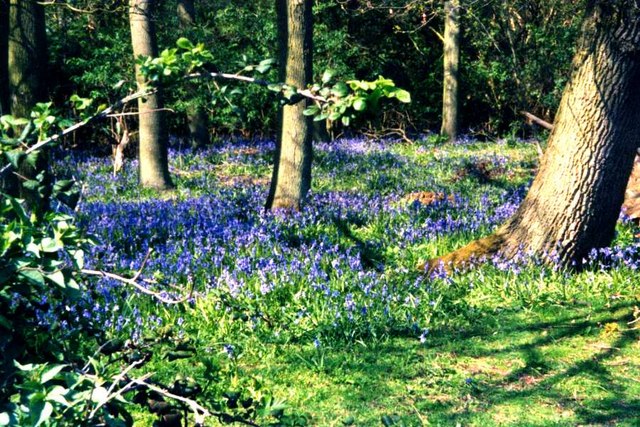
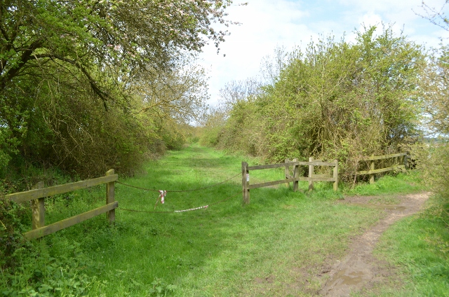
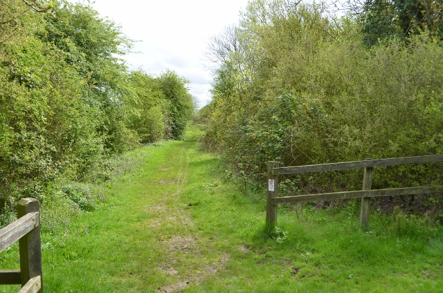
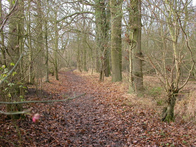
Bowels Wood is a picturesque woodland located in Bedfordshire, England. Covering an area of approximately 50 acres, it is a popular destination for nature lovers and outdoor enthusiasts. The woodland is known for its diverse range of native trees, including oak, beech, and ash, creating a rich and vibrant ecosystem.

The forest floor of Bowels Wood is covered with a thick carpet of ferns, bluebells, and wildflowers, adding to its natural beauty. The woodland is home to a variety of wildlife, such as deer, foxes, and a wide range of bird species, making it a perfect spot for birdwatching and wildlife photography.

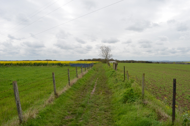
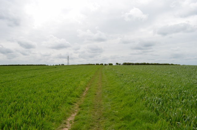
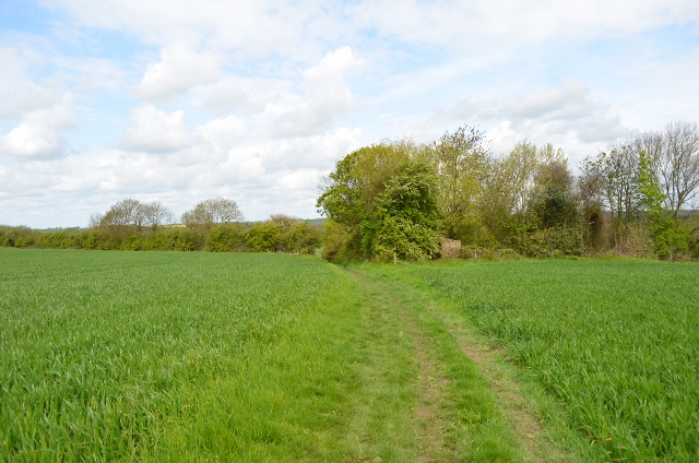
There are several well-maintained walking trails that wind through the woodland, allowing visitors to explore its tranquil beauty. These trails offer scenic views of the surrounding countryside and provide an opportunity to immerse oneself in nature. Additionally, the wood is equipped with picnic areas, making it an ideal place for families and friends to enjoy a day out.

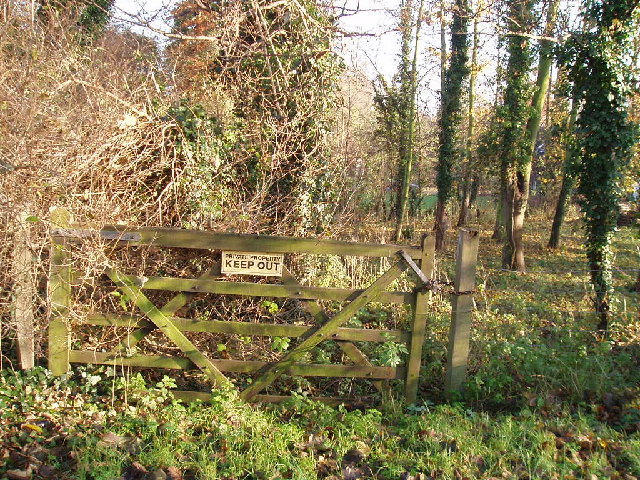
Bowels Wood is managed by the local authorities, ensuring its preservation and protection for future generations. The woodland is open to the public throughout the year, and there is no entry fee, making it accessible to all.

Overall, Bowels Wood offers a serene and peaceful escape from the hustle and bustle of urban life. Its natural beauty, diverse flora and fauna, and well-maintained trails make it a must-visit destination for nature enthusiasts and those seeking a tranquil retreat in Bedfordshire.

If you have any feedback on the listing, please let us know in the comments section below.
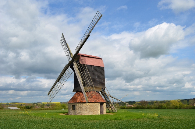
Bowels Wood Images

Images are sourced within 2km of 52.151736/-0.53594732 or Grid Reference TL0051. Thanks to Geograph Open Source API. All images are credited.

Stevington Belts Bluebell woods near the Great Ouse, at their best on a preternaturally warm late April afternoon.
Stevington Belts
Bluebell woods near the Great Ouse, at their best on a preternaturally warm late April afternoon.
Autumn layby Layby on A428 (Northampton Road) looking west towards the junction with the lanes that lead off north towards Stevington and south towards Stagsden.
Autumn layby
Layby on A428 (Northampton Road) looking west towards the junction with the lanes that lead off north towards Stevington and south towards Stagsden.
John Bunyan trail Leaving Bromham, over the hill towards Stevington
John Bunyan trail
Leaving Bromham, over the hill towards Stevington
John Bunyan trail Leaving Bromham, over the hill towards Stevington
John Bunyan trail
Leaving Bromham, over the hill towards Stevington
John Bunyan trail Looking towards Bromham, behind me is the small village of Stevington.
John Bunyan trail
Looking towards Bromham, behind me is the small village of Stevington.
Former Railway Line The ex Bedford to Northampton line crosses here, this is a footpath. The bricks are the former pig sty for Skylark cottage which is a burnt out shell.
Former Railway Line
The ex Bedford to Northampton line crosses here, this is a footpath. The bricks are the former pig sty for Skylark cottage which is a burnt out shell.
Former Railway Line Bedford to Northampton line closed in the mid 1960s under Beeching cuts.
Former Railway Line
Bedford to Northampton line closed in the mid 1960s under Beeching cuts.
Former Railway Line Bedford to Northampton line closed in the mid 1960s under Beeching cuts.
Former Railway Line
Bedford to Northampton line closed in the mid 1960s under Beeching cuts.
Stevington Windmill A post mill with four common cloth type sails, the last mill to use this ancient technology commercially. The building was built in 1770 and restored in 1921,1958 and 2004. All the internal machinery is intact, inside is one set of stones with a governor and iron tentering beam. There is no faintail, this is a very simple machine. Once called on a survey 'useless'. It was used mostly for grinding cattle feed until 1939 before purchased by Bedford Borough Council as part of the County's contribution to the Festival of Britain.
It is sometimes used, for example mills open weekend. Access can be gained via a key from the Royal George in the village.
Stevington Windmill
A post mill with four common cloth type sails, the last mill to use this ancient technology commercially. The building was built in 1770 and restored in 1921,1958 and 2004. All the internal machinery is intact, inside is one set of stones with a governor and iron tentering beam. There is no faintail, this is a very simple machine. Once called on a survey 'useless'. It was used mostly for grinding cattle feed until 1939 before purchased by Bedford Borough Council as part of the County's contribution to the Festival of Britain. It is sometimes used, for example mills open weekend. Access can be gained via a key from the Royal George in the village.
Stevington Windmill The four common sails are not very common these days as they required a lot of work. Its very dated technology compared to patent sails.
Stevington Windmill
The four common sails are not very common these days as they required a lot of work. Its very dated technology compared to patent sails.
Stevington Windmill The postmill on an otherwise overcast cloudy day. This year the farm hasn't planted oil seed rape.
Stevington Windmill
The postmill on an otherwise overcast cloudy day. This year the farm hasn't planted oil seed rape.
Stevington Windmill P Keech restored the mill in 1921, the build date of 1770 can also be seen.
Stevington Windmill
P Keech restored the mill in 1921, the build date of 1770 can also be seen.
Stevington Windmill The crown and central pivot post can be seen here as can the grain bin. The governor is to the left.
Stevington Windmill
The crown and central pivot post can be seen here as can the grain bin. The governor is to the left.
Stevington Windmill The tentering gear can be seen, a later 19th C addition. The simple setup can be seen with the stone above running a belt to the governor. The balls swing out via centrifugal inertia moving the steel yard up or down. Via a pivot this adjusts the tentering arm and thus the distance between the stones, maintaining quality.
Stevington Windmill
The tentering gear can be seen, a later 19th C addition. The simple setup can be seen with the stone above running a belt to the governor. The balls swing out via centrifugal inertia moving the steel yard up or down. Via a pivot this adjusts the tentering arm and thus the distance between the stones, maintaining quality.
Stevington Windmill This is it! Basically the brakewheel straight onto a stone nut and one pair of Derbyshire grits. The massive windshaft is obviously from one big tree trunk.
Stevington Windmill
This is it! Basically the brakewheel straight onto a stone nut and one pair of Derbyshire grits. The massive windshaft is obviously from one big tree trunk.
Stevington Windmill The windshaft runs the vital sack hoist which in turn engased via a handle and rope.
Stevington Windmill
The windshaft runs the vital sack hoist which in turn engased via a handle and rope.
Stevington Windmill Just the one pair for grinding animal feed on Derbyshire grits.
Stevington Windmill
Just the one pair for grinding animal feed on Derbyshire grits.
Stevington Windmill Governor and tentering beam. The tentering gear can be seen, a later 19th C addition. The simple setup can be seen with the stone above running a belt to the governor. The balls swing out via centrifugal inertia moving the steel yard up or down. Via a pivot this adjusts the tentering arm and thus the distance between the stones, maintaining quality.
Stevington Windmill
Governor and tentering beam. The tentering gear can be seen, a later 19th C addition. The simple setup can be seen with the stone above running a belt to the governor. The balls swing out via centrifugal inertia moving the steel yard up or down. Via a pivot this adjusts the tentering arm and thus the distance between the stones, maintaining quality.
Show me another place!

Bowels Wood is located at Grid Ref: TL0051 (Lat: 52.151736, Lng: -0.53594732)

Unitary Authority: Bedford

Police Authority: Bedfordshire

What 3 Words

///grandson.healthier.distanced. Near Bromham, Bedfordshire

Related Wikis

Bromham, Bedfordshire

Bromham is a village and civil parish in the Borough of Bedford in Bedfordshire, England, situated around 3 miles (4.8 km) west of Bedford town centre...

Church of St Owen, Bromham, Bedfordshire

Church of St Owen is a Grade I listed church in Bromham, Bedfordshire, England. It became a listed building on 13 July 1964.The church is a 17th-century...

Church of St James, Biddenham

Church of St James is a Grade I listed church in Biddenham, Bedfordshire, England. It became a listed building on 13 July 1964. The Church has a website...

West End, Bedfordshire

West End is a hamlet located in the Borough of Bedford in Bedfordshire, England. The settlement is close to Carlton, Pavenham and Stevington. West End...

Biddenham Dovecote

The Biddenham dovecote was a structure located in Biddenham, a village in Bedfordshire, England. Built on the order of Elizabeth Boteler in 1706, in a...

Hanger Wood

Hanger Wood is an ancient woodland and Site of Special Scientific Interest (SSSI) in the parish of Stagsden, Bedfordshire in the United Kingdom. Situated...

Lincroft Academy

Lincroft Academy is a co-educational secondary school located in Oakley in the English county of Bedfordshire.It was established as a secondary modern...

Biddenham Pit

Biddenham Pit is a gravel pit and Site of Special Scientific Interest (SSSI), 0.41 hectares in size located in Biddenham, Bedfordshire. The pit was notified...

Nearby Amenities

Located within 500m of 52.151736,-0.53594732
Library
Bromham Library
Wikidata: Q55163421
Lat/Long: 52.1501772/-0.5340349
Post Box
Brand: Royal Mail
Brand Wikidata: Q638098
Operator: Royal Mail
Operator Wikidata: Q638098
Ref: MK43 288
Lat/Long: 52.1493515/-0.5315184
Post Box
Brand: Royal Mail
Brand Wikidata: Q638098
Operator: Royal Mail
Operator Wikidata: Q638098
Ref: MK43 280
Lat/Long: 52.1495623/-0.5416093
Community Centre
Leslie Sell Scout Activity Centre
Addr City: Bromham
Addr Country: GB
Addr Postcode: MK43 8LD
Addr Street: Molivers Lane
Fhrs Authority: Bedford
Fhrs Id: 102829
Fhrs Local Authority Id: 34270
Operator: Scouting UK
Lat/Long: 52.1529732/-0.5342629
Community Centre
The Leslie Sell Girl Guide Camping and Training Ground
Addr City: Bromham
Addr Country: GB
Addr Postcode: MK43 8LD
Addr Street: Molivers Lane
Fhrs Authority: Bedford
Fhrs Id: 102825
Fhrs Local Authority Id: 34268
Lat/Long: 52.1535449/-0.5316943
Addr Country: GB
Addr Housenumber: 82
Addr Street: Springfield Drive
Lat/Long: 52.1492405/-0.5336416
Addr Country: GB
Addr Housenumber: 75
Addr Street: Springfield Drive
Lat/Long: 52.1494249/-0.5341525
Addr Country: GB
Addr Housenumber: 6
Addr Street: Springfield Drive
Lat/Long: 52.1523038/-0.5335911
Addr Country: GB
Addr Housenumber: 4
Addr Street: Springfield Drive
Lat/Long: 52.1525562/-0.533271
The data included in this document is from www.openstreetmap.org. The data is made available under ODbL.

Have you been to Bowels Wood?

Leave your review of Bowels Wood below (or comments, questions and feedback).