Ashton-Under-Lyne

Settlement in Lancashire

England

Ashton-Under-Lyne

St John the Evangelist
St John the Evangelist Credit: thejackrustles

Ashton-under-Lyne is a town located in the metropolitan borough of Tameside, within the county of Greater Manchester, England. Situated in the historic county of Lancashire, it lies about 6 miles east of Manchester city center and is known for its rich industrial heritage.

The town has a population of approximately 45,000 people and is part of the wider Greater Manchester urban area. Ashton-under-Lyne is well-connected, with excellent transport links including bus services, a train station, and nearby motorway access.

Historically, Ashton-under-Lyne played a significant role during the Industrial Revolution, particularly in the cotton and coal industries. The town was known for its numerous cotton mills and coal mines, which brought wealth and employment to the local community.

Today, Ashton-under-Lyne has diversified its economy and offers a range of industries, including manufacturing, retail, and services. The town center features a variety of shops, cafes, and restaurants, providing a vibrant hub for locals and visitors alike.

Ashton-under-Lyne has several notable landmarks, including the imposing Ashton Town Hall and the historic Ashton Market, which dates back to the 19th century. The market offers a wide array of stalls selling fresh produce, clothing, and household items.

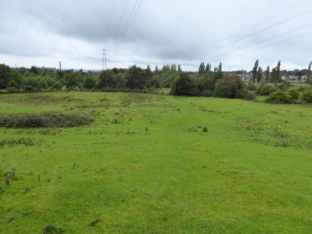
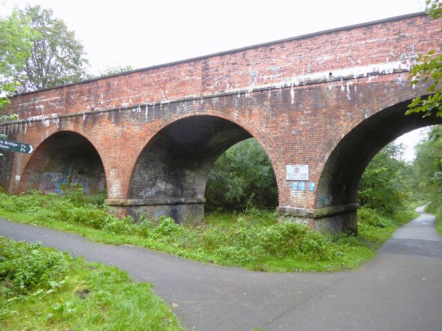
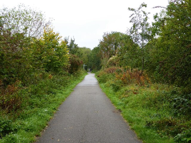
The town is also surrounded by picturesque countryside, making it a popular destination for outdoor activities such as hiking and cycling. Additionally, Ashton-under-Lyne is home to several parks and green spaces, providing recreational opportunities for residents.

Overall, Ashton-under-Lyne is a town that combines its rich industrial past with modern amenities, offering a diverse range of attractions and activities for both residents and visitors.

If you have any feedback on the listing, please let us know in the comments section below.

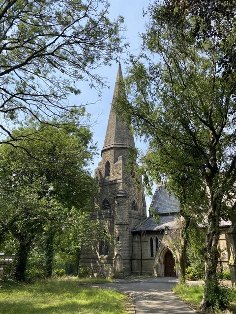
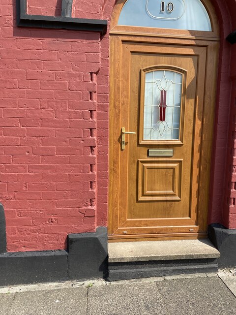
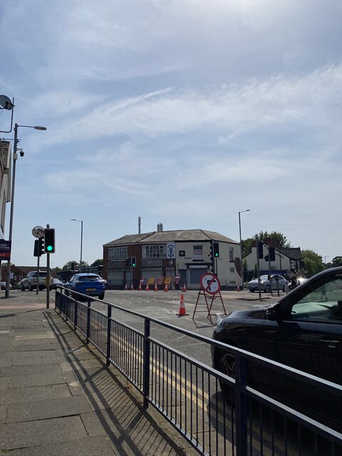
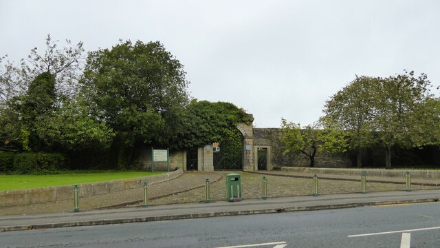
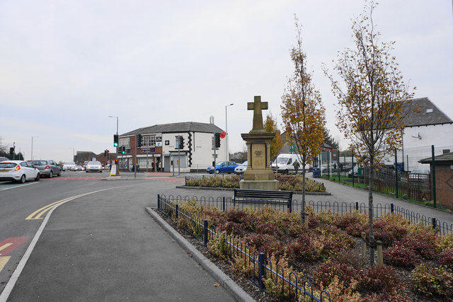
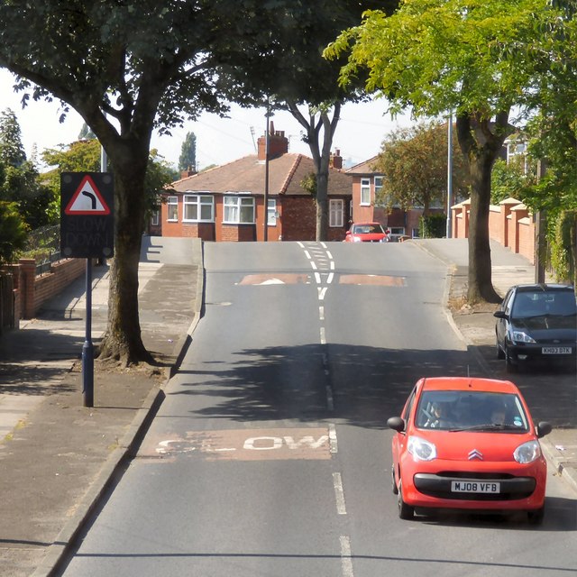
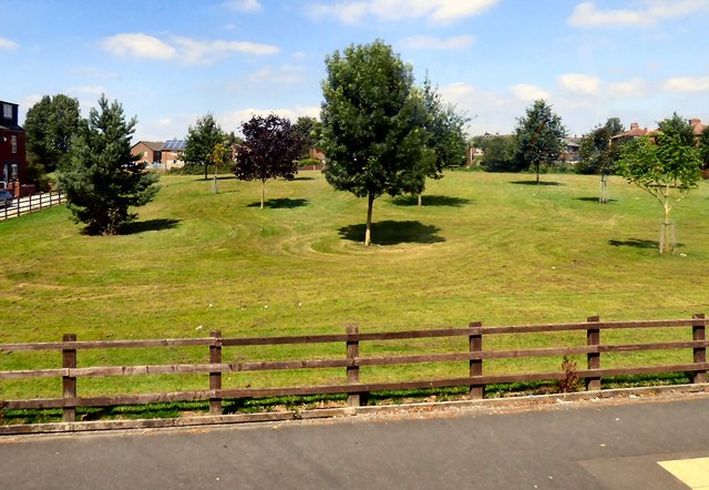
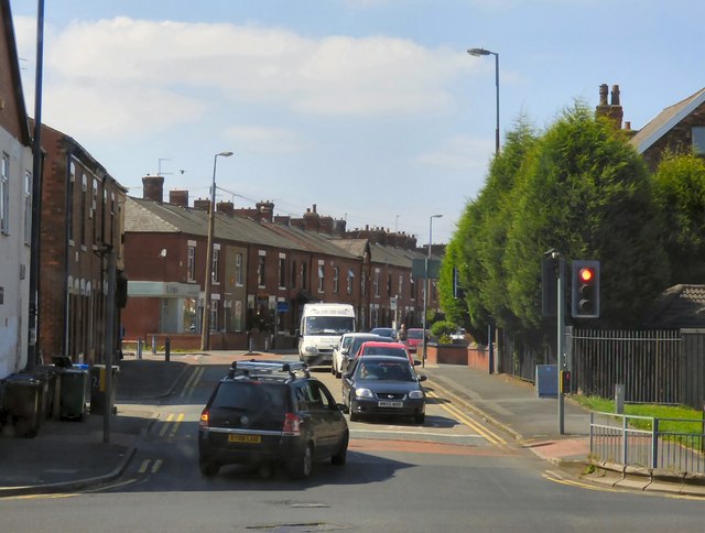
Ashton-Under-Lyne Images

Images are sourced within 2km of 53.490642/-2.083617 or Grid Reference SJ9499. Thanks to Geograph Open Source API. All images are credited.

St John the Evangelist
OS Cut Mark - Ashton-under-Lyne, #10 Hurst Cross <span class="nowrap"><a title="https://www.bench-marks.org.uk/bm91192" rel="nofollow ugc noopener" href="https://www.bench-marks.org.uk/bm91192">Link</a><img style="margin-left:2px;" alt="External link" title="External link - shift click to open in new window" src="https://s1.geograph.org.uk/img/external.png" width="10" height="10"/></span>
OS Cut Mark - Ashton-under-Lyne, #10 Hurst Cross
Location of OS Cut Mark - Ashton-under-Lyne, #10 Hurst Cross
Nook Lane
Nook Lane
Preserved archway to former barracks On Mossley Road, the entrance to Ladysmith Barracks which has been replaced with housing
Preserved archway to former barracks
On Mossley Road, the entrance to Ladysmith Barracks which has been replaced with housing
Field path from Arlies Lane Heading towards the defined paths that lead to Stamford Park circuits
Field path from Arlies Lane
Heading towards the defined paths that lead to Stamford Park circuits
Cranbourne Road viaduct Across the former railway between Ashton and Oldham, now a cycle path.
Cranbourne Road viaduct
Across the former railway between Ashton and Oldham, now a cycle path.
Smallshaw Brook Entering a culvert to pass under the former Ashton to Oldham railway
Smallshaw Brook
Entering a culvert to pass under the former Ashton to Oldham railway
Cycle path following route of former railway On the embankment across Downshaw Clough. The railway connected Ashton-under-Lyne and Oldham.
Cycle path following route of former railway
On the embankment across Downshaw Clough. The railway connected Ashton-under-Lyne and Oldham.
New housing estate off Lees Road These houses are on Smallshaw Way
New housing estate off Lees Road
These houses are on Smallshaw Way
Shri Swaminarayan Mandir Temple On Lees Road
Shri Swaminarayan Mandir Temple
On Lees Road
Traffic calming on Smallshaw Lane
Hurst Cross The cross was provided by public subscription in the Victorian era, but it has since been moved a little from its original site. It still gives its name to the locality.
Hurst Cross
The cross was provided by public subscription in the Victorian era, but it has since been moved a little from its original site. It still gives its name to the locality.
Football match at Hurst Cross The home of Ashton United FC. The spire of St John's Church sticks up behind.
Football match at Hurst Cross
The home of Ashton United FC. The spire of St John's Church sticks up behind.
Queens Road The B6194 through Hurst.
Queens Road
The B6194 through Hurst.
Wood Lane
Wood Lane
Dale Grove A green space off Wilshaw Lane.
Dale Grove
A green space off Wilshaw Lane.
Newmarket Road At the junction with Oldham Road.
Newmarket Road
At the junction with Oldham Road.
Show me another place!

Ashton-Under-Lyne is located at Grid Ref: SJ9499 (Lat: 53.490642, Lng: -2.083617)

Unitary Authority: Tameside

Police Authority: Greater Manchester

What 3 Words

///icons.deaf.steps. Near Ashton-under-Lyne, Manchester

Related Wikis

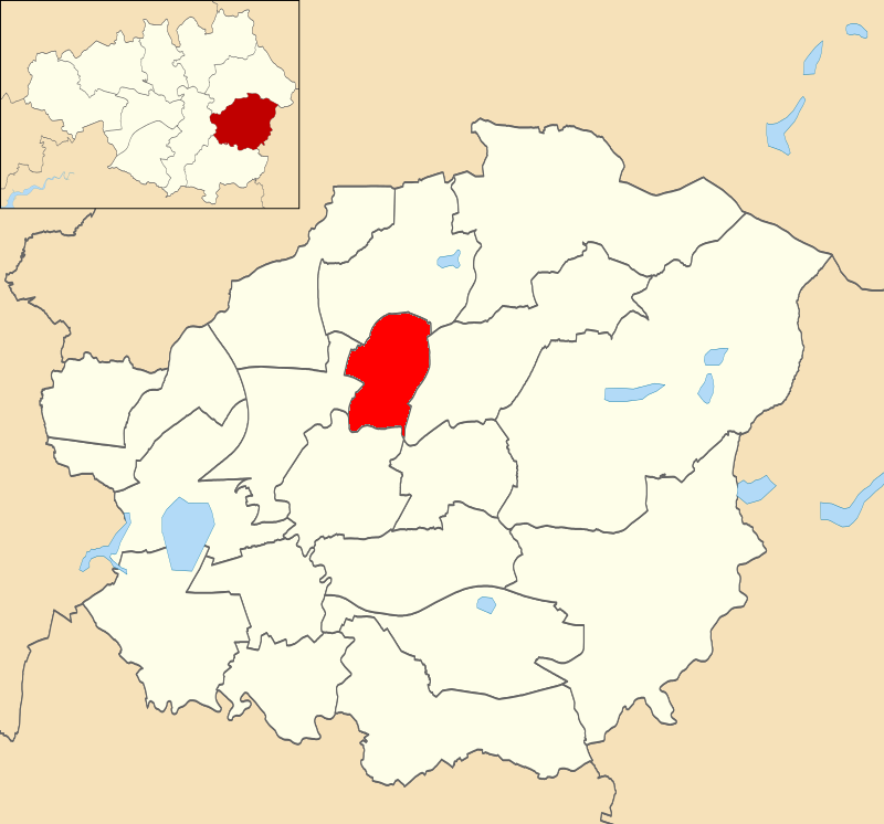
Ashton St. Michael's (ward)

Ashton St Michael's is an electoral ward of Tameside, England. It is represented in Westminster by Angela Rayner Labour MP for Ashton-under-Lyne. ��2...

Tameside College

Tameside College is a further education college located in Ashton-under-Lyne, Greater Manchester, England. The college offers a range of courses for students...

Albion Congregational Church

Albion Congregational Church was built on Stamford Street East in Ashton-Under-Lyne by John Brooke between 1890 and 95. It is a Grade II listed building...

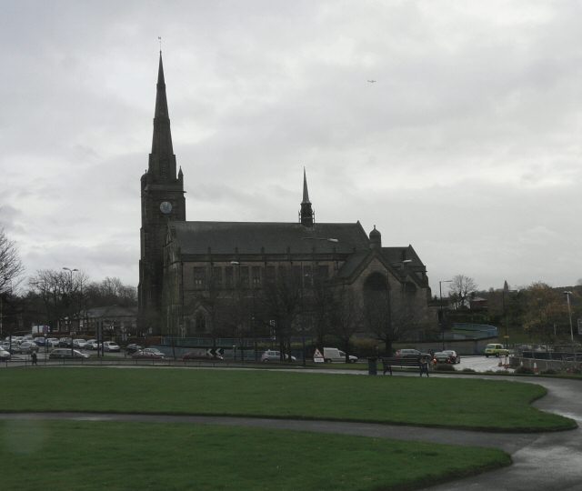
St Michael and All Angels' Church, Ashton-under-Lyne

St. Michael's Church (also known as, St. Michael and All Angels' Church) is an Anglican parish church in Ashton-under-Lyne, Tameside, Greater Manchester...

Nearby Amenities

Located within 500m of 53.490642,-2.083617
Cycleway: asl
Lat/Long: 53.4873592/-2.0876104
Fuel
Brand: Texaco
Lat/Long: 53.4876464/-2.0829485
Bus Stop
Hurst Brook, Union Road / adjacent Holden Street
Bus: yes
Naptan AtcoCode: 1800EH00401
Naptan Bearing: SW
Naptan CommonName: Union Road/Holden Street
Naptan Indicator: O/s House 18
Naptan Landmark: HOUSE 18
Naptan NaptanCode: manatwmp
Naptan PlusbusZoneRef: MNCRPIC
Naptan ShortCommonName: Holden Street
Naptan Street: UNION ROAD
Naptan Verified: no
Network: TfGM
Operator: TfGM
Public Transport: platform
Source: naptan_import
Lat/Long: 53.4933014/-2.089203
Bus Stop
Arlington Way/Penny Meadow
Bus: yes
Naptan AtcoCode: 1800EH00551
Naptan Bearing: S
Naptan CommonName: Arlington Way/Penny Meadow
Naptan Indicator: Park
Naptan Landmark: FLATS
Naptan NaptanCode: manatwmw
Naptan PlusbusZoneRef: MNCRPIC
Naptan ShortCommonName: Penny Meadow
Naptan Street: ARLINGTON WAY
Naptan Verified: no
Network: TfGM
Public Transport: platform
Source: naptan_import
Lat/Long: 53.489427/-2.0879449
Bus Stop
Curzon Road/Wigmore Street
Bus: yes
Naptan AtcoCode: 1800EH04961
Naptan Bearing: SE
Naptan CommonName: Curzon Road/Wigmore Street
Naptan Indicator: O/s House 22
Naptan Landmark: HOUSE 22
Naptan NaptanCode: manawdpg
Naptan PlusbusZoneRef: MNCRPIC
Naptan ShortCommonName: Wigmore Street
Naptan Street: CURZON ROAD
Naptan Verified: no
Network: TfGM
Public Transport: platform
Source: naptan_import
Lat/Long: 53.4922576/-2.0779415
Bus Stop
Curzon Road/Wigmore Street
Bus: yes
Naptan AtcoCode: 1800EH04971
Naptan Bearing: NW
Naptan CommonName: Curzon Road/Wigmore Street
Naptan Indicator: O/s House 25
Naptan Landmark: HOUSE 25
Naptan NaptanCode: manawdpj
Naptan PlusbusZoneRef: MNCRPIC
Naptan ShortCommonName: Wigmore Street
Naptan Street: CURZON ROAD
Naptan Verified: no
Network: TfGM
Public Transport: platform
Source: naptan_import
Lat/Long: 53.4922664/-2.0782128
Bus Stop
Hurst, Mossley Road / near Princess Street
Bench: no
Bus: yes
Naptan AtcoCode: 1800EH09261
Naptan Bearing: NE
Naptan CommonName: Mossley Road/Queens Road
Naptan Indicator: New Inn
Naptan Landmark: NEW INN
Naptan NaptanCode: manawpjd
Naptan PlusbusZoneRef: MNCRPIC
Naptan ShortCommonName: Queens Road
Naptan Street: MOSSLEY ROAD
Naptan Verified: no
Network: TfGM
Operator: TfGM
Public Transport: platform
Shelter: yes
Source: naptan_import
Tactile Paving: no
Lat/Long: 53.4931377/-2.0781016
Bus Stop
Hurst, Mossley Road / opposite Princess Street
Bus: yes
Naptan AtcoCode: 1800EH09271
Naptan Bearing: SW
Naptan CommonName: Mossley Road/Post Office
Naptan Indicator: Chemist
Naptan Landmark: CHEMIST
Naptan NaptanCode: manawpjg
Naptan PlusbusZoneRef: MNCRPIC
Naptan ShortCommonName: Post Office
Naptan Street: MOSSLEY ROAD
Naptan Verified: no
Network: TfGM
Operator: TfGM
Public Transport: platform
Shelter: yes
Source: naptan_import
Tactile Paving: no
Lat/Long: 53.4927394/-2.0787227
Bus Stop
Cockbrook, Mossley Road / near Neal Avenue
Bench: yes
Bus: yes
Naptan AtcoCode: 1800EH09281
Naptan Bearing: SW
Naptan CommonName: Mossley Road/Heys Primary School
Naptan Indicator: Nr Standale Eng
Naptan Landmark: TRADING EstateATE
Naptan NaptanCode: manawpjm
Naptan PlusbusZoneRef: MNCRPIC
Naptan ShortCommonName: Heys Primary Schl
Naptan Street: MOSSLEY ROAD
Naptan Verified: no
Network: TfGM
Operator: TfGM
Public Transport: platform
Shelter: no
Source: naptan_import
Tactile Paving: no
Lat/Long: 53.4915449/-2.0818439
Bus Stop
Cockbrook, Crickets Lane / opposite Neal Avenue
Bus: yes
Naptan AtcoCode: 1800EH09291
Naptan Bearing: NE
Naptan CommonName: Crickets Lane/Mossley Road
Naptan Indicator: Nr House 196
Naptan Landmark: HOUSE 196
Naptan NaptanCode: manawpjp
Naptan PlusbusZoneRef: MNCRPIC
Naptan ShortCommonName: Mossley Road
Naptan Street: CRICKETS LANE
Naptan Verified: no
Network: TfGM
Operator: TfGM
Public Transport: platform
Source: naptan_import
Lat/Long: 53.4912451/-2.0830585
Taxi
Market Hall
Naptan AtcoCode: 1800EHT1421
Naptan CommonName: Market Hall
Naptan Indicator: Old Cross St
Naptan Landmark: OLD ST
Naptan PlusbusZoneRef: MNCRPIC
Naptan Street: Old Cross St
Naptan Verified: no
Source: naptan_import
Lat/Long: 53.4888245/-2.0899623
Bus Stop
Montague Road/Mossley Road
Bus: yes
Naptan AtcoCode: 1800EH21161
Naptan Bearing: S
Naptan CommonName: Montague Road/Mossley Road
Naptan Indicator: O/s House 128
Naptan Landmark: HOUSE 128
Naptan NaptanCode: mandagwg
Naptan PlusbusZoneRef: MNCRPIC
Naptan ShortCommonName: Mossley Road
Naptan Street: MONTAGUE ROAD
Naptan Verified: no
Network: TfGM
Public Transport: platform
Source: naptan_import
Lat/Long: 53.4929502/-2.0772041
Bus Stop
Montague Road/Mossley Road
Bus: yes
Naptan AtcoCode: 1800EH21171
Naptan Bearing: N
Naptan CommonName: Montague Road/Mossley Road
Naptan Indicator: Opp House 126
Naptan Landmark: HOUSE 103
Naptan NaptanCode: mandagwj
Naptan PlusbusZoneRef: MNCRPIC
Naptan ShortCommonName: Mossley Road
Naptan Street: MONTAGUE ROAD
Naptan Verified: no
Network: TfGM
Public Transport: platform
Source: naptan_import
Lat/Long: 53.4928602/-2.0773698
Bus Stop
Montague Road/Sixth Form College
Bus: yes
Naptan AtcoCode: 1800EH21181
Naptan Bearing: N
Naptan CommonName: Montague Road/Sixth Form College
Naptan Indicator: School
Naptan Landmark: HOUSE 83
Naptan NaptanCode: mandagwm
Naptan PlusbusZoneRef: MNCRPIC
Naptan ShortCommonName: College
Naptan Street: MONTAGUE ROAD
Naptan Verified: no
Network: TfGM
Public Transport: platform
Source: naptan_import
Lat/Long: 53.4912062/-2.0775024
Bus Stop
Montague Road/Sixth Form College
Bus: yes
Naptan AtcoCode: 1800EH21191
Naptan Bearing: S
Naptan CommonName: Montague Road/Sixth Form College
Naptan Indicator: Op House 77
Naptan Landmark: COLLEGE
Naptan NaptanCode: mandagwp
Naptan PlusbusZoneRef: MNCRPIC
Naptan ShortCommonName: College
Naptan Street: MONTAGUE ROAD
Naptan Verified: no
Network: TfGM
Public Transport: platform
Source: naptan_import
Lat/Long: 53.4909636/-2.0773513
Bus Stop
Montague Road/Beaufort Road
Bus: yes
Naptan AtcoCode: 1800EH21201
Naptan Bearing: N
Naptan CommonName: Montague Road/Beaufort Road
Naptan Indicator: O/s House 17
Naptan Landmark: HOUSE 21
Naptan NaptanCode: mandagwt
Naptan PlusbusZoneRef: MNCRPIC
Naptan ShortCommonName: Beaufort Road
Naptan Street: MONTAGUE ROAD
Naptan Verified: no
Network: TfGM
Public Transport: platform
Source: naptan_import
Lat/Long: 53.4882937/-2.0777232
Bus Stop
Montague Road/Beaufort Road
Bus: yes
Naptan AtcoCode: 1800EH21211
Naptan Bearing: S
Naptan CommonName: Montague Road/Beaufort Road
Naptan Indicator: O/s House 24
Naptan Landmark: HOUSE 24
Naptan NaptanCode: mandajad
Naptan PlusbusZoneRef: MNCRPIC
Naptan ShortCommonName: Beaufort Road
Naptan Street: MONTAGUE ROAD
Naptan Verified: no
Network: TfGM
Public Transport: platform
Source: naptan_import
Lat/Long: 53.4880781/-2.0775721
Bus Stop
Beaufort Road/Heys Road (Stop B)
Bus: yes
Local Ref: B
Naptan AtcoCode: 1800EH21221
Naptan Bearing: SE
Naptan CommonName: Beaufort Road/Heys Road (Stop B)
Naptan Indicator: Stop B
Naptan Landmark: O/S HOUSE 32
Naptan NaptanCode: mandajag
Naptan PlusbusZoneRef: MNCRPIC
Naptan ShortCommonName: Heys Road
Naptan Street: BEAUFORT ROAD
Naptan Verified: no
Network: TfGM
Public Transport: platform
Source: naptan_import
Lat/Long: 53.4880056/-2.0784913
Bus Stop
Cockbrook, Beaufort Road / Heys Road (Stop A)
Bus: yes
Local Ref: A
Naptan AtcoCode: 1800EH21231
Naptan Bearing: NW
Naptan CommonName: Beaufort Road/Heys Road (Stop A)
Naptan Indicator: Stop A
Naptan Landmark: ASHTON COLLEGE
Naptan NaptanCode: mandajaj
Naptan PlusbusZoneRef: MNCRPIC
Naptan ShortCommonName: Heys Road
Naptan Street: BEAUFORT ROAD
Naptan Verified: no
Network: TfGM
Operator: TfGM
Public Transport: platform
Ref: A
Source: naptan_import
Lat/Long: 53.4883196/-2.0794414
Bus Stop
Beaufort Road/Tameside College
Bus: yes
Naptan AtcoCode: 1800EH21241
Naptan Bearing: SE
Naptan CommonName: Beaufort Road/Tameside College
Naptan Indicator: Derby Road
Naptan Landmark: HOUSE 78
Naptan NaptanCode: mandajam
Naptan PlusbusZoneRef: MNCRPIC
Naptan ShortCommonName: Tameside College
Naptan Street: BEAUFORT ROAD
Naptan Verified: no
Network: TfGM
Public Transport: platform
Source: naptan_import
Lat/Long: 53.4896123/-2.0818251
Bus Stop
Cockbrook, Beaufort Road / outside Tameside College
Bus: yes
Naptan AtcoCode: 1800EH21251
Naptan Bearing: NW
Naptan CommonName: Beaufort Road/Tameside College
Naptan Indicator: Ashton College
Naptan Landmark: ASHTON COLLEGE
Naptan NaptanCode: mandajap
Naptan PlusbusZoneRef: MNCRPIC
Naptan ShortCommonName: Tameside College
Naptan Street: BEAUFORT ROAD
Naptan Verified: no
Network: TfGM
Operator: TfGM
Public Transport: platform
Source: naptan_import
Lat/Long: 53.4896929/-2.0822925
Bus Stop
Curzon Road/Turn Street
Bus: yes
Naptan AtcoCode: 1800EH21661
Naptan Bearing: SE
Naptan CommonName: Curzon Road/Turn Street
Naptan Indicator: Timber Shop
Naptan Landmark: HOPE CHAPEL
Naptan NaptanCode: mandajwd
Naptan PlusbusZoneRef: MNCRPIC
Naptan ShortCommonName: Turn Street
Naptan Street: CURZON ROAD
Naptan Verified: no
Network: TfGM
Public Transport: platform
Source: naptan_import
Lat/Long: 53.495022/-2.0839911
Bus Stop
Curzon Road/French Street
Bus: yes
Naptan AtcoCode: 1800EH21671
Naptan Bearing: NW
Naptan CommonName: Curzon Road/French Street
Naptan Indicator: Hurst Church
Naptan Landmark: HURST CHURCH
Naptan NaptanCode: mandajwg
Naptan PlusbusZoneRef: MNCRPIC
Naptan ShortCommonName: French Street
Naptan Street: CURZON ROAD
Naptan Verified: no
Network: TfGM
Public Transport: platform
Source: naptan_import
Lat/Long: 53.4933704/-2.0806114
Bus Stop
Curzon Road/Leam Street
Bench: no
Bus: yes
Naptan AtcoCode: 1800EH21681
Naptan Bearing: SE
Naptan CommonName: Curzon Road/Leam Street
Naptan Indicator: Hurst Church
Naptan Landmark: HURST CHURCH
Naptan NaptanCode: mandajwj
Naptan PlusbusZoneRef: MNCRPIC
Naptan ShortCommonName: Leam Street
Naptan Street: CURZON ROAD
Naptan Verified: no
Network: TfGM
Public Transport: platform
Shelter: no
Source: naptan_import
Tactile Paving: no
Lat/Long: 53.4931821/-2.079978
Bus Stop
Whiteacre Road/Diamond Street
Bus: yes
Naptan AtcoCode: 1800EH21691
Naptan Bearing: SW
Naptan CommonName: Whiteacre Road/Diamond Street
Naptan Indicator: Newsagents
Naptan Landmark: HOUSE 166
Naptan NaptanCode: mandajwm
Naptan PlusbusZoneRef: MNCRPIC
Naptan ShortCommonName: Diamond Street
Naptan Street: WHITEACRE ROAD
Naptan Verified: no
Network: TfGM
Public Transport: platform
Source: naptan_import
Lat/Long: 53.4936571/-2.0819837
Bus Stop
Whiteacre Road/Halfway House
Bus: yes
Naptan AtcoCode: 1800EH21701
Naptan Bearing: NE
Naptan CommonName: Whiteacre Road/Halfway House
Naptan Indicator: Halfway House
Naptan Landmark: HALFWAY HOUSE
Naptan NaptanCode: mandajwp
Naptan PlusbusZoneRef: MNCRPIC
Naptan ShortCommonName: Halfway House
Naptan Street: WHITEACRE ROAD
Naptan Verified: no
Network: TfGM
Public Transport: platform
Source: naptan_import
Lat/Long: 53.4933511/-2.0825257
Bus Stop
Whiteacre Road/Mount Pleasant Street
Bus: yes
Naptan AtcoCode: 1800EH21711
Naptan Bearing: SW
Naptan CommonName: Whiteacre Road/Mount Pleasant Street
Naptan Indicator: Field
Naptan Landmark: SCHOOL
Naptan NaptanCode: mandajwt
Naptan PlusbusZoneRef: MNCRPIC
Naptan ShortCommonName: Mount Pleasant St
Naptan Street: WHITEACRE ROAD
Naptan Verified: no
Network: TfGM
Public Transport: platform
Source: naptan_import
Lat/Long: 53.4914441/-2.0845417
Bus Stop
Whiteacre Road/Mount Pleasant Street
Bus: yes
Naptan AtcoCode: 1800EH21721
Naptan Bearing: NE
Naptan CommonName: Whiteacre Road/Mount Pleasant Street
Naptan Indicator: Diy Store
Naptan Landmark: DIY STORE
Naptan NaptanCode: mandamad
Naptan PlusbusZoneRef: MNCRPIC
Naptan ShortCommonName: Mount Pleasant St
Naptan Street: WHITEACRE ROAD
Naptan Verified: no
Network: TfGM
Public Transport: platform
Source: naptan_import
Lat/Long: 53.491543/-2.0846324
Bus Stop
Hurst Brook, Union Road / opposite Holden Street
Bus: yes
Naptan AtcoCode: 1800EH21851
Naptan Bearing: NE
Naptan CommonName: Union Road/Holden Street
Naptan Indicator: House 25
Naptan Landmark: HOUSE 25
Naptan NaptanCode: mandamdp
Naptan Notes: INDICATOR AMENDED
Naptan PlusbusZoneRef: MNCRPIC
Naptan ShortCommonName: Holden Street
Naptan Street: UNION ROAD
Naptan Verified: no
Network: TfGM
Operator: TfGM
Public Transport: platform
Source: naptan_import
Lat/Long: 53.4936162/-2.0888871
Bus Stop
Stamford Street/Granville Street
Bus: yes
Naptan AtcoCode: 1800EH24011
Naptan Bearing: E
Naptan CommonName: Stamford Street/Granville Street
Naptan Indicator: Conserve Club
Naptan Landmark: CONSERVE CLUB
Naptan NaptanCode: mandamjd
Naptan Notes: LOCATION AMENDED
Naptan PlusbusZoneRef: MNCRPIC
Naptan ShortCommonName: Granville Street
Naptan Street: Stamford Street
Naptan Verified: no
Network: TfGM
Public Transport: platform
Source: naptan_import
Lat/Long: 53.4870431/-2.0794993
Bus Stop
Park Parade/Shaw Street
Bus: yes
Naptan AtcoCode: 1800EH24021
Naptan Bearing: E
Naptan CommonName: Park Parade/Shaw Street
Naptan Indicator: Opp Cemetery
Naptan Landmark: DENTAL PRACTICE
Naptan NaptanCode: mandamjg
Naptan PlusbusZoneRef: MNCRPIC
Naptan ShortCommonName: Shaw Street
Naptan Street: PARK PARADE
Naptan Verified: no
Network: TfGM
Public Transport: platform
Source: naptan_import
Lat/Long: 53.4876599/-2.0845794
Bus Stop
Park Parade/Shaw Street
Bus: yes
Naptan AtcoCode: 1800EH24031
Naptan Bearing: W
Naptan CommonName: Park Parade/Shaw Street
Naptan Indicator: Cemetery
Naptan Landmark: RAILWAY BRIDGE
Naptan NaptanCode: mandamjm
Naptan PlusbusZoneRef: MNCRPIC
Naptan ShortCommonName: Shaw Street
Naptan Street: PARK PARADE
Naptan Verified: no
Network: TfGM
Public Transport: platform
Source: naptan_import
Lat/Long: 53.4874892/-2.0843982
Bus Stop
Ashton-under-Lyne, Penny Meadow / opposite Crickets Lane
Bus: yes
Naptan AtcoCode: 1800EH24151
Naptan Bearing: E
Naptan CommonName: Penny Meadow/Crickets Lane
Naptan Indicator: Sullivans Tavrn
Naptan Landmark: HOUSE 2
Naptan NaptanCode: mandampa
Naptan PlusbusZoneRef: MNCRPIC
Naptan ShortCommonName: Crickets Lane
Naptan Street: PENNY MEADOW
Naptan Verified: no
Network: TfGM
Operator: TfGM
Public Transport: platform
Source: naptan_import
Lat/Long: 53.4902543/-2.0865816
Bus Stop
Ashton-under-Lyne, Penny Meadow / near Crickets Lane
Bus: yes
Naptan AtcoCode: 1800EH24161
Naptan Bearing: W
Naptan CommonName: Penny Meadow/Crickets Lane
Naptan Indicator: Albion Carpets
Naptan Landmark: ALBION CARPETS
Naptan NaptanCode: mandampd
Naptan PlusbusZoneRef: MNCRPIC
Naptan ShortCommonName: Crickets Lane
Naptan Street: PENNY MEADOW
Naptan Verified: no
Network: TfGM
Operator: TfGM
Public Transport: platform
Source: naptan_import
Lat/Long: 53.4900596/-2.0871663
Traffic Signals
Lat/Long: 53.4900586/-2.0882785
Traffic Signals
Traffic Signals: signal
Lat/Long: 53.4873797/-2.0873271
Post Box
costcutter
Brand: Royal Mail
Brand Wikidata: Q638098
Mapillary: 5831825936913054
Operator: Royal Mail
Operator Wikidata: Q638098
Post Box Mounting: building
Post Box Type: wall
Survey Date: 2023-03-05
Lat/Long: 53.4926699/-2.0792814
Post Box
heys road
Lat/Long: 53.4902826/-2.0788523
Post Box
Lat/Long: 53.4944311/-2.0811834
Barrier: block
Motor Vehicle: no
Lat/Long: 53.4888917/-2.0860792
Noexit: yes
Lat/Long: 53.4898631/-2.0878327
Crossing
Crossing: marked
Lat/Long: 53.4900388/-2.0885335
Speed Camera
Lat/Long: 53.4873246/-2.0817589
Crossing
Crossing: unmarked
Lat/Long: 53.4882091/-2.0869271
Addr City: Ashton-under-Lyne
Historic: memorial
Memorial: war_memorial
Lat/Long: 53.4887505/-2.0879143
Crossing
Crossing: unmarked
Lat/Long: 53.4882969/-2.0869651
Cycleway: asl
Lat/Long: 53.4872027/-2.0874848
Barrier: bollard
Lat/Long: 53.4874608/-2.0834514
School: entrance
Lat/Long: 53.4881706/-2.0844908
Crossing
Crossing: traffic_signals
Lat/Long: 53.487525/-2.0841949
Generator Method: wind_turbine
Generator Output Electricity: yes
Generator Source: wind
Generator Type: vertical_axis
Power: generator
Lat/Long: 53.4914125/-2.0764049
Traffic Signals
Traffic Signals: signal
Lat/Long: 53.493787/-2.0818486
Traffic Signals
Traffic Signals: signal
Lat/Long: 53.4938296/-2.081563
Traffic Signals
Traffic Signals: signal
Lat/Long: 53.4940714/-2.0815187
Traffic Signals
Traffic Signals: signal
Lat/Long: 53.4940355/-2.0820059
Pharmacy
Old Cross Pharmacy
Healthcare: pharmacy
Lat/Long: 53.4895997/-2.0884544
Generator Method: photovoltaic
Generator Output Electricity: yes
Generator Source: solar
Generator Type: solar_photovoltaic_panel
Location: roof
Power: generator
Lat/Long: 53.48874/-2.078352
Generator Method: photovoltaic
Generator Output Electricity: yes
Generator Source: solar
Generator Type: solar_photovoltaic_panel
Location: roof
Power: generator
Lat/Long: 53.490922/-2.0803976
Generator Method: photovoltaic
Generator Output Electricity: yes
Generator Source: solar
Generator Type: solar_photovoltaic_panel
Location: roof
Power: generator
Lat/Long: 53.4908151/-2.0805827
Generator Method: photovoltaic
Generator Output Electricity: yes
Generator Source: solar
Generator Type: solar_photovoltaic_panel
Location: roof
Power: generator
Lat/Long: 53.4907066/-2.0807356
Generator Method: photovoltaic
Generator Output Electricity: yes
Generator Source: solar
Generator Type: solar_photovoltaic_panel
Location: roof
Power: generator
Lat/Long: 53.4906252/-2.0808026
Generator Method: photovoltaic
Generator Output Electricity: yes
Generator Source: solar
Generator Type: solar_photovoltaic_panel
Location: roof
Power: generator
Lat/Long: 53.4904688/-2.08047
Generator Method: photovoltaic
Generator Output Electricity: yes
Generator Source: solar
Generator Type: solar_photovoltaic_panel
Location: roof
Power: generator
Lat/Long: 53.4902055/-2.0828787
Generator Method: photovoltaic
Generator Output Electricity: yes
Generator Source: solar
Generator Type: solar_photovoltaic_panel
Location: roof
Power: generator
Lat/Long: 53.4900779/-2.0826024
Generator Method: photovoltaic
Generator Output Electricity: yes
Generator Source: solar
Generator Type: solar_photovoltaic_panel
Location: roof
Power: generator
Lat/Long: 53.4913784/-2.0858693
Generator Method: photovoltaic
Generator Output Electricity: yes
Generator Source: solar
Generator Type: solar_photovoltaic_panel
Location: roof
Power: generator
Lat/Long: 53.4931517/-2.0866127
Generator Method: photovoltaic
Generator Output Electricity: yes
Generator Source: solar
Generator Type: solar_photovoltaic_panel
Location: roof
Power: generator
Lat/Long: 53.4931804/-2.0866878
Generator Method: photovoltaic
Generator Output Electricity: yes
Generator Source: solar
Generator Type: solar_photovoltaic_panel
Location: roof
Power: generator
Lat/Long: 53.4932777/-2.0868863
Generator Method: photovoltaic
Generator Output Electricity: yes
Generator Source: solar
Generator Type: solar_photovoltaic_panel
Location: roof
Power: generator
Lat/Long: 53.4932219/-2.0876373
Generator Method: photovoltaic
Generator Output Electricity: yes
Generator Source: solar
Generator Type: solar_photovoltaic_panel
Location: roof
Power: generator
Lat/Long: 53.4931836/-2.087581
Generator Method: photovoltaic
Generator Output Electricity: yes
Generator Source: solar
Generator Type: solar_photovoltaic_panel
Location: roof
Power: generator
Lat/Long: 53.4931644/-2.0875085
Generator Method: photovoltaic
Generator Output Electricity: yes
Generator Source: solar
Generator Type: solar_photovoltaic_panel
Location: roof
Power: generator
Lat/Long: 53.4931915/-2.0873127
Generator Method: photovoltaic
Generator Output Electricity: yes
Generator Source: solar
Generator Type: solar_photovoltaic_panel
Location: roof
Power: generator
Lat/Long: 53.4931325/-2.087192
Generator Method: photovoltaic
Generator Output Electricity: yes
Generator Source: solar
Generator Type: solar_photovoltaic_panel
Location: roof
Power: generator
Lat/Long: 53.493091/-2.0871009
Generator Method: photovoltaic
Generator Output Electricity: yes
Generator Source: solar
Generator Type: solar_photovoltaic_panel
Location: roof
Power: generator
Lat/Long: 53.4930368/-2.0869802
Generator Method: photovoltaic
Generator Output Electricity: yes
Generator Source: solar
Generator Type: solar_photovoltaic_panel
Location: roof
Power: generator
Lat/Long: 53.4929921/-2.0868809
Generator Method: photovoltaic
Generator Output Electricity: yes
Generator Source: solar
Generator Type: solar_photovoltaic_panel
Location: roof
Power: generator
Lat/Long: 53.4929314/-2.0864813
Generator Method: photovoltaic
Generator Output Electricity: yes
Generator Source: solar
Generator Type: solar_photovoltaic_panel
Location: roof
Power: generator
Lat/Long: 53.4929011/-2.0863606
Generator Method: photovoltaic
Generator Output Electricity: yes
Generator Source: solar
Generator Type: solar_photovoltaic_panel
Location: roof
Power: generator
Lat/Long: 53.4928692/-2.0862211
Generator Method: photovoltaic
Generator Output Electricity: yes
Generator Source: solar
Generator Type: solar_photovoltaic_panel
Location: roof
Power: generator
Lat/Long: 53.4928389/-2.0861084
Generator Method: photovoltaic
Generator Output Electricity: yes
Generator Source: solar
Generator Type: solar_photovoltaic_panel
Location: roof
Power: generator
Lat/Long: 53.4928086/-2.0859636
Generator Method: photovoltaic
Generator Output Electricity: yes
Generator Source: solar
Generator Type: solar_photovoltaic_panel
Location: roof
Power: generator
Lat/Long: 53.4933064/-2.086028
Generator Method: photovoltaic
Generator Output Electricity: yes
Generator Source: solar
Generator Type: solar_photovoltaic_panel
Location: roof
Power: generator
Lat/Long: 53.4933655/-2.0859502
Generator Method: photovoltaic
Generator Output Electricity: yes
Generator Source: solar
Generator Type: solar_photovoltaic_panel
Location: roof
Power: generator
Lat/Long: 53.4934485/-2.0856873
Generator Method: photovoltaic
Generator Output Electricity: yes
Generator Source: solar
Generator Type: solar_photovoltaic_panel
Location: roof
Power: generator
Lat/Long: 53.4934038/-2.0855854
Generator Method: photovoltaic
Generator Output Electricity: yes
Generator Source: solar
Generator Type: solar_photovoltaic_panel
Location: roof
Power: generator
Lat/Long: 53.4933479/-2.0854567
Generator Method: photovoltaic
Generator Output Electricity: yes
Generator Source: solar
Generator Type: solar_photovoltaic_panel
Location: roof
Power: generator
Lat/Long: 53.4935219/-2.0852796
Generator Method: photovoltaic
Generator Output Electricity: yes
Generator Source: solar
Generator Type: solar_photovoltaic_panel
Location: roof
Power: generator
Lat/Long: 53.4935984/-2.0854728
Generator Method: photovoltaic
Generator Output Electricity: yes
Generator Source: solar
Generator Type: solar_photovoltaic_panel
Location: roof
Power: generator
Lat/Long: 53.4934437/-2.0871786
Generator Method: photovoltaic
Generator Output Electricity: yes
Generator Source: solar
Generator Type: solar_photovoltaic_panel
Location: roof
Power: generator
Lat/Long: 53.4936032/-2.0866529
Generator Method: photovoltaic
Generator Output Electricity: yes
Generator Source: solar
Generator Type: solar_photovoltaic_panel
Location: roof
Power: generator
Lat/Long: 53.4936447/-2.0865966
Generator Method: photovoltaic
Generator Output Electricity: yes
Generator Source: solar
Generator Type: solar_photovoltaic_panel
Location: roof
Power: generator
Lat/Long: 53.4937325/-2.0862425
Generator Method: photovoltaic
Generator Output Electricity: yes
Generator Source: solar
Generator Type: solar_photovoltaic_panel
Location: roof
Power: generator
Lat/Long: 53.4937963/-2.0863901
Generator Method: photovoltaic
Generator Output Electricity: yes
Generator Source: solar
Generator Type: solar_photovoltaic_panel
Location: roof
Power: generator
Lat/Long: 53.4938186/-2.0864518
Generator Method: photovoltaic
Generator Output Electricity: yes
Generator Source: solar
Generator Type: solar_photovoltaic_panel
Location: roof
Power: generator
Lat/Long: 53.493849/-2.0865188
Generator Method: photovoltaic
Generator Output Electricity: yes
Generator Source: solar
Generator Type: solar_photovoltaic_panel
Location: roof
Power: generator
Lat/Long: 53.4938921/-2.0869909
Generator Method: photovoltaic
Generator Output Electricity: yes
Generator Source: solar
Generator Type: solar_photovoltaic_panel
Location: roof
Power: generator
Lat/Long: 53.4938554/-2.0853601
Generator Method: photovoltaic
Generator Output Electricity: yes
Generator Source: solar
Generator Type: solar_photovoltaic_panel
Location: roof
Power: generator
Lat/Long: 53.4937963/-2.0852448
Generator Method: photovoltaic
Generator Output Electricity: yes
Generator Source: solar
Generator Type: solar_photovoltaic_panel
Location: roof
Power: generator
Lat/Long: 53.4936687/-2.0849765
Generator Method: photovoltaic
Generator Output Electricity: yes
Generator Source: solar
Generator Type: solar_photovoltaic_panel
Location: roof
Power: generator
Lat/Long: 53.4939335/-2.0849041
Generator Method: photovoltaic
Generator Output Electricity: yes
Generator Source: solar
Generator Type: solar_photovoltaic_panel
Location: roof
Power: generator
Lat/Long: 53.4938857/-2.0848022
Generator Method: photovoltaic
Generator Output Electricity: yes
Generator Source: solar
Generator Type: solar_photovoltaic_panel
Location: roof
Power: generator
Lat/Long: 53.493841/-2.0846842
Generator Method: photovoltaic
Generator Output Electricity: yes
Generator Source: solar
Generator Type: solar_photovoltaic_panel
Location: roof
Power: generator
Lat/Long: 53.4937772/-2.0845581
Generator Method: photovoltaic
Generator Output Electricity: yes
Generator Source: solar
Generator Type: solar_photovoltaic_panel
Location: roof
Power: generator
Lat/Long: 53.4937245/-2.0844428
Generator Method: photovoltaic
Generator Output Electricity: yes
Generator Source: solar
Generator Type: solar_photovoltaic_panel
Location: roof
Power: generator
Lat/Long: 53.4935761/-2.0845152
Generator Method: photovoltaic
Generator Output Electricity: yes
Generator Source: solar
Generator Type: solar_photovoltaic_panel
Location: roof
Power: generator
Lat/Long: 53.4935506/-2.0846788
Generator Method: photovoltaic
Generator Output Electricity: yes
Generator Source: solar
Generator Type: solar_photovoltaic_panel
Location: roof
Power: generator
Lat/Long: 53.4935378/-2.0847781
Generator Method: photovoltaic
Generator Output Electricity: yes
Generator Source: solar
Generator Type: solar_photovoltaic_panel
Location: roof
Power: generator
Lat/Long: 53.4936814/-2.0843194
Generator Method: photovoltaic
Generator Output Electricity: yes
Generator Source: solar
Generator Type: solar_photovoltaic_panel
Location: roof
Power: generator
Lat/Long: 53.4936367/-2.084196
Generator Method: photovoltaic
Generator Output Electricity: yes
Generator Source: solar
Generator Type: solar_photovoltaic_panel
Location: roof
Power: generator
Lat/Long: 53.4940277/-2.0847915
Generator Method: photovoltaic
Generator Output Electricity: yes
Generator Source: solar
Generator Type: solar_photovoltaic_panel
Location: roof
Power: generator
Lat/Long: 53.4940819/-2.0847325
Generator Method: photovoltaic
Generator Output Electricity: yes
Generator Source: solar
Generator Type: solar_photovoltaic_panel
Location: roof
Power: generator
Lat/Long: 53.4942942/-2.084416
Generator Method: photovoltaic
Generator Output Electricity: yes
Generator Source: solar
Generator Type: solar_photovoltaic_panel
Location: roof
Power: generator
Lat/Long: 53.4943261/-2.0844964
Generator Method: photovoltaic
Generator Output Electricity: yes
Generator Source: solar
Generator Type: solar_photovoltaic_panel
Location: roof
Power: generator
Lat/Long: 53.4943468/-2.0850892
Generator Method: photovoltaic
Generator Output Electricity: yes
Generator Source: solar
Generator Type: solar_photovoltaic_panel
Location: roof
Power: generator
Lat/Long: 53.4944043/-2.0852367
Generator Method: photovoltaic
Generator Output Electricity: yes
Generator Source: solar
Generator Type: solar_photovoltaic_panel
Location: roof
Power: generator
Lat/Long: 53.4942782/-2.0856739
Generator Method: photovoltaic
Generator Output Electricity: yes
Generator Source: solar
Generator Type: solar_photovoltaic_panel
Location: roof
Power: generator
Lat/Long: 53.4943021/-2.0857437
Generator Method: photovoltaic
Generator Output Electricity: yes
Generator Source: solar
Generator Type: solar_photovoltaic_panel
Location: roof
Power: generator
Lat/Long: 53.494366/-2.0858858
Generator Method: photovoltaic
Generator Output Electricity: yes
Generator Source: solar
Generator Type: solar_photovoltaic_panel
Location: roof
Power: generator
Lat/Long: 53.4944601/-2.0853655
Generator Method: photovoltaic
Generator Output Electricity: yes
Generator Source: solar
Generator Type: solar_photovoltaic_panel
Location: roof
Power: generator
Lat/Long: 53.4943564/-2.0838661
Generator Method: photovoltaic
Generator Output Electricity: yes
Generator Source: solar
Generator Type: solar_photovoltaic_panel
Location: roof
Power: generator
Lat/Long: 53.4944649/-2.0841343
Generator Method: photovoltaic
Generator Output Electricity: yes
Generator Source: solar
Generator Type: solar_photovoltaic_panel
Location: roof
Power: generator
Lat/Long: 53.4945128/-2.0842121
Generator Method: photovoltaic
Generator Output Electricity: yes
Generator Source: solar
Generator Type: solar_photovoltaic_panel
Location: roof
Power: generator
Lat/Long: 53.4945574/-2.0843328
Generator Method: photovoltaic
Generator Output Electricity: yes
Generator Source: solar
Generator Type: solar_photovoltaic_panel
Location: roof
Power: generator
Lat/Long: 53.4946197/-2.0844508
Generator Method: photovoltaic
Generator Output Electricity: yes
Generator Source: solar
Generator Type: solar_photovoltaic_panel
Location: roof
Power: generator
Lat/Long: 53.4947904/-2.0846922
Generator Method: photovoltaic
Generator Output Electricity: yes
Generator Source: solar
Generator Type: solar_photovoltaic_panel
Location: roof
Power: generator
Lat/Long: 53.494867/-2.0849014
Generator Method: photovoltaic
Generator Output Electricity: yes
Generator Source: solar
Generator Type: solar_photovoltaic_panel
Location: roof
Power: generator
Lat/Long: 53.4946516/-2.0850677
Generator Method: photovoltaic
Generator Output Electricity: yes
Generator Source: solar
Generator Type: solar_photovoltaic_panel
Location: roof
Power: generator
Lat/Long: 53.4947888/-2.0854486
Generator Method: photovoltaic
Generator Output Electricity: yes
Generator Source: solar
Generator Type: solar_photovoltaic_panel
Location: roof
Power: generator
Lat/Long: 53.4948303/-2.0855291
Generator Method: photovoltaic
Generator Output Electricity: yes
Generator Source: solar
Generator Type: solar_photovoltaic_panel
Location: roof
Power: generator
Lat/Long: 53.4943245/-2.0834128
Generator Method: photovoltaic
Generator Output Electricity: yes
Generator Source: solar
Generator Type: solar_photovoltaic_panel
Location: roof
Power: generator
Lat/Long: 53.4942463/-2.0835228
Generator Method: photovoltaic
Generator Output Electricity: yes
Generator Source: solar
Generator Type: solar_photovoltaic_panel
Location: roof
Power: generator
Lat/Long: 53.4942192/-2.0835711
Generator Method: photovoltaic
Generator Output Electricity: yes
Generator Source: solar
Generator Type: solar_photovoltaic_panel
Location: roof
Power: generator
Lat/Long: 53.4941059/-2.0837964
Generator Method: photovoltaic
Generator Output Electricity: yes
Generator Source: solar
Generator Type: solar_photovoltaic_panel
Location: roof
Power: generator
Lat/Long: 53.4940596/-2.0837025
Generator Method: photovoltaic
Generator Output Electricity: yes
Generator Source: solar
Generator Type: solar_photovoltaic_panel
Location: roof
Power: generator
Lat/Long: 53.4940069/-2.0835979
Generator Method: photovoltaic
Generator Output Electricity: yes
Generator Source: solar
Generator Type: solar_photovoltaic_panel
Location: roof
Power: generator
Lat/Long: 53.4937804/-2.0835603
Generator Method: photovoltaic
Generator Output Electricity: yes
Generator Source: solar
Generator Type: solar_photovoltaic_panel
Location: roof
Power: generator
Lat/Long: 53.4937054/-2.0834021
Generator Method: photovoltaic
Generator Output Electricity: yes
Generator Source: solar
Generator Type: solar_photovoltaic_panel
Location: roof
Power: generator
Lat/Long: 53.4936671/-2.0833297
Generator Method: photovoltaic
Generator Output Electricity: yes
Generator Source: solar
Generator Type: solar_photovoltaic_panel
Location: roof
Power: generator
Lat/Long: 53.4938474/-2.083335
Generator Method: photovoltaic
Generator Output Electricity: yes
Generator Source: solar
Generator Type: solar_photovoltaic_panel
Location: roof
Power: generator
Lat/Long: 53.4939383/-2.0832224
Generator Method: photovoltaic
Generator Output Electricity: yes
Generator Source: solar
Generator Type: solar_photovoltaic_panel
Location: roof
Power: generator
Lat/Long: 53.4938234/-2.0830749
Generator Method: photovoltaic
Generator Output Electricity: yes
Generator Source: solar
Generator Type: solar_photovoltaic_panel
Location: roof
Power: generator
Lat/Long: 53.4937851/-2.0829944
Generator Method: photovoltaic
Generator Output Electricity: yes
Generator Source: solar
Generator Type: solar_photovoltaic_panel
Location: roof
Power: generator
Lat/Long: 53.4937612/-2.0829354
Generator Method: photovoltaic
Generator Output Electricity: yes
Generator Source: solar
Generator Type: solar_photovoltaic_panel
Location: roof
Power: generator
Lat/Long: 53.4934788/-2.0832277
Generator Method: photovoltaic
Generator Output Electricity: yes
Generator Source: solar
Generator Type: solar_photovoltaic_panel
Location: roof
Power: generator
Lat/Long: 53.4935203/-2.0830963
Generator Method: photovoltaic
Generator Output Electricity: yes
Generator Source: solar
Generator Type: solar_photovoltaic_panel
Location: roof
Power: generator
Lat/Long: 53.4935522/-2.0830212
Generator Method: photovoltaic
Generator Output Electricity: yes
Generator Source: solar
Generator Type: solar_photovoltaic_panel
Location: roof
Power: generator
Lat/Long: 53.4935809/-2.0829542
Generator Method: photovoltaic
Generator Output Electricity: yes
Generator Source: solar
Generator Type: solar_photovoltaic_panel
Location: roof
Power: generator
Lat/Long: 53.4946691/-2.0861889
Generator Method: photovoltaic
Generator Output Electricity: yes
Generator Source: solar
Generator Type: solar_photovoltaic_panel
Location: roof
Power: generator
Lat/Long: 53.4947058/-2.0862855
Generator Method: photovoltaic
Generator Output Electricity: yes
Generator Source: solar
Generator Type: solar_photovoltaic_panel
Location: roof
Power: generator
Lat/Long: 53.4945638/-2.0869265
Generator Method: photovoltaic
Generator Output Electricity: yes
Generator Source: solar
Generator Type: solar_photovoltaic_panel
Location: roof
Power: generator
Lat/Long: 53.4942654/-2.0865832
Generator Method: photovoltaic
Generator Output Electricity: yes
Generator Source: solar
Generator Type: solar_photovoltaic_panel
Location: roof
Power: generator
Lat/Long: 53.4941059/-2.086787
Generator Method: photovoltaic
Generator Output Electricity: yes
Generator Source: solar
Generator Type: solar_photovoltaic_panel
Location: roof
Power: generator
Lat/Long: 53.4940708/-2.0867227
Generator Method: photovoltaic
Generator Output Electricity: yes
Generator Source: solar
Generator Type: solar_photovoltaic_panel
Location: roof
Power: generator
Lat/Long: 53.4940389/-2.086661
Generator Method: photovoltaic
Generator Output Electricity: yes
Generator Source: solar
Generator Type: solar_photovoltaic_panel
Location: roof
Power: generator
Lat/Long: 53.4939782/-2.0865161
Generator Method: photovoltaic
Generator Output Electricity: yes
Generator Source: solar
Generator Type: solar_photovoltaic_panel
Location: roof
Power: generator
Lat/Long: 53.4944569/-2.0871625
Generator Method: photovoltaic
Generator Output Electricity: yes
Generator Source: solar
Generator Type: solar_photovoltaic_panel
Location: roof
Power: generator
Lat/Long: 53.4940708/-2.0873825
Generator Method: photovoltaic
Generator Output Electricity: yes
Generator Source: solar
Generator Type: solar_photovoltaic_panel
Location: roof
Power: generator
Lat/Long: 53.4940468/-2.0873288
Generator Method: photovoltaic
Generator Output Electricity: yes
Generator Source: solar
Generator Type: solar_photovoltaic_panel
Location: roof
Power: generator
Lat/Long: 53.4939591/-2.0878197
Generator Method: photovoltaic
Generator Output Electricity: yes
Generator Source: solar
Generator Type: solar_photovoltaic_panel
Location: roof
Power: generator
Lat/Long: 53.4938984/-2.087699
Generator Method: photovoltaic
Generator Output Electricity: yes
Generator Source: solar
Generator Type: solar_photovoltaic_panel
Location: roof
Power: generator
Lat/Long: 53.4938378/-2.0875971
Generator Method: photovoltaic
Generator Output Electricity: yes
Generator Source: solar
Generator Type: solar_photovoltaic_panel
Location: roof
Power: generator
Lat/Long: 53.4937835/-2.0874898
Generator Method: photovoltaic
Generator Output Electricity: yes
Generator Source: solar
Generator Type: solar_photovoltaic_panel
Location: roof
Power: generator
Lat/Long: 53.4937117/-2.0873288
Generator Method: photovoltaic
Generator Output Electricity: yes
Generator Source: solar
Generator Type: solar_photovoltaic_panel
Location: roof
Power: generator
Lat/Long: 53.4936718/-2.0872457
Generator Method: photovoltaic
Generator Output Electricity: yes
Generator Source: solar
Generator Type: solar_photovoltaic_panel
Location: roof
Power: generator
Lat/Long: 53.4936176/-2.0871277
Generator Method: photovoltaic
Generator Output Electricity: yes
Generator Source: solar
Generator Type: solar_photovoltaic_panel
Location: roof
Power: generator
Lat/Long: 53.4938234/-2.085572
Generator Method: photovoltaic
Generator Output Electricity: yes
Generator Source: solar
Generator Type: solar_photovoltaic_panel
Location: roof
Power: generator
Lat/Long: 53.4945636/-2.0822954
Noexit: yes
Lat/Long: 53.4898361/-2.0875794
Crossing
Crossing: marked
Lat/Long: 53.4901606/-2.088412
Traffic Signals
Traffic Signals: signal
Lat/Long: 53.4872544/-2.0880668
Cycleway: asl
Lat/Long: 53.4872548/-2.0880069
Traffic Signals
Traffic Signals: signal
Lat/Long: 53.4880937/-2.0876311
Crossing
Crossing: marked
Lat/Long: 53.4880605/-2.0868488
Give Way
Lat/Long: 53.4880843/-2.087121
Traffic Signals
Traffic Signals: signal
Lat/Long: 53.4880406/-2.0873629
Crossing
Crossing: marked
Lat/Long: 53.488161/-2.0866995
Crossing
Crossing: marked
Lat/Long: 53.48775/-2.0886126
Barrier: bollard
Bicycle: yes
Foot: yes
Horse: yes
Motor Vehicle: no
Lat/Long: 53.4888581/-2.0844299
Barrier: bollard
Bicycle: yes
Foot: yes
Horse: yes
Material: concrete
Motor Vehicle: no
Lat/Long: 53.4893386/-2.0836184
Crossing
Crossing: unmarked
Crossing Markings: no
Lat/Long: 53.4886198/-2.0893149
Crossing
Crossing: traffic_signals
Lat/Long: 53.4885714/-2.0891983
Crossing
Crossing: traffic_signals
Crossing Island: no
Lat/Long: 53.4882822/-2.0886794
Crossing
Crossing: traffic_signals
Lat/Long: 53.4884071/-2.0887488
Traffic Signals
Traffic Signals: signal
Lat/Long: 53.4882375/-2.0887608
Crossing
Crossing: marked
Crossing Island: no
Tactile Paving: yes
Lat/Long: 53.4899441/-2.0881399
Crossing
Crossing: marked
Tactile Paving: yes
Lat/Long: 53.4899625/-2.0879438
Crossing
Crossing: marked
Lat/Long: 53.4901365/-2.0886348
Crossing
Crossing: marked
Lat/Long: 53.4901947/-2.0881813
Replica of the old cross
Access: yes
Description: The first reference to Ashton market cross comes from local marriage registers of 1854. The ancient cross was replaced in 1763 or 1764 by an oak shaft on a stone base and steps, surmounted by sphere and crown. This probably stood slightly to the south o
Historic: monument
Inscription: Ashton Market Cross
Lat/Long: 53.4885513/-2.0893159
Bench
Lat/Long: 53.4886494/-2.0878508
Bench
Lat/Long: 53.4885232/-2.0884406
Bench
Lat/Long: 53.4884975/-2.0882796
Post Box
Brand: Royal Mail
Brand Wikidata: Q638098
Drive Through: no
Mapillary: 2362255630601267
Operator: Royal Mail
Operator Wikidata: Q638098
Post Box Mounting: brick_pillar
Post Box Type: wall
Lat/Long: 53.4904132/-2.0855505
Post Office
Mossley Road Post Office
Addr Country: GB
Addr Postcode: OL6 6NE
Brand: Post Office
Brand Wikidata: Q1783168
Contact Website: https://www.postoffice.co.uk/branch-finder/2154242/mossley-road
Ref Pol Id: 7897
Lat/Long: 53.4924606/-2.0789956
Photo Booth
Lat/Long: 53.4928945/-2.078705
Waste Basket
Lat/Long: 53.4927797/-2.0791379
Atm
Cash In: no
Lat/Long: 53.4925251/-2.0791312
Waste Basket
Lat/Long: 53.4925754/-2.0791393
Waste Basket
Lat/Long: 53.4927055/-2.0787957
Waste Basket
Lat/Long: 53.4931509/-2.078055
Barrier: lift_gate
Lat/Long: 53.4891076/-2.0893498
Barrier: bollard
Bollard: foldable
Lat/Long: 53.4891802/-2.0873908
Barrier: bollard
Bollard: foldable
Lat/Long: 53.4894287/-2.0866376
Bus Stop
Ashton-under-Lyne, Penny Meadow / near Swan Street
Bus: yes
Naptan AtcoCode: 1800EH17991
Naptan Bearing: W
Naptan Landmark: PROPERTY 91
Naptan NaptanCode: MANTWPGA
Naptan Street: Penny Meadow
Network: TfGM
Operator: TfGM
Public Transport: platform
Lat/Long: 53.4898221/-2.0907752
Bus Stop
Ashton-under-Lyne, Penny Meadow / near Glebe Street
Bus: yes
Naptan AtcoCode: 1800EH15911
Naptan Bearing: W
Naptan Landmark: CHEMIST
Naptan NaptanCode: MANTPTPG
Naptan Street: Penny Meadow
Network: TfGM
Operator: TfGM
Public Transport: platform
Lat/Long: 53.4899334/-2.0892209
Cycleway: asl
Lat/Long: 53.4872069/-2.0884724
Traffic Signals
Traffic Signals: signal
Lat/Long: 53.4872038/-2.0884088
Traffic Signals
Traffic Signals: signal
Lat/Long: 53.4874648/-2.0888686
Cycleway: asl
Lat/Long: 53.4874956/-2.0888881
Traffic Signals
Traffic Signals: signal
Lat/Long: 53.4872077/-2.0874227
Traffic Signals
Traffic Signals: signal
Lat/Long: 53.4873957/-2.0876054
Traffic Signals
Traffic Signals: signal
Lat/Long: 53.4884469/-2.0888483
Cycleway: asl
Lat/Long: 53.4884244/-2.0887945
Traffic Signals
Traffic Signals: crossing
Lat/Long: 53.4885543/-2.0892038
Cycleway: asl
Lat/Long: 53.4882621/-2.0887159
Give Way
Lat/Long: 53.4874662/-2.088799
Cycleway: asl
Lat/Long: 53.488055/-2.0876141
Cycleway: asl
Lat/Long: 53.4880147/-2.0874079
Telephone
Booth: KX100
Mapillary: 2362255630601267
Lat/Long: 53.4904373/-2.0855694
The data included in this document is from www.openstreetmap.org. The data is made available under ODbL.

Have you been to Ashton-Under-Lyne?

Leave your review of Ashton-Under-Lyne below (or comments, questions and feedback).