Loudham's Wood

Wood, Forest in Buckinghamshire

England

Loudham's Wood

Park Grove
Park Grove Credit: kconnell

Loudham's Wood is a picturesque woodland located in Buckinghamshire, England. Covering an area of approximately 100 acres, this enchanting forest is a haven for nature lovers and outdoor enthusiasts. It is situated near the village of Loudham, hence the name.

The wood is primarily composed of broadleaf trees such as oak, beech, and birch, creating a vibrant and diverse ecosystem. These ancient trees provide a dense canopy that filters sunlight, creating a tranquil and shaded atmosphere within the woodland. The forest floor is blanketed with a rich carpet of moss, ferns, and wildflowers, further enhancing its natural beauty.

Loudham's Wood is home to a variety of wildlife, making it an ideal spot for wildlife enthusiasts and birdwatchers. Visitors may catch glimpses of deer, foxes, rabbits, and an array of bird species, including woodpeckers, owls, and warblers. The woodland is also a popular habitat for butterflies, providing a kaleidoscope of colors during the warmer months.

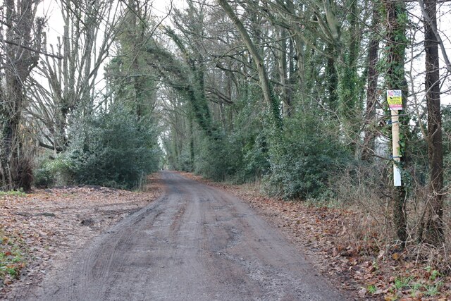
Several well-maintained paths and trails wind through the wood, allowing visitors to explore its beauty and discover hidden corners. The forest is a popular destination for walkers, joggers, and dog owners, providing a peaceful and serene environment for exercise and relaxation.

Loudham's Wood is a treasured natural gem in Buckinghamshire, offering a momentary escape from the hustle and bustle of everyday life. Its lush vegetation, diverse wildlife, and serene ambiance make it a must-visit destination for anyone seeking solace in nature.

If you have any feedback on the listing, please let us know in the comments section below.

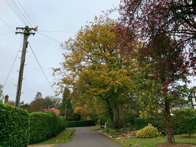
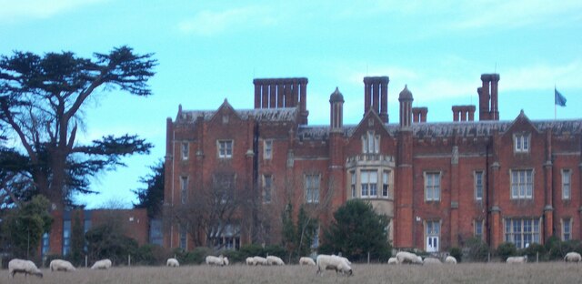
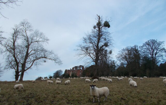
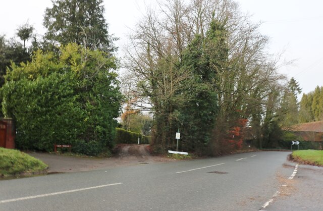
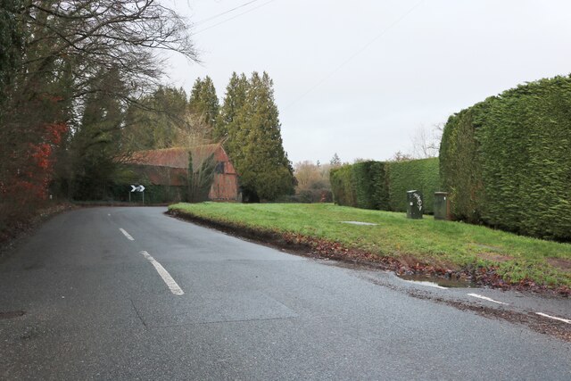
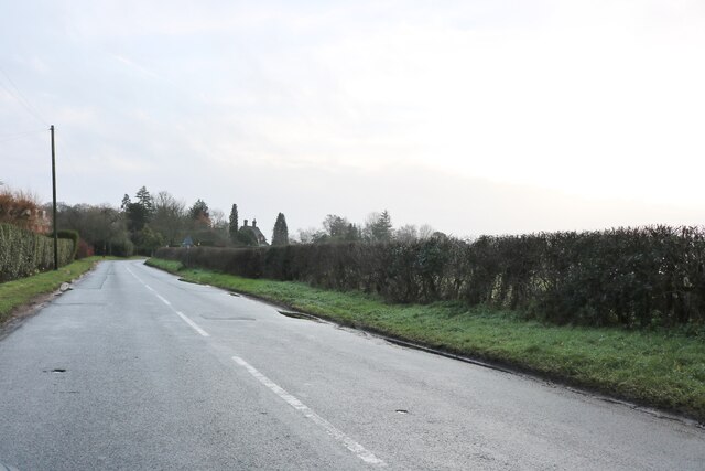
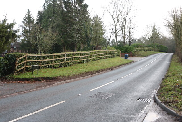
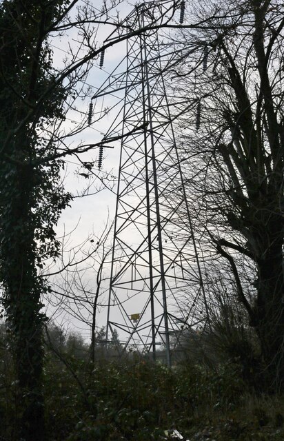
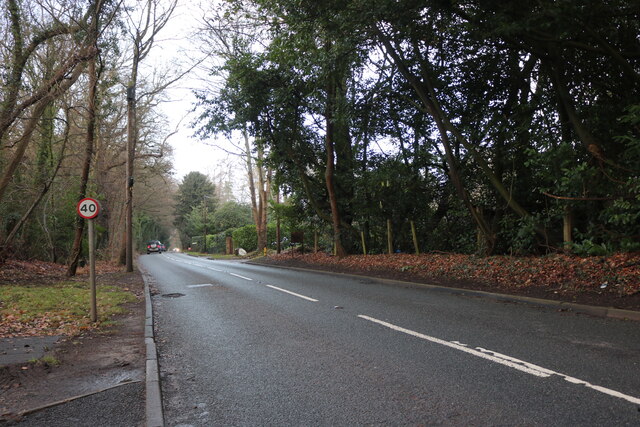
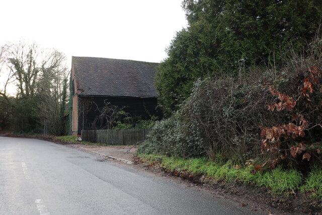
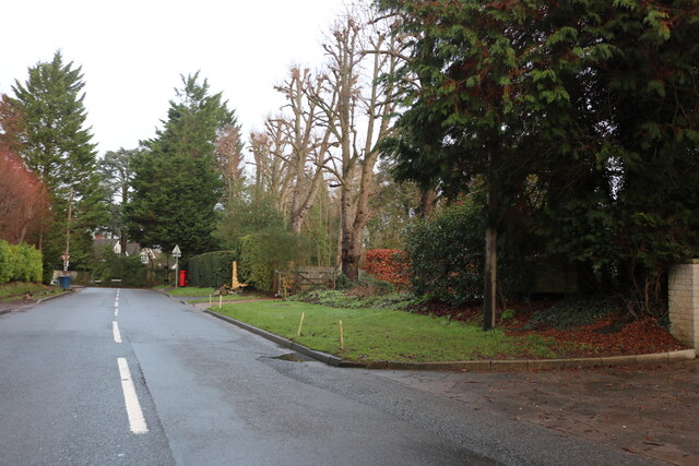
Loudham's Wood Images

Images are sourced within 2km of 51.66197/-0.5572508 or Grid Reference SU9996. Thanks to Geograph Open Source API. All images are credited.

Park Grove
Park Grove
Chalfont and Latimer tube station This station is in Zone 8 of the London Underground on the Metropolitan Line and it serves the villages of Little Chalfont and Latimer in the county of Buckinghamshire.
Chalfont and Latimer tube station
This station is in Zone 8 of the London Underground on the Metropolitan Line and it serves the villages of Little Chalfont and Latimer in the county of Buckinghamshire.
Grazing sheep at Latimer Park
Sheep at Latimer Park
Fungi on a tree, Latimer Park
Shops on Burtons Lane, Little Chalfont
Rain on Chalfont Station Road At the corner of Burtons Lane, with illuminated trees for Christmas.
Rain on Chalfont Station Road
At the corner of Burtons Lane, with illuminated trees for Christmas.
Christmas tree on Burtons Lane, Little Chalfont Those streaks in the sky are heavy rain.
Christmas tree on Burtons Lane, Little Chalfont
Those streaks in the sky are heavy rain.
Cokes Lane, Little Chalfont
Nightingales Lane, Chalfont St Giles
Pylon by Nightingales Lane, Chalfont St Giles
Nightingales Lane, Chalfont St Giles
Cokes Lane, Little Chalfont
Track from Nightingales Lane to Amersham Road
Burtons Lane, Little Chalfont
Show me another place!

Loudham's Wood is located at Grid Ref: SU9996 (Lat: 51.66197, Lng: -0.5572508)

Unitary Authority: Buckinghamshire

Police Authority: Thames Valley

What 3 Words

///stable.ahead.cloud. Near Little Chalfont, Buckinghamshire

Related Wikis

Little Chalfont

Little Chalfont is a village and civil parish in south-east Buckinghamshire, England. It is one of a group of villages known collectively as The Chalfonts...

Chalfont & Latimer station

Chalfont & Latimer is a London Underground and National Rail station in Travelcard Zone 8 (previously zone C) on the Metropolitan line, in Buckinghamshire...

Dr Challoner's High School

Dr Challoner's High School, abbreviated to DCHS, is a grammar school for girls between the ages of 11 and 18, located in Buckinghamshire, England. In August...

Harewood Downs Golf Club

Harewood Downs Golf Club is a golf club, located circa 2.5 miles (4.0 km) south-east of Amersham, Buckinghamshire, England. It is located northwest of...
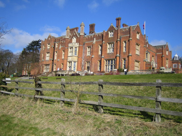
Latimer House

Latimer House is a large country house at Latimer, Buckinghamshire. It is now branded as De Vere Latimer Estate and functions as a countryside hotel used...

Latimer, Buckinghamshire

Latimer is a village that sits on the border between Buckinghamshire and Hertfordshire, England. In 2013, the civil parish of Latimer was renamed, Latimer...

Chenies Manor House

Chenies Manor House in the parish of Chenies in Buckinghamshire, England, is a Tudor Grade I listed building once known as Chenies Palace, although it...

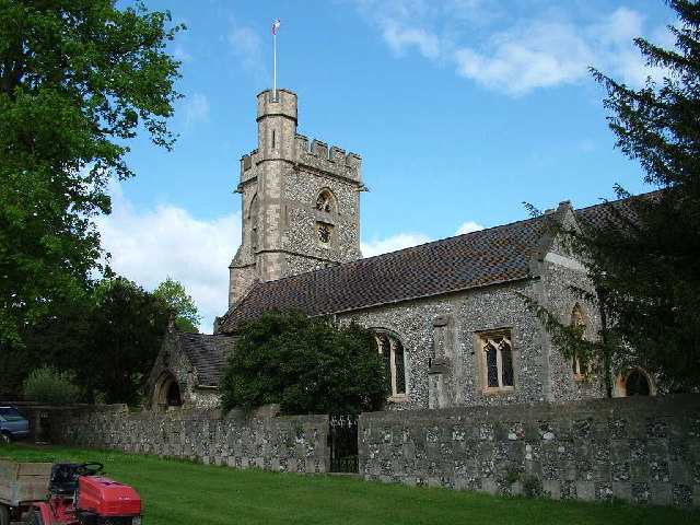
St Michael's, Chenies

St Michael's Church at Chenies, Buckinghamshire, is a Grade I listed Anglican parish church in the Diocese of Oxford in England. It is not of great architectural...

Nearby Amenities

Located within 500m of 51.66197,-0.5572508
Post Box
Mapillary: 770306353674898
Post Box Type: pillar
Ref: HP8 99
Survey Date: 2020-09-24
Lat/Long: 51.6600499/-0.5581239
Barrier: stile
Foot: yes
Lat/Long: 51.6583037/-0.5597617
Turning Circle
Lat/Long: 51.6590065/-0.5594668
Turning Circle
Turning Circle: knuckle
Lat/Long: 51.6611426/-0.5620177
Turning Circle
Turning Circle: hammer
Lat/Long: 51.658916/-0.5583796
Turning Loop
Lat/Long: 51.659631/-0.560711
Burton's Farm
Place: farm
Lat/Long: 51.658645/-0.5534437
Street Lamp
Lamp Type: electric
Lat/Long: 51.6598342/-0.5580922
Addr Housename: Westlea House
Addr Street: Burtons Lane
Lat/Long: 51.6593417/-0.5570247
Street Lamp
Lamp Type: electric
Lat/Long: 51.6609156/-0.5544486
Direction: 155
Generator Method: photovoltaic
Generator Output Electricity: yes
Generator Solar Modules: 16
Generator Source: solar
Generator Type: solar_photovoltaic_panel
Location: roof
Power: generator
Lat/Long: 51.6614228/-0.5517892
Direction: 150
Generator Method: photovoltaic
Generator Output Electricity: yes
Generator Solar Modules: 14
Generator Source: solar
Generator Type: solar_photovoltaic_panel
Location: roof
Power: generator
Lat/Long: 51.6590307/-0.5591898
Direction: 165
Generator Method: photovoltaic
Generator Output Electricity: yes
Generator Solar Modules: 16
Generator Source: solar
Generator Type: solar_photovoltaic_panel
Location: roof
Power: generator
Lat/Long: 51.659067/-0.558498
Direction: 155
Generator Method: photovoltaic
Generator Output Electricity: yes
Generator Solar Modules: 16
Generator Source: solar
Generator Type: solar_photovoltaic_panel
Location: roof
Power: generator
Lat/Long: 51.6602737/-0.5609196
Direction: 155
Generator Method: photovoltaic
Generator Output Electricity: yes
Generator Solar Modules: 16
Generator Source: solar
Generator Type: solar_photovoltaic_panel
Location: roof
Power: generator
Lat/Long: 51.6600108/-0.5616902
Grit Bin
Lat/Long: 51.6629192/-0.5616687
Camera Features: infrared
Camera Mount: pole
Camera Type: fixed
Direction: 335
Height: 2.5
Man Made: surveillance
Surveillance: camera
Lat/Long: 51.6618651/-0.5601781
Camera Features: infrared
Camera Mount: pole
Camera Type: fixed
Direction: 160
Height: 2.5
Man Made: surveillance
Surveillance: camera
Lat/Long: 51.6619826/-0.5602589
Street Lamp
Lamp Type: sodium
Lat/Long: 51.6622044/-0.55014
Direction: 150
Generator Method: photovoltaic
Generator Output Electricity: yes
Generator Solar Modules: 16
Generator Source: solar
Generator Type: solar_photovoltaic_panel
Location: roof
Power: generator
Lat/Long: 51.6628747/-0.5620142
Direction: 165
Fixme: survey needed for solar PV module count
Generator Method: photovoltaic
Generator Output Electricity: yes
Generator Solar Modules: 26
Generator Source: solar
Generator Type: solar_photovoltaic_panel
Location: roof
Power: generator
Lat/Long: 51.6631969/-0.5640515
Fixme: survey needed. substation?
Lat/Long: 51.6598687/-0.5594278
Turning Loop
Lat/Long: 51.6596007/-0.5589965
Direction: 200
Generator Method: photovoltaic
Generator Output Electricity: yes
Generator Solar Modules: 20
Generator Source: solar
Generator Type: solar_photovoltaic_panel
Location: roof
Power: generator
Lat/Long: 51.6595012/-0.5608124
Direction: 155
Generator Method: photovoltaic
Generator Output Electricity: yes
Generator Solar Modules: 16
Generator Source: solar
Generator Type: solar_photovoltaic_panel
Location: roof
Power: generator
Lat/Long: 51.6597051/-0.5587432
Direction: 155
Generator Method: photovoltaic
Generator Output Electricity: yes
Generator Solar Modules: 14
Generator Source: solar
Generator Type: solar_photovoltaic_panel
Location: roof
Power: generator
Lat/Long: 51.6594322/-0.557259
Direction: 160
Generator Method: photovoltaic
Generator Output Electricity: yes
Generator Solar Modules: 2
Generator Source: solar
Generator Type: solar_photovoltaic_panel
Location: roof
Power: generator
Lat/Long: 51.6652917/-0.5617595
Direction: 160
Generator Method: photovoltaic
Generator Output Electricity: yes
Generator Solar Modules: 6
Generator Source: solar
Generator Type: solar_photovoltaic_panel
Location: roof
Power: generator
Lat/Long: 51.6652643/-0.5618702
Direction: 70
Fixme: survey for panel count
Generator Method: photovoltaic
Generator Output Electricity: yes
Generator Solar Modules: 6
Generator Source: solar
Generator Type: solar_photovoltaic_panel
Location: roof
Power: generator
Lat/Long: 51.6651808/-0.5622721
Grit Bin
Lat/Long: 51.6653031/-0.5579357
Street Lamp
Lamp Type: high_pressure_sodium
Lat/Long: 51.6640412/-0.562276
Man Made: street_cabinet
Operator: BT Openreach
Street Cabinet: broadband
Lat/Long: 51.6600058/-0.558047
Direction: 155
Generator Method: photovoltaic
Generator Output Electricity: yes
Generator Solar Modules: 16
Generator Source: solar
Generator Type: solar_photovoltaic_panel
Location: roof
Power: generator
Lat/Long: 51.6603086/-0.5555639
Fixme: solar panels?
Lat/Long: 51.6661367/-0.5590646
Fire Hydrant
Emergency: fire_hydrant
Fire Hydrant Diameter: 80
Fire Hydrant Type: underground
Lat/Long: 51.6607524/-0.5554649
Power: substation
Lat/Long: 51.6614377/-0.5523953
Fire Hydrant
Emergency: fire_hydrant
Fire Hydrant Diameter: 80
Fire Hydrant Type: underground
Lat/Long: 51.6598781/-0.5581466
Fire Hydrant
Emergency: fire_hydrant
Fire Hydrant Diameter: 80
Fire Hydrant Type: underground
Lat/Long: 51.6640803/-0.5624485
Turning Circle
Turning Circle: knuckle
Lat/Long: 51.6608695/-0.5629185
Generator Method: photovoltaic
Generator Output Electricity: yes
Generator Solar Modules: 12w
Generator Source: solar
Generator Type: solar_photovoltaic_panel
Location: roof
Power: generator
Tilted: no
Lat/Long: 51.6625361/-0.5635187
Direction: 155
Generator Method: photovoltaic
Generator Output Electricity: yes
Generator Solar Modules: 8
Generator Source: solar
Generator Type: solar_photovoltaic_panel
Location: roof
Power: generator
Lat/Long: 51.6640838/-0.5627394
Direction: 155
Generator Method: photovoltaic
Generator Output Electricity: yes
Generator Solar Modules: 6
Generator Source: solar
Generator Type: solar_photovoltaic_panel
Location: roof
Power: generator
Lat/Long: 51.664232/-0.5628369
Fire Hydrant
Emergency: fire_hydrant
Fire Hydrant Diameter: 100
Fire Hydrant Type: underground
Survey Date: 2024-01-23
Lat/Long: 51.6619764/-0.5512208
The data included in this document is from www.openstreetmap.org. The data is made available under ODbL.

Have you been to Loudham's Wood?

Leave your review of Loudham's Wood below (or comments, questions and feedback).