Stringer's Common

Wood, Forest in Surrey Guildford

England

Stringer's Common
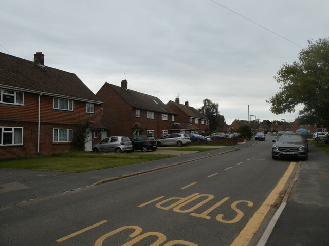
A gloomy morning in Fir Tree Road This month the weather has been consistently warm, with just a couple of rainy days right at the end <span class="nowrap"><a title="https://www.metoffice.gov.uk/binaries/content/assets/metofficegovuk/pdf/weather/learn-about/uk-past-events/summaries/uk_monthly_climate_summary_202109.pdf" rel="nofollow ugc noopener" href="https://www.metoffice.gov.uk/binaries/content/assets/metofficegovuk/pdf/weather/learn-about/uk-past-events/summaries/uk_monthly_climate_summary_202109.pdf">Link</a><img style="margin-left:2px;" alt="External link" title="External link - shift click to open in new window" src="https://s1.geograph.org.uk/img/external.png" width="10" height="10"/></span>
A gloomy morning in Fir Tree Road Credit: Basher Eyre

Stringer's Common is a charming woodland area located in Surrey, England. Situated within the larger district of Wood, Forest, it covers an approximate area of 100 acres. The common is characterized by its dense foliage, tall trees, and a variety of wildlife, offering a picturesque escape from the urban environment.

The woodland is predominantly composed of mature oak and beech trees, creating a majestic canopy that provides shade and shelter to the flora and fauna below. The forest floor is adorned with a rich carpet of ferns, bluebells, and other wildflowers, creating a vibrant and colorful display during the spring and summer months.

Stringer's Common is home to a diverse range of wildlife, including numerous bird species such as woodpeckers, owls, and various songbirds. Small mammals such as squirrels, rabbits, and foxes can also be spotted among the trees, while the occasional deer can be seen grazing in the open areas.

The common offers several well-maintained footpaths that wind their way through the woodland, providing visitors with an opportunity to explore and immerse themselves in nature. These paths lead to picturesque viewpoints, tranquil ponds, and secluded picnic spots, allowing visitors to relax and enjoy the peaceful surroundings.

Stringer's Common is a popular destination for nature lovers, hikers, and families looking to connect with the natural world. Its close proximity to Wood, Forest makes it easily accessible, while its unspoiled beauty and tranquil ambiance make it a truly enchanting place to visit.

If you have any feedback on the listing, please let us know in the comments section below.

Stringer's Common Images

Images are sourced within 2km of 51.265402/-0.57962093 or Grid Reference SU9952. Thanks to Geograph Open Source API. All images are credited.

A gloomy morning in Fir Tree Road This month the weather has been consistently warm, with just a couple of rainy days right at the end <span class="nowrap"><a title="https://www.metoffice.gov.uk/binaries/content/assets/metofficegovuk/pdf/weather/learn-about/uk-past-events/summaries/uk_monthly_climate_summary_202109.pdf" rel="nofollow ugc noopener" href="https://www.metoffice.gov.uk/binaries/content/assets/metofficegovuk/pdf/weather/learn-about/uk-past-events/summaries/uk_monthly_climate_summary_202109.pdf">Link</a><img style="margin-left:2px;" alt="External link" title="External link - shift click to open in new window" src="https://s1.geograph.org.uk/img/external.png" width="10" height="10"/></span>
A gloomy morning in Fir Tree Road
This month the weather has been consistently warm, with just a couple of rainy days right at the end LinkExternal link
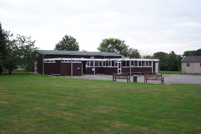
Pond Meadow School: late September 2021 Within which is the Prince Philip Courtyard. The Duke left us in April but departing this month are: 5th September, Girls Aloud's Sarah Harding and Tony Selby, star of the National Service comedy 'Get some in'; 16th September, inventor of the C5 Sir Clive Sinclair and goal scorer extraordinaire, one half of Saint & Greavsie, Jimmy Greaves; 26th Quo bassist, Alan Lancaster; and 27th, '66 World Cup striker Roger Hunt
Pond Meadow School: late September 2021
Within which is the Prince Philip Courtyard. The Duke left us in April but departing this month are: 5th September, Girls Aloud's Sarah Harding and Tony Selby, star of the National Service comedy 'Get some in'; 16th September, inventor of the C5 Sir Clive Sinclair and goal scorer extraordinaire, one half of Saint & Greavsie, Jimmy Greaves; 26th Quo bassist, Alan Lancaster; and 27th, '66 World Cup striker Roger Hunt
St Peter's Shared Church: late September: Once a rarity, such ecumenical churches are now in many communities. Making history this month: 7th September, El Salvador becomes the first country in the world to accept Bitcoin as an official currency; 14th September, North Korea demonstrates two short-range ballistic missiles that land just outside Japan's territorial waters; 15th, AUKUS: a trilateral security pact between Australia, the United Kingdom, and the United States is formed; 25th, a major petrol panic kicks off in the UK leading to chaos everywhere for many days; 26th, and the German federal election is held- it ends in deadlock and Angela Merkel is staying on until a coalition emerges...
St Peter's Shared Church: late September:
Once a rarity, such ecumenical churches are now in many communities. Making history this month: 7th September, El Salvador becomes the first country in the world to accept Bitcoin as an official currency; 14th September, North Korea demonstrates two short-range ballistic missiles that land just outside Japan's territorial waters; 15th, AUKUS: a trilateral security pact between Australia, the United Kingdom, and the United States is formed; 25th, a major petrol panic kicks off in the UK leading to chaos everywhere for many days; 26th, and the German federal election is held- it ends in deadlock and Angela Merkel is staying on until a coalition emerges...
Dawn breaks at Bellfields (1) Town centre bound bus stop in Stoughton Road
Dawn breaks at Bellfields (1)
Town centre bound bus stop in Stoughton Road
Dawn breaks at Bellfields (2) Looking across Stoughton Road towards Maple Grove
Dawn breaks at Bellfields (2)
Looking across Stoughton Road towards Maple Grove
Dawn breaks at Bellfields (3) Houses in Stoughton Road
Dawn breaks at Bellfields (3)
Houses in Stoughton Road
Dawn breaks at Bellfields (4) Looking from Stoughton Road into Hornbeam Road
Dawn breaks at Bellfields (4)
Looking from Stoughton Road into Hornbeam Road
Dawn breaks at Bellfields (5) Looking along Hornbeam Road towards Stoughton Road
Dawn breaks at Bellfields (5)
Looking along Hornbeam Road towards Stoughton Road
Dawn breaks at Bellfields (6) Houses in Hornbeam Road
Dawn breaks at Bellfields (6)
Houses in Hornbeam Road
Dawn breaks at Bellfields (7) Junction of Medlar Close and Hornbeam Road
Dawn breaks at Bellfields (7)
Junction of Medlar Close and Hornbeam Road
Dawn breaks at Bellfields (8) Looking from Stoughton Road into Medlar Close
Dawn breaks at Bellfields (8)
Looking from Stoughton Road into Medlar Close
Dawn breaks at Bellfields (9) Mid section of Hornbeam Road
Dawn breaks at Bellfields (9)
Mid section of Hornbeam Road
Dawn breaks at Bellfields (10) Approaching the junction of Hornbeam Road and Cedar Way
Dawn breaks at Bellfields (10)
Approaching the junction of Hornbeam Road and Cedar Way
Dawn breaks at Bellfields (11) Bus stop at the junction of Hornbeam Road and Cedar Way
Dawn breaks at Bellfields (11)
Bus stop at the junction of Hornbeam Road and Cedar Way
Dawn breaks at Bellfields (12) Looking westwards from the junction of Cedar Way and Hornbeam Road
Dawn breaks at Bellfields (12)
Looking westwards from the junction of Cedar Way and Hornbeam Road
Dawn breaks at Bellfields (13) Bus heading westwards along Cedar Way
(looking from the bottom end of Fir Tree Road)
Dawn breaks at Bellfields (13)
Bus heading westwards along Cedar Way (looking from the bottom end of Fir Tree Road)
Dawn breaks at Bellfields (14) Postbox by the bus stop at the bottom end of Fir Tree Road
Dawn breaks at Bellfields (14)
Postbox by the bus stop at the bottom end of Fir Tree Road
Dawn breaks at Bellfields (15) Telegraph pole in Fir Tree Road
Dawn breaks at Bellfields (15)
Telegraph pole in Fir Tree Road
Show me another place!

Stringer's Common is located at Grid Ref: SU9952 (Lat: 51.265402, Lng: -0.57962093)

Administrative County: Surrey

District: Guildford

Police Authority: Surrey

What 3 Words

///rubble.fonts.rise. Near Fairlands, Surrey

Related Wikis

Stringer's Common

Stringer's Common is a 30-hectare (74-acre) nature reserve east of Worplesdon in Surrey. It is owned by Surrey County Council and managed by the Surrey...

Cycling UK

Cycling UK is a trading name of the Cyclists' Touring Club (CTC), which is a charitable membership organisation supporting cyclists and promoting bicycle...

Jacobs Well, Surrey

Jacobs Well or Jacobswell is a small village in Surrey, England, of 20th century creation, with a population of 1,171. The village forms a northern outskirt...

Pond Meadow School

Pond Meadow School is a small special school with academy status located in Guildford, Surrey, England for pupils aged 2 – 19. == References ==

Nearby Amenities

Located within 500m of 51.265402,-0.57962093
Mini Roundabout
Direction: clockwise
Lat/Long: 51.2643195/-0.5849981
Power: tower
Source: sas
Lat/Long: 51.263285/-0.583712
Best One Hazel Stores
Addr City: Guildford
Addr Country: GB
Addr Postcode: GU1 1NS
Addr Street: Hazel Avenue
Brand: Best-one
Brand Wikidata: Q4896532
Contact Website: https://stores.best-one.co.uk/hazel-stores-best-one-af627160860c
Fhrs Authority: Guildford
Fhrs Id: 649793
Fhrs Local Authority Id: 4359
Shop: convenience
Lat/Long: 51.261111/-0.5802779
Bus Stop
Hazel Avenue Shops
Naptan AtcoCode: 40004407195A
Naptan Bearing: NE
Naptan CommonName: Hazel Avenue Shops
Naptan Indicator: adj
Naptan Landmark: Hazel Avenue Shops
Naptan NaptanCode: surapgwm
Naptan PlusbusZoneRef: GUILDFD
Naptan Street: Hazel Avenue
Naptan Verified: yes
Public Transport: platform
Source: naptan_import
Lat/Long: 51.2611634/-0.5806667
Stoke Hill
Natural: peak
Source: npe
Lat/Long: 51.2622043/-0.5816503
Noexit: yes
Lat/Long: 51.2617873/-0.5775024
Noexit: yes
Lat/Long: 51.2621625/-0.5772112
Noexit: yes
Lat/Long: 51.2623061/-0.5767208
Stringers Farm
Landuse: farm
Note Retag: CS #48756035
Source: photo
Lat/Long: 51.2631906/-0.5774694
Man Made: phone_mast
Source: photo
Lat/Long: 51.2635508/-0.5785986
Stringers Barn
Landuse: farm
Note Retag: CS #48756035
Source: photo
Lat/Long: 51.2677103/-0.5796574
Created By: Potlatch 0.10f
Postal Code: GU1 1MX
Lat/Long: 51.2637371/-0.580302
Bicycle Parking
Capacity: 1
Lat/Long: 51.2642679/-0.5851144
Grange Park Stores
Addr City: Guildford
Addr Country: GB
Addr Postcode: GU2 9PB
Addr Street: Burden Way
Addr Unit: 1 - 2, The Parade
Fhrs Authority: Guildford
Fhrs Id: 650164
Fhrs Local Authority Id: 614
Shop: convenience
Lat/Long: 51.2642398/-0.5852313
Old Phone: +44 1483 236350
Removed Amenity: telephone
Lat/Long: 51.2643504/-0.5857047
Post Box
Post Box Mounting: brick_pillar
Post Box Type: wall
Ref: GU2 297
Lat/Long: 51.2643544/-0.5857639
Post Box
Ref: GU4 37
Lat/Long: 51.2649191/-0.5736839
Bus Stop
Mansel Close
Bench: no
Naptan AtcoCode: 40004407180A
Naptan Bearing: W
Naptan CommonName: Mansel Close
Naptan Indicator: Just Before
Naptan Landmark: Mansel Close
Naptan NaptanCode: surapgdw
Naptan PlusbusZoneRef: GUILDFD
Naptan Street: Grange Road
Naptan Verified: no
Public Transport: platform
Shelter: no
Source: naptan_import
Tactile Paving: no
Lat/Long: 51.2657443/-0.5861128
Bus Stop
Mansel Close
Naptan AtcoCode: 40004407180B
Naptan Bearing: E
Naptan CommonName: Mansel Close
Naptan Indicator: Just after
Naptan Landmark: Mansel Close
Naptan NaptanCode: surapgja
Naptan PlusbusZoneRef: GUILDFD
Naptan Street: Grange Road
Naptan Verified: no
Public Transport: platform
Shelter: no
Source: naptan_import
Lat/Long: 51.2657995/-0.5857171
Bus Stop
Burden Way Shops
Naptan AtcoCode: 40004407181A
Naptan Bearing: N
Naptan CommonName: Burden Way Shops
Naptan Indicator: Just Before
Naptan Landmark: Burden Way Shops
Naptan NaptanCode: surapgjd
Naptan PlusbusZoneRef: GUILDFD
Naptan Street: Grange Road
Naptan Verified: no
Public Transport: platform
Source: naptan_import
Lat/Long: 51.264002/-0.5850875
Bus Stop
Burden Way Shops
Naptan AtcoCode: 40004407181B
Naptan Bearing: S
Naptan CommonName: Burden Way Shops
Naptan Indicator: Just after
Naptan Landmark: Burden Way Shops
Naptan NaptanCode: surapgjg
Naptan PlusbusZoneRef: GUILDFD
Naptan Street: Grange Road
Naptan Verified: no
Public Transport: platform
Source: naptan_import
Lat/Long: 51.2639247/-0.5849239
Bus Stop
Juniper Close
Naptan AtcoCode: 40004407194A
Naptan Bearing: SW
Naptan CommonName: Juniper Close
Naptan Indicator: Just after
Naptan Landmark: Juniper Close
Naptan NaptanCode: surapgwj
Naptan PlusbusZoneRef: GUILDFD
Naptan Street: Hazel Avenue
Naptan Verified: no
Public Transport: platform
Source: naptan_import
Lat/Long: 51.2630109/-0.5791183
Bus Stop
Juniper Close
Naptan AtcoCode: 40004407194B
Naptan Bearing: NE
Naptan BusStopType: CUS
Naptan CommonName: Juniper Close
Naptan Indicator: Just Before
Naptan Landmark: Juniper Close
Naptan NaptanCode: surgpamt
Naptan Street: Hazel Avenue
Naptan Verified: no
Note: Alighting point only.
Physically Present: no
Public Transport: platform
Source: naptan_import
Lat/Long: 51.2630355/-0.5792899
Bus Stop
Hazel Avenue Shops
Naptan AtcoCode: 40004407195B
Naptan Bearing: SW
Naptan CommonName: Hazel Avenue Shops
Naptan Indicator: Opp
Naptan Landmark: Hazel Avenue Shops
Naptan NaptanCode: surapgwp
Naptan PlusbusZoneRef: GUILDFD
Naptan Street: Hazel Avenue
Naptan Verified: yes
Public Transport: platform
Source: naptan_import
Lat/Long: 51.2612629/-0.580439
Bus Stop
Stringers Avenue
Bench: yes
Naptan AtcoCode: 40004407197A
Naptan Bearing: N
Naptan CommonName: Stringers Avenue
Naptan Indicator: Opp
Naptan Landmark: Stringers Avenue
Naptan NaptanCode: surapjag
Naptan PlusbusZoneRef: GUILDFD
Naptan Street: Woking Road
Naptan Verified: no
Public Transport: platform
Shelter: yes
Source: naptan_import
Lat/Long: 51.2684159/-0.5760899
Bus Stop
Stringers Avenue
Naptan AtcoCode: 40004407197B
Naptan Bearing: S
Naptan CommonName: Stringers Avenue
Naptan Indicator: Just after
Naptan Landmark: Stringers Avenue
Naptan NaptanCode: surapjaj
Naptan PlusbusZoneRef: GUILDFD
Naptan Street: Woking Road
Naptan Verified: no
Public Transport: platform
Source: naptan_import
Lat/Long: 51.2676161/-0.5757351
Bus Stop
Whitehouse Lane
Naptan AtcoCode: 40004407198A
Naptan Bearing: N
Naptan CommonName: Whitehouse Lane
Naptan Indicator: Opp
Naptan Landmark: Whitehouse Lane
Naptan NaptanCode: surapjam
Naptan PlusbusZoneRef: GUILDFD
Naptan Street: Woking Road
Naptan Verified: no
Public Transport: platform
Source: naptan_import
Lat/Long: 51.2650513/-0.5740797
Bus Stop
Whitehouse Lane
Naptan AtcoCode: 40004407198B
Naptan Bearing: S
Naptan CommonName: Whitehouse Lane
Naptan Indicator: adj
Naptan Landmark: Whitehouse Lane
Naptan NaptanCode: surapjap
Naptan PlusbusZoneRef: GUILDFD
Naptan Street: Woking Road
Naptan Verified: no
Public Transport: platform
Source: naptan_import
Lat/Long: 51.2648499/-0.573719
Jacobs Well Road
Naptan AtcoCode: 40004407201A
Naptan Bearing: N
Naptan BusStopType: CUS
Naptan CommonName: Jacobs Well Road
Naptan Indicator: Just before
Naptan Landmark: Jacobs Well Road
Naptan NaptanCode: surgpjwj
Naptan Street: Woking Road
Naptan Verified: no
Source: naptan_import
Lat/Long: 51.2631312/-0.5734988
Barrier: cycle_barrier
Lat/Long: 51.2621875/-0.5845122
Information: board
Lat/Long: 51.2676491/-0.5817168
Gunners Farm
Landuse: farm
Note: FIXME not sure which farm is which
Note Retag: CS #48756035
Source: photo
Lat/Long: 51.2643428/-0.5778968
Bullens Hill Farm
Landuse: farm
Note: FIXME not sure which farm is which
Note Retag: CS #48756035
Source: photo
Lat/Long: 51.2643761/-0.5779792
Crossing
Crossing: unmarked
Crossing Island: yes
Kerb: lowered
Tactile Paving: yes
Lat/Long: 51.2634803/-0.5733473
Crossing
Crossing: unmarked
Kerb: lowered
Sloped Curb: yes
Lat/Long: 51.2681879/-0.5758785
Give Way
Direction: forward
Source: DigitalGlobe-Standard
Lat/Long: 51.2679957/-0.5757946
Crossing
Crossing: unmarked
Kerb: lowered
Sloped Curb: yes
Lat/Long: 51.2681799/-0.5759384
Crossing
Crossing: unmarked
Lat/Long: 51.2636274/-0.58596
Give Way
Direction: backward
Lat/Long: 51.263488/-0.5733301
The data included in this document is from www.openstreetmap.org. The data is made available under ODbL.

Have you been to Stringer's Common?

Leave your review of Stringer's Common below (or comments, questions and feedback).