Outfield Plantation

Wood, Forest in Buckinghamshire

England

Outfield Plantation

Chalfont St Giles Village Green
Chalfont St Giles Credit: Christine Matthews

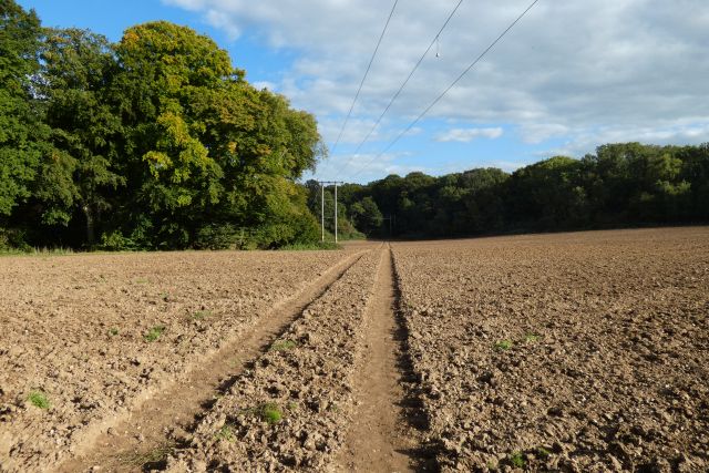
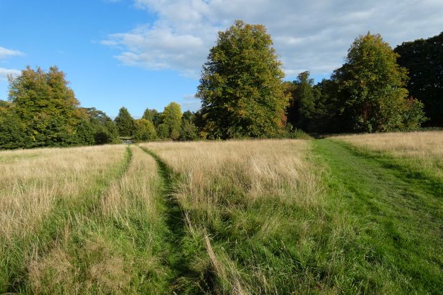
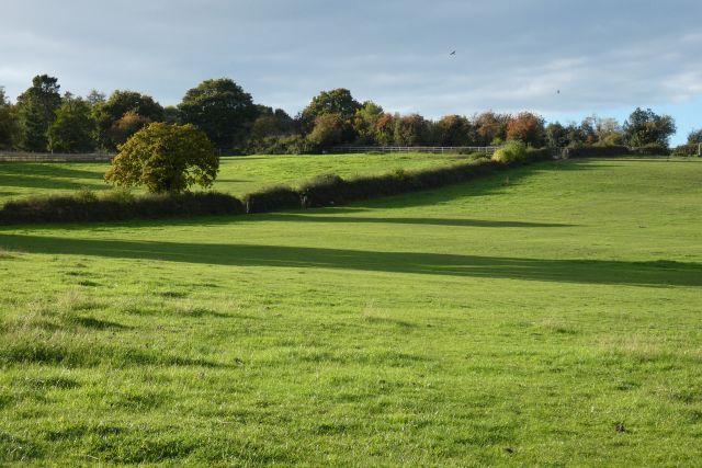
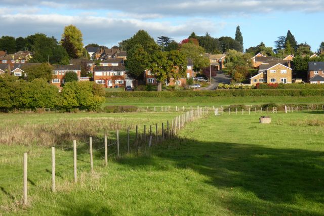
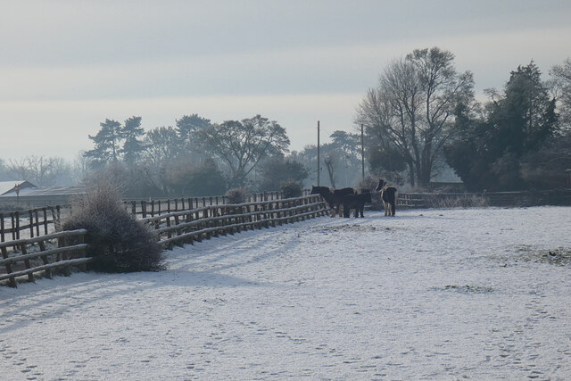
Outfield Plantation is a stunning wooded area located in Buckinghamshire, England. Spanning over a vast expanse, it is known for its dense forest and lush greenery. The plantation is situated in a picturesque location, surrounded by rolling hills and a tranquil atmosphere, making it a popular destination for nature lovers and outdoor enthusiasts.

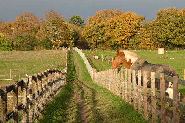
The woodland in Outfield Plantation is predominantly made up of various species of trees, such as oak, beech, and birch. These trees create a dense canopy, providing a haven for a wide variety of wildlife. Visitors to the plantation can often spot a range of animals, including deer, foxes, and a plethora of bird species.

The plantation offers numerous walking trails and paths, allowing visitors to explore the area and admire its natural beauty. It is a haven for hikers, joggers, and cyclists, who can enjoy the peacefulness and serenity of the forest. Additionally, there are picnic areas and benches scattered throughout the plantation, providing a perfect spot for visitors to relax and enjoy a meal amidst the beautiful surroundings.

Outfield Plantation also plays an essential role in the conservation of the local ecosystem. It is actively managed to maintain a healthy balance between wildlife preservation and recreational activities. Local authorities and conservation groups work together to ensure the sustainability of the plantation, protecting the diverse range of flora and fauna that call it home.

Overall, Outfield Plantation in Buckinghamshire is a cherished natural treasure. Its enchanting woodland, abundant wildlife, and well-maintained trails make it a must-visit destination for anyone seeking a peaceful retreat within the embrace of nature.

If you have any feedback on the listing, please let us know in the comments section below.

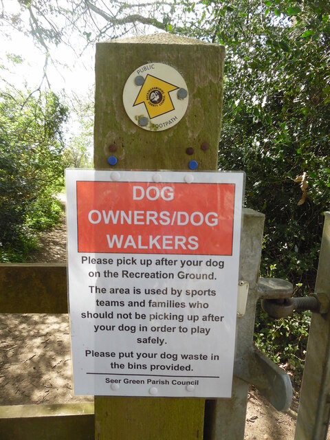
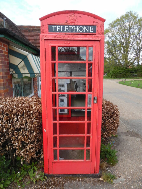
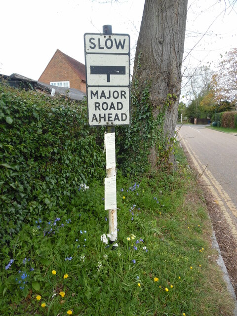
Outfield Plantation Images

Images are sourced within 2km of 51.613848/-0.57220914 or Grid Reference SU9891. Thanks to Geograph Open Source API. All images are credited.

Chalfont St Giles Village Green
Chalfont St Giles
Village Green
Dog Notice near Recreation Ground, Seer Green This notice, which has been erected by Seer Green Parish Council, is on the footpath between Butlers Cross and Seer Green. It has the following wording:

                         DOG 
                      OWNERS/DOG
                       WALKERS

               Please pick up after your dog
                 on the Recreation Ground.

               The area is used by sports
                 teams and families who
               should not be picking up after
                 your dog in order to play
                         safely.
               
                Please put your dog waste in
                     the bins provided.

 A public footpath arrow marker can be seen above the notice.
Dog Notice near Recreation Ground, Seer Green
This notice, which has been erected by Seer Green Parish Council, is on the footpath between Butlers Cross and Seer Green. It has the following wording: DOG OWNERS/DOG WALKERS Please pick up after your dog on the Recreation Ground. The area is used by sports teams and families who should not be picking up after your dog in order to play safely. Please put your dog waste in the bins provided. A public footpath arrow marker can be seen above the notice.
Red K6 Telephone Box in Jordans village This telephone box is located by Jordans Village Store in Green West Road, HP9 2SY. Its payphone has now been taken out and an Audio History of Jordans Village installed instead. Details of Jordans village can be found at <span class="nowrap"><a title="https://www.jordansvillage.co.uk/index.html" rel="nofollow ugc noopener" href="https://www.jordansvillage.co.uk/index.html">Link</a><img style="margin-left:2px;" alt="External link" title="External link - shift click to open in new window" src="https://s1.geograph.org.uk/img/external.png" width="10" height="10"/></span>. Green North Road can just be seen to the right of the photo.
Red K6 Telephone Box in Jordans village
This telephone box is located by Jordans Village Store in Green West Road, HP9 2SY. Its payphone has now been taken out and an Audio History of Jordans Village installed instead. Details of Jordans village can be found at LinkExternal link. Green North Road can just be seen to the right of the photo.
Old Road Sign in Seer Green Lane, Jordans This photo shows the old road sign located in Seer Green Lane HP9 2ST and which is missing its red circle with inverted triangle above it. During the mid-1960s, this particular sign was replaced by the inverted triangle "Give Way" sign. This road leads to Jordans Lane in the distance.
Old Road Sign in Seer Green Lane, Jordans
This photo shows the old road sign located in Seer Green Lane HP9 2ST and which is missing its red circle with inverted triangle above it. During the mid-1960s, this particular sign was replaced by the inverted triangle "Give Way" sign. This road leads to Jordans Lane in the distance.
The Crown
The Crown
Farmland, Chalfont St Peter
Grassland, Chalfont St Giles
Pasture, Chalfont St Peter
Pasture, Chalfont St Giles
Pasture, Seer Green A footpath heads through paddocks to reach Butler's Cross and the western edge of Chalfont St Giles.
Pasture, Seer Green
A footpath heads through paddocks to reach Butler's Cross and the western edge of Chalfont St Giles.
Pasture, Chalfont St Giles A bridleway passes between horse paddocks on the approach to Narcot Lane.
Pasture, Chalfont St Giles
A bridleway passes between horse paddocks on the approach to Narcot Lane.
Chalfont St Giles The main road leading into the village from the south west.  The High Street is round the next corner.
Chalfont St Giles
The main road leading into the village from the south west. The High Street is round the next corner.
Chalfont St Giles - rosettes display
Playground and skate park, Chalfont St Peter
Chalfont St. Peter & Chalfont St. Giles Parish Councils
High Street, Chalfont St Peter
Chalfont St Peter AFC, Gravel Hill
Allotment Gardens, Chalfont St Peter
Show me another place!

Outfield Plantation is located at Grid Ref: SU9891 (Lat: 51.613848, Lng: -0.57220914)

Unitary Authority: Buckinghamshire

Police Authority: Thames Valley

What 3 Words

///works.owner.boom. Near Chalfont St Peter, Buckinghamshire

Related Wikis

British Defence Film Library

The British Defence Film Library (BDFL) is part of the Services Sound and Vision Corporation and is responsible for maintaining the library and distribution...

Chalfonts Community College

Chalfonts Community College is a co-educational secondary school in Chalfont St Peter, Buckinghamshire. It takes children from the age of 11 through to...

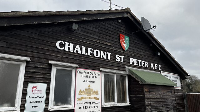
Chalfont St Peter A.F.C.

Chalfont St Peter Association Football Club is a football club based in Chalfont St Peter, Buckinghamshire, England. They are currently members of the...

Welders House

Welders House is a Grade II listed house located in the village of Jordans, in Buckinghamshire, England. It was built between 1898 and 1899 for the politician...

Jordans, Buckinghamshire

Jordans is a village in Chalfont St Giles parish, Buckinghamshire, England, and the civil parish of Hedgerley. It is a centre for Quakerism, holds the...

Chalfont St Peter

Chalfont St Peter is a large village and civil parish in southeastern Buckinghamshire, England. It is in a group of villages called The Chalfonts which...

Chalfont Wasps F.C.

Chalfont Wasps Football Club is a football club based in Chalfont St Giles, near Amersham, England. They are currently members of the Hellenic League Division...

Chalfont Common

Chalfont Common is a hamlet in the parish of Chalfont St Peter, Buckinghamshire, England. It is located in the Chiltern Hills, approximately one mile...

Nearby Amenities

Located within 500m of 51.613848,-0.57220914
Mini Roundabout
Lat/Long: 51.614073/-0.5743019
Barrier: yes
Lat/Long: 51.6156382/-0.5702231
Turning Circle
Lat/Long: 51.6154722/-0.5756244
Communication Satellite: yes
Man Made: antenna
Lat/Long: 51.6161889/-0.5765674
Communication Satellite: yes
Man Made: antenna
Lat/Long: 51.6159147/-0.5765649
Communication Satellite: yes
Man Made: antenna
Lat/Long: 51.61568/-0.5766314
Communication Satellite: yes
Man Made: antenna
Lat/Long: 51.6156563/-0.5763277
Communication Satellite: yes
Man Made: antenna
Lat/Long: 51.6155495/-0.5761561
Communication Satellite: yes
Man Made: antenna
Lat/Long: 51.6155809/-0.5759668
Communication Satellite: yes
Man Made: antenna
Lat/Long: 51.6155655/-0.5757973
Communication Satellite: yes
Man Made: antenna
Lat/Long: 51.6156223/-0.5756732
Communication Satellite: yes
Man Made: antenna
Lat/Long: 51.6156693/-0.5754838
Communication Satellite: yes
Man Made: antenna
Lat/Long: 51.6156594/-0.5753108
Communication Satellite: yes
Man Made: antenna
Lat/Long: 51.6156616/-0.5751486
Communication Satellite: yes
Man Made: antenna
Lat/Long: 51.6155739/-0.5753704
Communication Satellite: yes
Man Made: antenna
Lat/Long: 51.6155721/-0.575438
Communication Satellite: yes
Man Made: antenna
Lat/Long: 51.6153757/-0.5757043
Communication Satellite: yes
Man Made: antenna
Lat/Long: 51.6153765/-0.575828
Communication Satellite: yes
Man Made: antenna
Lat/Long: 51.6153857/-0.5759844
Communication Satellite: yes
Man Made: antenna
Lat/Long: 51.6154817/-0.5762558
Communication Satellite: yes
Man Made: antenna
Lat/Long: 51.6154255/-0.5763127
Communication Satellite: yes
Man Made: antenna
Lat/Long: 51.6154139/-0.5764737
Communication Satellite: yes
Man Made: antenna
Lat/Long: 51.6152349/-0.5764954
Communication Satellite: yes
Man Made: antenna
Lat/Long: 51.6152776/-0.5763259
Communication Satellite: yes
Man Made: antenna
Lat/Long: 51.6152948/-0.5759546
Communication Satellite: yes
Man Made: antenna
Lat/Long: 51.6152935/-0.5758231
Communication Satellite: yes
Man Made: antenna
Lat/Long: 51.6152955/-0.5756895
Communication Satellite: yes
Man Made: antenna
Lat/Long: 51.6153927/-0.5748581
Communication Satellite: yes
Man Made: antenna
Lat/Long: 51.6153351/-0.5749425
Communication Satellite: yes
Man Made: antenna
Lat/Long: 51.6153033/-0.5750485
Communication Satellite: yes
Man Made: antenna
Lat/Long: 51.615291/-0.5751294
Communication Satellite: yes
Man Made: antenna
Lat/Long: 51.6152842/-0.5752055
Communication Satellite: yes
Man Made: antenna
Lat/Long: 51.615285/-0.5752548
Communication Satellite: yes
Man Made: antenna
Lat/Long: 51.615292/-0.5753165
Communication Satellite: yes
Man Made: antenna
Lat/Long: 51.615277/-0.5753526
Communication Satellite: yes
Man Made: antenna
Lat/Long: 51.6152682/-0.5753984
Communication Satellite: yes
Man Made: antenna
Lat/Long: 51.61529/-0.575433
Communication Satellite: yes
Man Made: antenna
Lat/Long: 51.6152819/-0.5754833
Communication Satellite: yes
Man Made: antenna
Lat/Long: 51.6151479/-0.575054
Communication Satellite: yes
Man Made: antenna
Lat/Long: 51.6151679/-0.5750886
Communication Satellite: yes
Man Made: antenna
Lat/Long: 51.6151652/-0.5749944
Communication Satellite: yes
Man Made: antenna
Lat/Long: 51.6151752/-0.5749384
Communication Satellite: yes
Man Made: antenna
Lat/Long: 51.6151612/-0.5748458
Communication Satellite: yes
Man Made: antenna
Lat/Long: 51.615373/-0.5754149
Direction: 165
Generator Method: photovoltaic
Generator Output Electricity: yes
Generator Solar Modules: 18
Generator Source: solar
Generator Type: solar_photovoltaic_panel
Location: roof
Power: generator
Lat/Long: 51.6107902/-0.5678097
Crossing
Lat/Long: 51.6145299/-0.5714242
Direction: 170
Generator Method: photovoltaic
Generator Output Electricity: yes
Generator Solar Modules: 36
Generator Source: solar
Generator Type: solar_photovoltaic_panel
Location: roof
Power: generator
Lat/Long: 51.6165907/-0.5693515
Communication Satellite: yes
Man Made: antenna
Lat/Long: 51.6135042/-0.5761482
Communication Satellite: yes
Man Made: antenna
Lat/Long: 51.6134648/-0.576152
Communication Satellite: yes
Man Made: antenna
Lat/Long: 51.613426/-0.5761557
Communication Satellite: yes
Man Made: antenna
Lat/Long: 51.6134224/-0.5760921
Communication Satellite: yes
Man Made: antenna
Lat/Long: 51.6134612/-0.5760884
Communication Satellite: yes
Man Made: antenna
Lat/Long: 51.6135006/-0.5760846
Communication Satellite: yes
Man Made: antenna
Lat/Long: 51.6134206/-0.5760333
Communication Satellite: yes
Man Made: antenna
Lat/Long: 51.6134594/-0.5760296
Communication Satellite: yes
Man Made: antenna
Lat/Long: 51.6134988/-0.5760258
Turning Circle
Lat/Long: 51.614019/-0.5774365
Man Made: mast
Lat/Long: 51.6143058/-0.5737622
Communication Satellite: yes
Man Made: antenna
Lat/Long: 51.6154215/-0.5754681
Communication Satellite: yes
Man Made: antenna
Lat/Long: 51.6137291/-0.5764003
Communication Satellite: yes
Man Made: antenna
Lat/Long: 51.6137186/-0.5763654
The data included in this document is from www.openstreetmap.org. The data is made available under ODbL.

Have you been to Outfield Plantation?

Leave your review of Outfield Plantation below (or comments, questions and feedback).