Blackwell Spinney

Wood, Forest in Bedfordshire

England

Blackwell Spinney

Paavenham Road with layby Looking northeast from the junction with Pavenham Road coming from Chellington, and Pavenham Road from West End, which continues to Pavenham.
Paavenham Road with layby Credit: M J Richardson

Blackwell Spinney is a charming woodland located in Bedfordshire, England. Situated in the scenic county, specifically in the village of Blackwell, this spinney is a delightful natural area that offers a serene and peaceful retreat for visitors.

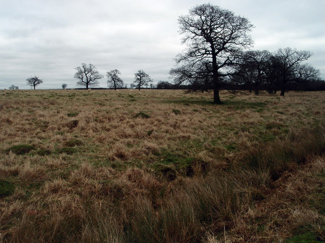
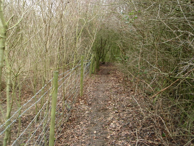
Covering an area of approximately 25 acres, Blackwell Spinney is characterized by its dense collection of trees, predominantly consisting of oak and beech. These towering trees provide a rich canopy, creating a shaded and cool environment, even on the hottest of days. The forest floor is adorned with a variety of wildflowers and ferns, adding to the natural beauty of the area.

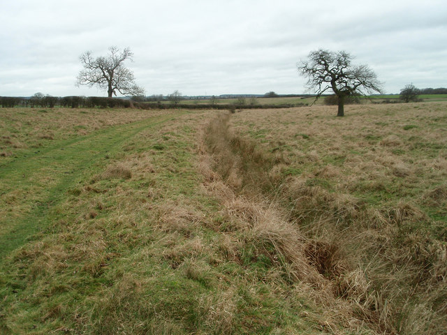
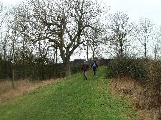
The spinney is crisscrossed by a network of well-maintained footpaths, allowing visitors to explore and meander through the woodland at their own pace. These paths lead to several picturesque spots, including a tranquil pond that is home to a diverse range of wildlife, such as ducks and dragonflies.

Blackwell Spinney also serves as a habitat for numerous bird species, making it a popular destination for birdwatching enthusiasts. Visitors may catch a glimpse of woodpeckers, owls, and various songbirds as they traverse the woodland.

The spinney is open to the public year-round, and entry is free. It is an ideal spot for outdoor activities such as walking, picnicking, and photography. Whether one seeks solitude or wishes to immerse themselves in nature, Blackwell Spinney offers a peaceful haven in the heart of Bedfordshire.

If you have any feedback on the listing, please let us know in the comments section below.

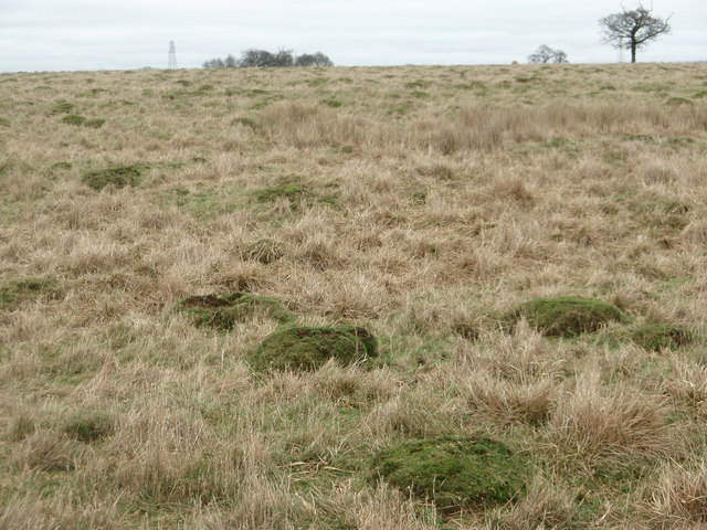
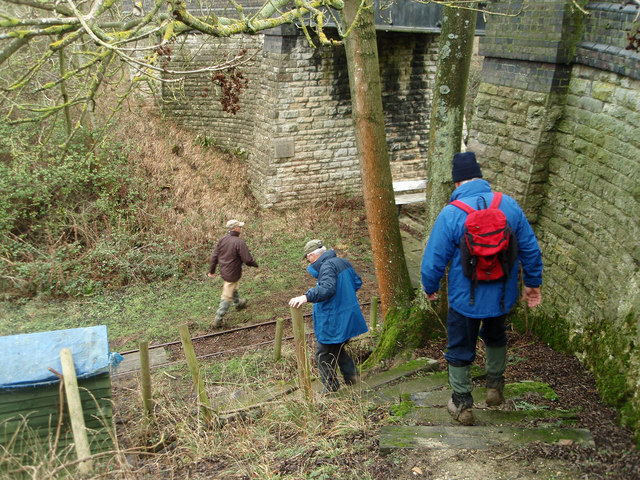
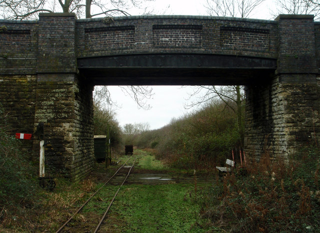
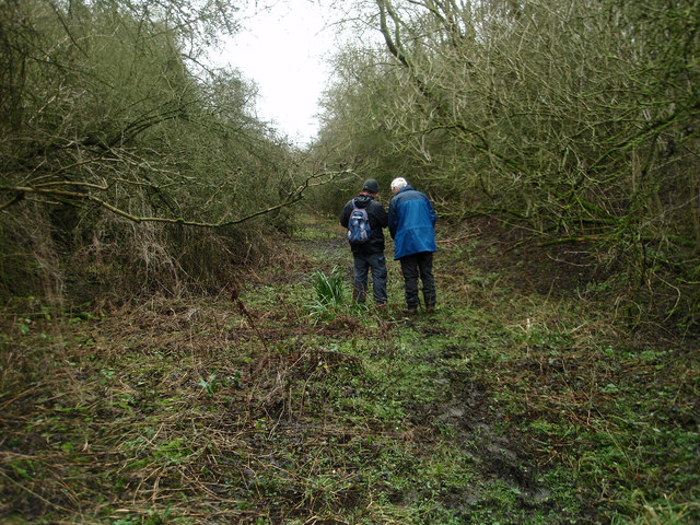
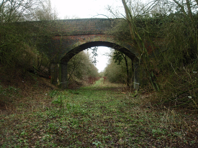
Blackwell Spinney Images

Images are sourced within 2km of 52.177092/-0.57869751 or Grid Reference SP9754. Thanks to Geograph Open Source API. All images are credited.

Paavenham Road with layby Looking northeast from the junction with Pavenham Road coming from Chellington, and Pavenham Road from West End, which continues to Pavenham.
Paavenham Road with layby
Looking northeast from the junction with Pavenham Road coming from Chellington, and Pavenham Road from West End, which continues to Pavenham.
Pax Hill Farm High Street, Pavenham.
Pax Hill Farm
High Street, Pavenham.
Carlton and Harrold from the air Carlton is the village to the left of centre, Harold is at the top, between the lakes.
Carlton and Harrold from the air
Carlton is the village to the left of centre, Harold is at the top, between the lakes.
Old pasture land Large ant hills suggest that this field has not been under the plough for many years if at all. Usually described as rough grazing.
Old pasture land
Large ant hills suggest that this field has not been under the plough for many years if at all. Usually described as rough grazing.
Ant hills in pasture land Rough grazing near Turvey.
Ant hills in pasture land
Rough grazing near Turvey.
Grazing land and bridleway near Turvey
Heading towards an old railway bridge On the bridleway that crosses the disused railway line.
Heading towards an old railway bridge
On the bridleway that crosses the disused railway line.
Descending on to the old railway track bed A footpath runs along the former railway line but you need to descend with care from the bridleway.
Descending on to the old railway track bed
A footpath runs along the former railway line but you need to descend with care from the bridleway.
Bridge over the old railway The bridge appears to have been built for farm access over the railway cutting. The track is for a light industrial railway collection.
Bridge over the old railway
The bridge appears to have been built for farm access over the railway cutting. The track is for a light industrial railway collection.
Former Northampton - Bedford railway line Walking along the footpath that follows the former railway line. A <span class="nowrap"><a title="http://turvey.homestead.com/railways.html" rel="nofollow ugc noopener" href="http://turvey.homestead.com/railways.html">Link</a><img style="margin-left:2px;" alt="External link" title="External link - shift click to open in new window" src="https://s1.geograph.org.uk/img/external.png" width="10" height="10"/></span> detailing some history of the railway near Turvey.
Former Northampton - Bedford railway line
Walking along the footpath that follows the former railway line. A LinkExternal link detailing some history of the railway near Turvey.
Farm and field access bridge over the old Bedford - Northampton railway line The footpath ends this side of the bridge and is very tricky to ascend out of the cutting.
Farm and field access bridge over the old Bedford - Northampton railway line
The footpath ends this side of the bridge and is very tricky to ascend out of the cutting.
Footpath near the railway line at Turvey Despite appearing to be overgrown work is going on to open out the footpath.
Footpath near the railway line at Turvey
Despite appearing to be overgrown work is going on to open out the footpath.
Stevington village centre Little has changed in 6/7 years <a href="https://www.geograph.org.uk/photo/88066">SP9853 : Stevington village centre</a>

The great Domesday survey of 1086 recorded Stevington (Stiuentone) as one of the richest parishes in the County. The cross was probably erected by Hugh II, Bishop of Lincoln, between 1207 and 1227. It may originally have stood at the Hospice.
The pub is for let, the Royal George is around the corner.
Stevington village centre
Little has changed in 6/7 years SP9853 : Stevington village centre The great Domesday survey of 1086 recorded Stevington (Stiuentone) as one of the richest parishes in the County. The cross was probably erected by Hugh II, Bishop of Lincoln, between 1207 and 1227. It may originally have stood at the Hospice. The pub is for let, the Royal George is around the corner.
Houses in Stevington
Cross and Red Lion pub, Stevington The cross dates from the C13. See <span class="nowrap"><a title="http://stevingtonhistoricaltrust.org.uk/index.htm" rel="nofollow ugc noopener" href="http://stevingtonhistoricaltrust.org.uk/index.htm">Link</a><img style="margin-left:2px;" alt="External link" title="External link - shift click to open in new window" src="https://s1.geograph.org.uk/img/external.png" width="10" height="10"/></span> for more details.
Cross and Red Lion pub, Stevington
The cross dates from the C13. See LinkExternal link for more details.
St Mary the Virgin, Stevington The church has ancient origins. The lowest part of the tower dates from the C10. See <span class="nowrap"><a title="http://stevingtonhistoricaltrust.org.uk/index.htm" rel="nofollow ugc noopener" href="http://stevingtonhistoricaltrust.org.uk/index.htm">Link</a><img style="margin-left:2px;" alt="External link" title="External link - shift click to open in new window" src="https://s1.geograph.org.uk/img/external.png" width="10" height="10"/></span> for further information.
St Mary the Virgin, Stevington
The church has ancient origins. The lowest part of the tower dates from the C10. See LinkExternal link for further information.
Manor house, Stevington
St Mary, Stevington This is the roofless shell of a former chapel that once adjoined the south side of the chancel. Shown here is its former east window. Why and when the chapel was abandoned in such a manner seems not to be on record.
St Mary, Stevington
This is the roofless shell of a former chapel that once adjoined the south side of the chancel. Shown here is its former east window. Why and when the chapel was abandoned in such a manner seems not to be on record.
Show me another place!

Blackwell Spinney is located at Grid Ref: SP9754 (Lat: 52.177092, Lng: -0.57869751)

Unitary Authority: Bedford

Police Authority: Bedfordshire

What 3 Words

///reckon.emulating.dorms. Near Stevington, Bedfordshire

Nearby Locations

Blackwell Spinney

Related Wikis

Stevington Marsh

Stevington Marsh is a 7.5-hectare (19-acre) biological Site of Special Scientific Interest in Pavenham in Bedfordshire. It was notified in 1987 under Section...

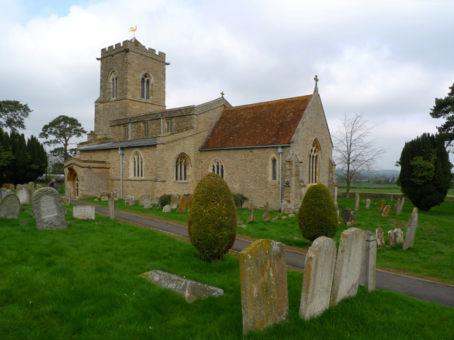
Church of St Mary, Stevington

Church of St Mary is a Grade I listed church in Stevington, Bedfordshire, England. It became a listed building on 13 July 1964. It is the Anglican parish...
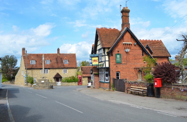
Stevington

Stevington is a village and civil parish in the Borough of Bedford in northern Bedfordshire, England. It is on the River Great Ouse four to five miles...

Pavenham Osier Beds

Pavenham Osier Beds is a 1.3 hectare nature reserve south of Pavenham, on the banks of the River Great Ouse, in Bedfordshire. It is managed by the Wildlife...

Carlton with Chellington

Carlton with Chellington is a civil parish in the historical Hundred of Willey in Bedfordshire, England, and is within the Borough of Bedford. The parish...

Pavenham

Pavenham is a small village and civil parish on the River Great Ouse in the Borough of Bedford in Bedfordshire, England, about 6 miles (10 km) north-west...

Church of St Mary, Carlton, Bedfordshire

Church of St Mary is a Grade I listed church in Carlton, Bedfordshire, England. == See also == Grade I listed buildings in Bedfordshire == References ==

West End, Bedfordshire

West End is a hamlet located in the Borough of Bedford in Bedfordshire, England. The settlement is close to Carlton, Pavenham and Stevington. West End...

Nearby Amenities

Located within 500m of 52.177092,-0.57869751
The data included in this document is from www.openstreetmap.org. The data is made available under ODbL.

Have you been to Blackwell Spinney?

Leave your review of Blackwell Spinney below (or comments, questions and feedback).