Rickford Common

Wood, Forest in Surrey Guildford

England

Rickford Common

Holly Lane, south from Worplesdon
Holly Lane, south from Worplesdon Credit: Robin Webster

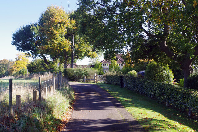
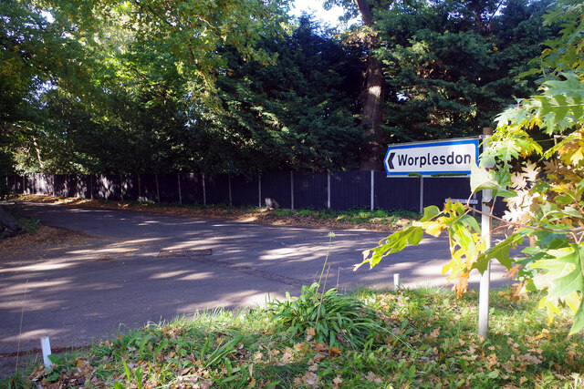
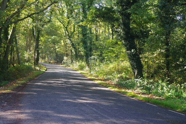
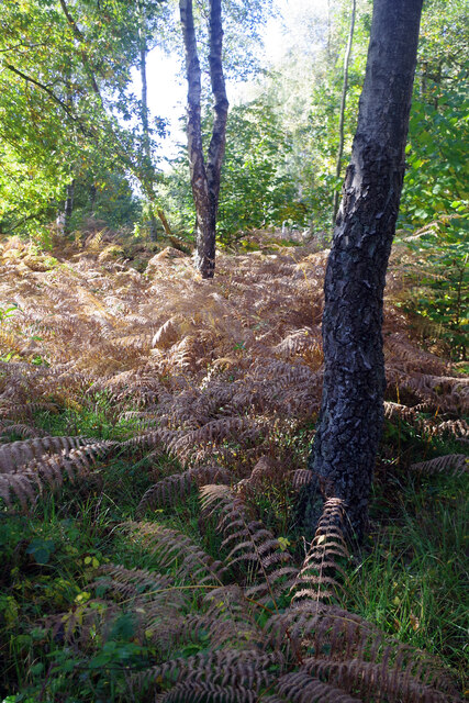
Rickford Common is a picturesque woodland located in the county of Surrey, England. Covering an area of approximately 25 hectares, it is a well-preserved example of ancient woodland. The common is situated near the village of Wood Street Village, just a few miles from the bustling town of Guildford.

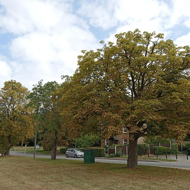
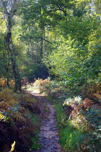
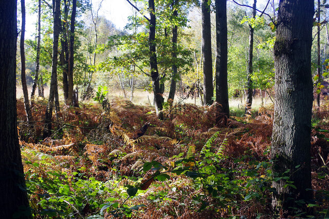
The woodland is primarily made up of deciduous trees, including oak, beech, and birch. These tall, majestic trees create a dense canopy that provides shelter for a variety of wildlife. The forest floor is adorned with a rich carpet of bluebells during the spring months, creating a stunning display of color.

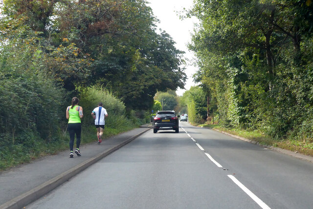
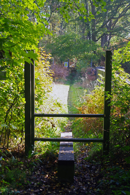
Rickford Common is crisscrossed with a network of footpaths, making it a popular destination for walkers and nature enthusiasts. These paths meander through the woodland, allowing visitors to explore the diverse flora and fauna that call this place home. The common is also home to a number of rare and protected species, such as the great crested newt and the nightjar.

In addition to its natural beauty, Rickford Common also holds historical significance. It is believed that the common was once part of the Royal Forest of Windsor and has been used for centuries as a source of timber and fuel.

Overall, Rickford Common offers a tranquil retreat from the hustle and bustle of modern life. Its ancient woodland, abundant wildlife, and rich history make it a truly special place for anyone seeking to connect with nature.

If you have any feedback on the listing, please let us know in the comments section below.

Rickford Common Images

Images are sourced within 2km of 51.278869/-0.60856949 or Grid Reference SU9754. Thanks to Geograph Open Source API. All images are credited.

Holly Lane, south from Worplesdon
Looking autumnal, but then they would These conker trees at Worplesden do look the part, but my mother tells me horse chestnuts are always the first to turn...
Looking autumnal, but then they would
These conker trees at Worplesden do look the part, but my mother tells me horse chestnuts are always the first to turn...
Path to Havering Farm This public footpath, effectively an extension of Burdenshot Hill, leads across the stile and then over the Woking to Guildford railway.
Path to Havering Farm
This public footpath, effectively an extension of Burdenshot Hill, leads across the stile and then over the Woking to Guildford railway.
Railway south of Worplesdon A Portsmouth to London Waterloo train approaches Worplesdon at speed on the Portsmouth Direct Line.
Railway south of Worplesdon
A Portsmouth to London Waterloo train approaches Worplesdon at speed on the Portsmouth Direct Line.
Burdenshot Hill, Worplesdon Burdenshot Hill is a private road to the north east of Worplesdon village lined with some very large houses. The one in view here is called Oakhanger. From the end of this road a path leads to Worplesdon station.
Burdenshot Hill, Worplesdon
Burdenshot Hill is a private road to the north east of Worplesdon village lined with some very large houses. The one in view here is called Oakhanger. From the end of this road a path leads to Worplesdon station.
The way to Worplesdon Motorists are directed down Goose Rye Road to Worplesdon village. Worplesdon was recorded in the Domesday Book as Werpesdune and there is evidence that the area was settled in Roman times; the Goose Rye name is derived from a local farm.
The way to Worplesdon
Motorists are directed down Goose Rye Road to Worplesdon village. Worplesdon was recorded in the Domesday Book as Werpesdune and there is evidence that the area was settled in Roman times; the Goose Rye name is derived from a local farm.
Goose Rye Road, Worplesdon Goose Rye Road passes through a thickly wooded area on its approach to Worplesdon village. In the 19th century this was common heathland used for grazing animals.
Goose Rye Road, Worplesdon
Goose Rye Road passes through a thickly wooded area on its approach to Worplesdon village. In the 19th century this was common heathland used for grazing animals.
Path towards Jordan Hill This footpath heads intriguingly into this stretch of woodland that forms the northern part of the Whitmoor Common Site of Special Scientific Interest.
Path towards Jordan Hill
This footpath heads intriguingly into this stretch of woodland that forms the northern part of the Whitmoor Common Site of Special Scientific Interest.
Whitmoor Common Woodland, part of Whitmoor Common Site of Special Scientific Interest, seen from the track south of Goose Rye Road and Gosling Cottage.
Whitmoor Common
Woodland, part of Whitmoor Common Site of Special Scientific Interest, seen from the track south of Goose Rye Road and Gosling Cottage.
Whitmoor Common Whitmoor Common is designated a Site of Special Scientific Interest covering 166 hectares (410 acres). It includes heathland and woodland; a network of paths makes it easily accessible to the public. Although the practice has long been discontinued, at one time bracken on the common was cut down in the autumn to provide winter bedding for farm animals.
Whitmoor Common
Whitmoor Common is designated a Site of Special Scientific Interest covering 166 hectares (410 acres). It includes heathland and woodland; a network of paths makes it easily accessible to the public. Although the practice has long been discontinued, at one time bracken on the common was cut down in the autumn to provide winter bedding for farm animals.
The Jolly Farmer, Worplesdon It is good to see a pub deep in the Surrey countryside that appears to be thriving. It was built in the mid 18th century and is now a Fuller's house with a beer garden to the rear. It stands adjacent to Whitmoor Common.
The Jolly Farmer, Worplesdon
It is good to see a pub deep in the Surrey countryside that appears to be thriving. It was built in the mid 18th century and is now a Fuller's house with a beer garden to the rear. It stands adjacent to Whitmoor Common.
The Jolly Farmer, Worplesdon - pub sign The artist for this Fuller's pub sign has chosen a curious image featuring an American tractor built by Case. For many years Case was a major manufacturer of agricultural machinery in the USA but the company did not enter the British market until it acquired David Brown Tractors of Yorkshire in the 1970s - long after the machine featured here would have been a museum piece.
The Jolly Farmer, Worplesdon - pub sign
The artist for this Fuller's pub sign has chosen a curious image featuring an American tractor built by Case. For many years Case was a major manufacturer of agricultural machinery in the USA but the company did not enter the British market until it acquired David Brown Tractors of Yorkshire in the 1970s - long after the machine featured here would have been a museum piece.
Private road across Whitmoor Common There are a number of private roads across this part of Surrey - private, that is, for motor vehicles - giving access to some of the very large houses in this area.
Private road across Whitmoor Common
There are a number of private roads across this part of Surrey - private, that is, for motor vehicles - giving access to some of the very large houses in this area.
Entrance to Hertford Park, Worplesdon This grand entrance leads off Burdenshott Road. The plaque by the gate refers to Hertford Park but the map shows it as Hockley Lands.
Entrance to Hertford Park, Worplesdon
This grand entrance leads off Burdenshott Road. The plaque by the gate refers to Hertford Park but the map shows it as Hockley Lands.
Mirror on Burdenshott Road The mirror reflects the entrance seen here: <a href="https://www.geograph.org.uk/photo/7319630">SU9854 : Entrance to Hertford Park, Worplesdon</a>, presumably provided to give drivers a good view along Burdenshott Road.
Mirror on Burdenshott Road
The mirror reflects the entrance seen here: SU9854 : Entrance to Hertford Park, Worplesdon, presumably provided to give drivers a good view along Burdenshott Road.
The roundabout, Fairlands Avenue
Perry Hill Antiques A retail outlet for distressed goods on the A320 in the Perry Hill area of Worplesdon.
Perry Hill Antiques
A retail outlet for distressed goods on the A320 in the Perry Hill area of Worplesdon.
Walkway beside the A322, Worplesdon The walkway from the Memorial Hall to the green in the Perry Hill area of Worplesdon.
Walkway beside the A322, Worplesdon
The walkway from the Memorial Hall to the green in the Perry Hill area of Worplesdon.
Show me another place!

Rickford Common is located at Grid Ref: SU9754 (Lat: 51.278869, Lng: -0.60856949)

Administrative County: Surrey

District: Guildford

Police Authority: Surrey

What 3 Words

///caked.suffice.unfair. Near Fairlands, Surrey

Related Wikis

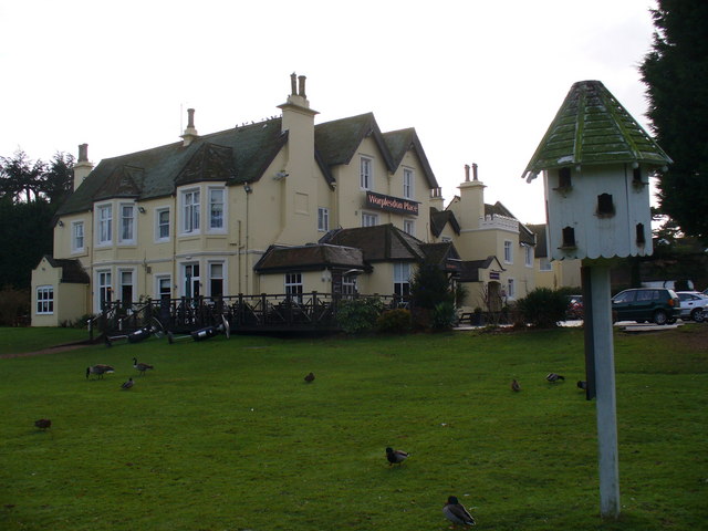
Worplesdon Place Hotel, Guildford

Worplesdon Place Hotel near Guildford, Surrey is a house of historical significance. It appears to have been built in about 1845 by Sir William Bovill...

Worplesdon

Worplesdon is a village 3.1 miles (5.0 km) NNW of Guildford in Surrey, England and a large dispersed civil parish that includes the settlements of: Worplesdon...

Fox Corner Wildlife Area

Fox Corner Wildlife Area is a 6.2-hectare (15-acre) Local Nature Reserve south-west of Woking in Surrey. It is owned and managed by Guildford Borough Council...

Whitmoor Common

Whitmoor Common is a 166-hectare (410-acre) biological Site of Special Scientific Interest on the northern outskirts of Guildford in Surrey. It is part...

Nearby Amenities

Located within 500m of 51.278869,-0.60856949
Crossing
Bicycle: yes
Crossing: uncontrolled
Kerb: lowered
Sloped Curb: yes
Source: Bing
Traffic Calming: table
Lat/Long: 51.2783714/-0.6108894
Crossing
Bicycle: yes
Crossing: unmarked
Kerb: lowered
Sloped Curb: yes
Source: Bing
Lat/Long: 51.2766629/-0.609531
Crossing
Bicycle: yes
Crossing: uncontrolled
Kerb: lowered
Sloped Curb: yes
Source: Bing
Traffic Calming: table
Lat/Long: 51.2759075/-0.6091429
Post Box
Brand: Royal Mail
Brand Wikidata: Q638098
Collection Times: Mo-Fr 16:30; Sa 07:45
Mapillary: 671384034366479
Operator: Royal Mail
Operator Wikidata: Q638098
Post Box Mounting: pier
Post Box Type: lamp
Ref: GU3 6
Royal Cypher: EIIR
Royal Cypher Wikidata: Q33102113
Source: photo
Survey Date: 2022-07-28
Lat/Long: 51.2771985/-0.6096985
Crossing
Bicycle: yes
Crossing: unmarked
Kerb: lowered
Sloped Curb: yes
Source: Bing
Lat/Long: 51.2798648/-0.6143353
The Old Stables
Building: yes
Source: survey
Lat/Long: 51.2751898/-0.6093678
Garden Reach
Addr City: Worplesdon
Addr Housename: Garden Reach
Addr Postcode: GU3 3RA
Addr Street: The Avenue
Building: yes
Building Levels: 2
Source: photo;local knowledge
Lat/Long: 51.2771096/-0.6084071
Bus Stop
Rickford Common
Naptan AtcoCode: 40004407167A
Naptan Bearing: NW
Naptan CommonName: Rickford Common
Naptan Indicator: Opp
Naptan Landmark: Rickford Common
Naptan NaptanCode: surapdta
Naptan Street: A322
Naptan Verified: no
Public Transport: platform
Shelter: no
Source: naptan_import
Lat/Long: 51.2799226/-0.6144647
Bus Stop
Rickford Common
Naptan AtcoCode: 40004407167B
Naptan Bearing: SE
Naptan CommonName: Rickford Common
Naptan Indicator: adj
Naptan Landmark: Rickford Common
Naptan NaptanCode: surapdtd
Naptan Street: A322 Worplesdon Road
Naptan Verified: no
Public Transport: platform
Source: naptan_import
Lat/Long: 51.2796266/-0.6130207
Bus Stop
Village Hall
Naptan AtcoCode: 40004407168A
Naptan Bearing: N
Naptan CommonName: Village Hall
Naptan Indicator: Just Before
Naptan Landmark: Village Hall
Naptan NaptanCode: surapdtg
Naptan Street: Worplesdon Road
Naptan Verified: no
Public Transport: platform
Shelter: yes
Source: naptan_import
Lat/Long: 51.2764778/-0.6092947
Bus Stop
Village Hall
Naptan AtcoCode: 40004407168B
Naptan Bearing: S
Naptan CommonName: Village Hall
Naptan Indicator: Just after
Naptan Landmark: Village Hall
Naptan NaptanCode: surapdtj
Naptan Street: Worplesdon Road
Naptan Verified: no
Public Transport: platform
Source: naptan_import
Lat/Long: 51.2760813/-0.6089023
Jordan Hill
Natural: peak
Source: os_street_view
Lat/Long: 51.2781457/-0.6028343
Crossing
Crossing Island: yes
Kerb: lowered
Sloped Curb: yes
Source: Bing
Lat/Long: 51.276266/-0.6090884
Give Way
Lat/Long: 51.2794145/-0.6053369
Give Way
Lat/Long: 51.2793871/-0.6052697
Give Way
Lat/Long: 51.2794432/-0.6051867
Crossing
Lat/Long: 51.2792473/-0.6123323
FreeYourMind.UK
Addr City: Guildford
Addr Place: Worplesdon Memorial Hall
Addr Postcode: GU3 3RF
Addr Street: Worplesdon Road
Description: Advanced subconscious coaching and therapy. Reduce stress, anxiety, anger and trauma. Increase calm, confidence, happiness.
Email: info@freeyourmind.uk
Note: Based in Worplesdon Memorial Hall.
Office: therapist
Opening Hours: Mo-Su 08:00-20:00
Phone: +44 20 8133 0242
Website: https://freeyourmind.uk
Wheelchair: yes
Lat/Long: 51.2768571/-0.6102026
Leisure: playground
Lat/Long: 51.2763427/-0.6096679
Man Made: dovecote
Lat/Long: 51.2755033/-0.6078693
The data included in this document is from www.openstreetmap.org. The data is made available under ODbL.

Have you been to Rickford Common?

Leave your review of Rickford Common below (or comments, questions and feedback).