Baycombe Wood
Wood, Forest in Sussex Arun
England
Baycombe Wood

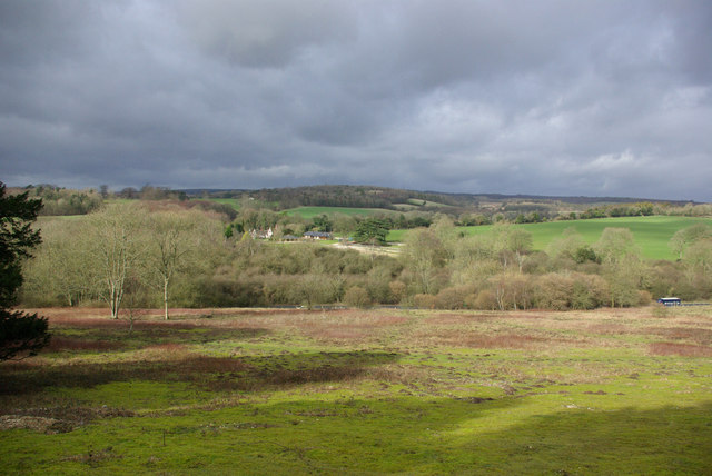
Baycombe Wood is a picturesque woodland located in Sussex, England. Spread across an area of approximately 100 hectares, it is a popular destination for nature lovers and outdoor enthusiasts. The wood is situated in the High Weald Area of Outstanding Natural Beauty, contributing to its charm and tranquility.
Baycombe Wood is predominantly composed of mixed broadleaf trees, including oak, beech, and ash. The trees create a dense canopy, providing a shaded and cool environment even on hot summer days. The forest floor is carpeted with a variety of wildflowers, adding bursts of color to the landscape.
The wood is home to a diverse range of wildlife. Visitors may encounter various species of birds, including woodpeckers, owls, and songbirds. Squirrels and rabbits can often be seen darting through the undergrowth, while badgers and foxes are known to roam the area during the twilight hours. Additionally, the presence of rare and endangered species such as dormice and bats makes Baycombe Wood a site of ecological importance.
A network of footpaths and trails weaves through the wood, allowing visitors to explore its natural beauty. These paths provide opportunities for walking, jogging, and cycling, making it an ideal destination for outdoor activities. There are also designated picnic areas where visitors can relax and enjoy the peaceful surroundings.
Baycombe Wood offers a serene escape from the hustle and bustle of everyday life. Its natural beauty, diverse wildlife, and recreational opportunities make it a must-visit destination for nature enthusiasts and those seeking a tranquil retreat in the heart of Sussex.
If you have any feedback on the listing, please let us know in the comments section below.
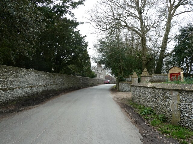
Baycombe Wood Images
Images are sourced within 2km of 50.870226/-0.62240519 or Grid Reference SU9708. Thanks to Geograph Open Source API. All images are credited.


Baycombe Wood is located at Grid Ref: SU9708 (Lat: 50.870226, Lng: -0.62240519)
Administrative County: West Sussex
District: Arun
Police Authority: Sussex
What 3 Words
///breed.failed.contents. Near Fontwell, West Sussex
Nearby Locations
Related Wikis

Slindon
Slindon is a mostly rural village and civil parish in the Arun District of West Sussex, England, containing a developed nucleus amid woodland. Much of...

Dale Park
Dale Park was an English country house in Madehurst, West Sussex. == History == In 1780, Sir George Thomas, 3rd Baronet created Dale Park near Madehurst...

Nore Folly
Nore Folly (also known as Slindon Folly) is a stone construction located near the village of Slindon, West Sussex, United Kingdom. The folly resembles...

Madehurst
Madehurst is a small village and civil parish in the Arun District of West Sussex, England on the south slopes of the South Downs in the South Downs National...

A27 road
The A27 is a major road in England. It runs from its junction with the A36 at Whiteparish (near Salisbury) in the county of Wiltshire, follows the south...

Fontwell (electoral division)
Fontwell is an electoral division of West Sussex in the United Kingdom and returns one member to sit on West Sussex County Council. The current County...
Fairmile Bottom
Fairmile Bottom is a 70.2-hectare (173-acre) biological Site of Special Scientific Interest north-west of Arundel in West Sussex. An area of 61.3 hectares...

Walberton
Walberton is a village and civil parish in the Arun District of West Sussex, England, 5 miles (8 km) north-west of Littlehampton, and south of the A27...
Nearby Amenities
Located within 500m of 50.870226,-0.62240519Have you been to Baycombe Wood?
Leave your review of Baycombe Wood below (or comments, questions and feedback).