Shire Oaks

Wood, Forest in Rutland

England

Shire Oaks

Wakerley, St John the Baptist
Wakerley, St John the Baptist Credit: Dave Kelly

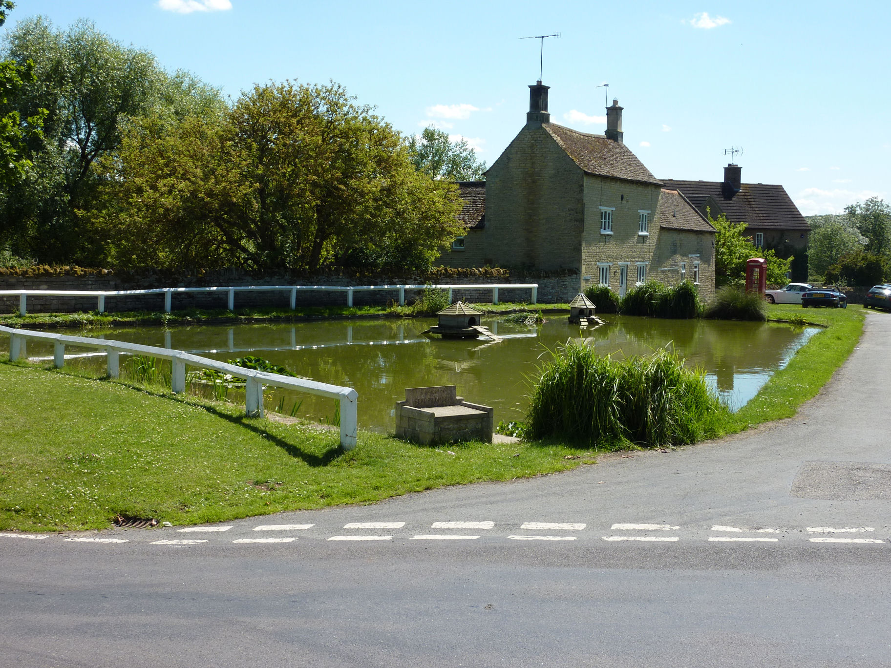
Shire Oaks is a charming village located in the county of Rutland, England. Situated amidst a picturesque wood or forest, the village offers a serene and idyllic setting for its residents and visitors alike. With a population of around 500 people, it maintains a close-knit community atmosphere.

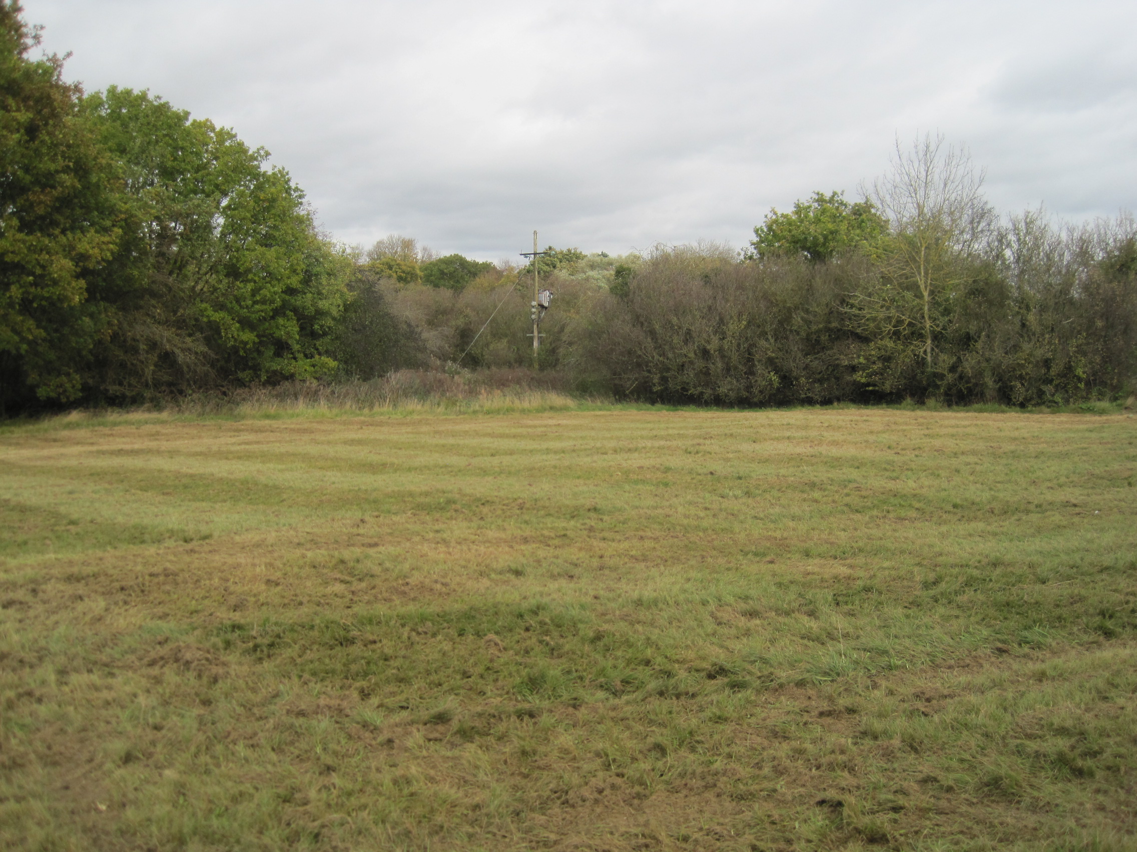
The village is known for its stunning natural beauty, with the surrounding woodlands providing a haven for wildlife enthusiasts and nature lovers. The forest is home to a diverse range of flora and fauna, including ancient oak trees that have stood tall for centuries. The abundance of walking trails and paths allows for leisurely strolls, providing an opportunity to soak in the tranquility of the surroundings.

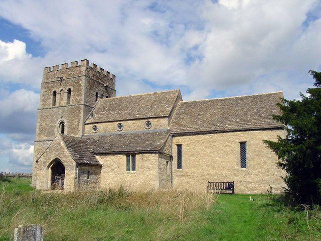
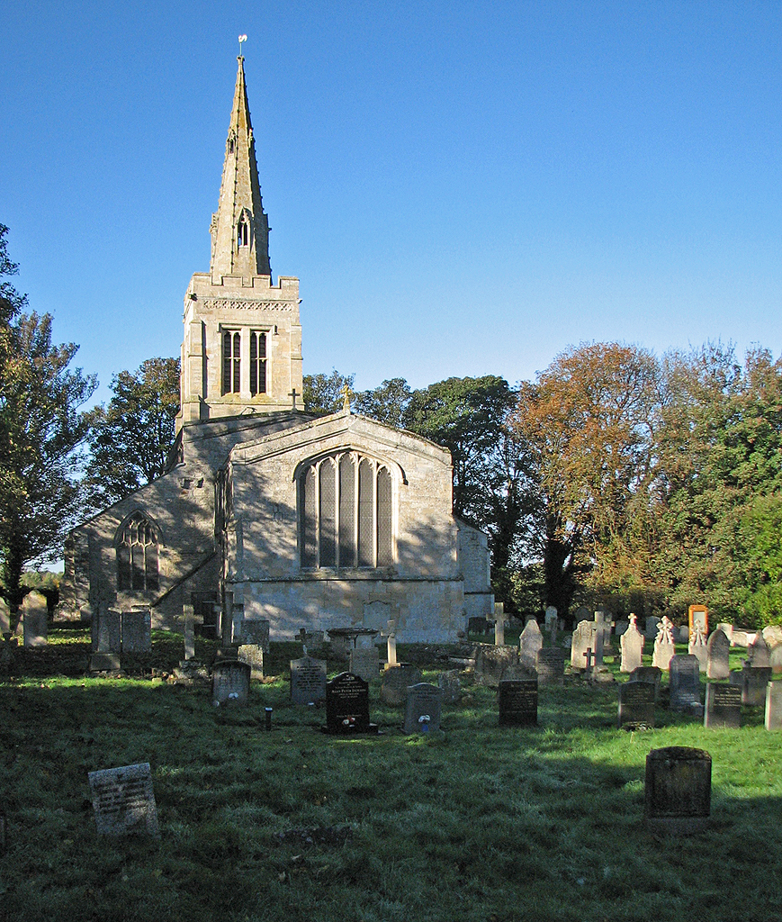
Shire Oaks boasts a rich history, evident in its architecture and landmarks. The village church, St. Mary's, is a prominent feature, displaying exquisite medieval craftsmanship. The church serves as a focal point for the community, hosting regular services and events that bring residents together.

Despite its small size, Shire Oaks offers a range of amenities to cater to the needs of its residents. These include a local pub, a village hall, and a primary school, ensuring that the village remains self-sufficient and self-contained.

Shire Oaks provides a peaceful retreat from the hustle and bustle of nearby towns and cities, offering a lifestyle that embraces nature and community spirit. With its natural beauty, rich history, and strong sense of community, Shire Oaks is a hidden gem that captivates all who visit.

If you have any feedback on the listing, please let us know in the comments section below.

Shire Oaks Images

Images are sourced within 2km of 52.59875/-0.5808 or Grid Reference SK9601. Thanks to Geograph Open Source API. All images are credited.

Wakerley, St John the Baptist
Wakerley Bridge This is one of the ancient bridges across the Welland, and the river marks the boundary between Rutland and Northamptonshire, Barrowden being in Rutland, and Wakerley in Northamptonshire.

The bridge dates from the 14th century, and was widened to its present width in 1793.  (Civil Engineering Heritage: Eastern & Central England
1994, E. A. Labrum, SBN 07277 1970 X)

This is a scheduled ancient monument (see <span class="nowrap"><a title="https://historicengland.org.uk/listing/the-list/list-entry/1003639" rel="nofollow ugc noopener" href="https://historicengland.org.uk/listing/the-list/list-entry/1003639">Link</a><img style="margin-left:2px;" alt="External link" title="External link - shift click to open in new window" src="https://s1.geograph.org.uk/img/external.png" width="10" height="10"/></span> ).

Half of it is a grade II listed building.  The listing at <span class="nowrap"><a title="https://historicengland.org.uk/listing/the-list/list-entry/1073960" rel="nofollow ugc noopener" href="https://historicengland.org.uk/listing/the-list/list-entry/1073960">Link</a><img style="margin-left:2px;" alt="External link" title="External link - shift click to open in new window" src="https://s1.geograph.org.uk/img/external.png" width="10" height="10"/></span> is titled "Bridge (That Part In Barrowden C Parish), Wakerley Road"
Wakerley Bridge
This is one of the ancient bridges across the Welland, and the river marks the boundary between Rutland and Northamptonshire, Barrowden being in Rutland, and Wakerley in Northamptonshire. The bridge dates from the 14th century, and was widened to its present width in 1793. (Civil Engineering Heritage: Eastern & Central England 1994, E. A. Labrum, SBN 07277 1970 X) This is a scheduled ancient monument (see LinkExternal link ). Half of it is a grade II listed building. The listing at LinkExternal link is titled "Bridge (That Part In Barrowden C Parish), Wakerley Road"
Bridge over the Welland The bridge is described in Civil Engineering Heritage: Eastern & Central England, E. A. Labrum, 1994 where it says

"A five-arch stone bridge carrying a minor road, typical of such bridges from the 14th century. Since the bridge's widening in 1793, the arch shapes are different on the upstream side from those on the downstream side.
The original arches are the downstream ones — pointed, with chamfered arch rings. Upstream they are segmental.
The spans vary from 9ft 10in to 11ft 4in. The piers are 6ft wide and the bridge is 81ft long. The 1793 work added 2ft to the bridge's width to make the present dimension of 12ft between the stone parapets.
There are cutwaters on both sides and a carved head on the keystone of the second arch from the north end."

This is a scheduled ancient monument (see <span class="nowrap"><a title="https://historicengland.org.uk/listing/the-list/list-entry/1003639" rel="nofollow ugc noopener" href="https://historicengland.org.uk/listing/the-list/list-entry/1003639">Link</a><img style="margin-left:2px;" alt="External link" title="External link - shift click to open in new window" src="https://s1.geograph.org.uk/img/external.png" width="10" height="10"/></span> ) although the listing there lacks anything like the detail quoted above.
Bridge over the Welland
The bridge is described in Civil Engineering Heritage: Eastern & Central England, E. A. Labrum, 1994 where it says "A five-arch stone bridge carrying a minor road, typical of such bridges from the 14th century. Since the bridge's widening in 1793, the arch shapes are different on the upstream side from those on the downstream side. The original arches are the downstream ones — pointed, with chamfered arch rings. Upstream they are segmental. The spans vary from 9ft 10in to 11ft 4in. The piers are 6ft wide and the bridge is 81ft long. The 1793 work added 2ft to the bridge's width to make the present dimension of 12ft between the stone parapets. There are cutwaters on both sides and a carved head on the keystone of the second arch from the north end." This is a scheduled ancient monument (see LinkExternal link ) although the listing there lacks anything like the detail quoted above.
The River Welland The river seen from the parapet of <a href="https://www.geograph.org.uk/photo/7193606">SP9599 : Wakerley Bridge</a>.  The Welland is the county boundary, so we have Rutland on the left and Northamptonshire on the right.
The River Welland
The river seen from the parapet of SP9599 : Wakerley Bridge. The Welland is the county boundary, so we have Rutland on the left and Northamptonshire on the right.
The river from the bridge The view from the parapet of <a href="https://www.geograph.org.uk/photo/7193606">SP9599 : Wakerley Bridge</a>. The Welland is the county boundary, so we have Northamptonshire on the left and Rutland on the right.
The river from the bridge
The view from the parapet of SP9599 : Wakerley Bridge. The Welland is the county boundary, so we have Northamptonshire on the left and Rutland on the right.
A bit of a struggle I had to climb over this stile to take the image in <a href="https://www.geograph.org.uk/photo/7193612">SP9599 : Bridge over the Welland</a>.  I must be getting old, but it was rather a stretch.  This is an essential obstacle on the path called the Rutland Round.

There is a cunning lift-gate on the right to allow dogs through.
A bit of a struggle
I had to climb over this stile to take the image in SP9599 : Bridge over the Welland. I must be getting old, but it was rather a stretch. This is an essential obstacle on the path called the Rutland Round. There is a cunning lift-gate on the right to allow dogs through.
A field in Rutland The long distance path called the Rutland Round passes through this field.
A field in Rutland
The long distance path called the Rutland Round passes through this field.
A scheduled ancient monument Between Barrowden and Wakerley is one of the ancient bridges across the Welland, recently restored by Jason "the mason"  Henfrey who said “The work also included the creation of special hides for bats which have been cut into the back of new stone before being placed into the bridge. These hides replace gaps, now repaired, which bats had made their home. The new bat hides have been marked with a stone masonry mark resembling a bat.”  Although the river marks the boundary with Northamptonshire, Rutland county council assumes responsibility for the bridge and carried out the recent restoration.

This is a scheduled ancient monument (see <span class="nowrap"><a title="https://historicengland.org.uk/listing/the-list/list-entry/1003639" rel="nofollow ugc noopener" href="https://historicengland.org.uk/listing/the-list/list-entry/1003639">Link</a><img style="margin-left:2px;" alt="External link" title="External link - shift click to open in new window" src="https://s1.geograph.org.uk/img/external.png" width="10" height="10"/></span> ).

Half of it is a grade II listed building.  The listing at <span class="nowrap"><a title="https://historicengland.org.uk/listing/the-list/list-entry/1073960" rel="nofollow ugc noopener" href="https://historicengland.org.uk/listing/the-list/list-entry/1073960">Link</a><img style="margin-left:2px;" alt="External link" title="External link - shift click to open in new window" src="https://s1.geograph.org.uk/img/external.png" width="10" height="10"/></span> is titled "Bridge (That Part In Barrowden C Parish), Wakerley Road"
A scheduled ancient monument
Between Barrowden and Wakerley is one of the ancient bridges across the Welland, recently restored by Jason "the mason" Henfrey who said “The work also included the creation of special hides for bats which have been cut into the back of new stone before being placed into the bridge. These hides replace gaps, now repaired, which bats had made their home. The new bat hides have been marked with a stone masonry mark resembling a bat.” Although the river marks the boundary with Northamptonshire, Rutland county council assumes responsibility for the bridge and carried out the recent restoration. This is a scheduled ancient monument (see LinkExternal link ). Half of it is a grade II listed building. The listing at LinkExternal link is titled "Bridge (That Part In Barrowden C Parish), Wakerley Road"
Carey's House, Barrowden Largely of 1834 <span class="nowrap"><a title="https://historicengland.org.uk/listing/the-list/list-entry/1176903?section=official-list-entry" rel="nofollow ugc noopener" href="https://historicengland.org.uk/listing/the-list/list-entry/1176903?section=official-list-entry">Link</a><img style="margin-left:2px;" alt="External link" title="External link - shift click to open in new window" src="https://s1.geograph.org.uk/img/external.png" width="10" height="10"/></span>
Carey's House, Barrowden
Largely of 1834 LinkExternal link
Grass field, Barrowden
Tixover church This isolated parish church stands on the north bank of the Welland at the end of a field road about 1 km outside the present site of the small Rutland village of Tixover. Seen here from the opposite, Northamptonshire, side of the river.
Tixover church
This isolated parish church stands on the north bank of the Welland at the end of a field road about 1 km outside the present site of the small Rutland village of Tixover. Seen here from the opposite, Northamptonshire, side of the river.
Tixover Church This historic church has only a track leading to it. Although normally locked, a key can be obtained from a house in the village of Tixover.
Tixover Church
This historic church has only a track leading to it. Although normally locked, a key can be obtained from a house in the village of Tixover.
Church of St John the Baptist, Wakerley No longer used for regular worship (though the graveyard has recent burials), the church is cared for by the Churches Conservation Trust.
Church of St John the Baptist, Wakerley
No longer used for regular worship (though the graveyard has recent burials), the church is cared for by the Churches Conservation Trust.
Main street into Wakerley The finger post indicates the Jurassic Way north to Barrowden
Main street into Wakerley
The finger post indicates the Jurassic Way north to Barrowden
Former railway bridge
Former railway bridge Looking WNW along the former trackbed.
Former railway bridge
Looking WNW along the former trackbed.
Church Lane, Barrowden One of the most attractive corners of a very pretty village. The Cottage dates from 1805.
Church Lane, Barrowden
One of the most attractive corners of a very pretty village. The Cottage dates from 1805.
Show me another place!

Shire Oaks is located at Grid Ref: SK9601 (Lat: 52.59875, Lng: -0.5808)

Unitary Authority: Rutland

Police Authority: Leicestershire

What 3 Words

///jazzy.installs.bitters. Near South Luffenham, Rutland

Nearby Locations

Shire Oaks

Related Wikis

Luffenham Heath Golf Course

Luffenham Heath Golf Course is a 75.1-hectare (186-acre) biological Site of Special Scientific Interest east of South Luffenham in Rutland. It is the course...

Wakerley and Barrowden railway station

Wakerley and Barrowden railway station is a former railway station in Wakerley, Northamptonshire, England which also served the nearby village of Barrowden...

Tixover

Tixover is a small village and civil parish in Rutland. The population of the civil parish at the 2001 census was 174, falling to 163 at the 2011 census...

St Luke's Church, Tixover

St Luke's Church is a church in Tixover, Rutland. It is a Grade II* listed building. The church is close to the River Welland, now about 3/4 mile from...

Wakerley

Wakerley is a linear village and civil parish in the county of Northamptonshire, England. Forming part of North Northamptonshire, Wakerley is close to...

Barrowden

Barrowden is a village in Rutland in the East Midlands of England. The village's name means 'burial-mound hill'. There are a number of barrows in the...

Luffenham Heath Golf Club

Luffenham Heath is an 18-hole golf course near South Luffenham in Rutland, England. Designed by Harry Colt, it began under the patronage of the Earl of...

St John the Baptist's Church, Wakerley

St John the Baptist's Church is a redundant Anglican church in the village of Wakerley, Northamptonshire, England. It is recorded in the National Heritage...

Nearby Amenities

Located within 500m of 52.59875,-0.5808
Parking
Access: yes
Parking: layby
Source: Bing
Lat/Long: 52.5974306/-0.5761388
The data included in this document is from www.openstreetmap.org. The data is made available under ODbL.

Have you been to Shire Oaks?

Leave your review of Shire Oaks below (or comments, questions and feedback).