Queen Mary's Plantation

Wood, Forest in Berkshire

England

Queen Mary's Plantation

Closure Notice at Santander Bank, Windsor This photo shows the closure notice at the Santander Bank branch in Peascod Street. It has the following wording:

   Important Information

 We're sorry that this branch is permanently 
 closing on 5 August 2021

 Your nearest Santander branch(es):
 . 48 The Observatory, High Street, Slough SL1 1DL
 . 46-48 High Street, Staines TW18 4DY

 We look forward to welcoming you there.
Closure Notice at Santander Bank, Windsor Credit: David Hillas

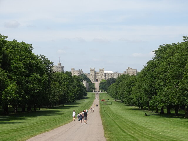
Queen Mary's Plantation is a picturesque woodland located in Berkshire, England. Covering an area of approximately 200 acres, this stunning forest is renowned for its natural beauty and historical significance. The plantation is situated near the village of Wood, offering visitors a tranquil escape from the bustling urban environment.

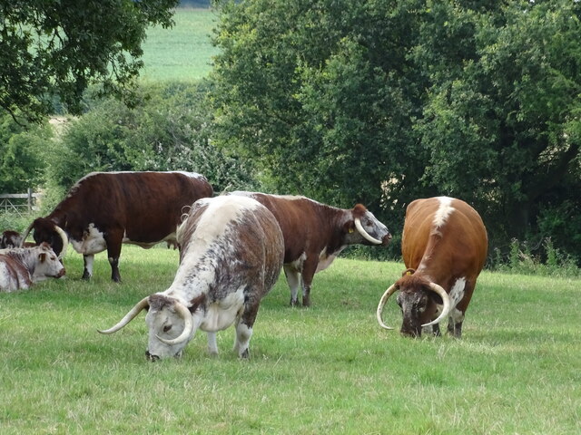
The woodland is named after Queen Mary, the wife of King George V, who established the plantation in the early 20th century. The area was initially used as a hunting ground for the royal family, with numerous deer species inhabiting the forest. Today, the plantation serves as a popular recreational spot, attracting nature enthusiasts, hikers, and families seeking outdoor adventures.

Queen Mary's Plantation boasts a diverse range of tree species, including oak, beech, and pine, creating a rich and varied ecosystem. The forest floor is adorned with a carpet of wildflowers and ferns, providing a haven for a variety of wildlife, such as birds, butterflies, and small mammals.

The plantation offers a network of well-marked trails, allowing visitors to explore the forest at their own pace. These paths lead to scenic viewpoints, serene ponds, and hidden clearings, providing ample opportunities for picnicking, photography, and birdwatching. Additionally, the forest is home to several wooden sculptures, adding an artistic touch to the natural surroundings.

Overall, Queen Mary's Plantation in Berkshire is a stunning woodland that combines natural beauty with historical significance. Its well-maintained trails, diverse wildlife, and peaceful ambiance make it an ideal destination for nature lovers and those seeking a serene escape from the modern world.

If you have any feedback on the listing, please let us know in the comments section below.

Queen Mary's Plantation Images

Images are sourced within 2km of 51.467378/-0.62190494 or Grid Reference SU9575. Thanks to Geograph Open Source API. All images are credited.

Closure Notice at Santander Bank, Windsor This photo shows the closure notice at the Santander Bank branch in Peascod Street. It has the following wording:

   Important Information

 We're sorry that this branch is permanently 
 closing on 5 August 2021

 Your nearest Santander branch(es):
 . 48 The Observatory, High Street, Slough SL1 1DL
 . 46-48 High Street, Staines TW18 4DY

 We look forward to welcoming you there.
Closure Notice at Santander Bank, Windsor
This photo shows the closure notice at the Santander Bank branch in Peascod Street. It has the following wording: Important Information We're sorry that this branch is permanently closing on 5 August 2021 Your nearest Santander branch(es): . 48 The Observatory, High Street, Slough SL1 1DL . 46-48 High Street, Staines TW18 4DY We look forward to welcoming you there.
Santander Bank branch in Windsor (1) Located at 97 Peascod Street SL4 1AZ, this bank is due for closure on Thursday 5th August 2021 as indicated by the notice in the window <a title="https://www.geograph.org.uk/photo/6916357" href="https://www.geograph.org.uk/photo/6916357">Link</a> refers. It is one of 111 such branches due for closure in the Summer 2021.
Santander Bank branch in Windsor (1)
Located at 97 Peascod Street SL4 1AZ, this bank is due for closure on Thursday 5th August 2021 as indicated by the notice in the window Link refers. It is one of 111 such branches due for closure in the Summer 2021.
Santander Bank branch in Windsor (2) This photo shows the Santander Bank branch in Peascod Street which is due to close permanently on Thursday 5th August 2021. To the right of the photo, people can be seen enjoying themselves seated under the white parasols. A sign perhaps of the Covid-19 restrictions having been relaxed recently.
Santander Bank branch in Windsor (2)
This photo shows the Santander Bank branch in Peascod Street which is due to close permanently on Thursday 5th August 2021. To the right of the photo, people can be seen enjoying themselves seated under the white parasols. A sign perhaps of the Covid-19 restrictions having been relaxed recently.
View along The Long Walk
View towards Windsor Castle
Long-horned cattle
Long-horned cattle
View towards Windsor Castle
Tree stump
Tree stump
Information Board in Windsor High Street This information board is located in the High Street near the junction with Peascod Street, its postcode being SL4 1LH. It has the title "The Queen's Walkway" and was unveiled by Her Majesty the Queen on the 21st April 2016 which was her ninetieth birthday.
 In the top row are illustrations of from left to right, Windsor Castle, Queen Victoria's Statue, The Guildhall and Windsor Parish Church. In the lower row are illustrations of from left to right, Queen Elizabeth II, Queen Victoria, Windsor Castle, The Guildhall Windsor and Windsor Parish Church. The lettering of these titles are also indicated in the Braille language for those people who have little or no vision. Both end columns have wording to describe the Queen's Walkway and what to see on it.
Information Board in Windsor High Street
This information board is located in the High Street near the junction with Peascod Street, its postcode being SL4 1LH. It has the title "The Queen's Walkway" and was unveiled by Her Majesty the Queen on the 21st April 2016 which was her ninetieth birthday. In the top row are illustrations of from left to right, Windsor Castle, Queen Victoria's Statue, The Guildhall and Windsor Parish Church. In the lower row are illustrations of from left to right, Queen Elizabeth II, Queen Victoria, Windsor Castle, The Guildhall Windsor and Windsor Parish Church. The lettering of these titles are also indicated in the Braille language for those people who have little or no vision. Both end columns have wording to describe the Queen's Walkway and what to see on it.
Part of the Information Board in Windsor High Street (1) The left column of this information board has the following wording:

 The Queen's Walkway

 The Queen and the Duke of Edinburgh have enjoyed a long association with Windsor. The Queen and her sister, Princess Margaret, spent most of the Second World War in the Castle. After King George VI died in February 1952, the Queen and the Duke of Edinburgh opened some rooms in the Castle, and it soon became their weekend retreat from London. They are there for the Easter Court, for the Garter Ceremony and Royal Ascot in June, and since 1969 there have been occasional State Visits to Windsor, with the procession passing this spot.
 Since 1917 Windsor has also been the name of the Royal House.
 In ancient times, the Anglo-Saxon Kings held court in a palace at Old Windsor, but William the Conqueror saw the advantage of building a tower on high land above the Thames to help guard London. His son, Henry I built a residence within the Castle walls and first held court there in 1110. Most
sovereigns have lived in the Castle since then, and many Kings and Queens of
England are buried in St George's Chapel.
 The Queen's Walkway celebrates the town of Windsor. The original town was largely laid out by 1170. "New Windsor" had rights as a free borough and was made into a royal borough under a charter of Edward I in 1277.
 William Shakespeare knew Windsor well and it inspired his play, The Merry Wives of Windsor. The present Guildhall (to the right) was built between 1687 and 1691, and since 1778 when George III moved to Windsor, the town has profited from its royal associations. Since the English Civil War, Windsor has been a garrison town with a military presence that continues to this day. Windsor Bridge formed a permanent link to Eton in 1822 and the arrival of the Great Western Railway in 1849 made Windsor more accessible to London.
 The Queen's Walkway will help you explore this historic town with its theatre, its churches, its parks and gardens, its elegant residential streets, its many historic monuments, its railway stations, and the River Thames.
                                  
                        Unveiled by 
                      Her Majesty The Queen 
                   On the occasion of her 90th Birthday
                         21st April 2016

 To the right of the photo can be seen illustrations of people cheering with
 Union Jack flags and of Queen Elizabeth II.
Part of the Information Board in Windsor High Street (1)
The left column of this information board has the following wording: The Queen's Walkway The Queen and the Duke of Edinburgh have enjoyed a long association with Windsor. The Queen and her sister, Princess Margaret, spent most of the Second World War in the Castle. After King George VI died in February 1952, the Queen and the Duke of Edinburgh opened some rooms in the Castle, and it soon became their weekend retreat from London. They are there for the Easter Court, for the Garter Ceremony and Royal Ascot in June, and since 1969 there have been occasional State Visits to Windsor, with the procession passing this spot. Since 1917 Windsor has also been the name of the Royal House. In ancient times, the Anglo-Saxon Kings held court in a palace at Old Windsor, but William the Conqueror saw the advantage of building a tower on high land above the Thames to help guard London. His son, Henry I built a residence within the Castle walls and first held court there in 1110. Most sovereigns have lived in the Castle since then, and many Kings and Queens of England are buried in St George's Chapel. The Queen's Walkway celebrates the town of Windsor. The original town was largely laid out by 1170. "New Windsor" had rights as a free borough and was made into a royal borough under a charter of Edward I in 1277. William Shakespeare knew Windsor well and it inspired his play, The Merry Wives of Windsor. The present Guildhall (to the right) was built between 1687 and 1691, and since 1778 when George III moved to Windsor, the town has profited from its royal associations. Since the English Civil War, Windsor has been a garrison town with a military presence that continues to this day. Windsor Bridge formed a permanent link to Eton in 1822 and the arrival of the Great Western Railway in 1849 made Windsor more accessible to London. The Queen's Walkway will help you explore this historic town with its theatre, its churches, its parks and gardens, its elegant residential streets, its many historic monuments, its railway stations, and the River Thames. Unveiled by Her Majesty The Queen On the occasion of her 90th Birthday 21st April 2016 To the right of the photo can be seen illustrations of people cheering with Union Jack flags and of Queen Elizabeth II.
Part of the Information Board in Windsor High Street (2) This photo shows the middle part of the Queen's Walkway information board in Windsor High Street. The top level has illustrations of Windsor Castle and Queen Victoria's Statue with people waving their Union Jack flags and a band of guardsmen marching in procession. Below are illustrations of Queen Elizabeth II, Queen Victoria and Windsor Castle. Braille lettering can be seen below the names.
Part of the Information Board in Windsor High Street (2)
This photo shows the middle part of the Queen's Walkway information board in Windsor High Street. The top level has illustrations of Windsor Castle and Queen Victoria's Statue with people waving their Union Jack flags and a band of guardsmen marching in procession. Below are illustrations of Queen Elizabeth II, Queen Victoria and Windsor Castle. Braille lettering can be seen below the names.
Part of the Information Board in Windsor High Street (3) This photo shows the right hand side of the information board in the High Street near Peascod Street. The left half has illustrations of The Guildhall and Windsor Parish Church with people waving their Union Jack flags and taking photos. On the right half is a map of The Queen's Walkway in Windsor with the following wording:

 The Queen's Walkway is 6.37km,
 representing the 63 years and 7 months
 of Britain's longest reigning monarch,
 Queen Victoria, a record superseded
 by Her Majesty Queen Elizabeth II
 some time after 5.30pm on 
 9 September 2015.
 The Walkway takes approximately
 two hours to complete. There are
 63 points of interest marked along
 the way which can be explored
 by visiting
 <span class="nowrap"><a title="www.outdoortrust.com" rel="nofollow ugc noopener" href="http://www.outdoortrust.com">Link</a><img style="margin-left:2px;" alt="External link" title="External link - shift click to open in new window" src="https://s1.geograph.org.uk/img/external.png" width="10" height="10"/></span>.

 The wording below the map mentions The Outdoor Trust who would like to thank the many supporters who have helped create The Queen's Walkway including generous donations. Incidentally, 6.37km is 3.96 miles in imperial measurement.
Part of the Information Board in Windsor High Street (3)
This photo shows the right hand side of the information board in the High Street near Peascod Street. The left half has illustrations of The Guildhall and Windsor Parish Church with people waving their Union Jack flags and taking photos. On the right half is a map of The Queen's Walkway in Windsor with the following wording: The Queen's Walkway is 6.37km, representing the 63 years and 7 months of Britain's longest reigning monarch, Queen Victoria, a record superseded by Her Majesty Queen Elizabeth II some time after 5.30pm on 9 September 2015. The Walkway takes approximately two hours to complete. There are 63 points of interest marked along the way which can be explored by visiting LinkExternal link. The wording below the map mentions The Outdoor Trust who would like to thank the many supporters who have helped create The Queen's Walkway including generous donations. Incidentally, 6.37km is 3.96 miles in imperial measurement.
Passageway under the railway in Goswell Road
Pedestrianised area in Peascod Street The main shopping area in Windsor.
Pedestrianised area in Peascod Street
The main shopping area in Windsor.
86 & 87 Peascod Street A C16/17th Grade II listed building.
86 & 87 Peascod Street
A C16/17th Grade II listed building.
Windsor & Eton Central station
Cambridge Gate, Park Street Windsor
The Long Walk Windsor
Show me another place!

Queen Mary's Plantation is located at Grid Ref: SU9575 (Lat: 51.467378, Lng: -0.62190494)

Unitary Authority: Windsor and Maidenhead

Police Authority: Thames Valley

What 3 Words

///basket.hang.basket. Near Windsor, Berkshire

Related Wikis

Windsor & Eton F.C.

Windsor & Eton F.C. was an English association football club based in Windsor, Berkshire, last playing in the Southern League Premier Division in 2010...

Windsor F.C. (2011)

Windsor Football Club is an English football club formed in 2011 after Windsor & Eton folded. The club are current members of the Combined Counties League...

Virginia Water F.C.

Virginia Water Football Club is a football club based in Virginia Water, Surrey, England. They are currently members of the Combined Counties League Premier...
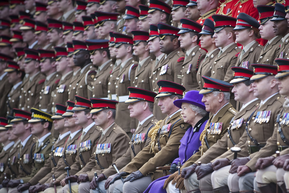
Combermere Barracks

Combermere Barracks, Windsor is a British Army installation 0.9 miles (1.4 km) from Windsor Castle. == History == The original barracks, known as Clewer...

Queensmead School Windsor

Queensmead School Windsor was a Catholic non-selective private day school for boys and girls aged 2 to 18 in Windsor, Berkshire, England, located at the...

Shaw Farm, Windsor

Shaw Farm is on the royal estate at Windsor. Originally a home farm for Windsor Castle, by the early 19th century it came into the ownership of Princess...
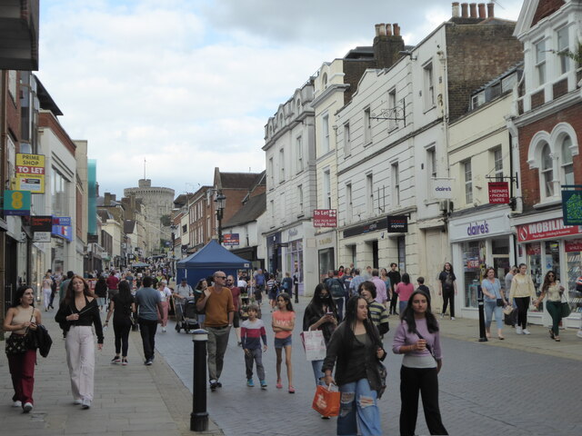
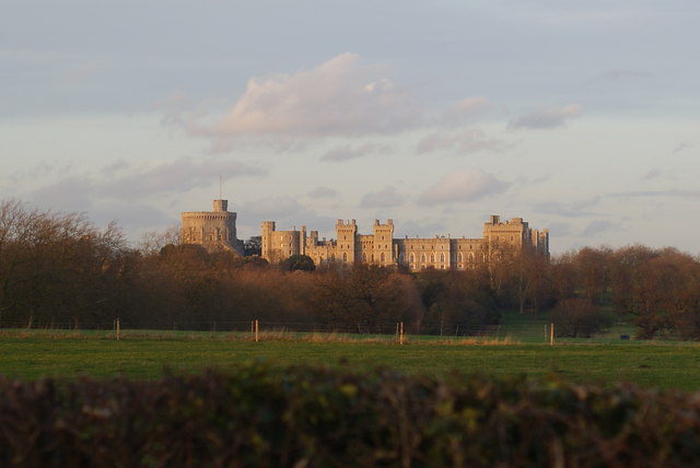
Windsor, Berkshire

Windsor is a historic market town in the Royal Borough of Windsor and Maidenhead in Berkshire, England. It is the site of Windsor Castle, one of the official...

Victoria Barracks, Windsor

Victoria Barracks is a British Army barracks located 0.25 miles (0.40 km) south of Windsor Castle. == History == The original barracks were built in 1853...

Nearby Amenities

Located within 500m of 51.467378,-0.62190494
Bus Stop
Trevelyan School
Naptan AtcoCode: 036006372373
Naptan Bearing: W
Naptan CommonName: Trevelyan School
Naptan Indicator: o/s
Naptan Landmark: Cavalry Crescent
Naptan NaptanCode: windmtj
Naptan PlusbusZoneRef: WINDSEC
Naptan Street: St Leonards Road
Naptan Verified: no
Public Transport: platform
Source: naptan_import
Lat/Long: 51.4710141/-0.6182223
Bus Stop
Stag and Hounds PH
Bus: yes
Naptan AtcoCode: 036006758759
Naptan Bearing: E
Naptan CommonName: Stag and Hounds PH
Naptan Indicator: o/s
Naptan Landmark: Bulkeley Avenue
Naptan NaptanCode: windwma
Naptan PlusbusZoneRef: WINDSEC
Naptan Street: St Leonards Road
Naptan Verified: no
Public Transport: platform
Shelter: no
Source: naptan_import
Lat/Long: 51.4710749/-0.6221996
Bus Stop
Stag and Hounds PH
Bus: yes
Naptan AtcoCode: 036006758760
Naptan Bearing: W
Naptan CommonName: Stag and Hounds PH
Naptan Indicator: opp
Naptan Landmark: Bulkeley Avenue
Naptan NaptanCode: windwmd
Naptan PlusbusZoneRef: WINDSEC
Naptan Street: St Leonards Road
Naptan Verified: no
Public Transport: platform
Source: naptan_import
Lat/Long: 51.4709914/-0.6224561
Spital Meadow
Place: locality
Lat/Long: 51.4677224/-0.625683
Gardeners Hall
Building: yes
Lat/Long: 51.4705387/-0.6193945
Spital
Place: neighbourhood
Lat/Long: 51.4711367/-0.6226198
Turning Loop
Lat/Long: 51.4681824/-0.61603
Direction: 180
Generator Method: photovoltaic
Generator Output Electricity: yes
Generator Solar Modules: 12
Generator Source: solar
Generator Type: solar_photovoltaic_panel
Location: roof
Power: generator
Lat/Long: 51.471763/-0.6231595
The data included in this document is from www.openstreetmap.org. The data is made available under ODbL.

Have you been to Queen Mary's Plantation?

Leave your review of Queen Mary's Plantation below (or comments, questions and feedback).