Beckworth Spinney

Wood, Forest in Rutland

England

Beckworth Spinney

Loves Lane The lane runs down to Empingham.
Loves Lane Credit: Julian P Guffogg

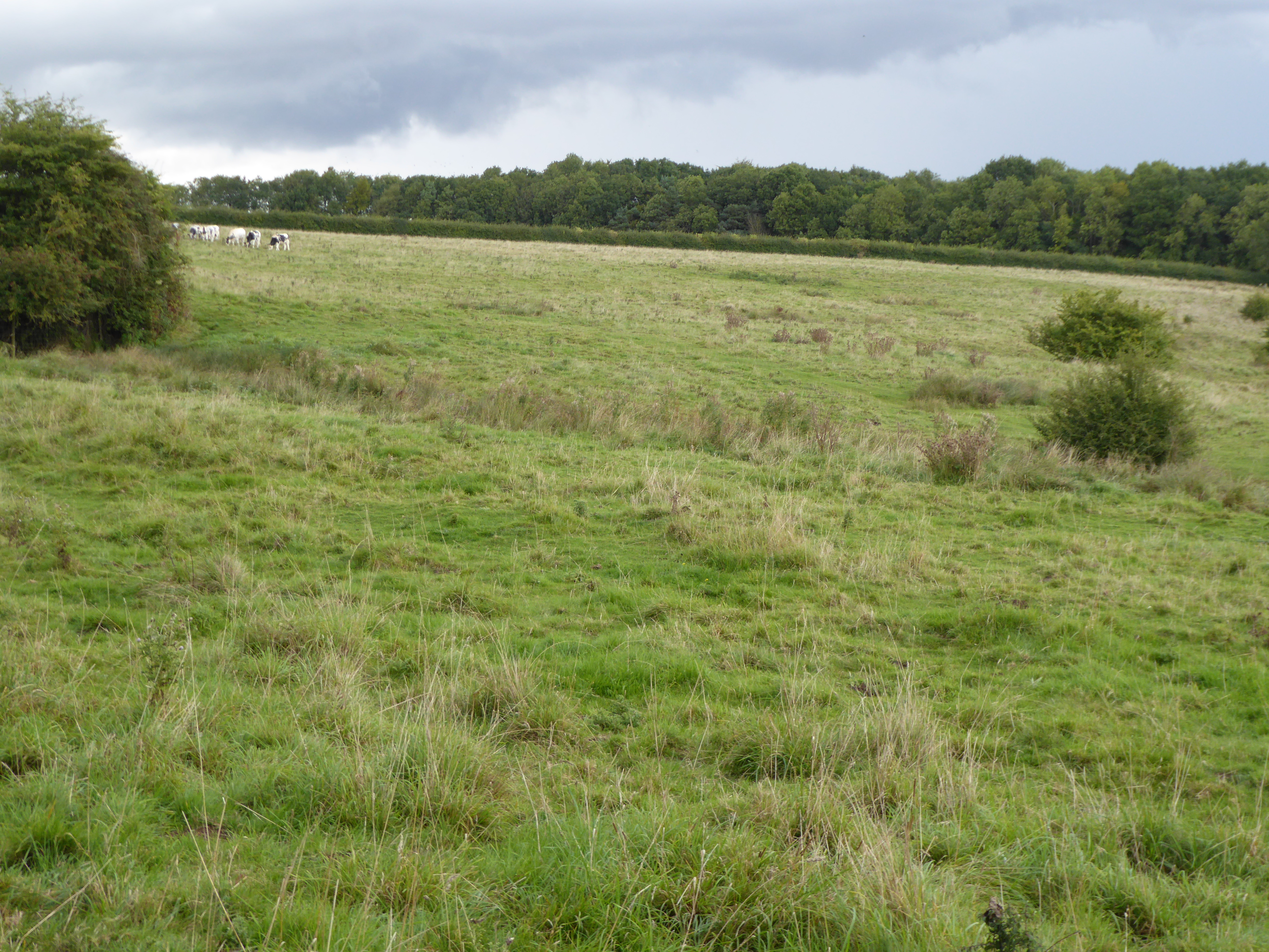
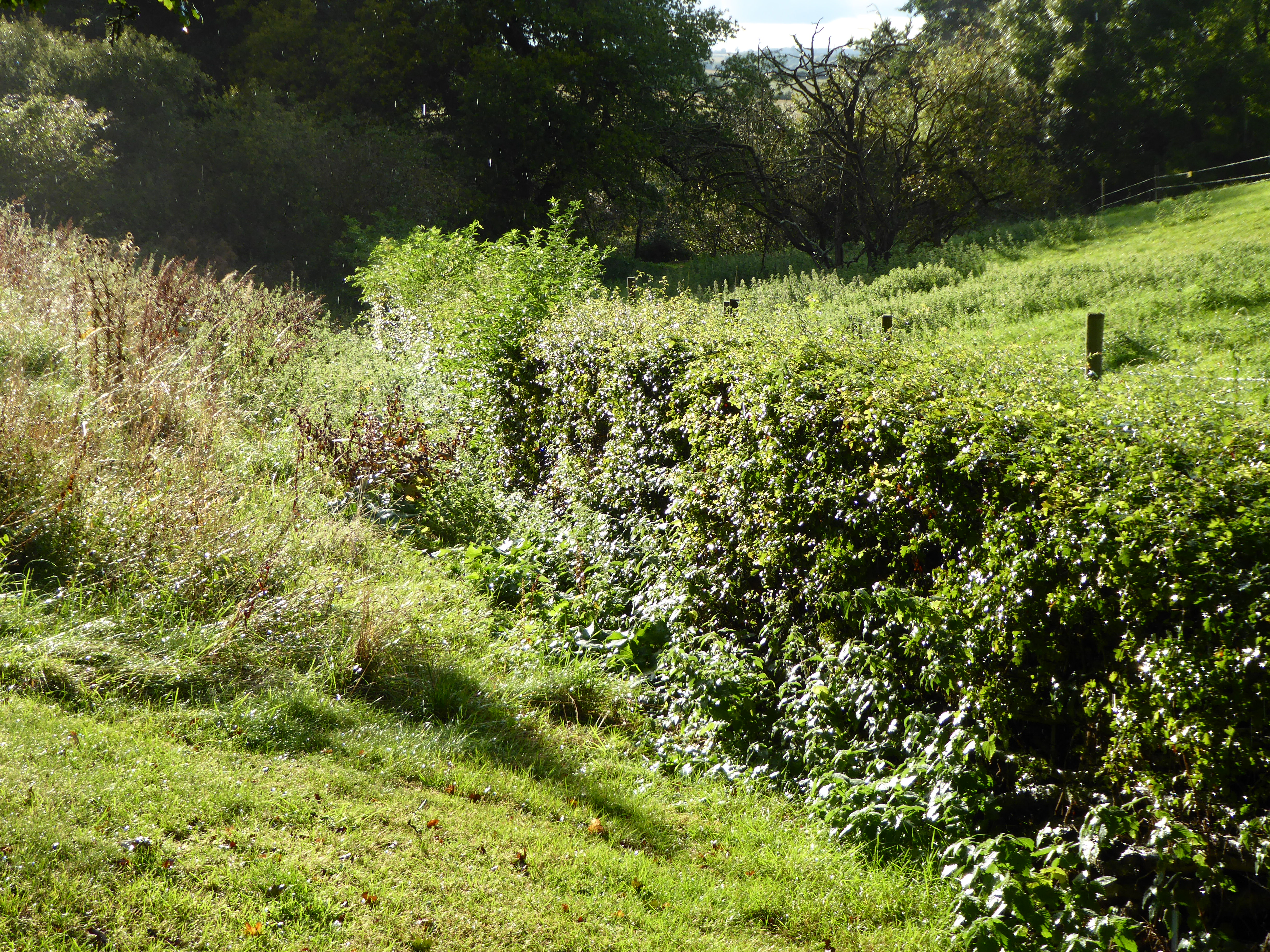
Beckworth Spinney is a picturesque wood located in Rutland, a county in the East Midlands region of England. Covering an area of approximately 20 acres, it is a popular destination for nature lovers and outdoor enthusiasts.

The Spinney comprises a diverse mix of broadleaf trees, including oak, ash, birch, and hazel, which create a vibrant and colorful canopy during the spring and autumn seasons. The woodland floor is adorned with an array of wildflowers such as bluebells, primroses, and wood anemones, adding to its natural beauty.

The wood is intersected by a network of well-maintained footpaths, which allow visitors to explore its tranquil surroundings. These paths lead to various points of interest, including a small pond that serves as a watering hole for local wildlife, such as ducks, frogs, and dragonflies.

Birdwatchers can delight in the diverse avian population that calls Beckworth Spinney home. Species such as the great spotted woodpecker, tawny owl, and chiffchaff can often be spotted among the trees, while wood warblers and redstarts are known to visit during their migratory journeys.

The wood is managed by a local conservation group, which ensures its preservation and protection. They organize educational events and guided walks to promote awareness of the woodland's ecological importance and its role in supporting biodiversity.

Overall, Beckworth Spinney is a charming woodland retreat, offering a peaceful escape from the hustle and bustle of everyday life. Its natural beauty, diverse flora and fauna, and well-maintained trails make it an ideal destination for nature enthusiasts of all ages.

If you have any feedback on the listing, please let us know in the comments section below.

Beckworth Spinney Images

Images are sourced within 2km of 52.670765/-0.59446987 or Grid Reference SK9509. Thanks to Geograph Open Source API. All images are credited.

Loves Lane The lane runs down to Empingham.
Loves Lane
The lane runs down to Empingham.
Stubble field, Chapel Hill, Empingham
Macmillan Way - on the dam at Rutland Water
Get Younger Every Day By playing cricket.

Or drinking beer - as father William might say.  <span class="nowrap"><a title="http://barclayperkins.blogspot.com/2012/01/william-younger-adverts-from-1920s-part_31.html" rel="nofollow ugc noopener" href="http://barclayperkins.blogspot.com/2012/01/william-younger-adverts-from-1920s-part_31.html">Link</a><img style="margin-left:2px;" alt="External link" title="External link - shift click to open in new window" src="https://s1.geograph.org.uk/img/external.png" width="10" height="10"/></span>

Not often you see a Younger's pub sign in England.  This one is attached to the end of the Empingham Cricket and Social Club's premises, so both pursuits can be enjoyed here. <span class="nowrap"><a title="https://empinghamcsc.org/" rel="nofollow ugc noopener" href="https://empinghamcsc.org/">Link</a><img style="margin-left:2px;" alt="External link" title="External link - shift click to open in new window" src="https://s1.geograph.org.uk/img/external.png" width="10" height="10"/></span>
Get Younger Every Day
By playing cricket. Or drinking beer - as father William might say. LinkExternal link Not often you see a Younger's pub sign in England. This one is attached to the end of the Empingham Cricket and Social Club's premises, so both pursuits can be enjoyed here. LinkExternal link
I can see the sea from here! Not the sea but Rutland Water reservoir can certainly be seen in the distance.
I can see the sea from here!
Not the sea but Rutland Water reservoir can certainly be seen in the distance.
The Hereward Way crossing the River Gwash - 1 A ford is provided for this section of the Way, designated as a 'byway open to all traffic'. Fortunately an adjacent footbridge caters for pedestrians <a href="https://www.geograph.org.uk/photo/7366069">SK9508 : The Hereward Way crossing the River Gwash -2</a>
The Hereward Way crossing the River Gwash - 1
A ford is provided for this section of the Way, designated as a 'byway open to all traffic'. Fortunately an adjacent footbridge caters for pedestrians SK9508 : The Hereward Way crossing the River Gwash -2
The Hereward Way crossing the River Gwash -2 A footbridge for pedestrians. The adjacent ford caters for other traffic <a href="https://www.geograph.org.uk/photo/7366068">SK9508 : The Hereward Way crossing the River Gwash - 1</a>
The Hereward Way crossing the River Gwash -2
A footbridge for pedestrians. The adjacent ford caters for other traffic SK9508 : The Hereward Way crossing the River Gwash - 1
Rutland Water Considering how dry it has been over the past four weeks the reservoir still seems quite high.
Rutland Water
Considering how dry it has been over the past four weeks the reservoir still seems quite high.
Bridge over North Brook The road is Loves Lane.
Bridge over North Brook
The road is Loves Lane.
Towards the Crossroads on Empingham Lane Grantham Lane runs to left and right.
Towards the Crossroads on Empingham Lane
Grantham Lane runs to left and right.
The Great Tower, Rutland Water Bronze sculpture commissioned by the International Arts Foundation in 1980, by artist Alexander <span class="nowrap"><a title="https://www.art-alexander.com/" rel="nofollow ugc noopener" href="https://www.art-alexander.com/">Link</a><img style="margin-left:2px;" alt="External link" title="External link - shift click to open in new window" src="https://s1.geograph.org.uk/img/external.png" width="10" height="10"/></span> . It is close to the Sykes Lane car park and visitor centre on the north side of the lake.
The Great Tower, Rutland Water
Bronze sculpture commissioned by the International Arts Foundation in 1980, by artist Alexander LinkExternal link . It is close to the Sykes Lane car park and visitor centre on the north side of the lake.
Cattle grid on cycle route near Sykes Spinney, Whitwell Rutland Water is Anglian Water's reservoir in the county of Rutland, it was known as Empingham Reservoir during its construction and until its opening in 1976.
It has a surface area of 10.86 square kilometres (4.19 sq miles), making it the largest reservoir in England by surface area. 
Set in 3,100 acres (13 km²) of countryside, it has a 25 mile (40 km) perimeter track for walking and cycling.
Cattle grid on cycle route near Sykes Spinney, Whitwell
Rutland Water is Anglian Water's reservoir in the county of Rutland, it was known as Empingham Reservoir during its construction and until its opening in 1976. It has a surface area of 10.86 square kilometres (4.19 sq miles), making it the largest reservoir in England by surface area. Set in 3,100 acres (13 km²) of countryside, it has a 25 mile (40 km) perimeter track for walking and cycling.
Sykes Lane car park by Rutland Water Rutland Water is Anglian Water's reservoir in the county of Rutland, it was known as Empingham Reservoir during its construction and until its opening in 1976.
It has a surface area of 10.86 square kilometres (4.19 sq miles), making it the largest reservoir in England by surface area. 
Set in 3,100 acres (13 km²) of countryside, it has a 25 mile (40 km) perimeter track for walking and cycling.
Sykes Lane car park by Rutland Water
Rutland Water is Anglian Water's reservoir in the county of Rutland, it was known as Empingham Reservoir during its construction and until its opening in 1976. It has a surface area of 10.86 square kilometres (4.19 sq miles), making it the largest reservoir in England by surface area. Set in 3,100 acres (13 km²) of countryside, it has a 25 mile (40 km) perimeter track for walking and cycling.
The dam of Rutland Water Rutland Water is Anglian Water's reservoir in the county of Rutland, it was known as Empingham Reservoir during its construction and until its opening in 1976.
It has a surface area of 10.86 square kilometres (4.19 sq miles), making it the largest reservoir in England by surface area. 
Set in 3,100 acres (13 km²) of countryside, it has a 25 mile (40 km) perimeter track for walking and cycling.
The dam of Rutland Water
Rutland Water is Anglian Water's reservoir in the county of Rutland, it was known as Empingham Reservoir during its construction and until its opening in 1976. It has a surface area of 10.86 square kilometres (4.19 sq miles), making it the largest reservoir in England by surface area. Set in 3,100 acres (13 km²) of countryside, it has a 25 mile (40 km) perimeter track for walking and cycling.
Path on the dam of Rutland Water Rutland Water is Anglian Water's reservoir in the county of Rutland, it was known as Empingham Reservoir during its construction and until its opening in 1976.
It has a surface area of 10.86 square kilometres (4.19 sq miles), making it the largest reservoir in England by surface area. 
Set in 3,100 acres (13 km²) of countryside, it has a 25 mile (40 km) perimeter track for walking and cycling.
Path on the dam of Rutland Water
Rutland Water is Anglian Water's reservoir in the county of Rutland, it was known as Empingham Reservoir during its construction and until its opening in 1976. It has a surface area of 10.86 square kilometres (4.19 sq miles), making it the largest reservoir in England by surface area. Set in 3,100 acres (13 km²) of countryside, it has a 25 mile (40 km) perimeter track for walking and cycling.
Path on the dam of Rutland Water A 290 mile route devised to raise funds for Macmillan Cancer Support to which all proceeds are donated. It runs along sea banks and river banks, from Boston, across the Lincolnshire fens via Stamford, eventually to Abbotsbury on the Dorset Coast. From the fens it follows, as near as possible, the course of the oolitic limestone belt, called 'Cotswold' stone in that area, but found in slightly varying form from South Yorkshire to Dorset.
The Way provides a link with the Viking Way at Oakham, the Thames Path National Trail near Thames Head and with the South West Coast Path National Trail at the finish. It also has a Macmillan Way West (<a title="https://www.geograph.org.uk/snippet/3380" href="https://www.geograph.org.uk/snippet/3380">Link</a> ) from Castle Cary to Barnstaple.
Path on the dam of Rutland Water
A 290 mile route devised to raise funds for Macmillan Cancer Support to which all proceeds are donated. It runs along sea banks and river banks, from Boston, across the Lincolnshire fens via Stamford, eventually to Abbotsbury on the Dorset Coast. From the fens it follows, as near as possible, the course of the oolitic limestone belt, called 'Cotswold' stone in that area, but found in slightly varying form from South Yorkshire to Dorset. The Way provides a link with the Viking Way at Oakham, the Thames Path National Trail near Thames Head and with the South West Coast Path National Trail at the finish. It also has a Macmillan Way West (Link ) from Castle Cary to Barnstaple.
The dam of Rutland Water Rutland Water is Anglian Water's reservoir in the county of Rutland, it was known as Empingham Reservoir during its construction and until its opening in 1976.
It has a surface area of 10.86 square kilometres (4.19 sq miles), making it the largest reservoir in England by surface area. 
Set in 3,100 acres (13 km²) of countryside, it has a 25 mile (40 km) perimeter track for walking and cycling.
The dam of Rutland Water
Rutland Water is Anglian Water's reservoir in the county of Rutland, it was known as Empingham Reservoir during its construction and until its opening in 1976. It has a surface area of 10.86 square kilometres (4.19 sq miles), making it the largest reservoir in England by surface area. Set in 3,100 acres (13 km²) of countryside, it has a 25 mile (40 km) perimeter track for walking and cycling.
Infrastructure building, Rutland Water Rutland Water is Anglian Water's reservoir in the county of Rutland, it was known as Empingham Reservoir during its construction and until its opening in 1976.
It has a surface area of 10.86 square kilometres (4.19 sq miles), making it the largest reservoir in England by surface area. 
Set in 3,100 acres (13 km²) of countryside, it has a 25 mile (40 km) perimeter track for walking and cycling.
Infrastructure building, Rutland Water
Rutland Water is Anglian Water's reservoir in the county of Rutland, it was known as Empingham Reservoir during its construction and until its opening in 1976. It has a surface area of 10.86 square kilometres (4.19 sq miles), making it the largest reservoir in England by surface area. Set in 3,100 acres (13 km²) of countryside, it has a 25 mile (40 km) perimeter track for walking and cycling.
Show me another place!

Beckworth Spinney is located at Grid Ref: SK9509 (Lat: 52.670765, Lng: -0.59446987)

Unitary Authority: Rutland

Police Authority: Leicestershire

What 3 Words

///perform.stem.passively. Near Empingham, Rutland

Related Wikis

Empingham Marshy Meadows

Empingham Marshy Meadows is a 14 hectare biological Site of Special Scientific Interest north of Empingham in Rutland.This site in the valley of the North...
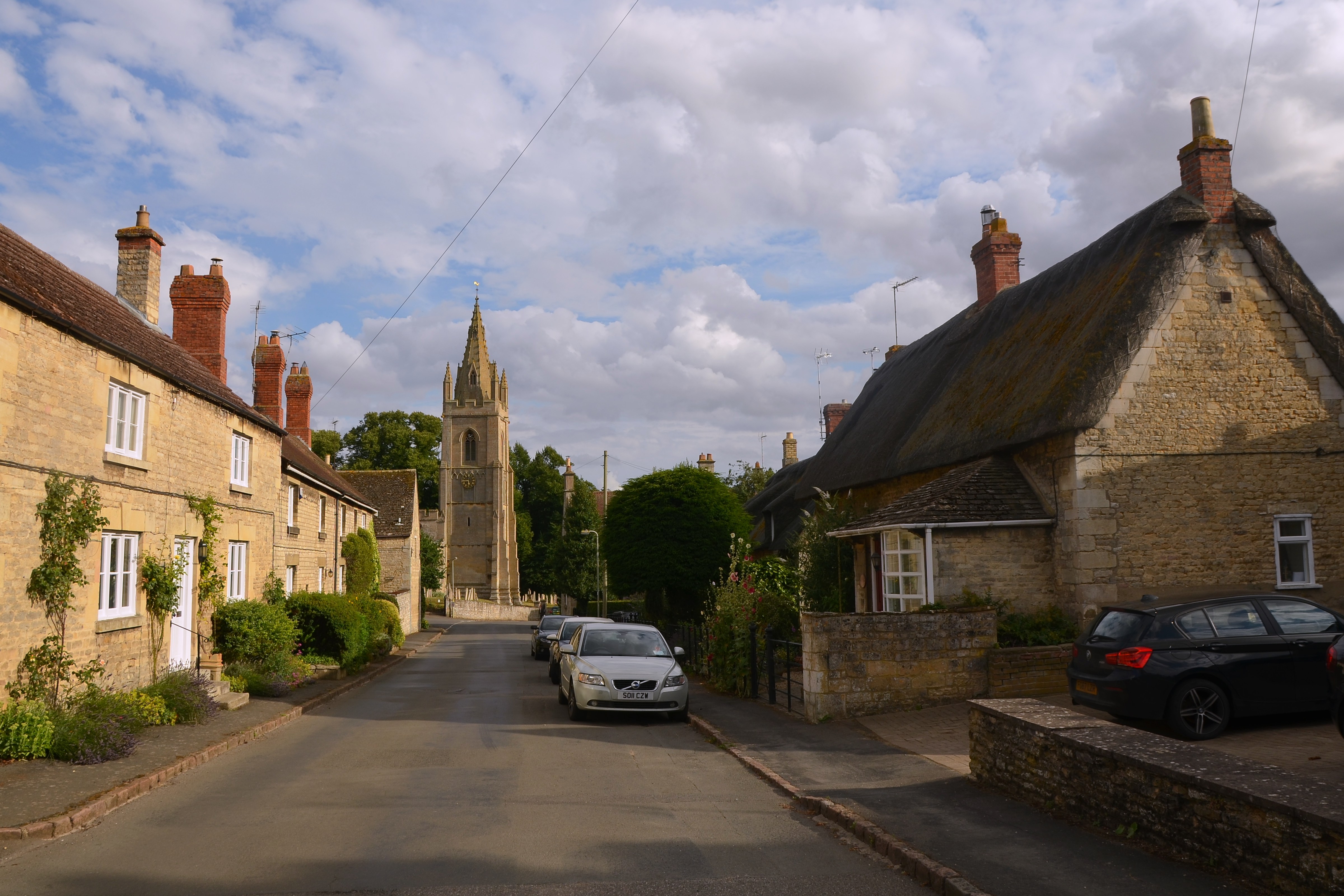
Empingham

Empingham is a village in the county of Rutland in the East Midlands of England. The population of the civil parish was 815 at the 2001 census including...

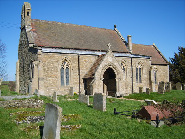
St Peter's Church, Empingham

St Peter's Church is a church in Empingham, Rutland. It is a Grade I listed building. == History == The church was mostly built in the 13th century but...

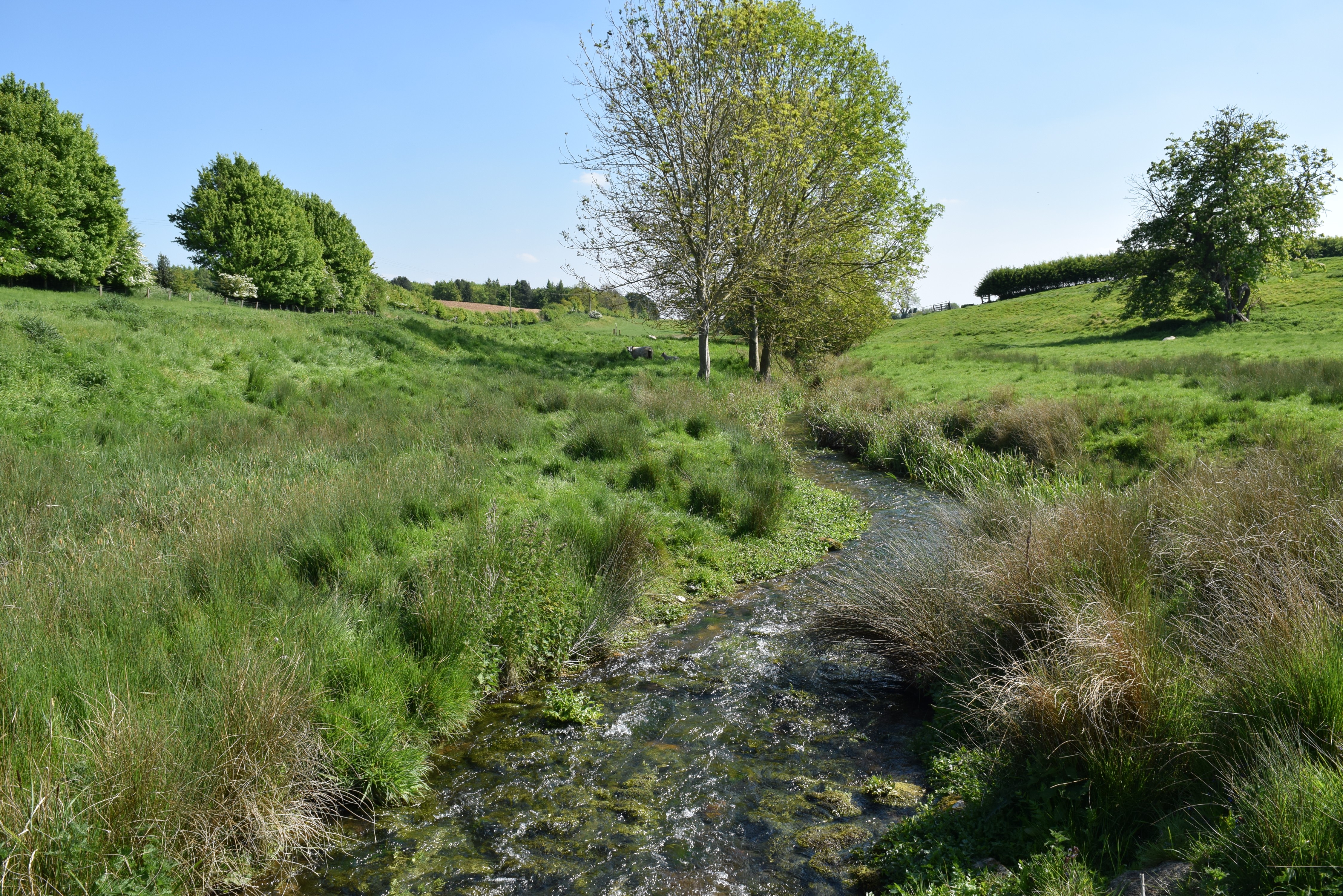
North Brook, Rutland

The North Brook is a small watercourse in Rutland in the East Midlands of England. It is a tributary of the River Gwash and part of the River Welland catchment...

Bloody Oaks Quarry

Bloody Oaks Quarry is a 1.3-hectare (3.2-acre) biological Site of Special Scientific Interest north-west of Great Casterton in Rutland. It is owned and...

Church of St Michael and All Angels, Whitwell

The Church of St Michael and All Angels is a church in Whitwell, Rutland. It is a Grade II* listed building. == History == The church consists of a south...

Whitwell, Rutland

Whitwell is a village and civil parish in the county of Rutland in the East Midlands of England. The population at the 2001 census was 41. At the 2011...

Shacklewell Hollow

Shacklewell Hollow is a 3.2 hectares (7.9 acres) biological Site of Special Scientific Interest east of Empingham in Rutland, and beside the A606 road...

Related Videos

【4K】EMPINGHAM VILLAGE 4K WALKING TOUR

Come with me as I venture around Empingham village in Rutland, encountering a beautiful village with one prime village idiot ...

Exton Village Walk, English Countryside 4K

https://www.buymeacoffee.com/Daveswalks All support is hugely appreciated and it helps me keep the channel going! No talking ...

Sebi’s travels#havefun#in#the#summertime#sebisuniverse#travel #uk#rutland #beach #shortbreak #shorts

Sebi's travels,#in#the#summertime#sebisuniverse #travel #uk #shortbreak #shorts#inthesummertime#havefun #splash #rutland ...

Nearby Amenities

Located within 500m of 52.670765,-0.59446987
Empingham
Place: village
Wikidata: Q995972
Lat/Long: 52.6664827/-0.5966682
Church Farm
Place: farm
Source: Bing
Lat/Long: 52.6665561/-0.5954547
Access: no
Barrier: stile
Foot: yes
Stile: stepover
Lat/Long: 52.6706223/-0.5888018
Bar
Empingham Cricket Club
Addr City: Oakham
Addr Country: GB
Addr Postcode: LE15 8QB
Addr Street: Highfield Close
Addr Village: Empingham
Fhrs Authority: Rutland
Fhrs Id: 1153572
Fhrs Local Authority Id: 100251
Lat/Long: 52.6686404/-0.5984116
Barrier: swing_gate
Lat/Long: 52.6689206/-0.5978707
Leisure: fitness_station
Sport: fitness
Lat/Long: 52.670306/-0.5933958
Leisure: fitness_station
Sport: fitness
Lat/Long: 52.6703948/-0.5934021
Leisure: fitness_station
Sport: fitness
Lat/Long: 52.6704759/-0.5935694
Leisure: fitness_station
Sport: fitness
Lat/Long: 52.6705825/-0.5934209
Leisure: fitness_station
Sport: fitness
Lat/Long: 52.6706916/-0.5934732
Access: no
Barrier: stile
Foot: yes
Stile: stepover
Lat/Long: 52.6728363/-0.5894666
The data included in this document is from www.openstreetmap.org. The data is made available under ODbL.

Have you been to Beckworth Spinney?

Leave your review of Beckworth Spinney below (or comments, questions and feedback).