Greetham Wood Near

Wood, Forest in Rutland

England

Greetham Wood Near

The nameless stream This is definitely a consequent stream, following the contours of the land it carved when so much larger in post-glacial times.  It looks a little like a ditch, were it not for that profile following shape, and the asymmetric terrace.

And yet, this stream, which feeds the lakes at Holywell Hall beyond Clipsham appears to have no name, at least on maps.  Locals call it "the Clipsham Stream".  It is both lovely and unloved at one and the same time.
The nameless stream Credit: Bob Harvey

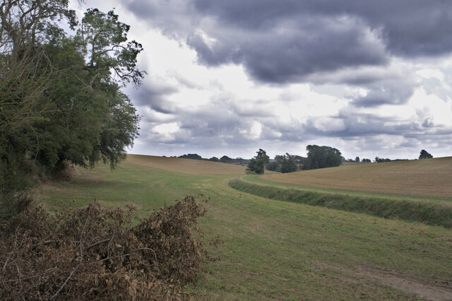
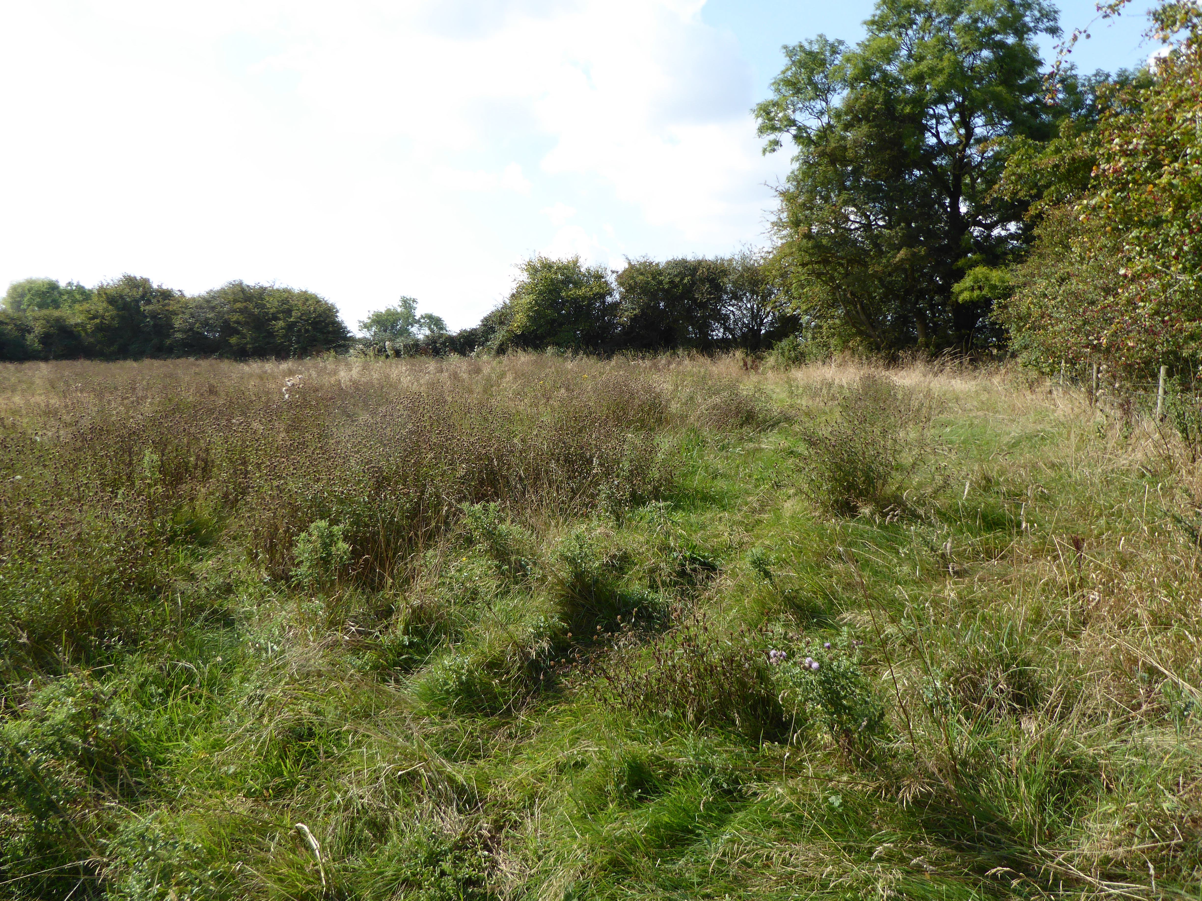
Greetham Wood Near is a picturesque woodland located in Rutland, England. Covering an area of approximately 50 hectares, this wood offers a tranquil and scenic escape for nature enthusiasts and visitors alike.

The wood is predominantly composed of broadleaf trees, with a mix of species including oak, ash, birch, and beech. These trees provide a rich canopy that offers shade during the summer months and creates a stunning display of colors in the autumn. The forest floor is covered in a lush carpet of ferns, bluebells, and other wildflowers, adding to the beauty of the woodland.

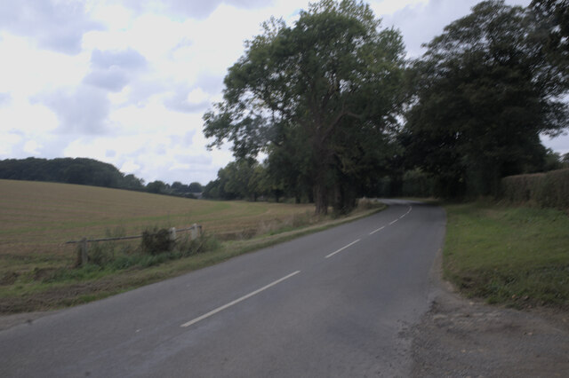
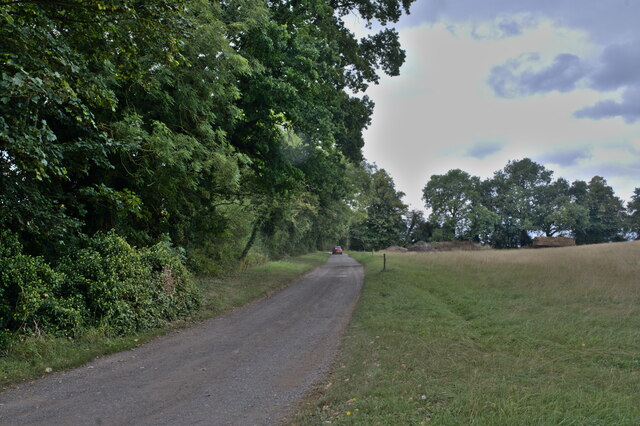
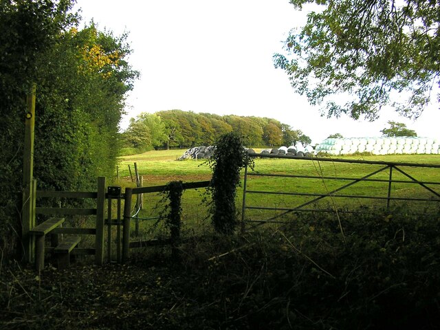
Greetham Wood Near is crisscrossed by a network of well-maintained footpaths, allowing visitors to explore the area and enjoy a leisurely walk. These paths lead to various points of interest, including a small pond that attracts a variety of wildlife, such as ducks, dragonflies, and frogs.

The wood is also home to a diverse range of bird species, making it a popular spot for birdwatching. Visitors may spot woodpeckers, owls, and various songbirds as they wander through the tranquil forest.

Greetham Wood Near is managed by the Forestry Commission, ensuring the preservation and conservation of this natural habitat. The wood offers a peaceful retreat for visitors seeking to connect with nature, whether for a relaxing stroll, picnic, or wildlife observation.

If you have any feedback on the listing, please let us know in the comments section below.

Greetham Wood Near Images

Images are sourced within 2km of 52.721068/-0.60145581 or Grid Reference SK9414. Thanks to Geograph Open Source API. All images are credited.

The nameless stream This is definitely a consequent stream, following the contours of the land it carved when so much larger in post-glacial times.  It looks a little like a ditch, were it not for that profile following shape, and the asymmetric terrace.

And yet, this stream, which feeds the lakes at Holywell Hall beyond Clipsham appears to have no name, at least on maps.  Locals call it "the Clipsham Stream".  It is both lovely and unloved at one and the same time.
The nameless stream
This is definitely a consequent stream, following the contours of the land it carved when so much larger in post-glacial times. It looks a little like a ditch, were it not for that profile following shape, and the asymmetric terrace. And yet, this stream, which feeds the lakes at Holywell Hall beyond Clipsham appears to have no name, at least on maps. Locals call it "the Clipsham Stream". It is both lovely and unloved at one and the same time.
Looking toward Stretton
Along Clipsham Road
Along Clipsham Road
The Egg House and Field View The Egg House is a vending machine selling eggs.
The Egg House and Field View
The Egg House is a vending machine selling eggs.
Great Lane No longer open to vehicles.
Great Lane
No longer open to vehicles.
Muddy field  off Thistleton Lane
Muddy field off Thistleton Lane
Barrier at the end of Great Lane Great Lane is no longer open to vehicles.
Barrier at the end of Great Lane
Great Lane is no longer open to vehicles.
The Viking Way towards Thistleton
Wet entrance to a field near Greetham
Autumn sown crop near Greetham
Prepared field off Hooby Lane
Stile at the top of Church Lane, Stretton
The Plough, Main Street, Greetham
Former Chapel, Main Street, Greetham Former Primitive Methodist Chapel opened in 1889, as indicated by the datestone at the top of the gable and closed in 1960. I don't know what its use was in 2009 when the image was taken, but in 2014 it was being used as 2 garages. <span class="nowrap"><a title="https://www.myprimitivemethodists.org.uk/content/chapels/rutland/greetham_primitive_methodist_chapel" rel="nofollow ugc noopener" href="https://www.myprimitivemethodists.org.uk/content/chapels/rutland/greetham_primitive_methodist_chapel">Link</a><img style="margin-left:2px;" alt="External link" title="External link - shift click to open in new window" src="https://s1.geograph.org.uk/img/external.png" width="10" height="10"/></span>
Former Chapel, Main Street, Greetham
Former Primitive Methodist Chapel opened in 1889, as indicated by the datestone at the top of the gable and closed in 1960. I don't know what its use was in 2009 when the image was taken, but in 2014 it was being used as 2 garages. LinkExternal link
Wooden Bus Shelter, Main Street, Greetham This image was taken in October 2009. Google Street View from May 2021 shows a new, more open shelter which will not give as much protection in bad weather, but it does have a bench seat inside.
Wooden Bus Shelter, Main Street, Greetham
This image was taken in October 2009. Google Street View from May 2021 shows a new, more open shelter which will not give as much protection in bad weather, but it does have a bench seat inside.
Village Centre The middle of Stretton Village has a postbox, a former telephone kiosk with a defibrillator, and the (non-functioning) village pump.  The stone wall behind surrounds the former village school.

See <a href="https://www.geograph.org.uk/photo/1527421">SK9415 : Water Pump & Telephone Box , Manor Rd., Stretton</a> for an older version with the telephone still in use.
Village Centre
The middle of Stretton Village has a postbox, a former telephone kiosk with a defibrillator, and the (non-functioning) village pump. The stone wall behind surrounds the former village school. See SK9415 : Water Pump & Telephone Box , Manor Rd., Stretton for an older version with the telephone still in use.
The village postbox A "lamp box" bracketed onto a wooden post.  It dates from the early years of Queen Elizabeth.

See <a href="https://www.geograph.org.uk/photo/7410140">SK9415 : Village Centre</a> for the context.
The village postbox
A "lamp box" bracketed onto a wooden post. It dates from the early years of Queen Elizabeth. See SK9415 : Village Centre for the context.
Defibrillator in the phone box Inside the phone box seen in <a href="https://www.geograph.org.uk/photo/7410140">SK9415 : Village Centre</a> is this defibrillator.
See <a href="https://www.geograph.org.uk/photo/7410140">SK9415 : Village Centre</a> for the context.
Defibrillator in the phone box
Inside the phone box seen in SK9415 : Village Centre is this defibrillator. See SK9415 : Village Centre for the context.
Show me another place!

Greetham Wood Near is located at Grid Ref: SK9414 (Lat: 52.721068, Lng: -0.60145581)

Unitary Authority: Rutland

Police Authority: Leicestershire

What 3 Words

///responses.online.eased. Near Greetham, Rutland

Nearby Locations

Greetham Wood Near

Related Wikis

St Nicholas' Church, Stretton

St Nicholas' Church is a church in Stretton, Rutland. It is a Grade II* listed building. == History == The small church consists of nave with north aisle...
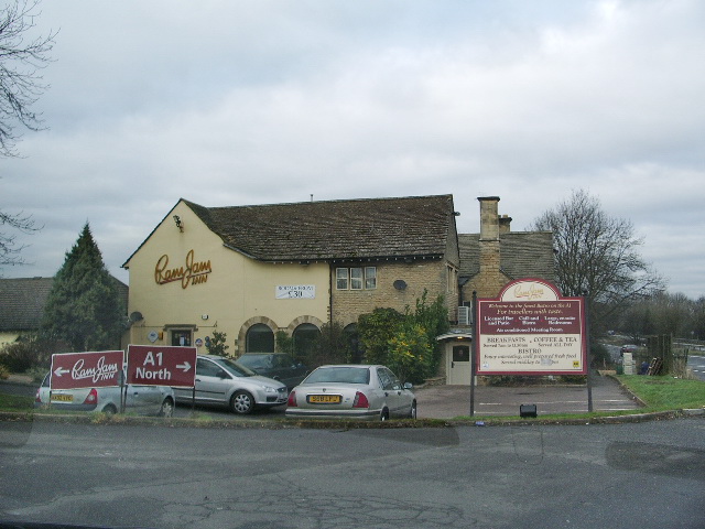
Ram Jam Inn

The Ram Jam Inn was a historic pub in the civil parish of Greetham, Rutland, England, located on the west side of the Great North Road (now the A1), near...

Merry's Meadows

Merry's Meadows is a 12.4-hectare (31-acre) nature reserve west of Stretton in Rutland. It is managed by the Leicestershire and Rutland Wildlife Trust...
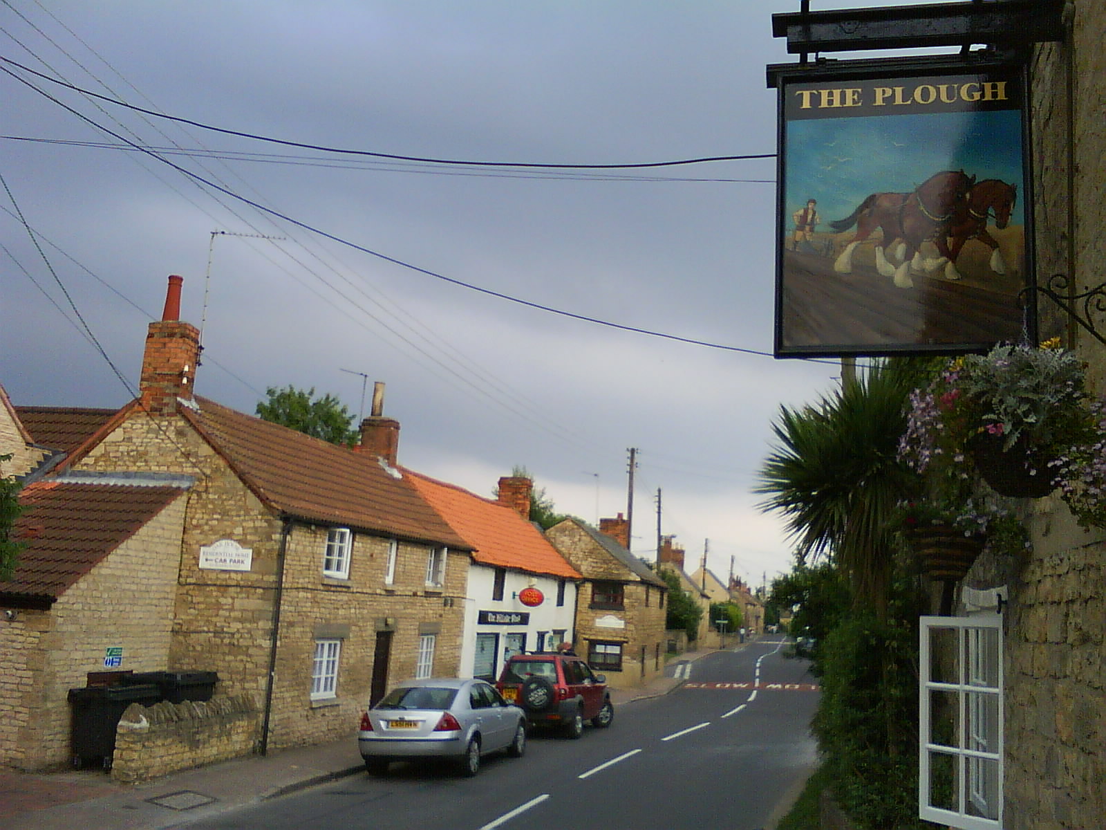
Stretton, Rutland

Stretton is a village and civil parish in the county of Rutland, England, just off the A1 Great North Road. The population of the civil parish was 770...

Greetham, Rutland

Greetham is a village and civil parish in the county of Rutland in the East Midlands of England. The village's name means 'homestead/village which is gravelly...

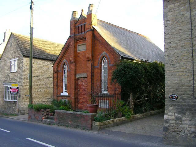
Church of St Mary the Virgin, Greetham

The Church of St Mary the Virgin is the Church of England parish church in Greetham, Rutland. It is a Grade I listed building. == History == The oldest...

RAF Woolfox Lodge

Royal Air Force Woolfox Lodge, or more simply RAF Woolfox Lodge, is a former Royal Air Force station next to the A1 road in Rutland, UK. The airfield is...

Horn, Rutland

Horn is a former civil parish, now in the parish of Exton and Horn, in the county of Rutland, England. In 2001 it had a population of 9, which was included...

Nearby Amenities

Located within 500m of 52.721068,-0.60145581
The Olde Greetham Inn
Alt Name: New Inn Farm
Place: isolated_dwelling
Source: Bing
Lat/Long: 52.7227488/-0.5971086
Generator Method: photovoltaic
Generator Output Electricity: yes
Generator Source: solar
Generator Type: solar_photovoltaic_panel
Location: roof
Power: generator
Lat/Long: 52.7184171/-0.6061653
Golf: pin
Lat/Long: 52.7172299/-0.6031279
The data included in this document is from www.openstreetmap.org. The data is made available under ODbL.

Have you been to Greetham Wood Near?

Leave your review of Greetham Wood Near below (or comments, questions and feedback).