Wall, East

Settlement in Shropshire

England

Wall, East

April showers on Wenlock Edge Sunshine and showers on Wenlock Edge; some of Shropshire's best walking.
April showers on Wenlock Edge Credit: Jeremy Bolwell

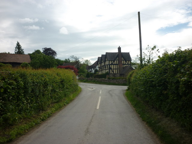
Wall is a small village located in the county of Shropshire, England. Situated in the eastern part of the county, it falls within the administrative area of Telford and Wrekin. The village is nestled in a picturesque rural setting, surrounded by rolling hills and green countryside.

Wall boasts a rich history, evident in its charming buildings and landmarks. One of the village's notable attractions is the ruins of a Roman fort called Deva Victrix, which once stood here during the Roman occupation of Britain. These ruins serve as a reminder of Wall's ancient past and attract visitors interested in Roman history.

Despite its small size, Wall offers various amenities to its residents and visitors. The village has a local pub, serving a selection of food and drinks, providing a cozy and friendly atmosphere. Additionally, there is a village hall that hosts community events and gatherings.

The surrounding countryside provides ample opportunities for outdoor activities and exploration. The village is located close to the Shropshire Hills Area of Outstanding Natural Beauty, offering scenic walks, cycling routes, and wildlife spotting. The nearby River Severn also provides opportunities for fishing and boating.

Transport links in Wall are relatively good, with the village being easily accessible by road. The A5 road runs nearby, connecting Wall to Telford and other surrounding towns. The nearest railway station is located in Shrewsbury, approximately 10 miles away, offering connections to major cities in the region.

Overall, Wall is a quaint and historic village, offering a peaceful and picturesque setting for residents and visitors alike.

If you have any feedback on the listing, please let us know in the comments section below.
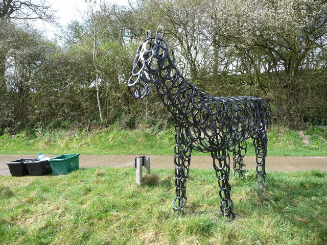
Wall, East Images

Images are sourced within 2km of 52.534698/-2.697066 or Grid Reference SO5293. Thanks to Geograph Open Source API. All images are credited.

April showers on Wenlock Edge Sunshine and showers on Wenlock Edge; some of Shropshire's best walking.
April showers on Wenlock Edge
Sunshine and showers on Wenlock Edge; some of Shropshire's best walking.
Growing lambs on Wenlock Edge The April showers make the new lambs look very white compared to their mothers. This growing lamb seeks some shelter behind its mum.
Growing lambs on Wenlock Edge
The April showers make the new lambs look very white compared to their mothers. This growing lamb seeks some shelter behind its mum.
Shropshire Way waymarker on Wenlock Edge The Shropshire Way and the Jack Mytton Way both run on this section of Wenlock Edge.
Shropshire Way waymarker on Wenlock Edge
The Shropshire Way and the Jack Mytton Way both run on this section of Wenlock Edge.
Horse art at Wilderhope Farm This black horse made out of old horse shoes stands beside the farm access track to Wilderhope Farm. Not anatomically perfect but the artist had a good eye and a sense of humour. Great bit of recycling too.
Horse art at Wilderhope Farm
This black horse made out of old horse shoes stands beside the farm access track to Wilderhope Farm. Not anatomically perfect but the artist had a good eye and a sense of humour. Great bit of recycling too.
The south facing front of Wilderhope Manor This manor house dates from 1585 and was built for a Francis Smallman. He obviously built to last and had vision. The Smallman family held the manor and house until 1745, through some very turbulent times. It was here in 1587 or so that someone must have said "The Spanish Armada? What's that?"
The south facing front of Wilderhope Manor
This manor house dates from 1585 and was built for a Francis Smallman. He obviously built to last and had vision. The Smallman family held the manor and house until 1745, through some very turbulent times. It was here in 1587 or so that someone must have said "The Spanish Armada? What's that?"
Wilderhope Manor on Wenlock Edge A fine example of a Shropshire Elizabethan manor house, with surviving interior features such as the original oak stairs, secondary spiral stair also in oak and fine plaster moulded ceilings in many of the main rooms. It was built for the Smallman family in 1585 and was retained by that family until 1742, since when it has passed through several hands and is now owned by the National Trust who lease it to the Youth Hostels Association as a youth hostel.
Wilderhope Manor on Wenlock Edge
A fine example of a Shropshire Elizabethan manor house, with surviving interior features such as the original oak stairs, secondary spiral stair also in oak and fine plaster moulded ceilings in many of the main rooms. It was built for the Smallman family in 1585 and was retained by that family until 1742, since when it has passed through several hands and is now owned by the National Trust who lease it to the Youth Hostels Association as a youth hostel.
Wilderhope Manor, Wenlock Edge The magnificent chimney stacks can be appreciated from this angle. The building was also equipped with garderobes - quite advanced for Shropshire at the time - and lavish interior fittings. In the 1580's Elizabethan England was doing well and a prosperous yeoman farmer class was emerging and advancing themselves and able to build like this - think Walter Raleigh beating the Spanish, Elizabeth I at the height of her powers and an, as yet, unknown William Shakespeare possibly touring the country in a troupe of actors. Quite a time.
Wilderhope Manor, Wenlock Edge
The magnificent chimney stacks can be appreciated from this angle. The building was also equipped with garderobes - quite advanced for Shropshire at the time - and lavish interior fittings. In the 1580's Elizabethan England was doing well and a prosperous yeoman farmer class was emerging and advancing themselves and able to build like this - think Walter Raleigh beating the Spanish, Elizabeth I at the height of her powers and an, as yet, unknown William Shakespeare possibly touring the country in a troupe of actors. Quite a time.
The rear of Wilderhope Manor, Wenlock Edge There are five chimney stacks at the far (west) end, three at the rear and another three at the near (east) end - the building was equipped for cold winters. The round tower on the rear elevation contains the spiral stairs. The garderobes also emptied at the rear of the building.
The rear of Wilderhope Manor, Wenlock Edge
There are five chimney stacks at the far (west) end, three at the rear and another three at the near (east) end - the building was equipped for cold winters. The round tower on the rear elevation contains the spiral stairs. The garderobes also emptied at the rear of the building.
Hailstorm on Wenlock Edge This hailstorm came in from the west, behind us, but we heard its hissing approach, resulting in a scramble to don full waterproofs as it came overhead in a stinging downpour of bouncing ice droplets. The sheep moved ahead of us most reluctantly and the lambs looked quite discomfitted. Lightning flashed and just a few seconds later thunder pealed to complete the mini-drama.
Hailstorm on Wenlock Edge
This hailstorm came in from the west, behind us, but we heard its hissing approach, resulting in a scramble to don full waterproofs as it came overhead in a stinging downpour of bouncing ice droplets. The sheep moved ahead of us most reluctantly and the lambs looked quite discomfitted. Lightning flashed and just a few seconds later thunder pealed to complete the mini-drama.
Manor Farm, Rushbury
Entering Rushbury
Entering Rushbury
Longville Farm, Longville One of two farms in the village; the other is <a href="https://www.geograph.org.uk/photo/2649111">SO5493 : Home Farm, Longville</a> on the other side of the road.
Longville Farm, Longville
One of two farms in the village; the other is SO5493 : Home Farm, Longville on the other side of the road.
Home Farm, Longville One of two farms right in the village; the other is <a href="https://www.geograph.org.uk/photo/2649109">SO5493 : Longville Farm, Longville</a> opposite here
Home Farm, Longville
One of two farms right in the village; the other is SO5493 : Longville Farm, Longville opposite here
Station Farm house, Longville As far as I know, it's no longer a working farm, but it's certainly a striking building as you come down the road into Longville from Wenlock Edge.
Station Farm house, Longville
As far as I know, it's no longer a working farm, but it's certainly a striking building as you come down the road into Longville from Wenlock Edge.
Large barn on the northern side of Longville
Benchmark - north side of Heath Bridge This benchmark is cut into the stonework on the northern parapet of the bridge over the Heath Brook.
Benchmark - north side of Heath Bridge
This benchmark is cut into the stonework on the northern parapet of the bridge over the Heath Brook.
The track down to The Coats Farm access track, and bridleway, which leads eventually up onto Wenlock Edge.
The track down to The Coats
Farm access track, and bridleway, which leads eventually up onto Wenlock Edge.
The Coats farmhouse
The Coats farmhouse
Show me another place!

Wall, East is located at Grid Ref: SO5293 (Lat: 52.534698, Lng: -2.697066)

Unitary Authority: Shropshire

Police Authority: West Mercia

What 3 Words

///tent.brightens.pizza. Near Cardington, Shropshire

Related Wikis

Longville railway station

Longville railway station was a station in Longville in the Dale, Shropshire, England. The station was opened in 1867 and closed in 1951. The station is...

Wilderhope Manor

Wilderhope Manor is a 16th-century manor house in the care of the National Trust. It is located on Wenlock Edge 7 miles (11 km) south west of Much Wenlock...

Shropshire Hills

The Shropshire Hills are a dissected upland area and one of the natural regions of England. They lie wholly within the county of Shropshire and encompass...

Rushbury

Rushbury is a village and civil parish in Shropshire, roughly five miles from Church Stretton and eight miles from Much Wenlock. Nearby villages include...

Nearby Amenities

Located within 500m of 52.534698,-2.697066
Power: pole
Lat/Long: 52.5322105/-2.7009738
Power: pole
Lat/Long: 52.5327652/-2.6995146
Power: pole
Lat/Long: 52.5332808/-2.6982218
Power: pole
Lat/Long: 52.5322904/-2.6916826
Power: pole
Lat/Long: 52.5327587/-2.6926535
Power: pole
Lat/Long: 52.5331797/-2.6934797
Power: pole
Lat/Long: 52.5339269/-2.6940295
Power: pole
Lat/Long: 52.5336969/-2.6972428
Power: pole
Lat/Long: 52.5344425/-2.6955825
Power: pole
Lat/Long: 52.5347362/-2.6946303
Power: pole
Lat/Long: 52.5354018/-2.6926535
Power: pole
Lat/Long: 52.5357559/-2.6915914
Power: pole
Lat/Long: 52.5361442/-2.6904273
Give Way
Direction: forward
Lat/Long: 52.5346699/-2.6971057
Give Way
Direction: backward
Lat/Long: 52.5347535/-2.697064
The data included in this document is from www.openstreetmap.org. The data is made available under ODbL.

Have you been to Wall, East?

Leave your review of Wall, East below (or comments, questions and feedback).