Ashton

Settlement in Cheshire

England

Ashton

Lay-by on the A54 near Tarvin
Lay-by on the A54 near Tarvin Credit: Eirian Evans

Ashton is a small village located in the county of Cheshire, England. Situated approximately 5 miles east of the market town of Chester, Ashton is a rural community with a population of around 1,000 residents. The village is surrounded by picturesque countryside, offering beautiful views and a tranquil atmosphere.

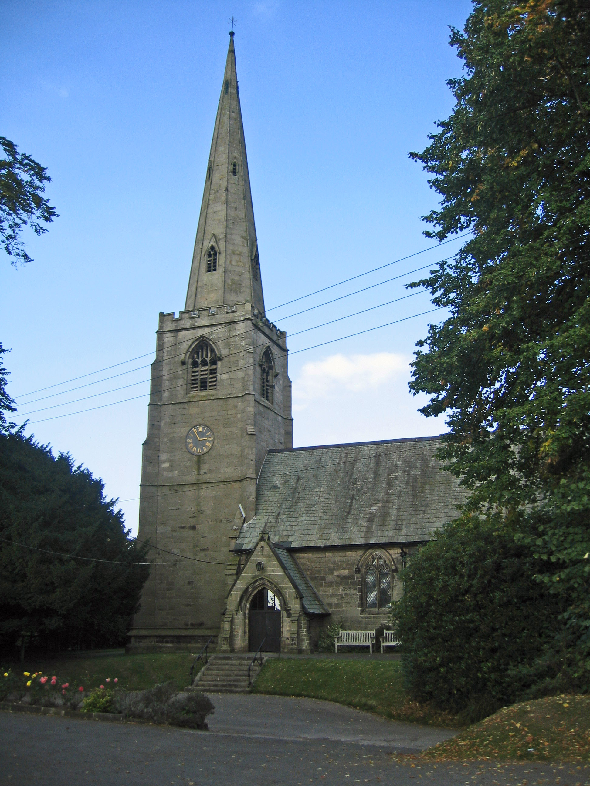
One of the notable landmarks in Ashton is the St. John the Baptist Church, a historic building dating back to the 14th century. The church is known for its stunning architecture and attracts visitors who are interested in historical and architectural heritage.

Despite its small size, Ashton has a strong sense of community, with various local organizations and events that bring residents together. The village has a primary school, which plays a crucial role in the education of local children.

With its close proximity to Chester, residents of Ashton have easy access to the amenities and services of a larger town. Chester offers a wide range of shops, restaurants, and leisure facilities, as well as excellent transport links to other parts of the region.

Surrounding Ashton are numerous opportunities for outdoor activities and exploration. The village is located near the Cheshire countryside, which is known for its rolling hills, scenic walks, and nature reserves. This makes Ashton an attractive place for those who enjoy outdoor pursuits or simply appreciate the beauty of the natural surroundings.

In summary, Ashton is a charming village in Cheshire, offering a peaceful and close-knit community, access to nearby amenities, and the natural beauty of the surrounding countryside.

If you have any feedback on the listing, please let us know in the comments section below.

Ashton Images

Images are sourced within 2km of 53.217338/-2.7428053 or Grid Reference SJ5069. Thanks to Geograph Open Source API. All images are credited.

Lay-by on the A54 near Tarvin
Kelsall Lock up Lock-up: probably early-mid C19. Rock-faced buff sandstone, massive
slabs forming flat roof. Stands cl.6m in height and is semi-circular

<span class="nowrap"><a title="https://britishlistedbuildings.co.uk/101130532-lock-up-on-the-end-of-the-barn-at-weldon-house-kelsall#.Yx355HbMKUk" rel="nofollow ugc noopener" href="https://britishlistedbuildings.co.uk/101130532-lock-up-on-the-end-of-the-barn-at-weldon-house-kelsall#.Yx355HbMKUk">Link</a><img style="margin-left:2px;" alt="External link" title="External link - shift click to open in new window" src="https://s1.geograph.org.uk/img/external.png" width="10" height="10"/></span>
Kelsall Lock up
Lock-up: probably early-mid C19. Rock-faced buff sandstone, massive slabs forming flat roof. Stands cl.6m in height and is semi-circular LinkExternal link
St. John the Evangelist's Church, Ashton Hayes Originally part of the parish of Tarvin, St John's became a separate parish in 1849. In that year the church was built.

<span class="nowrap"><a title="https://en.wikipedia.org/wiki/St_John_the_Evangelist%27s_Church,_Ashton_Hayes" rel="nofollow ugc noopener" href="https://en.wikipedia.org/wiki/St_John_the_Evangelist%27s_Church,_Ashton_Hayes">Link</a><img style="margin-left:2px;" alt="External link" title="External link - shift click to open in new window" src="https://s1.geograph.org.uk/img/external.png" width="10" height="10"/></span>
St. John the Evangelist's Church, Ashton Hayes
Originally part of the parish of Tarvin, St John's became a separate parish in 1849. In that year the church was built. LinkExternal link
The Golden Lion, Ashton
Milepost to the south of Ashton
Eastern end of Shay Lane Comes out in the village of Ashton.
Eastern end of Shay Lane
Comes out in the village of Ashton.
Kelsall Telephone Exchange, Dog Lane (formerly Frodsham Street)
Just a confirmation of changing  times Refer to the submission for the Telephone Exchange <a href="https://www.geograph.org.uk/photo/111776">SJ5168 : Kelsall Telephone Exchange, Dog Lane (formerly Frodsham Street)</a>.
Just a confirmation of changing times
Refer to the submission for the Telephone Exchange SJ5168 : Kelsall Telephone Exchange, Dog Lane (formerly Frodsham Street).
Shay Lane, Ashton This green lane runs from Ashton to Longley Farm
Shay Lane, Ashton
This green lane runs from Ashton to Longley Farm
Straw and silage in a field near Ashton This photograph was taken from Shay lane, Ashton <a href="https://www.geograph.org.uk/gridref/SJ5169">SJ5169</a>.
Straw and silage in a field near Ashton
This photograph was taken from Shay lane, Ashton SJ5169.
Mouldsworth - Ashton church from Congar Lane Mouldsworth. Congar Lane - view towards Ashton church from bridge over Ashton Brook at the parish boundary with Horton-cum-Peel.
Mouldsworth - Ashton church from Congar Lane
Mouldsworth. Congar Lane - view towards Ashton church from bridge over Ashton Brook at the parish boundary with Horton-cum-Peel.
View across field to A54 View looking N across field to A54 from SJ5067
View across field to A54
View looking N across field to A54 from SJ5067
Footbridge Excellent bridges in place on the footpath running from the A54 to Tarvin Sands.
Footbridge
Excellent bridges in place on the footpath running from the A54 to Tarvin Sands.
Footpath Tarvin Sands to Lower Street Farm The footpath between Tarvin Sands and Lower Street Farm on the A54. The path crosses a number of ditches where excellent footbridges are positioned.
Footpath Tarvin Sands to Lower Street Farm
The footpath between Tarvin Sands and Lower Street Farm on the A54. The path crosses a number of ditches where excellent footbridges are positioned.
Lane and Footpath Junction in Kelsall The lane that turns left here is an access track to private property, whilst the track straight ahead provides access to outlying farmland and is also a public footpath.
Lane and Footpath Junction in Kelsall
The lane that turns left here is an access track to private property, whilst the track straight ahead provides access to outlying farmland and is also a public footpath.
Eastern end of Shay Lane Pleasant byway between Longley Lane, Kelsall, and Ashton Hayes.
Eastern end of Shay Lane
Pleasant byway between Longley Lane, Kelsall, and Ashton Hayes.
West End, Ashton Hayes Pretty corner on a snowy day.
West End, Ashton Hayes
Pretty corner on a snowy day.
Footpath southwest of Ashton Hayes Pleasant hedged path leading eventually to Tarvin.
Footpath southwest of Ashton Hayes
Pleasant hedged path leading eventually to Tarvin.
Show me another place!

Ashton is located at Grid Ref: SJ5069 (Lat: 53.217338, Lng: -2.7428053)

Unitary Authority: Cheshire West and Chester

Police Authority: Cheshire

Also known as: Ashton Hayes

What 3 Words

///sling.amounting.aimless. Near Mouldsworth, Cheshire

Related Wikis

Ashton Hayes

Ashton Hayes is a village and former civil parish, now in the parish of Ashton Hayes and Horton-cum-Peel, in the unitary authority of Cheshire West and...

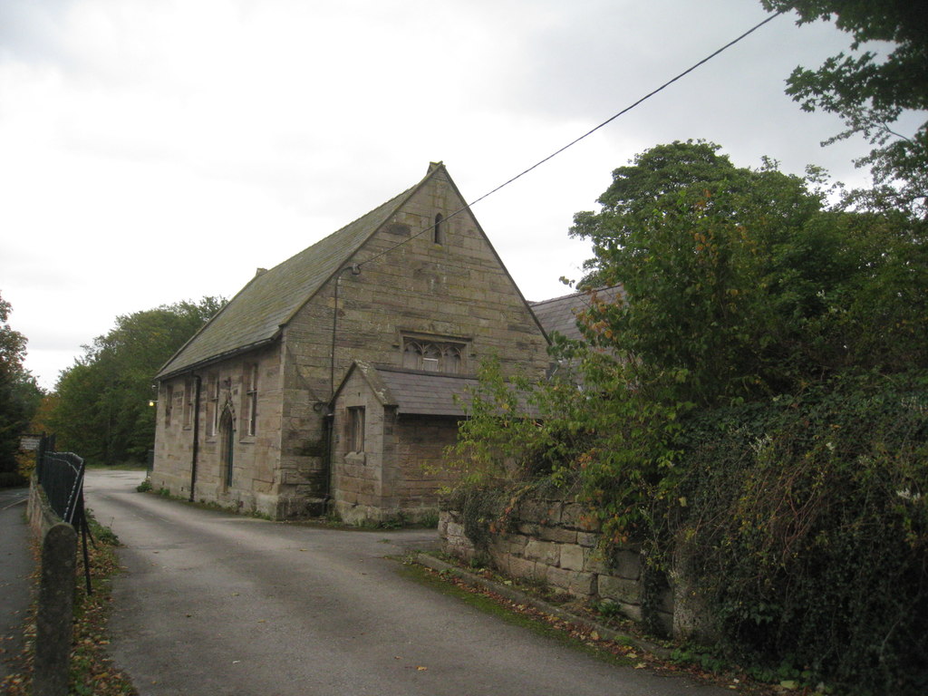
St John the Evangelist's Church, Ashton Hayes

St John the Evangelist's Church is located to the north of the village of Ashton Hayes, Cheshire, England. It is an active Anglican parish church in the...

Horton-cum-Peel

Horton-cum-Peel is a former civil parish, now in the parish of Ashton Hayes and Horton-cum-Peel, in the Borough of Cheshire West and Chester and ceremonial...
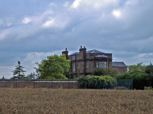
Peel Hall, Cheshire

Peel Hall is a country house near the village of Ashton Hayes, Cheshire, England. It is recorded in the National Heritage List for England as a designated...
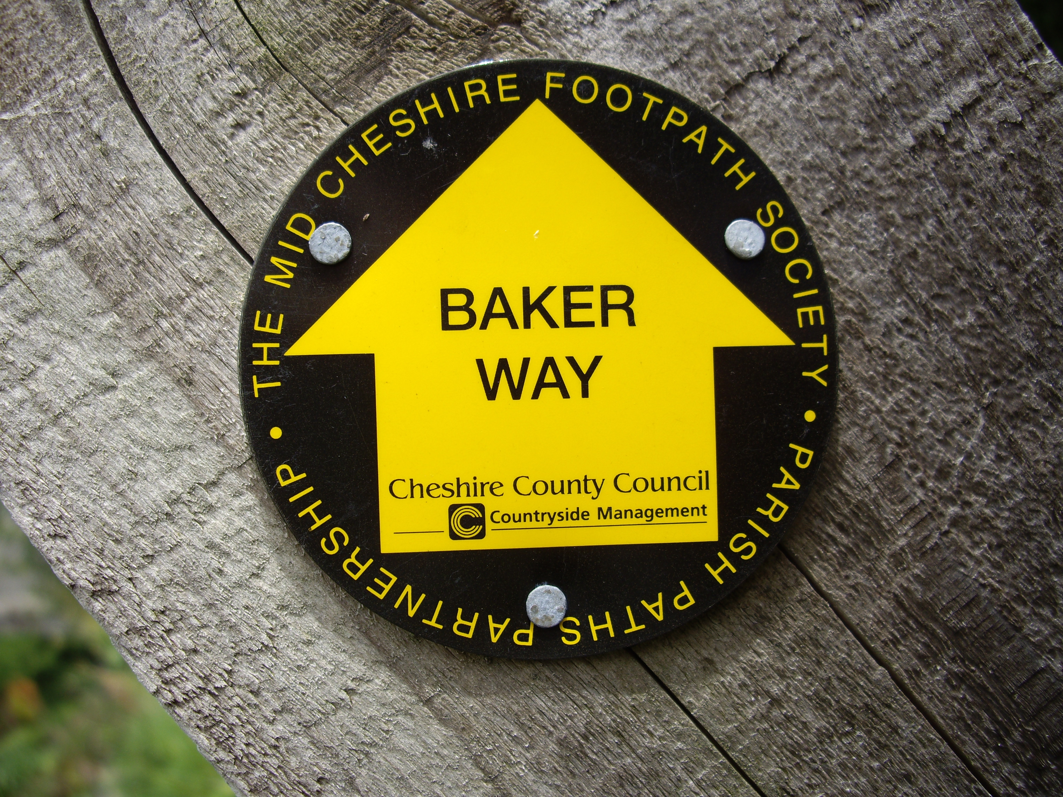
Baker Way

The Baker Way is a footpath running from Chester railway station to Delamere railway station within the English county of Cheshire. The total length of...

Church of St Cuthbert by the Forest

The Church of St Cuthbert by the Forest is in the village of Mouldsworth, Cheshire, England. It is an active Roman Catholic church in the diocese of Shrewsbury...

Mouldsworth railway station

Mouldsworth railway station opened on 22 June 1870 and serves the village of Mouldsworth in Cheshire, England. It is managed by Northern Trains. The station...

Mouldsworth

Mouldsworth is a village and civil parish on the outskirts of Chester in the unitary authority of Cheshire West and Chester and the ceremonial county of...

Nearby Amenities

Located within 500m of 53.217338,-2.7428053
Turning Circle
Lat/Long: 53.2168371/-2.7392701
Check Date: 2015-07-20
Disused Amenity: pub
Old Name: The Golden Lion
Lat/Long: 53.2175293/-2.7428741
Barrier: stile
Foot: yes
Lat/Long: 53.216129/-2.7424944
Barrier: stile
Foot: yes
Lat/Long: 53.2164515/-2.7436244
Place Of Worship
Ashton Hayes Methodist Chapel
Denomination: methodist
Religion: christian
Lat/Long: 53.2164797/-2.7436205
Barrier: stile
Foot: yes
Lat/Long: 53.2165393/-2.7457535
Barrier: stile
Foot: yes
Lat/Long: 53.2157606/-2.7488458
Parking
Parking: surface
Lat/Long: 53.2177195/-2.7426445
Post Office
Source: OS OpenData StreetView
Lat/Long: 53.2173783/-2.7423738
Aston Village Shop
Addr Postcode: CH3 8BH
Addr Street: Kelsall Road
Fhrs Id: 290979
Shop: convenience
Source Addr: FHRS Open Data
Lat/Long: 53.217339/-2.7424192
Ashton Childrens Playground
Access: yes
Leisure: playground
Lat/Long: 53.2159852/-2.7442699
Barrier: bollard
Lat/Long: 53.2176779/-2.7428413
Direction: SSW
Generator Method: photovoltaic
Generator Output Electricity: yes
Generator Source: solar
Generator Type: solar_photovoltaic_panel
Location: roof
Power: generator
Lat/Long: 53.2180684/-2.7420597
Direction: WSW
Generator Method: photovoltaic
Generator Output Electricity: yes
Generator Source: solar
Generator Type: solar_photovoltaic_panel
Location: roof
Power: generator
Lat/Long: 53.2199228/-2.7436421
Defibrillator
Emergency: defibrillator
Indoor: no
Ref: CPAD234
Lat/Long: 53.2173588/-2.7427102
Post Box
Brand: Royal Mail
Brand Wikidata: Q638098
Brand Wikipedia: en:Royal Mail
Collection Times: Mo-Fr 16:45; Sa 10:00, Su off
Drive Through: no
Operator: Royal Mail
Operator Wikidata: Q638098
Post Box Type: pillar
Ref: CH3 191
Royal Cypher: GVIR
Royal Cypher Wikidata: Q33102169
Lat/Long: 53.2172871/-2.7424367
Cafe
The Pavilion Café
Opening Hours: Sa,Su 14:00-16:00
Lat/Long: 53.2157815/-2.7446913
Leisure: picnic_table
Lat/Long: 53.2157252/-2.7472536
Bench
Lat/Long: 53.2164231/-2.7455155
Bench
Lat/Long: 53.2162453/-2.7462588
Leisure: fitness_station
Lat/Long: 53.2163009/-2.7461363
Leisure: fitness_station
Lat/Long: 53.2161185/-2.7448844
Bench
Lat/Long: 53.2163927/-2.7454151
Leisure: picnic_table
Lat/Long: 53.2163007/-2.7451082
Bench
Lat/Long: 53.216369/-2.7453276
Bus Stop
Ashton Hayes, Church Road / Gongar Lane
Bus: yes
Naptan AtcoCode: 0610CHIM314
Naptan Bearing: NE
Naptan BusStopType: CUS
Naptan CommonName: Gongar Lane
Naptan Crossing: Gongar Lane
Naptan Indicator: cnr
Naptan Landmark: The Village Farm
Naptan LocalityName: Ashton Hayes
Naptan NaptanCode: chwtpam
Naptan ShortCommonName: Gongar Lane
Naptan Street: Church Road
Public Transport: platform
Source: naptan_import
Lat/Long: 53.2193511/-2.7417169
Bus Stop
Ashton Hayes, Church Road / Golden Lion PH
Bus: yes
Naptan AtcoCode: 0610CH689
Naptan Bearing: NE
Naptan BusStopType: CUS
Naptan CommonName: Golden Lion PH
Naptan Crossing: West End
Naptan Indicator: opp
Naptan Landmark: Golden Lion PH
Naptan LocalityName: Ashton Hayes
Naptan NaptanCode: chwdtdw
Naptan ShortCommonName: Golden Lion PH
Naptan Street: Church Road
Public Transport: platform
Source: naptan_import
Lat/Long: 53.2178317/-2.742943
The data included in this document is from www.openstreetmap.org. The data is made available under ODbL.

Have you been to Ashton?

Leave your review of Ashton below (or comments, questions and feedback).