Miry Sike Wood

Wood, Forest in Yorkshire Scarborough

England

Miry Sike Wood

Near Backleys Looking east at the bottom of the steep hill near Backleys.
Near Backleys Credit: T Eyre

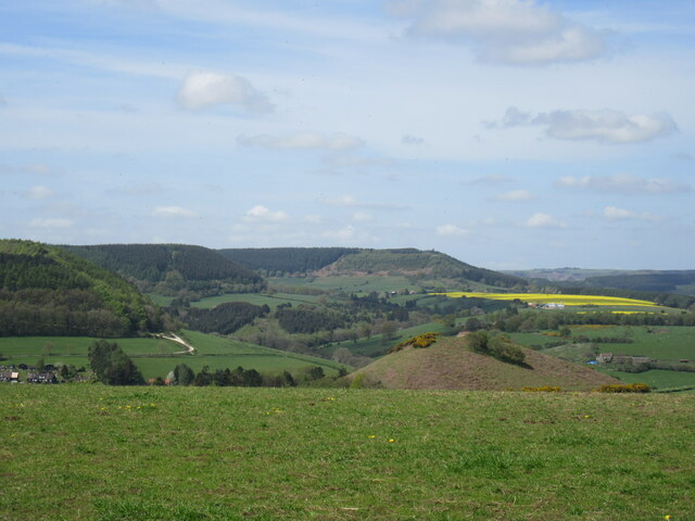
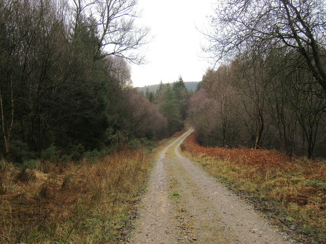
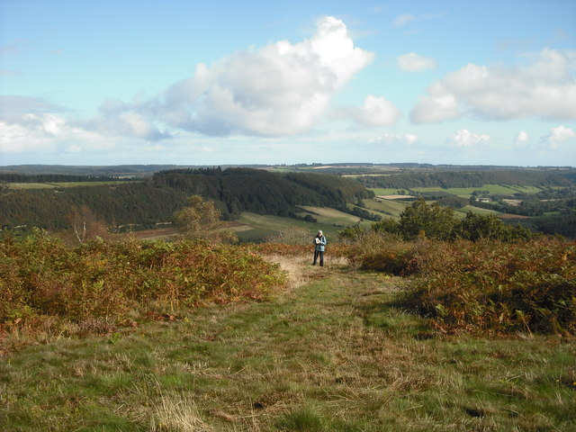
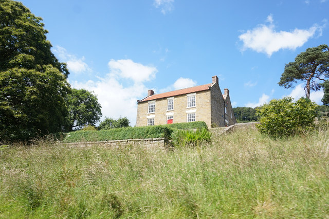
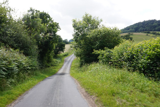
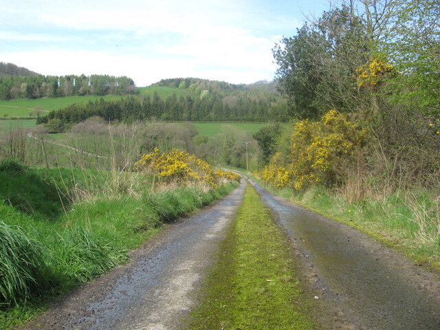
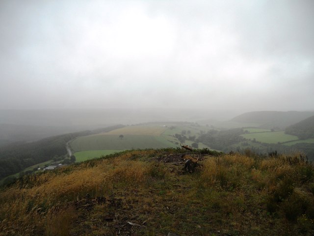
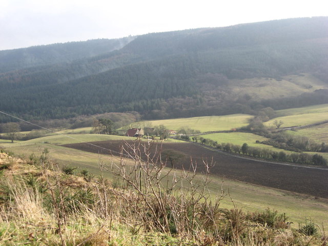
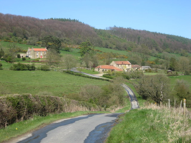
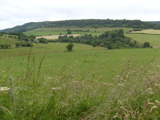
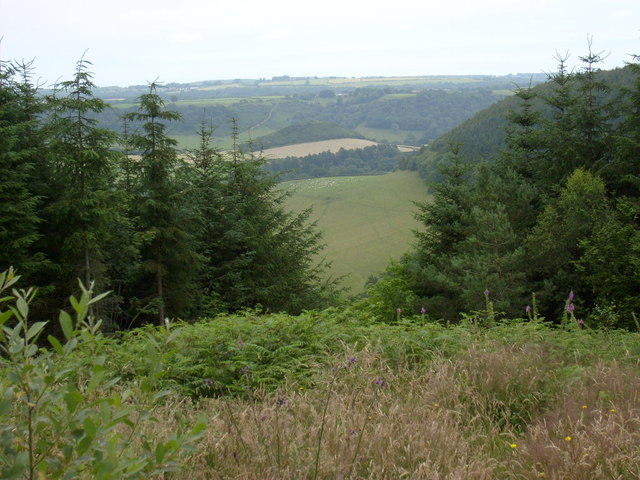
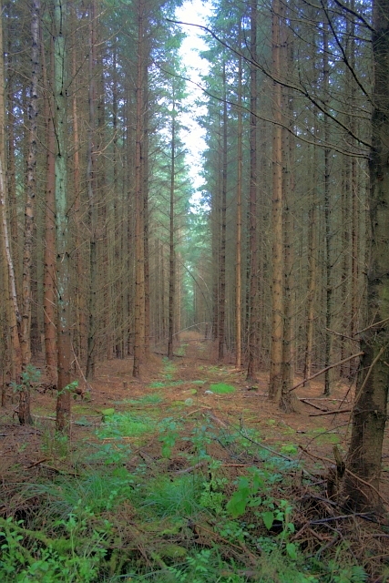
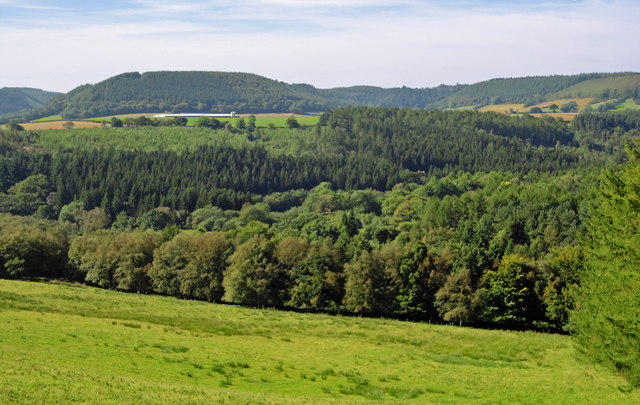
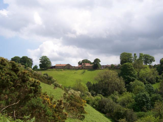
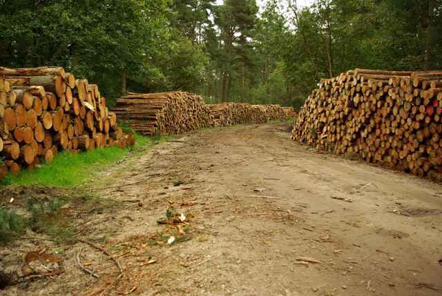
Miry Sike Wood is a picturesque woodland located in the county of Yorkshire, England. Covering an area of approximately 100 acres, it is nestled in the heart of the Yorkshire Dales, known for its stunning natural beauty and diverse wildlife. The wood is situated near the town of Skipton, making it easily accessible for visitors.

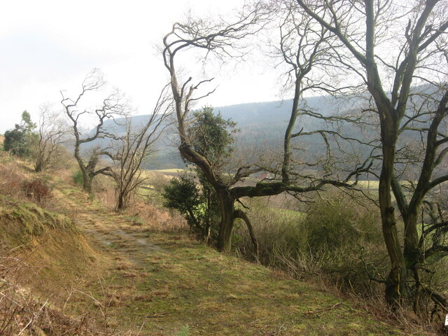
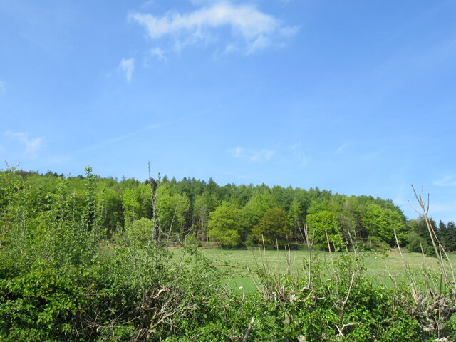
The woodland is characterized by its dense canopy of ancient trees, including oak, beech, and ash, which create a serene and tranquil atmosphere. The forest floor is covered in a thick carpet of moss and ferns, adding to the enchanting ambiance. Miry Sike Wood is also home to a wide variety of plant species, such as bluebells, primroses, and wild garlic, which create a stunning display of color during the spring months.

As visitors explore the woodland, they may encounter a range of wildlife. Miry Sike Wood is known for its diverse bird population, including woodpeckers, owls, and various species of songbirds. Additionally, the forest is inhabited by mammals such as deer, rabbits, and squirrels, which can often be spotted darting through the trees.

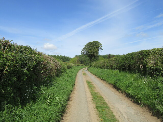
The wood offers a network of well-maintained footpaths, allowing visitors to fully immerse themselves in the natural beauty of the surroundings. There are also designated picnic areas and benches where visitors can relax and appreciate the peaceful ambiance. Miry Sike Wood provides a perfect retreat for nature lovers, hikers, and those seeking a tranquil escape from the hustle and bustle of everyday life.

If you have any feedback on the listing, please let us know in the comments section below.

Miry Sike Wood Images

Images are sourced within 2km of 54.308579/-0.56607599 or Grid Reference SE9391. Thanks to Geograph Open Source API. All images are credited.

Near Backleys Looking east at the bottom of the steep hill near Backleys.
Near Backleys
Looking east at the bottom of the steep hill near Backleys.
Broxa Moor Lane a narrow single track road that soon becomes a wider gravel track in Broxa Forest.
Broxa Moor Lane
a narrow single track road that soon becomes a wider gravel track in Broxa Forest.
Snainton Lane view Looking north.
Snainton Lane view
Looking north.
Broxa view Looking west from Broxa.
Broxa view
Looking west from Broxa.
Track near Birch Hall In Langdale Forest.
Track near Birch Hall
In Langdale Forest.
The Pinnacle A feature known as the Pinnacle located on the end of a spur of Troutsdale Moor viewed from the footpath around the Access Land. I cannot find what this feature marks or commemorates, possibly it is a folly.
The Pinnacle
A feature known as the Pinnacle located on the end of a spur of Troutsdale Moor viewed from the footpath around the Access Land. I cannot find what this feature marks or commemorates, possibly it is a folly.
View from The Pinnacle A view from the feature shown in <a href="https://www.geograph.org.uk/photo/5148050">SE9289 : The Pinnacle</a>. the edge of the spur is about where the figure is, with the valley of Troutsdale running off into the background. The linear wood along the scarp slope is Backleys Wood
View from The Pinnacle
A view from the feature shown in SE9289 : The Pinnacle. the edge of the spur is about where the figure is, with the valley of Troutsdale running off into the background. The linear wood along the scarp slope is Backleys Wood
Troutsdale Low Hall From Estell Lane.
Troutsdale Low Hall
From Estell Lane.
Estell Lane towards Nettledale Lane
Mount Misery access road The access road to Mount Misery, in Troutsdale.
Mount Misery access road
The access road to Mount Misery, in Troutsdale.
Forest path
Forest path
View from Jerry Noddle Looking east from Jerry Noddle toward Bickley Rigg. Jerry Noddle has been recently cleared of forest making this view possible
View from Jerry Noddle
Looking east from Jerry Noddle toward Bickley Rigg. Jerry Noddle has been recently cleared of forest making this view possible
View from near Backleys The view down into Troutsdale from near Backleys.
View from near Backleys
The view down into Troutsdale from near Backleys.
Troutsdale Lane Troutsdale Lane near Troutsdale Low Hall.
Troutsdale Lane
Troutsdale Lane near Troutsdale Low Hall.
Near Darncombe View north-east near Darncombe, Langdale Rigg in the distance.
Near Darncombe
View north-east near Darncombe, Langdale Rigg in the distance.
View from Waitcliff End View east from Waitcliff End.
View from Waitcliff End
View east from Waitcliff End.
Forest Ride, above Troutsdale Low Hall
West Side Road Views The view across to Bickley Heights and Wait Cliff
West Side Road Views
The view across to Bickley Heights and Wait Cliff
Show me another place!

Miry Sike Wood is located at Grid Ref: SE9391 (Lat: 54.308579, Lng: -0.56607599)

Division: North Riding

Administrative County: North Yorkshire

District: Scarborough

Police Authority: North Yorkshire

What 3 Words

///obliging.maple.dimension. Near Burniston, North Yorkshire

Related Wikis

Darncombe-cum-Langdale End

Darncombe-cum-Langdale End is a civil parish in the Scarborough district of North Yorkshire, England. According to the 2001 UK census, Darncombe-cum-Langdale...

Broxa-cum-Troutsdale

Broxa-cum-Troutsdale is a civil parish in the Scarborough district of North Yorkshire, England. The population as of the 2011 census remained less than...

Broxa, North Yorkshire

Broxa is a village in the Scarborough district of North Yorkshire, England, within the North York Moors National Park. The village is 6.2 miles (10 km...

Wykeham Forest

Wykeham Forest is a 2,760-acre (1,115-hectare) woodland 6 miles (9.7 km) in the North York Moors National Park, near to Wykeham, west of Scarborough, England...

Silpho

Silpho is a village and civil parish in the Scarborough district of the county of North Yorkshire, England. According to the 2001 UK census, Silpho parish...

Hackness

Hackness is a village and civil parish in the Scarborough district of the county of North Yorkshire, England. It lies within the North York Moors National...

Suffield, North Yorkshire

Suffield is a hamlet in the parish of Suffield-cum-Everley in the Scarborough district of North Yorkshire, England. the hamlet is 4.5 miles (7.2 km) north...

Harwood Dale

Harwood Dale is a village and civil parish in the Scarborough district of North Yorkshire, England. It lies within the North York Moors National Park...

Nearby Amenities

Located within 500m of 54.308579,-0.56607599
Post Box
Post Box Mounting: wooden_post
Post Box Type: lamp
Ref: YO13 79
Royal Cypher: EIIR
Royal Cypher Wikidata: Q33102113
Lat/Long: 54.3121421/-0.5671194
Pub
Moorcock Inn
Addr City: Scarborough
Addr Country: GB
Addr Postcode: YO13 0BN
Addr Street: West Side Road
Addr Village: Langdale End
Fhrs Id: 466664
Note: Not open prime time saturday night, which is not a good sign.
Wikidata: Q26441783
Lat/Long: 54.3084731/-0.5587621
White Lodge
Place: farm
Lat/Long: 54.308914/-0.5612867
Dale View
Place: locality
Lat/Long: 54.3087883/-0.5681289
Manor House
Place: isolated_dwelling
Lat/Long: 54.3114088/-0.5659456
Place Of Worship
Wesleyan Methodist Chapel
Addr City: Langdale End
Addr Postcode: YO13 0BN
Addr Street: West Side Road
Denomination: methodist
Religion: christian
Lat/Long: 54.3084896/-0.5590671
Historic: memorial
Inscription: ERECTED IN MEMORY OF THOSE WHO FELL DURING THE GREAT WAR 1914-1918 (Names) 1939-1945 (Names) "GREATER LOVE HATH NO MAN THAN THIS, THAT A MAN LAY DOWN HIS LIFE FOR HIS FRIENDS."
Memorial: war_memorial
Lat/Long: 54.3085312/-0.5589984
The data included in this document is from www.openstreetmap.org. The data is made available under ODbL.

Have you been to Miry Sike Wood?

Leave your review of Miry Sike Wood below (or comments, questions and feedback).