Burchetts Copse

Wood, Forest in Surrey Waverley

England

Burchetts Copse

Barn at Oxenford Grange It was built in 1843 by Augustus Welby Northmore Pugin in Medieval Gothic style of sandstone rubble with ashlar dressings. It has a plain tiled roof, part restored, with ridge cresting and gable end pinnacles. It is rectangular, with pentice roofed aisle extensions to side. There are five bays with gabled, opposing, entrances to centre, offset flanking buttresses and octagonal gable finial. There are rectangular breathers to both and sides, three to either side alternating with buttresses. There are double doors to centre on both sides with stable doors to side. Interior - main roof trusses on corbels with cross braced roof <span class="nowrap"><a title="https://www.britishlistedbuildings.co.uk/101334359" rel="nofollow ugc noopener" href="https://www.britishlistedbuildings.co.uk/101334359">Link</a><img style="margin-left:2px;" alt="External link" title="External link - shift click to open in new window" src="https://s1.geograph.org.uk/img/external.png" width="10" height="10"/></span>
Barn at Oxenford Grange Credit: John Baker

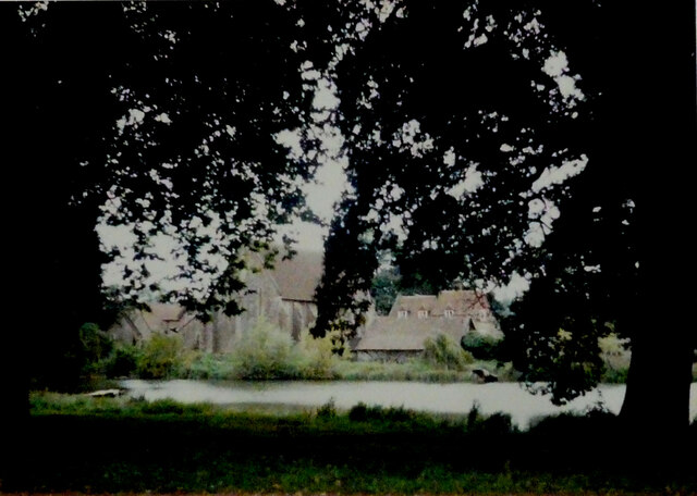
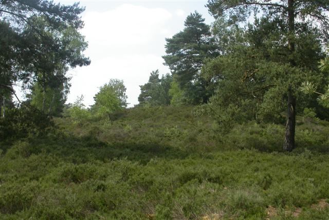
Burchetts Copse is a woodland area located in Surrey, England. Covering an area of approximately 500 acres, it is a beautiful and diverse forest that attracts visitors from near and far.

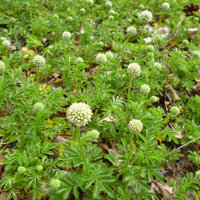
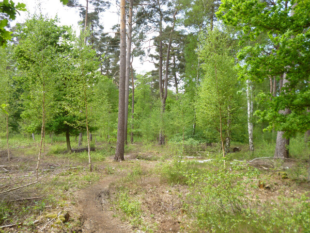
The copse is characterized by its dense tree cover, consisting mainly of native species such as oak, beech, and birch. These towering trees create a picturesque landscape and provide a habitat for a wide range of wildlife. Birdwatchers in particular will be delighted by the copse, as it is home to various species including woodpeckers, owls, and buzzards.

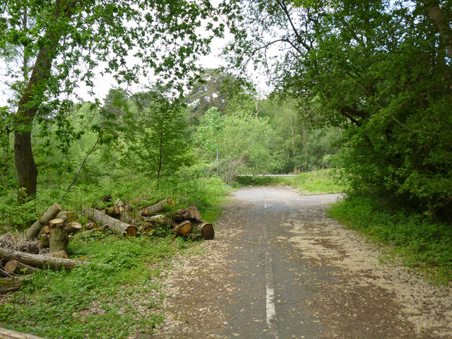
A network of well-maintained footpaths winds its way through Burchetts Copse, allowing visitors to explore its natural wonders at their own pace. These paths offer stunning views of the surrounding countryside and lead to hidden gems such as secluded ponds and streams. The copse is also home to a number of picnic areas, making it a perfect spot for a family day out or a peaceful retreat.

Burchetts Copse is not only a place of natural beauty, but also of historical significance. It is believed that the area has been wooded for centuries, with evidence of human activity dating back to the Bronze Age. The copse has been carefully managed by local authorities to preserve its unique ecosystem, ensuring that future generations can continue to enjoy its natural wonders.

Overall, Burchetts Copse is a must-visit destination for nature lovers and outdoor enthusiasts. Its tranquil atmosphere, diverse wildlife, and stunning scenery make it an idyllic retreat from the hustle and bustle of everyday life.

If you have any feedback on the listing, please let us know in the comments section below.

Burchetts Copse Images

Images are sourced within 2km of 51.169843/-0.66790988 or Grid Reference SU9342. Thanks to Geograph Open Source API. All images are credited.

Barn at Oxenford Grange It was built in 1843 by Augustus Welby Northmore Pugin in Medieval Gothic style of sandstone rubble with ashlar dressings. It has a plain tiled roof, part restored, with ridge cresting and gable end pinnacles. It is rectangular, with pentice roofed aisle extensions to side. There are five bays with gabled, opposing, entrances to centre, offset flanking buttresses and octagonal gable finial. There are rectangular breathers to both and sides, three to either side alternating with buttresses. There are double doors to centre on both sides with stable doors to side. Interior - main roof trusses on corbels with cross braced roof <span class="nowrap"><a title="https://www.britishlistedbuildings.co.uk/101334359" rel="nofollow ugc noopener" href="https://www.britishlistedbuildings.co.uk/101334359">Link</a><img style="margin-left:2px;" alt="External link" title="External link - shift click to open in new window" src="https://s1.geograph.org.uk/img/external.png" width="10" height="10"/></span>
Barn at Oxenford Grange
It was built in 1843 by Augustus Welby Northmore Pugin in Medieval Gothic style of sandstone rubble with ashlar dressings. It has a plain tiled roof, part restored, with ridge cresting and gable end pinnacles. It is rectangular, with pentice roofed aisle extensions to side. There are five bays with gabled, opposing, entrances to centre, offset flanking buttresses and octagonal gable finial. There are rectangular breathers to both and sides, three to either side alternating with buttresses. There are double doors to centre on both sides with stable doors to side. Interior - main roof trusses on corbels with cross braced roof LinkExternal link
Chippie in Portsmouth Road Fish and chip shops are a great British institution. In the 16th century Iberian refugees in London began selling white fish fried in a thin coat of flour. Friday became a particularly busy day as both Jews and Catholics wanted cooked fish that day. A hundred years later, Hugenots brought their fondness for fried potato to the capital. Joseph Malin opened the first chippy in Bethnal Green during the 1860s. Today there are more than 10,000 in England alone.
Chippie in Portsmouth Road
Fish and chip shops are a great British institution. In the 16th century Iberian refugees in London began selling white fish fried in a thin coat of flour. Friday became a particularly busy day as both Jews and Catholics wanted cooked fish that day. A hundred years later, Hugenots brought their fondness for fried potato to the capital. Joseph Malin opened the first chippy in Bethnal Green during the 1860s. Today there are more than 10,000 in England alone.
Bus stop at the junction of Guildford and Portsmouth Roads Bus stops range from a simple sign with the number of the bus and the company operating the service to elaborate structures that have an architectural pedigree all of their own. These days they are often linked via computer to the bus and the depot and display the waiting time in minutes.
Bus stop at the junction of Guildford and Portsmouth Roads
Bus stops range from a simple sign with the number of the bus and the company operating the service to elaborate structures that have an architectural pedigree all of their own. These days they are often linked via computer to the bus and the depot and display the waiting time in minutes.
The Star pub, Wheeler Street On the corner of Wheeler Lane and Petworth Road (A283).
The Star pub, Wheeler Street
On the corner of Wheeler Lane and Petworth Road (A283).
Pirri-pirri bur, Acaena novae-zelandiae An alien from New Zealand. The bur stage comes later as the seeds form.  It has clover-like flower heads, but the tiny flowers are not clover-like, nor are the leaves. I have only seen this in similar Surrey locations e.g. <a href="https://www.geograph.org.uk/photo/4971923">SU9167 : Plant in Swinley Forest</a>, although it apparently crops up quite widely.
Pirri-pirri bur, Acaena novae-zelandiae
An alien from New Zealand. The bur stage comes later as the seeds form. It has clover-like flower heads, but the tiny flowers are not clover-like, nor are the leaves. I have only seen this in similar Surrey locations e.g. SU9167 : Plant in Swinley Forest, although it apparently crops up quite widely.
Former Webb Road No longer a road connecting with the A3 beyond, now a bridleway.
Former Webb Road
No longer a road connecting with the A3 beyond, now a bridleway.
End of bridleway 593 and A3 crossing point, Witley Common Bridleway 593 was formerly Webb Road. There is a hazardous crossing point here of the busy dual carriageway to a path parallel with the A3 on the other side.
End of bridleway 593 and A3 crossing point, Witley Common
Bridleway 593 was formerly Webb Road. There is a hazardous crossing point here of the busy dual carriageway to a path parallel with the A3 on the other side.
Witley Common A largely wooded public access common.
Witley Common
A largely wooded public access common.
A3 approaching pedestrian crossing point This is all the protection pedestrians get at the crossing point seen in <a href="https://www.geograph.org.uk/photo/7267969">SU9341 : End of bridleway 593 and A3 crossing point, Witley Common</a>.
A3 approaching pedestrian crossing point
This is all the protection pedestrians get at the crossing point seen in SU9341 : End of bridleway 593 and A3 crossing point, Witley Common.
Milford - war memorial By St. John's church on Church Road.
Milford - war memorial
By St. John's church on Church Road.
Tomb, St. John's churchyard, Milford Several Webbs.
Tomb, St. John's churchyard, Milford
Several Webbs.
St. John's church, Milford
Milford Club, Church Road CIU affiliated.
Milford Club, Church Road
CIU affiliated.
Cut mark on Station Lane bridge over River Ock East parapet south end, 50.025 m above datum.
Cut mark on Station Lane bridge over River Ock
East parapet south end, 50.025 m above datum.
East parapet, Station Lane bridge over River Ock The other side of the road is just railings, suggesting the road has been widened.
East parapet, Station Lane bridge over River Ock
The other side of the road is just railings, suggesting the road has been widened.
Railings, west side of Church Lane bridge over River Ock The other side has an elderly brick parapet.
Railings, west side of Church Lane bridge over River Ock
The other side has an elderly brick parapet.
Signs, Secretts Farm Shop and Country Delicatessen
Milford Pharmacy On Portsmouth Road.
Milford Pharmacy
On Portsmouth Road.
Show me another place!

Burchetts Copse is located at Grid Ref: SU9342 (Lat: 51.169843, Lng: -0.66790988)

Administrative County: Surrey

District: Waverley

Police Authority: Surrey

What 3 Words

///silence.port.overpower. Near Milford, Surrey

Related Wikis

Rodborough Common, Surrey

Rodborough Common is a 62.2-hectare (154-acre) Local Nature Reserve west of Milford in Surrey. It is owned by Surrey County Council and managed by Surrey...

Elstead Group of Commons

Elstead Group of Commons is a 180-hectare (440-acre) nature reserve east of Elstead in Surrey. It is composed of Royal, Elstead and Ockley Commons, which...

Oxenford Farm

Oxenford Farm is a former abbey farm, a dependency of Waverley Abbey in the civil parish of Witley, Surrey, England, with several listed buildings around...

Milford, Surrey

Milford is a village in the civil parish of Witley south west of Godalming in Surrey, England that was a small village in the early medieval period — it...

Rodborough School

Rodborough School is a coeducational secondary school with academy status, located in Milford, Surrey, England. The school is a feeder school for Godalming...

Witley Camp

Witley Military Camp, often simplified to Camp Witley, was a temporary army camp set up on Witley Common, Surrey, England during both the First and Second...

Witley Common

Witley Common is an area of woodland and heath, close to Witley, Surrey, in the United Kingdom. It is part of a much larger Site of Special Scientific...

Aaron's Hill, Surrey

Aaron's Hill is a suburb of Godalming in Surrey, England. It is named after the hill it sits on and has a road named after it. Aaron's Hill is adjacent...

Nearby Amenities

Located within 500m of 51.169843,-0.66790988
Mousehill Down
Place: locality
Source: npe
Lat/Long: 51.1702307/-0.6624018
Power: pole
Lat/Long: 51.1734515/-0.6721874
Power: pole
Lat/Long: 51.1733362/-0.6709645
Barrier: stile
Foot: yes
Note: possibly 2 stiles separted by short bit of path
Source: survey
Stile: stepover
Lat/Long: 51.1733303/-0.6659319
Power: pole
Lat/Long: 51.1733784/-0.66918
Power: pole
Lat/Long: 51.1733775/-0.6675388
Power: pole
Lat/Long: 51.1734272/-0.6659084
Rodborough Common
Natural: heath
Lat/Long: 51.1670935/-0.6667279
Power: tower
Lat/Long: 51.1735894/-0.669278
The data included in this document is from www.openstreetmap.org. The data is made available under ODbL.

Have you been to Burchetts Copse?

Leave your review of Burchetts Copse below (or comments, questions and feedback).