Hearne Copse

Wood, Forest in Sussex Chichester

England

Hearne Copse

Pond near the Pen-y-Bos Track The curious Welsh-sounding name "Pen-y-Bos" apparently comes from the Brythonic language spoken by the ancient Britons, which was obviously related to Welsh. (cf Pen-y-ghent in Yorkshire)
Pond near the Pen-y-Bos Track Credit: Ian Cunliffe

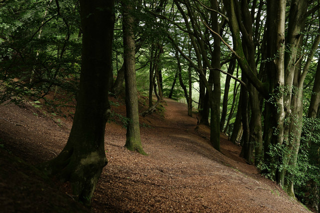
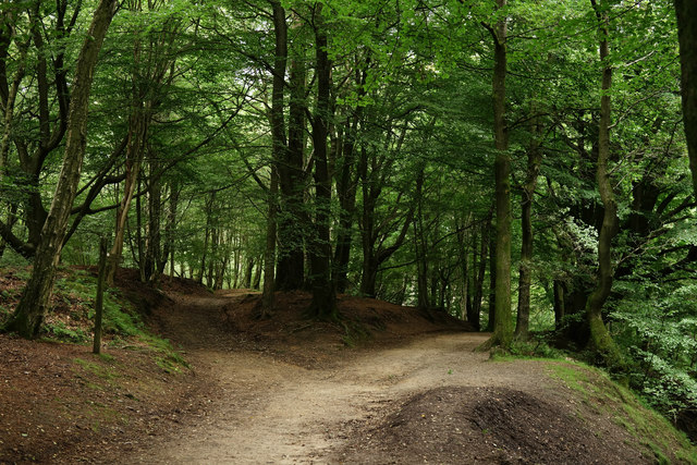
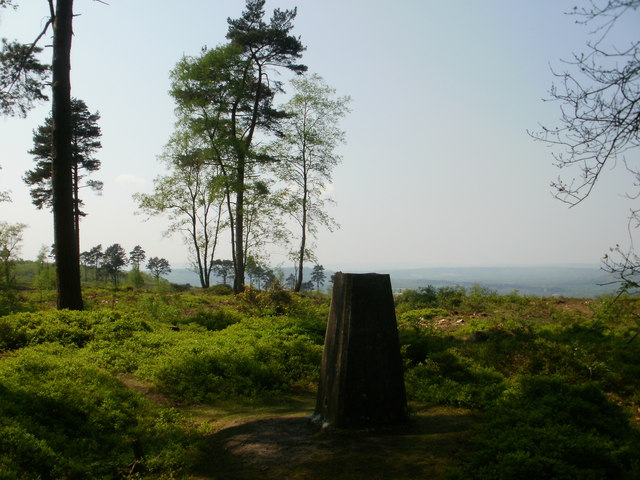
Hearne Copse is a picturesque wood located in the county of Sussex, England. Covering an area of approximately 100 acres, it is known for its dense and diverse forest, making it a popular destination for nature enthusiasts and hikers.

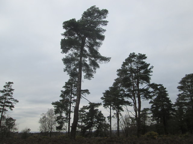
The copse is characterized by its abundant oak and beech trees, which create a lush and verdant canopy, especially during the summer months. The forest floor is adorned with a vibrant carpet of wildflowers, including bluebells, primroses, and foxgloves, adding a splash of color to the surroundings.

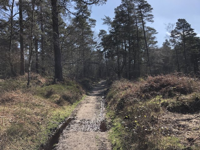
Several walking trails wind through Hearne Copse, allowing visitors to explore the woodland at their leisure. These trails range in difficulty, catering to both casual strollers and more experienced hikers. Along the way, hikers may encounter a variety of wildlife, such as squirrels, rabbits, and a wide assortment of bird species.

Hearne Copse is also home to a small stream that meanders through the wood, enhancing the tranquil and serene atmosphere. The sound of running water, combined with the chorus of birdsong, creates a soothing ambiance that further adds to the charm of this natural oasis.

The copse is easily accessible, with a car park located nearby, and there are designated picnic areas for visitors to enjoy a leisurely lunch amidst the beauty of nature. Additionally, there are information boards scattered throughout the wood, offering insightful details about the flora and fauna found within Hearne Copse.

In conclusion, Hearne Copse in Sussex is a captivating woodland that offers a peaceful escape from the hustle and bustle of everyday life. With its stunning trees, diverse wildlife, and well-maintained trails, it is a haven for nature lovers and an ideal destination for those seeking solace in the great outdoors.

If you have any feedback on the listing, please let us know in the comments section below.

Hearne Copse Images

Images are sourced within 2km of 51.075718/-0.67501078 or Grid Reference SU9231. Thanks to Geograph Open Source API. All images are credited.

Pond near the Pen-y-Bos Track The curious Welsh-sounding name "Pen-y-Bos" apparently comes from the Brythonic language spoken by the ancient Britons, which was obviously related to Welsh. (cf Pen-y-ghent in Yorkshire)
Pond near the Pen-y-Bos Track
The curious Welsh-sounding name "Pen-y-Bos" apparently comes from the Brythonic language spoken by the ancient Britons, which was obviously related to Welsh. (cf Pen-y-ghent in Yorkshire)
View SW from the Pen-y-Bos Track Something was burning down in the valley - hence the smoke. The curious Welsh-sounding name "Pen-y-Bos" apparently comes from the Brythonic language spoken by the ancient Britons, which was obviously related to Welsh. (cf Pen-y-ghent in Yorkshire)
View SW from the Pen-y-Bos Track
Something was burning down in the valley - hence the smoke. The curious Welsh-sounding name "Pen-y-Bos" apparently comes from the Brythonic language spoken by the ancient Britons, which was obviously related to Welsh. (cf Pen-y-ghent in Yorkshire)
Wooded slope on the east side of Black Down
Black Down View, through the beech trees, of a track which is not shown as a public right of way on the map.
Black Down
View, through the beech trees, of a track which is not shown as a public right of way on the map.
Black Down Junction of two major bridleways, close to the highest point on Black Down.
Black Down
Junction of two major bridleways, close to the highest point on Black Down.
Rickfield Copse - Avenue An avenue of young fruit trees planted on the lower slopes of Black Down.
Rickfield Copse - Avenue
An avenue of young fruit trees planted on the lower slopes of Black Down.
Avenue by Rickfield Copse Avenue of young apple trees below Black Down.
Avenue by Rickfield Copse
Avenue of young apple trees below Black Down.
Wateredge Copse Sussex Weald west of Northchapel - mix of grassy fields and woodland.
Wateredge Copse
Sussex Weald west of Northchapel - mix of grassy fields and woodland.
Sheep on the right line The bridleway I was walking had crossed the field before turning to head towards a Copse. If there was any doubt over the line of the bridleway my followers were keen to show me.
Sheep on the right line
The bridleway I was walking had crossed the field before turning to head towards a Copse. If there was any doubt over the line of the bridleway my followers were keen to show me.
Grey day on Black Down
Pen-y-bos The ancient track from Celtic times known as Pen-y-bos.
Pen-y-bos
The ancient track from Celtic times known as Pen-y-bos.
Path to Northchapel The path leaves Jobson’s Lane opposite Jobson’s Cottage and heads towards Northchapel.
Path to Northchapel
The path leaves Jobson’s Lane opposite Jobson’s Cottage and heads towards Northchapel.
Bridleway to Bullock Lane The bridleway leaves beside the tree on the left to head towards New Barn Copse before turning right and becoming Bullock Lane.
Bridleway to Bullock Lane
The bridleway leaves beside the tree on the left to head towards New Barn Copse before turning right and becoming Bullock Lane.
Trig point at the top of Black Down, West Sussex – view south west Black Down is the highest point in West Sussex and the South Downs National Park.  As my two photos from the trig point show, the view to the south west has a more open aspect.   A far better view is from the Temple of the Winds viewpoint, around half a mile to the south.
Trig point at the top of Black Down, West Sussex – view south west
Black Down is the highest point in West Sussex and the South Downs National Park. As my two photos from the trig point show, the view to the south west has a more open aspect. A far better view is from the Temple of the Winds viewpoint, around half a mile to the south.
Avenue of trees, west of Northchapel
Jobson's Lane, west of Northchapel
A bunch of brownies near Ramsfold Farm These brown Jerseys probably belong to Ramsfold farm which is situated beyond the trees and pond which is just visible.
A bunch of brownies near Ramsfold Farm
These brown Jerseys probably belong to Ramsfold farm which is situated beyond the trees and pond which is just visible.
Jobson's Lane NE to Gospel Green
Show me another place!

Hearne Copse is located at Grid Ref: SU9231 (Lat: 51.075718, Lng: -0.67501078)

Administrative County: West Sussex

District: Chichester

Police Authority: Sussex

What 3 Words

///husky.galloping.national. Near Haslemere, Surrey

Related Wikis

Haste Hill

Haste Hill is a hill near Haslemere, Surrey in England which was probably the original settlement of the town of Haslemere. It was used as the site of...

Blackdown, West Sussex

Blackdown, or Black Down, summit elevation 279.7 metres (918 ft) AMSL, is the highest point in both the historic county of Sussex and the South Downs National...

Ramsnest Common

Ramsnest Common is a hamlet in the far south of the Borough of Waverley, the largest district of Surrey, England centred on the A283 1.5 miles (2.4 km...

Ramster

Ramster Garden is an open garden, near Chiddingfold, Surrey, covering over 20 acres (81,000 m2). First landscaped and laid out in the 1890s by Gauntlett...

Nearby Amenities

Located within 500m of 51.075718,-0.67501078
Hearne Copse
Natural: wood
Source: os_street_view
Lat/Long: 51.0754673/-0.674986
Barrier: stile
Lat/Long: 51.0772256/-0.6715887
Barrier: stile
Lat/Long: 51.0772566/-0.6704545
The data included in this document is from www.openstreetmap.org. The data is made available under ODbL.

Have you been to Hearne Copse?

Leave your review of Hearne Copse below (or comments, questions and feedback).