Path Field

Wood, Forest in Sussex Chichester

England

Path Field

View ESE towards Leggatt Hill
View ESE towards Leggatt Hill Credit: Ian Cunliffe

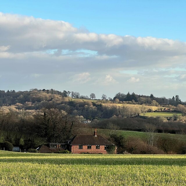
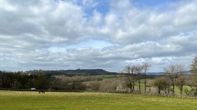
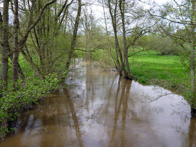
Path Field is a woodland area located in the county of Sussex, England. Situated in the heart of the South Downs National Park, this forested landscape offers a tranquil and picturesque setting for nature enthusiasts and hikers alike. Stretching over several acres, Path Field is characterized by its dense growth of trees, predominantly consisting of oak, beech, and ash.

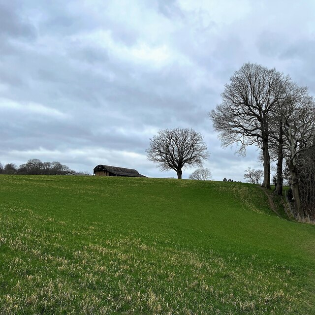
The forest is crisscrossed by a network of well-maintained footpaths, allowing visitors to explore its natural wonders at their own pace. These paths wind through the woodland, revealing breathtaking views of the surrounding countryside and providing opportunities to spot the diverse range of wildlife that call Path Field home. From squirrels and foxes to a variety of bird species, there is no shortage of fauna to encounter during a visit.

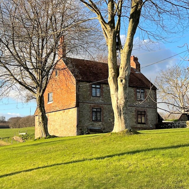
In addition to its natural beauty, Path Field boasts a rich history. The woodland has been in existence for centuries, with records dating back to medieval times. Over the years, it has served various purposes, including grazing land and a source of timber for local communities. Today, it is a protected area, and efforts are made to preserve its ecological significance.

Path Field is easily accessible, with a parking lot and visitor information center located at its entrance. The site is open year-round, with admission being free of charge. Whether it's a leisurely stroll, a family picnic, or an immersive nature experience, Path Field offers something for everyone seeking solace in the embrace of nature.

If you have any feedback on the listing, please let us know in the comments section below.

Path Field Images

Images are sourced within 2km of 50.991079/-0.68463192 or Grid Reference SU9222. Thanks to Geograph Open Source API. All images are credited.

View ESE towards Leggatt Hill
House at Redlands Farm
View SW towards Redlands Farm The Serpent Trail follows the edge of the wood on the right.
View SW towards Redlands Farm
The Serpent Trail follows the edge of the wood on the right.
The Old Rectory
The Old Rectory
View SSW from the path south of Lodsworth The South Downs can be seen in the distance.
View SSW from the path south of Lodsworth
The South Downs can be seen in the distance.
Pound House I suppose this has to be a cross-grid shot because the centre of the house is in the square to the west of the camera. However the right-hand third of the house is in the same square as the camera!
Pound House
I suppose this has to be a cross-grid shot because the centre of the house is in the square to the west of the camera. However the right-hand third of the house is in the same square as the camera!
"Factory" near Halfway Bridge This rather unusual and functional-looking building is labelled "factory" on the map. We need a bit of local knowledge to furnish a better description. The bulk of the building is in the square to the south of the camera, so it counts as a cross-grid shot.
"Factory" near Halfway Bridge
This rather unusual and functional-looking building is labelled "factory" on the map. We need a bit of local knowledge to furnish a better description. The bulk of the building is in the square to the south of the camera, so it counts as a cross-grid shot.
The Old Vicarage It's interesting that Lodsworth also has an "Old Rectory". See:<a title="https://www.geograph.org.uk/photo/7136962" href="https://www.geograph.org.uk/photo/7136962">Link</a>
The Old Vicarage
It's interesting that Lodsworth also has an "Old Rectory". See:Link
The Old House
The Old House
Old Langham Farm I've taken the name from the map. This rather elegant house doesn't look like a farmhouse, and it's right in the centre of the village too.
Old Langham Farm
I've taken the name from the map. This rather elegant house doesn't look like a farmhouse, and it's right in the centre of the village too.
View NW towards Bexleyhill The mast of Midhurst Transmitting Station can be seen on the summit of Bexleyhill.
View NW towards Bexleyhill
The mast of Midhurst Transmitting Station can be seen on the summit of Bexleyhill.
House in River The house appears to be called "High Bank" according to the map. This is a cross-grid shot. The camera was in the square to the north.
House in River
The house appears to be called "High Bank" according to the map. This is a cross-grid shot. The camera was in the square to the north.
Stream NE of Eel Bridge Beyond Eel Bridge, this stream flows through a steep-sided little valley to Halfway Bridge. After that it joins the River Rother.
Stream NE of Eel Bridge
Beyond Eel Bridge, this stream flows through a steep-sided little valley to Halfway Bridge. After that it joins the River Rother.
Selham church St. James's is a grade I listed building, oldest parts 11th century.
Selham church
St. James's is a grade I listed building, oldest parts 11th century.
Selham church St. James's is a grade I listed building, oldest parts 11th century.
Selham church
St. James's is a grade I listed building, oldest parts 11th century.
River Rother upstream of Ambersham Bridge
Ditch in Rother valley This runs parallel with the river for a considerable distance.
Ditch in Rother valley
This runs parallel with the river for a considerable distance.
Bridleway 3348 towards Heath End Lane The bridleway runs along the parish boundary between Easebourne (right) and Lodsworth.
Bridleway 3348 towards Heath End Lane
The bridleway runs along the parish boundary between Easebourne (right) and Lodsworth.
Show me another place!

Path Field is located at Grid Ref: SU9222 (Lat: 50.991079, Lng: -0.68463192)

Administrative County: West Sussex

District: Chichester

Police Authority: Sussex

What 3 Words

///poets.nights.bleak. Near Midhurst, West Sussex

Related Wikis

Lodsworth

Lodsworth is a small village, ecclesiastical parish and civil parish in the Chichester district of West Sussex, England. It is situated between Midhurst...

Queen Elizabeth Oak

The Queen Elizabeth Oak is a large sessile oak tree in Cowdray Park near the village of Lodsworth in the Western Weald, West Sussex, England. It lies...

Fernhurst (electoral division)

Fernhurst is an electoral division of West Sussex in the United Kingdom, and returns one member to sit on West Sussex County Council. == Extent == The...

River Lod, West Sussex

The River Lod is a short river draining about 52 km2 (20 sq mi) of north west Sussex. The main source is on the Greensand Ridge at Marley Heights near...

South Ambersham

South Ambersham is a hamlet and former civil parish, now in the parish of Graffham, in the Chichester district of West Sussex, England. It lies 0.7 miles...

Selham

Selham is a small village and former civil parish, now in the parish of Graffham, in the Chichester district of West Sussex, England. It lies south of...

Selham railway station

Selham railway station served the village of Selham in the county of West Sussex in England. The station was out in mostly open fields, although a public...

Cowdray Park, West Sussex

Cowdray Park is a country house at the centre of the 16,500-acre (6,700-hectare) Cowdray Estate in Midhurst, West Sussex. The park lies in the South Downs...

Nearby Amenities

Located within 500m of 50.991079,-0.68463192
Moorland Farm
Naptan AtcoCode: 4400MO0419
Naptan Bearing: W
Naptan BusStopType: CUS
Naptan CommonName: Moorland Farm
Naptan Indicator: adj
Naptan Landmark: Hail & Ride
Naptan NaptanCode: wsxdwtwp
Naptan Street: A272
Naptan Verified: no
Source: naptan_import
Lat/Long: 50.9880607/-0.6855435
Bus Stop
Moorland Farm
Naptan AtcoCode: 4400MO0420
Naptan Bearing: E
Naptan BusStopType: CUS
Naptan CommonName: Moorland Farm
Naptan Indicator: adj
Naptan Landmark: Hail & Ride
Naptan NaptanCode: wsxdwtwt
Naptan Street: A272
Naptan Verified: no
Public Transport: platform
Source: naptan_import
Lat/Long: 50.988286/-0.6855941
The data included in this document is from www.openstreetmap.org. The data is made available under ODbL.

Have you been to Path Field?

Leave your review of Path Field below (or comments, questions and feedback).