Hazel Copse

Wood, Forest in Surrey Waverley

England

Hazel Copse

Barn at Oxenford Grange It was built in 1843 by Augustus Welby Northmore Pugin in Medieval Gothic style of sandstone rubble with ashlar dressings. It has a plain tiled roof, part restored, with ridge cresting and gable end pinnacles. It is rectangular, with pentice roofed aisle extensions to side. There are five bays with gabled, opposing, entrances to centre, offset flanking buttresses and octagonal gable finial. There are rectangular breathers to both and sides, three to either side alternating with buttresses. There are double doors to centre on both sides with stable doors to side. Interior - main roof trusses on corbels with cross braced roof <span class="nowrap"><a title="https://www.britishlistedbuildings.co.uk/101334359" rel="nofollow ugc noopener" href="https://www.britishlistedbuildings.co.uk/101334359">Link</a><img style="margin-left:2px;" alt="External link" title="External link - shift click to open in new window" src="https://s1.geograph.org.uk/img/external.png" width="10" height="10"/></span>
Barn at Oxenford Grange Credit: John Baker

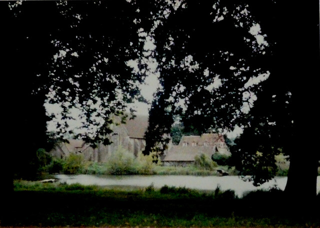
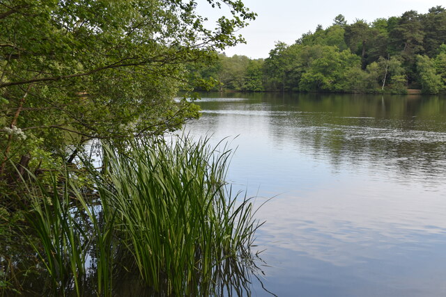
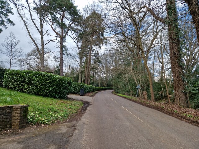
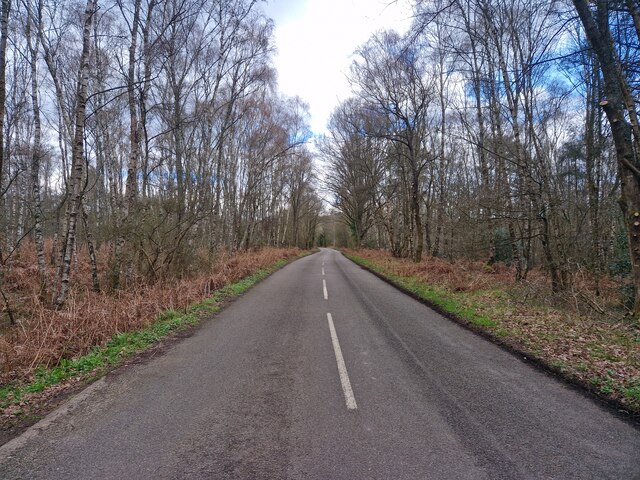
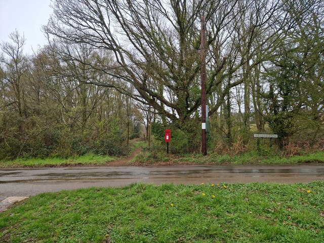
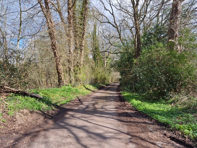
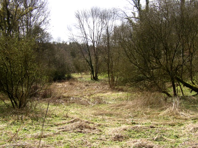
Hazel Copse is a picturesque woodland located in Surrey, England. Covering an area of approximately 30 acres, it is a prime example of a well-preserved ancient woodland. The copse is predominantly made up of hazel trees, which lend their name to the area, but it also boasts a diverse range of other tree species such as oak, birch, and beech.

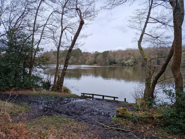
The woodland is known for its rich biodiversity and serves as a vital habitat for numerous plant and animal species. Its dense canopy provides a haven for a variety of bird species, including woodpeckers, thrushes, and owls. Additionally, the forest floor is adorned with an array of wildflowers during spring and summer, attracting butterflies and other insects.

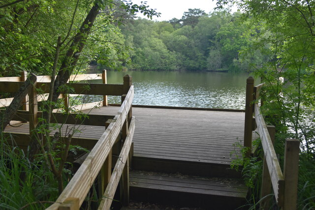
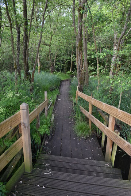
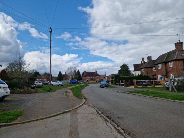
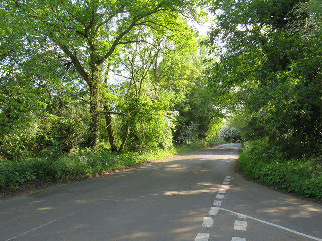
Hazel Copse is a popular destination for nature enthusiasts and walkers, offering a network of well-maintained footpaths that wind through the woods. Visitors can enjoy leisurely strolls while immersing themselves in the tranquility of the forest. The copse also features a designated picnic area, where visitors can relax and enjoy the surroundings.

Managed by the local council, Hazel Copse is carefully preserved to maintain its natural beauty and ecological importance. Regular maintenance work, such as tree planting and clearing invasive species, is carried out to ensure the woodland remains healthy and sustainable for future generations to enjoy.

Overall, Hazel Copse is a hidden gem in Surrey, offering a serene escape from the hustle and bustle of everyday life. Its ancient woodland charm, diverse wildlife, and well-maintained trails make it a must-visit destination for nature lovers and those seeking a peaceful retreat in the heart of nature.

If you have any feedback on the listing, please let us know in the comments section below.
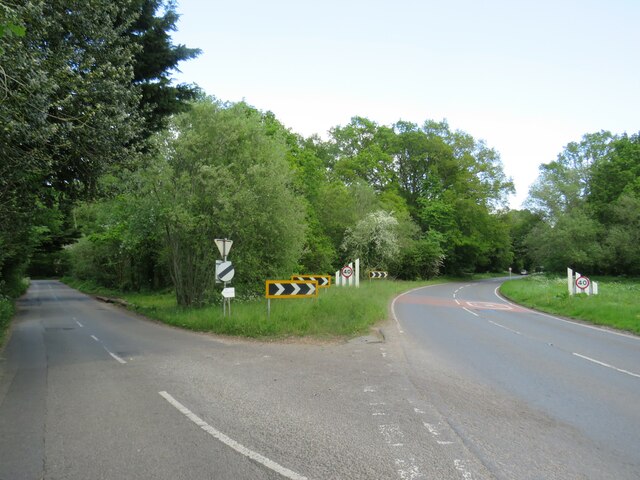
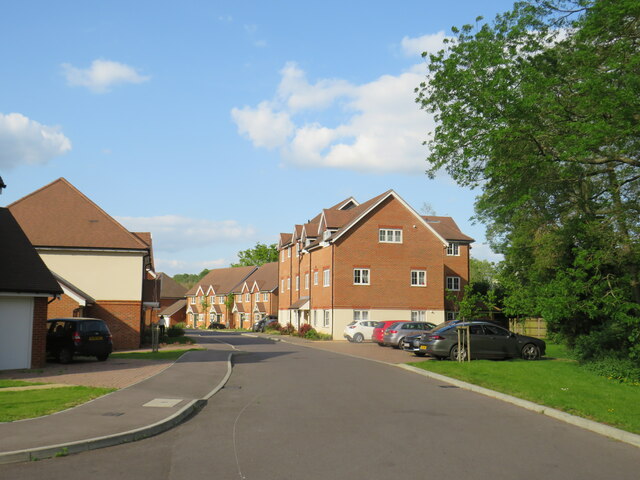
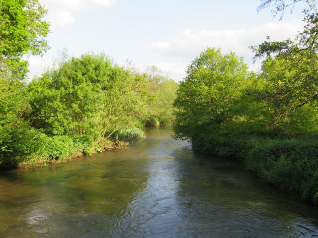
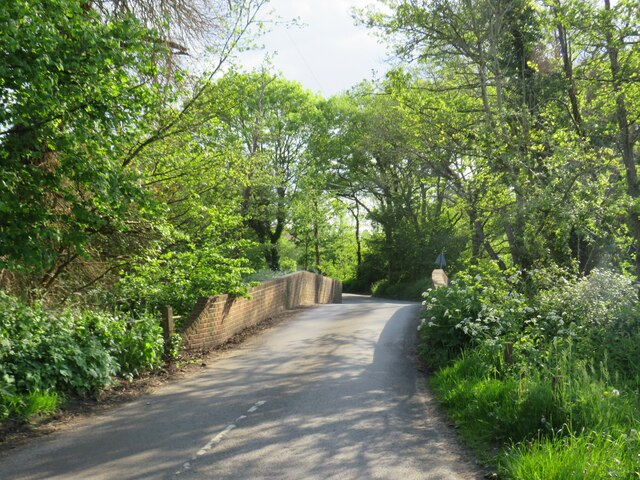
Hazel Copse Images

Images are sourced within 2km of 51.191132/-0.68091977 or Grid Reference SU9244. Thanks to Geograph Open Source API. All images are credited.

Barn at Oxenford Grange It was built in 1843 by Augustus Welby Northmore Pugin in Medieval Gothic style of sandstone rubble with ashlar dressings. It has a plain tiled roof, part restored, with ridge cresting and gable end pinnacles. It is rectangular, with pentice roofed aisle extensions to side. There are five bays with gabled, opposing, entrances to centre, offset flanking buttresses and octagonal gable finial. There are rectangular breathers to both and sides, three to either side alternating with buttresses. There are double doors to centre on both sides with stable doors to side. Interior - main roof trusses on corbels with cross braced roof <span class="nowrap"><a title="https://www.britishlistedbuildings.co.uk/101334359" rel="nofollow ugc noopener" href="https://www.britishlistedbuildings.co.uk/101334359">Link</a><img style="margin-left:2px;" alt="External link" title="External link - shift click to open in new window" src="https://s1.geograph.org.uk/img/external.png" width="10" height="10"/></span>
Barn at Oxenford Grange
It was built in 1843 by Augustus Welby Northmore Pugin in Medieval Gothic style of sandstone rubble with ashlar dressings. It has a plain tiled roof, part restored, with ridge cresting and gable end pinnacles. It is rectangular, with pentice roofed aisle extensions to side. There are five bays with gabled, opposing, entrances to centre, offset flanking buttresses and octagonal gable finial. There are rectangular breathers to both and sides, three to either side alternating with buttresses. There are double doors to centre on both sides with stable doors to side. Interior - main roof trusses on corbels with cross braced roof LinkExternal link
View across The Tarn
Landing stage on The Tarn
Boardwalk through marshy edges of The Tarn
Springfield: early April 2023 (taken from the junction with Bankside Close)
Springfield: early April 2023
(taken from the junction with Bankside Close)
Fulbrook  Lane in early April
Fulbrook Lane in early April
Navigating northwards up the Basher (12) Top end of Fulbrook Lane
Navigating northwards up the Basher (12)
Top end of Fulbrook Lane
The Tarn: April 2020
Postbox in Suffield Lane
Looking eastwards in Ham Lane
The Green, Elstead, near Farnham The Green in the village of Elstead in Surrey.
The Green, Elstead, near Farnham
The Green in the village of Elstead in Surrey.
Milford Road, Elstead, near Farnham Milford Road is on the route of the B3001 as it passes through the village of Elstead in Surrey.
Milford Road, Elstead, near Farnham
Milford Road is on the route of the B3001 as it passes through the village of Elstead in Surrey.
Road junction near Elstead, Surrey A road junction near the village of Elstead in Surrey.  The road to the right is the B3001, the road to the left is a minor unclassified road.
Road junction near Elstead, Surrey
A road junction near the village of Elstead in Surrey. The road to the right is the B3001, the road to the left is a minor unclassified road.
Weyburn Lane, Elstead, near Farnham Weyburn Lane forms part of a recent housing development on the site formerly occupied by Weyburn Works.  For an image taken in more-or-less the same place in 2009, see <a href="https://www.geograph.org.uk/photo/1608487">SU9243 : Weyburn Works entrance</a>
Weyburn Lane, Elstead, near Farnham
Weyburn Lane forms part of a recent housing development on the site formerly occupied by Weyburn Works. For an image taken in more-or-less the same place in 2009, see SU9243 : Weyburn Works entrance
River Wey near Elstead, Surrey A view of the River Wey near the village of Elstead in Surrey.
River Wey near Elstead, Surrey
A view of the River Wey near the village of Elstead in Surrey.
Somerset Bridge, near Elstead Somerset Bridge crosses the River Wey near the village of Elstead in Surrey.
Somerset Bridge, near Elstead
Somerset Bridge crosses the River Wey near the village of Elstead in Surrey.
Attleford Lane, near Elstead Attleford Lane is a minor lane through woodland in Surrey.
Attleford Lane, near Elstead
Attleford Lane is a minor lane through woodland in Surrey.
Shackleford Road, near Elstead Shackleford Road is a minor road through woodland near the village of Elstead in Surrey.  This image was taken in the late afternoon of a day in May.  Sunlight shines through gaps in the tree canopy.
Shackleford Road, near Elstead
Shackleford Road is a minor road through woodland near the village of Elstead in Surrey. This image was taken in the late afternoon of a day in May. Sunlight shines through gaps in the tree canopy.
Show me another place!

Hazel Copse is located at Grid Ref: SU9244 (Lat: 51.191132, Lng: -0.68091977)

Administrative County: Surrey

District: Waverley

Police Authority: Surrey

What 3 Words

///loud.safely.worms. Near Elstead, Surrey

Related Wikis

Peper Harow

Peper Harow is a rural village and civil parish in southwest Surrey close to the town of Godalming. It was a noted early cricket venue. Its easternmost...

Elstead

Elstead is a civil parish in Surrey, England with shops, houses and cottages spanning the north and south sides of the River Wey; development is concentrated...

Oxenford Farm

Oxenford Farm is a former abbey farm, a dependency of Waverley Abbey in the civil parish of Witley, Surrey, England, with several listed buildings around...

Shackleford

Shackleford is a village and civil parish in the Borough of Guildford, Surrey, England centred to the west of the A3 between Guildford and Petersfield...

Puttenham and Crooksbury Commons

Puttenham and Crooksbury Commons is a 113.8-hectare (281-acre) biological Site of Special Scientific Interest between Farnham and Guildford in Surrey....

Elstead Group of Commons

Elstead Group of Commons is a 180-hectare (440-acre) nature reserve east of Elstead in Surrey. It is composed of Royal, Elstead and Ockley Commons, which...

Charterhouse to Eashing

Charterhouse to Eashing is a 68.4-hectare (169-acre) biological Site of Special Scientific Interest west of Godalming in Surrey.This is a steep valley...

Thundry Meadows

Thundry Meadows is a 16-hectare (40-acre) nature reserve in Elstead in Surrey. It is managed by the Surrey Wildlife Trust. Part of it is Charleshill Site...

Nearby Amenities

Located within 500m of 51.191132,-0.68091977
Give Way
Lat/Long: 51.1887014/-0.6797375
Barrier: stile
Lat/Long: 51.1872031/-0.6822758
Barrier: kissing_gate
Lat/Long: 51.1899209/-0.6848309
Power: pole
Lat/Long: 51.1902408/-0.6878096
Power: pole
Lat/Long: 51.1896541/-0.6863344
Power: pole
Lat/Long: 51.1886471/-0.6862512
Power: pole
Lat/Long: 51.1875577/-0.6844541
The data included in this document is from www.openstreetmap.org. The data is made available under ODbL.

Have you been to Hazel Copse?

Leave your review of Hazel Copse below (or comments, questions and feedback).