Jackman's Hill

Hill, Mountain in Surrey Waverley

England

Jackman's Hill

Barn at Oxenford Grange It was built in 1843 by Augustus Welby Northmore Pugin in Medieval Gothic style of sandstone rubble with ashlar dressings. It has a plain tiled roof, part restored, with ridge cresting and gable end pinnacles. It is rectangular, with pentice roofed aisle extensions to side. There are five bays with gabled, opposing, entrances to centre, offset flanking buttresses and octagonal gable finial. There are rectangular breathers to both and sides, three to either side alternating with buttresses. There are double doors to centre on both sides with stable doors to side. Interior - main roof trusses on corbels with cross braced roof <span class="nowrap"><a title="https://www.britishlistedbuildings.co.uk/101334359" rel="nofollow ugc noopener" href="https://www.britishlistedbuildings.co.uk/101334359">Link</a><img style="margin-left:2px;" alt="External link" title="External link - shift click to open in new window" src="https://s1.geograph.org.uk/img/external.png" width="10" height="10"/></span>
Barn at Oxenford Grange Credit: John Baker

Jackman's Hill is a prominent geographical feature located in Surrey, England. It is classified as a hill rather than a mountain, standing at an elevation of approximately 200 meters above sea level. The hill is situated near the village of Chiddingfold, within the picturesque Surrey Hills Area of Outstanding Natural Beauty.

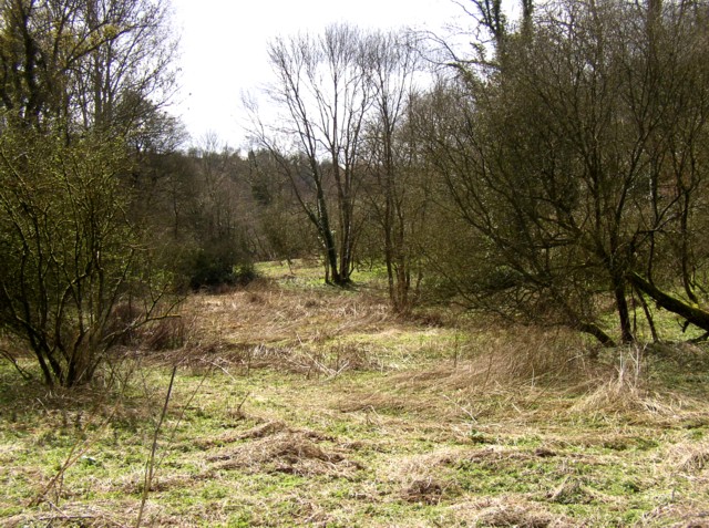
Rising above the surrounding landscape, Jackman's Hill offers breathtaking panoramic views of the surrounding countryside. From its summit, one can observe vast expanses of rolling hills, lush green meadows, and dense woodlands that stretch as far as the eye can see. The tranquil atmosphere and stunning vistas make it a popular destination for nature lovers, hikers, and photographers alike.

The hill is covered in a mix of grassland and woodland, forming a diverse ecosystem that supports a wide range of plant and animal species. Visitors may encounter various types of wildflowers, such as bluebells and primroses, as well as an array of bird species, including skylarks and kestrels.

Jackman's Hill is also steeped in history. It is believed to have been named after an ancient landowner or local figure, although the exact origins of the name remain unclear. The surrounding area is dotted with archaeological sites and historical landmarks, providing glimpses into the region's past.

Overall, Jackman's Hill offers a tranquil escape from the bustling city life, providing visitors with the opportunity to immerse themselves in the natural beauty and rich history of Surrey.

If you have any feedback on the listing, please let us know in the comments section below.

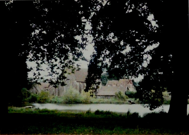
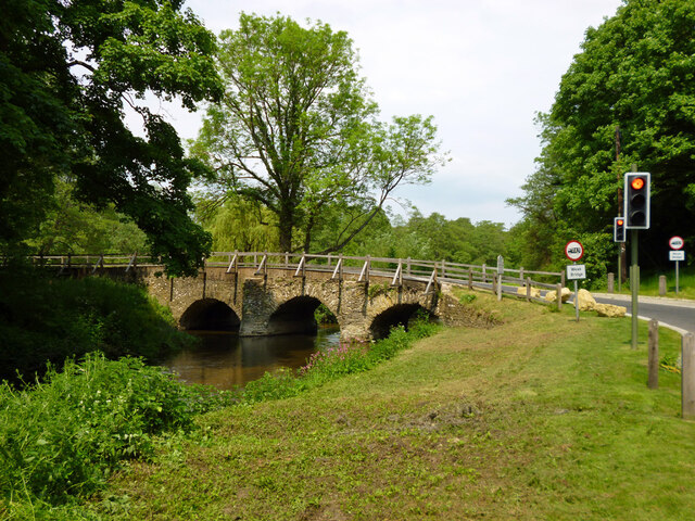
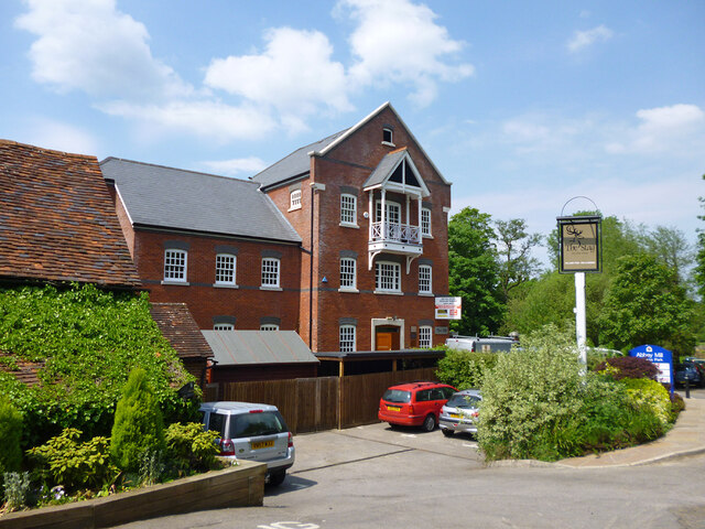
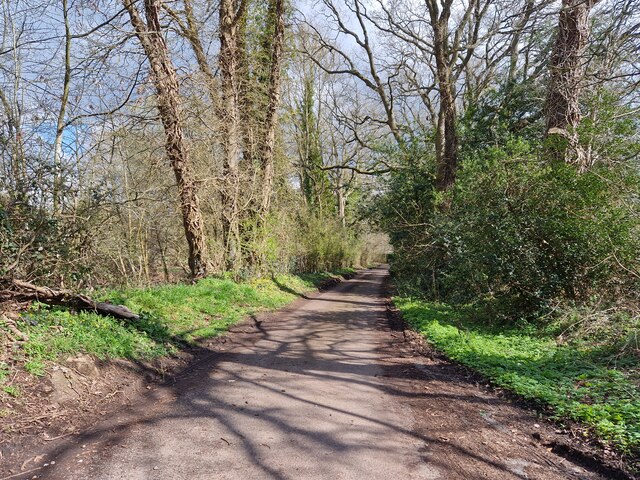
Jackman's Hill Images

Images are sourced within 2km of 51.190021/-0.67335281 or Grid Reference SU9244. Thanks to Geograph Open Source API. All images are credited.

Barn at Oxenford Grange It was built in 1843 by Augustus Welby Northmore Pugin in Medieval Gothic style of sandstone rubble with ashlar dressings. It has a plain tiled roof, part restored, with ridge cresting and gable end pinnacles. It is rectangular, with pentice roofed aisle extensions to side. There are five bays with gabled, opposing, entrances to centre, offset flanking buttresses and octagonal gable finial. There are rectangular breathers to both and sides, three to either side alternating with buttresses. There are double doors to centre on both sides with stable doors to side. Interior - main roof trusses on corbels with cross braced roof <span class="nowrap"><a title="https://www.britishlistedbuildings.co.uk/101334359" rel="nofollow ugc noopener" href="https://www.britishlistedbuildings.co.uk/101334359">Link</a><img style="margin-left:2px;" alt="External link" title="External link - shift click to open in new window" src="https://s1.geograph.org.uk/img/external.png" width="10" height="10"/></span>
Barn at Oxenford Grange
It was built in 1843 by Augustus Welby Northmore Pugin in Medieval Gothic style of sandstone rubble with ashlar dressings. It has a plain tiled roof, part restored, with ridge cresting and gable end pinnacles. It is rectangular, with pentice roofed aisle extensions to side. There are five bays with gabled, opposing, entrances to centre, offset flanking buttresses and octagonal gable finial. There are rectangular breathers to both and sides, three to either side alternating with buttresses. There are double doors to centre on both sides with stable doors to side. Interior - main roof trusses on corbels with cross braced roof LinkExternal link
One of Eashing Bridges There are two 13th century bridges over the two routes of the River Wey here, with a causeway between them. Together they are a grade I listed building and scheduled Ancient Monument. This is the eastern bridge of three arches, the other has four.
One of Eashing Bridges
There are two 13th century bridges over the two routes of the River Wey here, with a causeway between them. Together they are a grade I listed building and scheduled Ancient Monument. This is the eastern bridge of three arches, the other has four.
River Wey Looking upstream some way below Eashing Bridges.
River Wey
Looking upstream some way below Eashing Bridges.
River Wey Two branches of the river reunite below Eashing Bridges.
River Wey
Two branches of the river reunite below Eashing Bridges.
One of Eashing Bridges There are two 13th century bridges over the two routes of the River Wey here, with a causeway between them. Together they are a grade I listed building and scheduled Ancient Monument. This is the western bridge, looking upstream.
One of Eashing Bridges
There are two 13th century bridges over the two routes of the River Wey here, with a causeway between them. Together they are a grade I listed building and scheduled Ancient Monument. This is the western bridge, looking upstream.
The Mill, Eashing On the River Wey, most of which flows under it. Now offices in the Abbey Mill Business Park, as are the other buildings in the large mill complex beyond. The Stag inn sign refers to an adjacent pub off to the left.
The Mill, Eashing
On the River Wey, most of which flows under it. Now offices in the Abbey Mill Business Park, as are the other buildings in the large mill complex beyond. The Stag inn sign refers to an adjacent pub off to the left.
Abbey Mill Business Park On the site of Eashing Mill, although the buildings do not seem to correspond very well with the original paper (later woollen) mill which had this entire area roofed over.
Abbey Mill Business Park
On the site of Eashing Mill, although the buildings do not seem to correspond very well with the original paper (later woollen) mill which had this entire area roofed over.
River Wey at Eashing Mill The river emerging from under the mill building, now offices. The majority of the flow comes this way now, there is an alternative natural course.
River Wey at Eashing Mill
The river emerging from under the mill building, now offices. The majority of the flow comes this way now, there is an alternative natural course.
Catkins and Bunker near Eashing An old WW2 bunker is slowly vanishing into the undergrowth on the edge of Eashing Copse.
Catkins and Bunker near Eashing
An old WW2 bunker is slowly vanishing into the undergrowth on the edge of Eashing Copse.
Bridleway and Paddocks, Lower Eashing The Wey Valley is quite steep along here with wooded sides and only a narrow strip of land at the bottom which is grazed by horses.
Bridleway and Paddocks, Lower Eashing
The Wey Valley is quite steep along here with wooded sides and only a narrow strip of land at the bottom which is grazed by horses.
Eashing Copse A strip of woodland along the steep side of the Wey Valley.
Eashing Copse
A strip of woodland along the steep side of the Wey Valley.
Yard at Eashing Mill There has been a mill on this site at least since the Domesday Book, firstly for corn, then a long period of paper making and at the end producing flock which was a sort of stuffing material for mattresses etc.
Full story on <span class="nowrap"><a title="https://shackleford.org/hamlets/eashing/eashing-mill/" rel="nofollow ugc noopener" href="https://shackleford.org/hamlets/eashing/eashing-mill/">Link</a><img style="margin-left:2px;" alt="External link" title="External link - shift click to open in new window" src="https://s1.geograph.org.uk/img/external.png" width="10" height="10"/></span> from which it seems that what's here now is not old but is recent building made to look like a mill.
It's quite convincing.
Yard at Eashing Mill
There has been a mill on this site at least since the Domesday Book, firstly for corn, then a long period of paper making and at the end producing flock which was a sort of stuffing material for mattresses etc. Full story on LinkExternal link from which it seems that what's here now is not old but is recent building made to look like a mill. It's quite convincing.
Part of Eashing Mill There has been a mill on this site at least since the Domesday Book, firstly for corn, then a long period of paper making and at the end producing flock which was a sort of stuffing material for mattresses etc.
Full story on <span class="nowrap"><a title="https://shackleford.org/hamlets/eashing/eashing-mill/" rel="nofollow ugc noopener" href="https://shackleford.org/hamlets/eashing/eashing-mill/">Link</a><img style="margin-left:2px;" alt="External link" title="External link - shift click to open in new window" src="https://s1.geograph.org.uk/img/external.png" width="10" height="10"/></span> from which it seems that what's here now is not old but is recent building made to look like a mill.
It's quite convincing.
Part of Eashing Mill
There has been a mill on this site at least since the Domesday Book, firstly for corn, then a long period of paper making and at the end producing flock which was a sort of stuffing material for mattresses etc. Full story on LinkExternal link from which it seems that what's here now is not old but is recent building made to look like a mill. It's quite convincing.
Overfall at Eashing Mill A spillway from the millstream above the mill allowing surplus water not needed for the mill to  bypass it and continue down the River Wey.
Overfall at Eashing Mill
A spillway from the millstream above the mill allowing surplus water not needed for the mill to bypass it and continue down the River Wey.
Mill in the Valley Looking down at the buildings of Eashing Mill from a footpath up the south side of the valley.
Mill in the Valley
Looking down at the buildings of Eashing Mill from a footpath up the south side of the valley.
Houses in Lower Eashing
Looking eastwards in Ham Lane
Show me another place!

Jackman's Hill is located at Grid Ref: SU9244 (Lat: 51.190021, Lng: -0.67335281)

Administrative County: Surrey

District: Waverley

Police Authority: Surrey

What 3 Words

///speaker.stick.meanders. Near Elstead, Surrey

Related Wikis

Peper Harow

Peper Harow is a rural village and civil parish in southwest Surrey close to the town of Godalming. It was a noted early cricket venue. Its easternmost...

Oxenford Farm

Oxenford Farm is a former abbey farm, a dependency of Waverley Abbey in the civil parish of Witley, Surrey, England, with several listed buildings around...

Shackleford

Shackleford is a village and civil parish in the Borough of Guildford, Surrey, England centred to the west of the A3 between Guildford and Petersfield...

Elstead

Elstead is a civil parish in Surrey, England with shops, houses and cottages spanning the north and south sides of the River Wey; development is concentrated...

Elstead Group of Commons

Elstead Group of Commons is a 180-hectare (440-acre) nature reserve east of Elstead in Surrey. It is composed of Royal, Elstead and Ockley Commons, which...

Charterhouse to Eashing

Charterhouse to Eashing is a 68.4-hectare (169-acre) biological Site of Special Scientific Interest west of Godalming in Surrey.This is a steep valley...

Puttenham and Crooksbury Commons

Puttenham and Crooksbury Commons is a 113.8-hectare (281-acre) biological Site of Special Scientific Interest between Farnham and Guildford in Surrey....

Rodborough Common, Surrey

Rodborough Common is a 62.2-hectare (154-acre) Local Nature Reserve west of Milford in Surrey. It is owned by Surrey County Council and managed by Surrey...

Nearby Amenities

Located within 500m of 51.190021,-0.67335281
Give Way
Lat/Long: 51.1887014/-0.6797375
Barrier: kissing_gate
Foot: designated
Lat/Long: 51.1909596/-0.672286
Barrier: kissing_gate
Lat/Long: 51.1898096/-0.666752
Post Box
Collection Plate: CP5
Collection Times: Mo-Fr 16:30; Sa 09:30
Last Checked: 2021-05-29
Operator: Royal Mail
Post Box Type: wall
Ref: GU8 84
Royal Cypher: EVIIR
Royal Cypher Wikidata: Q33102324
Source: survey
Lat/Long: 51.1894995/-0.6664869
Power: pole
Lat/Long: 51.1865541/-0.677526
Power: pole
Lat/Long: 51.1866028/-0.6753668
Power: pole
Lat/Long: 51.1864852/-0.6738406
Power: pole
Lat/Long: 51.1863507/-0.6714535
The data included in this document is from www.openstreetmap.org. The data is made available under ODbL.

Have you been to Jackman's Hill?

Leave your review of Jackman's Hill below (or comments, questions and feedback).