Bell's Copse

Wood, Forest in Buckinghamshire

England

Bell's Copse

Road from Woburn to Woburn Sands Very grand for an unclassified road, and indeed it once was the A50.
Road from Woburn to Woburn Sands Credit: Robin Webster

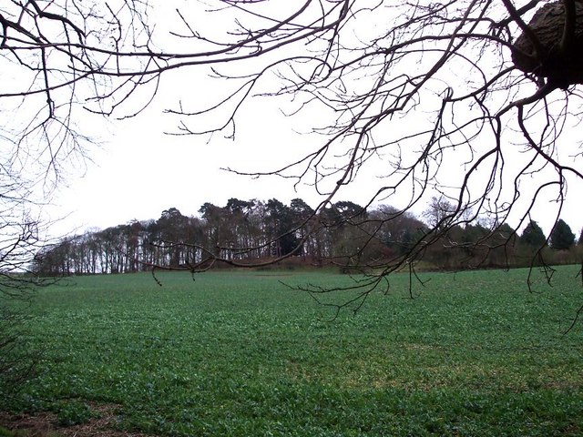
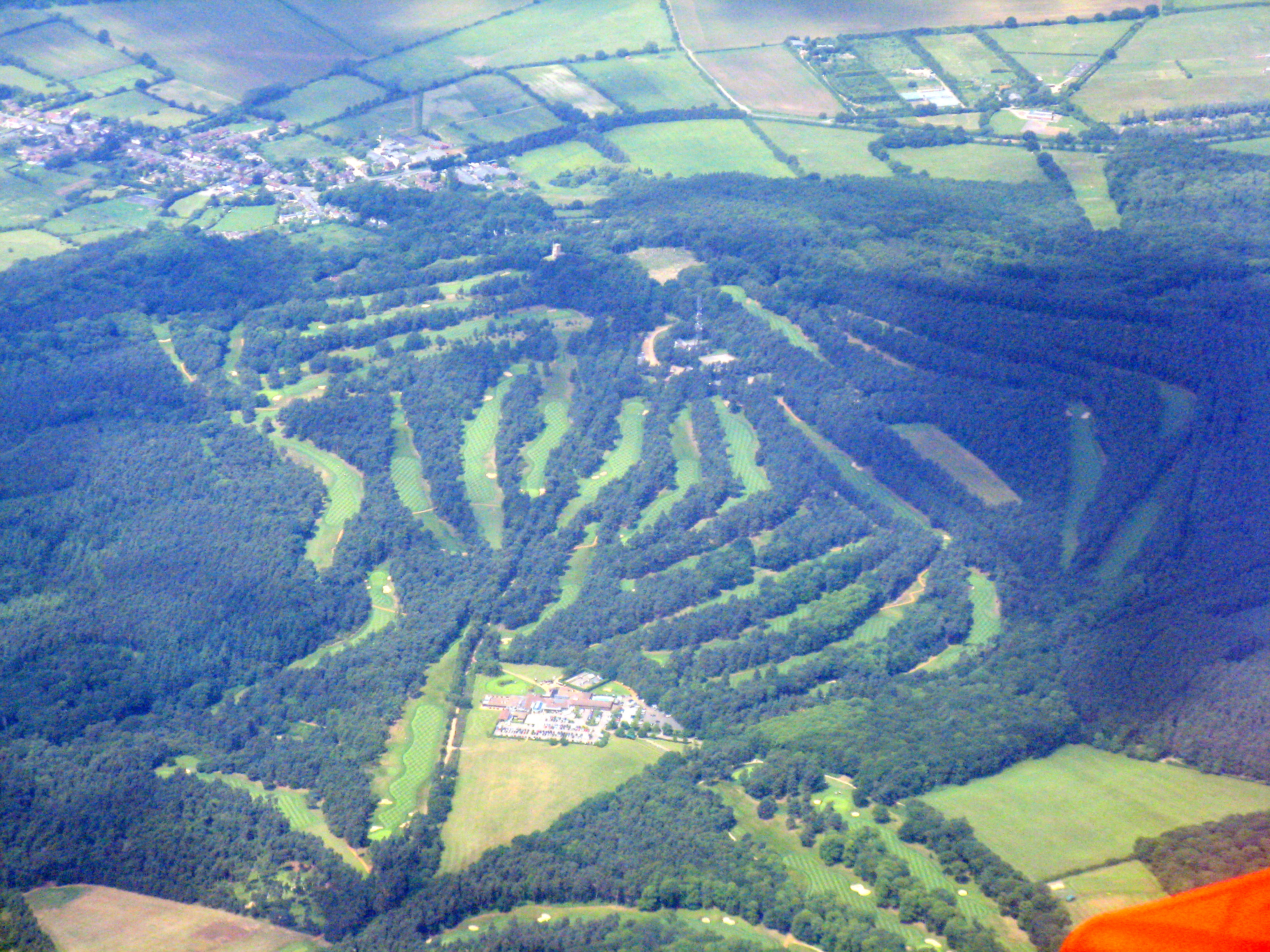
Bell's Copse is a picturesque woodland located in the county of Buckinghamshire, England. Situated near the village of Aston Clinton, this enchanting forest covers an area of approximately 10 hectares. The copse is named after the Bell family, who once owned the land in the 19th century.

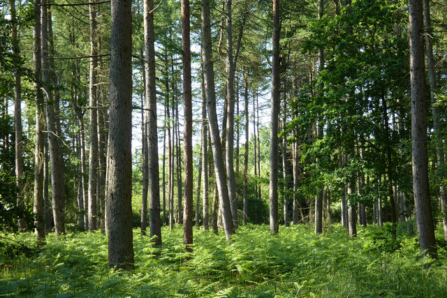
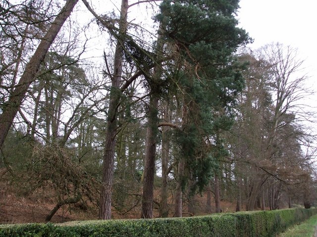
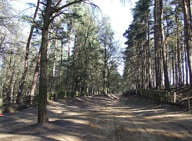
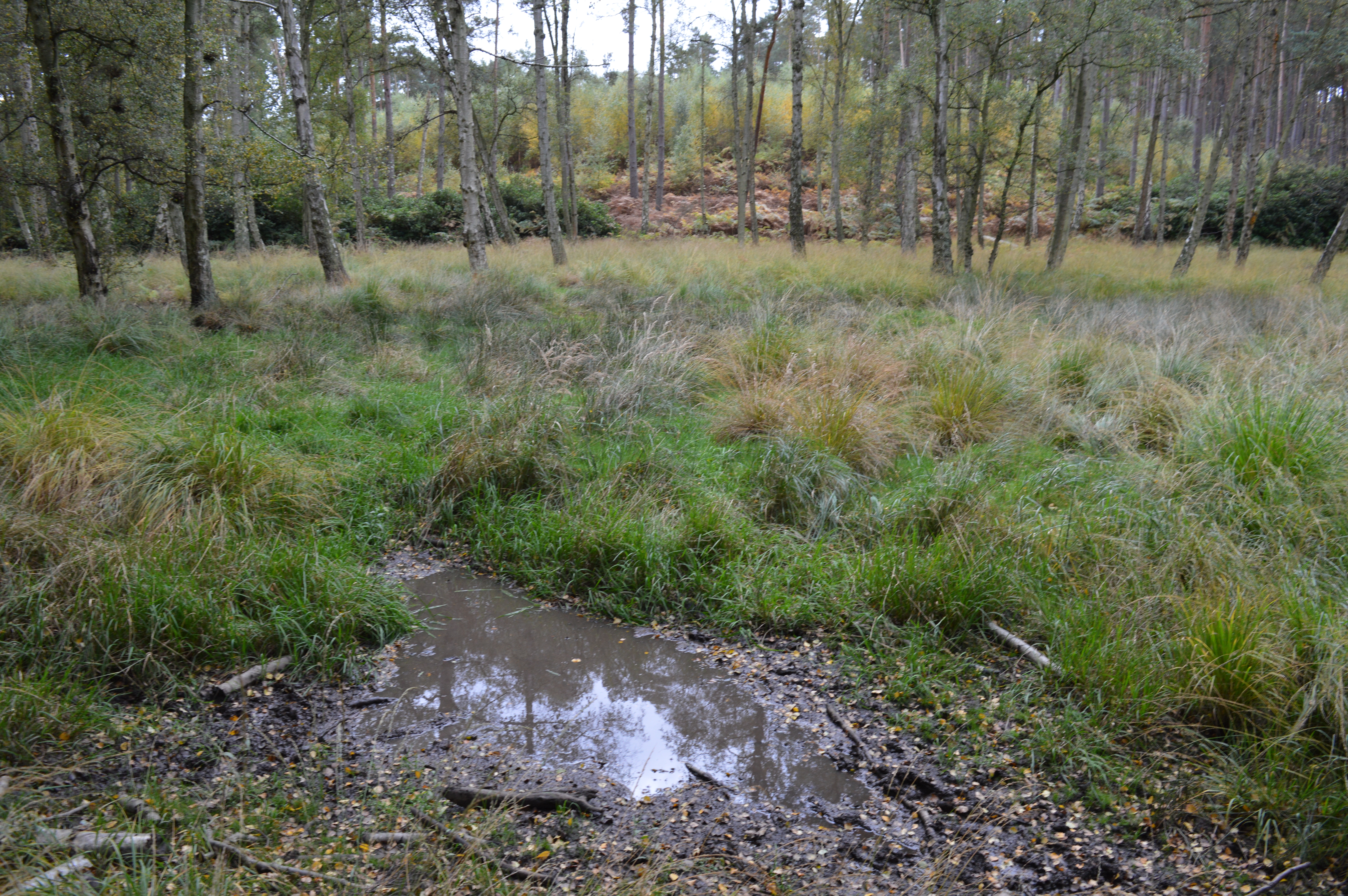
As one enters Bell's Copse, they are greeted by a diverse array of tree species, including oak, ash, beech, and birch. These majestic trees create a dense canopy, providing shelter for a variety of wildlife. The forest floor is adorned with a carpet of lush green ferns and wildflowers, adding to the copse's natural beauty.

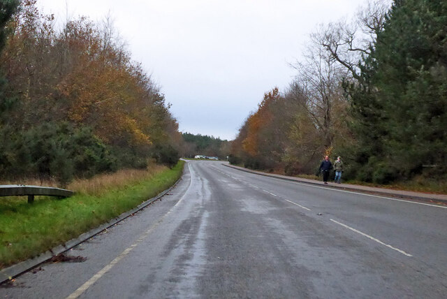
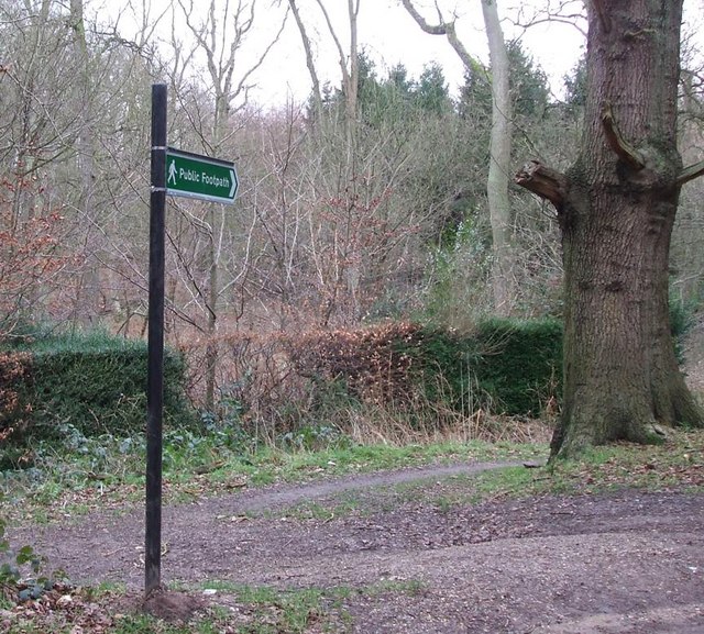
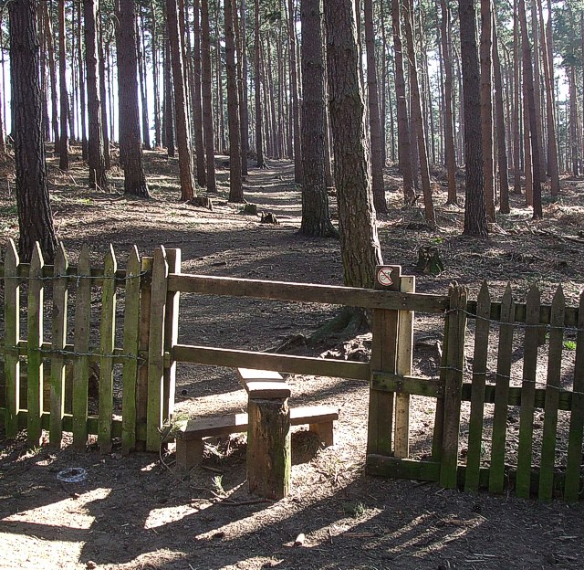
The woodland is crisscrossed by a network of well-maintained footpaths, making it a popular spot for hikers and nature enthusiasts. These paths lead visitors through the heart of the copse, allowing them to explore its hidden nooks and crannies. Along the way, one may encounter an abundance of wildlife, such as deer, squirrels, and a rich variety of bird species.

Bell's Copse is not only a haven for nature lovers but also serves as an important ecological site. The forest provides a valuable habitat for numerous plant and animal species, contributing to the biodiversity of the region. The copse also acts as a natural carbon sink, helping to mitigate the effects of climate change.

Visitors to Bell's Copse can enjoy a peaceful and tranquil environment, far from the hustle and bustle of urban life. With its breathtaking scenery and abundant wildlife, this idyllic woodland offers a perfect retreat for those seeking solace in nature.

If you have any feedback on the listing, please let us know in the comments section below.
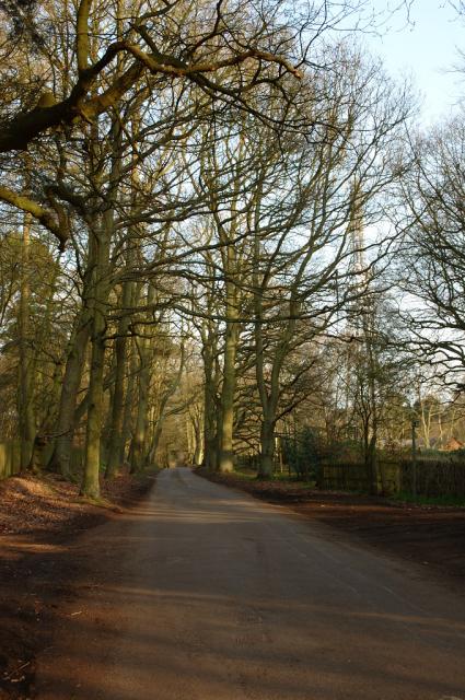
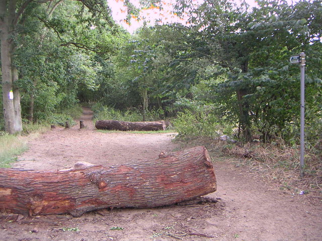
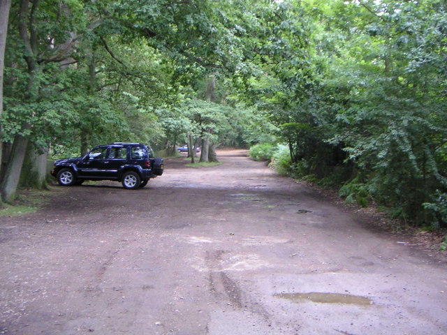
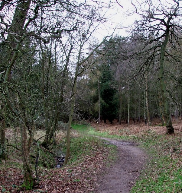
Bell's Copse Images

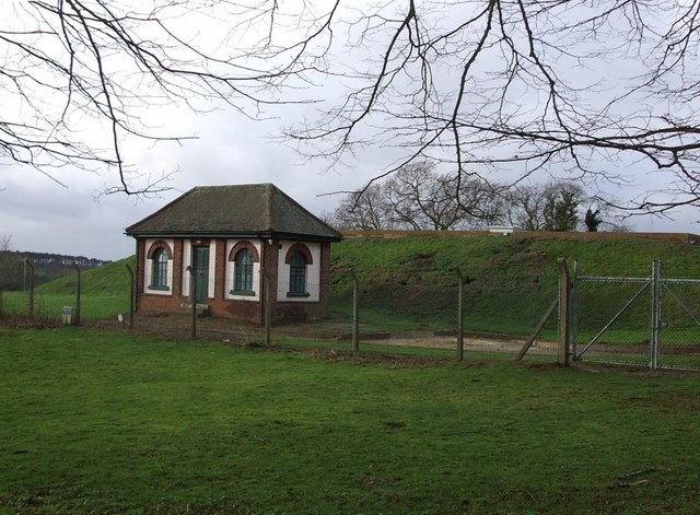
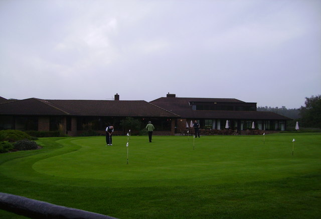
Images are sourced within 2km of 51.99211/-0.66105478 or Grid Reference SP9233. Thanks to Geograph Open Source API. All images are credited.

Road from Woburn to Woburn Sands Very grand for an unclassified road, and indeed it once was the A50.
Road from Woburn to Woburn Sands
Very grand for an unclassified road, and indeed it once was the A50.
Woodland, Woburn Mostly pines to the north of the junction of paths in Lowe's Wood.
Woodland, Woburn
Mostly pines to the north of the junction of paths in Lowe's Wood.
Farmland, Woburn Peas to the west of Job's Farm.
Farmland, Woburn
Peas to the west of Job's Farm.
Farmland, Woburn Barley to the north of the ruins of Horsemoor Farm.
Farmland, Woburn
Barley to the north of the ruins of Horsemoor Farm.
Country road ESE of Bow Brickhill The single track road from Bow Brickhill that runs ESE through the woods.  The mast at SP91475 34195 is just visible through the trees.
Country road ESE of Bow Brickhill
The single track road from Bow Brickhill that runs ESE through the woods. The mast at SP91475 34195 is just visible through the trees.
Public Bridleway The view southwards into Browns Wood along the bridleway that joins up with the Milton Keynes Boundary Walk.
Public Bridleway
The view southwards into Browns Wood along the bridleway that joins up with the Milton Keynes Boundary Walk.
Sandy Lane The view at the top of Aspley Heath looking down Sandy Lane.  I believe you're allowed to drive your car down here if you're foolish enough, so it's mainly used as a public footpath and bridleway.
Sandy Lane
The view at the top of Aspley Heath looking down Sandy Lane. I believe you're allowed to drive your car down here if you're foolish enough, so it's mainly used as a public footpath and bridleway.
St Mary Magdalen, Little Brickhill Located at the highest point of the village, St Mary's church is on the corner of the Roman Road "Watling Street" and the old Woburn Road, which was removed as part of the A5 Bypass.
St Mary Magdalen, Little Brickhill
Located at the highest point of the village, St Mary's church is on the corner of the Roman Road "Watling Street" and the old Woburn Road, which was removed as part of the A5 Bypass.
Old Green Man Public House Located on the old A5 road Watling Street in Little Brickhill.
Old Green Man Public House
Located on the old A5 road Watling Street in Little Brickhill.
Path into Buttermilk Wood near Lowe's Wood This path leads into the woods in the heart of a quite large wood. Different parts of the wood have different names, and this path leads into what appears from the map to be called Buttermilk Wood, but is also close to Lowe's Wood.
Path into Buttermilk Wood near Lowe's Wood
This path leads into the woods in the heart of a quite large wood. Different parts of the wood have different names, and this path leads into what appears from the map to be called Buttermilk Wood, but is also close to Lowe's Wood.
Roadside pines A very neatly trimmed hedge separates these pines on the edge of Charle Wood from the lane from Little Brickhill to Woburn. The whole of this area probably once belonged to the Dukes of Bedford whose ancestral home of Woburn Abbey is nearby - they may well still own all the woodland.
Roadside pines
A very neatly trimmed hedge separates these pines on the edge of Charle Wood from the lane from Little Brickhill to Woburn. The whole of this area probably once belonged to the Dukes of Bedford whose ancestral home of Woburn Abbey is nearby - they may well still own all the woodland.
Waterworks Building, Little Brickhill Behind this little Waterworks building can be seen rising the embankment of one of two covered reservoirs here.
Waterworks Building, Little Brickhill
Behind this little Waterworks building can be seen rising the embankment of one of two covered reservoirs here.
Footpath into the woods near Shire Oak This sign points the way to <a href="https://www.geograph.org.uk/photo/311246">SP9232 : Path into Buttermilk Wood near Lowe's Wood</a>. It forms part of the Milton Keynes Boundary Walk - which makes M.K. cover a pretty large area. As can be seen from the maps of the area this is in the midst of a wood near a place called Shire Oak.
Footpath into the woods near Shire Oak
This sign points the way to SP9232 : Path into Buttermilk Wood near Lowe's Wood. It forms part of the Milton Keynes Boundary Walk - which makes M.K. cover a pretty large area. As can be seen from the maps of the area this is in the midst of a wood near a place called Shire Oak.
Pumpkin Park This little wood on rising ground to the southwest of Pinfoldpond is called "Pumpkin Park". The photo was taken from roughly opposite <a href="https://www.geograph.org.uk/photo/311254">SP9332 : Roadside pines</a>.
Pumpkin Park
This little wood on rising ground to the southwest of Pinfoldpond is called "Pumpkin Park". The photo was taken from roughly opposite SP9332 : Roadside pines.
Covered Reservoir, Little Brickhill There are two covered reservoirs here, south-east of the village of Little Brickhill. The one seen here is the further from the village. In front of it can be seen <a href="https://www.geograph.org.uk/photo/313264">SP9132 : Waterworks Building, Little Brickhill</a> which presumably contains control equipment for the reservoirs.
Covered Reservoir, Little Brickhill
There are two covered reservoirs here, south-east of the village of Little Brickhill. The one seen here is the further from the village. In front of it can be seen SP9132 : Waterworks Building, Little Brickhill which presumably contains control equipment for the reservoirs.
Woburn Golf Club Club house and practice putting green
Woburn Golf Club
Club house and practice putting green
Track through New  Wavendon Heath This track is a "BOAT", that is a "Byway Open to All Traffic" marked on 1:25000 scale OS maps with a line of green crosses. It leads into the New Wavendon Heath section of Aspley Woods as a continuation of the lane from Little Brickhill and continues through the woods to Aspley Heath.
Track through New Wavendon Heath
This track is a "BOAT", that is a "Byway Open to All Traffic" marked on 1:25000 scale OS maps with a line of green crosses. It leads into the New Wavendon Heath section of Aspley Woods as a continuation of the lane from Little Brickhill and continues through the woods to Aspley Heath.
Stile into New Wavendon Heath This stile leads into conifers of the New Wavendon Heath section of Aspley Woods from off the byway seen in <a href="https://www.geograph.org.uk/photo/367427">SP9233 : Track through New  Wavendon Heath</a>
Stile into New Wavendon Heath
This stile leads into conifers of the New Wavendon Heath section of Aspley Woods from off the byway seen in SP9233 : Track through New Wavendon Heath
Show me another place!

Bell's Copse is located at Grid Ref: SP9233 (Lat: 51.99211, Lng: -0.66105478)

Unitary Authority: Milton Keynes

Police Authority: Thames Valley

What 3 Words

///suiting.shoppers.bills. Near Bow Brickhill, Buckinghamshire

Related Wikis

2016 Women's British Open

The 2016 Ricoh Women's British Open was played 28–31 July in England at the Woburn Golf and Country Club near Milton Keynes, Buckinghamshire, northwest...

Woburn Golf and Country Club

Woburn Golf Club is a golf club in England located in Little Brickhill, near Milton Keynes within the county of Bedfordshire, about fifty miles (80 km...

2019 Women's British Open

The 2019 AIG Women's British Open was played from 1–4 August in England at Woburn Golf Club in Milton Keynes, Buckinghamshire, fifty miles (80 km) northwest...

Wavendon Heath Ponds

Wavendon Heath Ponds is a 4.7-hectare (12-acre) biological Site of Special Scientific Interest in Aspley Heath in Bedfordshire. It was notified in 1986...

Have you been to Bell's Copse?

Leave your review of Bell's Copse below (or comments, questions and feedback).