Ash Holt
Wood, Forest in Lincolnshire West Lindsey
England
Ash Holt

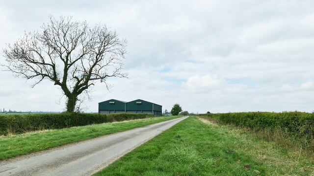
Ash Holt is a small village located in the county of Lincolnshire, England. Situated in the district of North Kesteven, it is nestled within the scenic countryside of the county. The village is known for its picturesque woodlands and forests, which surround the area and give it a tranquil and natural atmosphere.
The woodlands of Ash Holt are abundant with diverse flora and fauna, making it a popular destination for nature enthusiasts and hikers. The forest provides a habitat for various species of wildlife, including deer, foxes, rabbits, and a wide range of bird species. The dense canopy of trees offers shade and shelter, creating a peaceful environment for visitors.
The village itself is small and tightly-knit, with a close community that takes pride in its rural heritage. It has a few local amenities, including a village hall, a pub, and a primary school, providing essential services for the residents. The village is primarily residential, with a mix of old cottages and modern houses.
Ash Holt is surrounded by the beautiful Lincolnshire countryside, offering stunning views and numerous opportunities for outdoor activities. The nearby market town of Sleaford provides additional amenities and services, including shops, restaurants, and leisure facilities.
Overall, Ash Holt is a charming village that offers a peaceful and idyllic setting for those seeking a quiet countryside retreat. Its woodlands and forests, along with its close-knit community, make it a desirable place to live or visit for nature lovers and those looking to escape the hustle and bustle of city life.
If you have any feedback on the listing, please let us know in the comments section below.
Ash Holt Images
Images are sourced within 2km of 53.370485/-0.61928091 or Grid Reference SK9186. Thanks to Geograph Open Source API. All images are credited.


Ash Holt is located at Grid Ref: SK9186 (Lat: 53.370485, Lng: -0.61928091)
Administrative County: Lincolnshire
District: West Lindsey
Police Authority: Lincolnshire
What 3 Words
///quietly.door.sleepless. Near Willingham, Lincolnshire
Nearby Locations
Related Wikis

West Lindsey
West Lindsey is a local government district in Lincolnshire, England. Its council is based in Gainsborough, the district's largest town. The district also...

Fillingham
Fillingham is a village and civil parish in the West Lindsey district of Lincolnshire, England. It is situated 9 miles (14.5 km) north from the city and...
Glentworth, Lincolnshire
Glentworth is a village and civil parish in the West Lindsey district of Lincolnshire, England. The population of the parish (including Caenby Corner)...

Harpswell, Lincolnshire
Harpswell is a village and civil parish in the West Lindsey district of Lincolnshire, England. It is situated just west off the junction of the A631 and...

St Chad's Church, Harpswell
St Chad's Church, Harpswell, is a parish church in the Church of England in Harpswell, Lincolnshire. == History == The ancient church of St Chad in the...

Coates medieval settlement
Coates medieval settlement is a deserted medieval village in the civil parish of Stow, in the West Lindsey district, in the county of Lincolnshire, England...

Hemswell Cliff
Hemswell Cliff is a village and civil parish in the West Lindsey district of Lincolnshire, England. It is situated on the A631 road between Caenby Corner...

Hemswell
Hemswell is a village and civil parish in the West Lindsey district of Lincolnshire, England. It is situated just north of the A631 on the Lincoln Cliff...
Nearby Amenities
Located within 500m of 53.370485,-0.61928091Have you been to Ash Holt?
Leave your review of Ash Holt below (or comments, questions and feedback).