Broad Firs

Wood, Forest in Surrey Guildford

England

Broad Firs

View across The Tarn
View across The Tarn Credit: David Martin

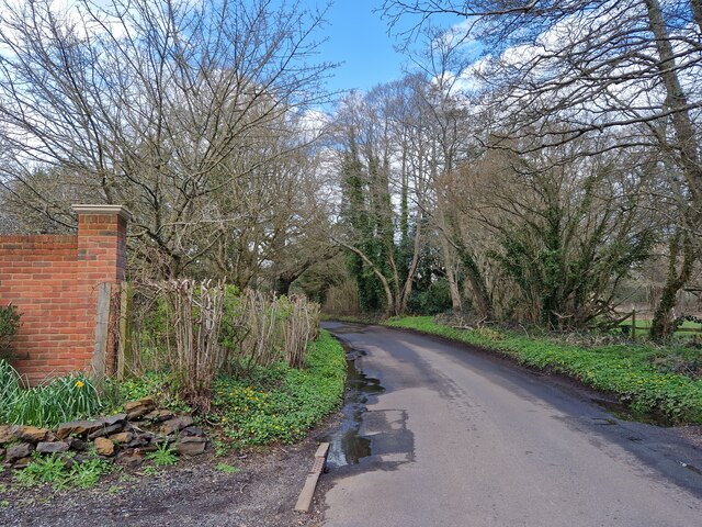
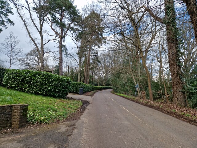
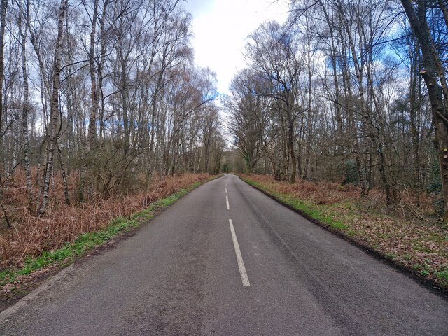
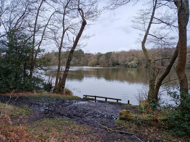
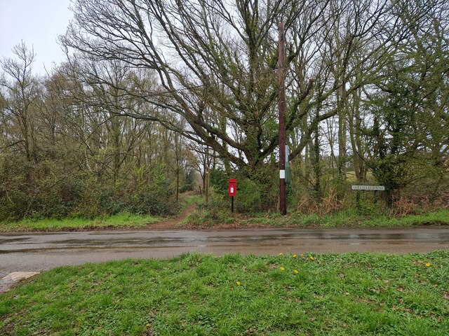
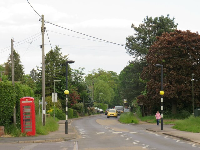
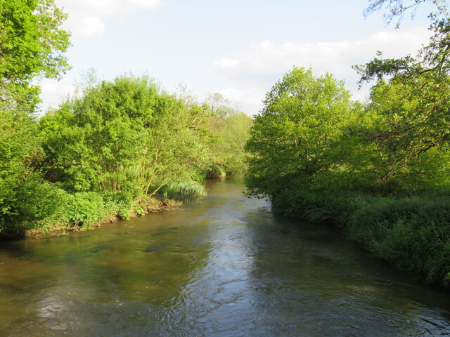
Broad Firs, located in Surrey, England, is a picturesque woodland area known for its lush greenery and serene atmosphere. Situated in the heart of the Surrey Hills Area of Outstanding Natural Beauty, it is a popular destination for nature enthusiasts, hikers, and families seeking a peaceful retreat.

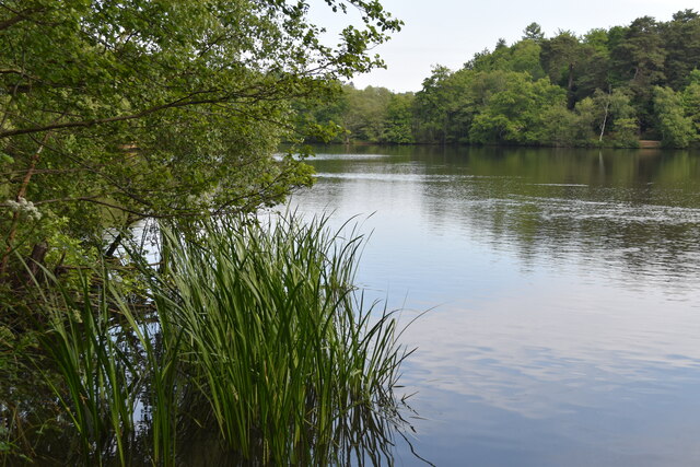
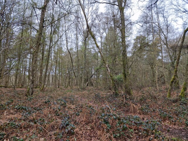
Covering an area of approximately 100 acres, Broad Firs boasts a diverse range of tree species, including oak, beech, and birch. The woodland's dense canopy provides a habitat for various wildlife, such as deer, squirrels, and a wide array of bird species, making it a haven for birdwatchers and wildlife enthusiasts.

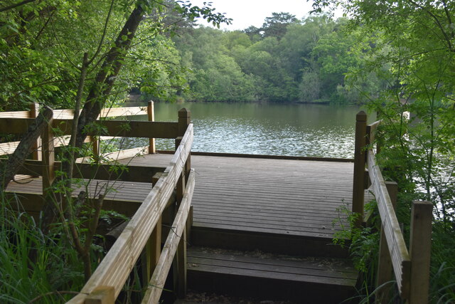
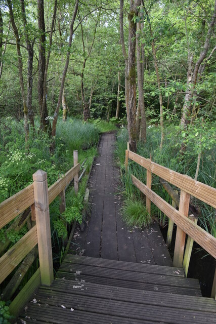
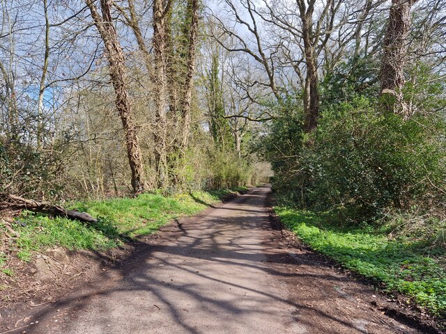
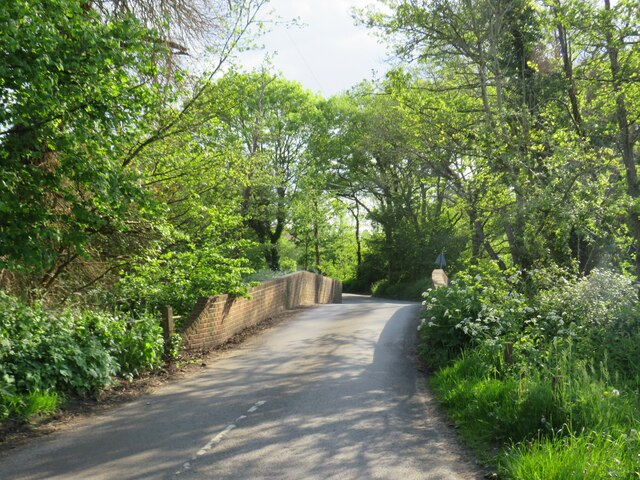
The woodland is crisscrossed by a network of well-maintained footpaths and trails, allowing visitors to explore its natural beauty at their own pace. These pathways offer stunning views of the surrounding countryside and are suitable for both leisurely strolls and more challenging hikes.

Broad Firs is also home to an abundance of wildflowers, which carpet the forest floor during the spring and summer months, creating a vibrant and enchanting atmosphere. It is not uncommon to spot bluebells, foxgloves, and primroses, among other floral species.

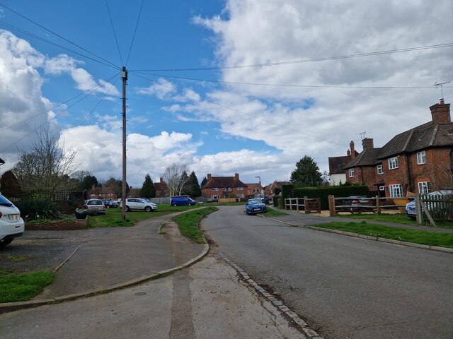
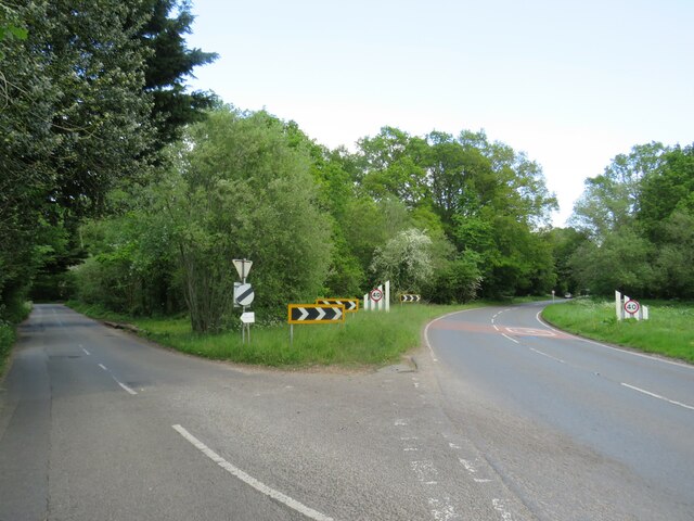
Given its close proximity to major towns and cities, such as Guildford and Dorking, Broad Firs is easily accessible for day trips or weekend getaways. Its tranquil and idyllic setting makes it a popular destination for picnics, family outings, and even wedding ceremonies.

Overall, Broad Firs in Surrey offers a wonderful opportunity to escape the hustle and bustle of city life and immerse oneself in the beauty of nature.

If you have any feedback on the listing, please let us know in the comments section below.

Broad Firs Images

Images are sourced within 2km of 51.198677/-0.68820421 or Grid Reference SU9145. Thanks to Geograph Open Source API. All images are credited.

View across The Tarn
Landing stage on The Tarn
Boardwalk through marshy edges of The Tarn
Springfield: early April 2023 (taken from the junction with Bankside Close)
Springfield: early April 2023
(taken from the junction with Bankside Close)
Navigating northwards up the Basher (11) Taken in Fulbrook Lane, just past Thundry Farm
Navigating northwards up the Basher (11)
Taken in Fulbrook Lane, just past Thundry Farm
Fulbrook  Lane in early April
Fulbrook Lane in early April
Navigating northwards up the Basher (12) Top end of Fulbrook Lane
Navigating northwards up the Basher (12)
Top end of Fulbrook Lane
The Tarn: April 2020
Postbox in Suffield Lane
Navigating northwards up the Basher (13) Woodland just off the path near Warren Pond
Navigating northwards up the Basher (13)
Woodland just off the path near Warren Pond
Looking eastwards in Ham Lane
The Green, Elstead, near Farnham The Green in the village of Elstead in Surrey.
The Green, Elstead, near Farnham
The Green in the village of Elstead in Surrey.
Milford Road, Elstead, near Farnham Milford Road is on the route of the B3001 as it passes through the village of Elstead in Surrey.
Milford Road, Elstead, near Farnham
Milford Road is on the route of the B3001 as it passes through the village of Elstead in Surrey.
Road junction near Elstead, Surrey A road junction near the village of Elstead in Surrey.  The road to the right is the B3001, the road to the left is a minor unclassified road.
Road junction near Elstead, Surrey
A road junction near the village of Elstead in Surrey. The road to the right is the B3001, the road to the left is a minor unclassified road.
Weyburn Lane, Elstead, near Farnham Weyburn Lane forms part of a recent housing development on the site formerly occupied by Weyburn Works.  For an image taken in more-or-less the same place in 2009, see <a href="https://www.geograph.org.uk/photo/1608487">SU9243 : Weyburn Works entrance</a>
Weyburn Lane, Elstead, near Farnham
Weyburn Lane forms part of a recent housing development on the site formerly occupied by Weyburn Works. For an image taken in more-or-less the same place in 2009, see SU9243 : Weyburn Works entrance
River Wey near Elstead, Surrey A view of the River Wey near the village of Elstead in Surrey.
River Wey near Elstead, Surrey
A view of the River Wey near the village of Elstead in Surrey.
Somerset Bridge, near Elstead Somerset Bridge crosses the River Wey near the village of Elstead in Surrey.
Somerset Bridge, near Elstead
Somerset Bridge crosses the River Wey near the village of Elstead in Surrey.
Attleford Lane, near Elstead Attleford Lane is a minor lane through woodland in Surrey.
Attleford Lane, near Elstead
Attleford Lane is a minor lane through woodland in Surrey.
Show me another place!

Broad Firs is located at Grid Ref: SU9145 (Lat: 51.198677, Lng: -0.68820421)

Administrative County: Surrey

District: Guildford

Police Authority: Surrey

What 3 Words

///headstone.goat.blanks. Near Elstead, Surrey

Related Wikis

Puttenham and Crooksbury Commons

Puttenham and Crooksbury Commons is a 113.8-hectare (281-acre) biological Site of Special Scientific Interest between Farnham and Guildford in Surrey....

Peper Harow

Peper Harow is a rural village and civil parish in southwest Surrey close to the town of Godalming. It was a noted early cricket venue. Its easternmost...

Elstead

Elstead is a civil parish in Surrey, England with shops, houses and cottages spanning the north and south sides of the River Wey; development is concentrated...

Shackleford

Shackleford is a village and civil parish in the Borough of Guildford, Surrey, England centred to the west of the A3 between Guildford and Petersfield...

Oxenford Farm

Oxenford Farm is a former abbey farm, a dependency of Waverley Abbey in the civil parish of Witley, Surrey, England, with several listed buildings around...

Thundry Meadows

Thundry Meadows is a 16-hectare (40-acre) nature reserve in Elstead in Surrey. It is managed by the Surrey Wildlife Trust. Part of it is Charleshill Site...

Charleshill SSSI

Charleshill SSSI is a 10.1-hectare (25-acre) biological Site of Special Scientific Interest west of Elstead in Surrey. It is part of Thundry Meadows nature...

Prior's Field School

Prior's Field is an independent girls' boarding and day school in Guildford, Surrey in the south-east of England. Founded in 1902 by Julia Huxley, it stands...

Nearby Amenities

Located within 500m of 51.198677,-0.68820421
Cutt Mill
Building: yes
Source: npe
Lat/Long: 51.2018432/-0.6923125
Junction: give_way
Lat/Long: 51.195323/-0.6860064
Post Box
Collection Times: Mo-Fr 09:00; Sa 07:00
Operator: Royal Mail
Operator Wikidata: Q638098
Post Box Type: wall
Ref: GU8 49D
Royal Cypher: EIIR
Royal Cypher Wikidata: Q33102113
Lat/Long: 51.1959432/-0.6924569
Addr Housename: Little Gatwick
Lat/Long: 51.1958735/-0.6918922
Addr Housename: Gatwick
Lat/Long: 51.1960718/-0.6913178
Addr Housename: Gatwick End
Lat/Long: 51.1959357/-0.6910691
Lower Pyramid
Natural: wood
Lat/Long: 51.2008688/-0.6861889
The Marsh
Natural: wood
Lat/Long: 51.2010109/-0.6890311
Broad Firs
Natural: wood
Lat/Long: 51.1993142/-0.6897263
New Six Acres
Natural: wood
Lat/Long: 51.1990574/-0.6831325
The Breaches
Natural: wood
Lat/Long: 51.1971543/-0.687604
Botany Bay
Natural: wood
Lat/Long: 51.1977/-0.6916217
Gatwick
Place: locality
Lat/Long: 51.1970901/-0.6943123
The data included in this document is from www.openstreetmap.org. The data is made available under ODbL.

Have you been to Broad Firs?

Leave your review of Broad Firs below (or comments, questions and feedback).