Beansides Wood

Wood, Forest in Surrey Waverley

England

Beansides Wood

The Three Horseshoes
The Three Horseshoes Credit: Alex McGregor

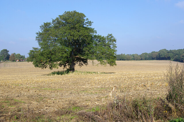
Beansides Wood is a picturesque woodland located in Surrey, England. Stretching over an area of approximately 100 acres, it is a natural haven boasting a diverse range of plant and animal species. The wood is situated in the heart of the Surrey Hills Area of Outstanding Natural Beauty, which adds to its charm and popularity among nature enthusiasts.

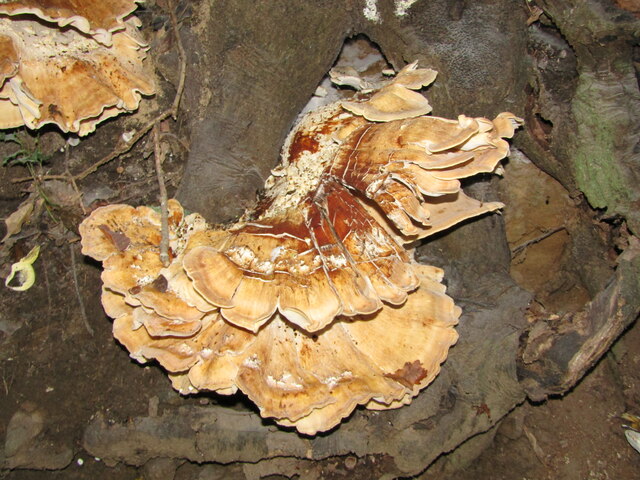
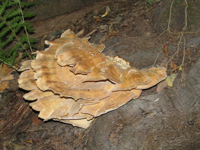
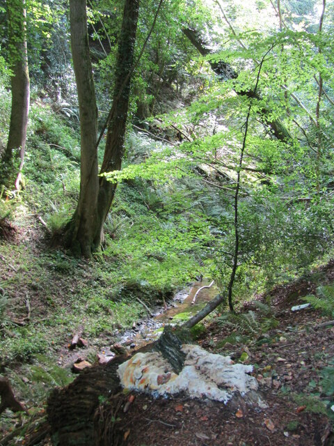
The woodland is predominantly made up of deciduous trees, including oak, beech, and birch, which create a stunning canopy throughout the year. In spring, the forest floor is carpeted with vibrant wildflowers, such as bluebells and primroses, adding a splash of color to the surroundings.

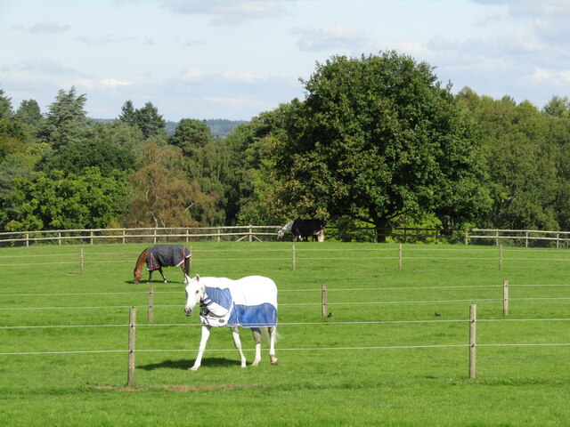
Beansides Wood is also home to an abundance of wildlife. Birdwatchers can spot a variety of species, including woodpeckers, nuthatches, and tawny owls. The wood is also a habitat for deer, foxes, badgers, and numerous small mammals, making it an exciting place for nature lovers and photographers.

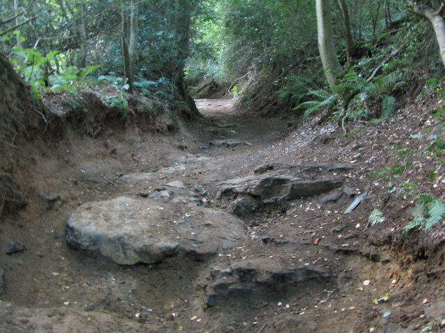
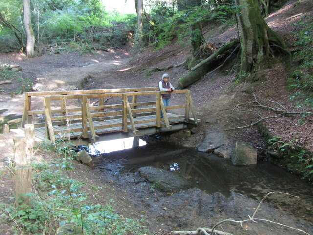
The wood offers several walking trails, allowing visitors to explore its beauty at their own pace. These trails meander through the woodland, offering glimpses of tranquil ponds, ancient trees, and hidden clearings. The peaceful ambiance of Beansides Wood makes it an ideal destination for those seeking solace in nature or engaging in outdoor activities like picnicking, photography, or nature walks.

Beansides Wood is easily accessible, with a car park and well-maintained footpaths. There are also informative signposts throughout the wood, providing visitors with interesting facts about the local flora and fauna. It is a true gem in Surrey's countryside, offering visitors an opportunity to immerse themselves in the natural beauty of the area.

If you have any feedback on the listing, please let us know in the comments section below.

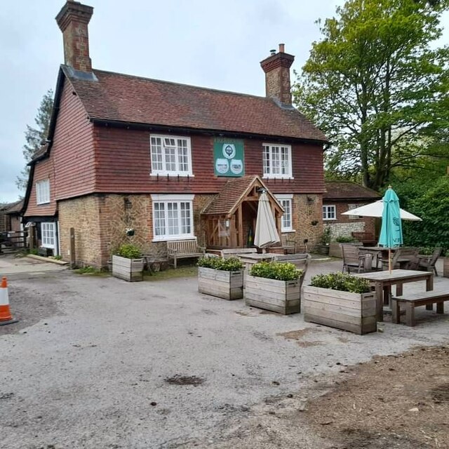
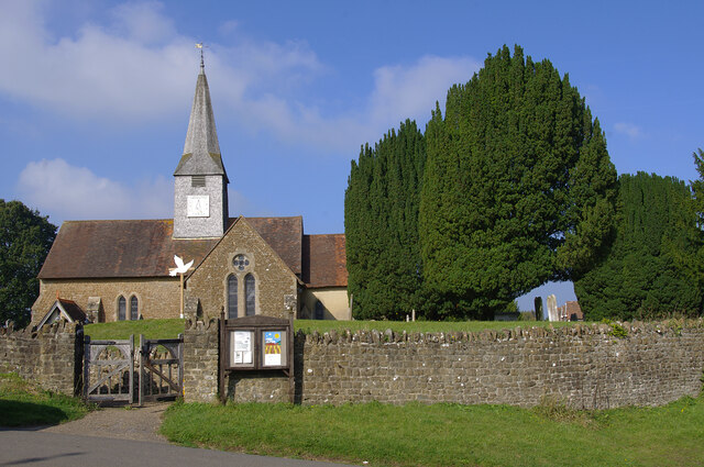
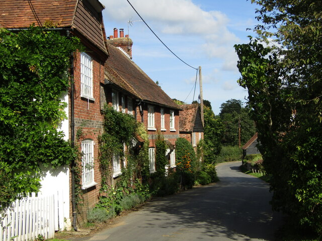
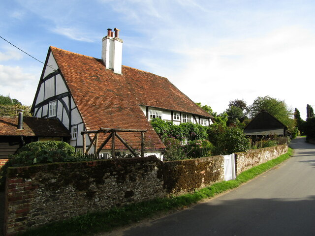
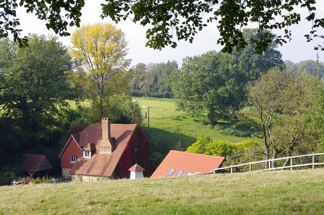
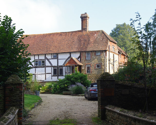
Beansides Wood Images

Images are sourced within 2km of 51.15148/-0.72268583 or Grid Reference SU8939. Thanks to Geograph Open Source API. All images are credited.

The Three Horseshoes
St Michael & All Angels Church Grade I listed building - <span class="nowrap"><a title="https://historicengland.org.uk/listing/the-list/list-entry/1260876" rel="nofollow ugc noopener" href="https://historicengland.org.uk/listing/the-list/list-entry/1260876">Link</a><img style="margin-left:2px;" alt="External link" title="External link - shift click to open in new window" src="https://s1.geograph.org.uk/img/external.png" width="10" height="10"/></span>
St Michael & All Angels Church
Grade I listed building - LinkExternal link
Farmland, Thursley The crop has been harvested.
Farmland, Thursley
The crop has been harvested.
Old petrol pumps, Thursley On the old A3, before it was upgraded to dual carriageway. No longer used but still surviving, and repainted since 2012.
Old petrol pumps, Thursley
On the old A3, before it was upgraded to dual carriageway. No longer used but still surviving, and repainted since 2012.
Thursley - The Street Old red brick cottages line the village's former main street, now a quiet lane.
<span class="nowrap"><a title="www.thursley-pc.gov.uk" rel="nofollow ugc noopener" href="http://www.thursley-pc.gov.uk">Link</a><img style="margin-left:2px;" alt="External link" title="External link - shift click to open in new window" src="https://s1.geograph.org.uk/img/external.png" width="10" height="10"/></span>
Thursley - The Street
Old red brick cottages line the village's former main street, now a quiet lane. LinkExternal link
Thursley - St Michael's Church Parts of St Michael and All Angels date back to Saxon times but much of the fabric is now Victorian.
Note the cross carries a black drape - mourning for Queen Elizabeth II (1926-2022).
<span class="nowrap"><a title="www.thursley-pc.gov.uk" rel="nofollow ugc noopener" href="http://www.thursley-pc.gov.uk">Link</a><img style="margin-left:2px;" alt="External link" title="External link - shift click to open in new window" src="https://s1.geograph.org.uk/img/external.png" width="10" height="10"/></span>
Thursley - St Michael's Church
Parts of St Michael and All Angels date back to Saxon times but much of the fabric is now Victorian. Note the cross carries a black drape - mourning for Queen Elizabeth II (1926-2022). LinkExternal link
Thursley - Font Original font of Bargate stone inside St Michael and All Angels Church which has Saxon roots.
Thursley - Font
Original font of Bargate stone inside St Michael and All Angels Church which has Saxon roots.
Thursley - Royal Arms Board with royal coat of arms dated 1783, realm of King George III, within the historic parish church.
Thursley - Royal Arms
Board with royal coat of arms dated 1783, realm of King George III, within the historic parish church.
Thursley - Sunset Cottage Timber-framed 16th century cottage with a distinctively large sloping roof on The Street.
Thursley - Sunset Cottage
Timber-framed 16th century cottage with a distinctively large sloping roof on The Street.
Daffodils in Thursley Churchyard
Pitlands Farm Grade II listed building - <span class="nowrap"><a title="https://historicengland.org.uk/listing/the-list/list-entry/1240826" rel="nofollow ugc noopener" href="https://historicengland.org.uk/listing/the-list/list-entry/1240826">Link</a><img style="margin-left:2px;" alt="External link" title="External link - shift click to open in new window" src="https://s1.geograph.org.uk/img/external.png" width="10" height="10"/></span>
Pitlands Farm
Grade II listed building - LinkExternal link
Upper Highfield Farm House Grade II listed building - <span class="nowrap"><a title="https://historicengland.org.uk/listing/the-list/list-entry/1240875" rel="nofollow ugc noopener" href="https://historicengland.org.uk/listing/the-list/list-entry/1240875">Link</a><img style="margin-left:2px;" alt="External link" title="External link - shift click to open in new window" src="https://s1.geograph.org.uk/img/external.png" width="10" height="10"/></span>
Upper Highfield Farm House
Grade II listed building - LinkExternal link
Thursley - Paddocks Horsieculture is common in the grassy fields south of Thursley.
Thursley - Paddocks
Horsieculture is common in the grassy fields south of Thursley.
Thursley - Fungus Large bracket fungus ca 1 foot from end to end in woodland close to Ridgeway Farm.
Thursley - Fungus
Large bracket fungus ca 1 foot from end to end in woodland close to Ridgeway Farm.
Thursley - Fungus Large bracket fungus ca 1 foot from end to end in woodland close to Ridgeway Farm.
Thursley - Fungus
Large bracket fungus ca 1 foot from end to end in woodland close to Ridgeway Farm.
Thursley - Byway Ancient and deeply incised trackway with exposed flat rocks in woodland close to Ridgeway Farm.
Thursley - Byway
Ancient and deeply incised trackway with exposed flat rocks in woodland close to Ridgeway Farm.
Thursley - Incised Valley In deciduous woodland south of Vanhurst Copse.
Note the large white splodge of white fungus in the foreground - ca 2 feet from end to end.
Thursley - Incised Valley
In deciduous woodland south of Vanhurst Copse. Note the large white splodge of white fungus in the foreground - ca 2 feet from end to end.
Thursley - Footbridge In deciduous woodland south of Vanhurst Copse. The bridge parallels an old ford.
Thursley - Footbridge
In deciduous woodland south of Vanhurst Copse. The bridge parallels an old ford.
Show me another place!

Beansides Wood is located at Grid Ref: SU8939 (Lat: 51.15148, Lng: -0.72268583)

Administrative County: Surrey

District: Waverley

Police Authority: Surrey

What 3 Words

///disco.monks.firebird. Near Elstead, Surrey

Related Wikis

Thursley, Hankley and Frensham Commons

Thursley, Hankley and Frensham Commons is a 1,878.5-hectare (4,642-acre) biological Site of Special Scientific Interest west of Godalming in Surrey. Thursley...

Thursley

Thursley is a village and civil parish in southwest Surrey, west of the A3 between Milford and Hindhead. An associated hamlet is Bowlhead Green. To the...

Thursley Common

Thursley Common is a national nature reserve in Surrey, England, and has also been designated as a Ramsar wetland. It is also part of a Site of Special...

South West Surrey (UK Parliament constituency)

South West Surrey is a constituency represented in the House of Commons of the UK Parliament. Since 2005, the seat has been represented by Conservative...

Hankley Common

Hankley Common is a 560-hectare (1,400-acre) nature reserve and filming location in the south-west of Elstead in Surrey. It is owned by the Ministry of...

Rushmoor, Surrey

Rushmoor is a village in the civil parish of Frensham, in the Waverley district, in the county of Surrey, England. In 2019 it had an estimated population...

Bron-y-de

Bron-y-de (transl. 'Breast of the south') was a house and surrounding farm in the village of Churt in the southern English county of Surrey. The main house...

Stockstone Quarry

Stockstone Quarry is a 3.9-hectare (9.6-acre) geological Site of Special Scientific Interest south of Farnham in Surrey. It is a Geological Conservation...

Nearby Amenities

Located within 500m of 51.15148,-0.72268583
Barrier: stile
Lat/Long: 51.1495372/-0.7201791
The data included in this document is from www.openstreetmap.org. The data is made available under ODbL.

Have you been to Beansides Wood?

Leave your review of Beansides Wood below (or comments, questions and feedback).