Tatnall's Wood

Wood, Forest in Buckinghamshire

England

Tatnall's Wood

The Forest is Closed For some reason Forestry England have closed Aston Hill Coppice. The car park and trails are all shut with barriers, and notices like this have been put up.
No idea what's going on, and whatever it is doesn't look to be very urgent.
The Forest is Closed Credit: Des Blenkinsopp

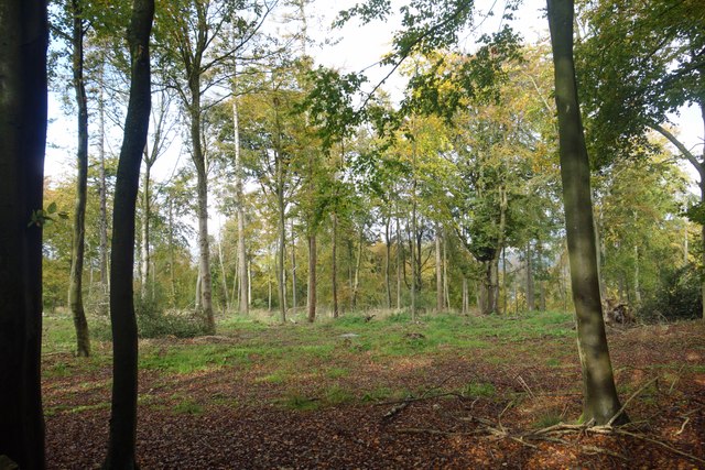
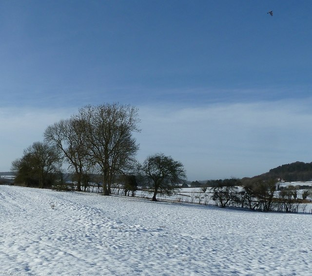
Tatnall's Wood is a charming woodland located in Buckinghamshire, England. Situated in the heart of the county, it covers an area of approximately 50 acres, offering visitors a tranquil escape from the hustle and bustle of everyday life.

The woodland is characterized by its diverse range of tree species, including oak, beech, birch, and pine. These trees create a dense canopy that provides shade and shelter, creating a haven for a variety of wildlife. The forest floor is adorned with a carpet of bluebells during the spring months, creating a breathtaking sight for nature enthusiasts.

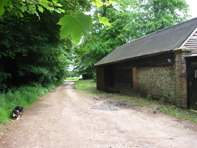
Tatnall's Wood is crisscrossed by a network of footpaths and trails, allowing visitors to explore the area at their own pace. These paths lead to hidden corners and secluded spots, perfect for picnics or simply enjoying the serenity of the surroundings. As visitors wander through the wood, they may encounter a plethora of wildlife, including deer, squirrels, and a wide array of bird species.

The woodland has a rich history, with evidence of human activity dating back centuries. It was once part of a larger estate and has retained its natural beauty despite its proximity to neighboring villages and towns. Tatnall's Wood is now owned and managed by the local council, who ensure its preservation and accessibility for the enjoyment of the public.

For nature lovers, Tatnall's Wood is a true gem, offering a peaceful retreat where one can connect with nature and experience the beauty of Buckinghamshire's woodlands.

If you have any feedback on the listing, please let us know in the comments section below.

Tatnall's Wood Images

Images are sourced within 2km of 51.77391/-0.70565544 or Grid Reference SP8909. Thanks to Geograph Open Source API. All images are credited.

The Forest is Closed For some reason Forestry England have closed Aston Hill Coppice. The car park and trails are all shut with barriers, and notices like this have been put up.
No idea what's going on, and whatever it is doesn't look to be very urgent.
The Forest is Closed
For some reason Forestry England have closed Aston Hill Coppice. The car park and trails are all shut with barriers, and notices like this have been put up. No idea what's going on, and whatever it is doesn't look to be very urgent.
No Access to the Forest For some reason Aston Hill Coppice, an area of Forestry England access land, has been closed. This is the entrance to the parking area. Other access points are similarly shut. No idea why.
In the background is a small historical monument to do with Aston Martin cars which owe the name to events here. <a href="https://www.geograph.org.uk/photo/1262861">SP8910 : The Origin of the Aston Martin Car</a>
No Access to the Forest
For some reason Aston Hill Coppice, an area of Forestry England access land, has been closed. This is the entrance to the parking area. Other access points are similarly shut. No idea why. In the background is a small historical monument to do with Aston Martin cars which owe the name to events here. SP8910 : The Origin of the Aston Martin Car
The Forbidden Forest Aston Hill Coppice, an area of wooded access land, has been closed to the public by Forestry England for some reason.
This is a view from the footpath along the edge. Nothing obvious going on.
The Forbidden Forest
Aston Hill Coppice, an area of wooded access land, has been closed to the public by Forestry England for some reason. This is a view from the footpath along the edge. Nothing obvious going on.
One Way Road, Wendover Woods Vehicle access to the parking and visitor area in Wendover Woods is down quite a long forest drive on a single track road. It is a pleasant wooded drive with viewpoints along the way, but it's a private road with a barrier at the end and it will cost you £2 minimum to get out again, depending how long you stay.
One Way Road, Wendover Woods
Vehicle access to the parking and visitor area in Wendover Woods is down quite a long forest drive on a single track road. It is a pleasant wooded drive with viewpoints along the way, but it's a private road with a barrier at the end and it will cost you £2 minimum to get out again, depending how long you stay.
Chiltern Edge View The Chiltern escarpment is quite steep along here with wide views to the west over Aylesbury Vale.
Chiltern Edge View
The Chiltern escarpment is quite steep along here with wide views to the west over Aylesbury Vale.
Field north of Wendover Woods Wendover Woods has the highest point of the Chiltern Hills which is also the 'county top' of Buckinghamshire. A stone in the woods marks what is considered to be the highest point, though it's not marked on OS maps. This field lies to the east of the stone; the view is to the west and the trees of Tatnall's Wood.
Field north of Wendover Woods
Wendover Woods has the highest point of the Chiltern Hills which is also the 'county top' of Buckinghamshire. A stone in the woods marks what is considered to be the highest point, though it's not marked on OS maps. This field lies to the east of the stone; the view is to the west and the trees of Tatnall's Wood.
Chickweed Growing on the uncultivated fringe of a field.
Chickweed
Growing on the uncultivated fringe of a field.
Field corner with cow parsley and hawthorn A fenced off fringe of a pasture - actually just off the public footpath.
Field corner with cow parsley and hawthorn
A fenced off fringe of a pasture - actually just off the public footpath.
Footpath,  Wendover Woods Numerous paths straggle across the Forestry Commission woodlands of Wendover Woods, this is a view along one of them as it leaves the access road.
The tarmacked access road through the woods allows vehicular access to the various facilities such as car parks, barbecue areas, café and "Go Ape" - as well as the many woodland walks.
Footpath, Wendover Woods
Numerous paths straggle across the Forestry Commission woodlands of Wendover Woods, this is a view along one of them as it leaves the access road. The tarmacked access road through the woods allows vehicular access to the various facilities such as car parks, barbecue areas, café and "Go Ape" - as well as the many woodland walks.
Glade in Wendover Woods Taken from the footpath seen in <a href="https://www.geograph.org.uk/photo/2958760">SP8809 : Footpath,  Wendover Woods</a> looking into a glade of mostly deciduous trees, though the tree in the foreground is a yew, which is an evergreen, though not a conifer.
Glade in Wendover Woods
Taken from the footpath seen in SP8809 : Footpath, Wendover Woods looking into a glade of mostly deciduous trees, though the tree in the foreground is a yew, which is an evergreen, though not a conifer.
Crossroads at Hale Wood
Wendover Woods, view south-west
Wendover view from Haddington Hill Coombe Hill can be seen beyond the Buckinghamshire town of Wendover from one of the higher points of the county in the Wendover Woods.  At this time of year, when trees are in leaf, views like this are far and few between in these parts.
Wendover view from Haddington Hill
Coombe Hill can be seen beyond the Buckinghamshire town of Wendover from one of the higher points of the county in the Wendover Woods. At this time of year, when trees are in leaf, views like this are far and few between in these parts.
Glimpse of Boddington Hill from Haddington Hill Green is the colour - Wendover Woods in summer.
Glimpse of Boddington Hill from Haddington Hill
Green is the colour - Wendover Woods in summer.
Chivery Cottage from Black Wood This good looking house with unusual full height windows fitted between the old beams of the rear gables is I believe called Chivery Cottage. The view is from the path from The Crong to Chivery just as it has emerged from Black Wood.
Chivery Cottage from Black Wood
This good looking house with unusual full height windows fitted between the old beams of the rear gables is I believe called Chivery Cottage. The view is from the path from The Crong to Chivery just as it has emerged from Black Wood.
Field boundary at The Hale The Hale is a small group of houses in the countryside to the east of Wendover. These trees and hedge mark a field boundary. See also <a href="https://www.geograph.org.uk/photo/3316447">SP8907 : Clump of trees at The Hale</a>
Field boundary at The Hale
The Hale is a small group of houses in the countryside to the east of Wendover. These trees and hedge mark a field boundary. See also SP8907 : Clump of trees at The Hale
Clump of trees at The Hale A closer view of the trees seen in <a href="https://www.geograph.org.uk/photo/3316444">SP8907 : Field boundary at The Hale</a>. The dark limbs of the trees contrast with bright snow.
Clump of trees at The Hale
A closer view of the trees seen in SP8907 : Field boundary at The Hale. The dark limbs of the trees contrast with bright snow.
Hale lane - view downhill Hale Lane rises quite quickly once past The Hale when travelling eastwards. This is the view roughly westwards looking downhill back towards The Hale. See also <a href="https://www.geograph.org.uk/photo/3316462">SP8907 : Hale Lane - view uphill</a> and <a href="https://www.geograph.org.uk/photo/3316466">SP8907 : Track up to Hale Wood from Hale Lane</a> taken from the same position.
Hale lane - view downhill
Hale Lane rises quite quickly once past The Hale when travelling eastwards. This is the view roughly westwards looking downhill back towards The Hale. See also SP8907 : Hale Lane - view uphill and SP8907 : Track up to Hale Wood from Hale Lane taken from the same position.
Show me another place!

Tatnall's Wood is located at Grid Ref: SP8909 (Lat: 51.77391, Lng: -0.70565544)

Unitary Authority: Buckinghamshire

Police Authority: Thames Valley

What 3 Words

///like.diverged.regret. Near Wendover, Buckinghamshire

Related Wikis

Wendover Woods

Wendover Woods is an area of woodland on the north edge of the Chiltern Hills in England. Named after the nearby town of Wendover, the woods are part of...

Haddington Hill

Haddington Hill (also called Wendover Hill) is a hill in The Chilterns, and the highest point in the English county of Buckinghamshire. On the north-eastern...

Dancersend

Dancersend is an 81.3-hectare (201-acre) Site of Special Scientific Interest (SSSI) south of Aston Clinton in Buckinghamshire. Part of the site is managed...

Chivery

Chivery is a hamlet located in the Chiltern Hills in the present-day parish of Aston Clinton, in Aylesbury Vale District in the county of Buckinghamshire...

Trenchard Museum

The Trenchard Museum is based at RAF Halton, Halton, Buckinghamshire, England. The overall aim of the museum is to preserve and display items that relate...

Aston Hill Mountain Bike Area

Aston Hill Bike Park is located adjacent to Wendover Woods on the ridge of the Chiltern Hills, above Aston Clinton, Buckinghamshire. It is managed by...

Dancersend Waterworks

Dancersend Waterworks is a 4-hectare biological Site of Special Scientific Interest in Spencersgreen south of Aston Clinton in Buckinghamshire. It was...

Halton House

Halton House is a country house in the Chiltern Hills above the village of Halton in Buckinghamshire, England. It was built for Alfred Freiherr de Rothschild...

Nearby Amenities

Located within 500m of 51.77391,-0.70565544
Wendover Woods
Description: Highest Point of the Chiltern Hills
Ele: 267.5
Natural: peak
Source: https://www.hill-bagging.co.uk/mountaindetails.php?qu=S&rf=2874
Tourism: minor_attraction
Wikidata: Q5637668
Wikipedia: en:Haddington Hill
Lat/Long: 51.7723763/-0.7111233
Bench
Backrest: yes
Lat/Long: 51.7726355/-0.7122197
Bench
Backrest: no
Lat/Long: 51.7717936/-0.7118724
Bench
Backrest: no
Lat/Long: 51.7717803/-0.7118985
Bench
Backrest: no
Lat/Long: 51.7717948/-0.7118388
Orienteering Course Start
Information: board
Orienteering: start
Sport: orienteering
Tourism: information
Website: https://www.forestry.gov.uk/forestry/englandbuckinghamshirenoforestwendoverwoodsmainentranceorienteeringcourse
Lat/Long: 51.7717721/-0.7118534
Waste Basket
Waste: dog_excrement
Lat/Long: 51.7715126/-0.7115082
Bench
Backrest: yes
Check Date: 2021-08-22
Lat/Long: 51.7714778/-0.7114875
Bench
Backrest: yes
Check Date: 2021-08-22
Lat/Long: 51.7719419/-0.7097511
Traffic Calming: bump
Lat/Long: 51.7724922/-0.7113095
Leisure: picnic_table
Lat/Long: 51.7727338/-0.7112159
Leisure: picnic_table
Lat/Long: 51.7728367/-0.7111824
Leisure: picnic_table
Lat/Long: 51.7730325/-0.711932
Check Date: 2021-08-22
Leisure: picnic_table
Lat/Long: 51.773664/-0.7118556
Check Date: 2021-08-22
Leisure: picnic_table
Lat/Long: 51.7736715/-0.7120031
Leisure: picnic_table
Lat/Long: 51.7731396/-0.7117671
The Chiltern Summit
Historic: memorial
Inscription: This cairn at a height of 876 FT (267 M) marks the heighest point on the Chiltern Hills. And was erected by the parish councils of Aston Clinton and Halton. By the Chiltern Society. The Forestry Commission and the Royal Air Force Halton.
Memorial: plaque
Lat/Long: 51.7733489/-0.7103961
Bench
Backrest: no
Check Date: 2021-08-22
Lat/Long: 51.7733221/-0.7103676
Countryside Award 1970
Historic: memorial
Memorial: plaque
Lat/Long: 51.7727354/-0.712608
Barrier: kissing_gate
Lat/Long: 51.7705954/-0.703754
Tatnall's Wood
Place: locality
Lat/Long: 51.7742333/-0.7053888
Bradnidge Wood
Place: locality
Lat/Long: 51.7753419/-0.6997991
Power: pole
Lat/Long: 51.7718815/-0.7012635
Power: pole
Lat/Long: 51.7747727/-0.7014754
Power: pole
Lat/Long: 51.7733487/-0.7013065
Power: pole
Lat/Long: 51.7727537/-0.7012743
Material: wood
Power: pole
Lat/Long: 51.771928/-0.7090312
Power: pole
Lat/Long: 51.7716458/-0.7073897
Power: pole
Lat/Long: 51.7713753/-0.7058904
Power: pole
Lat/Long: 51.7709811/-0.704167
Power: pole
Lat/Long: 51.7709031/-0.7032336
Power: pole
Lat/Long: 51.7708126/-0.7022184
Power: pole
Lat/Long: 51.771284/-0.7012394
Power: pole
Lat/Long: 51.7707313/-0.7011858
The data included in this document is from www.openstreetmap.org. The data is made available under ODbL.

Have you been to Tatnall's Wood?

Leave your review of Tatnall's Wood below (or comments, questions and feedback).