The Wilderness

Wood, Forest in Northamptonshire

England

The Wilderness

Cranford Road, Barton Seagrave
Cranford Road, Barton Seagrave Credit: David Howard

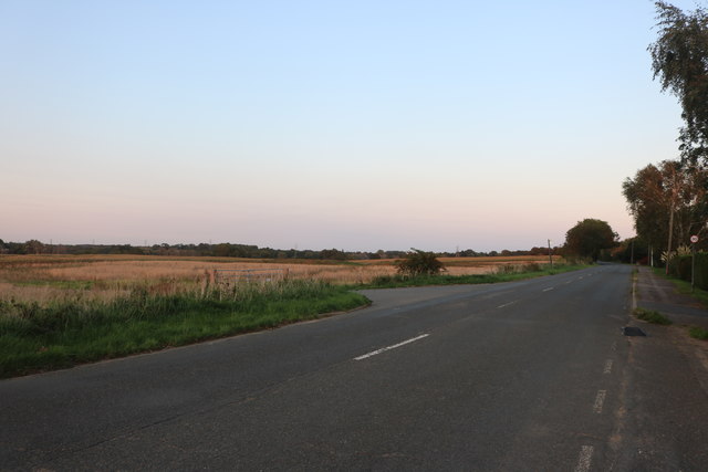
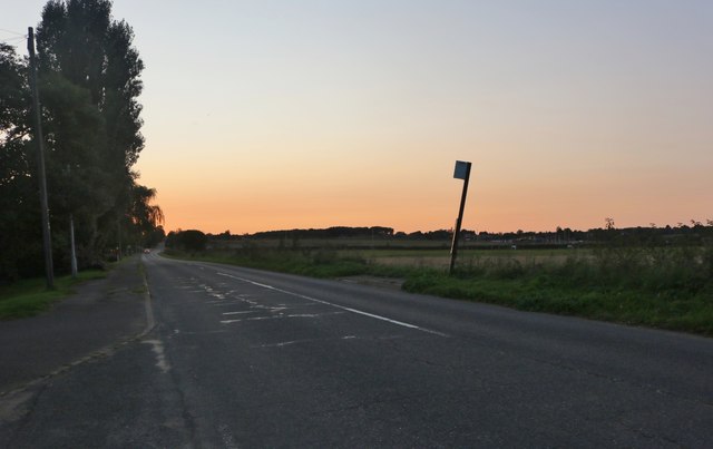
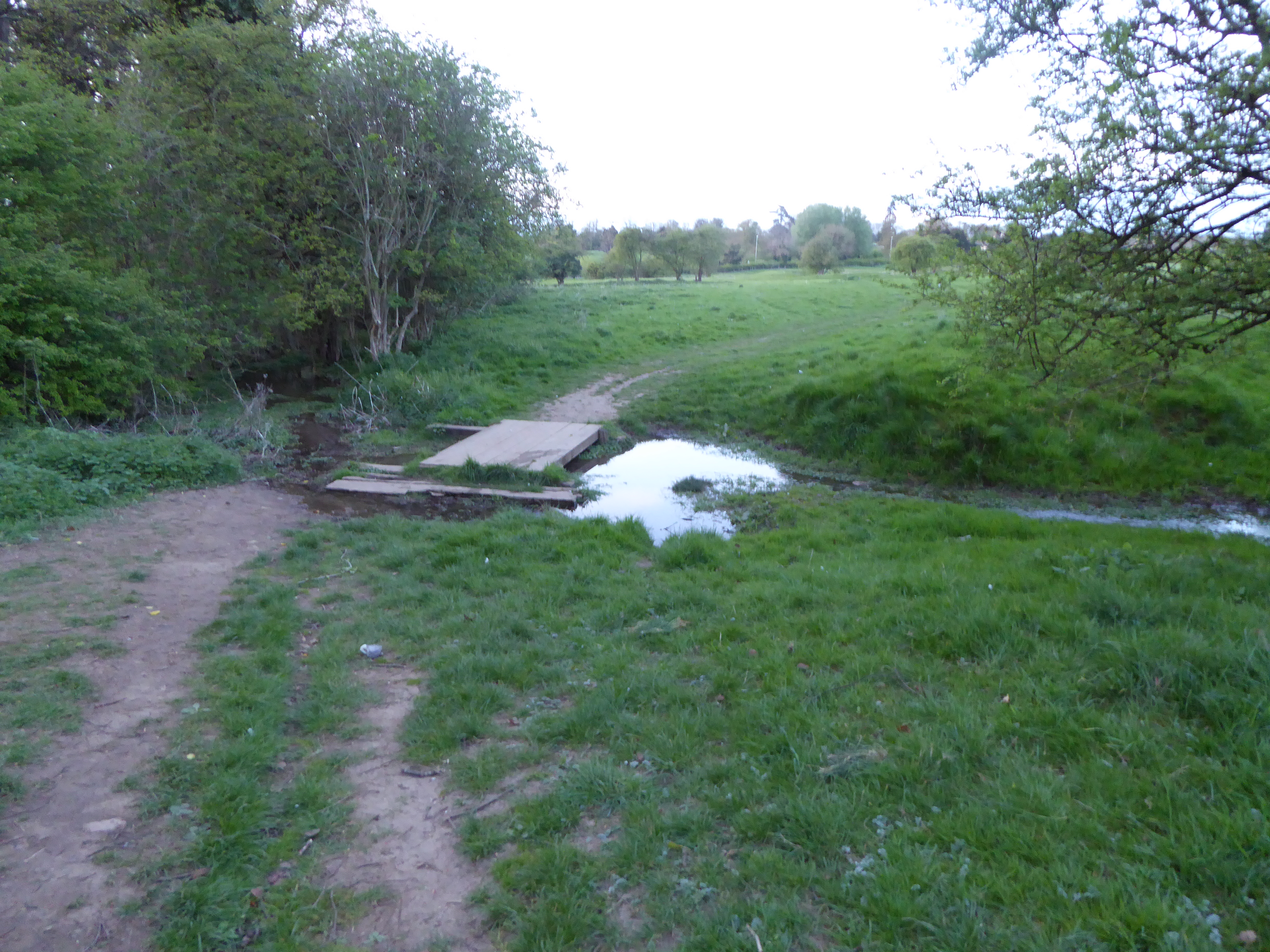
The Wilderness, located in Northamptonshire, is an enchanting wood or forest that spans across a significant area. It is situated in a picturesque part of the county and is renowned for its natural beauty and tranquility. The wood is a diverse ecosystem, home to a wide variety of flora and fauna.

The Wilderness offers a unique experience for nature enthusiasts, hikers, and wildlife observers. Visitors can explore the network of walking trails that wind through the wood, immersing themselves in the serene surroundings. The forest boasts a rich plant life, with an abundance of tree species, including oak, beech, and birch. These trees provide shelter and food for a diverse range of wildlife, including birds, mammals, and insects.

The wood is also home to several species of wildflowers, which carpet the forest floor during the spring and summer months, adding vibrant splashes of color to the landscape. Additionally, the Wilderness features a small stream that meanders through the woodland, enhancing its natural appeal.

With its secluded and peaceful atmosphere, The Wilderness serves as a haven for those seeking solace and a break from the hustle and bustle of everyday life. It is a perfect place for picnics, meditation, or simply enjoying the beauty of nature. The wood offers a respite from the outside world, allowing visitors to reconnect with the natural environment and appreciate its wonders.

If you have any feedback on the listing, please let us know in the comments section below.

The Wilderness Images

Images are sourced within 2km of 52.388391/-0.69916181 or Grid Reference SP8877. Thanks to Geograph Open Source API. All images are credited.

Cranford Road, Barton Seagrave
Barton Seagrave-Cranford Road Close to a new housing development.
Barton Seagrave-Cranford Road
Close to a new housing development.
Industrial effluent disposal At the back of the Alpro industrial unit.
Industrial effluent disposal
At the back of the Alpro industrial unit.
Morrisons distribution depot Conveniently situated beside the A14 main trunk road.
Morrisons distribution depot
Conveniently situated beside the A14 main trunk road.
St Edward's Roman Catholic Church, Kettering
The Wayfarers, Kettering
St Botolph, Barton Seagrave
Stubbs Lane
Stubbs Lane
Dale's Lodge has seen better days Derelict farm and house that appears to be destined for housing as the field all around has invertebrate fencing on its perimeter. So it's subject to a newt survey before works can begin.
Dale's Lodge has seen better days
Derelict farm and house that appears to be destined for housing as the field all around has invertebrate fencing on its perimeter. So it's subject to a newt survey before works can begin.
Kettering - Newman Works
Kettering - house at junction of Broadway and Headlands Home of the local radio station, Connect FM.
Kettering - house at junction of Broadway and Headlands
Home of the local radio station, Connect FM.
Kettering - Speight's At junction of London Road and Bowling Green Green.  Charles Speight built this as a photographic studio in 1886 (see <span class="nowrap"><a title="http://www.kettering.gov.uk/info/200070/museums_and_galleries/101/a_walk_in_and_around_the_manor_house_museum_gardens/10" rel="nofollow ugc noopener" href="http://www.kettering.gov.uk/info/200070/museums_and_galleries/101/a_walk_in_and_around_the_manor_house_museum_gardens/10">Link</a><img style="margin-left:2px;" alt="External link" title="External link - shift click to open in new window" src="https://s1.geograph.org.uk/img/external.png" width="10" height="10"/></span> ).  The building is now used as the Gateway Community Church.
Kettering - Speight's
At junction of London Road and Bowling Green Green. Charles Speight built this as a photographic studio in 1886 (see LinkExternal link ). The building is now used as the Gateway Community Church.
Kettering - London Road Hall
Kettering - hospital reception Off London Road.
Kettering - hospital reception
Off London Road.
Kettering - undertakers on London Road
Kettering - house at junction of London Road and Bowling Green Road
Kettering - Cemetery chapel
Show me another place!

The Wilderness is located at Grid Ref: SP8877 (Lat: 52.388391, Lng: -0.69916181)

Unitary Authority: North Northamptonshire

Police Authority: Northamptonshire

What 3 Words

///divide.gasp.blunt. Near Kettering, Northamptonshire

Related Wikis

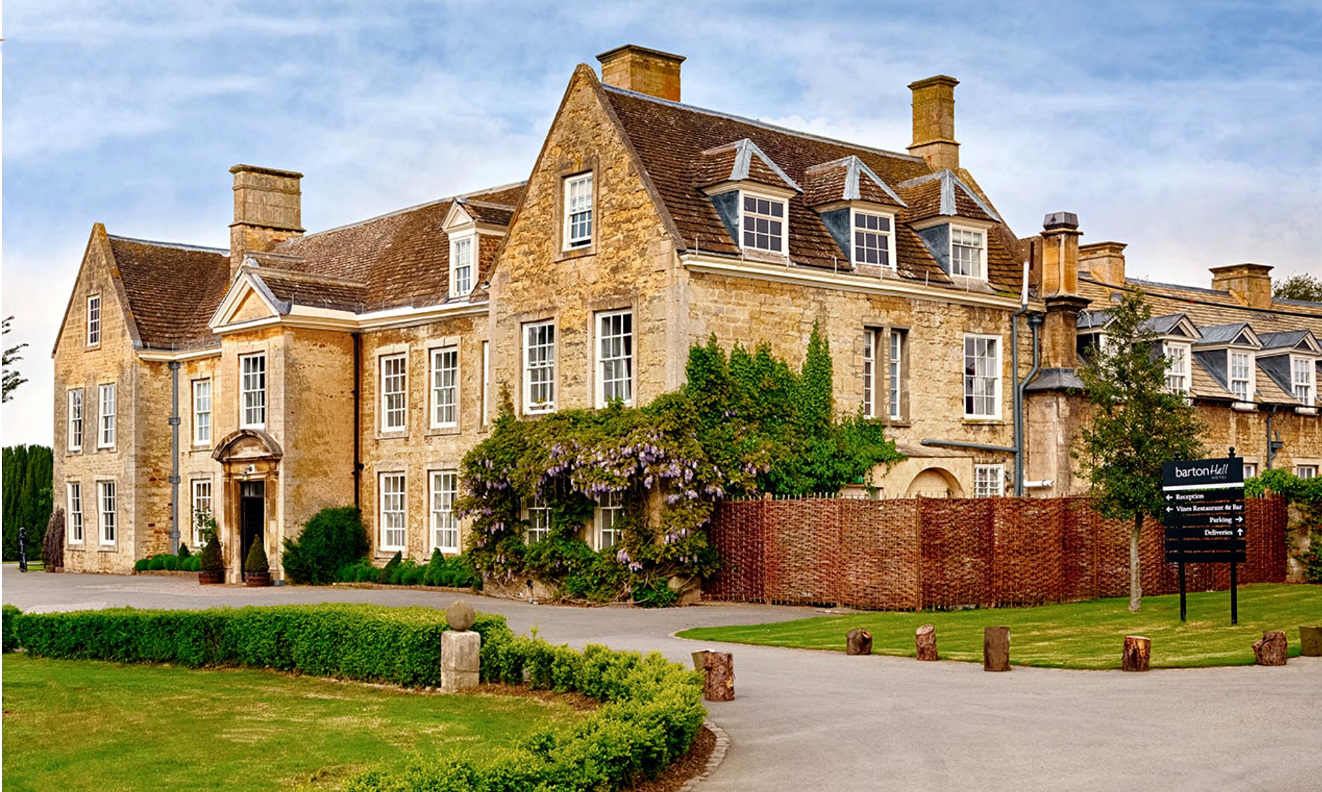
Barton Hall Hotel, Barton Seagrave

Barton Hall Hotel in Barton Seagrave near Kettering is a building of historical significance and is listed on the English Heritage Register. It was built...

Wicksteed Park

Wicksteed Park is a Grade II listed park in Kettering, Northamptonshire, England, which includes an amusement park within its grounds. The park is located...

Wicksteed Park Nature Reserve

Wicksteed Park is a 14.2-hectare (35-acre) nature reserve in Barton Seagrave, on the eastern outskirts of Kettering in Northamptonshire. It is managed...

Kettering Grammar School

Kettering Grammar School was a boys' grammar school (selective) that had a number of homes in Kettering, Northamptonshire throughout its history. ��2...

Tresham College of Further and Higher Education

Tresham College of Further and Higher Education (formerly Tresham Institute of Further and Higher Education) is a number of further education colleges...

The Latimer Arts College

The Latimer Arts College (formerly Latimer Community Arts College) is a foundation secondary school in Barton Seagrave, Northamptonshire, teaching students...

Clown Coaster

Clown Coaster is a children's steel coaster manufactured by Pinfari that opened at Wicksteed Park in Kettering, Northamptonshire, in October 2011. It previously...

Kettering Science Academy

Kettering Science Academy is a secondary and sixth form school in Kettering, Northamptonshire, England, teaching pupils from age 11 to 18. It is a member...

Nearby Amenities

Located within 500m of 52.388391,-0.69916181
Post Office
Barton Seagrave Post Office
Addr City: Kettering
Addr Country: GB
Addr Housenumber: 47
Addr Postcode: NN15 6SR
Addr Street: St Botolph's Road
Addr Village: Barton Seagrave
Brand: Post Office
Brand Wikidata: Q1783168
Fhrs Authority: North Northamptonshire
Fhrs Id: 1612770
Fhrs Local Authority Id: 24722
Ref Pol Id: 12589
Source: OS_OpenData_StreetView
Website: https://www.postoffice.co.uk/branch-finder/3162265/barton-seagrave
Lat/Long: 52.3842443/-0.6978264
Kindergarten
Little Bears Pre-School
Addr City: Kettering
Addr Country: GB
Addr Postcode: NN15 5DJ
Addr Street: Grantown Close
Lat/Long: 52.3899137/-0.7051276
Kindergarten
Rhymetime Nursery
Addr City: Kettering
Addr Country: GB
Addr Postcode: NN15 5BZ
Addr Street: Churchill Way
Fhrs Authority: North Northamptonshire
Fhrs Id: 68610
Fhrs Local Authority Id: 15343
Lat/Long: 52.3917977/-0.6984435
St Botolphs P C C
Addr City: Kettering
Addr Country: GB
Addr Housename: Church House
Addr Postcode: NN15 6SR
Addr Street: St Botolph's Road
Fhrs Authority: North Northamptonshire
Fhrs Id: 80982
Fhrs Local Authority Id: 1970
Office: religion
Lat/Long: 52.3844273/-0.6965678
Barrier: kissing_gate
Lat/Long: 52.3847296/-0.6956799
Post Box
Brand: Royal Mail
Brand Wikidata: Q638098
Collection Times: Mo-Fr 16:45; Sa 12:15
Operator: Royal Mail
Operator Wikidata: Q638098
Post Box Type: pillar
Ref: NN15 78
Royal Cypher: EIIR
Royal Cypher Wikidata: Q33102113
Source: survey
Lat/Long: 52.3843677/-0.6979218
Crossing
Crossing: traffic_signals
Crossing Ref: pelican
Lat/Long: 52.3856117/-0.7002914
Post Box
Brand: Royal Mail
Brand Wikidata: Q638098
Brand Wikipedia: en:Royal Mail
Operator: Royal Mail
Operator Wikidata: Q638098
Post Box Type: lamp
Ref: NN15 184
Lat/Long: 52.3908215/-0.6972402
Generator Method: photovoltaic
Generator Output Electricity: yes
Generator Source: solar
Generator Type: solar_photovoltaic_panel
Location: roof
Power: generator
Lat/Long: 52.3865425/-0.6945659
Generator Method: photovoltaic
Generator Output Electricity: yes
Generator Source: solar
Generator Type: solar_photovoltaic_panel
Location: roof
Power: generator
Lat/Long: 52.3914034/-0.6957536
Generator Method: photovoltaic
Generator Output Electricity: yes
Generator Source: solar
Generator Type: solar_photovoltaic_panel
Location: roof
Power: generator
Lat/Long: 52.3913835/-0.695822
Generator Method: photovoltaic
Generator Output Electricity: yes
Generator Source: solar
Generator Type: solar_photovoltaic_panel
Location: roof
Power: generator
Lat/Long: 52.3902988/-0.6984403
Generator Method: photovoltaic
Generator Output Electricity: yes
Generator Source: solar
Generator Type: solar_photovoltaic_panel
Location: roof
Power: generator
Lat/Long: 52.3902841/-0.6985557
Generator Method: photovoltaic
Generator Output Electricity: yes
Generator Source: solar
Generator Type: solar_photovoltaic_panel
Location: roof
Power: generator
Lat/Long: 52.3902055/-0.6989956
Generator Method: photovoltaic
Generator Output Electricity: yes
Generator Source: solar
Generator Type: solar_photovoltaic_panel
Location: roof
Power: generator
Lat/Long: 52.390253/-0.6989017
Generator Method: photovoltaic
Generator Output Electricity: yes
Generator Source: solar
Generator Type: solar_photovoltaic_panel
Location: roof
Power: generator
Lat/Long: 52.3898912/-0.6976598
Generator Method: photovoltaic
Generator Output Electricity: yes
Generator Source: solar
Generator Type: solar_photovoltaic_panel
Location: roof
Power: generator
Lat/Long: 52.3898896/-0.6977644
Generator Method: photovoltaic
Generator Output Electricity: yes
Generator Source: solar
Generator Type: solar_photovoltaic_panel
Location: roof
Power: generator
Lat/Long: 52.3889991/-0.7005378
Generator Method: photovoltaic
Generator Output Electricity: yes
Generator Source: solar
Generator Type: solar_photovoltaic_panel
Location: roof
Power: generator
Lat/Long: 52.3890539/-0.700401
Generator Method: photovoltaic
Generator Output Electricity: yes
Generator Source: solar
Generator Type: solar_photovoltaic_panel
Location: roof
Power: generator
Lat/Long: 52.391754/-0.7034158
Generator Method: photovoltaic
Generator Output Electricity: yes
Generator Source: solar
Generator Type: solar_photovoltaic_panel
Location: roof
Power: generator
Lat/Long: 52.3917499/-0.7033166
Generator Method: photovoltaic
Generator Output Electricity: yes
Generator Source: solar
Generator Type: solar_photovoltaic_panel
Location: roof
Power: generator
Lat/Long: 52.3914937/-0.7033635
Bus Stop
Castle Way (opp)
Bench: yes
Bin: yes
Bus: yes
Naptan AtcoCode: 300000654ST
Naptan CommonName: Castle Way
Naptan Indicator: opp
Naptan Landmark: Castle Way
Naptan NaptanCode: nthdjdja
Naptan Street: St Botolphs Road
Public Transport: platform
Shelter: yes
Lat/Long: 52.3850315/-0.6976104
Bus Stop
Castle Way (adj)
Bin: yes
Bus: yes
Naptan AtcoCode: 300000654SB
Naptan CommonName: Castle Way
Naptan Indicator: adj
Naptan Landmark: Castle Way
Naptan NaptanCode: nthdjdgd
Naptan Street: St Botolphs Road
Public Transport: platform
Lat/Long: 52.3840492/-0.6981669
Bus Stop
Barton Seagrave Hall (o/s)
Bench: yes
Bus: yes
Naptan AtcoCode: 300000654OB
Naptan CommonName: Barton Seagrave Hall
Naptan Indicator: o/s
Naptan Landmark: Barton Seagrave Hall
Naptan NaptanCode: nthdjawj
Naptan Street: Barton Road
Public Transport: platform
Shelter: yes
Lat/Long: 52.3864213/-0.6966502
Bus Stop
Barton Seagrave Hall (opp)
Bench: yes
Bin: yes
Bus: yes
Naptan AtcoCode: 300000654OP
Naptan CommonName: Barton Seagrave Hall
Naptan Indicator: opp
Naptan Landmark: Barton Seagrave Hall
Naptan NaptanCode: nthdjawm
Naptan Street: Barton Road
Public Transport: platform
Shelter: yes
Lat/Long: 52.3860776/-0.6980127
Bus Stop
Gleneagles Close (opp)
Naptan AtcoCode: 300000660GC
Naptan CommonName: Gleneagles Close
Naptan Indicator: opp
Naptan Landmark: Gleneagles Close
Naptan NaptanCode: nthdjdwt
Naptan Street: St Johns Road
Public Transport: platform
Lat/Long: 52.3905449/-0.6979913
Bus Stop
Kylesku Crescent (adj)
Naptan AtcoCode: 300000660CD
Naptan CommonName: Kylesku Crescent
Naptan Indicator: adj
Naptan Landmark: Kylesku Crescent
Naptan NaptanCode: nthdjdwj
Naptan Street: St Johns Road
Public Transport: platform
Lat/Long: 52.3905203/-0.7022452
Charging Station
Tesla Supercharger
Access: yes
Brand: Tesla Supercharger
Brand Wikidata: Q17089620
Capacity: 8
Fee: yes
Operator: Tesla, Inc.
Operator Wikidata: Q478214
Short Name: Tesla
Socket Type2 Combo: 8
Socket Type2 Combo Output: 250 kW
Lat/Long: 52.3866404/-0.6968542
The data included in this document is from www.openstreetmap.org. The data is made available under ODbL.

Have you been to The Wilderness?

Leave your review of The Wilderness below (or comments, questions and feedback).