Brownswell's Covert

Wood, Forest in Rutland

England

Brownswell's Covert

Rocks by Rail Museum, Cottesmore Two now preserved locomotives manufactured by Andrew Barclay Sons & Co.
Rocks by Rail Museum, Cottesmore Credit: Kevin Waterhouse

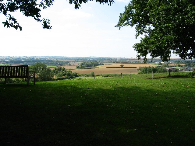
Brownswell's Covert is a picturesque woodland located in Rutland, a county in the East Midlands region of England. Covering an area of approximately 200 acres, this forested area is nestled within the charming countryside, offering visitors a tranquil and serene environment.

The woodland is predominantly made up of a diverse range of deciduous trees, including oak, beech, and birch. These trees create a dense canopy, providing shade and shelter to a variety of wildlife species that call this area home. The forest floor is blanketed with a lush carpet of ferns, mosses, and wildflowers, adding to the natural beauty of the covert.

Brownswell's Covert is crisscrossed with a network of well-maintained footpaths and trails, allowing visitors to explore the woods at their own pace. These paths wind through the forest, taking visitors past bubbling brooks, small ponds, and ancient trees, creating a sense of enchantment and wonder.

The woodland is a haven for birdwatchers and nature enthusiasts, with a rich diversity of avian species inhabiting the area. Visitors may spot woodpeckers, owls, and various songbirds, as well as the occasional glimpse of a deer or fox.

Within the covert, there are several designated picnic areas and benches where visitors can relax and enjoy the tranquility of the surroundings. The woodland is open to the public year-round, allowing visitors to experience its seasonal changes, from vibrant spring blooms to the golden hues of autumn.

Overall, Brownswell's Covert is a natural gem in Rutland, offering visitors the opportunity to immerse themselves in the beauty of nature and escape the hustle and bustle of everyday life.

If you have any feedback on the listing, please let us know in the comments section below.

Brownswell's Covert Images

Images are sourced within 2km of 52.698351/-0.69464332 or Grid Reference SK8811. Thanks to Geograph Open Source API. All images are credited.

Rocks by Rail Museum, Cottesmore Two now preserved locomotives manufactured by Andrew Barclay Sons & Co.
Rocks by Rail Museum, Cottesmore
Two now preserved locomotives manufactured by Andrew Barclay Sons & Co.
Pond at Burley on the Hill
Cottesmore Bridge A road bridge over the brook.
Cottesmore Bridge
A road bridge over the brook.
Unnamed brook Despite searching the map over several squares, I’m unable to find a name for this stretch of water.
Unnamed brook
Despite searching the map over several squares, I’m unable to find a name for this stretch of water.
Path down to the Tower House,  Burley on the Hill
Path down to the Tower House, Burley on the Hill
Path in the churchyard, Burley on the Hill Church Cottage by the gates dates from the eighteenth century <span class="nowrap"><a title="https://historicengland.org.uk/listing/the-list/list-entry/1361521?section=official-list-entry" rel="nofollow ugc noopener" href="https://historicengland.org.uk/listing/the-list/list-entry/1361521?section=official-list-entry">Link</a><img style="margin-left:2px;" alt="External link" title="External link - shift click to open in new window" src="https://s1.geograph.org.uk/img/external.png" width="10" height="10"/></span>
Path in the churchyard, Burley on the Hill
Church Cottage by the gates dates from the eighteenth century LinkExternal link
Church of the Holy Cross, Burley on the Hill Has Norman origins <span class="nowrap"><a title="https://historicengland.org.uk/listing/the-list/list-entry/1073794?section=official-list-entry" rel="nofollow ugc noopener" href="https://historicengland.org.uk/listing/the-list/list-entry/1073794?section=official-list-entry">Link</a><img style="margin-left:2px;" alt="External link" title="External link - shift click to open in new window" src="https://s1.geograph.org.uk/img/external.png" width="10" height="10"/></span>
Church of the Holy Cross, Burley on the Hill
Has Norman origins LinkExternal link
Route of former ironstone railway A line here linked the quarries south of Cottesmore with the main line near Ashwell.
Route of former ironstone railway
A line here linked the quarries south of Cottesmore with the main line near Ashwell.
Agricultural waste Cottesmore in the distance.
Agricultural waste
Cottesmore in the distance.
Brick Kiln Spinney
Brick Kiln Spinney
Rutland Railway Museum This is the main feature in this square, situated at the Cottesmore loading dock. The Museum is devoted to restored engines and other railway rolling stock associated with the past ironstone and limestone extraction industries. It's operated solely by volunteers who restore and maintain the hardware, run the cafe and organise open days etc. <span class="nowrap"><a title="http://ukhrail.uel.ac.uk/rrm.html" rel="nofollow ugc noopener" href="http://ukhrail.uel.ac.uk/rrm.html">Link</a><img style="margin-left:2px;" alt="External link" title="External link - shift click to open in new window" src="https://s1.geograph.org.uk/img/external.png" width="10" height="10"/></span> for more information.
Rutland Railway Museum
This is the main feature in this square, situated at the Cottesmore loading dock. The Museum is devoted to restored engines and other railway rolling stock associated with the past ironstone and limestone extraction industries. It's operated solely by volunteers who restore and maintain the hardware, run the cafe and organise open days etc. LinkExternal link for more information.
Rutland Railway Museum The number of engines at the museum, both steam and diesel powered, is staggering. This shows just a few!
Rutland Railway Museum
The number of engines at the museum, both steam and diesel powered, is staggering. This shows just a few!
The third dimension! On the 21st August there was a family air show at RAF Cottesmore which is about 5 kms from the Railway Museum. Here are the Red Arrows flying over while we were looking at the engines. I don't know whether this counts as the same grid square or not but they were certainly above the one I was in.
The third dimension!
On the 21st August there was a family air show at RAF Cottesmore which is about 5 kms from the Railway Museum. Here are the Red Arrows flying over while we were looking at the engines. I don't know whether this counts as the same grid square or not but they were certainly above the one I was in.
Red Arrows flying over the Rutland Railway Museum This is the proof for the photograph for this square of the Red Arrows!
Red Arrows flying over the Rutland Railway Museum
This is the proof for the photograph for this square of the Red Arrows!
Chapel Farm, near Cottesmore This shows the tree lined entrance to Chapel Farm, the only group of buildings in this square.
Chapel Farm, near Cottesmore
This shows the tree lined entrance to Chapel Farm, the only group of buildings in this square.
Motte and Bailey, at Alstoe Farm Right on the edge of the square at SK 893 119.
Motte and Bailey, at Alstoe Farm
Right on the edge of the square at SK 893 119.
Burley on the Hill, near Oakham Saved from dereliction several years ago, this late 17th Century grade II listed mansion and associated buildings have been successfully converted into residential accommodation.
Burley on the Hill, near Oakham
Saved from dereliction several years ago, this late 17th Century grade II listed mansion and associated buildings have been successfully converted into residential accommodation.
500 feet above sea level at Burley on the Hill Taken from SK 882 103, there are fantastic views from Burley across the Vale of Catmose
500 feet above sea level at Burley on the Hill
Taken from SK 882 103, there are fantastic views from Burley across the Vale of Catmose
Show me another place!

Brownswell's Covert is located at Grid Ref: SK8811 (Lat: 52.698351, Lng: -0.69464332)

Unitary Authority: Rutland

Police Authority: Leicestershire

What 3 Words

///lecturing.parsnip.coconut. Near Burley, Rutland

Related Wikis

Burley Castle

Burley Castle, more commonly called Alstoe, was to the north of the village of Burley, two miles north-east of Oakham in the county of Rutland, grid reference...

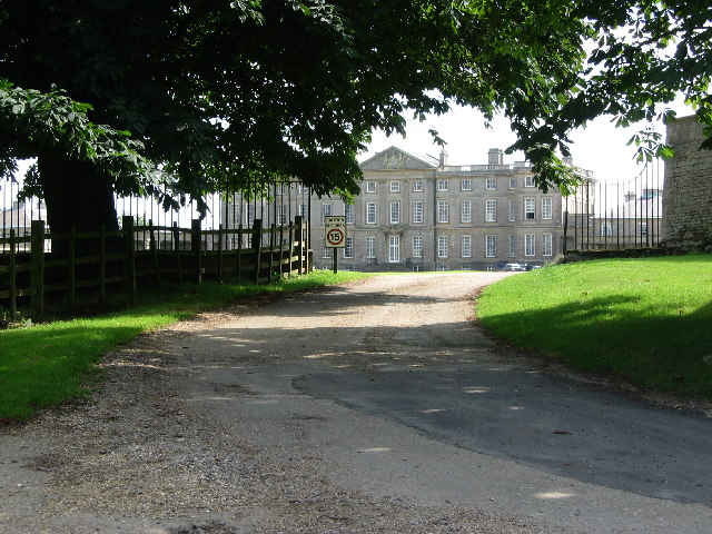
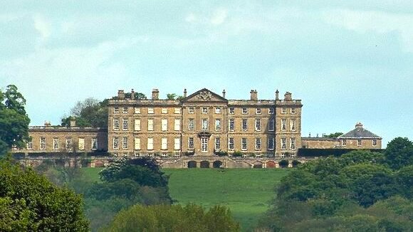
The Park, Burley-on-the-Hill

The Park was a cricket ground situated in the grounds of the mansion of George Finch, 9th Earl of Winchilsea at Burley-on-the-Hill in Rutland. It was used...

HM Prison Ashwell

HM Prison Ashwell was a Category C men's prison located in the parish of Burley, in the county of Rutland, England. The site of the former prison is located...

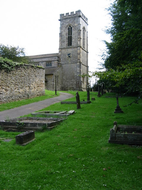
Holy Cross Church, Burley

Holy Cross Church is a redundant Anglican church in the village of Burley, Rutland, England. It is recorded in the National Heritage List for England as...

Rutland Railway Museum

Rutland Railway Museum, now trading as Rocks by Rail: The Living Ironstone Museum, is a heritage railway on part of a former Midland Railway mineral branch...

Oakham Rural District

Oakham was a rural district in Rutland, England from 1894 to 1974, covering the north of the county. The rural district had its origins in the Oakham Rural...

Burley, Rutland

Burley, or Burley-on-the-Hill, is a village and civil parish in the county of Rutland in the East Midlands of England. It is located two miles (3 km)...

Cottesmore Amateurs F.C.

Cottesmore AFC (formerly known as Cottesmore Amateurs FC) is a football club based in Cottesmore, Rutland, England. They are currently members of the Leicestershire...

Nearby Amenities

Located within 500m of 52.698351,-0.69464332
Power: pole
Lat/Long: 52.7004897/-0.6892848
Location Transition: yes
Power: pole
Lat/Long: 52.6993227/-0.6903336
Power: pole
Lat/Long: 52.6987001/-0.6908874
Power: pole
Lat/Long: 52.6978126/-0.6916881
Power: pole
Lat/Long: 52.6969121/-0.6925303
Power: pole
Lat/Long: 52.6960424/-0.6933403
Power: pole
Lat/Long: 52.6954199/-0.6936675
Power: pole
Lat/Long: 52.7022841/-0.6921816
Power: pole
Lat/Long: 52.7014243/-0.6921507
Power: pole
Lat/Long: 52.7006425/-0.6921481
Power: pole
Lat/Long: 52.6996632/-0.6921494
Power: pole
Lat/Long: 52.6990894/-0.6921145
Power: pole
Lat/Long: 52.6984807/-0.6920904
Power: pole
Lat/Long: 52.6977281/-0.6926188
Power: pole
Lat/Long: 52.6970023/-0.6931512
Power: pole
Lat/Long: 52.6961717/-0.6937534
Power: pole
Lat/Long: 52.6954963/-0.6941959
Power: pole
Lat/Long: 52.6948656/-0.69455
Power: pole
Lat/Long: 52.6942641/-0.6954029
Power: pole
Lat/Long: 52.6949127/-0.6946586
Power: pole
Lat/Long: 52.6943616/-0.6955075
Power: pole
Lat/Long: 52.6991748/-0.6894806
Power: pole
Lat/Long: 52.6991553/-0.6881851
Power: pole
Lat/Long: 52.6996136/-0.6912401
Power: pole
Lat/Long: 52.6995145/-0.6896845
Power: pole
Lat/Long: 52.699417/-0.6882468
Power: pole
Lat/Long: 52.6959417/-0.6928092
Power: pole
Lat/Long: 52.6966959/-0.6920636
Power: pole
Lat/Long: 52.6974112/-0.6914091
Power: pole
Lat/Long: 52.6980288/-0.6907386
Power: pole
Lat/Long: 52.6986368/-0.6900895
Location Transition: yes
Power: pole
Lat/Long: 52.7001646/-0.6895691
Power: pole
Lat/Long: 52.6941536/-0.6938285
The data included in this document is from www.openstreetmap.org. The data is made available under ODbL.

Have you been to Brownswell's Covert?

Leave your review of Brownswell's Covert below (or comments, questions and feedback).