Gravel Hanger

Wood, Forest in Surrey Waverley

England

Gravel Hanger

Hindhead Common Pine trees and a clearing near the visitor centre at the Devil's Punch Bowl.
Hindhead Common Credit: Ian Taylor

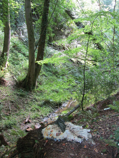
Gravel Hanger is a picturesque woodland area located in Surrey, England. Situated within the larger Surrey Hills Area of Outstanding Natural Beauty, Gravel Hanger is known for its stunning landscapes and diverse flora and fauna.

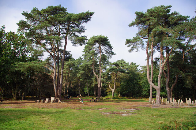
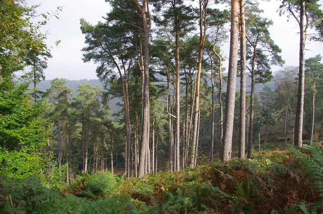
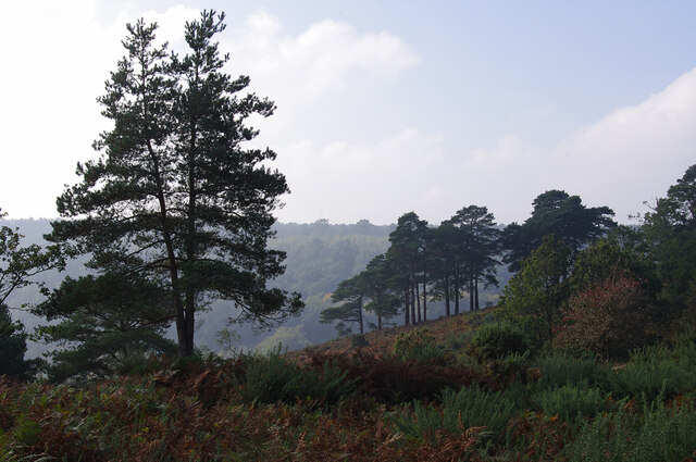
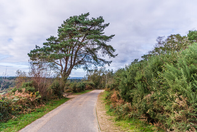
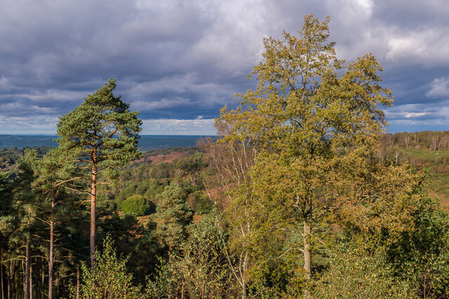
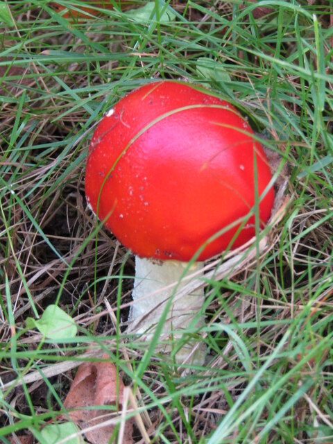
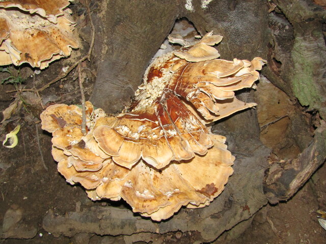
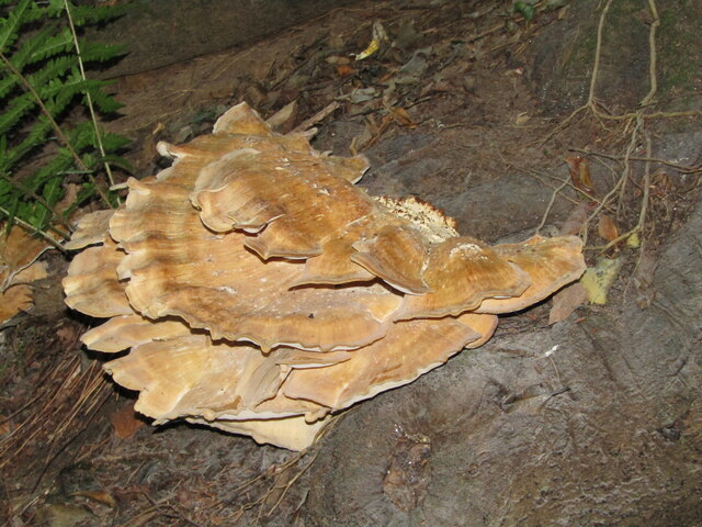
Covering an area of approximately 100 acres, Gravel Hanger is predominantly characterized by dense woodlands, consisting mainly of oak, beech, and chestnut trees. These ancient woodlands provide a haven for a wide variety of wildlife, including deer, badgers, foxes, and numerous bird species. The area is also home to several rare and protected plant species, making it a significant site for conservation efforts.

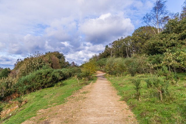
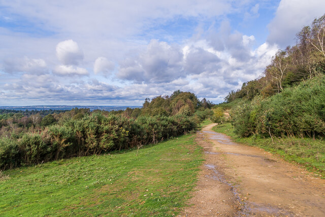
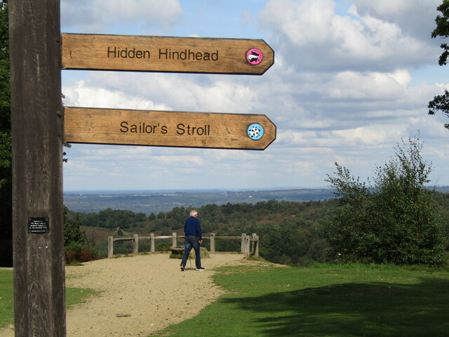
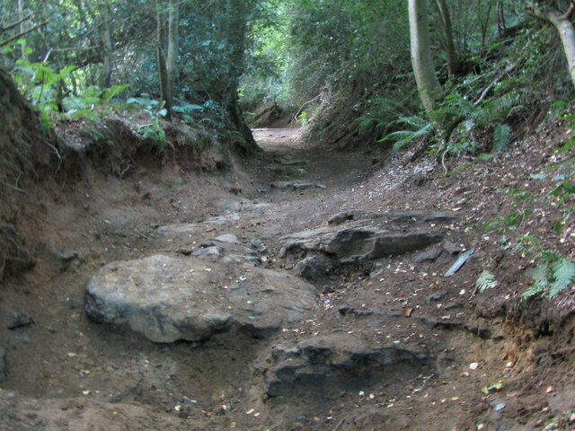
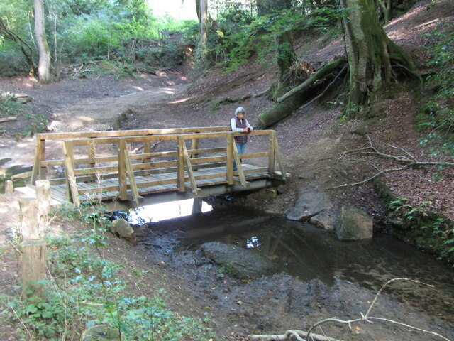
The Wood, Forest, as it is also known, offers numerous walking trails and footpaths, allowing visitors to explore its natural beauty at their own pace. These trails wind through the woods, offering breathtaking views of the surrounding countryside and providing opportunities for birdwatching and nature photography.

Gravel Hanger is a popular destination for outdoor enthusiasts and nature lovers alike. Its peaceful and serene atmosphere provides a welcome escape from the hustle and bustle of everyday life. Whether it's a leisurely stroll through the woods, a picnic in one of the designated areas, or simply enjoying the sounds of nature, Gravel Hanger offers a tranquil and rejuvenating experience for visitors of all ages.

Overall, Gravel Hanger, Surrey (Wood, Forest) is a captivating woodland area that showcases the natural beauty and biodiversity of the Surrey Hills. Its well-preserved woodlands, diverse wildlife, and scenic walking trails make it a must-visit destination for those seeking a peaceful retreat in the heart of nature.

If you have any feedback on the listing, please let us know in the comments section below.

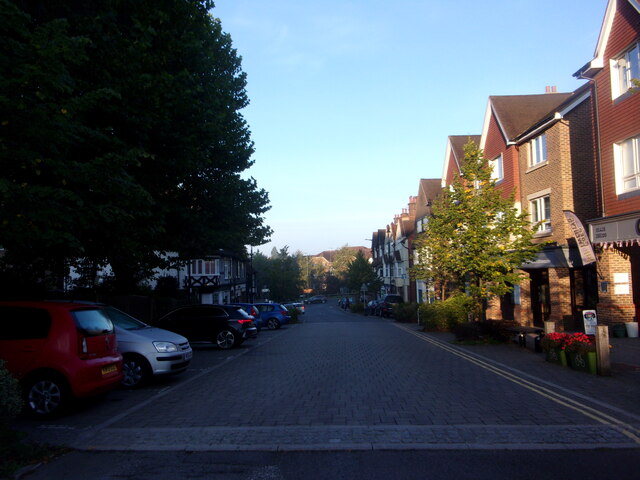
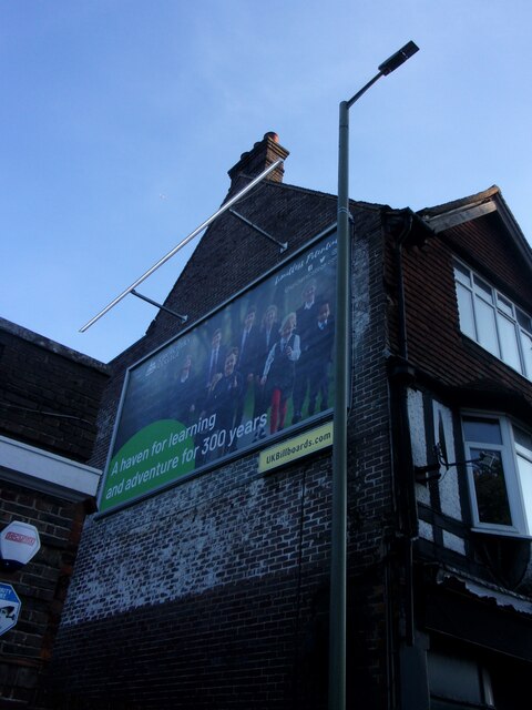
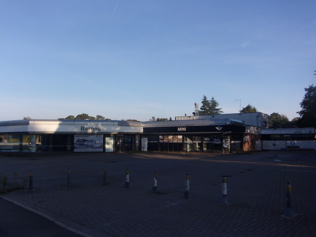
Gravel Hanger Images

Images are sourced within 2km of 51.127133/-0.74222103 or Grid Reference SU8837. Thanks to Geograph Open Source API. All images are credited.

Hindhead Common Pine trees and a clearing near the visitor centre at the Devil's Punch Bowl.
Hindhead Common
Pine trees and a clearing near the visitor centre at the Devil's Punch Bowl.
Devil's Punch Bowl Looking down into the natural bowl.
Devil's Punch Bowl
Looking down into the natural bowl.
Valley at Highcomb Looking across the valley, north of the Devil's Punch Bowl.
Valley at Highcomb
Looking across the valley, north of the Devil's Punch Bowl.
Pitlands Farm Grade II listed building - <span class="nowrap"><a title="https://historicengland.org.uk/listing/the-list/list-entry/1240826" rel="nofollow ugc noopener" href="https://historicengland.org.uk/listing/the-list/list-entry/1240826">Link</a><img style="margin-left:2px;" alt="External link" title="External link - shift click to open in new window" src="https://s1.geograph.org.uk/img/external.png" width="10" height="10"/></span>
Pitlands Farm
Grade II listed building - LinkExternal link
Byway, Devil's Punchbowl Byway above the Devil's Punch Bowl, giving an alternative route for traffic prohibited from using the A3 Hindhead Tunnel.
Byway, Devil's Punchbowl
Byway above the Devil's Punch Bowl, giving an alternative route for traffic prohibited from using the A3 Hindhead Tunnel.
Old A3, Devil's Punch Bowl Part of the route of the former A3 above the Devil's Punch Bowl, restored to nature following the opening of the Hindhead Tunnel in 2011.
Old A3, Devil's Punch Bowl
Part of the route of the former A3 above the Devil's Punch Bowl, restored to nature following the opening of the Hindhead Tunnel in 2011.
Devil's Punch Bowl Looking across the Devil's Punch Bowl.
Devil's Punch Bowl
Looking across the Devil's Punch Bowl.
Looking westwards along London Road Without doubt the biggest event in Hindhead's history was the building of the Hindhead Tunnel, before which this was a notorious bottleneck on the A3. Without doubt the biggest event in the UK was the death of Queen Elizabeth II after 70 years on the throne; although new Prime Minister Liz Truss and her chancellor Kwasi Kwarteng ran it close by introducing a "fiscal event" that saw markets react negatively and wipe out any benefits. On the world stage, Vladimir Putin held spurious referendums in 4 areas he had won from Ukraine, and announced that these would now be part of Russia in perpetuity. The Italians and Swedes chose parties of the right to form their next governments. And in outer space, NASA crashed a spacecraft into an asteroid to see if this could be done if it were ever really needed.
Looking westwards along London Road
Without doubt the biggest event in Hindhead's history was the building of the Hindhead Tunnel, before which this was a notorious bottleneck on the A3. Without doubt the biggest event in the UK was the death of Queen Elizabeth II after 70 years on the throne; although new Prime Minister Liz Truss and her chancellor Kwasi Kwarteng ran it close by introducing a "fiscal event" that saw markets react negatively and wipe out any benefits. On the world stage, Vladimir Putin held spurious referendums in 4 areas he had won from Ukraine, and announced that these would now be part of Russia in perpetuity. The Italians and Swedes chose parties of the right to form their next governments. And in outer space, NASA crashed a spacecraft into an asteroid to see if this could be done if it were ever really needed.
Advertising board in London Road It shows pupils from Churcher's College which celebrates its 300th anniversary this year. Richard Churcher made his fortune with the East India Company.

Every month on the last day, I record the most prominent deaths in the UK and beyond. One death overshadowed all others, that of Her Majesty Queen Elizabeth the Second on the 8th of September at 3:10pm.

Others to depart were: 1st September 2022, boxing legend Earnie Shavers; 2nd September, ASWAD's Drummie Zeb; 6th, armed robber turned author, John McVicar; 8th, Grange Hill's headteacher Mrs McCluskie, actress Gwyneth Powell; 15th, Rugby legend, Eddie Butler; 22nd, Wolf Hall author Hilary Mantel; 23rd the nasty nurse in 'One Flew Over the Cuckoo's Nest' Louise Fletcher; and on the 28th, US Rapper Coolio.
Advertising board in London Road
It shows pupils from Churcher's College which celebrates its 300th anniversary this year. Richard Churcher made his fortune with the East India Company. Every month on the last day, I record the most prominent deaths in the UK and beyond. One death overshadowed all others, that of Her Majesty Queen Elizabeth the Second on the 8th of September at 3:10pm. Others to depart were: 1st September 2022, boxing legend Earnie Shavers; 2nd September, ASWAD's Drummie Zeb; 6th, armed robber turned author, John McVicar; 8th, Grange Hill's headteacher Mrs McCluskie, actress Gwyneth Powell; 15th, Rugby legend, Eddie Butler; 22nd, Wolf Hall author Hilary Mantel; 23rd the nasty nurse in 'One Flew Over the Cuckoo's Nest' Louise Fletcher; and on the 28th, US Rapper Coolio.
Dawn breaks at the old BMW Garage in London Road This month has been mostly pleasant, weather wise. The hot spell promised for early September never materialised. Mostly it was warm and still. Towards the end of the month we caught the tail end of Hurricane Ian. The official Met Office summary is here <span class="nowrap"><a title="https://www.metoffice.gov.uk/binaries/content/assets/metofficegovuk/pdf/weather/learn-about/uk-past-events/summaries/uk_monthly_climate_summary_202209.pdf" rel="nofollow ugc noopener" href="https://www.metoffice.gov.uk/binaries/content/assets/metofficegovuk/pdf/weather/learn-about/uk-past-events/summaries/uk_monthly_climate_summary_202209.pdf">Link</a><img style="margin-left:2px;" alt="External link" title="External link - shift click to open in new window" src="https://s1.geograph.org.uk/img/external.png" width="10" height="10"/></span>
Dawn breaks at the old BMW Garage in London Road
This month has been mostly pleasant, weather wise. The hot spell promised for early September never materialised. Mostly it was warm and still. Towards the end of the month we caught the tail end of Hurricane Ian. The official Met Office summary is here LinkExternal link
Devil's Punch Bowl - Toadstool Red, waxy-looking toadstool, ca 3 inches high, in the grass beside a footpath.
Devil's Punch Bowl - Toadstool
Red, waxy-looking toadstool, ca 3 inches high, in the grass beside a footpath.
Devil's Punch Bowl - Viewpoint New wooden signposts for "Hidden Hindhead" and the "Sailor's Stroll" at the head of this large natural amphitheatre by Hindhead.
Devil's Punch Bowl - Viewpoint
New wooden signposts for "Hidden Hindhead" and the "Sailor's Stroll" at the head of this large natural amphitheatre by Hindhead.
Thursley - Fungus Large bracket fungus ca 1 foot from end to end in woodland close to Ridgeway Farm.
Thursley - Fungus
Large bracket fungus ca 1 foot from end to end in woodland close to Ridgeway Farm.
Thursley - Fungus Large bracket fungus ca 1 foot from end to end in woodland close to Ridgeway Farm.
Thursley - Fungus
Large bracket fungus ca 1 foot from end to end in woodland close to Ridgeway Farm.
Thursley - Byway Ancient and deeply incised trackway with exposed flat rocks in woodland close to Ridgeway Farm.
Thursley - Byway
Ancient and deeply incised trackway with exposed flat rocks in woodland close to Ridgeway Farm.
Thursley - Incised Valley In deciduous woodland south of Vanhurst Copse.
Note the large white splodge of white fungus in the foreground - ca 2 feet from end to end.
Thursley - Incised Valley
In deciduous woodland south of Vanhurst Copse. Note the large white splodge of white fungus in the foreground - ca 2 feet from end to end.
Thursley - Footbridge In deciduous woodland south of Vanhurst Copse. The bridge parallels an old ford.
Thursley - Footbridge
In deciduous woodland south of Vanhurst Copse. The bridge parallels an old ford.
Show me another place!

Gravel Hanger is located at Grid Ref: SU8837 (Lat: 51.127133, Lng: -0.74222103)

Administrative County: Surrey

District: Waverley

Police Authority: Surrey

What 3 Words

///thinker.hologram.reinforce. Near Hindhead, Surrey

Nearby Locations

Hyde Hill Gravel Hanger

Related Wikis

Beacon Hill (Hindhead, Surrey)

Beacon Hill, while ecumenically and administratively part of Hindhead, Surrey, is a discrete settlement with its own history, amenities and character....

Stockstone Quarry

Stockstone Quarry is a 3.9-hectare (9.6-acre) geological Site of Special Scientific Interest south of Farnham in Surrey. It is a Geological Conservation...

Hindhead

Hindhead is a village in the Waverley district of the ceremonial county of Surrey, England. It is the highest village in the county and its buildings are...

Devil's Punch Bowl

The Devil's Punch Bowl is a 282.2-hectare (697-acre) visitor attraction and biological Site of Special Scientific Interest situated just to the east of...

Undershaw

Undershaw is a former residence of the author Sir Arthur Conan Doyle, the creator of Sherlock Holmes. The house was built for Doyle at his order to accommodate...
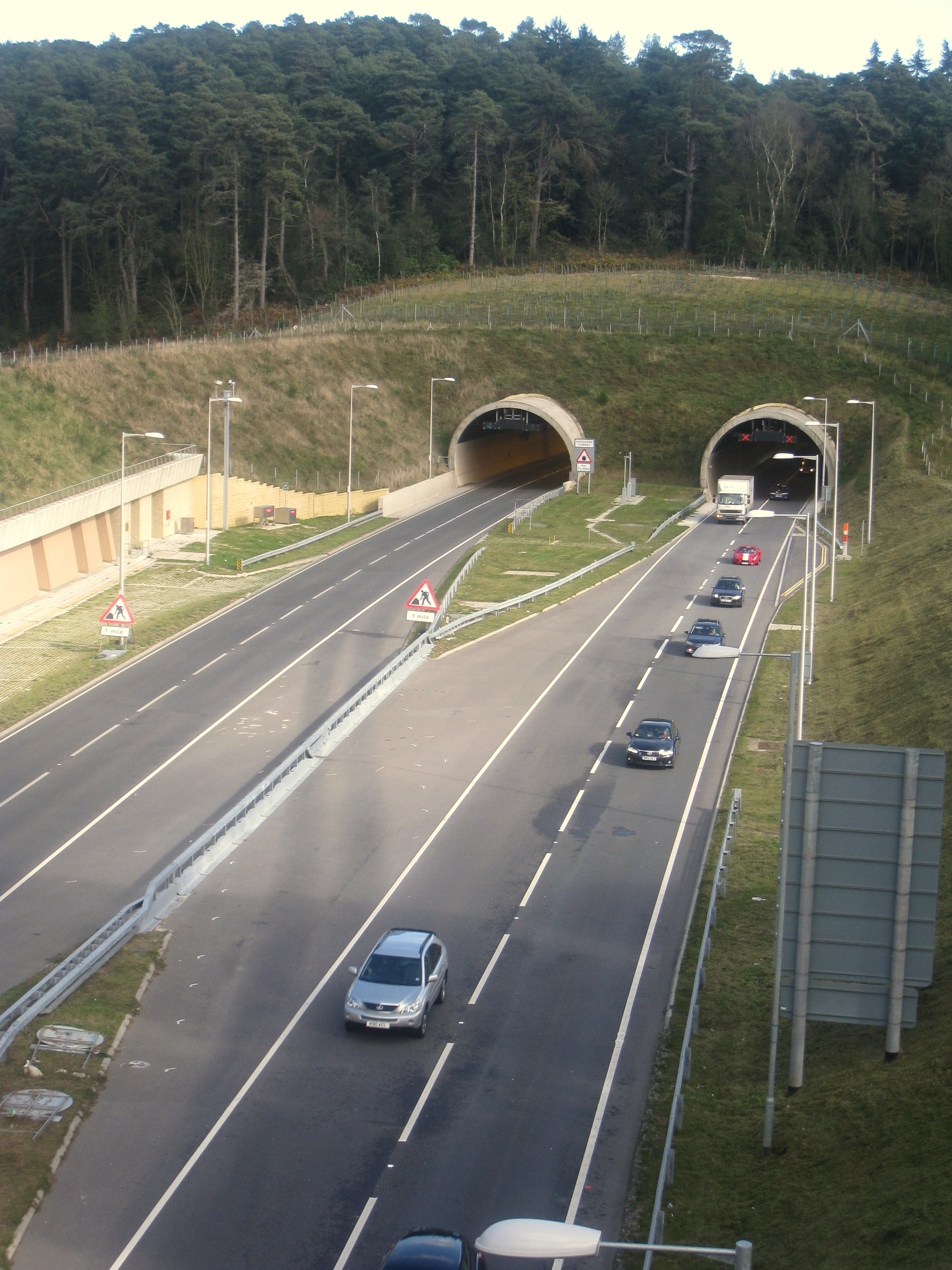
Hindhead Tunnel

The Hindhead Tunnel, opened in 2011, is part of the 4-mile (6.4 km) dual-carriageway that replaced one of the last remaining stretches of single-carriageway...

Grayshott

Grayshott is a village and civil parish in the East Hampshire district of Hampshire, England. It is on the Hampshire / Surrey border 4 miles (6.4 km) northwest...

St Edmund's School, Hindhead

St Edmund's School is a coeducational nursery, pre-prep, preparatory and senior school located in Hindhead, Surrey, around 10.5 miles south-west from the...

Nearby Amenities

Located within 500m of 51.127133,-0.74222103
Parking
Access: private
Source: visual_estimate
Lat/Long: 51.1276201/-0.7466287
Marchants Hill Camp
Description: Operated by PGL
Operator: PGL
Source: survey
Tourism: adventure_holiday
Lat/Long: 51.1265932/-0.7466055
Historic: memorial
Memorial: war_memorial
Source: photo
Lat/Long: 51.1239726/-0.7438511
Post Box
Brand: Royal Mail
Brand Wikidata: Q638098
Collection Plate: CP7D
Collection Times: Mo-Fr 09:00; Sa 07:00
Old Ref: GU26 96
Operator: Royal Mail
Operator Wikidata: Q638098
Post Box Mounting: pier
Post Box Type: lamp
Ref: GU26 96D
Royal Cypher: EIIR
Royal Cypher Wikidata: Q33102113
Source: survey
Survey Date: 2022-09-10
Lat/Long: 51.1239339/-0.7444898
Bus Stop
Downview Close
Bench: no
Bin: no
Lit: no
Naptan AtcoCode: 40004411270A
Naptan Bearing: NE
Naptan CommonName: Downview Close
Naptan Indicator: Just after
Naptan Landmark: Downview Close
Naptan NaptanCode: surdwgmj
Naptan Street: Wood Road
Naptan Verified: no
Shelter: no
Source: naptan_import
Tactile Paving: no
Lat/Long: 51.12358/-0.7449619
Bus Stop
Downview Close
Bench: no
Bin: no
Bus: yes
Lit: no
Naptan AtcoCode: 40004411270B
Naptan Bearing: SW
Naptan CommonName: Downview Close
Naptan Indicator: Just Before
Naptan Landmark: Downview Close
Naptan NaptanCode: surdwgmp
Naptan Street: Wood Road
Naptan Verified: no
Public Transport: platform
Shelter: no
Source: naptan_import
Source 1: survey
Survey Date: 2022-09-10
Tactile Paving: no
Lat/Long: 51.1235794/-0.7449048
Bus Stop
Reeds Corner
Naptan AtcoCode: 40004411276A
Naptan Bearing: SW
Naptan CommonName: Reeds Corner
Naptan Indicator: Just after
Naptan Landmark: Reeds Corner
Naptan NaptanCode: surdwgtd
Naptan Street: Beacon Hill Road
Naptan Verified: no
Shelter: no
Source: naptan_import
Lat/Long: 51.1250137/-0.7478383
Bus Stop
Reeds Corner
Naptan AtcoCode: 40004411276B
Naptan Bearing: NE
Naptan CommonName: Reeds Corner
Naptan Indicator: Just Before
Naptan Landmark: Reeds Corner
Naptan NaptanCode: surdwgtg
Naptan Street: Beacon Hill Road
Naptan Verified: no
Source: naptan_import
Lat/Long: 51.1251297/-0.7477494
Bus Stop
Clovelly Road
Naptan AtcoCode: 40004411277A
Naptan Bearing: SE
Naptan CommonName: Clovelly Road
Naptan Indicator: Just after
Naptan Landmark: Clovelly Road
Naptan NaptanCode: surdwgtj
Naptan Street: Tilford Road
Naptan Verified: no
Source: naptan_import
Lat/Long: 51.1266242/-0.7487522
Gravel Hanger
Place: locality
Source: OS 1:25k
Lat/Long: 51.1283367/-0.7420602
Post Box
Brand: Royal Mail
Brand Wikidata: Q638098
Collection Plate: CP7D
Collection Times: Mo-Fr 09:00; Sa 07:00
Note: This postbox's royal cypher was GR and it was a wall but it is now EIIR and is a brand new EIIR lamp postbox design.
Old Ref: GU26 110
Operator: Royal Mail
Operator Wikidata: Q638098
Post Box Type: lamp
Ref: GU26 110D
Royal Cypher: EIIR
Royal Cypher Wikidata: Q33102113
Source: survey+sas
Source 1: survey
Survey Date: 2022-09-10
Lat/Long: 51.1270419/-0.7492727
Leisure: pitch
Sport: soccer
Lat/Long: 51.1264836/-0.7450305
Power: pole
Lat/Long: 51.1257354/-0.7425709
Power: pole
Lat/Long: 51.1250679/-0.740633
Parking
Access: private
Source: visual_estimate
Lat/Long: 51.12739/-0.7465466
Bench
Backrest: yes
Colour: brown
Material: wood
Source: survey
Survey Date: 2022-09-10
Lat/Long: 51.1235892/-0.7448803
Turning Circle
Lat/Long: 51.1308739/-0.7456179
The data included in this document is from www.openstreetmap.org. The data is made available under ODbL.

Have you been to Gravel Hanger?

Leave your review of Gravel Hanger below (or comments, questions and feedback).