Wold Plantation

Wood, Forest in Yorkshire Ryedale

England

Wold Plantation

Bridge over a disused railway at Wharram Percy
Bridge over a disused railway at Wharram Percy Credit: Sandy Gerrard

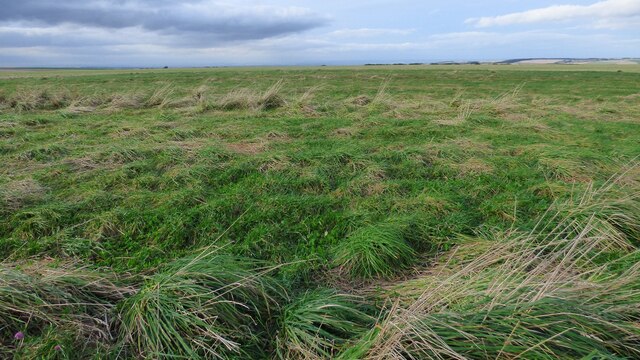
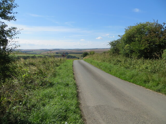
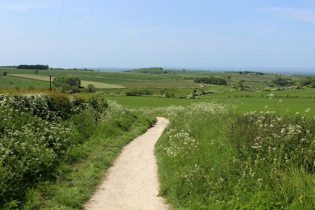
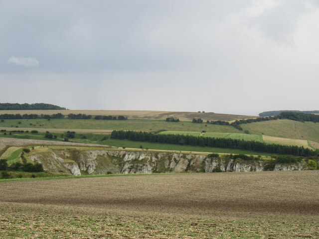
Wold Plantation, located in Yorkshire, England, is a sprawling woodland area renowned for its natural beauty and rich biodiversity. Covering an extensive area of approximately 500 acres, the plantation is nestled within the picturesque Yorkshire Wolds, a range of rolling hills and valleys.

The woodland comprises a variety of tree species, including oak, beech, birch, and ash, creating a diverse and enchanting ecosystem. These towering trees provide a dense canopy, offering a sheltered habitat for an array of wildlife, from small mammals like rabbits and squirrels to larger creatures such as deer and foxes.

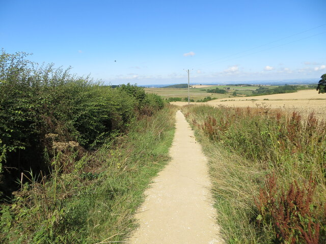
Visitors to Wold Plantation can explore the numerous well-maintained walking trails that crisscross the woodland, providing an opportunity to immerse themselves in nature and witness the beauty of the surrounding countryside. The trails meander through peaceful glades, offering serene spots for picnics or simply to sit and enjoy the tranquil atmosphere.

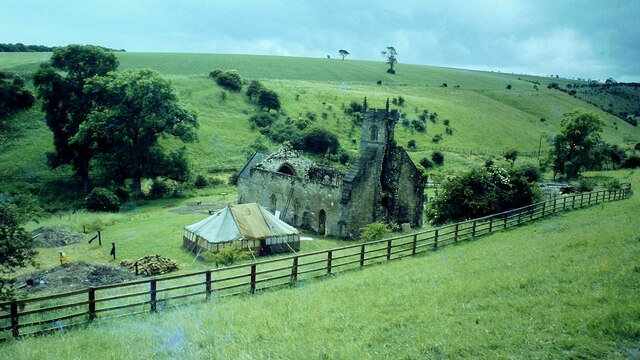
In addition to its natural allure, Wold Plantation also holds historical significance. The area was once part of a medieval hunting forest and still bears remnants of its past, including ancient boundary markers and earthworks. These historical elements add an extra layer of interest to the plantation, attracting both nature enthusiasts and history buffs alike.

Overall, Wold Plantation is a captivating destination that entices visitors with its breathtaking scenery, diverse wildlife, and historical charm. It serves as a haven for those seeking a peaceful retreat in the heart of Yorkshire's stunning countryside.

If you have any feedback on the listing, please let us know in the comments section below.

Wold Plantation Images

Images are sourced within 2km of 54.073075/-0.66659139 or Grid Reference SE8764. Thanks to Geograph Open Source API. All images are credited.

Bridge over a disused railway at Wharram Percy
Archaeological Excavation at Wharram Percy Mill in 1979
St Martin's Church, Wharram Percy in 1979
Tumulus north of William Dale A slight rise in the ground level denotes the position of this severely eroded prehistoric round barrow.
Tumulus north of William Dale
A slight rise in the ground level denotes the position of this severely eroded prehistoric round barrow.
Track through cultivated fields descending towards Wharram le Street Looking north-westward. The track is used by the Yorkshire Wolds Way long Distance Path.
Track through cultivated fields descending towards Wharram le Street
Looking north-westward. The track is used by the Yorkshire Wolds Way long Distance Path.
Footpath giving access to the site of the Medieval Village of Wharram Percy Looking north-westward. The path is also used by the Centenary Way Long Distance Path
Footpath giving access to the site of the Medieval Village of Wharram Percy
Looking north-westward. The path is also used by the Centenary Way Long Distance Path
Minor road descending towards Burdale House Looking south-eastward. This section of the road is used by the Chalklands Way Long Distance Path.
Minor road descending towards Burdale House
Looking south-eastward. This section of the road is used by the Chalklands Way Long Distance Path.
Hawthorn in Blossom on White Hill Very aptly named considering the amount of hawthorn bushes ablaze in white.  Passed on the footpath that leads from Bella Farm to the medieval site of Wharram Percy.
Hawthorn in Blossom on White Hill
Very aptly named considering the amount of hawthorn bushes ablaze in white. Passed on the footpath that leads from Bella Farm to the medieval site of Wharram Percy.
Trackbed of Former Railway at Wharram Percy Part of the former railway that once ran between Malton and Driffield, closed in 1958.
Trackbed of Former Railway at Wharram Percy
Part of the former railway that once ran between Malton and Driffield, closed in 1958.
Footpath leading to Wharram Percy Just under a mile, it leads down over chalk scenery to the deserted medieval village of Wharram Percy
Footpath leading to Wharram Percy
Just under a mile, it leads down over chalk scenery to the deserted medieval village of Wharram Percy
Ruins of St. Martin's Church, Wharram Percy St. Martin's Church evolved through 6 stages between the early 12th and 17th Centuries.
The tower collapsed in 1959, which led to an excavation that revealed two earlier churches.
There is nothing left of the medieval village of Wharram Percy, which was finally deserted in the early 16th Century.
Now under the protection of Historic England, the site has been heavily researched and investigated between the 1950's until recently.
The Wolds Way - now the Yorkshire Wolds Way passes close to the site.
Ruins of St. Martin's Church, Wharram Percy
St. Martin's Church evolved through 6 stages between the early 12th and 17th Centuries. The tower collapsed in 1959, which led to an excavation that revealed two earlier churches. There is nothing left of the medieval village of Wharram Percy, which was finally deserted in the early 16th Century. Now under the protection of Historic England, the site has been heavily researched and investigated between the 1950's until recently. The Wolds Way - now the Yorkshire Wolds Way passes close to the site.
A hedge on Station Road—Two questions? 1. Why is the hedge so wide?
2. Why has it been cut so low and to its full width?
A hedge on Station Road—Two questions?
1. Why is the hedge so wide? 2. Why has it been cut so low and to its full width?
The humps and bumps of the North Manor and ... ... an information board used by the cattle as a rubbing post.
The humps and bumps of the North Manor and ...
... an information board used by the cattle as a rubbing post.
Farm access bridge over former railway
Outside looking in Disused building associated with the former chalk quarry, a site now managed by Yorkshire Wildlife Trust.
Outside looking in
Disused building associated with the former chalk quarry, a site now managed by Yorkshire Wildlife Trust.
Nice neatly mown verge ... ... shame about the overgrown hedge blocking the footpath.
Nice neatly mown verge ...
... shame about the overgrown hedge blocking the footpath.
Trackside building of old railway
Kirk Hill Looking SE towards Burdale Quarry.
Kirk Hill
Looking SE towards Burdale Quarry.
Show me another place!

Wold Plantation is located at Grid Ref: SE8764 (Lat: 54.073075, Lng: -0.66659139)

Division: East Riding

Administrative County: North Yorkshire

District: Ryedale

Police Authority: North Yorkshire

What 3 Words

///elect.whimpered.corner. Near Fimber, East Yorkshire

Nearby Locations

Wold Plantation

Related Wikis

Wharram

Wharram is a civil parish in North Yorkshire, England. It lies on the Yorkshire Wolds, 6 miles (10 km) south-east of Malton. The principal settlement is...

Wharram-le-Street

Wharram-le-Street is a village and former civil parish, now in the parish of Wharram, in North Yorkshire, England. Until the 1974 local government reorganisation...

Wharram railway station

Wharram railway station was opened by the Malton and Driffield Railway in May 1853, serving the village of Wharram-le-Street in North Yorkshire, England...

Wharram Percy

Wharram Percy is a deserted medieval village and former civil parish near Wharram-le-Street, now in the parish of Wharram, on the western edge of the chalk...

Nearby Amenities

Located within 500m of 54.073075,-0.66659139
The data included in this document is from www.openstreetmap.org. The data is made available under ODbL.

Have you been to Wold Plantation?

Leave your review of Wold Plantation below (or comments, questions and feedback).