Aberffrwd

Settlement in Monmouthshire

Wales

Aberffrwd

The King of Prussia, Penpergwm The King of Prussia Public House lies on the southern side of the B4598 in the village of Penpergwm. 
It is shown on the 1881 edition of the Ordnance Survey map.
Like many rural pubs it has suffered from loss of trade and has been closed for years.
It sits in front of a plant hire company who have sought permission to demolish it.
The local council are questioning some details, but it seems its fate is sealed.
The King of Prussia, Penpergwm Credit: Colin Cheesman

Aberffrwd is a small village located in Monmouthshire, Wales. Situated in the southeastern part of the county, it is nestled within the scenic and picturesque Welsh countryside. The village is situated approximately 5 miles north of Abergavenny, one of the larger towns in the area.

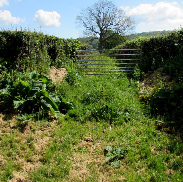
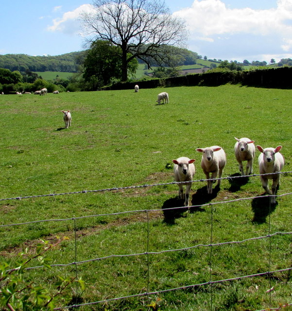
Although Aberffrwd is a small village, its charm lies in its tranquil and idyllic setting. Surrounded by rolling hills, lush green fields, and a meandering river, it offers a peaceful escape from the hustle and bustle of city life. The village is known for its stunning natural beauty, making it a popular destination for outdoor enthusiasts and nature lovers.

Aberffrwd is also home to a tight-knit community, with a small population of residents who take pride in their village. The community spirit is evident through various local events and activities that take place throughout the year, fostering a sense of togetherness among the villagers.

While the village itself does not have many amenities, nearby Abergavenny provides easy access to a range of facilities, including shops, restaurants, and leisure activities. This allows residents of Aberffrwd to enjoy the tranquility of village life while still having access to the conveniences of a larger town.

In summary, Aberffrwd is a charming and peaceful village in Monmouthshire, offering a beautiful natural setting and a close-knit community. It is an ideal place for those seeking a quiet and picturesque retreat, while still having access to nearby amenities.

If you have any feedback on the listing, please let us know in the comments section below.
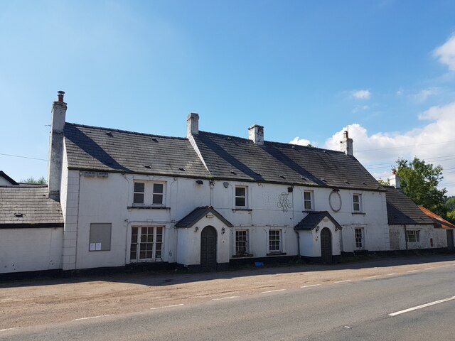
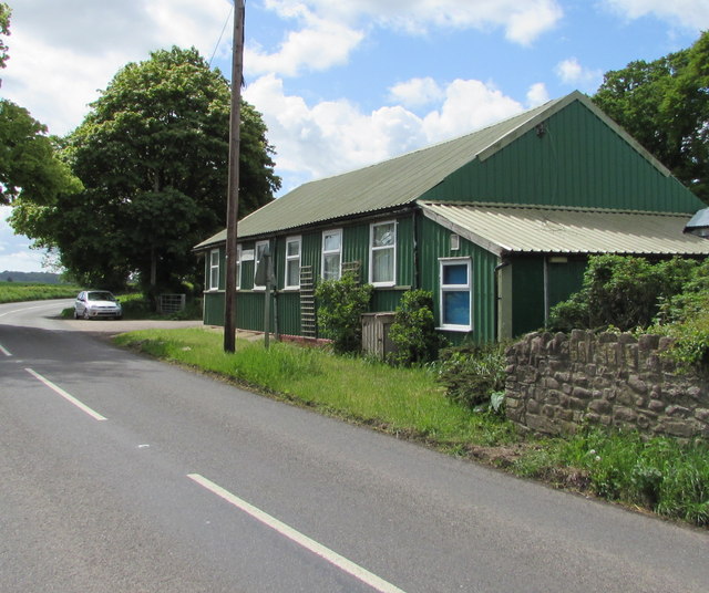
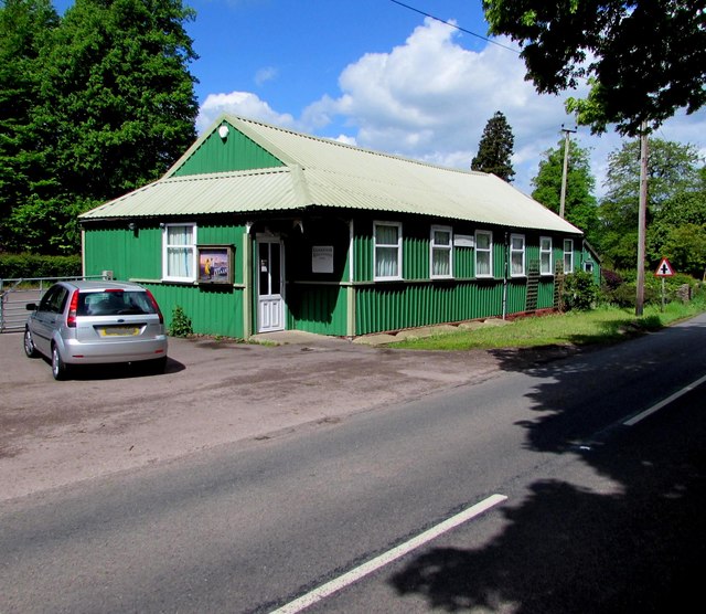
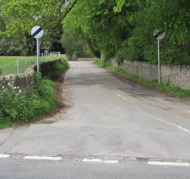
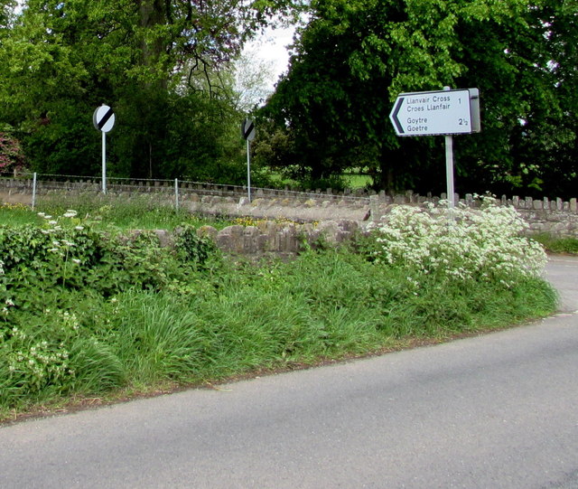
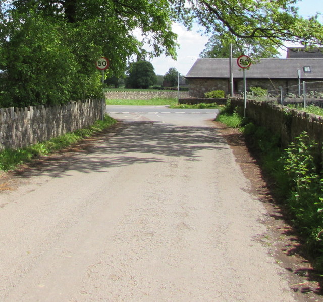
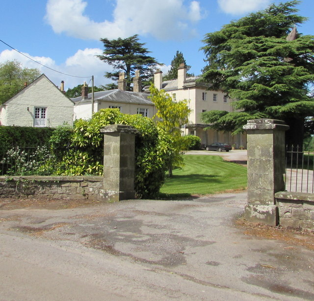
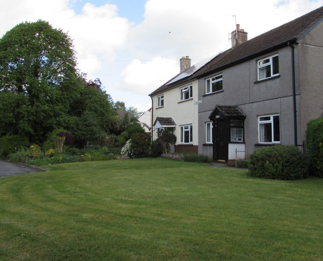
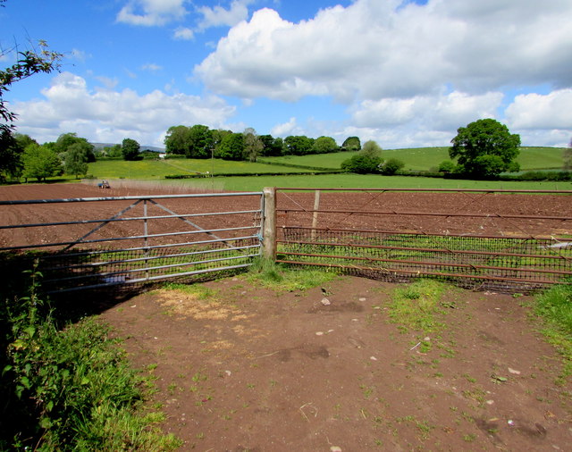
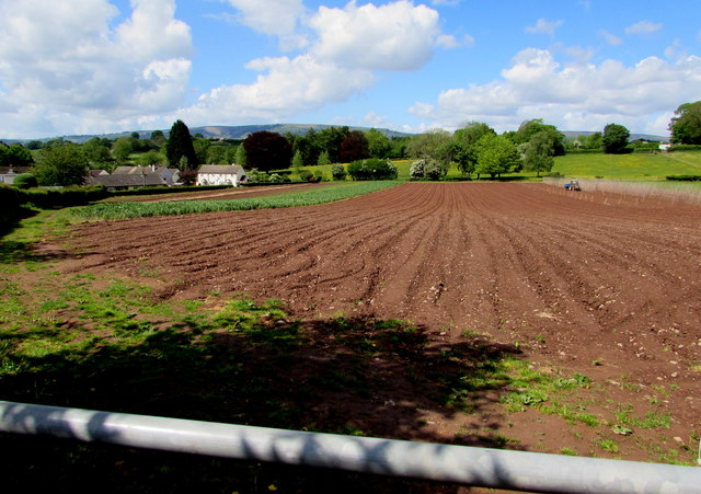
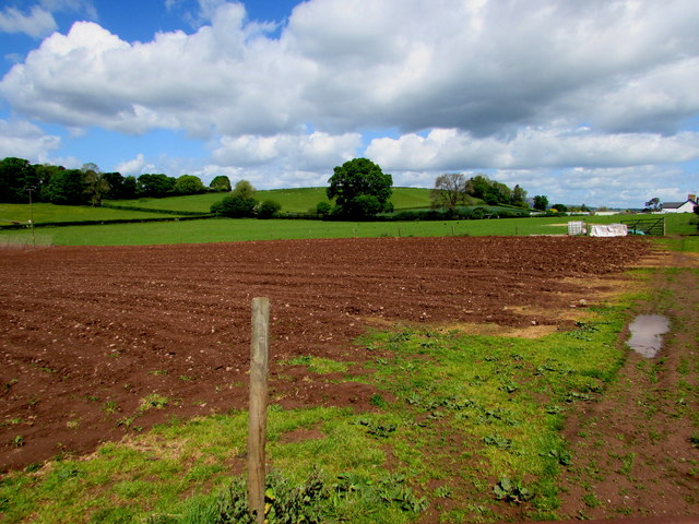
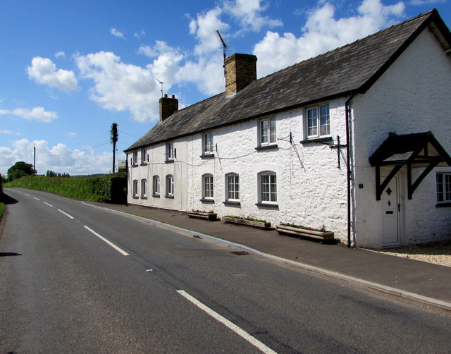
Aberffrwd Images

Images are sourced within 2km of 51.775878/-2.943511 or Grid Reference SO3509. Thanks to Geograph Open Source API. All images are credited.

The King of Prussia, Penpergwm The King of Prussia Public House lies on the southern side of the B4598 in the village of Penpergwm. 
It is shown on the 1881 edition of the Ordnance Survey map.
Like many rural pubs it has suffered from loss of trade and has been closed for years.
It sits in front of a plant hire company who have sought permission to demolish it.
The local council are questioning some details, but it seems its fate is sealed.
The King of Prussia, Penpergwm
The King of Prussia Public House lies on the southern side of the B4598 in the village of Penpergwm. It is shown on the 1881 edition of the Ordnance Survey map. Like many rural pubs it has suffered from loss of trade and has been closed for years. It sits in front of a plant hire company who have sought permission to demolish it. The local council are questioning some details, but it seems its fate is sealed.
Llanfair Kilgeddin Village Hall Corrugated metal building on the west side of the B4598 in rural Monmouthshire between Usk and Abergavenny.
<a title="https://www.geograph.org.uk/photo/5390430" href="https://www.geograph.org.uk/photo/5390430">Link</a> to another view of the hall.
Llanfair Kilgeddin Village Hall
Corrugated metal building on the west side of the B4598 in rural Monmouthshire between Usk and Abergavenny. Link to another view of the hall.
Llanfair Kilgeddin Village Hall Corrugated metal building on the west side of the B4598 in rural Monmouthshire between Usk and Abergavenny.
<a title="https://www.geograph.org.uk/photo/5390425" href="https://www.geograph.org.uk/photo/5390425">Link</a> to another view of the hall.
Llanfair Kilgeddin Village Hall
Corrugated metal building on the west side of the B4598 in rural Monmouthshire between Usk and Abergavenny. Link to another view of the hall.
Minor road west from Llanfair Kilgeddin, Monmouthshire Viewed across the B4598. A nearby sign <a title="https://www.geograph.org.uk/photo/5390440" href="https://www.geograph.org.uk/photo/5390440">Link</a> pointing this way shows Llanvair Cross 1 (mile), Goytre 2½.
The 50mph speed limit increases to the National Speed Limit ahead.
Minor road west from Llanfair Kilgeddin, Monmouthshire
Viewed across the B4598. A nearby sign Link pointing this way shows Llanvair Cross 1 (mile), Goytre 2½. The 50mph speed limit increases to the National Speed Limit ahead.
Direction and distances sign, Llanfair Kilgeddin, Monmouthshire Facing northbound traffic on the B4598 on the corner of this <a title="https://www.geograph.org.uk/photo/5390433" href="https://www.geograph.org.uk/photo/5390433">Link</a> minor road junction.
Direction and distances sign, Llanfair Kilgeddin, Monmouthshire
Facing northbound traffic on the B4598 on the corner of this Link minor road junction.
End of the National Speed Limit, Llanfair Kilgeddin, Monmouthshire The National Speed Limit on the minor road from Llanvair Cross
and Goytre drops to 50mph on the approach to the B4598 junction.
End of the National Speed Limit, Llanfair Kilgeddin, Monmouthshire
The National Speed Limit on the minor road from Llanvair Cross and Goytre drops to 50mph on the approach to the B4598 junction.
Grade II Listed Pant-y-Goitre House, Llanfair Kilgeddin, Monmouthshire Built in c1726 with later major changes. Grade II listed in 1956.
Grade II Listed Pant-y-Goitre House, Llanfair Kilgeddin, Monmouthshire
Built in c1726 with later major changes. Grade II listed in 1956.
Gethin Place houses, Llanfair Kilgeddin, Monmouthshire The name sign on the wall of the two semi-detached houses shows GETHIN PLACE.
Gethin Place houses, Llanfair Kilgeddin, Monmouthshire
The name sign on the wall of the two semi-detached houses shows GETHIN PLACE.
Llanvair Kilgeddin boundary sign, Monmouthshire The boundary sign is alongside the B4598. 
Llanvair Kilgeddin is a small village between Usk and Abergavenny. 
The village is also Llanfair Kilgeddin in English and Llanfair Cilgedin in Welsh.
Llanvair Kilgeddin boundary sign, Monmouthshire
The boundary sign is alongside the B4598. Llanvair Kilgeddin is a small village between Usk and Abergavenny. The village is also Llanfair Kilgeddin in English and Llanfair Cilgedin in Welsh.
Glanusk Farm access road, Llanfair Kilgeddin, Monmouthshire From the east side of the B4598.
Glanusk Farm access road, Llanfair Kilgeddin, Monmouthshire
From the east side of the B4598.
From 40 to 50 on the B4598, Llanfair Kilgeddin, Monmouthshire The 40mph speed limit on the B4598 near the main residential part of the village increases to 50mph ahead.
From 40 to 50 on the B4598, Llanfair Kilgeddin, Monmouthshire
The 40mph speed limit on the B4598 near the main residential part of the village increases to 50mph ahead.
From 50 to 40 on the B4598, Llanfair Kilgeddin, Monmouthshire The 50mph speed limit on the B4598 drops to 40mph on the approach to the main residential part of the village. The village boundary sign <a title="https://www.geograph.org.uk/photo/5394601" href="https://www.geograph.org.uk/photo/5394601">Link</a> is in the background.
From 50 to 40 on the B4598, Llanfair Kilgeddin, Monmouthshire
The 50mph speed limit on the B4598 drops to 40mph on the approach to the main residential part of the village. The village boundary sign Link is in the background.
Two field gates, Llanfair Kilgeddin, Monmouthshire On the west side of the B4598 in rural Monmouthshire.
Two field gates, Llanfair Kilgeddin, Monmouthshire
On the west side of the B4598 in rural Monmouthshire.
Mostly brown field, Llanfair Kilgeddin, Monmouthshire Viewed from the gate on the left here <a title="https://www.geograph.org.uk/photo/5394623" href="https://www.geograph.org.uk/photo/5394623">Link</a> in mid May 2017.
Mostly brown field, Llanfair Kilgeddin, Monmouthshire
Viewed from the gate on the left here Link in mid May 2017.
Brown field and green fields,  Llanfair Kilgeddin, Monmouthshire Viewed from the gate on the right here <a title="https://www.geograph.org.uk/photo/5394623" href="https://www.geograph.org.uk/photo/5394623">Link</a> in mid May 2017.
Brown field and green fields, Llanfair Kilgeddin, Monmouthshire
Viewed from the gate on the right here Link in mid May 2017.
Cherry Tree Cottages, Llanfair Kilgeddin  Semi-detached cottages alongside the B4598.
Cherry Tree Cottages, Llanfair Kilgeddin
Semi-detached cottages alongside the B4598.
7-bar gate across a track to Glanusk Farm, Llanfair Kilgeddin, Monmouthshire The track is on the east side of the B4598, opposite Cherry Tree Cottages. <a title="https://www.geograph.org.uk/photo/5394656" href="https://www.geograph.org.uk/photo/5394656">Link</a>
The untrodden mid May 2017 vegetation shows that this track has been little used recently.
7-bar gate across a track to Glanusk Farm, Llanfair Kilgeddin, Monmouthshire
The track is on the east side of the B4598, opposite Cherry Tree Cottages. Link The untrodden mid May 2017 vegetation shows that this track has been little used recently.
Inquisitive sheep, Llanfair Kilgeddin, Monmouthshire In a field on the east side of the B4598.
Inquisitive sheep, Llanfair Kilgeddin, Monmouthshire
In a field on the east side of the B4598.
Show me another place!

Aberffrwd is located at Grid Ref: SO3509 (Lat: 51.775878, Lng: -2.943511)

Unitary Authority: Monmouthshire

Police Authority: Gwent

What 3 Words

///alongside.piglets.archduke. Near Llanarth, Monmouthshire

Related Wikis

Pant-y-Goitre Bridge

Pant-y-Goitre Bridge crosses the River Usk between Abergavenny and Usk near the village of Llanfair Kilgeddin. The bridge carries the B4598. It was constructed...

St Michael's Church, Llanvihangel Gobion

The Church of St Michael, Llanvihangel Gobion, Monmouthshire is a parish church with datable origins to the 15th century. There is no record of a Victorian...

Llanvihangel Gobion

Llanfihangel Gobion (Welsh: Llanfihangel-y-gofion) is a village and rural parish of Monmouthshire, Wales, lying within the administrative community of...

Church of St Mary the Virgin, Llanfair Kilgeddin

St Mary the Virgin is the former parish church for Llanfair Kilgeddin, near Usk in Monmouthshire, south east Wales. It is a Grade I listed building, notable...

Aberffrwd, Monmouthshire

Aberffrwd is a village in Monmouthshire, Wales. It lies above the River Usk just off the A40 between Llanvihangel Gobion and Clytha. The population of...

Llansantffraed, Monmouthshire

Llansantffraed is the smallest parish in Monmouthshire, Wales, located four miles to the west of Raglan, north of the A40 between Raglan and Abergavenny...

St Bride's Church, Llansantffraed

The Church of St Bride (or St Bridget) in Llansantffraed near Raglan, Monmouthshire, Wales, is a parish church of Norman origins. The church was restored...

Great House, Llanarth

Great House, Llanarth, Monmouthshire is a farmhouse dating from the late-16th century. Extended in the mid-17th century and little altered thereafter,...

Nearby Amenities

Located within 500m of 51.775878,-2.943511
Llanvihangel Gobion
Place: hamlet
Wikidata: Q6661854
Lat/Long: 51.7795793/-2.9465718
Power: pole
Lat/Long: 51.778496/-2.9482416
Barrier: stile
Source: survey;gps
Lat/Long: 51.7754013/-2.9462886
Direction: 190
Generator Method: photovoltaic
Generator Output Electricity: yes
Generator Solar Modules: 5
Generator Source: solar
Generator Type: solar_photovoltaic_panel
Location: roof
Power: generator
Lat/Long: 51.7764688/-2.9498103
Direction: 190
Generator Method: photovoltaic
Generator Output Electricity: yes
Generator Solar Modules: 7
Generator Source: solar
Generator Type: solar_photovoltaic_panel
Location: roof
Power: generator
Lat/Long: 51.7764821/-2.9499713
Barrier: kissing_gate
Source: survey;gps
Lat/Long: 51.7752419/-2.9474122
The data included in this document is from www.openstreetmap.org. The data is made available under ODbL.

Have you been to Aberffrwd?

Leave your review of Aberffrwd below (or comments, questions and feedback).