Farclose Plantation

Wood, Forest in Yorkshire

England

Farclose Plantation

Track to Wold House Farm
Track to Wold House Farm Credit: David Brown

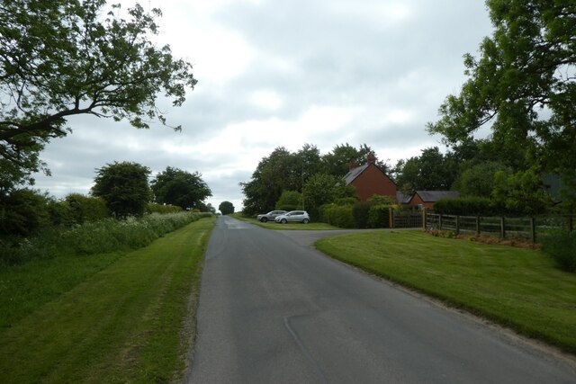
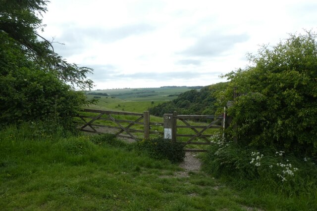
Farclose Plantation is a picturesque woodland located in Yorkshire, England. Nestled within the sprawling countryside, this enchanting forest is a sight to behold. Covering an area of approximately 100 acres, it is a haven for nature enthusiasts and outdoor lovers.

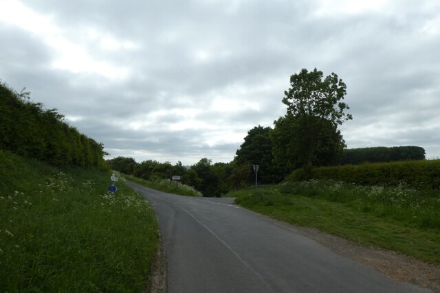
The woodland comprises a diverse range of trees, including oak, birch, beech, and pine. Their lush green foliage creates a serene ambiance, providing a refreshing escape from the hustle and bustle of daily life. A network of well-maintained trails weaves through the plantation, offering visitors an opportunity to explore its beauty.

Farclose Plantation is home to a rich variety of wildlife, making it a popular spot for animal enthusiasts. Birdwatchers can spot numerous species, such as woodpeckers, owls, and songbirds, while keen-eyed visitors may even catch a glimpse of deer, foxes, or rabbits roaming freely.

In addition to its natural beauty, Farclose Plantation offers various recreational activities. The forest is equipped with picnic areas, allowing families and friends to enjoy a leisurely lunch amidst the stunning backdrop. Adventure seekers can also partake in hiking, mountain biking, or horseback riding along the well-marked trails.

The plantation is easily accessible, with ample parking available for visitors. It is open year-round, allowing visitors to witness the changing seasons and experience the woodland's unique charm during each time of the year.

Farclose Plantation is a true gem in Yorkshire, offering a tranquil retreat for those seeking solace in nature's embrace.

If you have any feedback on the listing, please let us know in the comments section below.

Farclose Plantation Images

Images are sourced within 2km of 53.994929/-0.68692205 or Grid Reference SE8656. Thanks to Geograph Open Source API. All images are credited.

Track to Wold House Farm
Sunset near Greenwick Farm Looking into the setting sun in the Wolds.
Sunset near Greenwick Farm
Looking into the setting sun in the Wolds.
Passing Mill Farm Looking along Pocklington Lane to the west of Huggate.
Passing Mill Farm
Looking along Pocklington Lane to the west of Huggate.
Pocklington Lane Looking towards the junction for the road via Millington to the right and the road via Cobdale to the left.
Pocklington Lane
Looking towards the junction for the road via Millington to the right and the road via Cobdale to the left.
Bridleway above Pasture Dale Looking towards a gate to access the bridleway above Pasture Dale heading towards Millington.
Bridleway above Pasture Dale
Looking towards a gate to access the bridleway above Pasture Dale heading towards Millington.
Path descending from Huggate Looking along the path leading towards Glebe Farm.
Path descending from Huggate
Looking along the path leading towards Glebe Farm.
Lane towards Church Street Looking along the lane from Glebe Farm near Huggate.
Lane towards Church Street
Looking along the lane from Glebe Farm near Huggate.
Lane and footpath near Glebe Farm The footpath heads along the left side of the hedge.
Lane and footpath near Glebe Farm
The footpath heads along the left side of the hedge.
Footpath near Glebe Farm Looking along a path leading to Church Street in Huggate.
Footpath near Glebe Farm
Looking along a path leading to Church Street in Huggate.
Sunset near Glebe Farm Looking across the chalky farmland near Huggate.
Sunset near Glebe Farm
Looking across the chalky farmland near Huggate.
Field near Glebe Farm Looking across the chalky farmland.
Field near Glebe Farm
Looking across the chalky farmland.
Fields above Horse Dale Looking across the chalky farmland near Huggate.
Fields above Horse Dale
Looking across the chalky farmland near Huggate.
Sunset near York Lane Looking along a footpath towards York Lane as the sun is setting.
Sunset near York Lane
Looking along a footpath towards York Lane as the sun is setting.
Footpath from York Lane The footpath leads through to Pocklington Lane.
Footpath from York Lane
The footpath leads through to Pocklington Lane.
Track on Huggate Pasture Looking across farmland from a footpath between York Lane and Pocklington Lane.
Track on Huggate Pasture
Looking across farmland from a footpath between York Lane and Pocklington Lane.
Huggate Pasture in the setting sun Looking across the chalky farmland.
Huggate Pasture in the setting sun
Looking across the chalky farmland.
Bridleway to York Lane Looking along a path between Pocklington Lane and York Lane.
Bridleway to York Lane
Looking along a path between Pocklington Lane and York Lane.
Bridleway to Pocklington Lane Looking along a path from York Lane to Pocklington Lane.
Bridleway to Pocklington Lane
Looking along a path from York Lane to Pocklington Lane.
Show me another place!

Farclose Plantation is located at Grid Ref: SE8656 (Lat: 53.994929, Lng: -0.68692205)

Division: East Riding

Unitary Authority: East Riding of Yorkshire

Police Authority: Humberside

What 3 Words

///struck.balance.thudding. Near Fimber, East Yorkshire

Related Wikis

Huggate

Huggate is a village and civil parish in the East Riding of Yorkshire, England. It is situated approximately 13 miles (21 km) north-west of Beverley town...

Fridaythorpe

Fridaythorpe is a village and civil parish in the East Riding of Yorkshire, England. It is situated approximately 8 miles (13 km) north-east of Pocklington...

Bishop Wilton Wold

Bishop Wilton Wold is the highest point of the Yorkshire Wolds in the East Riding of Yorkshire, England. The summit, known as Garrowby Hill, lies about...

Painsthorpe

Painsthorpe is a hamlet in the East Riding of Yorkshire, England. It is located about 1 mile (1.6 km) east of the village of Kirby Underdale, the area...

Nearby Amenities

Located within 500m of 53.994929,-0.68692205
Information: route_marker
Tourism: information
Lat/Long: 53.9958654/-0.6801277
Information: route_marker
Note: I'm not conveinced this is still here
Tourism: information
Lat/Long: 53.9940892/-0.6796903
Note: Signed as bridleway at north and as public footpath at east.
Lat/Long: 53.9940632/-0.6800859
The data included in this document is from www.openstreetmap.org. The data is made available under ODbL.

Have you been to Farclose Plantation?

Leave your review of Farclose Plantation below (or comments, questions and feedback).