Cooper's Plantation

Wood, Forest in Leicestershire Melton

England

Cooper's Plantation

The Salt Way at Three Queens Three Queens is the name of the wood to the right of the road. It sits at the corner of the crossing of two ancient routes: the Salt Way (this road), and Sewstern Lane (crossing left to right at the start of the bend).
"The name Three Queens is said to refer to the burial barrows of three queens of the Bronze Age." <span class="nowrap"><a title="http://local-history.org.uk/waltham/pages/local-history/croxton-park-abbey/" rel="nofollow ugc noopener" href="http://local-history.org.uk/waltham/pages/local-history/croxton-park-abbey/">Link</a><img style="margin-left:2px;" alt="External link" title="External link - shift click to open in new window" src="https://s1.geograph.org.uk/img/external.png" width="10" height="10"/></span>. Several barrows have certainly been recorded here (Leicestershire historic environment record MLE3559 <span class="nowrap"><a title="https://www.heritagegateway.org.uk/Gateway/Results_Single.aspx?uid=MLE3559&resourceID=1021" rel="nofollow ugc noopener" href="https://www.heritagegateway.org.uk/Gateway/Results_Single.aspx?uid=MLE3559&resourceID=1021">Link</a><img style="margin-left:2px;" alt="External link" title="External link - shift click to open in new window" src="https://s1.geograph.org.uk/img/external.png" width="10" height="10"/></span> ), one containing the skeleton of a woman.
<span class="nowrap"><a title="https://www.bottesfordhistory.org.uk/content/about/read-it-hear-not-forgetting/not-forgetting-chapter-9-getting-about-in-the-past" rel="nofollow ugc noopener" href="https://www.bottesfordhistory.org.uk/content/about/read-it-hear-not-forgetting/not-forgetting-chapter-9-getting-about-in-the-past">Link</a><img style="margin-left:2px;" alt="External link" title="External link - shift click to open in new window" src="https://s1.geograph.org.uk/img/external.png" width="10" height="10"/></span> states "Here stood an 18th Century hostelry “of ill repute”, The Three Queens, frequented by cattle drovers and perhaps footpads. The inn eventually closed when the ancient trackways were replaced by newer roads, and there is nothing at the site now except a muddy track crossing a minor road."
The Salt Way at Three Queens Credit: Tim Heaton

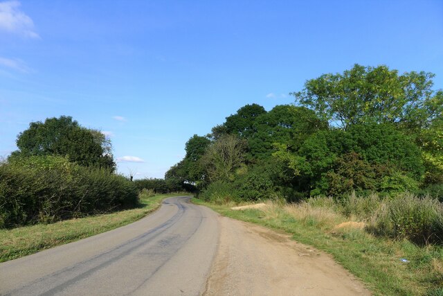
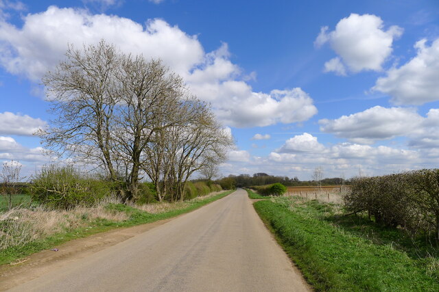
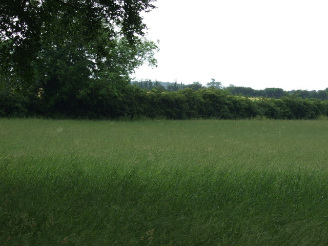
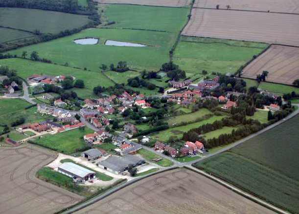
Cooper's Plantation is a picturesque woodland area located in Leicestershire, England. With its dense canopy of trees and vibrant undergrowth, it is a haven for nature enthusiasts and outdoor lovers alike. Covering an expansive area of land, the plantation is a true gem nestled within the heart of the county.

The woodland is named after the Cooper family, who owned and managed the plantation for several generations. It is believed that the family initially acquired the land in the early 19th century, and since then, it has been carefully preserved and developed into the beautiful woodland it is today.

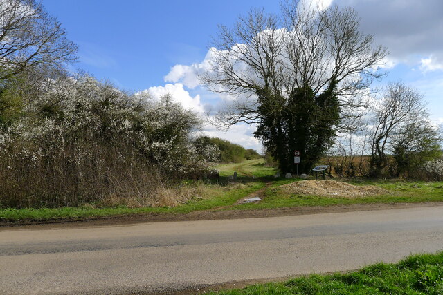
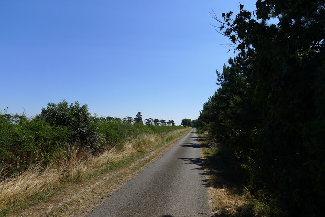
Cooper's Plantation boasts a diverse range of tree species, including oak, ash, beech, and birch. This rich variety creates a unique and vibrant ecosystem, supporting a wide array of flora and fauna. The forest floor is adorned with a carpet of wildflowers, while birdsong fills the air, making it a truly enchanting place to explore.

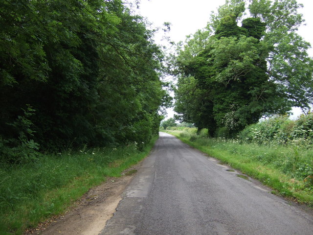
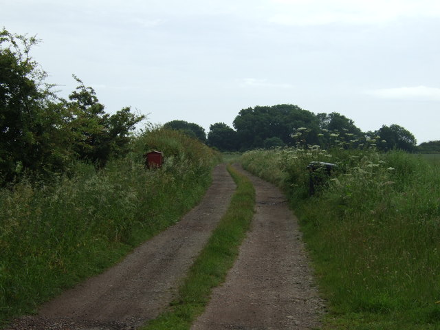
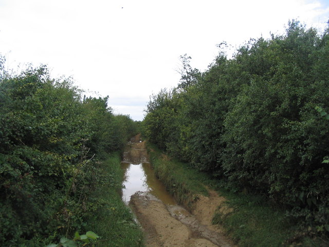
The plantation offers a network of well-maintained walking trails, allowing visitors to immerse themselves in the natural beauty of the woodland. Whether one prefers a leisurely stroll or a more challenging hike, there are options to suit all abilities. These trails wind through the woodland, offering glimpses of native wildlife such as deer, squirrels, and various bird species.

Cooper's Plantation is not only a haven for biodiversity but also a place of tranquility and serenity. With its peaceful atmosphere and stunning natural surroundings, it provides a welcome respite from the hustle and bustle of everyday life. It is an ideal destination for nature lovers seeking solace and a closer connection with the great outdoors.

If you have any feedback on the listing, please let us know in the comments section below.

Cooper's Plantation Images

Images are sourced within 2km of 52.843585/-0.72424923 or Grid Reference SK8628. Thanks to Geograph Open Source API. All images are credited.

The Salt Way at Three Queens Three Queens is the name of the wood to the right of the road. It sits at the corner of the crossing of two ancient routes: the Salt Way (this road), and Sewstern Lane (crossing left to right at the start of the bend).
"The name Three Queens is said to refer to the burial barrows of three queens of the Bronze Age." <span class="nowrap"><a title="http://local-history.org.uk/waltham/pages/local-history/croxton-park-abbey/" rel="nofollow ugc noopener" href="http://local-history.org.uk/waltham/pages/local-history/croxton-park-abbey/">Link</a><img style="margin-left:2px;" alt="External link" title="External link - shift click to open in new window" src="https://s1.geograph.org.uk/img/external.png" width="10" height="10"/></span>. Several barrows have certainly been recorded here (Leicestershire historic environment record MLE3559 <span class="nowrap"><a title="https://www.heritagegateway.org.uk/Gateway/Results_Single.aspx?uid=MLE3559&resourceID=1021" rel="nofollow ugc noopener" href="https://www.heritagegateway.org.uk/Gateway/Results_Single.aspx?uid=MLE3559&resourceID=1021">Link</a><img style="margin-left:2px;" alt="External link" title="External link - shift click to open in new window" src="https://s1.geograph.org.uk/img/external.png" width="10" height="10"/></span> ), one containing the skeleton of a woman.
<span class="nowrap"><a title="https://www.bottesfordhistory.org.uk/content/about/read-it-hear-not-forgetting/not-forgetting-chapter-9-getting-about-in-the-past" rel="nofollow ugc noopener" href="https://www.bottesfordhistory.org.uk/content/about/read-it-hear-not-forgetting/not-forgetting-chapter-9-getting-about-in-the-past">Link</a><img style="margin-left:2px;" alt="External link" title="External link - shift click to open in new window" src="https://s1.geograph.org.uk/img/external.png" width="10" height="10"/></span> states "Here stood an 18th Century hostelry “of ill repute”, The Three Queens, frequented by cattle drovers and perhaps footpads. The inn eventually closed when the ancient trackways were replaced by newer roads, and there is nothing at the site now except a muddy track crossing a minor road."
The Salt Way at Three Queens
Three Queens is the name of the wood to the right of the road. It sits at the corner of the crossing of two ancient routes: the Salt Way (this road), and Sewstern Lane (crossing left to right at the start of the bend). "The name Three Queens is said to refer to the burial barrows of three queens of the Bronze Age." LinkExternal link. Several barrows have certainly been recorded here (Leicestershire historic environment record MLE3559 LinkExternal link ), one containing the skeleton of a woman. LinkExternal link states "Here stood an 18th Century hostelry “of ill repute”, The Three Queens, frequented by cattle drovers and perhaps footpads. The inn eventually closed when the ancient trackways were replaced by newer roads, and there is nothing at the site now except a muddy track crossing a minor road."
Pinus nigra ssp. laricio These are Corsican Pine, growing in the garden of what used to be the school.

Although at first sight they are sturdy specimens, in fact they are infected with a disease called Red Band Needle Blight - caused by the fungus Dothistroma septosporum.  My correspondent says they are predicted for felling to prevent the spread of the disease, that can affect several species of Pinus.
Pinus nigra ssp. laricio
These are Corsican Pine, growing in the garden of what used to be the school. Although at first sight they are sturdy specimens, in fact they are infected with a disease called Red Band Needle Blight - caused by the fungus Dothistroma septosporum. My correspondent says they are predicted for felling to prevent the spread of the disease, that can affect several species of Pinus.
St Peter's Church - the celebrant's view Taken from behind the altarof this grade II* listed church (<span class="nowrap"><a title="https://historicengland.org.uk/listing/the-list/list-entry/1074988" rel="nofollow ugc noopener" href="https://historicengland.org.uk/listing/the-list/list-entry/1074988">Link</a><img style="margin-left:2px;" alt="External link" title="External link - shift click to open in new window" src="https://s1.geograph.org.uk/img/external.png" width="10" height="10"/></span> )
St Peter's Church - the celebrant's view
Taken from behind the altarof this grade II* listed church (LinkExternal link )
St Peter's Church - Nave and Chancel Arch
St Peter's Church - the roof St Peter's church at Saltby is a grade II* listed parish church with a C13 west tower, early C14 nave and chancel which were reworked in the C15 and the chancel was further remodelled during the 1885 restoration.  

The church is built of Ironstone with limestone dressings and the parapets hide roofs that are lead.  The tower is built in 3 stages with a late C14 belfry stage and a Perpendicular gabled south porch with double chamfered entrance arch.  There is a blocked north nave door and a blocked north door in the chancel to the east of an organ chamber with no organ.  

The font is a plain C13 drum font on a hexagonal stem and the bench sedilia and piscina are dated around 1885.
St Peter's Church - the roof
St Peter's church at Saltby is a grade II* listed parish church with a C13 west tower, early C14 nave and chancel which were reworked in the C15 and the chancel was further remodelled during the 1885 restoration. The church is built of Ironstone with limestone dressings and the parapets hide roofs that are lead. The tower is built in 3 stages with a late C14 belfry stage and a Perpendicular gabled south porch with double chamfered entrance arch. There is a blocked north nave door and a blocked north door in the chancel to the east of an organ chamber with no organ. The font is a plain C13 drum font on a hexagonal stem and the bench sedilia and piscina are dated around 1885.
Main Street Main street in Saltby is dominated by these Corsican Pines, which look splendid but there is a shadow over them.  See <a href="https://www.geograph.org.uk/photo/7060237">SK8526 : Pinus nigra ssp. laricio</a>.
Main Street
Main street in Saltby is dominated by these Corsican Pines, which look splendid but there is a shadow over them. See SK8526 : Pinus nigra ssp. laricio.
Village sign
Village sign
St Peter's Church - Name board St Peter's church at Saltby is a grade II* listed parish church with a C13 west tower, early C14 nave and chancel which were reworked in the C15 and the chancel was further remodelled during the 1885 restoration.  

The church is built of Ironstone with limestone dressings and the parapets hide roofs that are lead.  The tower is built in 3 stages with a late C14 belfry stage and a Perpendicular gabled south porch with double chamfered entrance arch.  There is a blocked north nave door and a blocked north door in the chancel to the east of an organ chamber with no organ.  

The font is a plain C13 drum font on a hexagonal stem and the bench sedilia and piscina are dated around 1885.
St Peter's Church - Name board
St Peter's church at Saltby is a grade II* listed parish church with a C13 west tower, early C14 nave and chancel which were reworked in the C15 and the chancel was further remodelled during the 1885 restoration. The church is built of Ironstone with limestone dressings and the parapets hide roofs that are lead. The tower is built in 3 stages with a late C14 belfry stage and a Perpendicular gabled south porch with double chamfered entrance arch. There is a blocked north nave door and a blocked north door in the chancel to the east of an organ chamber with no organ. The font is a plain C13 drum font on a hexagonal stem and the bench sedilia and piscina are dated around 1885.
Fingerpost A 4-way fingerpost in Saltby.
Fingerpost
A 4-way fingerpost in Saltby.
St Peter's Church, Saltby This is a grade II* listed church - see <span class="nowrap"><a title="https://historicengland.org.uk/listing/the-list/list-entry/1074988" rel="nofollow ugc noopener" href="https://historicengland.org.uk/listing/the-list/list-entry/1074988">Link</a><img style="margin-left:2px;" alt="External link" title="External link - shift click to open in new window" src="https://s1.geograph.org.uk/img/external.png" width="10" height="10"/></span>
St Peter's Church, Saltby
This is a grade II* listed church - see LinkExternal link
Gorse Lane east of Croxton Kerrial Part of the Salt Way, and a former Roman road along the top of the Lincolnshire Limestone ridge south of Grantham.
The name 'Gorse Lane' seems to be applied by local residents and businesses to the whole stretch of this road, from its junctions with the A607 in the west to the B1174 in the east. On OS and Google maps the name only appears on the eastern-most section of the road.
Gorse Lane east of Croxton Kerrial
Part of the Salt Way, and a former Roman road along the top of the Lincolnshire Limestone ridge south of Grantham. The name 'Gorse Lane' seems to be applied by local residents and businesses to the whole stretch of this road, from its junctions with the A607 in the west to the B1174 in the east. On OS and Google maps the name only appears on the eastern-most section of the road.
Sewstern Lane crossing the Salt Way at Three Queens Three Queens is the name of the wood on the left. It sits at the corner of the crossing of two ancient routes: Sewstern Lane (crossing straight ahead) and the Salt Way (road). The area around the wood contains several Bronze Age burial mounds (barrows); and the name 'Three Queens' may derive from these - because when one of the mounds was excavated, it was found to contain the skeleton of a woman. <span class="nowrap"><a title="https://heritage-explorer.lincolnshire.gov.uk/Monument/MLI33941" rel="nofollow ugc noopener" href="https://heritage-explorer.lincolnshire.gov.uk/Monument/MLI33941">Link</a><img style="margin-left:2px;" alt="External link" title="External link - shift click to open in new window" src="https://s1.geograph.org.uk/img/external.png" width="10" height="10"/></span>
<span class="nowrap"><a title="https://www.bottesfordhistory.org.uk/content/about/read-it-hear-not-forgetting/not-forgetting-chapter-9-getting-about-in-the-past" rel="nofollow ugc noopener" href="https://www.bottesfordhistory.org.uk/content/about/read-it-hear-not-forgetting/not-forgetting-chapter-9-getting-about-in-the-past">Link</a><img style="margin-left:2px;" alt="External link" title="External link - shift click to open in new window" src="https://s1.geograph.org.uk/img/external.png" width="10" height="10"/></span> states "Here stood an 18th Century hostelry "of ill repute", The Three Queens, frequented by cattle drovers and perhaps footpads. The inn eventually closed when the ancient trackways were replaced by newer roads, and there is nothing at the site now except a muddy track crossing a minor road."
Sewstern Lane crossing the Salt Way at Three Queens
Three Queens is the name of the wood on the left. It sits at the corner of the crossing of two ancient routes: Sewstern Lane (crossing straight ahead) and the Salt Way (road). The area around the wood contains several Bronze Age burial mounds (barrows); and the name 'Three Queens' may derive from these - because when one of the mounds was excavated, it was found to contain the skeleton of a woman. LinkExternal link LinkExternal link states "Here stood an 18th Century hostelry "of ill repute", The Three Queens, frequented by cattle drovers and perhaps footpads. The inn eventually closed when the ancient trackways were replaced by newer roads, and there is nothing at the site now except a muddy track crossing a minor road."
Road south-east of Croxton Kerrial A very quiet, narrow lane. Cooper's Plantation, and the far end, contains part of King Lud's Intrenchments
Road south-east of Croxton Kerrial
A very quiet, narrow lane. Cooper's Plantation, and the far end, contains part of King Lud's Intrenchments
Farmland near Croxton Kerrial Hedgeline and wheat crop near Croxton Kerrial
Farmland near Croxton Kerrial
Hedgeline and wheat crop near Croxton Kerrial
Farmland near Croxton Kerrial
Farmland near Three Queens
Lane towards Croxton Kerrial
Track towards Tipping's Lodge
Show me another place!

Cooper's Plantation is located at Grid Ref: SK8628 (Lat: 52.843585, Lng: -0.72424923)

Administrative County: Leicestershire

District: Melton

Police Authority: Leicestershire

What 3 Words

///balancing.blackmail.teachers. Near Colsterworth, Lincolnshire

Nearby Locations

Cooper's Plantation

Related Wikis

King Lud's Entrenchments and The Drift

King Lud's Entrenchments and The Drift is a 23.9 hectares (59 acres) biological Site of Special Scientific Interest which straddles the border between...

Saltby

Saltby is a village and former civil parish, now in the parish of Sproxton, in the Melton borough of Leicestershire, England. It lies close to the River...

RAF Saltby

Royal Air Force Saltby or more simply RAF Saltby is a former Royal Air Force station located near Saltby, Leicestershire, England The following units were...

Buckminster Gliding Club

The Buckminster Gliding Club (BGC) is a gliding club based at Saltby Airfield on the Leicestershire / Lincolnshire border, England. It is affiliated with...

Have you been to Cooper's Plantation?

Leave your review of Cooper's Plantation below (or comments, questions and feedback).