Links, East

Settlement in East Lothian

Scotland

Links, East

Milsey Bay Bass Rock can be seen in the distance to the east.
Milsey Bay Credit: Gary Rogers

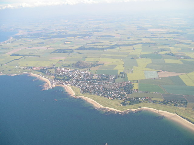
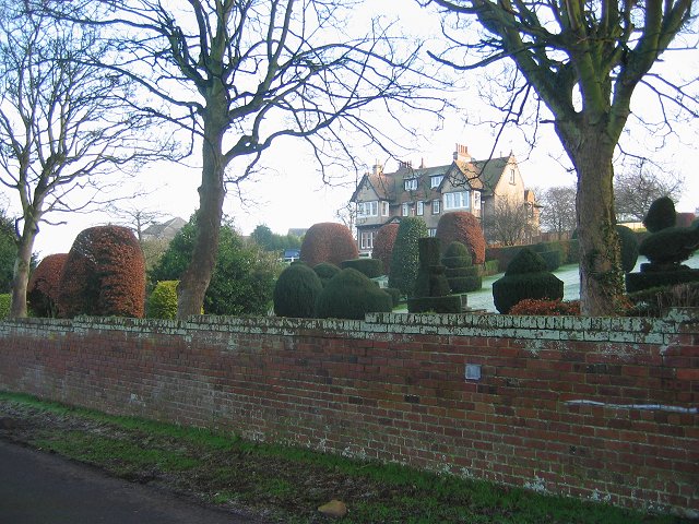
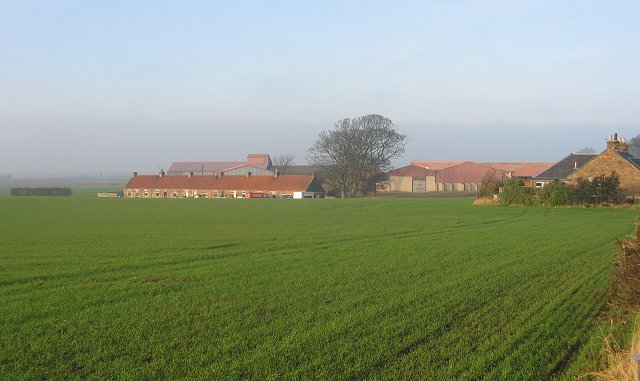
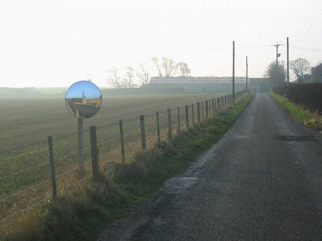
Links, East, East Lothian is a small coastal town located in the southeastern part of Scotland. Situated in the historic county of East Lothian, this town is known for its picturesque views, charming atmosphere, and its close proximity to the North Sea.

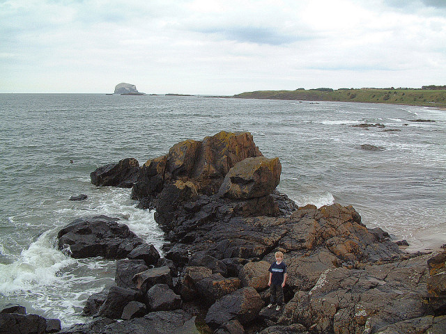
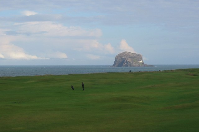
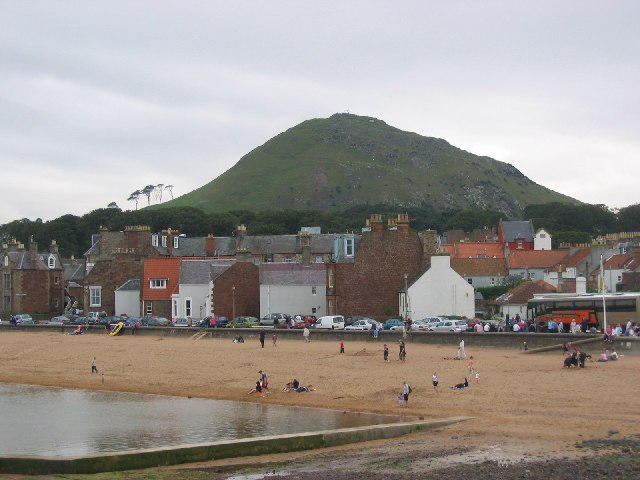
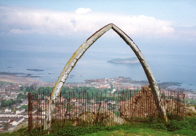
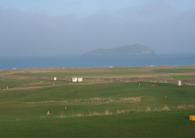
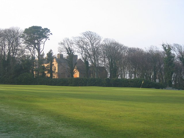
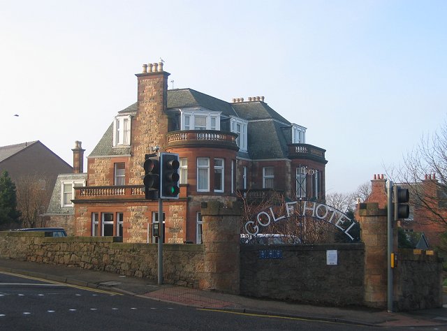
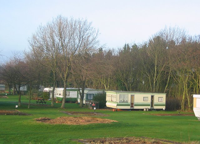
The town is set on the coast, making it a popular destination for beachgoers and outdoor enthusiasts. The Links, a large expanse of green space, offers a beautiful area for recreation and leisure activities. It is also home to a renowned golf course, attracting golfers from near and far. The stunning coastal walks along the cliffs provide breathtaking views of the sea, and birdwatchers can enjoy spotting a variety of seabirds in their natural habitat.

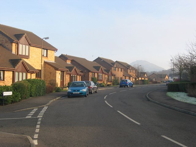
With a population of around 2,500 people, Links, East is a close-knit community that boasts a range of amenities. The town has a few local shops, cafes, and restaurants, providing residents and visitors with essential services and a taste of local cuisine.

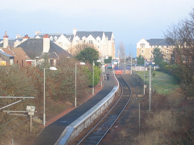
Links, East is well-connected to nearby towns and cities through a reliable transportation network. The town is easily accessible by road, and there are regular bus services connecting it to the surrounding areas. Edinburgh, the capital of Scotland, is just a short drive away, offering residents easy access to a wider range of amenities and attractions.

In summary, Links, East, East Lothian is a charming coastal town that offers beautiful scenery, outdoor activities, and a close-knit community. It is an ideal destination for those seeking a peaceful and picturesque place to live or visit.

If you have any feedback on the listing, please let us know in the comments section below.

Links, East Images

Images are sourced within 2km of 56.055726/-2.7241334 or Grid Reference NT5585. Thanks to Geograph Open Source API. All images are credited.

Milsey Bay Bass Rock can be seen in the distance to the east.
Milsey Bay
Bass Rock can be seen in the distance to the east.
Golf, Rugged Knowes. Its East Lothian, so a golf course in not far away, in this case it is The Glen. Bass Rock beyond.
Golf, Rugged Knowes.
Its East Lothian, so a golf course in not far away, in this case it is The Glen. Bass Rock beyond.
Beach, North Berwick. Taken from The Seabird Centre, one of North Berwick's beaches and The Law.
Beach, North Berwick.
Taken from The Seabird Centre, one of North Berwick's beaches and The Law.
North Berwick Law 'Summit' of North Berwick Law with whale jawbone (removed in 2005).  There has been a jawbone on the Law for approx 300 years until now. The building is an old watch house dating back to the Napoleonic Wars.
North Berwick Law
'Summit' of North Berwick Law with whale jawbone (removed in 2005). There has been a jawbone on the Law for approx 300 years until now. The building is an old watch house dating back to the Napoleonic Wars.
Summit of North Berwick Law These Jawbones were for many years a prominent feature of the summit but I believe they have recently fallen over and are awaiting being put back in place. The summit also has buildings dating from the second world war when the hill was a lookout for boats on the Firth of Forth and also the remains of an old fort. The view is north over the town of North Berwick to the island of Craigleith.
Summit of North Berwick Law
These Jawbones were for many years a prominent feature of the summit but I believe they have recently fallen over and are awaiting being put back in place. The summit also has buildings dating from the second world war when the hill was a lookout for boats on the Firth of Forth and also the remains of an old fort. The view is north over the town of North Berwick to the island of Craigleith.
North Berwick and East Fortune Taken from a microlight at about 6000 ft
North Berwick and East Fortune
Taken from a microlight at about 6000 ft
Ferrygate Newly ploughed sandy soil, looking south. There is a new small woodland to the right.
Ferrygate
Newly ploughed sandy soil, looking south. There is a new small woodland to the right.
West Links. With Craigleith offshore.
West Links.
With Craigleith offshore.
Carlekemp. Big house across the West Links. Formerly the preparatory school for St Augustus Abbey.
Carlekemp.
Big house across the West Links. Formerly the preparatory school for St Augustus Abbey.
Golf Hotel, North Berwick Amongst a lot of big houses on the road into North Berwick from the west.
Golf Hotel, North Berwick
Amongst a lot of big houses on the road into North Berwick from the west.
New houses, North Berwick. North Berwick, with its surviving railway link is one of the most expensive places to live in Scotland.
New houses, North Berwick.
North Berwick, with its surviving railway link is one of the most expensive places to live in Scotland.
North Berwick The railway station, with a frequent service to Edinburgh. There have been many attempts at closure, but now ex intercity trains are sometimes used because of the number of passengers.
North Berwick
The railway station, with a frequent service to Edinburgh. There have been many attempts at closure, but now ex intercity trains are sometimes used because of the number of passengers.
Large house, North Berwick. A lot of Edinburgh money headed this way about 100 years ago, thanks to the railway. There are many houses like this one.
Large house, North Berwick.
A lot of Edinburgh money headed this way about 100 years ago, thanks to the railway. There are many houses like this one.
Gilsland. Part of an enormous caravan site on the edge of North Berwick.
Gilsland.
Part of an enormous caravan site on the edge of North Berwick.
Straight road, Newhouse. View east to North Berwick Law. Note the cloud forming on the summit from the northeast wind carrying moist air off the North Sea.
Straight road, Newhouse.
View east to North Berwick Law. Note the cloud forming on the summit from the northeast wind carrying moist air off the North Sea.
Stubble, Newhouse. Spring sown barley is the most popular arable crop in Scotland. Fortunately this means stubble and ploughed fields in winter, and good bird populations. 
East Lothian has much arable land, by contrast there are now just two dairy farms in the county.
Stubble, Newhouse.
Spring sown barley is the most popular arable crop in Scotland. Fortunately this means stubble and ploughed fields in winter, and good bird populations. East Lothian has much arable land, by contrast there are now just two dairy farms in the county.
Newhouse. A row of cottages that once housed the workers on the farm in front of the farm.
Newhouse.
A row of cottages that once housed the workers on the farm in front of the farm.
Newhouse. Looking west, and a little of east.
Newhouse.
Looking west, and a little of east.
Show me another place!

Links, East is located at Grid Ref: NT5585 (Lat: 56.055726, Lng: -2.7241334)

Unitary Authority: East Lothian

Police Authority: The Lothians and Scottish Borders

What 3 Words

///clotting.politics.sprinkler. Near North Berwick, East Lothian

Related Wikis

Edington Cottage Hospital

Edington Cottage Hospital is a hospital located in 54 St Baldred's Road, North Berwick, East Lothian. It is managed by NHS Lothian. == History == The hospital...

North Berwick High School

North Berwick High School is a non-denominational state secondary school in North Berwick, East Lothian, Scotland. == See also == People educated at North...

North Berwick railway station

North Berwick railway station is a railway station serving the seaside town of North Berwick in East Lothian, Scotland. It is the terminus of the Edinburgh...
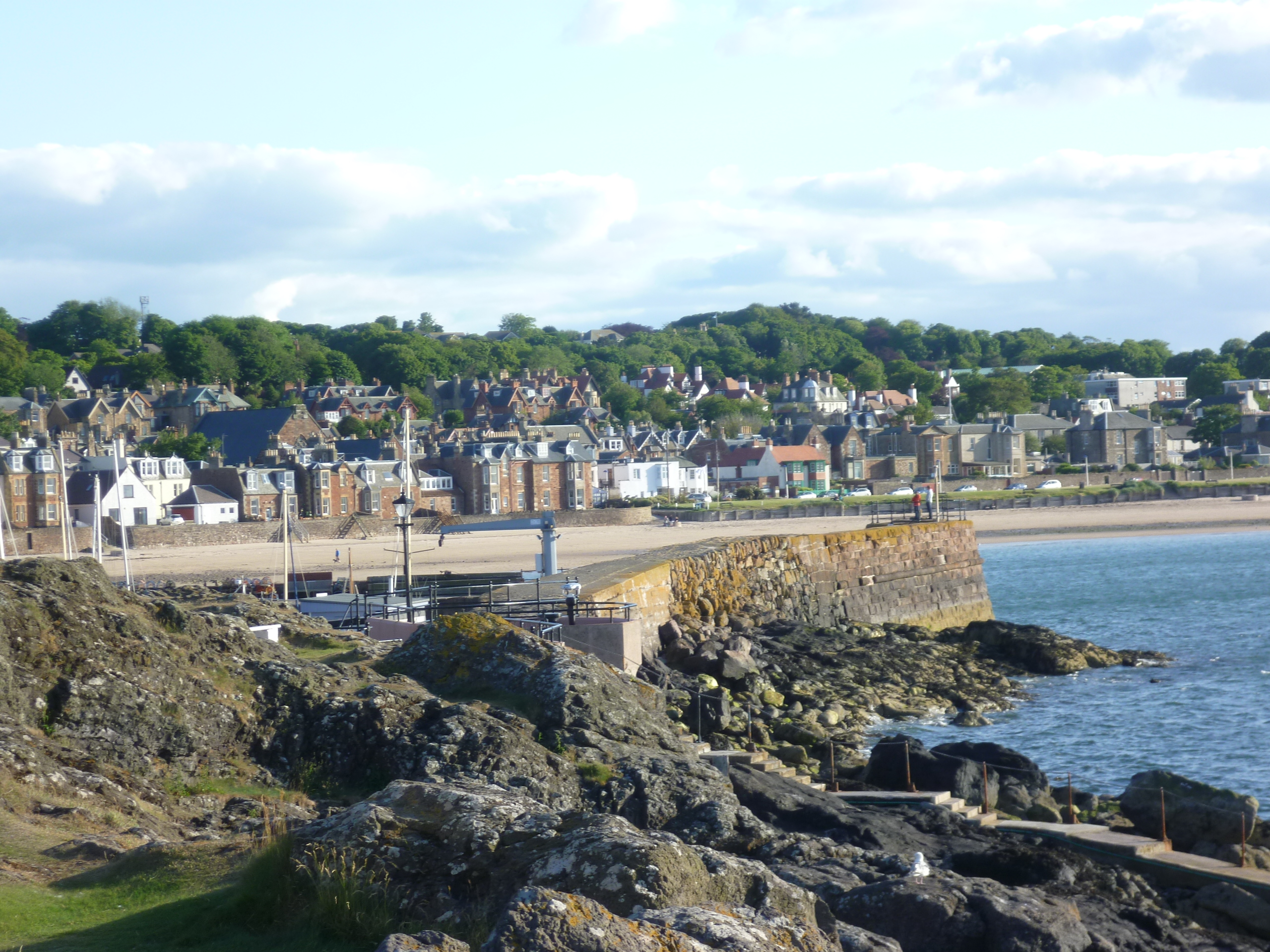
North Berwick

North Berwick (; Scottish Gaelic: Bearaig a Tuath) is a seaside town and former royal burgh in East Lothian, Scotland. It is situated on the south shore...

Related Videos

NORTH BERWICK Lodge & Grounds Walking Tour

Welcome to this walking tour of the beautiful Lodge Gardens in North Berwick, Scotland! Join me as I explore this picturesque spot ...

Hiking North Berwick Law - Stunning views of Scotland

Join me as I climb North Berwick Law - a 650ft hill in East Lothian, Scotland. The views from the top are stunning. North Berwick is ...

NORTH BERWICK, SCOTLAND 🏴󠁧󠁢󠁳󠁣󠁴󠁿.A Walking Tour🚶‍♀️of the most Beautiful Seaside Town. 4K HDR

A virtual walking tour of one the most beautiful seaside towns in Scotland 󠁧󠁢󠁳󠁣󠁴󠁿. Explore the gorgeous sandy beaches, ...

Beautiful NORTH BERWICK - Gorgeous Beaches, Steampunk Coffee and Chips - Walking Tour

Join me for a trip to beautiful North Berwick to check out its beautiful beaches, shops cafes and restaurants. I'll take you to the ...

Nearby Amenities

Located within 500m of 56.055726,-2.7241334
Traffic Signals
Lat/Long: 56.0582449/-2.7301347
North Berwick
Alt Name Sco: North Berrick
Is In: East Lothian, Scotland, UK
Name Gd: Bearaig-a-Tuath
Name Sco: Northbarrick
Place: town
Population: 6605
Wikidata: Q1012054
Wikipedia: en:North Berwick
Lat/Long: 56.0581178/-2.7209129
Crossing
Crossing: traffic_signals
Crossing Island: no
Tactile Paving: yes
Lat/Long: 56.0574834/-2.7287864
Traffic Signals
Traffic Signals: signal
Lat/Long: 56.0552969/-2.7195358
Bus Stop
Beach Road
Bench: no
Bin: no
Lit: no
Naptan AtcoCode: 627007010330
Naptan Bearing: E
Naptan CommonName: Putting Green
Naptan Indicator: opposite West End Place
Naptan NaptanCode: 58232643
Naptan Street: Beach Road
Naptan Verified: no
Note: name corrected from survey; position verified
Public Transport: platform
Shelter: yes
Source: naptan_import; survey
Tactile Paving: no
Lat/Long: 56.0587198/-2.7255147
Bus Stop
King's Knoll
Bus: yes
Naptan AtcoCode: 627007010360
Naptan Bearing: SE
Naptan CommonName: King's Knoll
Naptan Indicator: at
Naptan NaptanCode: 58234528
Naptan Street: Clifford Road
Naptan Verified: no
Public Transport: platform
Source: naptan_import
Lat/Long: 56.0555055/-2.7240802
Bus Stop
Railway Station
Bus: yes
Naptan AtcoCode: 627007010390
Naptan Bearing: E
Naptan CommonName: Railway Station
Naptan Indicator: near Railway Station
Naptan NaptanCode: 58234534
Naptan Street: Abbey Road
Naptan Verified: no
Note: name and position verified
Public Transport: platform
Shelter: no
Source: naptan_import; survey
Lat/Long: 56.0577631/-2.7275127
Bus Stop
Parish Church
Bench: no
Bin: no
Naptan AtcoCode: 627007020170
Naptan Bearing: W
Naptan CommonName: Parish Church
Naptan Indicator: opposite Parish Church
Naptan NaptanCode: 58232639
Naptan Street: Dirleton Avenue
Naptan Verified: no
Public Transport: platform
Shelter: no
Source: naptan_import
Lat/Long: 56.058137/-2.7308394
Bus Stop
Bowling Green
Bench: no
Bus: yes
Naptan AtcoCode: 627007020350
Naptan Bearing: W
Naptan CommonName: Bowling Green
Naptan Indicator: at
Naptan NaptanCode: 58234527
Naptan Street: Clifford Road
Naptan Verified: no
Public Transport: platform
Shelter: no
Source: naptan_import
Lat/Long: 56.0551667/-2.7208595
Bus Stop
Railway Station
Bus: yes
Naptan AtcoCode: 627007020390
Naptan Bearing: W
Naptan CommonName: Railway Station
Naptan Indicator: at Railway Station
Naptan NaptanCode: 58234529
Naptan Street: Station Road
Naptan Verified: no
Note: name and position verified
Public Transport: platform
Shelter: yes
Source: naptan_import; survey
Lat/Long: 56.0576309/-2.7294962
Bus Stop
Law Road
Naptan AtcoCode: 627007030290
Naptan Bearing: N
Naptan CommonName: Law Road
Naptan Indicator: opposite 11a Law Road
Naptan NaptanCode: 58234523
Naptan Street: Law Road
Naptan Verified: no
Public Transport: platform
Shelter: no
Source: naptan_import
Tactile Paving: no
Lat/Long: 56.054843/-2.719521
Bus Stop
Law Road Bus Stop
Bench: no
Naptan AtcoCode: 627007040280
Naptan Bearing: S
Naptan CommonName: Primary School
Naptan Indicator: opposite Primary School
Naptan NaptanCode: 58234536
Naptan Street: Law Road
Naptan Verified: no
Public Transport: platform
Shelter: no
Source: naptan_import
Lat/Long: 56.0536653/-2.7192093
Bus Stop
Dundas Avenue
Naptan AtcoCode: 627007040290
Naptan Bearing: S
Naptan CommonName: Dundas Avenue
Naptan Indicator: at Sunnyside
Naptan NaptanCode: 58234535
Naptan Street: Law Road
Naptan Verified: no
Public Transport: platform
Source: naptan_import
Lat/Long: 56.0546653/-2.7191805
Bus Stop
Church Road
Bus: yes
Naptan AtcoCode: 627007050380
Naptan Bearing: S
Naptan CommonName: Church Road
Naptan Indicator: Church
Naptan NaptanCode: 58234532
Naptan Street: Church Road
Naptan Verified: no
Note: name and position verified
Public Transport: platform
Shelter: yes
Source: naptan_import; survey
Lat/Long: 56.0583273/-2.721963
Post Box
Collection Times: Mo-Fr 09:00
Ref: EH39 119
Royal Cypher: GR
Lat/Long: 56.0584935/-2.7281588
Sweet News
Shop: newsagent
Lat/Long: 56.0580038/-2.7220297
Barrier: bollard
Bicycle: yes
Foot: yes
Material: concrete
Lat/Long: 56.0583409/-2.7204767
North Berwick
Public Transport: stop_position
Railway: stop
Train: yes
Lat/Long: 56.056654/-2.7308899
Addr Housename: Brentwood
Addr Housenumber: 39
Lat/Long: 56.0564052/-2.7260843
Give Way
Direction: forward
Lat/Long: 56.0561977/-2.7198096
Traffic Calming: cushion
Lat/Long: 56.0531834/-2.7214862
Traffic Calming: table
Lat/Long: 56.0546887/-2.7253751
Crossing
Crossing: uncontrolled
Crossing Island: no
Crossing Ref: zebra
Kerb: flush
Tactile Paving: yes
Traffic Calming: hump
Lat/Long: 56.0528643/-2.7236051
Traffic Calming: table
Lat/Long: 56.0542618/-2.7245745
Traffic Calming: cushion
Lat/Long: 56.052782/-2.7240507
Traffic Calming: cushion
Lat/Long: 56.0533016/-2.7208521
Junction: yes
Lat/Long: 56.0569949/-2.7282887
Bicycle Parking
North Berwick Train Station
Access: yes
Bicycle Parking: stands
Capacity: 30
Covered: yes
Fee: no
Lit: yes
Lat/Long: 56.0570651/-2.7303682
Bank
Bank of Scotland
Addr Country: GB
Addr Housenumber: 23
Addr Postcode: EH39 4AG
Addr Street: Westgate
Atm: yes
Brand: Bank of Scotland
Brand Wikidata: Q627381
Brand Wikipedia: en:Bank of Scotland
Contact Website: https://branches.bankofscotland.co.uk/north-berwick/23-westgate
Opening Hours: Mo-Fr 09:00-15:30
Operator: Lloyds Banking Group
Lat/Long: 56.0579005/-2.724601
Post Box
Collection Times: Mo-Fr 09:00; Sa 07:00
Operator: Royal Mail
Post Box Type: lamp
Ref: EH39 165D
Royal Cypher: scottish_crown
Lat/Long: 56.0574857/-2.7290028
Post Box
Ref: EH39 20
Lat/Long: 56.0555858/-2.7242627
Bus Stop
Marmion Court
Bench: no
Bin: no
Bus: yes
Lit: yes
Naptan AtcoCode: 627032795
Naptan Bearing: S
Naptan CommonName: Marmion Court
Naptan Indicator: nr
Naptan Landmark: Marmion Court
Naptan NaptanCode: 5824724
Naptan Street: Abbey Road
Public Transport: platform
Shelter: no
Tactile Paving: no
Lat/Long: 56.0570821/-2.7280784
Bus Stop
Westgate Court
Bus: yes
Naptan AtcoCode: 627007020395
Naptan Bearing: NW
Naptan CommonName: Westgate Court
Naptan Indicator: at
Naptan NaptanCode: 58235326
Naptan Street: Westgate
Public Transport: platform
Shelter: no
Source: survey
Lat/Long: 56.0582521/-2.7270833
Post Box
Ref: EH39 208
Lat/Long: 56.0581644/-2.722776
Post Box
Ref: EH39 328
Lat/Long: 56.0533583/-2.7190937
Post Box
Ref: EH39 173
Lat/Long: 56.0570906/-2.721741
Post Box
Ref: EH39 331
Lat/Long: 56.0546281/-2.7312063
Telephone
Booth: KX100
Covered: booth
Operator: BT
Lat/Long: 56.0574632/-2.7290645
Bus Stop
Lat/Long: 56.0553137/-2.7179068
Bus Stop
Lat/Long: 56.0551761/-2.7183348
Barrier: kerb
Kerb: flush
Tactile Paving: no
Lat/Long: 56.0577302/-2.7297144
Fast Food
Turkish Kebab House
Addr City: North Berwick
Addr Housenumber: 119
Addr Street: High Street
Cuisine: fish_and_chips
Payment Cash: only
Takeaway: only
Lat/Long: 56.0580126/-2.7223064
Restaurant
Lucky House
Cuisine: chinese
Takeaway: yes
Lat/Long: 56.058003/-2.7225044
Bar
The Puffin
Lat/Long: 56.0582479/-2.7213886
Restaurant
Osteria
Addr City: North Berwick
Addr Housenumber: 71
Addr Street: High Street
Cuisine: italian
Lat/Long: 56.0582973/-2.7198155
Pub
Golfers Rest
Lat/Long: 56.0580135/-2.7218795
Bar
The Beach Hut
Addr City: North Berwick
Addr Housenumber: 15-17
Addr Postcode: EH39 4HH
Addr Street: High Street
Fhrs Id: 1157986
Outdoor Seating: yes
Website: https://countyhotelnorthberwick.co.uk/
Lat/Long: 56.0585104/-2.7178461
Restaurant
The Grange
Addr City: North Berwick
Addr Housenumber: 35
Addr Postcode: EH39 4HH
Addr Street: High Street
Cuisine: steak_house
Fhrs Id: 16507
Lat/Long: 56.0584493/-2.7184744
Atm
Cash In: no
Check Date: 2024-02-11
Fee: no
Operator: HBOS
Lat/Long: 56.0578226/-2.7245714
Crossing
Crossing: uncontrolled
Lat/Long: 56.0522391/-2.7201449
Andersons
Shop: butcher
Lat/Long: 56.0586096/-2.7183206
Pharmacy
North Berwick Pharmacy
Addr City: North Berwick
Addr Housenumber: 66
Addr Postcode: EH39 4HF
Addr Street: High Street
Dispensing: yes
Healthcare: pharmacy
Opening Hours: Mo-Fr 09:00-17:30; Sa 09:00-17:00
Lat/Long: 56.0584912/-2.7196697
Pharmacy
Boots
Brand: Boots
Brand Wikidata: Q6123139
Brand Wikipedia: en:Boots UK
Dispensing: yes
Healthcare: pharmacy
Opening Hours: Mo-Fr 08:30-17:45; Sa 09:00-17:30
Lat/Long: 56.0584074/-2.7201954
Sugar Mountain
Shop: confectionery
Lat/Long: 56.0583811/-2.7204007
Cafe
Cake
Wheelchair: yes
Lat/Long: 56.0580914/-2.7210484
Cafe
Buttercup Cafe
Lat/Long: 56.0583475/-2.7206599
Fast Food
NB Eats
Addr City: North Berwick
Addr Housenumber: 100
Addr Postcode: EH39 4HE
Addr Street: High Street
Cuisine: sandwich
Website: https://www.northberwickeats.com/
Lat/Long: 56.0583126/-2.7209149
Addr Housenumber: 1
Addr Postcode: EH39 4BX
Addr Street: Station Row
Lat/Long: 56.0571986/-2.7314087
Addr Postcode: EH39 4BX
Addr Street: Station Row
Lat/Long: 56.0569246/-2.7310683
Crossing
Crossing: uncontrolled
Lat/Long: 56.0527229/-2.7233702
Traffic Calming: cushion
Lat/Long: 56.0533916/-2.7200818
Barrier: cycle_barrier
Lat/Long: 56.0588322/-2.7207188
Marketplace
Why Not?
Lat/Long: 56.0581148/-2.7212513
Crossing
Crossing: traffic_signals
Tactile Paving: yes
Lat/Long: 56.0553879/-2.7196079
Bostock Bakery
Addr City: North Berwick
Addr Housenumber: 42
Addr Postcode: EH39 4HQ
Addr Street: High Street
Contact Facebook: https://www.facebook.com/RossBaxterPatissier
Email: info@bostockbakery.co.uk
Fhrs Id: 744344
Operator: Ross Baxter Patissier
Shop: bakery
Source: survey
Lat/Long: 56.0585881/-2.7185033
Co-op Food
Branch: North Berwick
Brand: Co-op Food
Brand Wikidata: Q3277439
Brand Wikipedia: en:Co-op Food
Opening Hours: Mo-Su 07:00-22:00
Operator: The Co-operative Group
Operator Wikidata: Q117202
Shop: convenience
Website: https://www.coop.co.uk/store-finder/EH39-4HB/117-high-st
Lat/Long: 56.0579904/-2.7221778
Atm
Fee: no
Operator: Co-operative Bank
Source: local survey
Lat/Long: 56.0580431/-2.7222322
Bar
Herringbone
Addr City: North Berwick
Addr Housenumber: 1-3
Addr Postcode: EH39 4AE
Addr Street: Westgate
Website: https://www.theherringbone.co.uk/
Lat/Long: 56.0579987/-2.7228403
Traffic Calming: bump
Lat/Long: 56.0525319/-2.7205928
Bench
Lat/Long: 56.0581647/-2.7206538
Cancer Research UK
Brand: Cancer Research UK
Brand Wikidata: Q326079
Brand Wikipedia: en:Cancer Research UK
Shop: charity
Lat/Long: 56.0581302/-2.7208429
British Heart Foundation
Brand: British Heart Foundation
Brand Wikidata: Q4970039
Brand Wikipedia: en:British Heart Foundation
Shop: charity
Website: https://www.bhf.org.uk/what-we-do/find-bhf-near-you/north-berwick-bhf-shop
Lat/Long: 56.0582844/-2.7211213
Simpson & Marwick
Office: estate_agent
Lat/Long: 56.0583588/-2.720577
Cafe
JP's deli and cafe
Lat/Long: 56.0583241/-2.720831
Cut 'n' colours
Addr City: North Berwick
Addr Housenumber: 102
Addr Street: High Street
Shop: hairdresser
Lat/Long: 56.058303/-2.7209857
Doctors
North Berwick Health Centre
Addr Housenumber: 54
Addr Postcode: EH39 4PU
Addr Street: St Baldreds Road
Opening Hours: Mo-Fr 08:00-22:00
Phone: +44 1620897007
Lat/Long: 56.055675/-2.7186298
West Links Putting Green
Addr Street: Beach Road
Tourism: attraction
Lat/Long: 56.0587837/-2.7254018
Recycling
Recycling Batteries: no
Recycling Books: no
Recycling Cans: yes
Recycling Cardboard: yes
Recycling Cartons: no
Recycling Clothes: no
Recycling Electrical Appliances: no
Recycling Glass: yes
Recycling Glass Bottles: yes
Recycling Green Waste: no
Recycling Magazines: no
Recycling Newspaper: no
Recycling Paper: no
Recycling Type: container
Lat/Long: 56.0571702/-2.7294896
Arts Centre
Fingers & Thumbs
Addr City: North Berwick
Addr Housenumber: 37
Addr Postcode: EH39 4AG
Addr Street: Westgate
Website: http://fingersandthumbsnb.co.uk/
Lat/Long: 56.0579169/-2.7257589
Addr City: North Berwick
Addr Housename: Clova Cottage
Addr Housenumber: 18E
Addr Street: Westgate
Lat/Long: 56.0582015/-2.7253425
Addr City: North Berwick
Addr Housename: Well Cottage
Addr Housenumber: 29
Addr Street: Westgate
Lat/Long: 56.0579529/-2.7252694
Gilson Gray
Addr City: North Berwick
Addr Housenumber: 33
Addr Postcode: EH39 4AG
Addr Street: Westgate
Office: lawyer
Website: https://gilsongray.co.uk/
Lat/Long: 56.0579341/-2.7254424
Spa
Westgate Clinic
Addr City: North Berwick
Addr Housenumber: 39B
Addr Postcode: EH39 4AG
Addr Street: Westgate
Website: http://www.westgateclinic.com/
Lat/Long: 56.057936/-2.7259239
Westgate Galleries
Addr City: North Berwick
Addr Housenumber: 41
Addr Postcode: EH39 4AG
Addr Street: Westgate
Shop: gift
Website: https://www.westgategalleries.co.uk/
Lat/Long: 56.0579278/-2.7261297
Information: map
Tourism: information
Lat/Long: 56.0576039/-2.7294855
Give Way
Lat/Long: 56.0584149/-2.727443
East Lothian Chiropractic
Addr City: North Berwick
Addr Housenumber: 17
Addr Postcode: EH39 4AE
Addr Street: Westgate
Healthcare: alternative
Healthcare Speciality: chiropractic
Website: https://www.eastlothianchiropractic.com/
Lat/Long: 56.0579387/-2.7233752
Gannon Sports
Addr City: North Berwick
Addr Housenumber: 126
Addr Postcode: EH39 4HA
Addr Street: High Street
Shop: sports
Website: https://www.gannonsports.co.uk/
Lat/Long: 56.0581785/-2.7225555
Garden Stirling Burnet Solicitors
Addr City: North Berwick
Addr Housenumber: 8
Addr Postcode: EH39 4AF
Addr Street: Westgate
Office: estate_agent
Website: https://www.gsbsolicitors.co.uk/
Lat/Long: 56.0581693/-2.7229446
Addr Housename: Harbor Lodge
Lat/Long: 56.058138/-2.7226249
Addr City: North Berwick
Addr Housenumber: 11
Addr Postcode: EH39 4AE
Addr Street: Westgate
Lat/Long: 56.0579671/-2.7231322
Addr City: North Berwick
Addr Housenumber: 121
Addr Street: High Street
Lat/Long: 56.0580242/-2.7223567
Addr City: North Berwick
Addr Housenumber: 133
Addr Street: High Street
Lat/Long: 56.0580167/-2.7226628
Addr City: North Berwick
Addr Housenumber: 9
Addr Postcode: EH39 4AE
Addr Street: Westgate
Lat/Long: 56.0579697/-2.7230484
Lockett Bros
Addr City: North Berwick
Addr Housenumber: 133
Addr Street: High Street
Shop: alcohol
Website: https://www.lockettbros.co.uk/
Lat/Long: 56.0579973/-2.7227164
Post Depot
North Berwick Delivery Office
Addr City: North Berwick
Addr Housenumber: 2
Addr Postcode: EH39 4AA
Addr Street: Westgate
Operator: Royal Mail
Operator Type: private
Operator Wikidata: Q638098
Lat/Long: 56.0582285/-2.7227474
North Berwick Holiday Homes
Addr Housenumber: 129
Addr Street: High Street
Office: estate_agent
Lat/Long: 56.0580003/-2.7226078
North Berwick Opticians
Shop: optician
Lat/Long: 56.0580055/-2.7224009
Restaurant
Poonthais
Addr City: North Berwick
Addr Housenumber: 7
Addr Postcode: EH39 4AE
Addr Street: Westgate
Cuisine: thai
Website: http://www.poonthais.com/
Lat/Long: 56.0579491/-2.7229964
Disused Shop: bookmaker
Old Name: Scotbet
Lat/Long: 56.0582047/-2.7221894
Melvin and Friends
Addr City: North Berwick
Addr Housenumber: 103
Addr Street: High Street
Shop: hairdresser
Website: http://www.melvinandfriends.co.uk/
Lat/Long: 56.0580272/-2.7217227
Bicycle Parking
Bicycle Parking: stands
Capacity: 4
Check Date Capacity: 2022-03-10
Covered: no
Lat/Long: 56.0581747/-2.7217508
Earth Matters
Opening Hours: Mo-Sa 10:00-17:00
Shop: clothes
Lat/Long: 56.0583352/-2.7207494
Addr City: North Berwick
Addr Housenumber: 102
Addr Street: High Street
Lat/Long: 56.0582682/-2.7210508
Addr City: North Berwick
Addr Housenumber: 105
Addr Street: High Street
Lat/Long: 56.0580645/-2.7217787
Addr City: North Berwick
Addr Housenumber: 107
Addr Street: High Street
Lat/Long: 56.0580623/-2.7218377
Addr City: North Berwick
Addr Housenumber: 98
Addr Street: High Street
Lat/Long: 56.0582936/-2.720851
Madame Butterfly
Addr City: North Berwick
Addr Housenumber: 95
Addr Street: High Street
Shop: gift
Lat/Long: 56.05792/-2.722876
Stop 'n' Shop
Addr City: North Berwick
Addr Housenumber: 93
Addr Street: High Street
Shop: houseware
Lat/Long: 56.05809/-2.7214264
Addr City: North Berwick
Addr Housenumber: 99
Addr Postcode: EH39 4HD
Addr Street: High Street
Note: vacant
Lat/Long: 56.0580409/-2.7216151
Chandlers
Addr City: North Berwick
Addr Housenumber: 65
Addr Street: High Street
Shop: gift
Lat/Long: 56.0583171/-2.7196563
Fat Face
Addr City: North Berwick
Addr Housenumber: 73
Addr Street: High Street
Brand: Fat Face
Brand Wikidata: Q5437186
Brand Wikipedia: en:Fat Face
Shop: clothes
Lat/Long: 56.0582827/-2.7199325
Greens and Blues
Addr City: North Berwick
Addr Housenumber: 59
Addr Street: High Street
Shop: art
Lat/Long: 56.0583321/-2.7195329
Henry's of North Berwick
Shop: jewelry
Lat/Long: 56.0584399/-2.7199339
Addr City: North Berwick
Addr Housenumber: 61
Addr Street: High Street
Lat/Long: 56.0583538/-2.7195718
Addr City: North Berwick
Addr Housenumber: 63
Addr Street: High Street
Lat/Long: 56.0583493/-2.7196053
Addr City: North Berwick
Addr Housenumber: 69
Addr Street: High Street
Lat/Long: 56.0583276/-2.7197689
Addr City: North Berwick
Addr Housenumber: 77
Addr Street: High Street
Lat/Long: 56.0582872/-2.7200854
Addr City: North Berwick
Addr Housenumber: 79
Addr Street: High Street
Lat/Long: 56.0582842/-2.7201324
Meg Maitland
Addr City: North Berwick
Addr Housenumber: 76
Addr Street: High Street
Shop: clothes
Website: https://megmaitland.com/
Lat/Long: 56.0584272/-2.7200371
SO & Co
Addr City: North Berwick
Addr Housenumber: 75
Addr Postcode: EH39 4HG
Addr Street: High Street
Shop: accessories
Lat/Long: 56.0582722/-2.7200398
Bank
Skipton Building Society
Addr City: North Berwick
Addr Housenumber: 68
Addr Postcode: EH39 4HF
Addr Street: High Street
Brand: Skipton Building Society
Brand Wikidata: Q16931747
Brand Wikipedia: en:Skipton Building Society
Website: https://www.skipton.co.uk/branchfinder/North%20Berwick
Lat/Long: 56.0584526/-2.7198293
Tulipa
Addr City: North Berwick
Addr Housenumber: 67
Addr Street: High Street
Shop: florist
Lat/Long: 56.0583104/-2.719722
Cafe
Zanzibar
Addr City: North Berwick
Addr Housenumber: 81
Addr Street: High Street
Lat/Long: 56.058258/-2.7201739
Give Way
Lat/Long: 56.0575336/-2.7243424
Give Way
Lat/Long: 56.0575728/-2.7216385
Give Way
Lat/Long: 56.057986/-2.7244497
Give Way
Lat/Long: 56.0581586/-2.7219991
Give Way
Lat/Long: 56.0584493/-2.7195446
Give Way
Lat/Long: 56.0588616/-2.7198786
Coast Properties
Addr City: North Berwick
Addr Housenumber: 27
Addr Postcode: EH39 4HH
Addr Street: High Street
Office: estate_agent
Lat/Long: 56.0584718/-2.7182913
Fast Food
Greggs
Brand: Greggs
Brand Wikidata: Q3403981
Brand Wikipedia: en:Greggs
Contact Website: https://www.greggs.co.uk/shop-finder?shop-code=0596
Cuisine: sandwich;bakery
Takeaway: yes
Lat/Long: 56.0584958/-2.7191109
Heart and Sole
Addr City: North Berwick
Addr Housenumber: 60
Addr Street: High Street
Shop: shoes
Lat/Long: 56.0584846/-2.7192021
Addr City: North Berwick
Addr Housenumber: 33
Addr Street: High Street
Lat/Long: 56.0584778/-2.7184353
Addr City: North Berwick
Addr Housenumber: 38
Addr Street: High Street
Lat/Long: 56.0585842/-2.7183991
Addr City: North Berwick
Addr Housenumber: 39
Addr Street: High Street
Lat/Long: 56.0584479/-2.7186646
Addr City: North Berwick
Addr Housenumber: 46
Addr Street: High Street
Lat/Long: 56.058546/-2.7186217
Addr City: North Berwick
Addr Housenumber: 57
Addr Street: High Street
Lat/Long: 56.058379/-2.7192637
L'argenette
Shop: jewelry
Lat/Long: 56.058367/-2.7191699
N B Pet centre
Shop: pet
Lat/Long: 56.0584007/-2.7188949
Oxfam
Brand: Oxfam
Brand Wikidata: Q267941
Brand Wikipedia: en:Oxfam
Contact Website: https://www.oxfam.org.uk/shops/oxfam-shop-north-berwick/
Shop: charity
Lat/Long: 56.0583902/-2.7190478
Paper Flower
Addr City: North Berwick
Addr Housenumber: 37
Addr Street: High Street
Shop: gift
Lat/Long: 56.0584314/-2.7186056
Rock and Bird
Shop: craft
Lat/Long: 56.058507/-2.7194383
Save the Children
Brand: Save the Children
Brand Wikidata: Q215934
Shop: charity
Lat/Long: 56.0585778/-2.7185707
The Great Escape
Addr City: North Berwick
Addr Housenumber: 57
Addr Street: High Street
Shop: sports
Website: http://www.greatescapenorthberwick.co.uk/
Lat/Long: 56.0583528/-2.719307
Time & Tide
Shop: houseware
Lat/Long: 56.0585572/-2.718674
etc...
Opening Hours: Mo-Sa 10:00-17:00; Su 11:30-16:30
Shop: houseware
Lat/Long: 56.058516/-2.7193335
Turnbull's Home Hardware
Addr City: North Berwick
Addr Housenumber: 23
Addr Postcode: EH39 4HH
Addr Street: High Street
Shop: hardware
Lat/Long: 56.0584816/-2.7181801
The Co-operative Funeralcare
Brand: The Co-operative Funeralcare
Brand Wikidata: Q7726521
Brand Wikipedia: en:Co-op Funeralcare
Shop: funeral_directors
Lat/Long: 56.0586238/-2.7181959
AC Styling
Shop: beauty
Lat/Long: 56.0584991/-2.7179757
Cafe
Tea at Tiffanys
Lat/Long: 56.0584916/-2.7180756
West Links Golf Cottage
Addr Housenumber: 28
Addr Postcode: EH39 4AH
Addr Street: Westgate
Tourism: apartment
Website: http://www.westlinksgolfcottage.co.uk/
Lat/Long: 56.0585265/-2.7266936
Bus Stop
Sports Centre Bus Stop
Bus: yes
Naptan AtcoCode: 627007030280
Naptan Bearing: N
Naptan CommonName: Sports Centre
Naptan Indicator: at
Naptan NaptanCode: 58234398
Naptan Street: HADDINGTON ROAD
Public Transport: platform
Shelter: yes
Lat/Long: 56.0530506/-2.7196212
Anchor
Historic: monument
Lat/Long: 56.0591445/-2.7243867
Cafe
Costa
Addr City: North Berwick
Addr Housenumber: 17
Addr Postcode: EH39 4JF
Addr Street: Market Place
Brand: Costa
Brand Wikidata: Q608845
Brand Wikipedia: en:Costa Coffee
Cuisine: coffee_shop
Fhrs Id: 1046268
Takeaway: yes
Lat/Long: 56.0587578/-2.7196674
Covered: no
Leisure: picnic_table
Lat/Long: 56.0567698/-2.7177389
Covered: no
Leisure: picnic_table
Lat/Long: 56.0567327/-2.7179615
Covered: no
Leisure: picnic_table
Lat/Long: 56.0567825/-2.7181795
Cafe
The whynot? Cafe
Internet Access: wlan
Internet Access Fee: no
Outdoor Seating: no
Wheelchair: yes
Lat/Long: 56.058076/-2.7212554
Junction: yes
Lat/Long: 56.0568402/-2.7281263
Coastal Kids
Addr City: North Berwick
Addr Housenumber: 40
Addr Postcode: EH39 4HQ
Addr Street: High Street
Shop: clothes
Lat/Long: 56.0586026/-2.7184373
Downes Opticians
Addr City: North Berwick
Addr Housenumber: 5
Addr Postcode: EH39 4JF
Addr Street: Market Place
Opening Hours: Mo-Fr 09:00-17:30; Sa 09:00-15:00
Phone: +44 1620 893007
Shop: optician
Website: https://www.downesopticians.com/
Lat/Long: 56.0586124/-2.7194826
Give Way
Direction: backward
Lat/Long: 56.0556238/-2.7273517
Communication Mobile Phone: yes
Man Made: mast
Operator: EE & Hutchison 3G
Ref: 18382
Tower Construction: lattice
Tower Type: communication
Lat/Long: 56.0535296/-2.7258795
Norden
Shop: houseware
Lat/Long: 56.0584252/-2.7203206
All About Countrywear
Addr City: North Berwick
Addr Housenumber: 31
Addr Postcode: EH39 4HH
Addr Street: High Street
Shop: clothes
Lat/Long: 56.0584657/-2.7183622
North Berwick
Naptan AtcoCode: 9100NBERWCK
Network: National Rail
Network Website: https://www.nationalrail.co.uk/stations/nbw/
Network Wikidata: Q26334
Operator: ScotRail
Operator Website: https://www.scotrail.co.uk/plan-your-journey/stations-and-facilities/nbw
Operator Wikidata: Q18356161
Public Transport: station
Railway: station
Ref Crs: NBW
Train: yes
Wheelchair: yes
Wikidata: Q2192212
Wikipedia: en:North Berwick railway station
Lat/Long: 56.0566277/-2.7310042
Crossing
Crossing: traffic_signals
Tactile Paving: yes
Lat/Long: 56.0552915/-2.719772
Crossing
Crossing: traffic_signals
Tactile Paving: yes
Lat/Long: 56.0552901/-2.7193074
Crossing
Crossing: traffic_signals
Tactile Paving: yes
Lat/Long: 56.0551268/-2.7194662
Generator Method: photovoltaic
Generator Output Electricity: yes
Generator Source: solar
Generator Type: solar_photovoltaic_panel
Power: generator
Lat/Long: 56.0545673/-2.7184912
Generator Method: photovoltaic
Generator Output Electricity: yes
Generator Source: solar
Generator Type: solar_photovoltaic_panel
Power: generator
Lat/Long: 56.0545802/-2.7181444
Give Way
Direction: forward
Lat/Long: 56.0555134/-2.7319095
Addr City: North Berwick
Addr Housenumber: 55
Addr Street: Old Abbey Road
Lat/Long: 56.055809/-2.7311436
Addr City: North Berwick
Addr Housename: Cragievar
Addr Housenumber: 47
Addr Street: Old Abbey Road
Lat/Long: 56.0559414/-2.7307729
Addr City: North Berwick
Addr Housenumber: 43
Addr Street: Old Abbey Road
Lat/Long: 56.0559835/-2.7305901
Addr City: North Berwick
Addr Housename: Bethany
Addr Housenumber: 41
Addr Street: Old Abbey Road
Lat/Long: 56.0559797/-2.7304096
Addr City: North Berwick
Addr Housenumber: 39
Addr Street: Old Abbey Road
Lat/Long: 56.0560116/-2.7302946
Addr City: North Berwick
Addr Housenumber: 37
Addr Street: Old Abbey Road
Lat/Long: 56.0560876/-2.730228
Addr City: North Berwick
Addr Housenumber: 35
Addr Street: Old Abbey Road
Lat/Long: 56.0560594/-2.7300808
Addr City: North Berwick
Addr Housenumber: 33
Addr Street: Old Abbey Road
Lat/Long: 56.0561041/-2.729956
Addr City: North Berwick
Addr Housenumber: 31
Addr Street: Old Abbey Road
Lat/Long: 56.056133/-2.7298754
Addr City: North Berwick
Addr Housenumber: 29
Addr Street: Old Abbey Road
Lat/Long: 56.0561697/-2.7298042
Addr City: North Berwick
Addr Housename: The Croft
Addr Housenumber: 27
Addr Street: Old Abbey Road
Lat/Long: 56.0562194/-2.7296654
Addr City: North Berwick
Addr Housenumber: 25
Addr Street: Old Abbey Road
Lat/Long: 56.056323/-2.7299607
Addr City: North Berwick
Addr Housenumber: 23
Addr Street: Old Abbey Road
Lat/Long: 56.056365/-2.7298444
Addr City: North Berwick
Addr Housenumber: 21
Addr Street: Old Abbey Road
Lat/Long: 56.0563935/-2.7297653
Addr City: North Berwick
Addr Housenumber: 19
Addr Street: Old Abbey Road
Lat/Long: 56.05642/-2.7296917
Addr City: North Berwick
Addr Housenumber: 17
Addr Street: Old Abbey Road
Lat/Long: 56.0564472/-2.7296164
Addr City: North Berwick
Addr Housenumber: 15
Addr Street: Old Abbey Road
Lat/Long: 56.0562458/-2.7295766
Addr City: North Berwick
Addr Housename: An Teach Beag
Addr Housenumber: 13
Addr Street: Old Abbey Road
Lat/Long: 56.0562956/-2.7294376
Addr City: North Berwick
Addr Housenumber: 11
Addr Street: Old Abbey Road
Lat/Long: 56.0563783/-2.7291788
Addr City: North Berwick
Addr Housenumber: 9
Addr Street: Old Abbey Road
Lat/Long: 56.0564177/-2.7290816
Addr City: North Berwick
Addr Housenumber: 7
Addr Street: Old Abbey Road
Lat/Long: 56.05651/-2.7290599
Addr City: North Berwick
Addr Housenumber: 5
Addr Street: Old Abbey Road
Lat/Long: 56.0565288/-2.7289318
Addr City: North Berwick
Addr Housenumber: 3
Addr Street: Old Abbey Road
Lat/Long: 56.0565725/-2.728832
Addr City: North Berwick
Addr Housenumber: 1
Addr Street: Old Abbey Road
Lat/Long: 56.0566359/-2.7287585
Addr City: North Berwick
Addr Housename: Purves Cottage
Addr Housenumber: 18
Addr Street: Station Road
Lat/Long: 56.0567189/-2.7285212
Give Way
Direction: backward
Lat/Long: 56.0566432/-2.7279903
Give Way
Direction: backward
Lat/Long: 56.0573434/-2.7287212
Entrance: yes
Lat/Long: 56.0570735/-2.7288765
Entrance: yes
Lat/Long: 56.0571273/-2.7287137
Traffic Signals
Traffic Signals Direction: backward
Lat/Long: 56.0556692/-2.7321102
Traffic Calming: cushion
Lat/Long: 56.0556106/-2.7320391
Bicycle Parking
Access: yes
Bicycle Parking: stands
Capacity: 10
Covered: no
Lit: yes
Lat/Long: 56.0528307/-2.7206437
Bicycle Parking
Access: yes
Bicycle Parking: stands
Capacity: 32
Covered: no
Lit: yes
Lat/Long: 56.0526442/-2.7207148
Give Way
Direction: forward
Lat/Long: 56.052275/-2.7196312
Entrance: main
Lat/Long: 56.0528756/-2.7206353
Traffic Calming: cushion
Lat/Long: 56.0520166/-2.7264574
Traffic Calming: cushion
Lat/Long: 56.0522431/-2.7257678
Traffic Calming: cushion
Lat/Long: 56.0524311/-2.7251762
Traffic Calming: cushion
Lat/Long: 56.0526068/-2.7246268
Traffic Calming: cushion
Lat/Long: 56.0529872/-2.7226366
Traffic Calming: cushion
Lat/Long: 56.0530786/-2.7220371
Give Way
Direction: forward
Lat/Long: 56.0533704/-2.7206708
Give Way
Direction: backward
Lat/Long: 56.0533104/-2.7206042
Disused Shop: outdoor
Old Name: Trespass
Lat/Long: 56.0584119/-2.7187367
Addr City: North Berwick
Addr Housenumber: 4
Addr Street: York Road
Lat/Long: 56.0586406/-2.7301855
Crossing
Button Operated: yes
Crossing: traffic_signals
Crossing Island: no
Kerb: lowered
Tactile Paving: yes
Traffic Signals Sound: yes
Lat/Long: 56.0583221/-2.7302043
Crossing
Button Operated: yes
Crossing: traffic_signals
Crossing Island: no
Kerb: lowered
Tactile Paving: yes
Traffic Signals Sound: yes
Lat/Long: 56.058262/-2.7299205
Crossing
Button Operated: yes
Crossing: traffic_signals
Crossing Island: no
Kerb: lowered
Tactile Paving: yes
Traffic Signals Sound: yes
Lat/Long: 56.058099/-2.7299464
Crossing
Button Operated: yes
Crossing: traffic_signals
Crossing Island: no
Kerb: lowered
Tactile Paving: yes
Traffic Signals Sound: yes
Lat/Long: 56.058206/-2.7304754
Barrier: bollard
Bollard: fixed
Material: concrete
Lat/Long: 56.0572865/-2.7298853
Entrance: staircase
Lat/Long: 56.0578147/-2.7281601
Railway: buffer_stop
Lat/Long: 56.0569963/-2.7303444
Barrier: kerb
Lat/Long: 56.0568896/-2.7297699
Kerb: no
Lat/Long: 56.0576306/-2.7294125
Give Way
Direction: forward
Lat/Long: 56.0577879/-2.7296559
Bench
Lat/Long: 56.0576504/-2.7295527
Addr Flats: 14-23
Entrance: staircase
Lat/Long: 56.0579079/-2.7294994
Addr Flats: 1-13
Entrance: staircase
Lat/Long: 56.0580524/-2.7296693
Give Way
Direction: backward
Lat/Long: 56.0549426/-2.726908
Entrance: main
Lat/Long: 56.0581963/-2.7189469
Defibrillator
Defibrillator Location: High Street, North Berwick
Emergency: defibrillator
Indoor: no
Lat/Long: 56.0581344/-2.7211806
Bench
Backrest: yes
Direction: 160
Material: wood
Lat/Long: 56.0571446/-2.7282619
Crossing
Crossing: traffic_signals
Lat/Long: 56.0534592/-2.7193518
Crossing
Crossing: traffic_signals
Lat/Long: 56.0533558/-2.7196258
Crossing
Crossing: traffic_signals
Lat/Long: 56.0531988/-2.7194627
Edward Collin Fishmerchants
Addr City: North Berwick
Addr Housenumber: 91
Addr Postcode: EH39 4HD
Addr Street: High Street
Opening Hours: Tu-Sa 10:00-16:00
Phone: 07795 363665
Shop: seafood
Lat/Long: 56.0580866/-2.7212093
Veterinary
Links
Addr Housenumber: 29-31
Addr Street: Station Hill
Brand: Links
Website: https://www.linksvet.co.uk/about-us/north-berwick-vet-surgery
Lat/Long: 56.0582801/-2.7289854
ReUse Scotland
Addr Housenumber: 19-21
Addr Street: Station Hill
Shop: charity
Website: https://www.reusescotland.org/
Lat/Long: 56.0583063/-2.7286595
The data included in this document is from www.openstreetmap.org. The data is made available under ODbL.

Have you been to Links, East?

Leave your review of Links, East below (or comments, questions and feedback).