Hales Copse

Wood, Forest in Surrey Waverley

England

Hales Copse

Smithfield Lane, near Bordon Smithfield Lane is a minor lane through the Hampshire countryside, close to the border with Surrey.  A small post pox stands at the junction with Frensham Lane.
Smithfield Lane, near Bordon Credit: Malc McDonald

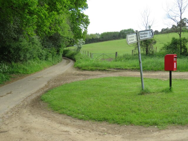
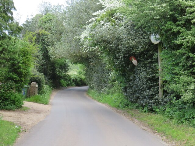
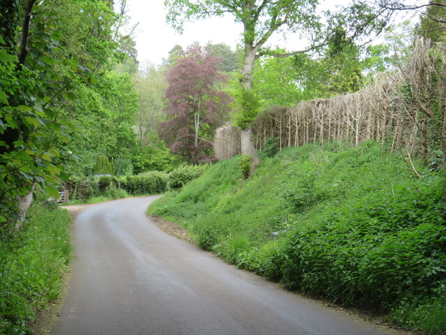
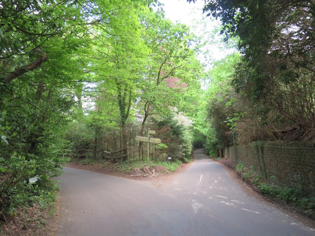
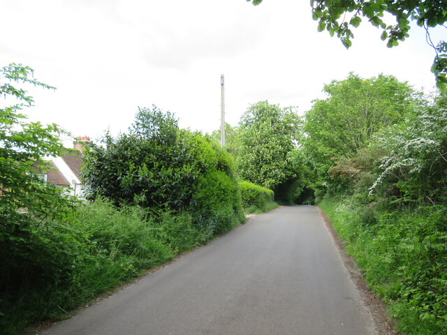
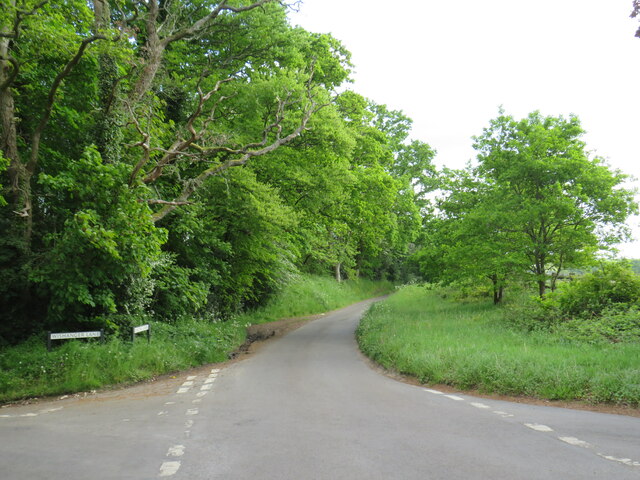
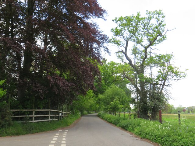
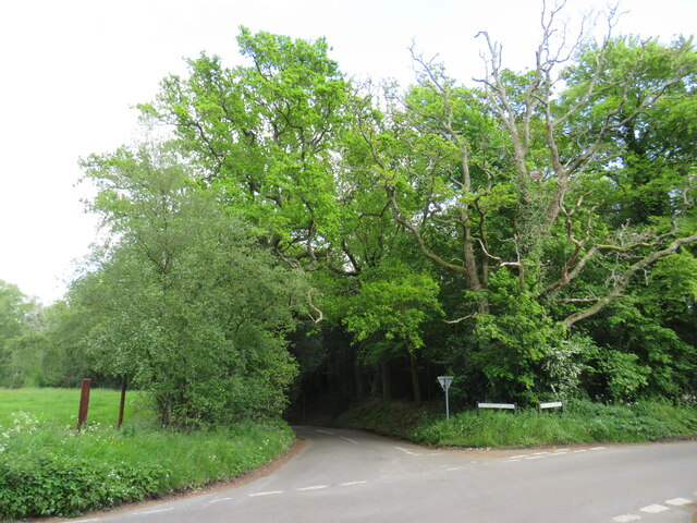
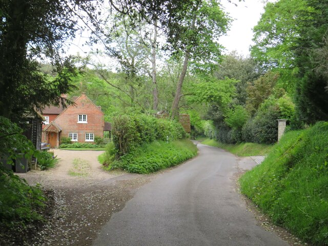
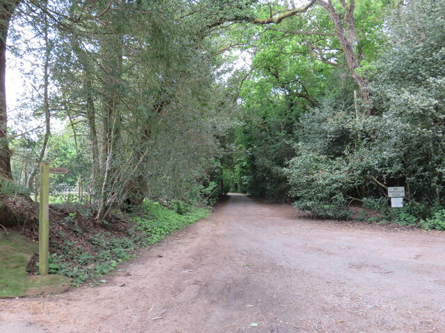
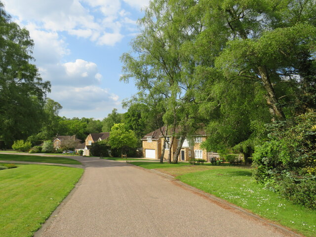
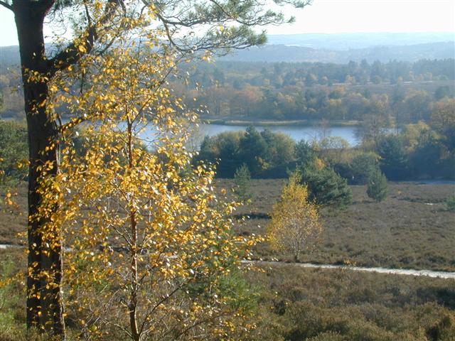
Hales Copse, located in Surrey, is a serene woodland area known for its natural beauty and rich biodiversity. Spanning over a significant area, the copse is primarily composed of dense oak and beech trees, creating a picturesque forest landscape. It is a popular destination for nature enthusiasts, hikers, and birdwatchers, offering a tranquil retreat from the bustling city life.

The copse is home to a diverse range of flora and fauna, with a variety of wildflowers, ferns, and mosses carpeting the forest floor, adding to its enchanting charm. The dense vegetation provides a perfect habitat for a plethora of bird species, including woodpeckers, thrushes, and warblers, making it a haven for bird lovers and ornithologists.

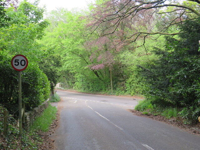
Apart from its natural beauty, Hales Copse also holds historical significance. The woodlands have been present for several centuries and have witnessed various historical events. Ancient pathways and tracks crisscross the area, revealing its past as a part of an extensive network of forested areas.

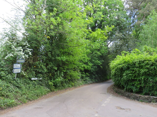
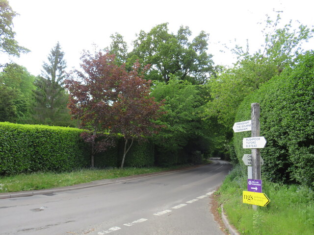
The copse is open to the public and offers a range of recreational activities. Visitors can explore the numerous walking trails that wind through the woods, allowing them to immerse themselves in the tranquility and natural wonders of the area. Additionally, the copse is a popular destination for picnicking and nature photography, with its stunning vistas and idyllic settings.

Hales Copse is truly a hidden gem in Surrey, providing a unique blend of natural beauty, historical significance, and recreational opportunities, making it an ideal destination for those seeking a peaceful escape into nature.

If you have any feedback on the listing, please let us know in the comments section below.

Hales Copse Images

Images are sourced within 2km of 51.147928/-0.79303925 or Grid Reference SU8439. Thanks to Geograph Open Source API. All images are credited.

Smithfield Lane, near Bordon Smithfield Lane is a minor lane through the Hampshire countryside, close to the border with Surrey.  A small post pox stands at the junction with Frensham Lane.
Smithfield Lane, near Bordon
Smithfield Lane is a minor lane through the Hampshire countryside, close to the border with Surrey. A small post pox stands at the junction with Frensham Lane.
Frensham Lane, near Bordon Frensham Lane is a minor lane through Hampshire countryside, close to the border with Surrey.  Driveways emerge onto the lane from the left.  Visibility for drivers turning onto the lane is quite limited, therefore safety mirrors have been installed to the right to give drivers a clearer view of anything passing when they are turning onto the lane.
Frensham Lane, near Bordon
Frensham Lane is a minor lane through Hampshire countryside, close to the border with Surrey. Driveways emerge onto the lane from the left. Visibility for drivers turning onto the lane is quite limited, therefore safety mirrors have been installed to the right to give drivers a clearer view of anything passing when they are turning onto the lane.
Frensham Lane, near Bordon Frensham Lane is a minor lane through Hampshire countryside, close to the border with Surrey.
Frensham Lane, near Bordon
Frensham Lane is a minor lane through Hampshire countryside, close to the border with Surrey.
Lane junction near Bordon A junction of minor lanes in Hampshire countryside, close to the border with Surrey.  A direction sign stands at the junction.  Over time, sap from overhanging trees has dripped onto the sign, partly obscuring it.
Lane junction near Bordon
A junction of minor lanes in Hampshire countryside, close to the border with Surrey. A direction sign stands at the junction. Over time, sap from overhanging trees has dripped onto the sign, partly obscuring it.
Frensham Lane, near Bordon Frensham Lane is a minor road through countryside in Hampshire, close to the border with Surrey.  Here it passes a farm on the left.
Frensham Lane, near Bordon
Frensham Lane is a minor road through countryside in Hampshire, close to the border with Surrey. Here it passes a farm on the left.
Bacon Lane, near Farnham Bacon Lane is a minor lane through countryside on the borers of Hampshire and Surrey.  At this point it is in Hampshire, but will cross the county boundary into Surrey less than a kilometre away.
Bacon Lane, near Farnham
Bacon Lane is a minor lane through countryside on the borers of Hampshire and Surrey. At this point it is in Hampshire, but will cross the county boundary into Surrey less than a kilometre away.
Bacon Lane, near Farnham Bacon Lane is a minor lane through countryside on the borders of Hampshire and Surrey.  Here, it is in Hampshire but will cross the boundary into Surrey about a kilometre ahead.
Bacon Lane, near Farnham
Bacon Lane is a minor lane through countryside on the borders of Hampshire and Surrey. Here, it is in Hampshire but will cross the boundary into Surrey about a kilometre ahead.
Bacon Lane, near Farnham Bacon Lane is a minor lane through countryside on the borders of Hampshire and Surrey.  In this view, it is in Hampshire.
Bacon Lane, near Farnham
Bacon Lane is a minor lane through countryside on the borders of Hampshire and Surrey. In this view, it is in Hampshire.
Wishanger Lane, near Farnham Wishanger Lane is a minor lane through countryside and woodland on the borders of Hampshire and Surrey.  Here, as it disappears into the trees, it is in Hampshire but will cross the boundary into Surrey less than half a kilometre away.
Wishanger Lane, near Farnham
Wishanger Lane is a minor lane through countryside and woodland on the borders of Hampshire and Surrey. Here, as it disappears into the trees, it is in Hampshire but will cross the boundary into Surrey less than half a kilometre away.
Wishanger Lane, near Farnham Wishanger Lane is a minor road through countryside on the borders of Hampshire and Surrey.  Here the lane passes a house on the Hampshire side of the border.  The lane will cross into Surrey about 200 metres further ahead.
Wishanger Lane, near Farnham
Wishanger Lane is a minor road through countryside on the borders of Hampshire and Surrey. Here the lane passes a house on the Hampshire side of the border. The lane will cross into Surrey about 200 metres further ahead.
Lampard Lane, Churt, near Farnham Lampard Lane is a minor lane on the edge of the Surrey village of Churt, very close to the border with Hampshire.
Lampard Lane, Churt, near Farnham
Lampard Lane is a minor lane on the edge of the Surrey village of Churt, very close to the border with Hampshire.
Public bridleway, Churt, near Farnham A public bridleway along a driveway on the edge of the village of Churt, in Surrey.  This location is very close to the border with Hampshire.
Public bridleway, Churt, near Farnham
A public bridleway along a driveway on the edge of the village of Churt, in Surrey. This location is very close to the border with Hampshire.
Star Hill Drive, Churt, near Farnham Star Hill Drive is a residential cul-de-sac on the edge of the village of Churt in Surrey.
Star Hill Drive, Churt, near Farnham
Star Hill Drive is a residential cul-de-sac on the edge of the village of Churt in Surrey.
Star Hill Drive, Churt, near Farnham Star Hill Drive is a residential cul-de-sac on the edge of the village of Churt in Surrey.
Star Hill Drive, Churt, near Farnham
Star Hill Drive is a residential cul-de-sac on the edge of the village of Churt in Surrey.
Star Hill, Churt, near Farnham Star Hill is a minor road on the edge of the village of Churt, in Surrey.  Here, the road approaches a junction with the A287.  The sign to the left of the image is a "repeater" sign reminding motorists that a speed limit of 50 miles per hour applies here.
Star Hill, Churt, near Farnham
Star Hill is a minor road on the edge of the village of Churt, in Surrey. Here, the road approaches a junction with the A287. The sign to the left of the image is a "repeater" sign reminding motorists that a speed limit of 50 miles per hour applies here.
Road junction in Churt, near Farnham A road junction on the edge of the village of Churt in Surrey.  The road to the left is the A287.
Road junction in Churt, near Farnham
A road junction on the edge of the village of Churt in Surrey. The road to the left is the A287.
The Old Post Office, Churt, near Farnham The Old Post Office stands at the corner of Jumps Road in the Surrey village of Churt.  As its name suggests, this building was once a post office.  It stall has a post box in the wall, to the right of the image.

The road passing in the foreground is the A287.
The Old Post Office, Churt, near Farnham
The Old Post Office stands at the corner of Jumps Road in the Surrey village of Churt. As its name suggests, this building was once a post office. It stall has a post box in the wall, to the right of the image. The road passing in the foreground is the A287.
A287 at Churt, near Farnham The A287 road at Churt in Surrey.
A287 at Churt, near Farnham
The A287 road at Churt in Surrey.
Show me another place!

Hales Copse is located at Grid Ref: SU8439 (Lat: 51.147928, Lng: -0.79303925)

Administrative County: Surrey

District: Waverley

Police Authority: Surrey

What 3 Words

///continues.bleak.ranches. Near Churt, Surrey

Nearby Locations

Hales Copse Furze Hill

Related Wikis

Frensham

Frensham is a village in Surrey, England, next to the A287 road, 13 miles (20.9 km) WSW of Guildford, the county town. Frensham lies on the right bank...

Pierrepont School, Frensham

Pierrepont School, Frensham, originally known as Pierrepont House School, was a private school in Surrey, England, with day pupils as well as boarders...

Churt

Churt is a village and civil parish in the borough of Waverley in Surrey, England, about 5.5 miles (8.9 km) south of the town of Farnham on the A287 road...

Devil's Jumps, Churt

The Devil's Jumps are a series of three small hills near the village of Churt in the county of Surrey in southern England. In the 18th century, the hills...

Dockenfield

Dockenfield is a village and civil parish in the borough of Waverley in Surrey, England. The parish is undulating, has a number of sources of the River...

Frensham Common

Frensham Common is a large Site of Special Scientific Interest (SSSI) heathland of 373 hectares (922 acres) which includes two lakes; it is owned and...

Barford, Hampshire

Barford is a scattered hamlet in the civil parish of Headley in the East Hampshire district of Hampshire, England. The village lies on the Hampshire-Surrey...

Arford

Arford is a village in the East Hampshire district of Hampshire, England, just north of the B3002 road, and is part of the civil parish of Headley. The...

Nearby Amenities

Located within 500m of 51.147928,-0.79303925
Churt House
Building: yes
Source: npe
Lat/Long: 51.1479469/-0.7876376
Bus Stop
Churt House
Bus: yes
Naptan AtcoCode: 40004411968A
Naptan Bearing: N
Naptan CommonName: Churt House
Naptan Indicator: Opp
Naptan Landmark: Churt House
Naptan NaptanCode: surgmtgd
Naptan Street: Churt Road
Naptan Verified: no
Public Transport: platform
Source: naptan_import
Lat/Long: 51.148023/-0.7885209
Bus Stop
Churt House
Bus: yes
Naptan AtcoCode: 40004411969A
Naptan Bearing: S
Naptan CommonName: Churt House
Naptan Indicator: Just after
Naptan Landmark: Churt House
Naptan NaptanCode: surgmtgj
Naptan Street: Churt Road
Naptan Verified: no
Public Transport: platform
Source: naptan_import
Lat/Long: 51.1474722/-0.7883066
Birchwood
Building: house
Source: OS_OpenData_StreetView
Lat/Long: 51.1491815/-0.7926518
Coppice Cottage
Building: house
Source: OS_OpenData_StreetView
Lat/Long: 51.1468152/-0.7921576
Field House
Building: house
Source: OS_OpenData_StreetView
Wikidata: Q26474147
Lat/Long: 51.1478729/-0.7957091
Foxhanger
Building: house
Source: OS_OpenData_StreetView
Lat/Long: 51.1484279/-0.7973613
Frensham Lodge
Building: house
Source: OS_OpenData_StreetView
Lat/Long: 51.1516982/-0.793923
Tyndrum
Building: house
Source: OS_OpenData_StreetView
Lat/Long: 51.15043/-0.7934698
The data included in this document is from www.openstreetmap.org. The data is made available under ODbL.

Have you been to Hales Copse?

Leave your review of Hales Copse below (or comments, questions and feedback).