Wardley Hanger

Wood, Forest in Sussex Chichester

England

Wardley Hanger

Inner Wall, Tuxlith Chapel This image shows the inner face of the west wall of the part of the chapel which was an extension to the original building. My grandparents and many other ancestors are interred around the chapel.
Inner Wall, Tuxlith Chapel Credit: Paul Collins

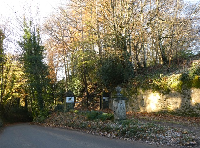
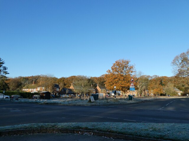
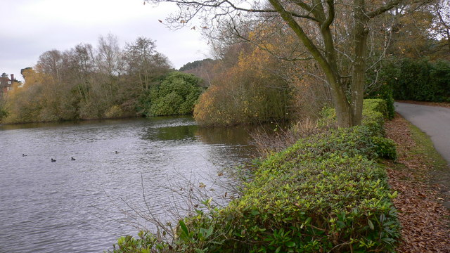
Wardley Hanger is a picturesque woodland area located in Sussex, England. Situated on the outskirts of the village of Wardley, it covers an area of approximately 100 acres and is part of the larger South Downs National Park.

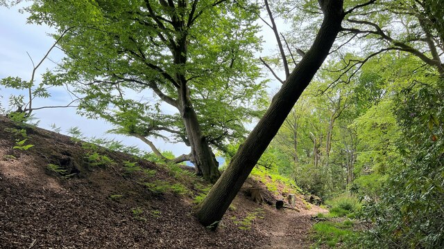
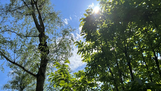
The hanger, named after the Old English word "hangra" meaning wooded slope, is characterized by its dense forest of predominantly deciduous trees, including oak, beech, and birch. The woodland floor is adorned with a rich variety of flora, such as bluebells, primroses, and ferns, creating a vibrant and enchanting atmosphere throughout the year.

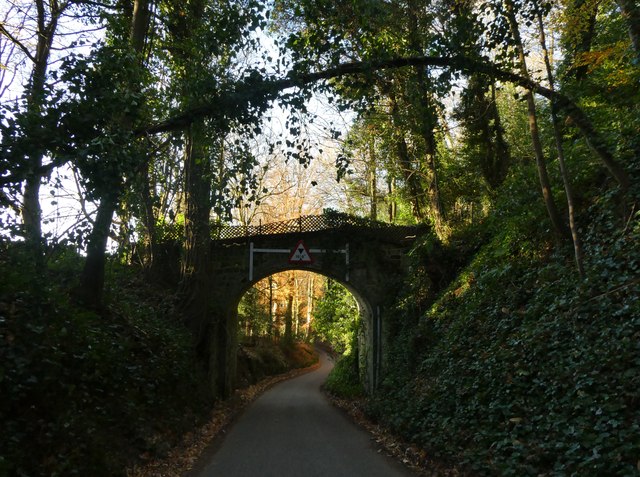
Wardley Hanger offers visitors an opportunity to immerse themselves in the tranquility of nature. It features several well-maintained footpaths and trails, allowing for leisurely walks or more adventurous hikes. The hanger is particularly popular with nature enthusiasts, photographers, and birdwatchers, as it is home to a diverse range of wildlife, including deer, foxes, badgers, and various species of birds.

Additionally, Wardley Hanger boasts stunning panoramic views of the surrounding countryside, with glimpses of the nearby South Downs and the English Channel in the distance. This makes it a popular spot for picnicking, photography, and simply enjoying the beauty of the natural landscape.

Overall, Wardley Hanger in Sussex offers a peaceful and idyllic retreat for those seeking to escape the hustle and bustle of everyday life and connect with nature in a truly picturesque setting.

If you have any feedback on the listing, please let us know in the comments section below.

Wardley Hanger Images

Images are sourced within 2km of 51.053046/-0.79710507 or Grid Reference SU8428. Thanks to Geograph Open Source API. All images are credited.

Inner Wall, Tuxlith Chapel This image shows the inner face of the west wall of the part of the chapel which was an extension to the original building. My grandparents and many other ancestors are interred around the chapel.
Inner Wall, Tuxlith Chapel
This image shows the inner face of the west wall of the part of the chapel which was an extension to the original building. My grandparents and many other ancestors are interred around the chapel.
Tuxlith Chapel This ancient and redundant chapel has recently been re-roofed. Two of my grandparents and many other ancestors lie in the churchyard.
Tuxlith Chapel
This ancient and redundant chapel has recently been re-roofed. Two of my grandparents and many other ancestors lie in the churchyard.
New Lipchis Way I've just realised where the "New Lipchis Way" gets its name. It's a 39-mile walk from Liphook (Lip) to Chichester Harbour (chis). There's an excellent view to the east from the bank on the left of the path.
New Lipchis Way
I've just realised where the "New Lipchis Way" gets its name. It's a 39-mile walk from Liphook (Lip) to Chichester Harbour (chis). There's an excellent view to the east from the bank on the left of the path.
Pylon near the bridleway on the south side of Iron Hill
Trees and sunlight - NE of Hillands Plantations
Bordering on the ridiculous (4) Looking from Sussex into Hampshire by Liphook Golf Course
Bordering on the ridiculous (4)
Looking from Sussex into Hampshire by Liphook Golf Course
Bordering on the ridiculous (5) Looking from south-southwest along the B2070 in Hampshire into west Sussex
Bordering on the ridiculous (5)
Looking from south-southwest along the B2070 in Hampshire into west Sussex
Vehicles behind a cyclist on the B2070
Cyclist on the B2070
Railway line and substation near Liphook A view of the Portsmouth Direct Line as it passes through the South Downs National Park.  The railway is electrified using the third rail system.

The building alongside the line is an electricity substation.  This distributes electricity to the third rail providing the power which drives the trains.  The short platform here is for staff to access the substation from a train.  There has never been a railway station here.
Railway line and substation near Liphook
A view of the Portsmouth Direct Line as it passes through the South Downs National Park. The railway is electrified using the third rail system. The building alongside the line is an electricity substation. This distributes electricity to the third rail providing the power which drives the trains. The short platform here is for staff to access the substation from a train. There has never been a railway station here.
Railway line near Liphook A view of the Portsmouth Direct Line in the South Downs National Park, near Liphook.  The railway is electrified using the third rail system.
Railway line near Liphook
A view of the Portsmouth Direct Line in the South Downs National Park, near Liphook. The railway is electrified using the third rail system.
Bridge over a railway near Liphook A bridge taking a lane over a railway line in the South Downs National Park.  The lane is private, but is a public right of way as a bridleway.
Bridge over a railway near Liphook
A bridge taking a lane over a railway line in the South Downs National Park. The lane is private, but is a public right of way as a bridleway.
Liphook Golf Club Liphook Golf Club is located on the edge of the South Downs National Park.  The golf club is in the county of West Sussex, just across the boundary from the town of Liphook which is in Hampshire.
Liphook Golf Club
Liphook Golf Club is located on the edge of the South Downs National Park. The golf club is in the county of West Sussex, just across the boundary from the town of Liphook which is in Hampshire.
County boundary near Liphook The signs either side of the B2070 road near Liphook  mark the county boundary between Hampshire and West Sussex.  This location is within the South Downs National Park.
County boundary near Liphook
The signs either side of the B2070 road near Liphook mark the county boundary between Hampshire and West Sussex. This location is within the South Downs National Park.
Entrance to Milland Place
Road bridge at Milland Place
Milland: the first frost of this winter (a) Looking from the Rising Sun car park
Milland: the first frost of this winter (a)
Looking from the Rising Sun car park
Milland: the first frost of this winter (b) Milland: the first frost of this winter
Milland: the first frost of this winter (b)
Milland: the first frost of this winter
Show me another place!

Wardley Hanger is located at Grid Ref: SU8428 (Lat: 51.053046, Lng: -0.79710507)

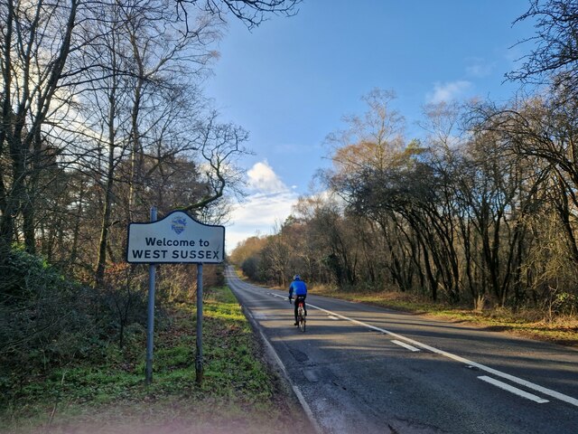
Administrative County: West Sussex

District: Chichester

Police Authority: Sussex

What 3 Words

///cheetahs.daring.clashes. Near Liphook, Hampshire

Related Wikis

Hollycombe Steam Collection

The Hollycombe Steam Collection is a collection of steam-powered vehicles, amusement rides, and attractions in South East England. It is based in West...
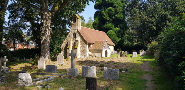
Tuxlith Chapel

Tuxlith Chapel, also known as Milland Old Church, is a redundant Anglican church in the village of Milland, West Sussex, England (grid reference SU 825...

Milland

Milland is a village and civil parish in the Chichester district of West Sussex, England. It is situated north of the A272 road on the border with Hampshire...

Liphook railway station

Liphook railway station serves the large village of Liphook, in Hampshire, England. It is on the Portsmouth Direct Line, 46 miles 67 chains (75.4 km) down...

Linch

Linch is an Anglican parish, and a loose collection of hamlets that make up the civil parish of the same name in the Chichester District of West Sussex...

Chapel Common

Chapel Common is a 101-hectare (250-acre) biological Site of Special Scientific Interest west of Fernhurst in West Sussex. A Roman road through the common...

Liphook

Liphook is a large village in the East Hampshire district of Hampshire, England. It is 4.1 miles (6.6 km) west of Haslemere, bypassed by the A3 road, and...

Forest Mere

Forest Mere is a 14.6-hectare (36-acre) biological Site of Special Scientific Interest north of Midhurst in West Sussex.The site consists of Folly Pond...

Related Videos

swcwalks, book 1, walk 6, Liphook to Haslemere. 6/10/22

This was a splendid 10 mile woodland walk on the very northern extremity of the South Downs National Park, last 'filmed' in ...

Marvellous model Gallopers

Amazing Model gallopers at our Fairground weekend.

Welcome to hollycombe

A brief look at what we offer experiance a magical day with our marvellous collection.

Nearby Amenities

Located within 500m of 51.053046,-0.79710507
Home Farm
Landuse: farm
Note Retag: CS #48756035
Residence: farm
Lat/Long: 51.0504/-0.791366
Landuse: farm
Note Retag: CS #48756035
Lat/Long: 51.0554/-0.803109
Wardley Hanger
Place: locality
Lat/Long: 51.0534/-0.796425
Power: pole
Lat/Long: 51.0515571/-0.8027852
Power: pole
Lat/Long: 51.0510799/-0.8008137
Power: pole
Lat/Long: 51.0504527/-0.800347
Power: pole
Lat/Long: 51.0506567/-0.7980189
Power: pole
Lat/Long: 51.0507579/-0.7970855
Power: pole
Lat/Long: 51.0507124/-0.7948351
Power: pole
Lat/Long: 51.0506871/-0.7931963
Power: pole
Lat/Long: 51.0515503/-0.7920215
Power: pole
Lat/Long: 51.0522096/-0.7911256
The data included in this document is from www.openstreetmap.org. The data is made available under ODbL.

Have you been to Wardley Hanger?

Leave your review of Wardley Hanger below (or comments, questions and feedback).