Jubilee Clump

Wood, Forest in Hampshire Rushmoor

England

Jubilee Clump

Old Milestone, A287, Folly Hill, Upper Hale The milestone is located 50m north of the junction with Heathyfields Road on the West side of the road in the hedge. Parish of Farnham (Waverley district). Carved stone post, Odiham stone design, erected by the Odiham & Farnham turnpike trust in the 18th century.

Inscription reads:-          FROM / ODIHAM / 6 / MILES / TO / FARNHAM / 1½ / MILES

The date of the image is not known but is probably before 2001.

Milestone Society National ID: SY_ODFA06
Old Milestone, A287, Folly Hill, Upper Hale Credit: Derek Renn

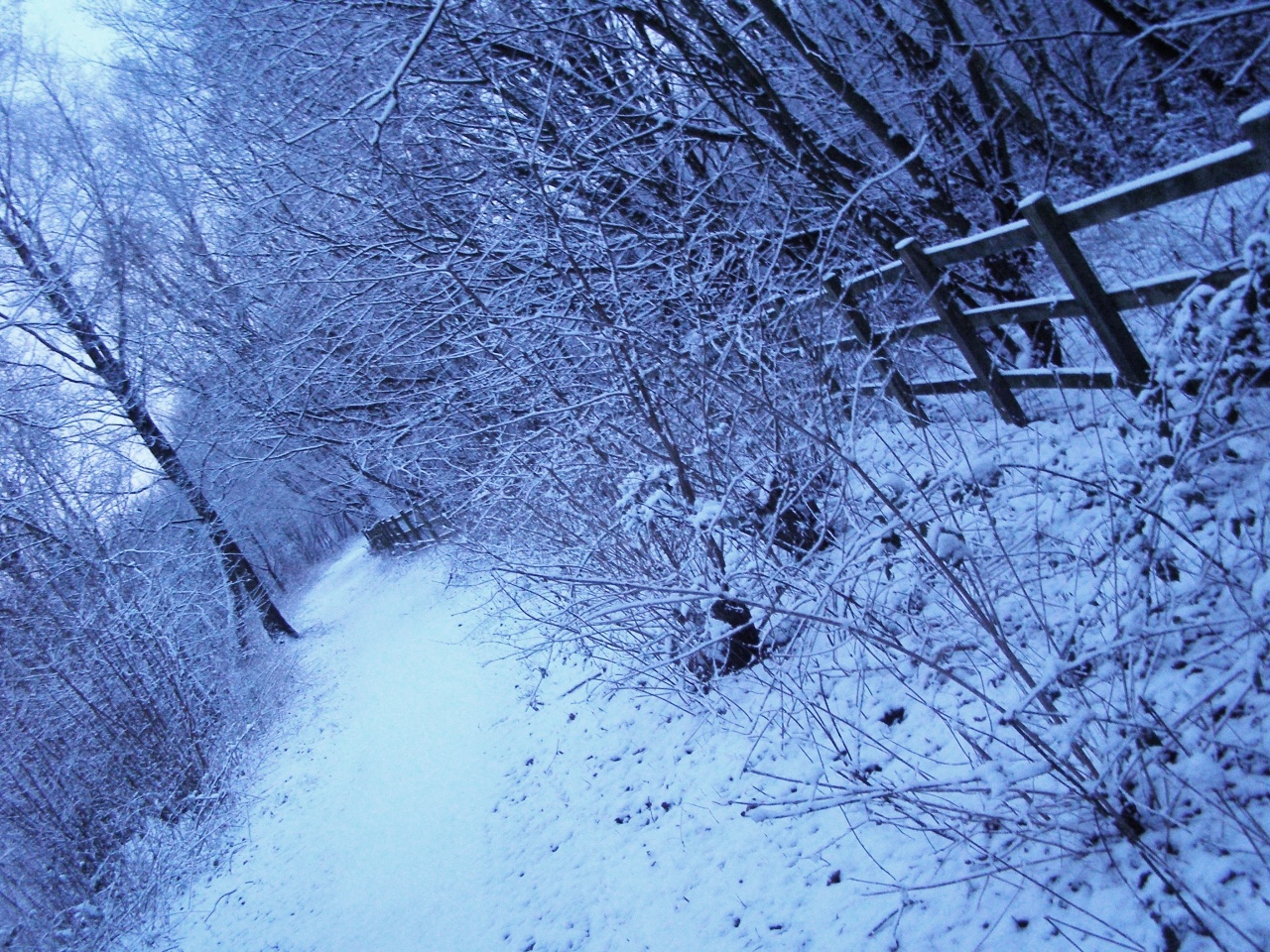
Jubilee Clump, located in Hampshire, England, is a small yet picturesque wood situated within the New Forest National Park. Covering an area of approximately 50 acres, this forested area is known for its natural beauty and tranquil atmosphere, making it a popular destination for nature enthusiasts and hikers alike.

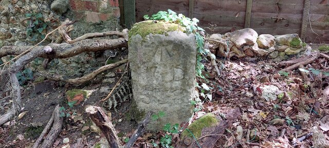
The name "Jubilee Clump" originated from the planting of a large group of oak trees to commemorate Queen Victoria's Golden Jubilee in 1887. These majestic oak trees, now over a century old, provide a stunning backdrop to the woodland and add to its charm and historical significance.

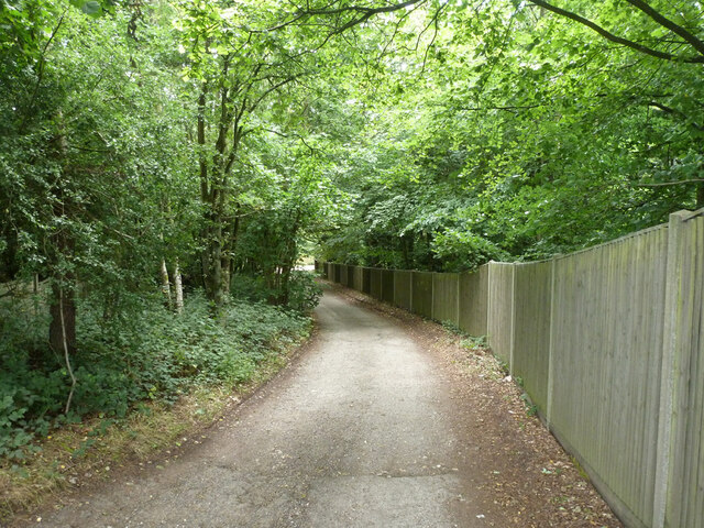
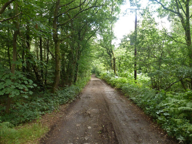
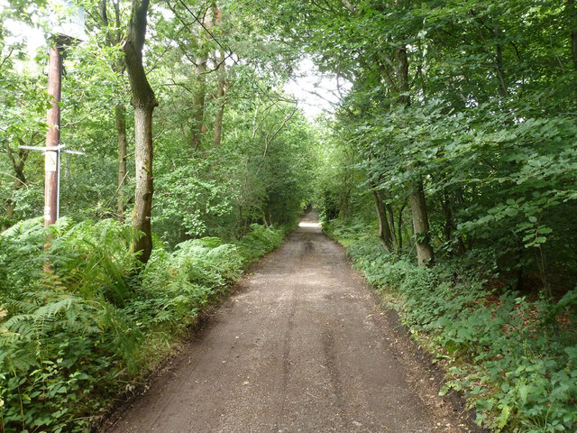
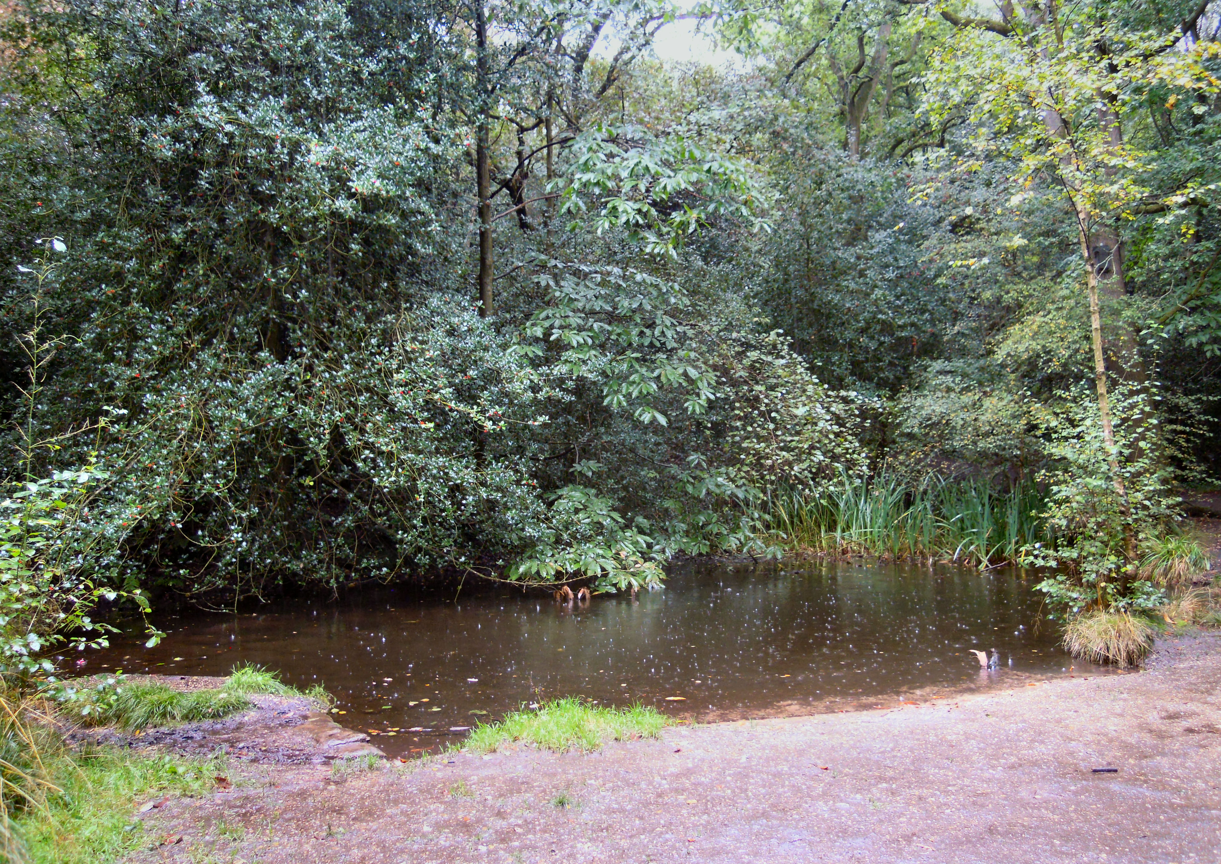
The forest itself consists primarily of broadleaf trees, including oak, beech, and birch, creating a diverse and vibrant ecosystem. Walking through Jubilee Clump, visitors can enjoy the soothing sounds of birdsong and the rustling of leaves underfoot, providing a true escape from the hustle and bustle of everyday life.

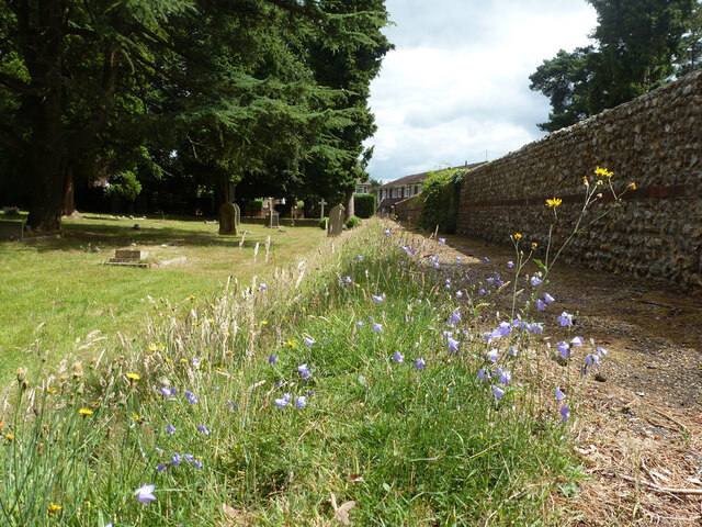
The wood is crisscrossed by a network of well-maintained footpaths, allowing visitors to explore the area and discover its hidden treasures. A walk through Jubilee Clump may reveal enchanting wildflowers, such as bluebells and primroses, which bloom in abundance during the spring months.

In addition to its natural beauty, Jubilee Clump is also home to a variety of wildlife. Deer, squirrels, and a multitude of bird species can often be spotted among the trees, making it a haven for wildlife enthusiasts and photographers.

Overall, Jubilee Clump offers a peaceful and idyllic setting, perfect for those seeking a tranquil escape into nature. Whether it be a leisurely stroll or a more adventurous hike, this Hampshire wood provides a delightful experience for visitors of all ages.

If you have any feedback on the listing, please let us know in the comments section below.

Jubilee Clump Images

Images are sourced within 2km of 51.244147/-0.80271498 or Grid Reference SU8350. Thanks to Geograph Open Source API. All images are credited.

Old Milestone, A287, Folly Hill, Upper Hale The milestone is located 50m north of the junction with Heathyfields Road on the West side of the road in the hedge. Parish of Farnham (Waverley district). Carved stone post, Odiham stone design, erected by the Odiham & Farnham turnpike trust in the 18th century.

Inscription reads:-          FROM / ODIHAM / 6 / MILES / TO / FARNHAM / 1½ / MILES

The date of the image is not known but is probably before 2001.

Milestone Society National ID: SY_ODFA06
Old Milestone, A287, Folly Hill, Upper Hale
The milestone is located 50m north of the junction with Heathyfields Road on the West side of the road in the hedge. Parish of Farnham (Waverley district). Carved stone post, Odiham stone design, erected by the Odiham & Farnham turnpike trust in the 18th century. Inscription reads:- FROM / ODIHAM / 6 / MILES / TO / FARNHAM / 1½ / MILES The date of the image is not known but is probably before 2001. Milestone Society National ID: SY_ODFA06
South Avenue at the junction of Farnborough Road
South Avenue, Hale
South Avenue, Hale
Farnborough Road, Heath End
Optiplan Kitchens on Farnborough Road, Heath End With a nice ghost sign above it.
Optiplan Kitchens on Farnborough Road, Heath End
With a nice ghost sign above it.
Armsworth Way, Farnham Viewed from Reeve Drive, part of a new development on the edge of Hale.
Armsworth Way, Farnham
Viewed from Reeve Drive, part of a new development on the edge of Hale.
Old Boundary Marker on Hungry Hill, Heath End War Department Boundary Marker on Hungry Hill, heathland behind The Crescent, Heath End. Farnham parish. Inscribed (arrow) / W D / 538. One of 546 numbered boundary markers marked on old OS maps around War Department land on the Hampshire/Surrey border.

Milestone Society National ID: SY_WDFARN538em
Old Boundary Marker on Hungry Hill, Heath End
War Department Boundary Marker on Hungry Hill, heathland behind The Crescent, Heath End. Farnham parish. Inscribed (arrow) / W D / 538. One of 546 numbered boundary markers marked on old OS maps around War Department land on the Hampshire/Surrey border. Milestone Society National ID: SY_WDFARN538em
Shops, Farnborough Road, Hale
Brooklands Road, unadopted part The road name is continuous, but a barrier ahead divides unadopted from adopted parts.
Brooklands Road, unadopted part
The road name is continuous, but a barrier ahead divides unadopted from adopted parts.
The Alma, Alma Lane, Hale Several pubs are named after the Alma, which is a river that figured prominently in the Crimean War.
The Alma, Alma Lane, Hale
Several pubs are named after the Alma, which is a river that figured prominently in the Crimean War.
Cottages on Alma Lane, Hale
In Hale Cemetery
In Hale Cemetery
In Hale Cemetery
In Hale Cemetery
In Hale Cemetery
In Hale Cemetery
Harebells, Hale Cemetery
Old Park Lane A public bridleway, also vehicle access to a few properties.
Old Park Lane
A public bridleway, also vehicle access to a few properties.
Old Park Lane A public bridleway, also vehicle access to a few properties.
Old Park Lane
A public bridleway, also vehicle access to a few properties.
Old Park Lane A public bridleway, also vehicle access to a few properties.
Old Park Lane
A public bridleway, also vehicle access to a few properties.
Show me another place!

Jubilee Clump is located at Grid Ref: SU8350 (Lat: 51.244147, Lng: -0.80271498)

Administrative County: Hampshire

District: Rushmoor

Police Authority: Hampshire

What 3 Words

///knowledge.burn.factory. Near Hale, Surrey

Related Wikis

Caesar's Camp, Rushmoor and Waverley

Caesar's Camp is an Iron Age hill fort straddling the border of the counties of Surrey and Hampshire in southern England. The fort straddles the borough...

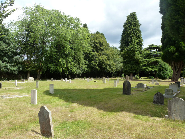
Upper Hale Cemetery, Farnham

Upper Hale Cemetery (also known as Hale Cemetery) is the burial ground for the district of Hale in Farnham in Surrey. Hale grew rapidly after 1854 when...

Bourley and Long Valley

Bourley and Long Valley is a 823.5-hectare (2,035-acre) biological Site of Special Scientific Interest between Fleet and Aldershot in Hampshire. It is...

Blackwater Valley Path

The Blackwater Valley Path follows the River Blackwater from its source in the Rowhill Nature Reserve in Aldershot to just beyond the point where it...

Heath End, Surrey

Heath End is a village in the Waverley district of Surrey, England, traditionally part of the large town parish of Farnham. Heath End is smaller in area...

Royal Pavilion, Aldershot

The Royal Pavilion, also known as the Queen's Pavilion, was a royal residence located at Aldershot in Hampshire. The most unpretentious of all royal residences...

Rowhill Nature Reserve

Rowhill Nature Reserve or Rowhill Copse is a 26.6-hectare (66-acre) Local Nature Reserve (LNR) which straddles the border between Aldershot in Hampshire...

Royal Garrison Church, Aldershot

Royal Garrison Church of All Saints is a Church of England church in Aldershot Garrison, England. It was built in 1863 and designed by the architect P...

Nearby Amenities

Located within 500m of 51.244147,-0.80271498
Bourley Hill
Natural: peak
Source: npe
Lat/Long: 51.2480009/-0.8044664
Tourism: viewpoint
Lat/Long: 51.2452066/-0.8016181
Natural: spring
Lat/Long: 51.2453382/-0.8012912
Bench
Backrest: yes
Inscription: 16.08.1986 DAVID STEPHEN COLLINS 21.11.200.
Material: wood
Lat/Long: 51.2451211/-0.8016046
Bench
Backrest: yes
Colour: black;blue;silver
Direction: 10
Inscription: RED ON..GREEN ON..GO
Material: steel
Seats: 2
Lat/Long: 51.245266/-0.801828
Bench
Backrest: yes
Colour: black;blue;silver
Direction: 70
Inscription: PREPARE TO DOUBLE
Material: steel
Seats: 2
Lat/Long: 51.2439179/-0.8009112
Historic: memorial
Inscription: Here lie the Ashes of 24645523 Sgt David Gerrard REME 25/09/60 - 24/06/97 The first REME Soldier to pass Pathfinder Selection "Arte et Marte"
Material: metal
Memorial: plaque
Lat/Long: 51.2450581/-0.8014205
Historic: memorial
Inscription: X Vig Pl 24324835 Pte Colin Stacey 22/4/1956 - 21/10/1993 Utrinque Paratus Sleep Well Brother
Material: metal
Memorial: plaque
Lat/Long: 51.2439764/-0.8008346
The data included in this document is from www.openstreetmap.org. The data is made available under ODbL.

Have you been to Jubilee Clump?

Leave your review of Jubilee Clump below (or comments, questions and feedback).