Broomfield Wood

Wood, Forest in Surrey Waverley

England

Broomfield Wood

Gong Hill north of Millbridge At the entrance to Edgeborough School
Gong Hill north of Millbridge Credit: David Howard

Broomfield Wood is a picturesque forest located in Surrey, England. Spread across an area of approximately 50 acres, this woodland is a natural haven for a variety of flora and fauna. It is nestled within the larger Surrey Hills Area of Outstanding Natural Beauty, enhancing its scenic appeal.

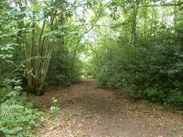
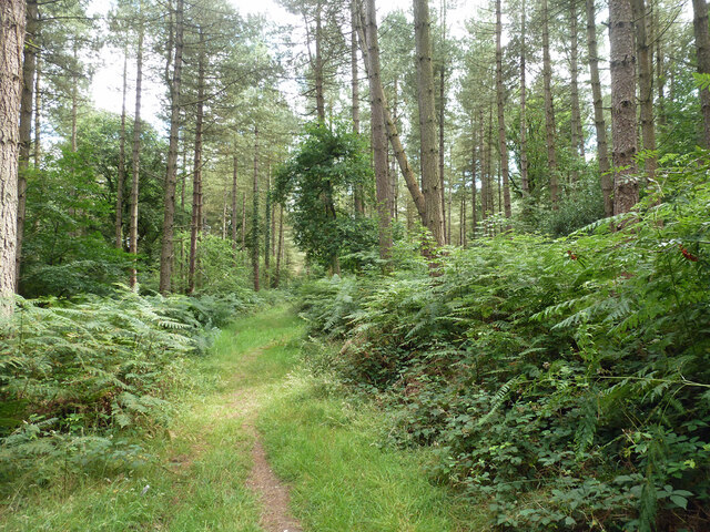
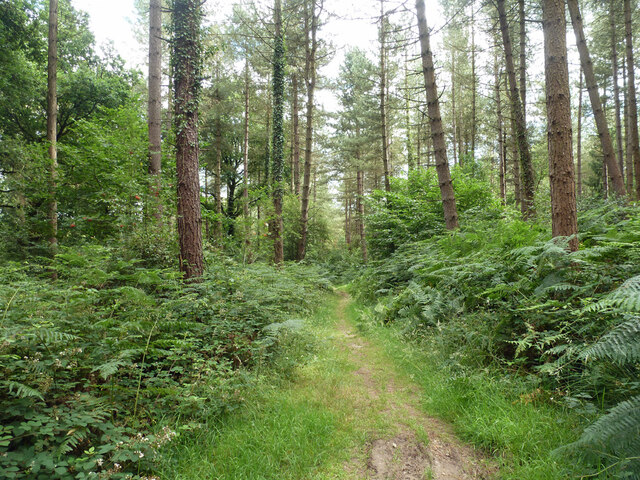
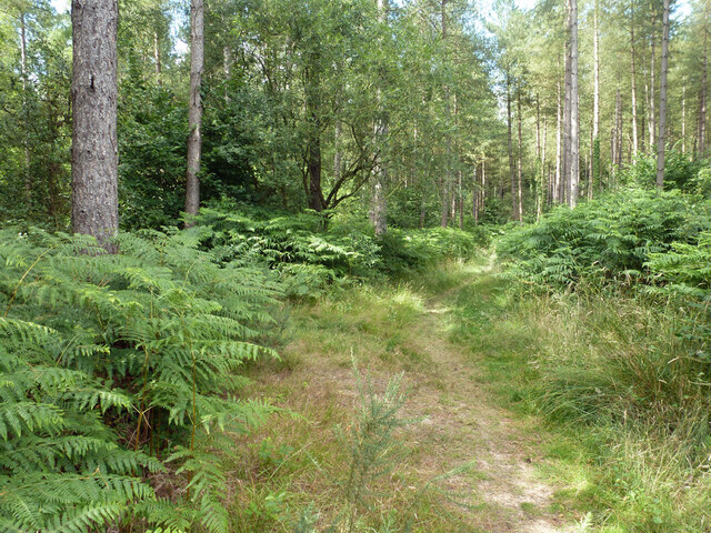
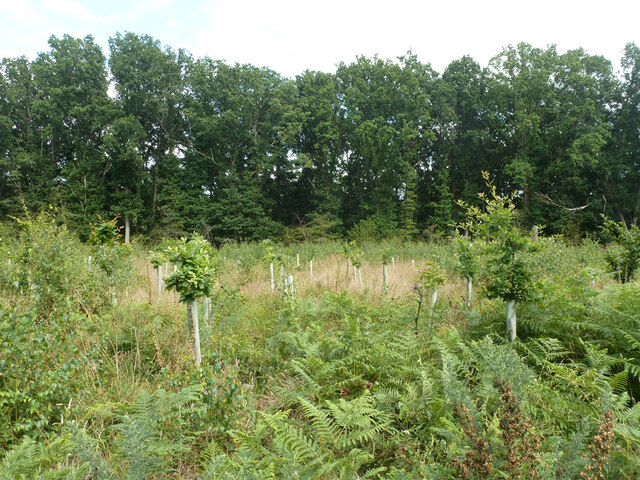
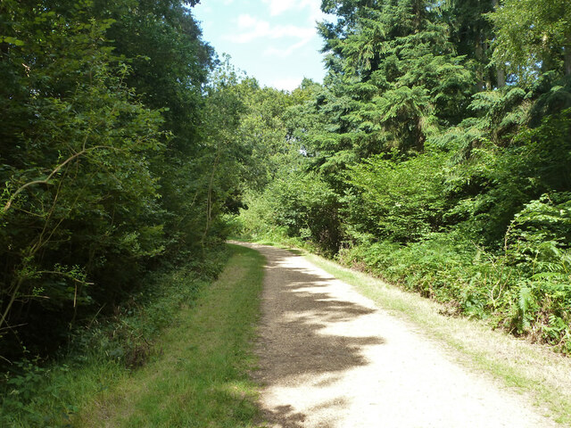
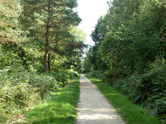
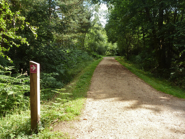
The wood is primarily composed of broadleaf trees such as oak, beech, and ash, which provide a dense canopy and create a peaceful atmosphere. The forest floor is covered with a rich carpet of bluebells during the spring season, creating a stunning visual display. Numerous walking trails wind through the woods, allowing visitors to immerse themselves in the serene surroundings.

Broomfield Wood is renowned for its diverse wildlife. Birdwatchers can spot a plethora of species, including woodpeckers, jays, and tawny owls. Squirrels, rabbits, and foxes are also commonly seen within the wood. The forest serves as an important habitat for these creatures, providing them with food and shelter.

The wood is managed by the Surrey Wildlife Trust, which ensures the preservation of its natural beauty and biodiversity. They conduct regular conservation work, maintaining the pathways and managing invasive species to protect the delicate ecosystem.

Broomfield Wood is a popular destination for nature enthusiasts, hikers, and families looking for a tranquil retreat. With its stunning natural features, diverse wildlife, and well-maintained trails, it offers a delightful experience for anyone seeking to connect with nature.

If you have any feedback on the listing, please let us know in the comments section below.

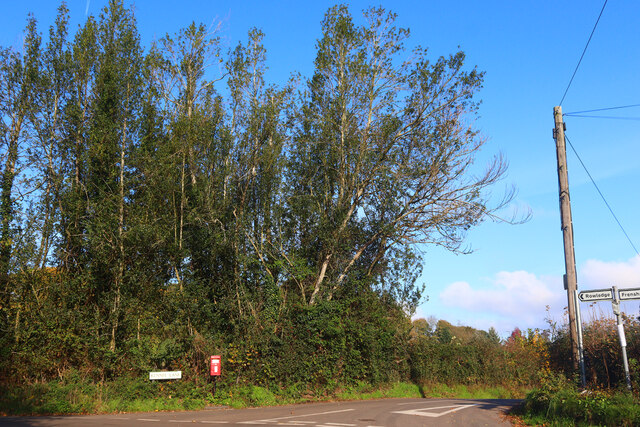
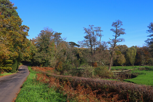
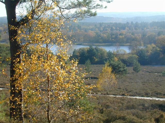
Broomfield Wood Images

Images are sourced within 2km of 51.17168/-0.81088621 or Grid Reference SU8342. Thanks to Geograph Open Source API. All images are credited.

Gong Hill north of Millbridge At the entrance to Edgeborough School
Gong Hill north of Millbridge
At the entrance to Edgeborough School
Gong Hill north of Millbridge
Frensham Road, Millbridge
View towards Gong Hill, Millbridge
Path, Alice Holt Forest Heading south in the Glenbervie Inclosure part of the Forestry Commission woodland.
Path, Alice Holt Forest
Heading south in the Glenbervie Inclosure part of the Forestry Commission woodland.
Path, Alice Holt Forest Heading south in the Glenbervie Inclosure part of the Forestry Commission woodland.
Path, Alice Holt Forest
Heading south in the Glenbervie Inclosure part of the Forestry Commission woodland.
Path, Alice Holt Forest Heading south in the Glenbervie Inclosure part of the Forestry Commission woodland.
Path, Alice Holt Forest
Heading south in the Glenbervie Inclosure part of the Forestry Commission woodland.
Path, Alice Holt Forest Heading north in the Glenbervie Inclosure part of the Forestry Commission woodland.
Path, Alice Holt Forest
Heading north in the Glenbervie Inclosure part of the Forestry Commission woodland.
Replanted area, Glenbervie Inclosure, Alice Holt Forest They appear to be a species of oak.
Replanted area, Glenbervie Inclosure, Alice Holt Forest
They appear to be a species of oak.
Track, Alice Holt Forest In the Glenbervie Inclosure part of the Forestry Commission woodland.
Track, Alice Holt Forest
In the Glenbervie Inclosure part of the Forestry Commission woodland.
Path, Alice Holt Forest In the Glenbervie Inclosure part of the Forestry Commission woodland.
Path, Alice Holt Forest
In the Glenbervie Inclosure part of the Forestry Commission woodland.
Woodhill Lane Looking towards Spreakley,  away from its junction with Boundary Road.
Woodhill Lane
Looking towards Spreakley, away from its junction with Boundary Road.
Footpath Binstead 51/3 in Alice Holt Forest Towards Dockenfield Street. The red arrow signs a circular route within the Forestry Commission woodland.
Footpath Binstead 51/3 in Alice Holt Forest
Towards Dockenfield Street. The red arrow signs a circular route within the Forestry Commission woodland.
A287 Frensham Main road through Frensham.
A287 Frensham
Main road through Frensham.
Kennel Lane Road junction near Millbridge.
Kennel Lane
Road junction near Millbridge.
Shortfield Common Road River running alongside the road.
Shortfield Common Road
River running alongside the road.
Frensham Common Along the A287, the war memorial is across the road
Frensham Common
Along the A287, the war memorial is across the road
2016: a year on Geograph (Day 273) Rear view, Frensham War Memorial
2016: a year on Geograph (Day 273)
Rear view, Frensham War Memorial
Show me another place!

Broomfield Wood is located at Grid Ref: SU8342 (Lat: 51.17168, Lng: -0.81088621)

Administrative County: Surrey

District: Waverley

Police Authority: Surrey

What 3 Words

///shredding.selection.answers. Near Churt, Surrey

Related Wikis

Frensham Heights School

Frensham Heights School is an independent school and sixth form college located near Farnham, Surrey, England, run by the registered charity, Frensham...

Pierrepont School, Frensham

Pierrepont School, Frensham, originally known as Pierrepont House School, was a private school in Surrey, England, with day pupils as well as boarders...

Rowledge

Rowledge is a village in England on the Surrey–Hampshire border, centred south of the A31 and Farnham. Neighbouring villages include Wrecclesham, Spreakley...

Frensham

Frensham is a village in Surrey, England, next to the A287 road, 13 miles (20.9 km) WSW of Guildford, the county town. Frensham lies on the right bank...

Dockenfield

Dockenfield is a village and civil parish in the borough of Waverley in Surrey, England. The parish is undulating, has a number of sources of the River...

Edgeborough School

Edgeborough School is a prep school near Farnham, Surrey in England. It is currently attended by ~360 kids between 2 and 13. The Head is Daniel Cox, former...

Frensham Common

Frensham Common is a large Site of Special Scientific Interest (SSSI) heathland of 373 hectares (922 acres) which includes two lakes; it is owned and...

Gong Hill

Gong Hill is a 5.9-hectare (15-acre) biological Site of Special Scientific Interest south of Farnham in Surrey.This heathland site is dominated by ling...

Nearby Amenities

Located within 500m of 51.17168,-0.81088621
Woodhill
Building: yes
Source: npe
Lat/Long: 51.1693609/-0.8152465
Broomfield
Building: yes
Source: npe
Lat/Long: 51.173438/-0.8106178
Barrier: stile
Lat/Long: 51.168112/-0.8070323
Barrier: stile
Lat/Long: 51.1681306/-0.8068513
Woodhill Farm
Landuse: farm
Note Retag: CS #48756035
Source: OS_OpenData_StreetView
Lat/Long: 51.1689307/-0.8134711
Barrier: stile
Lat/Long: 51.1702934/-0.8094805
Barrier: stile
Lat/Long: 51.1721939/-0.8046923
Barrier: stile
Lat/Long: 51.1730496/-0.8074808
Barrier: stile
Lat/Long: 51.1723555/-0.8049907
Give Way
Direction: backward
Lat/Long: 51.1731511/-0.8094045
Give Way
Direction: backward
Lat/Long: 51.1723313/-0.8133905
Give Way
Direction: forward
Lat/Long: 51.1723205/-0.8131925
Give Way
Direction: forward
Lat/Long: 51.1733236/-0.8097961
The data included in this document is from www.openstreetmap.org. The data is made available under ODbL.

Have you been to Broomfield Wood?

Leave your review of Broomfield Wood below (or comments, questions and feedback).