East Howe

Settlement in Dorset

England

East Howe

Kinson: Middle Road Middle Road is part of an estate of bungalows, the roads forming the shape of a three-pronged fork without the handle. As its name suggests, Middle Road is the middle 'prong'.

The sign is a modern one, dating from around 2014-15, by which time the council had replaced the coloured logo, which had been prone to fading after a while, to simple wording BOURNEMOUTH BOROUGH COUNCIL in smaller type.

This is photo no.269 of a series of 453 in my coronavirus lockdown walking project:
See <a title="https://www.geograph.org.uk/article/My-2020-Coronavirus-Lockdown-walking-project" href="https://www.geograph.org.uk/article/My-2020-Coronavirus-Lockdown-walking-project">Link</a> for the complete set of photos.
Kinson: Middle Road Credit: Chris Downer

East Howe is a small residential area located in the town of Bournemouth, in the county of Dorset, England. Situated on the eastern outskirts of Bournemouth, it is bordered by the neighborhoods of Littledown to the north and Iford to the east.

Primarily a suburban area, East Howe is known for its quiet and family-friendly atmosphere. The housing in the area mainly consists of detached and semi-detached houses, along with a few apartment complexes. The properties are generally well-maintained, with neatly manicured gardens and tree-lined streets.

Residents of East Howe benefit from its convenient location, with easy access to amenities and facilities. The neighborhood is home to several local shops, including a convenience store, a bakery, and a pharmacy, catering to everyday needs. There are also a few dining options, such as cafes and takeaways, offering a variety of cuisines.

One of the highlights of East Howe is its proximity to nature. The neighborhood is bordered by open green spaces, including King's Park, which offers recreational opportunities such as walking trails, sports pitches, and a children's play area. Additionally, the nearby River Stour provides opportunities for leisurely walks and picnics along its banks.

Transportation in East Howe is well-served by regular bus services, connecting residents to Bournemouth town center and other surrounding areas. The neighborhood also benefits from good road links, with easy access to the A338, a major road that connects Bournemouth to the wider region.

In summary, East Howe offers a peaceful residential environment with easy access to amenities and green spaces, making it an attractive place to live for families and individuals seeking a suburban lifestyle.

If you have any feedback on the listing, please let us know in the comments section below.
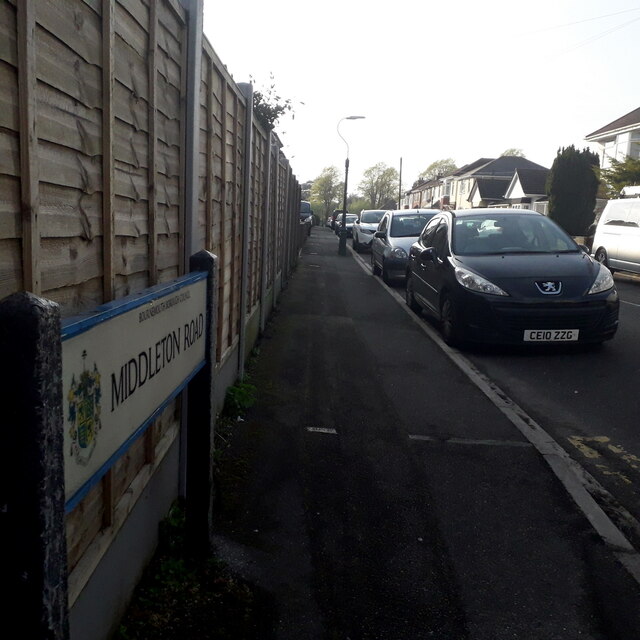
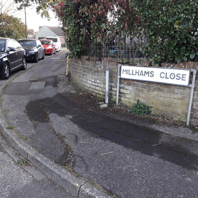
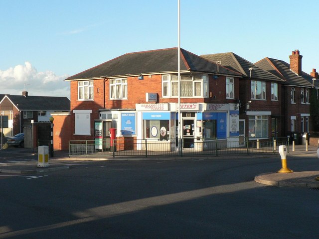
East Howe Images

Images are sourced within 2km of 50.758692/-1.9002244 or Grid Reference SZ0795. Thanks to Geograph Open Source API. All images are credited.

Kinson: Middle Road Middle Road is part of an estate of bungalows, the roads forming the shape of a three-pronged fork without the handle. As its name suggests, Middle Road is the middle 'prong'.

The sign is a modern one, dating from around 2014-15, by which time the council had replaced the coloured logo, which had been prone to fading after a while, to simple wording BOURNEMOUTH BOROUGH COUNCIL in smaller type.

This is photo no.269 of a series of 453 in my coronavirus lockdown walking project:
See <a title="https://www.geograph.org.uk/article/My-2020-Coronavirus-Lockdown-walking-project" href="https://www.geograph.org.uk/article/My-2020-Coronavirus-Lockdown-walking-project">Link</a> for the complete set of photos.
Kinson: Middle Road
Middle Road is part of an estate of bungalows, the roads forming the shape of a three-pronged fork without the handle. As its name suggests, Middle Road is the middle 'prong'. The sign is a modern one, dating from around 2014-15, by which time the council had replaced the coloured logo, which had been prone to fading after a while, to simple wording BOURNEMOUTH BOROUGH COUNCIL in smaller type. This is photo no.269 of a series of 453 in my coronavirus lockdown walking project: See Link for the complete set of photos.
Moordown: Middleton Road A one-segment road running between the main Redhill Avenue (far end) and Comley Road, comprising desirable detached houses that are typical of hereabouts. The two bungalows visible to the right are probably infill developments in what used to be the longer back garden of the Comley Road corner house.

The road sign is a standard one from around 2000-2006 featuring the borough coat of arms.

This is photo no.270 of a series of 453 in my coronavirus lockdown walking project:
See <a title="https://www.geograph.org.uk/article/My-2020-Coronavirus-Lockdown-walking-project" href="https://www.geograph.org.uk/article/My-2020-Coronavirus-Lockdown-walking-project">Link</a> for the complete set of photos.
Moordown: Middleton Road
A one-segment road running between the main Redhill Avenue (far end) and Comley Road, comprising desirable detached houses that are typical of hereabouts. The two bungalows visible to the right are probably infill developments in what used to be the longer back garden of the Comley Road corner house. The road sign is a standard one from around 2000-2006 featuring the borough coat of arms. This is photo no.270 of a series of 453 in my coronavirus lockdown walking project: See Link for the complete set of photos.
Bear Cross: Milford Drive Part of the 1950s bungalow development around Bear Cross, we look along Milford Drive past the sign that greets traffic emerging from Exbury Drive, towards its eastern end at Anstey Road. The latter is the boundary of the West Howe council estate, as can be glimpsed by the council semis in the background.

The sign is a modern one, from 2010-15 when this more modern, abstract emblem rather than the traditional town coat of arms as the working logo of the council.

This is photo no.271 of a series of 453 in my coronavirus lockdown walking project:
See <a title="https://www.geograph.org.uk/article/My-2020-Coronavirus-Lockdown-walking-project" href="https://www.geograph.org.uk/article/My-2020-Coronavirus-Lockdown-walking-project">Link</a> for the complete set of photos.
Bear Cross: Milford Drive
Part of the 1950s bungalow development around Bear Cross, we look along Milford Drive past the sign that greets traffic emerging from Exbury Drive, towards its eastern end at Anstey Road. The latter is the boundary of the West Howe council estate, as can be glimpsed by the council semis in the background. The sign is a modern one, from 2010-15 when this more modern, abstract emblem rather than the traditional town coat of arms as the working logo of the council. This is photo no.271 of a series of 453 in my coronavirus lockdown walking project: See Link for the complete set of photos.
Kinson: Millhams Close A cul-de-sac of bungalows off what was once a reasonably major side road, Millhams Road.

The sign is the standard Bournemouth nameplate from the 1980s, affixed with tubular steel which protrudes at each side. The vacant post just to the left almost certainly once had a No Through Road sign affixed to it, such as at <a href="https://www.geograph.org.uk/photo/6458895">SZ0794 : Ensbury Park: Dawn Close</a>.

This is photo no.272 of a series of 453 in my coronavirus lockdown walking project:
See <a title="https://www.geograph.org.uk/article/My-2020-Coronavirus-Lockdown-walking-project" href="https://www.geograph.org.uk/article/My-2020-Coronavirus-Lockdown-walking-project">Link</a> for the complete set of photos.
Kinson: Millhams Close
A cul-de-sac of bungalows off what was once a reasonably major side road, Millhams Road. The sign is the standard Bournemouth nameplate from the 1980s, affixed with tubular steel which protrudes at each side. The vacant post just to the left almost certainly once had a No Through Road sign affixed to it, such as at SZ0794 : Ensbury Park: Dawn Close. This is photo no.272 of a series of 453 in my coronavirus lockdown walking project: See Link for the complete set of photos.
Kinson: Millhams Drive A cul-de-sac off Millhams Road, younger than and diagonally opposite <a href="https://www.geograph.org.uk/photo/7075244">SZ0696 : Kinson: Millhams Close</a>.

The sign is of a design that became prevalent in Bournemouth around 1990 and was in use for most of that decade. Many are starting to look a bit shabby now, with peeling white or fading blue, and this is a very good example of the white deterioration.

This is photo no.273 of a series of 453 in my coronavirus lockdown walking project:
See <a title="https://www.geograph.org.uk/article/My-2020-Coronavirus-Lockdown-walking-project" href="https://www.geograph.org.uk/article/My-2020-Coronavirus-Lockdown-walking-project">Link</a> for the complete set of photos.
Kinson: Millhams Drive
A cul-de-sac off Millhams Road, younger than and diagonally opposite SZ0696 : Kinson: Millhams Close. The sign is of a design that became prevalent in Bournemouth around 1990 and was in use for most of that decade. Many are starting to look a bit shabby now, with peeling white or fading blue, and this is a very good example of the white deterioration. This is photo no.273 of a series of 453 in my coronavirus lockdown walking project: See Link for the complete set of photos.
Kinson: Millhams Road Looking across the village green at the heart of Kinson, long since a 'village' and very much a suburb of Bournemouth. Millhams Road was a through road coming out by Longham Bridge until roughly the late 1980s, when it was closed to traffic between the parish church and the council tip. That middle stretch is still usable by pedestrians and cyclists and forms part of the Millhams Mead Local Nature Reserve.

The public toilet block is visible at the far end of the green.

The road sign is a standard one from around 2000-2006, perhaps a little earlier, featuring the borough coat of arms.

This is photo no.274 of a series of 453 in my coronavirus lockdown walking project:
See <a title="https://www.geograph.org.uk/article/My-2020-Coronavirus-Lockdown-walking-project" href="https://www.geograph.org.uk/article/My-2020-Coronavirus-Lockdown-walking-project">Link</a> for the complete set of photos.
Kinson: Millhams Road
Looking across the village green at the heart of Kinson, long since a 'village' and very much a suburb of Bournemouth. Millhams Road was a through road coming out by Longham Bridge until roughly the late 1980s, when it was closed to traffic between the parish church and the council tip. That middle stretch is still usable by pedestrians and cyclists and forms part of the Millhams Mead Local Nature Reserve. The public toilet block is visible at the far end of the green. The road sign is a standard one from around 2000-2006, perhaps a little earlier, featuring the borough coat of arms. This is photo no.274 of a series of 453 in my coronavirus lockdown walking project: See Link for the complete set of photos.
East Howe: Minstead Road Minstead is a New Forest village, as is Marchwood, whose namesake road comes off Minstead Road – but these are the only two roads so named in the area.

The sign is from around 2000, and it morphed into another design, in blue rather than green and far more widely seen, including BOURNEMOUTH BOROUGH COUNCIL in smaller letters at the top, and the borough coat of arms on the left.

This is photo no.275 of a series of 453 in my coronavirus lockdown walking project:
See <a title="https://www.geograph.org.uk/article/My-2020-Coronavirus-Lockdown-walking-project" href="https://www.geograph.org.uk/article/My-2020-Coronavirus-Lockdown-walking-project">Link</a> for the complete set of photos.
East Howe: Minstead Road
Minstead is a New Forest village, as is Marchwood, whose namesake road comes off Minstead Road – but these are the only two roads so named in the area. The sign is from around 2000, and it morphed into another design, in blue rather than green and far more widely seen, including BOURNEMOUTH BOROUGH COUNCIL in smaller letters at the top, and the borough coat of arms on the left. This is photo no.275 of a series of 453 in my coronavirus lockdown walking project: See Link for the complete set of photos.
West Howe: Montgomery Avenue One of the main thoroughfares within the large 1950s West Howe council estate, linking its heart, Cunningham Crescent, with its eastern edge, here on the main Kinson Road. There are a few blocks of council flats here at this end – and at the other – while in between is half a mile or so of standard, very recognisable semi-detached council houses.

The sign is an early version of a standard Bournemouth design from around 2000, the early version recognisable by a slightly more emboldened typeface, the wording initially aligned to the left but the centralised layout was used by the time of this one.


This is photo no.276 of a series of 453 in my coronavirus lockdown walking project:
See <a title="https://www.geograph.org.uk/article/My-2020-Coronavirus-Lockdown-walking-project" href="https://www.geograph.org.uk/article/My-2020-Coronavirus-Lockdown-walking-project">Link</a> for the complete set of photos.
West Howe: Montgomery Avenue
One of the main thoroughfares within the large 1950s West Howe council estate, linking its heart, Cunningham Crescent, with its eastern edge, here on the main Kinson Road. There are a few blocks of council flats here at this end – and at the other – while in between is half a mile or so of standard, very recognisable semi-detached council houses. The sign is an early version of a standard Bournemouth design from around 2000, the early version recognisable by a slightly more emboldened typeface, the wording initially aligned to the left but the centralised layout was used by the time of this one. This is photo no.276 of a series of 453 in my coronavirus lockdown walking project: See Link for the complete set of photos.
Ensbury Park: Montrose Drive A cul-de-sac of bungalows off Priestley Road.

The sign tells us that the road isn't modern: it looks like an ordinary 1980s sign mounted on tubular steel (such as the one at <a href="https://www.geograph.org.uk/photo/6447362">SZ0795 : Ensbury Park: Barnes Close</a>), but careful scrutiny will tell us that the lettering and black border is embossed in the metalwork and not put on adhesively like the more modern variety. This makes it one of the older, perhaps 1960s, nameplates.

This is photo no.277 of a series of 451 in my coronavirus lockdown walking project:
See <a title="https://www.geograph.org.uk/article/My-2020-Coronavirus-Lockdown-walking-project" href="https://www.geograph.org.uk/article/My-2020-Coronavirus-Lockdown-walking-project">Link</a> for the complete set of photos.
Ensbury Park: Montrose Drive
A cul-de-sac of bungalows off Priestley Road. The sign tells us that the road isn't modern: it looks like an ordinary 1980s sign mounted on tubular steel (such as the one at SZ0795 : Ensbury Park: Barnes Close), but careful scrutiny will tell us that the lettering and black border is embossed in the metalwork and not put on adhesively like the more modern variety. This makes it one of the older, perhaps 1960s, nameplates. This is photo no.277 of a series of 451 in my coronavirus lockdown walking project: See Link for the complete set of photos.
Moordown: Moordown Close A small cul-de-sac of reasonably modern (1970s?) houses swinging around the corner behind the backs of houses on the main Wimborne Road.

The sign is a modern one - it is only in the last couple of years that Bournemouth Borough Council stopped including its name in smaller type at the top of the sign, perhaps in readiness for local government reorganisation in April 2019 which saw the borough council replaced by BCP (Bournemouth, Christchurch & Poole) council. The no-through-road sign incorporated within the nameplate is a fairly common arrangement, and the previous sign clearly didn't have one because the original accompanying sign remains alongside.

This is photo no.278 of a series of 453 in my coronavirus lockdown walking project:
See <a title="https://www.geograph.org.uk/article/My-2020-Coronavirus-Lockdown-walking-project" href="https://www.geograph.org.uk/article/My-2020-Coronavirus-Lockdown-walking-project">Link</a> for the complete set of photos.
Moordown: Moordown Close
A small cul-de-sac of reasonably modern (1970s?) houses swinging around the corner behind the backs of houses on the main Wimborne Road. The sign is a modern one - it is only in the last couple of years that Bournemouth Borough Council stopped including its name in smaller type at the top of the sign, perhaps in readiness for local government reorganisation in April 2019 which saw the borough council replaced by BCP (Bournemouth, Christchurch & Poole) council. The no-through-road sign incorporated within the nameplate is a fairly common arrangement, and the previous sign clearly didn't have one because the original accompanying sign remains alongside. This is photo no.278 of a series of 453 in my coronavirus lockdown walking project: See Link for the complete set of photos.
West Howe: Moore Avenue Seen here ascending from Poole Lane, Moore Avenue is one of the chief roads into the large, 1950s West Howe council estate, as attested by the bus stop (there is a more substantial one opposite, out of picture, with bus shelter).

After the block of flats, more standard semi-detached council houses take over before more flats are found nearer the centre of the estate.

The road sign is a standard one from around 2000-2006, perhaps a little earlier, featuring the borough coat of arms.

This is photo no.279 of a series of 453 in my coronavirus lockdown walking project:
See <a title="https://www.geograph.org.uk/article/My-2020-Coronavirus-Lockdown-walking-project" href="https://www.geograph.org.uk/article/My-2020-Coronavirus-Lockdown-walking-project">Link</a> for the complete set of photos.
West Howe: Moore Avenue
Seen here ascending from Poole Lane, Moore Avenue is one of the chief roads into the large, 1950s West Howe council estate, as attested by the bus stop (there is a more substantial one opposite, out of picture, with bus shelter). After the block of flats, more standard semi-detached council houses take over before more flats are found nearer the centre of the estate. The road sign is a standard one from around 2000-2006, perhaps a little earlier, featuring the borough coat of arms. This is photo no.279 of a series of 453 in my coronavirus lockdown walking project: See Link for the complete set of photos.
Moordown: Moorfield Grove One of the typical residential streets in Winton and Moordown, with its early 20th-century houses, Moorfield Grove is nevertheless slightly unusual in coming to an abrupt stop, at the back of what was originally the grounds of Winton Boys' School, a community centre and sheltered housing since the school moved to more modern premises in the late 1990s.

It is also unusual in having no road nameplate: it did until fairly recently but must have been the victim of vandalism or traffic collision.

This is photo no.280 of a series of 453 in my coronavirus lockdown walking project:
See <a title="https://www.geograph.org.uk/article/My-2020-Coronavirus-Lockdown-walking-project" href="https://www.geograph.org.uk/article/My-2020-Coronavirus-Lockdown-walking-project">Link</a> for the complete set of photos.
Moordown: Moorfield Grove
One of the typical residential streets in Winton and Moordown, with its early 20th-century houses, Moorfield Grove is nevertheless slightly unusual in coming to an abrupt stop, at the back of what was originally the grounds of Winton Boys' School, a community centre and sheltered housing since the school moved to more modern premises in the late 1990s. It is also unusual in having no road nameplate: it did until fairly recently but must have been the victim of vandalism or traffic collision. This is photo no.280 of a series of 453 in my coronavirus lockdown walking project: See Link for the complete set of photos.
West Howe: Moorside Close A small cul-de-sac off Moorside Road, hence the name, Moorside Close actually takes the course of one of the original tracks when this was all fields, before the large 1950s West Howe council estate was built: Behind us to the right is Ericksen Road, while at the top of the hill ahead is a path onto the eastern leg of Tedder Road, which continues diagonally into Mount Road – and that whole route is recognisable, when looking at older maps, as an original track or lane.

The sign is the standard Bournemouth nameplate from the 1980s, affixed with tubular steel which protrudes at each side.

This is photo no.281 of a series of 453 in my coronavirus lockdown walking project:
See <a title="https://www.geograph.org.uk/article/My-2020-Coronavirus-Lockdown-walking-project" href="https://www.geograph.org.uk/article/My-2020-Coronavirus-Lockdown-walking-project">Link</a> for the complete set of photos.
West Howe: Moorside Close
A small cul-de-sac off Moorside Road, hence the name, Moorside Close actually takes the course of one of the original tracks when this was all fields, before the large 1950s West Howe council estate was built: Behind us to the right is Ericksen Road, while at the top of the hill ahead is a path onto the eastern leg of Tedder Road, which continues diagonally into Mount Road – and that whole route is recognisable, when looking at older maps, as an original track or lane. The sign is the standard Bournemouth nameplate from the 1980s, affixed with tubular steel which protrudes at each side. This is photo no.281 of a series of 453 in my coronavirus lockdown walking project: See Link for the complete set of photos.
West Howe: Moorside Gardens Modern infill development of a few houses, off Moorside Road. Because the houses are tucked around the back of the two adjoining gardens, we can't see any of them from here at the end of the road.

The sign is a modern one, from 2010-15 when this more modern, abstract emblem rather than the traditional town coat of arms as the working logo of the council. It is unusual in being a short version with the road name on two lines.

This is photo no.282 of a series of 453 in my coronavirus lockdown walking project:
See <a title="https://www.geograph.org.uk/article/My-2020-Coronavirus-Lockdown-walking-project" href="https://www.geograph.org.uk/article/My-2020-Coronavirus-Lockdown-walking-project">Link</a> for the complete set of photos.
West Howe: Moorside Gardens
Modern infill development of a few houses, off Moorside Road. Because the houses are tucked around the back of the two adjoining gardens, we can't see any of them from here at the end of the road. The sign is a modern one, from 2010-15 when this more modern, abstract emblem rather than the traditional town coat of arms as the working logo of the council. It is unusual in being a short version with the road name on two lines. This is photo no.282 of a series of 453 in my coronavirus lockdown walking project: See Link for the complete set of photos.
West Howe: Moorside Road Looking at some of the semi-detached houses on this road which marks the southeastern edge of the large 1950s West Howe council estate.

The sign dates from around 1999/2000 and is one of the first to include the borough logo. It morphed from this version, one size regardless of the name length, to a similar design but with centred text, to the commonplace version with blue edges and with slightly less emboldened typeface.

This is photo no.283 of a series of 453 in my coronavirus lockdown walking project:
See <a title="https://www.geograph.org.uk/article/My-2020-Coronavirus-Lockdown-walking-project" href="https://www.geograph.org.uk/article/My-2020-Coronavirus-Lockdown-walking-project">Link</a> for the complete set of photos.
West Howe: Moorside Road
Looking at some of the semi-detached houses on this road which marks the southeastern edge of the large 1950s West Howe council estate. The sign dates from around 1999/2000 and is one of the first to include the borough logo. It morphed from this version, one size regardless of the name length, to a similar design but with centred text, to the commonplace version with blue edges and with slightly less emboldened typeface. This is photo no.283 of a series of 453 in my coronavirus lockdown walking project: See Link for the complete set of photos.
Moordown: Morden Road A short, one-segment road between Victoria Park and Vicarage Roads, we look along it from the latter end, alongside the grounds of Moordown St. John's Church of England Primary School. The fine, detached pre-war houses are the standard hereabouts.

The sign is the standard Bournemouth nameplate from the 1980s, affixed with tubular steel which protrudes at each side.

This is photo no.284 of a series of 453 in my coronavirus lockdown walking project:
See <a title="https://www.geograph.org.uk/article/My-2020-Coronavirus-Lockdown-walking-project" href="https://www.geograph.org.uk/article/My-2020-Coronavirus-Lockdown-walking-project">Link</a> for the complete set of photos.
Moordown: Morden Road
A short, one-segment road between Victoria Park and Vicarage Roads, we look along it from the latter end, alongside the grounds of Moordown St. John's Church of England Primary School. The fine, detached pre-war houses are the standard hereabouts. The sign is the standard Bournemouth nameplate from the 1980s, affixed with tubular steel which protrudes at each side. This is photo no.284 of a series of 453 in my coronavirus lockdown walking project: See Link for the complete set of photos.
West Howe: Mount Road When the large 1950s West Howe council estate was built, Mount Road utilised an original farm track or lane: overlaying older with present-day maps, the course is very obvious.

The sign is an early version of a standard Bournemouth design from around 2000, the early version recognisable by a slightly more emboldened typeface, aligned to the left when on two lines or, never on the newer versions, written on a single line as here.

This is photo no.286 of a series of 453 in my coronavirus lockdown walking project:
See Link for the complete set of photos.
West Howe: Mount Road
When the large 1950s West Howe council estate was built, Mount Road utilised an original farm track or lane: overlaying older with present-day maps, the course is very obvious. The sign is an early version of a standard Bournemouth design from around 2000, the early version recognisable by a slightly more emboldened typeface, aligned to the left when on two lines or, never on the newer versions, written on a single line as here. This is photo no.286 of a series of 453 in my coronavirus lockdown walking project: See Link for the complete set of photos.
Winton: Namu Road This curiously named road is generally pronounced "Name-you", but I have heard "Nar-mew" as well. I am not sure of the derivation but I presume it may be someone's surname? Anyway, it comprises fine inter-War detached houses which are typical of this immediate area. Unlike some of the older houses, there is at least room for off-road parking for most of them.

The sign is the standard Bournemouth nameplate from the 1980s, more often seen affixed with tubular steel which protrudes at each side, but this one is high on a lamppost facing Jameson Road.

This is photo no.288 of a series of 453 in my coronavirus lockdown walking project:
See <a title="https://www.geograph.org.uk/article/My-2020-Coronavirus-Lockdown-walking-project" href="https://www.geograph.org.uk/article/My-2020-Coronavirus-Lockdown-walking-project">Link</a> for the complete set of photos.
Winton: Namu Road
This curiously named road is generally pronounced "Name-you", but I have heard "Nar-mew" as well. I am not sure of the derivation but I presume it may be someone's surname? Anyway, it comprises fine inter-War detached houses which are typical of this immediate area. Unlike some of the older houses, there is at least room for off-road parking for most of them. The sign is the standard Bournemouth nameplate from the 1980s, more often seen affixed with tubular steel which protrudes at each side, but this one is high on a lamppost facing Jameson Road. This is photo no.288 of a series of 453 in my coronavirus lockdown walking project: See Link for the complete set of photos.
Show me another place!

East Howe is located at Grid Ref: SZ0795 (Lat: 50.758692, Lng: -1.9002244)

Unitary Authority: Bournemouth, Christchurch and Poole

Police Authority: Dorset

What 3 Words

///weep.gravy.flap. Near Bournemouth, Dorset

Related Wikis

East Howe

East Howe is a residential district of the town of Bournemouth, Dorset on the south coast of England. == Origins == The district takes its name from the...
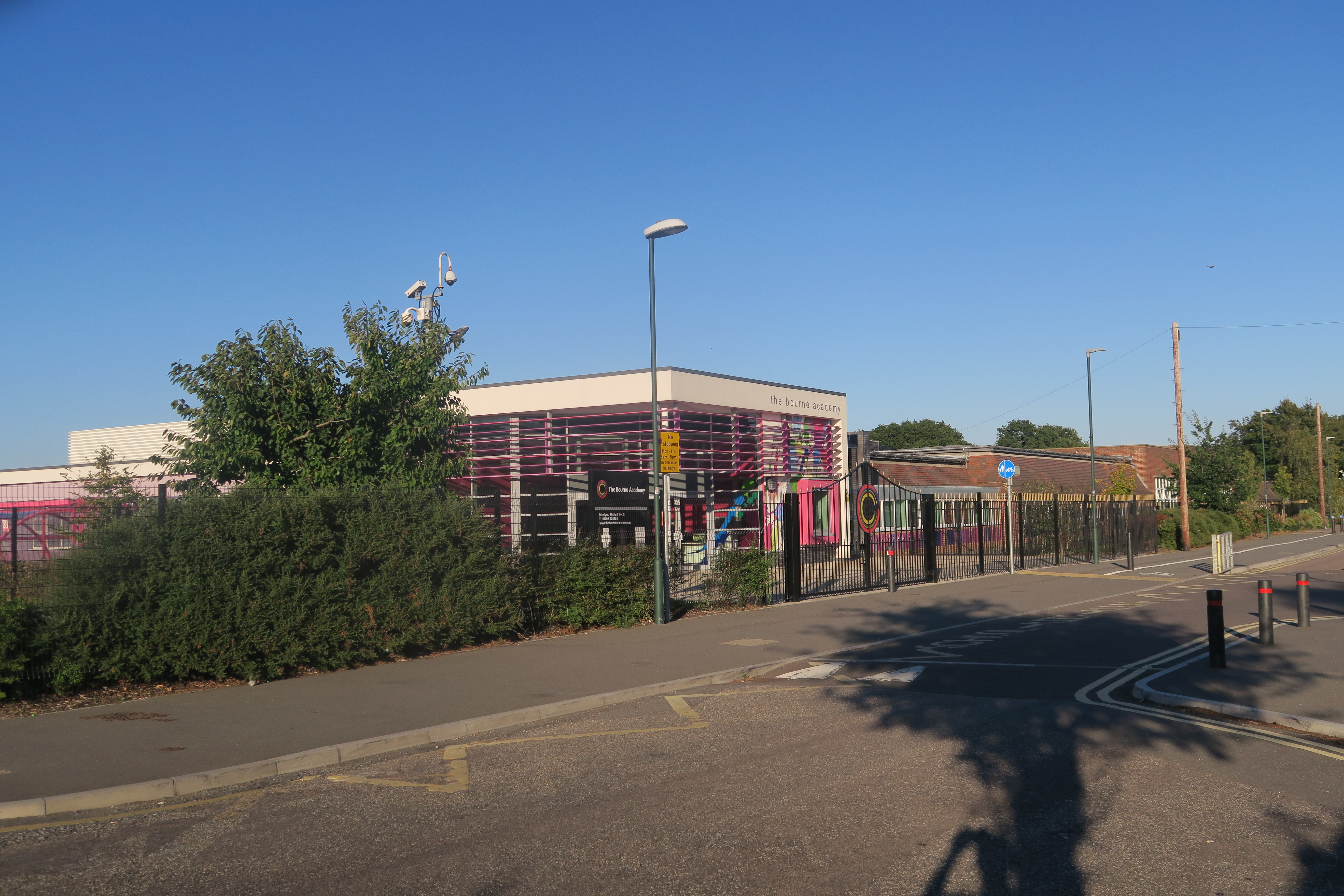
The Bourne Academy

== History == === 1937-1967: East Howe Senior School === The school was built in 1937 as East Howe Senior School for boys and girls. The original East Howe...

Kinson Cemetery

Kinson Cemetery is a municipal cemetery in Kinson, a suburb of Bournemouth, England. The cemetery is owned by Bournemouth, Christchurch and Poole Council...
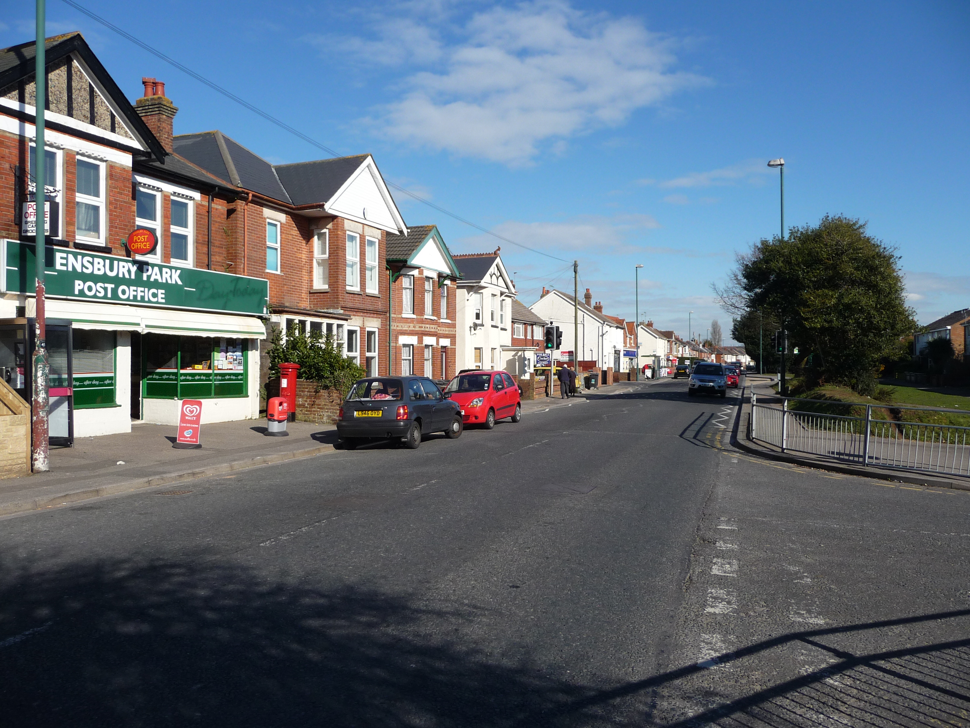
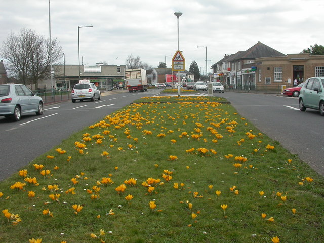
Ensbury Park

Ensbury Park is a mainly residential suburb of Bournemouth, in Dorset, England. It includes the housing estate of Slades Farm and lies within the ward...

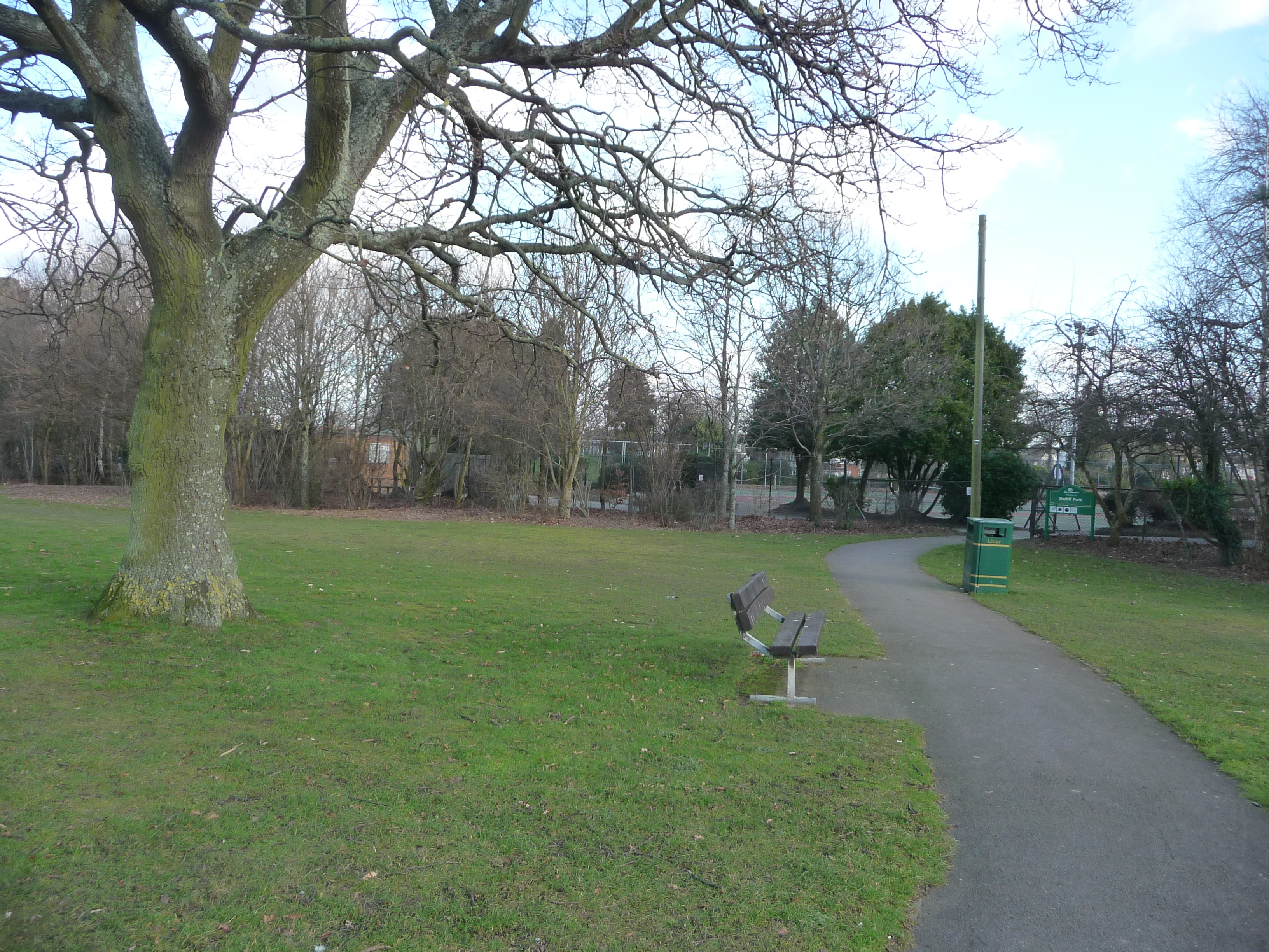
Redhill, Bournemouth

Redhill is a northern suburb of Bournemouth, Dorset in England. == Geography == Redhill borders Ensbury Park from the west, Northbourne to the north, Moordown...

Kinson

Kinson is a former village which has been absorbed by the town of Bournemouth in the county of Dorset in England. The area became part of Bournemouth on...

Slades Farm

Slades Farm is an area of Ensbury Park, Bournemouth, Dorset, England. == History == A renewed spate of housebuilding took place in the 1970s when Bournemouth...

Talbot Village

Talbot Village is located on the boundary of Bournemouth and Poole in Dorset, England. The old Talbot Village was built between 1850 and 1862 because of...

Nearby Amenities

Located within 500m of 50.758692,-1.9002244
Fuel
Esso
Brand: Esso
Brand Wikidata: Q867662
Fuel Diesel: yes
Operator: Motor Fuel Group
Operator Website: https://www.motorfuelgroup.com/locations/east-howe-fs752/
Operator Wikidata: Q107271358
Lat/Long: 50.7590153/-1.9009577
Turning Circle
Lat/Long: 50.7550423/-1.8969529
Post Box
Operator: Royal Mail
Operator Wikidata: Q638098
Post Box Type: pillar
Ref: BH10 366
Ref GB Uprn: 10015422477
Royal Cypher: EIIR
Royal Cypher Wikidata: Q33102113
Lat/Long: 50.7593589/-1.8947121
Post Box
Brand: Royal Mail
Brand Wikidata: Q638098
Brand Wikipedia: en:Royal Mail
Operator: Royal Mail
Operator Wikidata: Q638098
Post Box Type: pillar
Ref: BH10 343
Ref GB Uprn: 10015287583
Royal Cypher: GVIR
Royal Cypher Wikidata: Q33102169
Lat/Long: 50.7588025/-1.9004652
Crossing
Crossing: traffic_signals
Crossing Island: no
Tactile Paving: yes
Traffic Signals Sound: yes
Traffic Signals Vibration: yes
Lat/Long: 50.7594597/-1.9005416
Barrier: cycle_barrier
Motor Vehicle: no
Lat/Long: 50.7582528/-1.9012839
Barrier: kissing_gate
Source: Bournemouth Borough Council
Lat/Long: 50.7614864/-1.901823
Generator Method: photovoltaic
Generator Output Electricity: yes
Generator Source: solar
Generator Type: solar_photovoltaic_panel
Location: roof
Power: generator
Lat/Long: 50.7574679/-1.9067582
Generator Method: photovoltaic
Generator Output Electricity: yes
Generator Source: solar
Generator Type: solar_photovoltaic_panel
Location: roof
Power: generator
Lat/Long: 50.7574781/-1.9066616
Generator Method: photovoltaic
Generator Output Electricity: yes
Generator Source: solar
Generator Type: solar_photovoltaic_panel
Location: roof
Power: generator
Lat/Long: 50.757495/-1.9065677
Generator Method: photovoltaic
Generator Output Electricity: yes
Generator Source: solar
Generator Type: solar_photovoltaic_panel
Location: roof
Power: generator
Lat/Long: 50.7575222/-1.9062405
Generator Method: photovoltaic
Generator Output Electricity: yes
Generator Source: solar
Generator Type: solar_photovoltaic_panel
Location: roof
Power: generator
Lat/Long: 50.7575307/-1.9061627
Generator Method: photovoltaic
Generator Output Electricity: yes
Generator Source: solar
Generator Type: solar_photovoltaic_panel
Location: roof
Power: generator
Lat/Long: 50.7575918/-1.9056209
Generator Method: photovoltaic
Generator Output Electricity: yes
Generator Source: solar
Generator Type: solar_photovoltaic_panel
Location: roof
Power: generator
Lat/Long: 50.7576257/-1.9051864
Generator Method: photovoltaic
Generator Output Electricity: yes
Generator Source: solar
Generator Type: solar_photovoltaic_panel
Location: roof
Power: generator
Lat/Long: 50.7576444/-1.9048055
Generator Method: photovoltaic
Generator Output Electricity: yes
Generator Source: solar
Generator Type: solar_photovoltaic_panel
Location: roof
Power: generator
Lat/Long: 50.7576715/-1.9046044
Generator Method: photovoltaic
Generator Output Electricity: yes
Generator Source: solar
Generator Type: solar_photovoltaic_panel
Location: roof
Power: generator
Lat/Long: 50.7577071/-1.9042503
Generator Method: photovoltaic
Generator Output Electricity: yes
Generator Source: solar
Generator Type: solar_photovoltaic_panel
Location: roof
Power: generator
Lat/Long: 50.7578293/-1.9039418
Generator Method: photovoltaic
Generator Output Electricity: yes
Generator Source: solar
Generator Type: solar_photovoltaic_panel
Location: roof
Power: generator
Lat/Long: 50.7577869/-1.9040089
Generator Method: photovoltaic
Generator Output Electricity: yes
Generator Source: solar
Generator Type: solar_photovoltaic_panel
Location: roof
Power: generator
Lat/Long: 50.7579447/-1.9046741
Generator Method: photovoltaic
Generator Output Electricity: yes
Generator Source: solar
Generator Type: solar_photovoltaic_panel
Location: roof
Power: generator
Lat/Long: 50.7579209/-1.9053071
Generator Method: photovoltaic
Generator Output Electricity: yes
Generator Source: solar
Generator Type: solar_photovoltaic_panel
Location: roof
Power: generator
Lat/Long: 50.7582535/-1.9053312
Generator Method: photovoltaic
Generator Output Electricity: yes
Generator Source: solar
Generator Type: solar_photovoltaic_panel
Location: roof
Power: generator
Lat/Long: 50.7582773/-1.9052534
Generator Method: photovoltaic
Generator Output Electricity: yes
Generator Source: solar
Generator Type: solar_photovoltaic_panel
Location: roof
Power: generator
Lat/Long: 50.758318/-1.9050576
Generator Method: photovoltaic
Generator Output Electricity: yes
Generator Source: solar
Generator Type: solar_photovoltaic_panel
Location: roof
Power: generator
Lat/Long: 50.7582773/-1.9049933
Generator Method: photovoltaic
Generator Output Electricity: yes
Generator Source: solar
Generator Type: solar_photovoltaic_panel
Location: roof
Power: generator
Lat/Long: 50.7582331/-1.9049101
Generator Method: photovoltaic
Generator Output Electricity: yes
Generator Source: solar
Generator Type: solar_photovoltaic_panel
Location: roof
Power: generator
Lat/Long: 50.7585012/-1.9055539
Generator Method: photovoltaic
Generator Output Electricity: yes
Generator Source: solar
Generator Type: solar_photovoltaic_panel
Location: roof
Power: generator
Lat/Long: 50.7582976/-1.906219
Generator Method: photovoltaic
Generator Output Electricity: yes
Generator Source: solar
Generator Type: solar_photovoltaic_panel
Location: roof
Power: generator
Lat/Long: 50.7582077/-1.9066187
Generator Method: photovoltaic
Generator Output Electricity: yes
Generator Source: solar
Generator Type: solar_photovoltaic_panel
Location: roof
Power: generator
Lat/Long: 50.758491/-1.9071069
Generator Method: photovoltaic
Generator Output Electricity: yes
Generator Source: solar
Generator Type: solar_photovoltaic_panel
Location: roof
Power: generator
Lat/Long: 50.7577971/-1.9065704
Generator Method: photovoltaic
Generator Output Electricity: yes
Generator Source: solar
Generator Type: solar_photovoltaic_panel
Location: roof
Power: generator
Lat/Long: 50.7577835/-1.9067635
Generator Method: photovoltaic
Generator Output Electricity: yes
Generator Source: solar
Generator Type: solar_photovoltaic_panel
Location: roof
Power: generator
Lat/Long: 50.7577428/-1.9069513
Generator Method: photovoltaic
Generator Output Electricity: yes
Generator Source: solar
Generator Type: solar_photovoltaic_panel
Location: roof
Power: generator
Lat/Long: 50.7577309/-1.9070291
Generator Method: photovoltaic
Generator Output Electricity: yes
Generator Source: solar
Generator Type: solar_photovoltaic_panel
Location: roof
Power: generator
Lat/Long: 50.7585895/-1.9039392
Generator Method: photovoltaic
Generator Output Electricity: yes
Generator Source: solar
Generator Type: solar_photovoltaic_panel
Location: roof
Power: generator
Lat/Long: 50.7590001/-1.9037487
Generator Method: photovoltaic
Generator Output Electricity: yes
Generator Source: solar
Generator Type: solar_photovoltaic_panel
Location: roof
Power: generator
Lat/Long: 50.7590306/-1.9036656
Generator Method: photovoltaic
Generator Output Electricity: yes
Generator Source: solar
Generator Type: solar_photovoltaic_panel
Location: roof
Power: generator
Lat/Long: 50.7589526/-1.9039445
Generator Method: photovoltaic
Generator Output Electricity: yes
Generator Source: solar
Generator Type: solar_photovoltaic_panel
Location: roof
Power: generator
Lat/Long: 50.7592953/-1.9043039
Generator Method: photovoltaic
Generator Output Electricity: yes
Generator Source: solar
Generator Type: solar_photovoltaic_panel
Location: roof
Power: generator
Lat/Long: 50.7593682/-1.902928
Generator Method: photovoltaic
Generator Output Electricity: yes
Generator Source: solar
Generator Type: solar_photovoltaic_panel
Location: roof
Power: generator
Lat/Long: 50.7596211/-1.9040545
Generator Method: photovoltaic
Generator Output Electricity: yes
Generator Source: solar
Generator Type: solar_photovoltaic_panel
Location: roof
Power: generator
Lat/Long: 50.7598145/-1.9050094
Generator Method: photovoltaic
Generator Output Electricity: yes
Generator Source: solar
Generator Type: solar_photovoltaic_panel
Location: roof
Power: generator
Lat/Long: 50.759884/-1.9053473
Generator Method: photovoltaic
Generator Output Electricity: yes
Generator Source: solar
Generator Type: solar_photovoltaic_panel
Location: roof
Power: generator
Lat/Long: 50.7592325/-1.9053607
Generator Method: photovoltaic
Generator Output Electricity: yes
Generator Source: solar
Generator Type: solar_photovoltaic_panel
Location: roof
Power: generator
Lat/Long: 50.7599316/-1.9068628
Generator Method: photovoltaic
Generator Output Electricity: yes
Generator Source: solar
Generator Type: solar_photovoltaic_panel
Location: roof
Power: generator
Lat/Long: 50.7602166/-1.9068869
Generator Method: photovoltaic
Generator Output Electricity: yes
Generator Source: solar
Generator Type: solar_photovoltaic_panel
Location: roof
Power: generator
Lat/Long: 50.7601148/-1.9064712
Generator Method: photovoltaic
Generator Output Electricity: yes
Generator Source: solar
Generator Type: solar_photovoltaic_panel
Location: roof
Power: generator
Lat/Long: 50.7601029/-1.9064041
Generator Method: photovoltaic
Generator Output Electricity: yes
Generator Source: solar
Generator Type: solar_photovoltaic_panel
Location: roof
Power: generator
Lat/Long: 50.7605305/-1.9066884
Generator Method: photovoltaic
Generator Output Electricity: yes
Generator Source: solar
Generator Type: solar_photovoltaic_panel
Location: roof
Power: generator
Lat/Long: 50.7607578/-1.9063558
Generator Method: photovoltaic
Generator Output Electricity: yes
Generator Source: solar
Generator Type: solar_photovoltaic_panel
Location: roof
Power: generator
Lat/Long: 50.7604694/-1.9063156
Generator Method: photovoltaic
Generator Output Electricity: yes
Generator Source: solar
Generator Type: solar_photovoltaic_panel
Location: roof
Power: generator
Lat/Long: 50.7607188/-1.90616
Generator Method: photovoltaic
Generator Output Electricity: yes
Generator Source: solar
Generator Type: solar_photovoltaic_panel
Location: roof
Power: generator
Lat/Long: 50.7606577/-1.9059347
Generator Method: photovoltaic
Generator Output Electricity: yes
Generator Source: solar
Generator Type: solar_photovoltaic_panel
Location: roof
Power: generator
Lat/Long: 50.7606119/-1.905688
Generator Method: photovoltaic
Generator Output Electricity: yes
Generator Source: solar
Generator Type: solar_photovoltaic_panel
Location: roof
Power: generator
Lat/Long: 50.7605763/-1.9054814
Generator Method: photovoltaic
Generator Output Electricity: yes
Generator Source: solar
Generator Type: solar_photovoltaic_panel
Location: roof
Power: generator
Lat/Long: 50.7605305/-1.9053446
Generator Method: photovoltaic
Generator Output Electricity: yes
Generator Source: solar
Generator Type: solar_photovoltaic_panel
Location: roof
Power: generator
Lat/Long: 50.7605237/-1.9052776
Generator Method: photovoltaic
Generator Output Electricity: yes
Generator Source: solar
Generator Type: solar_photovoltaic_panel
Location: roof
Power: generator
Lat/Long: 50.7604711/-1.9051086
Generator Method: photovoltaic
Generator Output Electricity: yes
Generator Source: solar
Generator Type: solar_photovoltaic_panel
Location: roof
Power: generator
Lat/Long: 50.7604881/-1.9051649
Generator Method: photovoltaic
Generator Output Electricity: yes
Generator Source: solar
Generator Type: solar_photovoltaic_panel
Location: roof
Power: generator
Lat/Long: 50.7603914/-1.9057792
Generator Method: photovoltaic
Generator Output Electricity: yes
Generator Source: solar
Generator Type: solar_photovoltaic_panel
Location: roof
Power: generator
Lat/Long: 50.7603421/-1.9055351
Generator Method: photovoltaic
Generator Output Electricity: yes
Generator Source: solar
Generator Type: solar_photovoltaic_panel
Location: roof
Power: generator
Lat/Long: 50.7602692/-1.9051971
Generator Method: photovoltaic
Generator Output Electricity: yes
Generator Source: solar
Generator Type: solar_photovoltaic_panel
Location: roof
Power: generator
Lat/Long: 50.7601793/-1.9047841
Generator Method: photovoltaic
Generator Output Electricity: yes
Generator Source: solar
Generator Type: solar_photovoltaic_panel
Location: roof
Power: generator
Lat/Long: 50.7601572/-1.9046875
Generator Method: photovoltaic
Generator Output Electricity: yes
Generator Source: solar
Generator Type: solar_photovoltaic_panel
Location: roof
Power: generator
Lat/Long: 50.7603625/-1.9045695
Generator Method: photovoltaic
Generator Output Electricity: yes
Generator Source: solar
Generator Type: solar_photovoltaic_panel
Location: roof
Power: generator
Lat/Long: 50.7603947/-1.904709
Generator Method: photovoltaic
Generator Output Electricity: yes
Generator Source: solar
Generator Type: solar_photovoltaic_panel
Location: roof
Power: generator
Lat/Long: 50.7604321/-1.9048967
Generator Method: photovoltaic
Generator Output Electricity: yes
Generator Source: solar
Generator Type: solar_photovoltaic_panel
Location: roof
Power: generator
Lat/Long: 50.7604473/-1.9049557
Generator Method: photovoltaic
Generator Output Electricity: yes
Generator Source: solar
Generator Type: solar_photovoltaic_panel
Location: roof
Power: generator
Lat/Long: 50.7600707/-1.9042744
Generator Method: photovoltaic
Generator Output Electricity: yes
Generator Source: solar
Generator Type: solar_photovoltaic_panel
Location: roof
Power: generator
Lat/Long: 50.7602726/-1.9041564
Generator Method: photovoltaic
Generator Output Electricity: yes
Generator Source: solar
Generator Type: solar_photovoltaic_panel
Location: roof
Power: generator
Lat/Long: 50.7601878/-1.9037568
Generator Method: photovoltaic
Generator Output Electricity: yes
Generator Source: solar
Generator Type: solar_photovoltaic_panel
Location: roof
Power: generator
Lat/Long: 50.7599621/-1.9037729
Generator Method: photovoltaic
Generator Output Electricity: yes
Generator Source: solar
Generator Type: solar_photovoltaic_panel
Location: roof
Power: generator
Lat/Long: 50.7599197/-1.9036066
Generator Method: photovoltaic
Generator Output Electricity: yes
Generator Source: solar
Generator Type: solar_photovoltaic_panel
Location: roof
Power: generator
Lat/Long: 50.7600724/-1.9031157
Generator Method: photovoltaic
Generator Output Electricity: yes
Generator Source: solar
Generator Type: solar_photovoltaic_panel
Location: roof
Power: generator
Lat/Long: 50.7608495/-1.9048484
Generator Method: photovoltaic
Generator Output Electricity: yes
Generator Source: solar
Generator Type: solar_photovoltaic_panel
Location: roof
Power: generator
Lat/Long: 50.7606107/-1.9002046
Generator Method: photovoltaic
Generator Output Electricity: yes
Generator Source: solar
Generator Type: solar_photovoltaic_panel
Location: roof
Power: generator
Lat/Long: 50.7605937/-1.9001429
Generator Method: photovoltaic
Generator Output Electricity: yes
Generator Source: solar
Generator Type: solar_photovoltaic_panel
Location: roof
Power: generator
Lat/Long: 50.760575/-1.9000517
Generator Method: photovoltaic
Generator Output Electricity: yes
Generator Source: solar
Generator Type: solar_photovoltaic_panel
Location: roof
Power: generator
Lat/Long: 50.7608346/-1.8999122
Generator Method: photovoltaic
Generator Output Electricity: yes
Generator Source: solar
Generator Type: solar_photovoltaic_panel
Location: roof
Power: generator
Lat/Long: 50.7608143/-1.8997996
Generator Method: photovoltaic
Generator Output Electricity: yes
Generator Source: solar
Generator Type: solar_photovoltaic_panel
Location: roof
Power: generator
Lat/Long: 50.760816/-1.8996762
Generator Method: photovoltaic
Generator Output Electricity: yes
Generator Source: solar
Generator Type: solar_photovoltaic_panel
Location: roof
Power: generator
Lat/Long: 50.7608024/-1.8996091
Generator Method: photovoltaic
Generator Output Electricity: yes
Generator Source: solar
Generator Type: solar_photovoltaic_panel
Location: roof
Power: generator
Lat/Long: 50.7608821/-1.9000302
Generator Method: photovoltaic
Generator Output Electricity: yes
Generator Source: solar
Generator Type: solar_photovoltaic_panel
Location: roof
Power: generator
Lat/Long: 50.7606276/-1.8997808
Generator Method: photovoltaic
Generator Output Electricity: yes
Generator Source: solar
Generator Type: solar_photovoltaic_panel
Location: roof
Power: generator
Lat/Long: 50.7605767/-1.8998076
Generator Method: photovoltaic
Generator Output Electricity: yes
Generator Source: solar
Generator Type: solar_photovoltaic_panel
Location: roof
Power: generator
Lat/Long: 50.7605598/-1.899754
Generator Method: photovoltaic
Generator Output Electricity: yes
Generator Source: solar
Generator Type: solar_photovoltaic_panel
Location: roof
Power: generator
Lat/Long: 50.7606208/-1.8997245
Generator Method: photovoltaic
Generator Output Electricity: yes
Generator Source: solar
Generator Type: solar_photovoltaic_panel
Location: roof
Power: generator
Lat/Long: 50.7610569/-1.8994831
Generator Method: photovoltaic
Generator Output Electricity: yes
Generator Source: solar
Generator Type: solar_photovoltaic_panel
Location: roof
Power: generator
Lat/Long: 50.7610433/-1.8994321
Generator Method: photovoltaic
Generator Output Electricity: yes
Generator Source: solar
Generator Type: solar_photovoltaic_panel
Location: roof
Power: generator
Lat/Long: 50.761084/-1.8997218
Generator Method: photovoltaic
Generator Output Electricity: yes
Generator Source: solar
Generator Type: solar_photovoltaic_panel
Location: roof
Power: generator
Lat/Long: 50.7611129/-1.8998559
Generator Method: photovoltaic
Generator Output Electricity: yes
Generator Source: solar
Generator Type: solar_photovoltaic_panel
Location: roof
Power: generator
Lat/Long: 50.7614895/-1.8998639
Generator Method: photovoltaic
Generator Output Electricity: yes
Generator Source: solar
Generator Type: solar_photovoltaic_panel
Location: roof
Power: generator
Lat/Long: 50.7614912/-1.8997915
Generator Method: photovoltaic
Generator Output Electricity: yes
Generator Source: solar
Generator Type: solar_photovoltaic_panel
Location: roof
Power: generator
Lat/Long: 50.7614997/-1.8997298
Generator Method: photovoltaic
Generator Output Electricity: yes
Generator Source: solar
Generator Type: solar_photovoltaic_panel
Location: roof
Power: generator
Lat/Long: 50.7614963/-1.9000597
Generator Method: photovoltaic
Generator Output Electricity: yes
Generator Source: solar
Generator Type: solar_photovoltaic_panel
Location: roof
Power: generator
Lat/Long: 50.7616439/-1.8984558
Generator Method: photovoltaic
Generator Output Electricity: yes
Generator Source: solar
Generator Type: solar_photovoltaic_panel
Location: roof
Power: generator
Lat/Long: 50.7616592/-1.8980213
Generator Method: photovoltaic
Generator Output Electricity: yes
Generator Source: solar
Generator Type: solar_photovoltaic_panel
Location: roof
Power: generator
Lat/Long: 50.7613996/-1.8980025
Generator Method: photovoltaic
Generator Output Electricity: yes
Generator Source: solar
Generator Type: solar_photovoltaic_panel
Location: roof
Power: generator
Lat/Long: 50.7612282/-1.8984853
Generator Method: photovoltaic
Generator Output Electricity: yes
Generator Source: solar
Generator Type: solar_photovoltaic_panel
Location: roof
Power: generator
Lat/Long: 50.7608363/-1.8983378
Generator Method: photovoltaic
Generator Output Electricity: yes
Generator Source: solar
Generator Type: solar_photovoltaic_panel
Location: roof
Power: generator
Lat/Long: 50.7608024/-1.8985175
Generator Method: photovoltaic
Generator Output Electricity: yes
Generator Source: solar
Generator Type: solar_photovoltaic_panel
Location: roof
Power: generator
Lat/Long: 50.7607701/-1.8986113
Generator Method: photovoltaic
Generator Output Electricity: yes
Generator Source: solar
Generator Type: solar_photovoltaic_panel
Location: roof
Power: generator
Lat/Long: 50.7605716/-1.8976994
Generator Method: photovoltaic
Generator Output Electricity: yes
Generator Source: solar
Generator Type: solar_photovoltaic_panel
Location: roof
Power: generator
Lat/Long: 50.7604478/-1.8979703
Generator Method: photovoltaic
Generator Output Electricity: yes
Generator Source: solar
Generator Type: solar_photovoltaic_panel
Location: roof
Power: generator
Lat/Long: 50.7603748/-1.8981581
Generator Method: photovoltaic
Generator Output Electricity: yes
Generator Source: solar
Generator Type: solar_photovoltaic_panel
Location: roof
Power: generator
Lat/Long: 50.7603511/-1.8982573
Generator Method: photovoltaic
Generator Output Electricity: yes
Generator Source: solar
Generator Type: solar_photovoltaic_panel
Location: roof
Power: generator
Lat/Long: 50.7611281/-1.8975599
Generator Method: photovoltaic
Generator Output Electricity: yes
Generator Source: solar
Generator Type: solar_photovoltaic_panel
Location: roof
Power: generator
Lat/Long: 50.7605292/-1.8969993
Generator Method: photovoltaic
Generator Output Electricity: yes
Generator Source: solar
Generator Type: solar_photovoltaic_panel
Location: roof
Power: generator
Lat/Long: 50.7604104/-1.8972059
Generator Method: photovoltaic
Generator Output Electricity: yes
Generator Source: solar
Generator Type: solar_photovoltaic_panel
Location: roof
Power: generator
Lat/Long: 50.7602052/-1.8976699
Generator Method: photovoltaic
Generator Output Electricity: yes
Generator Source: solar
Generator Type: solar_photovoltaic_panel
Location: roof
Power: generator
Lat/Long: 50.7600335/-1.8971178
Generator Method: photovoltaic
Generator Output Electricity: yes
Generator Source: solar
Generator Type: solar_photovoltaic_panel
Location: roof
Power: generator
Lat/Long: 50.7600031/-1.8986058
Generator Method: photovoltaic
Generator Output Electricity: yes
Generator Source: solar
Generator Type: solar_photovoltaic_panel
Location: roof
Power: generator
Lat/Long: 50.7599964/-1.898515
Generator Method: photovoltaic
Generator Output Electricity: yes
Generator Source: solar
Generator Type: solar_photovoltaic_panel
Location: roof
Power: generator
Lat/Long: 50.7596212/-1.8981463
Generator Method: photovoltaic
Generator Output Electricity: yes
Generator Source: solar
Generator Type: solar_photovoltaic_panel
Location: roof
Power: generator
Lat/Long: 50.7594759/-1.8987474
Generator Method: photovoltaic
Generator Output Electricity: yes
Generator Source: solar
Generator Type: solar_photovoltaic_panel
Location: roof
Power: generator
Lat/Long: 50.7598747/-1.8973689
Generator Method: photovoltaic
Generator Output Electricity: yes
Generator Source: solar
Generator Type: solar_photovoltaic_panel
Location: roof
Power: generator
Lat/Long: 50.7600521/-1.8988863
Generator Method: photovoltaic
Generator Output Electricity: yes
Generator Source: solar
Generator Type: solar_photovoltaic_panel
Location: roof
Power: generator
Lat/Long: 50.7604678/-1.8988409
Generator Method: photovoltaic
Generator Output Electricity: yes
Generator Source: solar
Generator Type: solar_photovoltaic_panel
Location: roof
Power: generator
Lat/Long: 50.7590889/-1.8988649
Generator Method: photovoltaic
Generator Output Electricity: yes
Generator Source: solar
Generator Type: solar_photovoltaic_panel
Location: roof
Power: generator
Lat/Long: 50.7575043/-1.899697
Generator Method: photovoltaic
Generator Output Electricity: yes
Generator Source: solar
Generator Type: solar_photovoltaic_panel
Location: roof
Power: generator
Lat/Long: 50.7557956/-1.9003259
Generator Method: photovoltaic
Generator Output Electricity: yes
Generator Source: solar
Generator Type: solar_photovoltaic_panel
Location: roof
Power: generator
Lat/Long: 50.7553019/-1.90057
Generator Method: photovoltaic
Generator Output Electricity: yes
Generator Source: solar
Generator Type: solar_photovoltaic_panel
Location: roof
Power: generator
Lat/Long: 50.7620508/-1.8966227
Generator Method: photovoltaic
Generator Output Electricity: yes
Generator Source: solar
Generator Type: solar_photovoltaic_panel
Location: roof
Power: generator
Lat/Long: 50.7619372/-1.8971564
Generator Method: photovoltaic
Generator Output Electricity: yes
Generator Source: solar
Generator Type: solar_photovoltaic_panel
Location: roof
Power: generator
Lat/Long: 50.7618472/-1.8964644
Generator Method: photovoltaic
Generator Output Electricity: yes
Generator Source: solar
Generator Type: solar_photovoltaic_panel
Location: roof
Power: generator
Lat/Long: 50.7618201/-1.8963974
Generator Method: photovoltaic
Generator Output Electricity: yes
Generator Source: solar
Generator Type: solar_photovoltaic_panel
Location: roof
Power: generator
Lat/Long: 50.7617098/-1.8963008
Generator Method: photovoltaic
Generator Output Electricity: yes
Generator Source: solar
Generator Type: solar_photovoltaic_panel
Location: roof
Power: generator
Lat/Long: 50.7615707/-1.8966763
Generator Method: photovoltaic
Generator Output Electricity: yes
Generator Source: solar
Generator Type: solar_photovoltaic_panel
Location: roof
Power: generator
Lat/Long: 50.7614536/-1.8963759
Generator Method: photovoltaic
Generator Output Electricity: yes
Generator Source: solar
Generator Type: solar_photovoltaic_panel
Location: roof
Power: generator
Lat/Long: 50.7610617/-1.8966388
Generator Method: photovoltaic
Generator Output Electricity: yes
Generator Source: solar
Generator Type: solar_photovoltaic_panel
Location: roof
Power: generator
Lat/Long: 50.7609898/-1.9041746
Generator Method: photovoltaic
Generator Output Electricity: yes
Generator Source: solar
Generator Type: solar_photovoltaic_panel
Location: roof
Power: generator
Lat/Long: 50.7607998/-1.9032305
Generator Method: photovoltaic
Generator Output Electricity: yes
Generator Source: solar
Generator Type: solar_photovoltaic_panel
Location: roof
Power: generator
Lat/Long: 50.760831/-1.8992287
Generator Method: photovoltaic
Generator Output Electricity: yes
Generator Source: solar
Generator Type: solar_photovoltaic_panel
Location: roof
Power: generator
Lat/Long: 50.7563045/-1.8946811
Generator Method: photovoltaic
Generator Output Electricity: yes
Generator Source: solar
Generator Type: solar_photovoltaic_panel
Location: roof
Power: generator
Lat/Long: 50.7581251/-1.8932032
Generator Method: photovoltaic
Generator Output Electricity: yes
Generator Source: solar
Generator Type: solar_photovoltaic_panel
Location: roof
Power: generator
Lat/Long: 50.7584651/-1.8985468
Generator Method: photovoltaic
Generator Output Electricity: yes
Generator Source: solar
Generator Type: solar_photovoltaic_panel
Location: roof
Power: generator
Lat/Long: 50.7603146/-1.8997981
Generator Method: photovoltaic
Generator Output Electricity: yes
Generator Source: solar
Generator Type: solar_photovoltaic_panel
Location: roof
Power: generator
Lat/Long: 50.7603315/-1.8998705
Generator Method: photovoltaic
Generator Output Electricity: yes
Generator Source: solar
Generator Type: solar_photovoltaic_panel
Location: roof
Power: generator
Lat/Long: 50.7603782/-1.8997578
Generator Method: photovoltaic
Generator Output Electricity: yes
Generator Source: solar
Generator Type: solar_photovoltaic_panel
Location: roof
Power: generator
Lat/Long: 50.7603917/-1.8998356
Generator Method: photovoltaic
Generator Output Electricity: yes
Generator Source: solar
Generator Type: solar_photovoltaic_panel
Location: roof
Power: generator
Lat/Long: 50.760435/-1.8997793
Generator Method: photovoltaic
Generator Output Electricity: yes
Generator Source: solar
Generator Type: solar_photovoltaic_panel
Location: roof
Power: generator
Lat/Long: 50.7604537/-1.8998396
Generator Method: photovoltaic
Generator Output Electricity: yes
Generator Source: solar
Generator Type: solar_photovoltaic_panel
Location: roof
Power: generator
Lat/Long: 50.7602715/-1.9002507
Bus Stop
Tedder Road
Bench: no
Bin: no
Bus: yes
Lit: no
Naptan AtcoCode: 1290BOB20133
Naptan Bearing: NE
Naptan CommonName: Tedder Road
Naptan Indicator: NE-bound
Naptan NaptanCode: bouajtd
Naptan PlusbusZoneRef: BOMO
Naptan Street: Montgomery Avenue
Naptan Verified: no
Public Transport: platform
Shelter: no
Tactile Paving: no
Lat/Long: 50.7589557/-1.9048351
Bus Stop
Tedder Road
Bench: no
Bin: no
Bus: yes
Lit: no
Naptan AtcoCode: 1290BOB20132
Naptan Bearing: W
Naptan CommonName: Tedder Road
Naptan Indicator: W-bound
Naptan NaptanCode: bouajpg
Naptan PlusbusZoneRef: BOMO
Naptan Street: Montgomery Avenue
Naptan Verified: no
Public Transport: platform
Shelter: no
Tactile Paving: no
Lat/Long: 50.7587436/-1.9051436
Bus Stop
Moorside Road
Bench: yes
Bin: no
Bus: yes
Lit: yes
Naptan AtcoCode: 1290BOB20134
Naptan Bearing: NE
Naptan CommonName: Moorside Road
Naptan Indicator: NE-bound
Naptan NaptanCode: bouamdp
Naptan PlusbusZoneRef: BOMO
Naptan Street: Montgomery Avenue
Naptan Verified: no
Public Transport: platform
Shelter: yes
Tactile Paving: no
Lat/Long: 50.7600034/-1.9022414
Bus Stop
Moorside Road
Bench: yes
Bin: no
Bus: yes
Lit: yes
Naptan AtcoCode: 1290BOB20135
Naptan Bearing: SW
Naptan CommonName: Moorside Road
Naptan Indicator: SW-bound
Naptan NaptanCode: bouamgm
Naptan PlusbusZoneRef: BOMO
Naptan Street: Montgomery Avenue
Naptan Verified: no
Public Transport: platform
Shelter: yes
Tactile Paving: no
Lat/Long: 50.760056/-1.9017962
Bus Stop
East Howe Shops
Bench: yes
Bin: yes
Bus: yes
Lit: yes
Naptan AtcoCode: 1290DOB20924
Naptan Bearing: S
Naptan CommonName: East Howe Shops
Naptan Indicator: S-bound
Naptan NaptanCode: bouamta
Naptan PlusbusZoneRef: BOMO
Naptan Verified: no
Public Transport: platform
Shelter: yes
Tactile Paving: no
Lat/Long: 50.7590278/-1.9004832
Bus Stop
East Howe Shops
Bench: no
Bin: yes
Bus: yes
Lit: no
Naptan AtcoCode: 1290DOB20926
Naptan Bearing: SW
Naptan CommonName: East Howe Shops
Naptan Indicator: SW-bound
Naptan NaptanCode: bouamtp
Naptan PlusbusZoneRef: BOMO
Naptan Street: East Howe Lane
Naptan Verified: no
Public Transport: platform
Shelter: no
Tactile Paving: no
Lat/Long: 50.7587657/-1.8996879
Bus Stop
Green Lane
Bench: yes
Bin: no
Bus: yes
Lit: no
Naptan AtcoCode: 1290DOB21003
Naptan Bearing: NE
Naptan CommonName: Green Lane
Naptan Indicator: NE-bound
Naptan NaptanCode: bouapdt
Naptan PlusbusZoneRef: BOMO
Naptan Street: East Howe Lane
Naptan Verified: no
Public Transport: platform
Shelter: no
Tactile Paving: no
Lat/Long: 50.7599576/-1.8969159
Bus Stop
Green Lane
Bench: no
Bin: no
Bus: yes
Lit: no
Naptan AtcoCode: 1290DOB21002
Naptan Bearing: SW
Naptan CommonName: Green Lane
Naptan Indicator: SW-bound
Naptan NaptanCode: bouapgj
Naptan PlusbusZoneRef: BOMO
Naptan Street: East Howe Lane
Naptan Verified: no
Public Transport: platform
Shelter: no
Tactile Paving: no
Lat/Long: 50.7601298/-1.8963781
Bus Stop
Brook Road
Bench: no
Bin: no
Bus: yes
Lit: no
Naptan AtcoCode: 1290DOB20922
Naptan Bearing: S
Naptan CommonName: Brook Road
Naptan Indicator: S-bound
Naptan NaptanCode: bouamgp
Naptan PlusbusZoneRef: BOMO
Naptan Street: Kinson Road
Naptan Verified: no
Public Transport: platform
Shelter: no
Tactile Paving: no
Lat/Long: 50.7616687/-1.9017023
Bus Stop
Brook Road
Bench: no
Bin: no
Bus: yes
Lit: no
Naptan AtcoCode: 1290DOB20923
Naptan Bearing: N
Naptan CommonName: Brook Road
Naptan Indicator: opp
Naptan NaptanCode: bouamgj
Naptan PlusbusZoneRef: BOMO
Naptan Street: Kinson Road
Naptan Verified: no
Public Transport: platform
Shelter: no
Tactile Paving: no
Lat/Long: 50.7616483/-1.9018444
Grit Bin
Lat/Long: 50.7608092/-1.8959679
Onyx Lift Services
Office: yes
Lat/Long: 50.7588759/-1.8991967
Shop: vacant
Lat/Long: 50.7588272/-1.899266
Fast Food
Hong Kong City
Addr Housenumber: 11
Addr Postcode: BH10 5HX
Addr Street: East Howe Lane
Cuisine: chinese
Fhrs Id: 463047
Source Addr: FHRS Open Data
Lat/Long: 50.7587945/-1.899322
M+M Hair
Shop: hairdresser
Lat/Long: 50.758756/-1.8993796
In Dulge
Shop: hairdresser
Lat/Long: 50.7587164/-1.8994423
T Tech Computers
Shop: computer
Lat/Long: 50.7586726/-1.8995098
Fast Food
Chips Ahoy
Addr Housenumber: 3
Addr Postcode: BH10 5HX
Addr Street: East Howe Lane
Cuisine: fish_and_chips
Fhrs Id: 342764
Source Addr: FHRS Open Data
Lat/Long: 50.7586351/-1.8995807
EH Wash & Dry
Self Service: yes
Shop: laundry
Lat/Long: 50.758585/-1.8996598
Your Salon
Shop: hairdresser
Lat/Long: 50.7594522/-1.9007884
Urban Image
Shop: tattoo
Lat/Long: 50.7595544/-1.9007967
Smith's News
Addr Housenumber: 287
Addr Postcode: BH10 5HE
Addr Street: Kinson Road
Fhrs Id: 495366
Shop: newsagent
Source Addr: FHRS Open Data
Lat/Long: 50.7596367/-1.9008412
Hillside Stores
Addr Housenumber: 289
Addr Postcode: BH10 5HE
Addr Street: Kinson Road
Brand: Premier
Brand Wikidata: Q7240340
Brand Wikipedia: en:Premier Stores
Fhrs Id: 583438
Shop: convenience
Source Addr: FHRS Open Data
Website: https://www.premier-stores.co.uk/our-stores/hillside-stores-1
Lat/Long: 50.7597347/-1.9008972
Fast Food
Foodalicious
Lat/Long: 50.759791/-1.9009318
Crossing
Lat/Long: 50.7571527/-1.9055988
Crossing
Lat/Long: 50.7566558/-1.9057997
The data included in this document is from www.openstreetmap.org. The data is made available under ODbL.

Have you been to East Howe?

Leave your review of East Howe below (or comments, questions and feedback).