Chestnut Copse
Wood, Forest in Hampshire Hart
England
Chestnut Copse

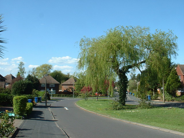
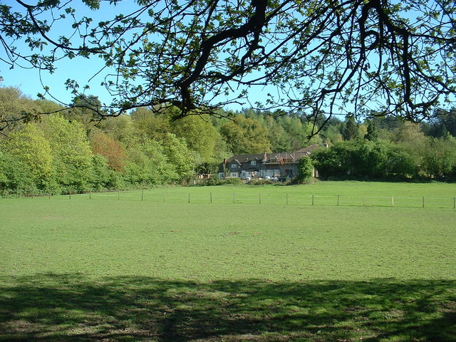
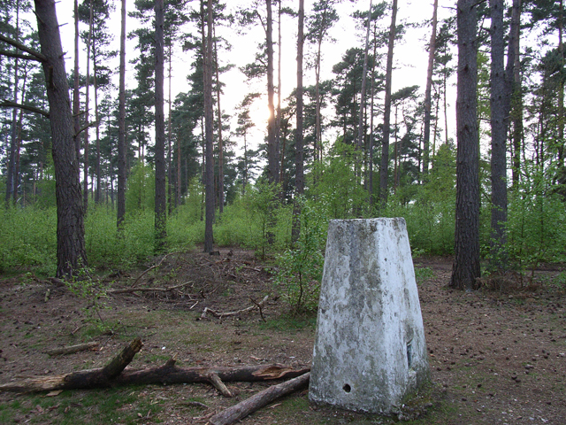
Chestnut Copse is a picturesque woodland located in the county of Hampshire, England. Situated in the southern region of the country, it covers an area of approximately 50 acres. The copse is mainly composed of chestnut trees, which give it its name, but it also contains a variety of other native tree species, such as oak, beech, and birch.
The woodland is a popular destination for nature enthusiasts and hikers, offering a tranquil and peaceful environment. It is characterized by its dense canopy, which provides shade and shelter for various wildlife species. Visitors can expect to encounter a diverse range of flora and fauna, including squirrels, foxes, and various bird species.
Chestnut Copse is crisscrossed by a network of well-maintained footpaths, allowing visitors to explore the woodland and enjoy its natural beauty. There are also designated picnic areas and benches for those who wish to relax and take in the surroundings. The copse is particularly beautiful during the autumn months when the leaves of the chestnut trees turn vibrant shades of orange and gold.
The woodland is managed and maintained by the local council, ensuring that it remains a safe and accessible place for both visitors and the local ecosystem. The council conducts regular tree maintenance to ensure the health and longevity of the woodland, as well as to preserve its natural charm.
Overall, Chestnut Copse in Hampshire is a stunning woodland that offers a tranquil escape from the hustle and bustle of daily life. Its diverse range of trees, wildlife, and vibrant colors make it a must-visit destination for nature lovers and outdoor enthusiasts alike.
If you have any feedback on the listing, please let us know in the comments section below.
Chestnut Copse Images
Images are sourced within 2km of 51.256815/-0.81396519 or Grid Reference SU8251. Thanks to Geograph Open Source API. All images are credited.


Chestnut Copse is located at Grid Ref: SU8251 (Lat: 51.256815, Lng: -0.81396519)
Administrative County: Hampshire
District: Hart
Police Authority: Hampshire
What 3 Words
///heartache.rides.armful. Near Fleet, Hampshire
Nearby Locations
Related Wikis
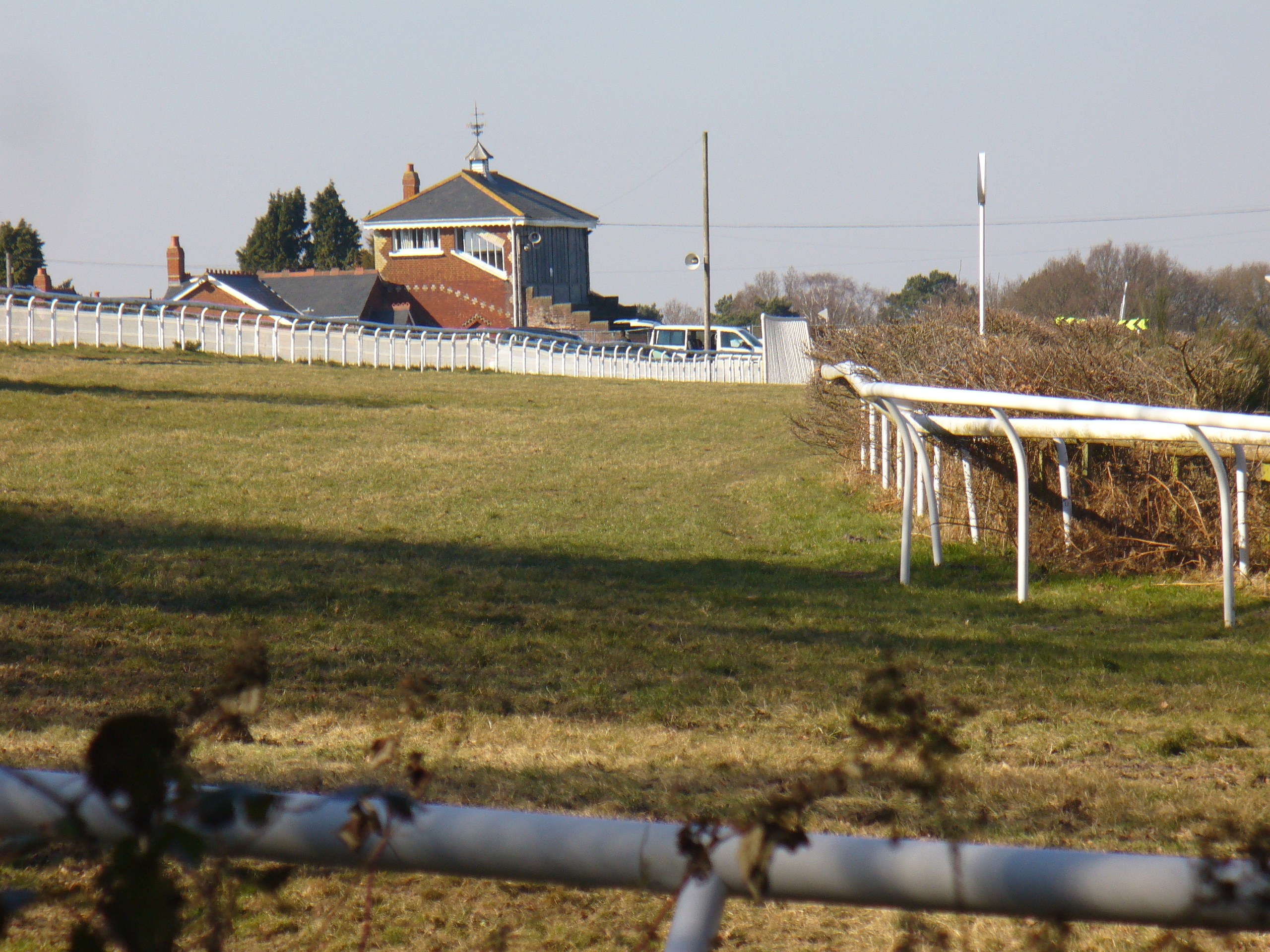
Tweseldown Racecourse
Tweseldown Racecourse southeast of Fleet, Hampshire was originally a National Hunt steeplechasing venue and the home of the equestrian dressage and eventing...

Bourley and Long Valley
Bourley and Long Valley is a 823.5-hectare (2,035-acre) biological Site of Special Scientific Interest between Fleet and Aldershot in Hampshire. It is...
Queen Elizabeth Barracks, Church Crookham
Queen Elizabeth Barracks was a military installation at Church Crookham, Hampshire, England. == History == The barracks, which were originally known as...

Caesar's Camp, Rushmoor and Waverley
Caesar's Camp is an Iron Age hill fort straddling the border of the counties of Surrey and Hampshire in southern England. The fort straddles the borough...

Church Crookham
Church Crookham is a large suburban village and civil parish, contiguous with the town of Fleet, in northeast Hampshire, England. It is 38 miles (61 km...

Royal Pavilion, Aldershot
The Royal Pavilion, also known as the Queen's Pavilion, was a royal residence located at Aldershot in Hampshire. The most unpretentious of all royal residences...

Eelmoor Marsh
Eelmoor Marsh is a 66.3-hectare (164-acre) biological Site of Special Scientific Interest between Fleet and Farnborough in Hampshire. It is part of Thames...
Rushmoor Arena
Rushmoor Arena is an outdoor arena in Aldershot. It is a secure area of 28 Hectares (68 acres) surrounded by a security fence which is mainly hidden by...
Related Videos

New Workshop Build - Part 1
This is the start of our new journey moving into a new woodworking workshop which was in a terrible state and needed complete ...

Silent Walk - Medieval Castle, England - 4K
Today we are walking around the Farnham Castle Keep, the medieval palace for the Bishops of Winchester. Farnham Castle was ...

Nearby Amenities
Located within 500m of 51.256815,-0.81396519Have you been to Chestnut Copse?
Leave your review of Chestnut Copse below (or comments, questions and feedback).