Wood Whins Belt

Wood, Forest in Yorkshire

England

Wood Whins Belt

The clubhouse at Kilnwick Percy Golf Club
The clubhouse at Kilnwick Percy Golf Club Credit: Rod Allday

Wood Whins Belt is a picturesque woodland area located in Yorkshire, England. Covering an area of approximately 100 acres, it is a haven for nature enthusiasts and those seeking tranquility amidst the beauty of nature. The woodland is situated in close proximity to the village of Wood, nestled within the larger Forest of Yorkshire.

The Wood Whins Belt is characterized by a diverse range of tree species, including oak, beech, and birch, among others. These towering trees create a dense canopy, providing shade and shelter for a wide array of flora and fauna. The forest floor is carpeted with lush vegetation, including ferns, bluebells, and wildflowers, creating a vibrant and colorful display throughout the seasons.

The woodland is crisscrossed by a network of well-maintained footpaths, allowing visitors to explore and immerse themselves in the natural surroundings. These paths lead to hidden clearings, babbling brooks, and small ponds, providing opportunities for peaceful reflection and wildlife observation. The Wood Whins Belt is home to a variety of bird species, such as woodpeckers, owls, and thrushes, making it a popular spot for birdwatchers.

The management of Wood Whins Belt focuses on preserving the natural biodiversity and maintaining the delicate balance of the ecosystem. The woodland is protected as a Site of Special Scientific Interest (SSSI), ensuring the conservation of its unique flora and fauna.

Wood Whins Belt offers a serene escape from the hustle and bustle of everyday life, providing visitors with a chance to reconnect with nature and enjoy the peaceful ambiance of this enchanting woodland.

If you have any feedback on the listing, please let us know in the comments section below.

Wood Whins Belt Images

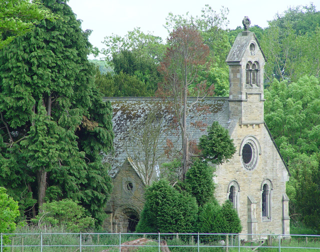
Images are sourced within 2km of 53.923879/-0.74350353 or Grid Reference SE8248. Thanks to Geograph Open Source API. All images are credited.

The clubhouse at Kilnwick Percy Golf Club
Kilnwick Road Looking along the B1246 away from Pocklington.
Kilnwick Road
Looking along the B1246 away from Pocklington.
Along the B1246 Looking along Kilnwick Road between Pocklington and Warter.
Along the B1246
Looking along Kilnwick Road between Pocklington and Warter.
Along Fishpond Hill Looking along the road between Pocklington and Warter.
Along Fishpond Hill
Looking along the road between Pocklington and Warter.
Farmland beside Featherbed Lane Looking across a recently baled field from the corner of Fishpond Hill and Featherbed Lane.
Farmland beside Featherbed Lane
Looking across a recently baled field from the corner of Fishpond Hill and Featherbed Lane.
Field boundary off Featherstone Lane Looking across farmland from Featherstone Lane.
Field boundary off Featherstone Lane
Looking across farmland from Featherstone Lane.
Kilnwick Percy Wood Looking across farmland towards woodland from Featherbed Lane.
Kilnwick Percy Wood
Looking across farmland towards woodland from Featherbed Lane.
Towards Cottage Farm Looking along Lowfield Lane towards Cottage Farm.
Towards Cottage Farm
Looking along Lowfield Lane towards Cottage Farm.
Along Lowfield Lane Looking along Lowfield Lane towards Nunburnholme.
Along Lowfield Lane
Looking along Lowfield Lane towards Nunburnholme.
Field off Lowfield Lane Looking across farmland near Stock Bridge.
Field off Lowfield Lane
Looking across farmland near Stock Bridge.
Farmland near Stock Bridge Looking across farmland near Nunburnholme from Lowfield Lane.
Farmland near Stock Bridge
Looking across farmland near Nunburnholme from Lowfield Lane.
Yorkshire Wolds Way towards Wold Farm
Path junction north of Bratt Wood
Yorkshire Wolds Way Towards Kilnwick Percy Hill (road).
Yorkshire Wolds Way
Towards Kilnwick Percy Hill (road).
Gate  and  track  going   right  into  Bratt  Wood The field track becomes Bratt Lane. Route of Yorkshire Wolds Way
Gate and track going right into Bratt Wood
The field track becomes Bratt Lane. Route of Yorkshire Wolds Way
Field  edge  Singleton's  Wood  to  the  left This is a very large field, rising all the time and the footpath crosses extensive ridge and furrow. There is usually cattle in this field in summer.
Field edge Singleton's Wood to the left
This is a very large field, rising all the time and the footpath crosses extensive ridge and furrow. There is usually cattle in this field in summer.
Hessey  Barn  no  more Yorkshire Wolds Way straight ahead. The flat area beyond the gate on the right is called Hessey Barn but there is nothing standing today, a footpath goes through the gate along two fields to a long plantation called The Belt.
Hessey Barn no more
Yorkshire Wolds Way straight ahead. The flat area beyond the gate on the right is called Hessey Barn but there is nothing standing today, a footpath goes through the gate along two fields to a long plantation called The Belt.
Show me another place!

Wood Whins Belt is located at Grid Ref: SE8248 (Lat: 53.923879, Lng: -0.74350353)

Division: East Riding

Unitary Authority: East Riding of Yorkshire

Police Authority: Humberside

What 3 Words

///backfired.hiking.support. Near Hayton, East Yorkshire

Related Wikis

Pocklington Rural District

Pocklington was a rural district in the East Riding of Yorkshire, England from 1894 to 1974.The district surrounded but did not originally include Pocklington...

Pocklington Iron Age burial ground

The Pocklington Iron Age burial ground is a prehistoric cemetery discovered in 2014 on the outskirts of Pocklington in the East Riding of Yorkshire, England...

Woldgate School and Sixth Form College

Woldgate School (formerly College) is a coeducational secondary school and sixth form on Kilnwick Road in Pocklington, East Riding of Yorkshire, England...

Kilnwick Percy

Kilnwick Percy is a village and former civil parish, now in the parish of Nunburnholme, in the East Riding of Yorkshire, England. It is situated approximately...

Nearby Amenities

Located within 500m of 53.923879,-0.74350353
Power: pole
Lat/Long: 53.9262297/-0.7401752
Power: pole
Lat/Long: 53.9273488/-0.7406411
Power: pole
Lat/Long: 53.9240171/-0.7394796
Power: pole
Lat/Long: 53.9251077/-0.7398445
Power: pole
Lat/Long: 53.9217071/-0.738616
Power: pole
Lat/Long: 53.9207395/-0.7382842
Wood Whins
Place: locality
Lat/Long: 53.9244665/-0.741104
The data included in this document is from www.openstreetmap.org. The data is made available under ODbL.

Have you been to Wood Whins Belt?

Leave your review of Wood Whins Belt below (or comments, questions and feedback).