Falkner's Copse

Wood, Forest in Surrey Waverley

England

Falkner's Copse

Path, Alice Holt Forest Heading south in the Glenbervie Inclosure part of the Forestry Commission woodland.
Path, Alice Holt Forest Credit: Robin Webster

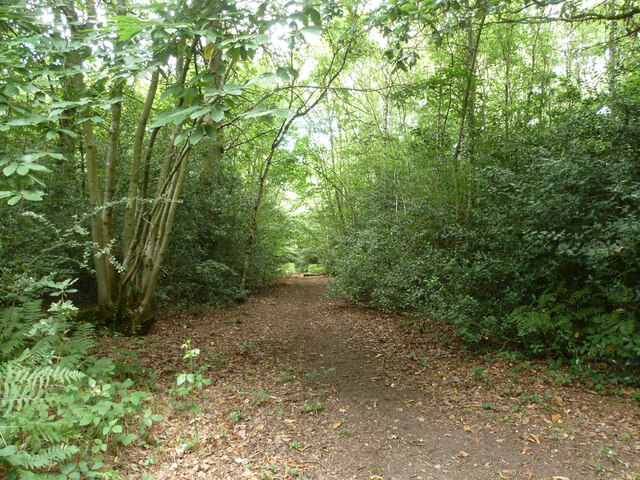
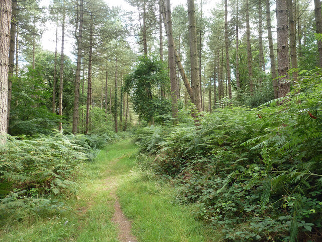
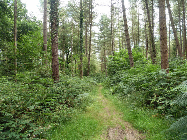
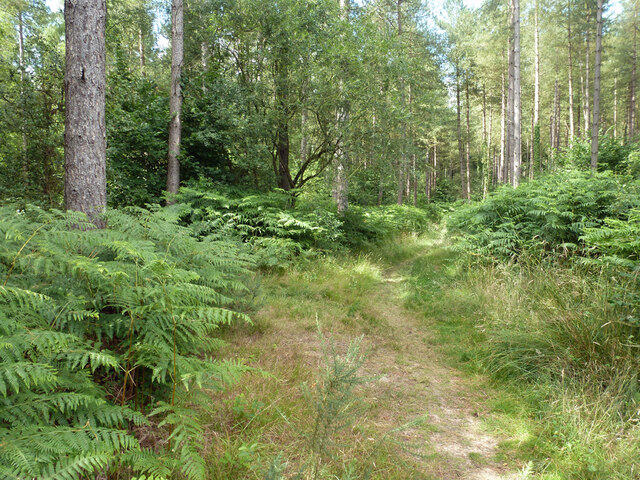
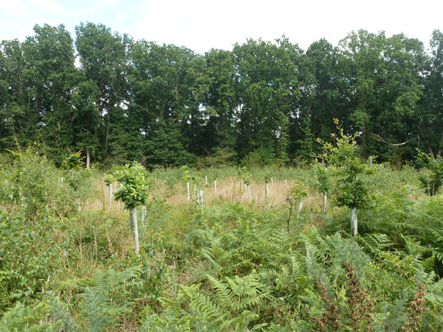
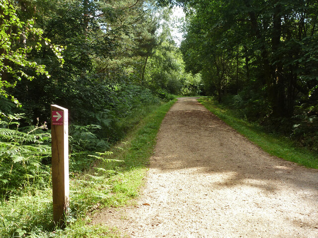
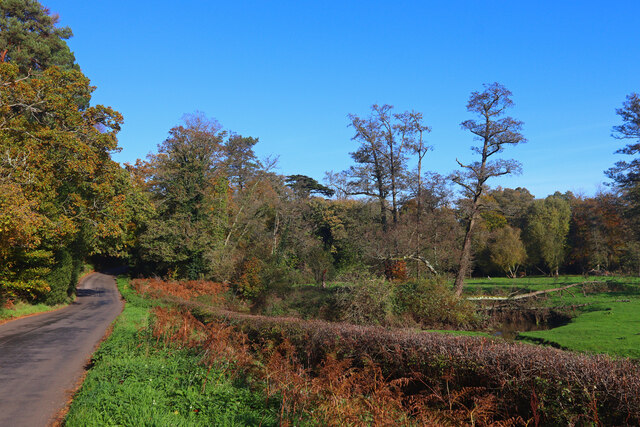
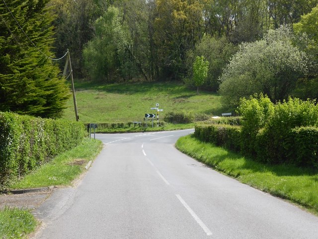
Falkner's Copse, located in Surrey, England, is a picturesque wood or forest that spans an area of approximately 100 acres. The copse is renowned for its natural beauty, thriving wildlife, and rich history.

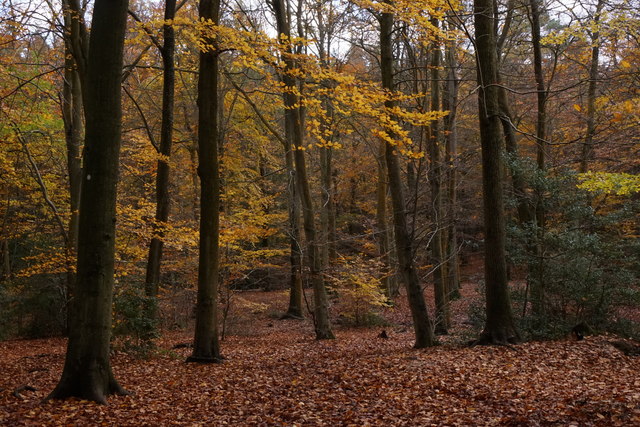
The wood is predominantly composed of a variety of deciduous trees, including oak, beech, and birch, which create a vibrant and diverse canopy during the summer months. The forest floor is adorned with a carpet of bluebells in the spring, creating a stunning display of colors. Additionally, the copse is home to several rare and protected plant species, making it an important site for conservation efforts.

Wildlife thrives in Falkner's Copse, with an abundance of species calling it home. Visitors may encounter various birds, including woodpeckers, owls, and thrushes, as well as small mammals like deer, foxes, and squirrels. The copse is also home to a wide array of insects, including butterflies and beetles, which add to its ecological diversity.

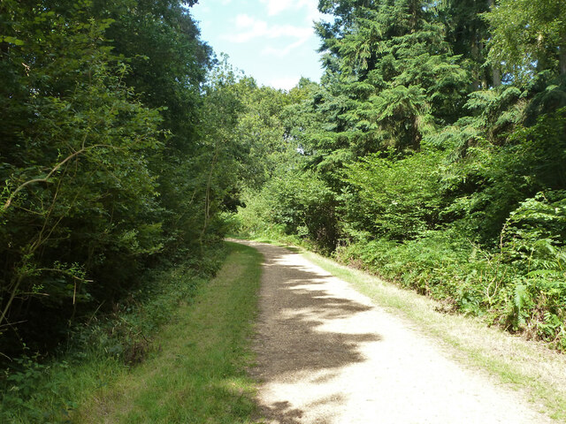
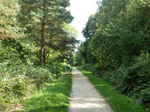
In terms of its history, Falkner's Copse has a fascinating past. It was once a part of an extensive medieval forest, providing a valuable source of timber and game for local communities. Over time, the forest has been managed sustainably, retaining its natural character while allowing for public access and enjoyment.

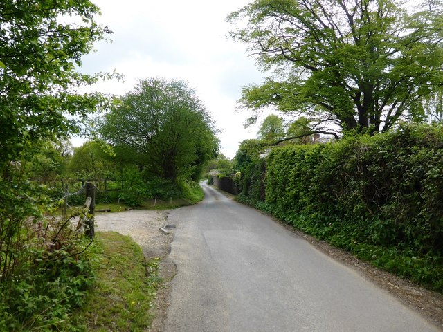
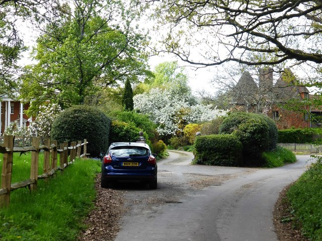
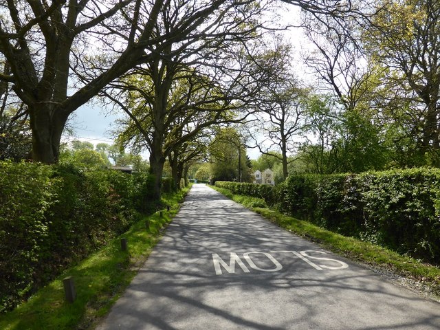
Today, Falkner's Copse attracts nature enthusiasts, hikers, and families who seek solace and tranquility in its serene surroundings. The copse offers numerous walking paths, picnic areas, and even birdwatching spots, making it an ideal destination for those looking to connect with nature.

If you have any feedback on the listing, please let us know in the comments section below.

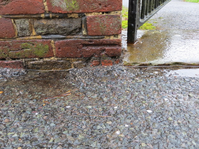
Falkner's Copse Images

Images are sourced within 2km of 51.165151/-0.82416924 or Grid Reference SU8241. Thanks to Geograph Open Source API. All images are credited.

Path, Alice Holt Forest Heading south in the Glenbervie Inclosure part of the Forestry Commission woodland.
Path, Alice Holt Forest
Heading south in the Glenbervie Inclosure part of the Forestry Commission woodland.
Path, Alice Holt Forest Heading south in the Glenbervie Inclosure part of the Forestry Commission woodland.
Path, Alice Holt Forest
Heading south in the Glenbervie Inclosure part of the Forestry Commission woodland.
Path, Alice Holt Forest Heading south in the Glenbervie Inclosure part of the Forestry Commission woodland.
Path, Alice Holt Forest
Heading south in the Glenbervie Inclosure part of the Forestry Commission woodland.
Path, Alice Holt Forest Heading north in the Glenbervie Inclosure part of the Forestry Commission woodland.
Path, Alice Holt Forest
Heading north in the Glenbervie Inclosure part of the Forestry Commission woodland.
Replanted area, Glenbervie Inclosure, Alice Holt Forest They appear to be a species of oak.
Replanted area, Glenbervie Inclosure, Alice Holt Forest
They appear to be a species of oak.
Track, Alice Holt Forest In the Glenbervie Inclosure part of the Forestry Commission woodland.
Track, Alice Holt Forest
In the Glenbervie Inclosure part of the Forestry Commission woodland.
Path, Alice Holt Forest In the Glenbervie Inclosure part of the Forestry Commission woodland.
Path, Alice Holt Forest
In the Glenbervie Inclosure part of the Forestry Commission woodland.
Woodhill Lane Looking towards Spreakley,  away from its junction with Boundary Road.
Woodhill Lane
Looking towards Spreakley, away from its junction with Boundary Road.
Footpath Binstead 51/3 in Alice Holt Forest Towards Dockenfield Street. The red arrow signs a circular route within the Forestry Commission woodland.
Footpath Binstead 51/3 in Alice Holt Forest
Towards Dockenfield Street. The red arrow signs a circular route within the Forestry Commission woodland.
Shortfield Common Road River running alongside the road.
Shortfield Common Road
River running alongside the road.
Upgrading the visitors car park Alice Holt Forest continues to be very popular.
Upgrading the visitors car park
Alice Holt Forest continues to be very popular.
St Mary's Church at Frensham Viewed from the east.
St Mary's Church at Frensham
Viewed from the east.
Ordnance Survey Cut Mark This mark can be found on a gatepost at the entrance to St Mary's Church at Frensham.
For more detail see : <span class="nowrap"><a title="http://www.bench-marks.org.uk/bm83668" rel="nofollow ugc noopener" href="http://www.bench-marks.org.uk/bm83668">Link</a><img style="margin-left:2px;" alt="External link" title="External link - shift click to open in new window" src="https://s1.geograph.org.uk/img/external.png" width="10" height="10"/></span>
Ordnance Survey Cut Mark
This mark can be found on a gatepost at the entrance to St Mary's Church at Frensham. For more detail see : LinkExternal link
Summerfield Lane at Broomfields
West End House and Oast House, West End Lane
Boundary Road near Bowlers Farm
Approaching the junction of Dockenfield Street and High Thicket Road
Beech woodland in Alice Holt Forest
Show me another place!

Falkner's Copse is located at Grid Ref: SU8241 (Lat: 51.165151, Lng: -0.82416924)

Administrative County: Surrey

District: Waverley

Police Authority: Surrey

What 3 Words

///triangles.export.twist. Near Churt, Surrey

Related Wikis

Dockenfield

Dockenfield is a village and civil parish in the borough of Waverley in Surrey, England. The parish is undulating, has a number of sources of the River...

Alice Holt Forest

Alice Holt Forest is a royal forest in Hampshire, situated some 4 miles (6.4 km) south of Farnham, Surrey. Once predominantly an ancient oak forest, it...

Pierrepont School, Frensham

Pierrepont School, Frensham, originally known as Pierrepont House School, was a private school in Surrey, England, with day pupils as well as boarders...

Bucks Horn Oak

Bucks Horn Oak is a small village in the East Hampshire district of Hampshire, England and is the main community within Alice Holt Forest. A small eastern...

Frensham Heights School

Frensham Heights School is an independent school and sixth form college located near Farnham, Surrey, England, run by the registered charity, Frensham...

Frensham

Frensham is a village in Surrey, England, next to the A287 road, 13 miles (20.9 km) WSW of Guildford, the county town. Frensham lies on the right bank...

Rowledge

Rowledge is a village in England on the Surrey–Hampshire border, centred south of the A31 and Farnham. Neighbouring villages include Wrecclesham, Spreakley...

Birdworld

Birdworld is the United Kingdom's largest bird park, covering 26 acres (11 ha). It is located in the East Hampshire district, close to the village of Bucks...

Nearby Amenities

Located within 500m of 51.165151,-0.82416924
Batts Corner
Place: hamlet
Source: npe
Lat/Long: 51.1616879/-0.8284504
Bealswood Common
Leisure: common
Source: npe
Lat/Long: 51.1629617/-0.8202394
Barrier: stile
Foot: yes
Lat/Long: 51.1624023/-0.8193695
Give Way
Lat/Long: 51.1630822/-0.8284791
Give Way
Lat/Long: 51.1628657/-0.8288207
Bowlers Farm
Landuse: farm
Note Retag: CS #48756035
Source: OS_OpenData_StreetView
Lat/Long: 51.165662/-0.8275028
Little Oakley
Addr Housename: Little Oakley
Building: house
Source: OS_OpenData_StreetView
Lat/Long: 51.1685538/-0.8277413
Bench
Lat/Long: 51.1620685/-0.8252314
Orchard End
Building: house
Source: OS_OpenData_StreetView
Lat/Long: 51.1616847/-0.8199755
Bealeswood House
Addr City: Farnham
Addr Housename: Bealeswood House
Addr Place: Dockenfield
Addr Street: Bealeswood Lane
Building: house
Source: OS_OpenData_StreetView
Lat/Long: 51.1614037/-0.822859
Bench
Backrest: yes
Lat/Long: 51.1629566/-0.8285354
Barrier: stile
Lat/Long: 51.1643278/-0.8252023
Defibrillator
Defibrillator Location: Facing carpark
Emergency: defibrillator
Indoor: no
Lat/Long: 51.1629409/-0.8275703
The data included in this document is from www.openstreetmap.org. The data is made available under ODbL.

Have you been to Falkner's Copse?

Leave your review of Falkner's Copse below (or comments, questions and feedback).