Ashley

Settlement in Kent Dover

England

Ashley

The A256 north from Dover Viewed from the North Downs Way on Waldershare Road
The A256 north from Dover Credit: Tim Heaton

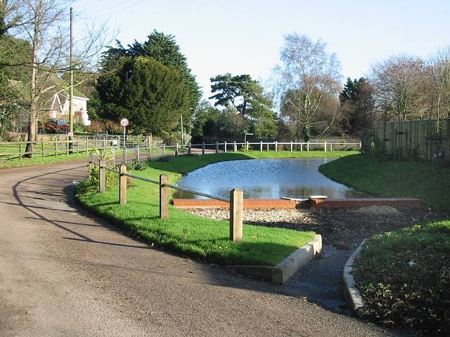
Ashley, Kent is a small village located in the southeastern part of England, within the county of Kent. It is situated approximately 10 miles northwest of the town of Canterbury and about 60 miles southeast of London. The village is nestled in a picturesque rural setting, surrounded by rolling hills and lush green fields.

With a population of around 500 residents, Ashley maintains a close-knit community atmosphere. The village is known for its tranquil and idyllic surroundings, offering a peaceful retreat from the hustle and bustle of larger towns and cities. The architecture in Ashley reflects its rich history, with several historic buildings and charming cottages lining the streets.

Despite its small size, Ashley offers a range of amenities for its residents. The village has a local pub, where locals and visitors can gather for a drink or a meal. There is also a village hall, which serves as a hub for community events and social gatherings. Additionally, Ashley is home to a primary school, providing education for the local children.

The surrounding countryside provides ample opportunities for outdoor activities and exploration. There are several walking and cycling trails that wind through the picturesque landscape, allowing visitors to immerse themselves in the natural beauty of the area. The village is also within easy reach of several nature reserves and parks, offering further opportunities for outdoor recreation.

Overall, Ashley, Kent is a charming and peaceful village, offering a serene and welcoming environment for its residents and visitors alike.

If you have any feedback on the listing, please let us know in the comments section below.
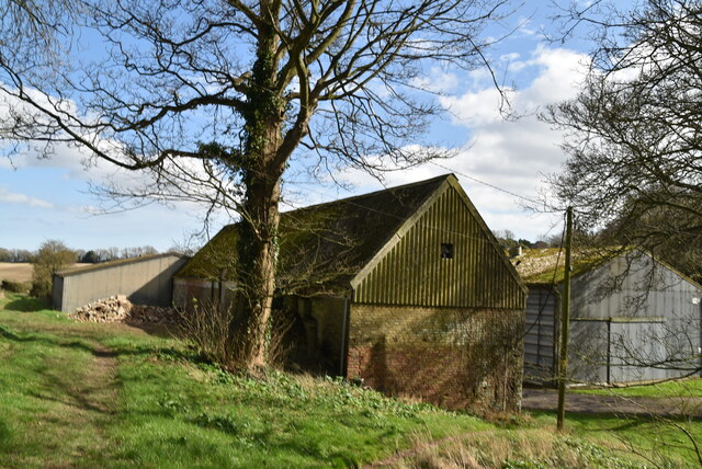
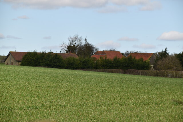
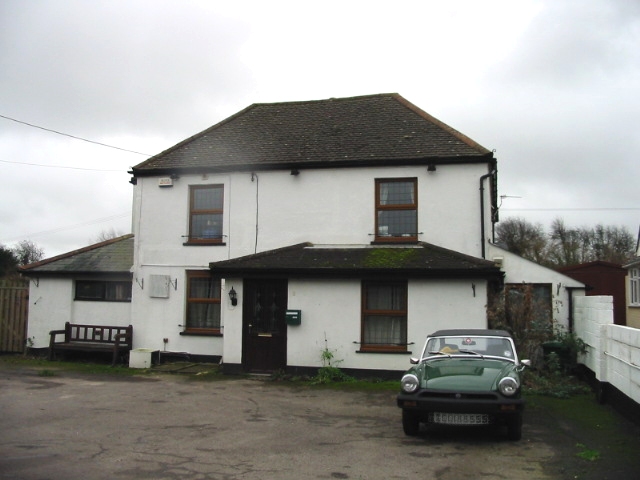
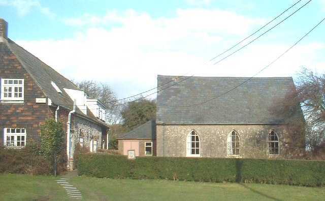
Ashley Images

Images are sourced within 2km of 51.189859/1.300918 or Grid Reference TR3048. Thanks to Geograph Open Source API. All images are credited.

The A256 north from Dover Viewed from the North Downs Way on Waldershare Road
The A256 north from Dover
Viewed from the North Downs Way on Waldershare Road
Churchyard of All Saints, Waldershare Unfortunately, the constricted space does not allow a proper picture of the church or the impressively large yew on the left. The 12th century church, largely rebuilt in the 19th century, contains some impressive 17th century monuments, and is in the care of the Churches Conservation Trust.
Churchyard of All Saints, Waldershare
Unfortunately, the constricted space does not allow a proper picture of the church or the impressively large yew on the left. The 12th century church, largely rebuilt in the 19th century, contains some impressive 17th century monuments, and is in the care of the Churches Conservation Trust.
Waldershare House A Grade I listed, early 18th century country house. Now converted to flats. Viewed from the North Downs Way.
Waldershare House
A Grade I listed, early 18th century country house. Now converted to flats. Viewed from the North Downs Way.
Wheat field west of Sandwich Road
Maydensole Farmhouse
Maydensole Farm
Maydensole Farm
Nissen Hut, Maydensole Farm This is a prefabricated steel structure made from a half-cylindrical skin of corrugated steel, was used extensively during World War II. Between April 16 and April 18, 1916, Major Peter Norman Nissen of the 29th Company Royal Engineers began to experiment with hut designs. Nissen, a mining engineer and inventor, constructed three prototype semi-cylindrical huts. The semi-cylindrical shape was derived from the drill-shed roof at Queen's University, Kingston, Ontario. Nissen’s design was subject to intensive review by his fellow officers, Lieutenant Colonels Shelly, Sewell and McDonald, and General Clive Gerard Liddell, which helped Nissen develop the design. After the third prototype was completed, the design was formalized and the Nissen hut was put into production in August 1916. At least 100,000 were produced in World War I
Nissen Hut, Maydensole Farm
This is a prefabricated steel structure made from a half-cylindrical skin of corrugated steel, was used extensively during World War II. Between April 16 and April 18, 1916, Major Peter Norman Nissen of the 29th Company Royal Engineers began to experiment with hut designs. Nissen, a mining engineer and inventor, constructed three prototype semi-cylindrical huts. The semi-cylindrical shape was derived from the drill-shed roof at Queen's University, Kingston, Ontario. Nissen’s design was subject to intensive review by his fellow officers, Lieutenant Colonels Shelly, Sewell and McDonald, and General Clive Gerard Liddell, which helped Nissen develop the design. After the third prototype was completed, the design was formalized and the Nissen hut was put into production in August 1916. At least 100,000 were produced in World War I
Isolated tree
Isolated tree
White Cliffs Country Trail The White Cliffs Trails were created in 1987 by Dover District Council to link the towns of Dover, Deal and Sandwich, going along the famous 'white cliffs' to the east of Dover to Deal with an inland return through the beautiful Kent countryside. A link from Deal to Northbourne via Sholden and a loop from Sandwich to Northbourne via Eastry provide a range of options.
The routes are marked on OS mapping but have no apparent current publications.
White Cliffs Country Trail
The White Cliffs Trails were created in 1987 by Dover District Council to link the towns of Dover, Deal and Sandwich, going along the famous 'white cliffs' to the east of Dover to Deal with an inland return through the beautiful Kent countryside. A link from Deal to Northbourne via Sholden and a loop from Sandwich to Northbourne via Eastry provide a range of options. The routes are marked on OS mapping but have no apparent current publications.
Shallow dry valley
Shallow dry valley
White Cliffs Country Trail The White Cliffs Trails were created in 1987 by Dover District Council to link the towns of Dover, Deal and Sandwich, going along the famous 'white cliffs' to the east of Dover to Deal with an inland return through the beautiful Kent countryside. A link from Deal to Northbourne via Sholden and a loop from Sandwich to Northbourne via Eastry provide a range of options.
The routes are marked on OS mapping but have no apparent current publications.
White Cliffs Country Trail
The White Cliffs Trails were created in 1987 by Dover District Council to link the towns of Dover, Deal and Sandwich, going along the famous 'white cliffs' to the east of Dover to Deal with an inland return through the beautiful Kent countryside. A link from Deal to Northbourne via Sholden and a loop from Sandwich to Northbourne via Eastry provide a range of options. The routes are marked on OS mapping but have no apparent current publications.
Inglenook Farm
Inglenook Farm
White Cliffs Country Trail Public footpath EE417 runs southwest from Sutton Court Farm, just north of the church of St Peter and St Paul in Sutton village, to Maydensole Farm, on Roman Road in West Langdon. The path appears to be of some considerable age: it is marked on the first reliable maps of the area, including the Ordnance Survey first edition one inch map. It is also enclosed by hedges on both sides for much of the way between Sutton Court and public footpath EE419, but sufficiently narrow to exclude the likelihood that it was ever more than a bridleroad. A dogleg in the path, southwest of the intersection with EE419, marks the traverse of the former parish boundary between Sutton and Little Mongeham. The west end of the path formerly passed through the farmyard of Maydensole Farm, but now emerges onto Roman Road just to the north of the farm.
White Cliffs Country Trail
Public footpath EE417 runs southwest from Sutton Court Farm, just north of the church of St Peter and St Paul in Sutton village, to Maydensole Farm, on Roman Road in West Langdon. The path appears to be of some considerable age: it is marked on the first reliable maps of the area, including the Ordnance Survey first edition one inch map. It is also enclosed by hedges on both sides for much of the way between Sutton Court and public footpath EE419, but sufficiently narrow to exclude the likelihood that it was ever more than a bridleroad. A dogleg in the path, southwest of the intersection with EE419, marks the traverse of the former parish boundary between Sutton and Little Mongeham. The west end of the path formerly passed through the farmyard of Maydensole Farm, but now emerges onto Roman Road just to the north of the farm.
White Cliffs Country Trail The White Cliffs Trails were created in 1987 by Dover District Council to link the towns of Dover, Deal and Sandwich, going along the famous 'white cliffs' to the east of Dover to Deal with an inland return through the beautiful Kent countryside. A link from Deal to Northbourne via Sholden and a loop from Sandwich to Northbourne via Eastry provide a range of options.
The routes are marked on OS mapping but have no apparent current publications.
White Cliffs Country Trail
The White Cliffs Trails were created in 1987 by Dover District Council to link the towns of Dover, Deal and Sandwich, going along the famous 'white cliffs' to the east of Dover to Deal with an inland return through the beautiful Kent countryside. A link from Deal to Northbourne via Sholden and a loop from Sandwich to Northbourne via Eastry provide a range of options. The routes are marked on OS mapping but have no apparent current publications.
Chalk farmland
Chalk farmland
White Cliffs Country Trail Public footpath EE417 runs southwest from Sutton Court Farm, just north of the church of St Peter and St Paul in Sutton village, to Maydensole Farm, on Roman Road in West Langdon. The path appears to be of some considerable age: it is marked on the first reliable maps of the area, including the Ordnance Survey first edition one inch map. It is also enclosed by hedges on both sides for much of the way between Sutton Court and public footpath EE419, but sufficiently narrow to exclude the likelihood that it was ever more than a bridleroad. A dogleg in the path, southwest of the intersection with EE419, marks the traverse of the former parish boundary between Sutton and Little Mongeham. The west end of the path formerly passed through the farmyard of Maydensole Farm, but now emerges onto Roman Road just to the north of the farm.
White Cliffs Country Trail
Public footpath EE417 runs southwest from Sutton Court Farm, just north of the church of St Peter and St Paul in Sutton village, to Maydensole Farm, on Roman Road in West Langdon. The path appears to be of some considerable age: it is marked on the first reliable maps of the area, including the Ordnance Survey first edition one inch map. It is also enclosed by hedges on both sides for much of the way between Sutton Court and public footpath EE419, but sufficiently narrow to exclude the likelihood that it was ever more than a bridleroad. A dogleg in the path, southwest of the intersection with EE419, marks the traverse of the former parish boundary between Sutton and Little Mongeham. The west end of the path formerly passed through the farmyard of Maydensole Farm, but now emerges onto Roman Road just to the north of the farm.
Oilseed rape
Oilseed rape
White Cliffs Country Trail The White Cliffs Trails were created in 1987 by Dover District Council to link the towns of Dover, Deal and Sandwich, going along the famous 'white cliffs' to the east of Dover to Deal with an inland return through the beautiful Kent countryside. A link from Deal to Northbourne via Sholden and a loop from Sandwich to Northbourne via Eastry provide a range of options.
The routes are marked on OS mapping but have no apparent current publications.
White Cliffs Country Trail
The White Cliffs Trails were created in 1987 by Dover District Council to link the towns of Dover, Deal and Sandwich, going along the famous 'white cliffs' to the east of Dover to Deal with an inland return through the beautiful Kent countryside. A link from Deal to Northbourne via Sholden and a loop from Sandwich to Northbourne via Eastry provide a range of options. The routes are marked on OS mapping but have no apparent current publications.
Show me another place!

Ashley is located at Grid Ref: TR3048 (Lat: 51.189859, Lng: 1.300918)

Administrative County: Kent

District: Dover

Police Authority: Kent

What 3 Words

///riot.going.decoded. Near Eythorne, Kent

Nearby Locations

Chill Wood Ashley

Related Wikis

Ashley, Kent

Ashley (also known, signposted and marked on some maps as Sutton) is a hamlet located in the parish of Sutton, some five miles (8 km) north of Dover on...

All Saints Church, Waldershare

All Saints Church is a redundant Anglican church in Waldershare, Kent, England. It is recorded in the National Heritage List for England as a designated...

East Studdal

East Studdal is a village near Dover in Kent, England. The population of the village is included in the civil parish of Sutton. == References == ��2�...

West Studdal

West Studdal is a village near Dover in Kent, England. The population of the village is included in the civil parish of Sutton.

West Langdon

West Langdon is a village and former civil parish, now in the parish of Langdon, in the Dover district of Kent, England. It is located five miles north...

Eythorne

Eythorne is a civil parish and small village located 7.3 miles north-northwest of Dover in Kent, with a combined population of approximately 2,500 residents...

Langdon, Kent

Langdon is a civil parish in the Dover district of Kent, England, and contains the villages of East Langdon and West Langdon, and the hamlets of Martin...

Eythorne Baptist Church

Eythorne Baptist Church originated in the meetings of early 16th century Baptists who had crossed the English Channel from the low countries to Kent to...

Nearby Amenities

Located within 500m of 51.189859,1.300918
Bus Stop
Chapel Lane
Flag: no
Naptan AtcoCode: 2400A032340A
Naptan Bearing: NE
Naptan BusStopType: CUS
Naptan CommonName: Chapel Lane
Naptan Indicator: NE-bound
Naptan NaptanCode: kntdjpdw
Naptan Street: Chapel Lane
Naptan Verified: no
Public Transport: platform
Ref: kntdjpdw
Source: naptan_import
Source Date: 2018-06-25T08:47:00
Lat/Long: 51.192176/1.3055714
Post Box
Brand: Royal Mail
Brand Wikidata: Q638098
Collection Times: Mo-Fr 09:00; Sa 07:00
Operator: Royal Mail
Operator Wikidata: Q638098
Post Box Mounting: building
Post Box Type: wall
Postal Code: CT15
Ref: CT15 17
Royal Cypher: VR
Royal Cypher Wikidata: Q33102356
Source: survey
Lat/Long: 51.1925466/1.3065126
Generator Method: photovoltaic
Generator Output Electricity: yes
Generator Source: solar
Generator Type: solar_photovoltaic_panel
Location: roof
Power: generator
Lat/Long: 51.1907833/1.3000687
Generator Method: photovoltaic
Generator Output Electricity: yes
Generator Solar Modules: 16
Generator Source: solar
Generator Type: solar_photovoltaic_panel
Location: roof
Power: generator
Lat/Long: 51.1909703/1.299718
Generator Method: photovoltaic
Generator Output Electricity: yes
Generator Solar Modules: 16
Generator Source: solar
Generator Type: solar_photovoltaic_panel
Location: roof
Power: generator
Lat/Long: 51.191241/1.3001901
Generator Method: photovoltaic
Generator Output Electricity: yes
Generator Solar Modules: 8
Generator Source: solar
Generator Type: solar_photovoltaic_panel
Location: roof
Power: generator
Lat/Long: 51.1909628/1.3035268
Bus Stop
Waldershare Road
Naptan AtcoCode: 2400104731
Naptan Bearing: SW
Naptan CommonName: Waldershare Road
Naptan Indicator: SW-bound
Naptan NaptanCode: kntjpjpm
Naptan Street: Waldershare Road
Public Transport: platform
Ref: kntjpjpm
Source: NAPTAN
Source Date: 2011-10-13T12:54:00
Lat/Long: 51.1908694/1.2999237
Bus Stop
Waldershare Road
Naptan AtcoCode: 2400104729
Naptan Bearing: NE
Naptan CommonName: Waldershare Road
Naptan Indicator: NE-bound
Naptan NaptanCode: kntjpjpj
Naptan Street: Waldershare Road
Public Transport: platform
Ref: kntjpjpj
Source: NAPTAN
Source Date: 2018-06-25T08:49:00
Lat/Long: 51.1909212/1.2996841
Bus Stop
Chapel Lane
Naptan AtcoCode: 2400103831
Naptan Bearing: SW
Naptan CommonName: Chapel Lane
Naptan Indicator: SW-bound
Naptan NaptanCode: kntjmjpm
Naptan Street: Chapel Lane
Public Transport: platform
Ref: kntjmjpm
Source: NAPTAN
Source Date: 2018-06-25T08:48:00
Lat/Long: 51.1920729/1.3057215
The data included in this document is from www.openstreetmap.org. The data is made available under ODbL.

Have you been to Ashley?

Leave your review of Ashley below (or comments, questions and feedback).