Admiral Plantation

Wood, Forest in Yorkshire

England

Admiral Plantation

Road near Martinholme Farm Looking along the road leading to Thixendale.
Road near Martinholme Farm Credit: DS Pugh

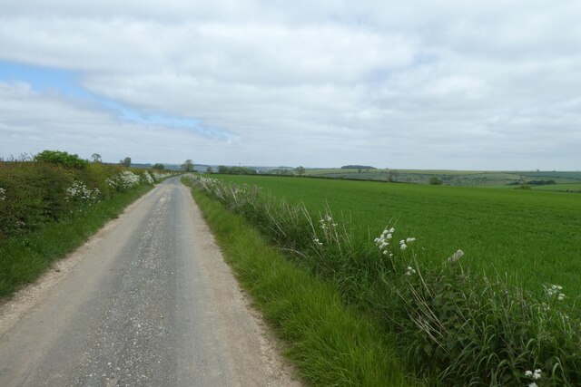
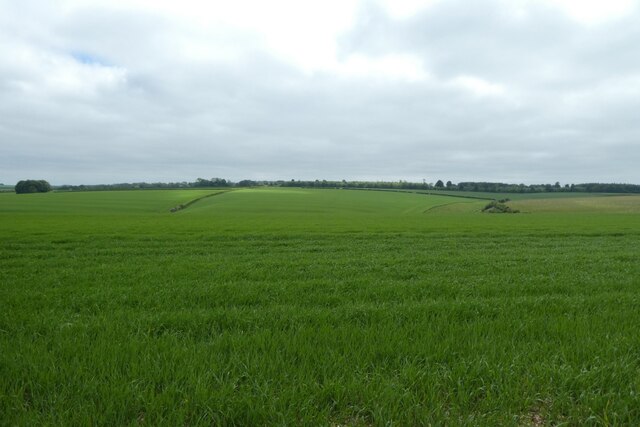
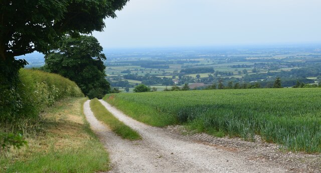
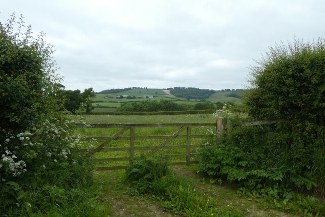
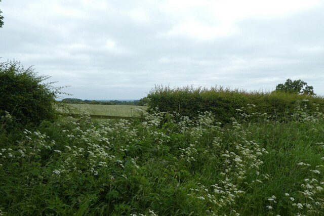
Admiral Plantation, located in Yorkshire, England, is a picturesque woodland area known for its lush greenery and serene ambiance. Spread across a vast expanse, it offers visitors a tranquil retreat from the bustling city life.

The plantation features a diverse range of tree species, including oak, birch, and pine, creating a beautiful tapestry of colors throughout the year. The woodland is meticulously maintained, with well-marked trails that allow visitors to explore its natural wonders at their own pace. These trails cater to different levels of difficulty, ensuring that both novice hikers and seasoned adventurers can enjoy the plantation's charm.

Wildlife enthusiasts will also find the Admiral Plantation to be a haven for various animal species. The woodland provides a natural habitat for an array of creatures, including deer, foxes, and a plethora of bird species. Birdwatchers can delight in spotting rare and migratory birds amidst the rustling leaves and towering trees.

In addition to its natural beauty, Admiral Plantation offers a range of recreational activities. Picnic areas are scattered throughout the woodland, providing visitors with a perfect spot to relax and enjoy a meal amidst nature. The plantation also boasts well-maintained cycling trails, allowing cyclists to explore the area's scenic surroundings.

Admiral Plantation is a true paradise for nature lovers and outdoor enthusiasts. Its serene atmosphere, diverse flora and fauna, and well-kept trails make it a popular destination for locals and tourists alike, seeking solace in Yorkshire's stunning countryside.

If you have any feedback on the listing, please let us know in the comments section below.

Admiral Plantation Images

Images are sourced within 2km of 54.017482/-0.75204023 or Grid Reference SE8158. Thanks to Geograph Open Source API. All images are credited.

Road near Martinholme Farm Looking along the road leading to Thixendale.
Road near Martinholme Farm
Looking along the road leading to Thixendale.
Fields at Martinholme Looking into Long Dale from the road to Thixendale.
Fields at Martinholme
Looking into Long Dale from the road to Thixendale.
Lane above the Vale of York. On the edge of the Wolds.
Lane above the Vale of York.
On the edge of the Wolds.
Field of barley at the Wolds edge Cereal crop in a field close to the scarp edge of the Wolds. The trees on the far side mask a sudden drop into a steep sided valley.
Field of barley at the Wolds edge
Cereal crop in a field close to the scarp edge of the Wolds. The trees on the far side mask a sudden drop into a steep sided valley.
Road through Uncleby One could easily pass by or through Uncleby without even noticing. A farm either side of the road and two or three residences make up this tiny community which hardly rates as a hamlet.
Road through Uncleby
One could easily pass by or through Uncleby without even noticing. A farm either side of the road and two or three residences make up this tiny community which hardly rates as a hamlet.
Entrance to Uncleby Wold Barn
Gate on Howe Hill Looking into a field north of Howe Lane.
Gate on Howe Hill
Looking into a field north of Howe Lane.
Howe Lane Looking along Howe Lane on Howe Hill.
Howe Lane
Looking along Howe Lane on Howe Hill.
Warning of gates Looking along Gatehowe Road which is a gated road leading to Hanging Grimston.
Warning of gates
Looking along Gatehowe Road which is a gated road leading to Hanging Grimston.
Gatehowe Road Looking down Gatehowe Road from Howe Hill.
Gatehowe Road
Looking down Gatehowe Road from Howe Hill.
Cow parsley beside Gatehouse Road Looking into a field beside Gatehowe Road.
Cow parsley beside Gatehouse Road
Looking into a field beside Gatehowe Road.
Road near the junction for Thixendale Looking along the Roman Road towards the junction with the road to Thixendale.
Road near the junction for Thixendale
Looking along the Roman Road towards the junction with the road to Thixendale.
Road above North Dale Looking along the Roman Road along the top of the Wolds.
Road above North Dale
Looking along the Roman Road along the top of the Wolds.
Road to Thixendale Looking along the road descending into Thixendale from Northdale Head.
Road to Thixendale
Looking along the road descending into Thixendale from Northdale Head.
Road from Northdale Head Looking along the road leading into Thixendale.
Road from Northdale Head
Looking along the road leading into Thixendale.
Barley in Uncleby Wold Looking across a field of barley beside the road to Thixendale.
Barley in Uncleby Wold
Looking across a field of barley beside the road to Thixendale.
Entrance  to  Cot  Nab  Farm  Garrowby  Street  A166
Entrance to Cot Nab Farm Garrowby Street A166
Radio  mast  on  Garrowby  Wold
Radio mast on Garrowby Wold
Show me another place!

Admiral Plantation is located at Grid Ref: SE8158 (Lat: 54.017482, Lng: -0.75204023)

Division: East Riding

Unitary Authority: East Riding of Yorkshire

Police Authority: Humberside

What 3 Words

///transmits.gong.period. Near Kirby Underdale, East Yorkshire

Related Wikis

Painsthorpe

Painsthorpe is a hamlet in the East Riding of Yorkshire, England. It is located about 1 mile (1.6 km) east of the village of Kirby Underdale, the area...

Painsthorpe Abbey

Painsthorpe Abbey was a short-lived monastery of the Anglican Order of St. Benedict. It was established in 1902 at Painsthorpe in the East Riding of Yorkshire...

Uncleby

Uncleby is a hamlet in the East Riding of Yorkshire, England. It forms part of the civil parish of Kirby Underdale. It is situated approximately 6.5 miles...

Kirby Underdale

Kirby Underdale is a village and civil parish in the East Riding of Yorkshire, England. It is situated approximately six miles (ten kilometres) north...

Bishop Wilton Wold

Bishop Wilton Wold is the highest point of the Yorkshire Wolds in the East Riding of Yorkshire, England. The summit, known as Garrowby Hill, lies about...

Garrowby

Garrowby is a hamlet in the East Riding of Yorkshire, England. It is situated approximately 5 miles (8 km) north of Pocklington town centre. It lies to...

Thixendale

Thixendale is a village and civil parish in North Yorkshire, England. Historically part of the East Riding of Yorkshire, it is located in the Yorkshire...

Minster FM

Minster FM was an Independent Local Radio station serving York and the surrounding areas such as Selby, Tadcaster, Thirsk, Northallerton and Goole. The...

Nearby Amenities

Located within 500m of 54.017482,-0.75204023
Hawk Hill Spring
Natural: spring
Lat/Long: 54.0183813/-0.7547598
Painsthorpe
Place: hamlet
Wikidata: Q7124913
Lat/Long: 54.0144554/-0.7568356
Natural: spring
Lat/Long: 54.0173735/-0.7526731
Natural: spring
Lat/Long: 54.0174716/-0.7528275
Natural: spring
Lat/Long: 54.0175868/-0.7524352
Natural: spring
Lat/Long: 54.0176211/-0.7532866
Natural: spring
Lat/Long: 54.0176751/-0.7521096
Natural: spring
Lat/Long: 54.0177486/-0.7569968
Natural: spring
Lat/Long: 54.0178124/-0.7582154
Natural: spring
Lat/Long: 54.0181214/-0.7568215
Natural: spring
Lat/Long: 54.0196109/-0.7502057
Natural: spring
Lat/Long: 54.0200536/-0.7496863
Natural: spring
Lat/Long: 54.0203037/-0.7488902
Passing Place
Lat/Long: 54.0135834/-0.7533251
The data included in this document is from www.openstreetmap.org. The data is made available under ODbL.

Have you been to Admiral Plantation?

Leave your review of Admiral Plantation below (or comments, questions and feedback).