Pond Wood

Wood, Forest in Hampshire Hart

England

Pond Wood

Dippenhall Street, Crondall
Dippenhall Street, Crondall Credit: David Howard

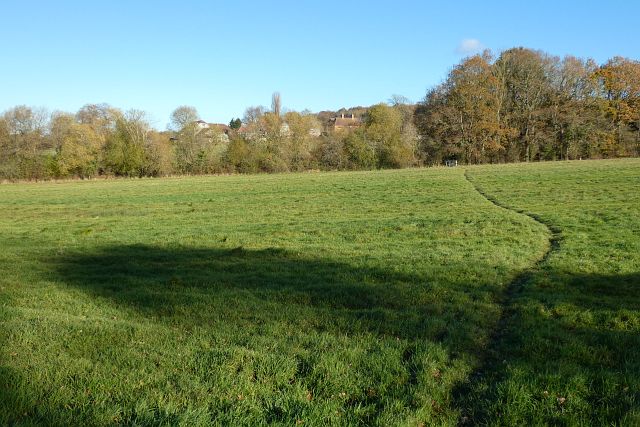
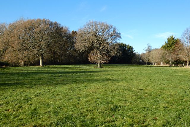
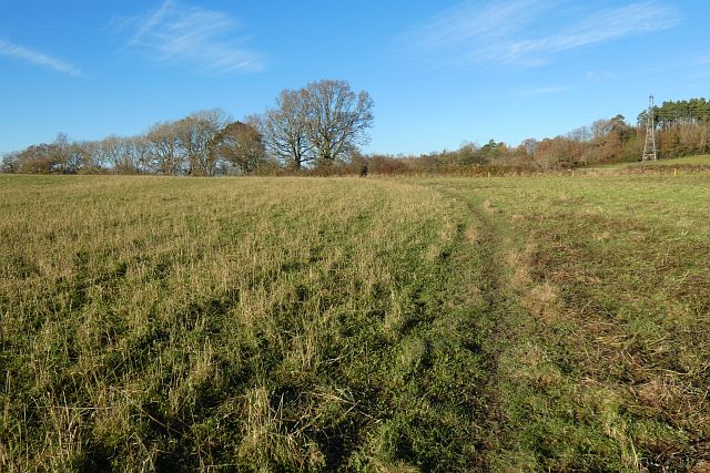
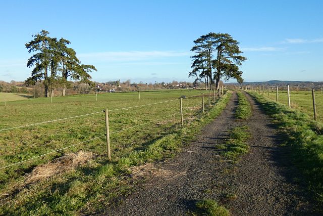
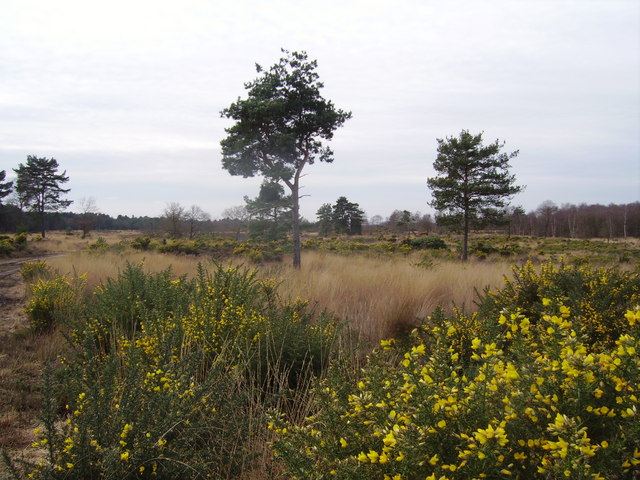
Pond Wood is a picturesque forest located in the county of Hampshire, England. Covering an area of approximately 100 acres, it is a popular destination for nature enthusiasts and hikers alike. The wood is situated near the village of Hampshire, nestled amidst rolling hills and lush greenery.

The woodland is characterized by its diverse range of tree species, including oak, beech, and birch. These majestic trees create a dense canopy, providing shade and shelter for an array of wildlife. It is not uncommon to spot various bird species such as woodpeckers, owls, and jays, along with small mammals like squirrels and rabbits.

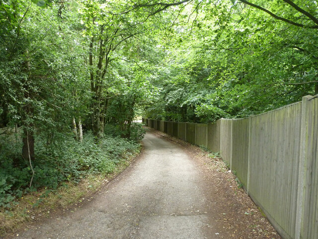
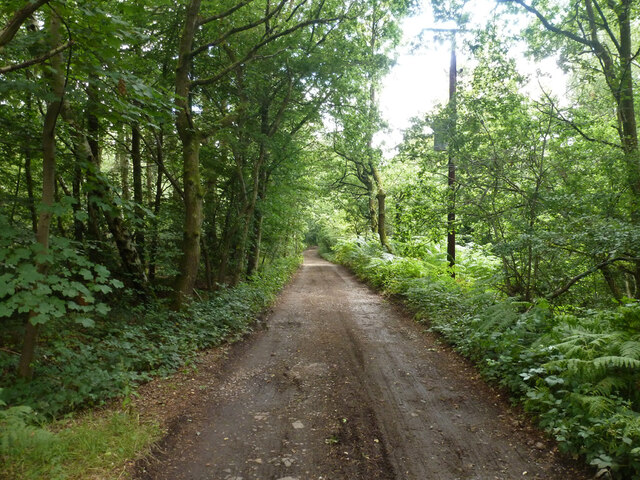
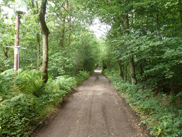
Traversing through Pond Wood, visitors can explore a network of well-maintained paths and trails. These pathways lead to a tranquil pond, which is the focal point of the wood. The pond is home to numerous aquatic plants and insects, attracting a variety of amphibians and water-dwelling creatures.

The wood offers a serene and peaceful environment, allowing visitors to escape the hustle and bustle of everyday life. It is a great place for family outings, picnics, and even photography enthusiasts looking to capture the beauty of nature.

Pond Wood is managed by the local authorities to preserve its natural beauty and protect the habitat of its inhabitants. It is open to the public throughout the year, with no admission fees. However, visitors are encouraged to respect the wood's fragile ecosystem and adhere to the guidelines set by the management to ensure its preservation for future generations to enjoy.

If you have any feedback on the listing, please let us know in the comments section below.

Pond Wood Images

Images are sourced within 2km of 51.226098/-0.83189718 or Grid Reference SU8148. Thanks to Geograph Open Source API. All images are credited.

Dippenhall Street, Crondall
Old Milestone, A287, Folly Hill, Upper Hale The milestone is located 50m north of the junction with Heathyfields Road on the West side of the road in the hedge. Parish of Farnham (Waverley district). Carved stone post, Odiham stone design, erected by the Odiham & Farnham turnpike trust in the 18th century.

Inscription reads:-          FROM / ODIHAM / 6 / MILES / TO / FARNHAM / 1½ / MILES

The date of the image is not known but is probably before 2001.

Milestone Society National ID: SY_ODFA06
Old Milestone, A287, Folly Hill, Upper Hale
The milestone is located 50m north of the junction with Heathyfields Road on the West side of the road in the hedge. Parish of Farnham (Waverley district). Carved stone post, Odiham stone design, erected by the Odiham & Farnham turnpike trust in the 18th century. Inscription reads:- FROM / ODIHAM / 6 / MILES / TO / FARNHAM / 1½ / MILES The date of the image is not known but is probably before 2001. Milestone Society National ID: SY_ODFA06
Lower Old Park Farmhouse -
Lower Old Park Farmhouse
-
Pasture, Crondall A footpath to the east of the village approaches Lea Farm.
Pasture, Crondall
A footpath to the east of the village approaches Lea Farm.
Former golf course, Crondall A footpath crosses this part of the golf course. Oak Park Golf Club is closed, at least for the time being.
Former golf course, Crondall
A footpath crosses this part of the golf course. Oak Park Golf Club is closed, at least for the time being.
Farmland, Crondall A footpath crosses this recently grazed field to the west of Dora's Green.
Farmland, Crondall
A footpath crosses this recently grazed field to the west of Dora's Green.
Pasture, Farnham A footpath crosses this field at Lower Old Park having exited Pond Copse, the eastern extension of which is on the left.
Pasture, Farnham
A footpath crosses this field at Lower Old Park having exited Pond Copse, the eastern extension of which is on the left.
Track and pasture, Farnham A footpath heading towards the western edge of the town from Dippenhall passes through paddocks grazed by equines.
Track and pasture, Farnham
A footpath heading towards the western edge of the town from Dippenhall passes through paddocks grazed by equines.
Pasture, Farnham Beside the footpath to the south-west of Dippenhall House.
Pasture, Farnham
Beside the footpath to the south-west of Dippenhall House.
Farmland, Crondall Beside the footpath to the south of Clare Park Farm.
Farmland, Crondall
Beside the footpath to the south of Clare Park Farm.
Pasture, Farnham Looking down from the footpath to the east of Dippenhall.
Pasture, Farnham
Looking down from the footpath to the east of Dippenhall.
Farmland, Farnham A footpath approaching Middle Old Park from the south through a crop of stubble turnips.
Farmland, Farnham
A footpath approaching Middle Old Park from the south through a crop of stubble turnips.
Pasture, Farnham Looking down from the bridleway below Upper Old Park.
Pasture, Farnham
Looking down from the bridleway below Upper Old Park.
Armsworth Way, Farnham Viewed from Reeve Drive, part of a new development on the edge of Hale.
Armsworth Way, Farnham
Viewed from Reeve Drive, part of a new development on the edge of Hale.
Old Park Lane A public bridleway, also vehicle access to a few properties.
Old Park Lane
A public bridleway, also vehicle access to a few properties.
Old Park Lane A public bridleway, also vehicle access to a few properties.
Old Park Lane
A public bridleway, also vehicle access to a few properties.
Old Park Lane A public bridleway, also vehicle access to a few properties.
Old Park Lane
A public bridleway, also vehicle access to a few properties.
Show me another place!

Pond Wood is located at Grid Ref: SU8148 (Lat: 51.226098, Lng: -0.83189718)

Administrative County: Hampshire

District: Hart

Police Authority: Hampshire

What 3 Words

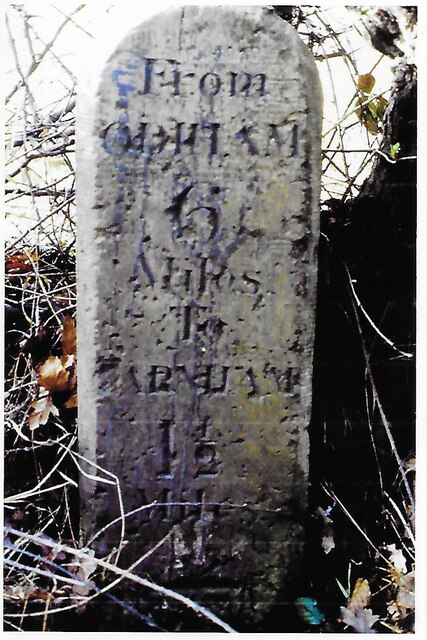
///frame.flap.retrieves. Near Crondall, Hampshire

Related Wikis

Dora's Green

Dora's Green is a hamlet in the Hart District of Hampshire, England. The hamlet lies near the A287 road between Farnham and Odiham on the Hampshire-Surrey...

Castle Bottom to Yateley and Hawley Commons

Castle Bottom to Yateley and Hawley Commons is a 922.7-hectare (2,280-acre) biological Site of Special Scientific Interest north of Fleet in Hampshire...
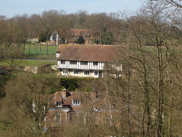
Dippenhall

Dippenhall is a rural hamlet in the civil parish of Farnham in the Waverley district of Surrey, England. The nearest town, Farnham, is about 1.6 miles...

Ewshot

Ewshot is a village and civil parish in Hampshire, England. It lies in the north east of the county, close to the Surrey border. The name Ewshot comes...

Guildford School of Art

Guildford School of Art was formed in 1856 as Guildford Working Men's Institution and was one of several schools of art run by Surrey County Council. After...

Surrey Institute of Art & Design, University College

Surrey Institute of Art & Design, University College (SIAD) was an art college in the United Kingdom from 1994 to 2005. It was formed from the merger of...

Storming of Farnham Castle

The Storming of Farnham Castle occurred on 1 December 1642, during the early stages of the First English Civil War, when a Parliamentarian force attacked...
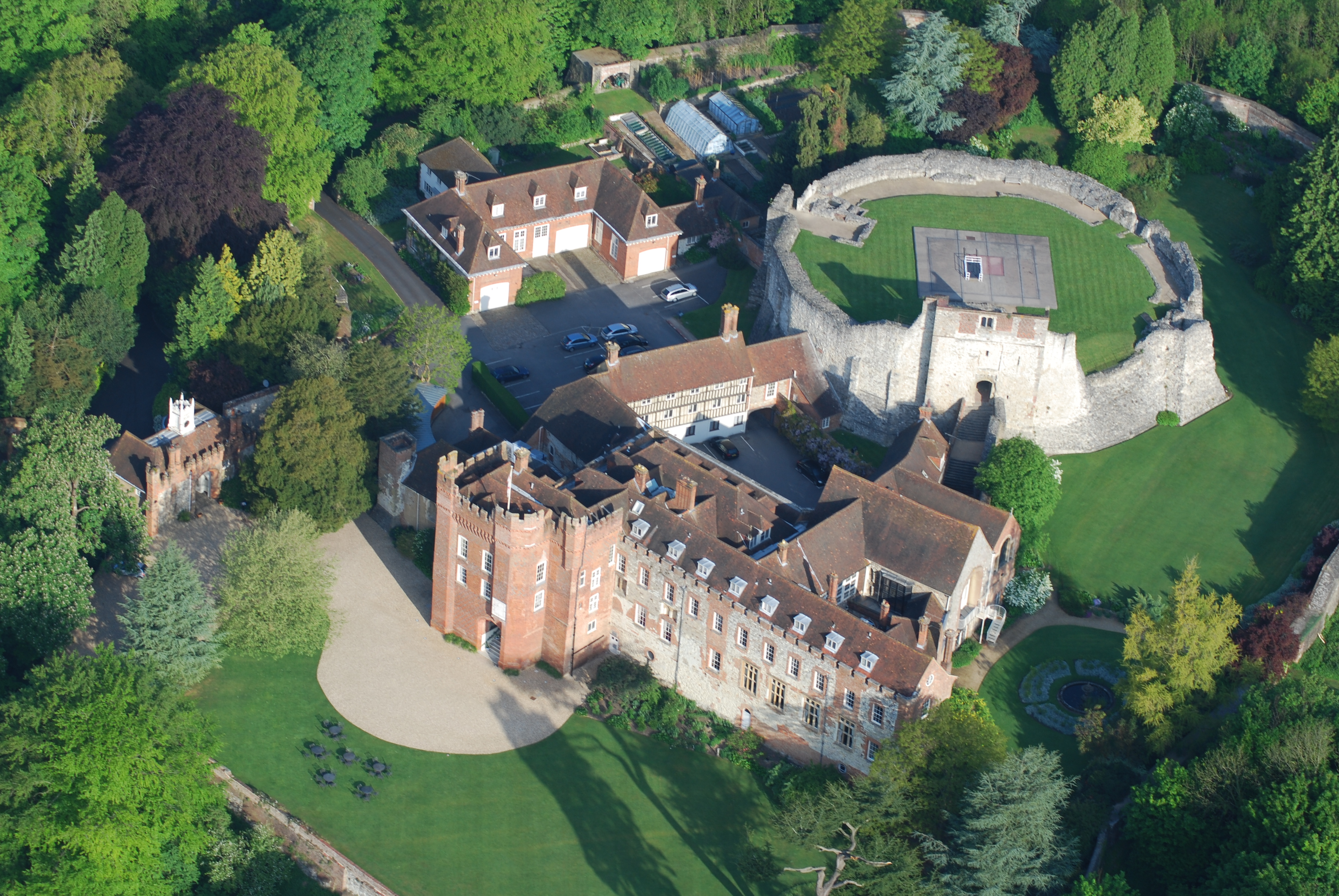
Farnham Castle

Farnham Castle is a 12th-century castle in Farnham, Surrey, England. It was formerly the residence of the Bishops of Winchester. == History == Built in...

Nearby Amenities

Located within 500m of 51.226098,-0.83189718
Lower Old Park
Building: residential
Source: npe
Lat/Long: 51.2223328/-0.8317073
Dora's Green
Is In: Hampshire, England, UK
Note: Modern signs just call the place "Dora's Green", not "Dora's Green Lane", hence name change
Place: hamlet
Source: npe
Wikidata: Q5297372
Lat/Long: 51.2279243/-0.837593
Power: tower
Source: bing
Lat/Long: 51.229764/-0.8346929
Power: tower
Source: bing
Lat/Long: 51.2291607/-0.8310611
Barrier: kissing_gate
Lat/Long: 51.2227183/-0.8302319
Keepers Cottage
Building: house
Source: sign;SAS
Lat/Long: 51.2233403/-0.8272978
Barrier: kissing_gate
Lat/Long: 51.2236204/-0.8320767
Direction: 200
Generator Method: photovoltaic
Generator Output Electricity: yes
Generator Solar Modules: 10
Generator Source: solar
Generator Type: solar_photovoltaic_panel
Location: roof
Power: generator
Lat/Long: 51.2279335/-0.8367199
Fixme: solar panels?
Lat/Long: 51.2279692/-0.8366577
Direction: 220
Generator Method: photovoltaic
Generator Output Electricity: yes
Generator Solar Modules: 16
Generator Source: solar
Generator Type: solar_photovoltaic_panel
Location: roof
Power: generator
Lat/Long: 51.2277466/-0.8370407
Direction: 215
Generator Method: photovoltaic
Generator Output Electricity: yes
Generator Solar Modules: 8
Generator Source: solar
Generator Type: solar_photovoltaic_panel
Location: roof
Power: generator
Lat/Long: 51.2280242/-0.837638
The data included in this document is from www.openstreetmap.org. The data is made available under ODbL.

Have you been to Pond Wood?

Leave your review of Pond Wood below (or comments, questions and feedback).