Little Cockshoots Wood

Wood, Forest in Buckinghamshire

England

Little Cockshoots Wood

West Wycombe : entrance, Hellfire Caves Deecription and background at <a href="https://www.geograph.org.uk/photo/3562974">SU8294 : Hellfire Caves, Church Lane, West Wycombe</a>.
West Wycombe : entrance, Hellfire Caves Credit: Jim Osley

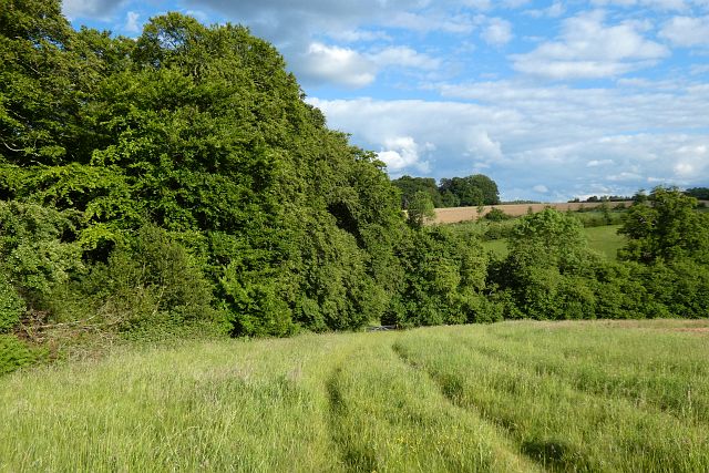
Little Cockshoots Wood is a charming woodland area located in the county of Buckinghamshire, England. It is situated near the village of Great Missenden, covering an approximate area of 30 acres. The wood is a part of the Chiltern Hills, an Area of Outstanding Natural Beauty.

The woodland is predominantly composed of deciduous trees, including oak, beech, and birch, creating a diverse and picturesque landscape. The forest floor is carpeted with a rich variety of wildflowers, adding to the wood's natural beauty. Additionally, the wood is home to a plethora of wildlife, including various bird species, small mammals, and insects.

Visitors to Little Cockshoots Wood can enjoy a peaceful and serene atmosphere, perfect for walking, picnicking, or simply immersing oneself in nature. There are several well-maintained footpaths that traverse the wood, allowing visitors to explore its hidden treasures. The wood is also a popular spot for nature enthusiasts and birdwatchers, as it provides an excellent opportunity to observe and appreciate the local flora and fauna.

Little Cockshoots Wood is easily accessible, with nearby parking facilities and public transport options. The wood is open to the public year-round, and there are no admission fees or restrictions on visiting hours. It is an ideal destination for those seeking a tranquil escape from the hustle and bustle of everyday life, offering a slice of natural beauty in the heart of Buckinghamshire.

If you have any feedback on the listing, please let us know in the comments section below.

Little Cockshoots Wood Images

Images are sourced within 2km of 51.64781/-0.82171386 or Grid Reference SU8194. Thanks to Geograph Open Source API. All images are credited.

West Wycombe : entrance, Hellfire Caves Deecription and background at <a href="https://www.geograph.org.uk/photo/3562974">SU8294 : Hellfire Caves, Church Lane, West Wycombe</a>.
West Wycombe : entrance, Hellfire Caves
West Wycombe Park View from the Dashwood Mausoleum.
West Wycombe Park
View from the Dashwood Mausoleum.
West Wycombe : St Paul's Church The church was built in 1875 to a design by architect John West Hugall.
West Wycombe : St Paul's Church
The church was built in 1875 to a design by architect John West Hugall.
The Dashwood Mausoleum
Railway bridge over the A4010 This brick built bridge carries the Chiltern Main Line over the A4010 road at West Wycombe on its way from High Wycombe to Princes Risborough.  It was built in the early 1900's as a replacement for the old Wycombe Railway bridge.  The Wycombe Railway was a single track formerly broad gauge railway between Maidenhead and Oxford.  The line was rebuilt as part of the Great Western/Great Central Joint Railway built from Northolt to Banbury to cut journey times from Paddington to Birmingham.  It also provided the Great Central with a second route from Marylebone to the north.  Today's services run from Marylebone to Birmingham Snow Hill.  The construction of the bridge is interesting in that it consists of 5 separate brick arches built on the skew across the road, clearly shown in the photograph.  The abutments of the old bridge can be seen beyond the new one.
Railway bridge over the A4010
This brick built bridge carries the Chiltern Main Line over the A4010 road at West Wycombe on its way from High Wycombe to Princes Risborough. It was built in the early 1900's as a replacement for the old Wycombe Railway bridge. The Wycombe Railway was a single track formerly broad gauge railway between Maidenhead and Oxford. The line was rebuilt as part of the Great Western/Great Central Joint Railway built from Northolt to Banbury to cut journey times from Paddington to Birmingham. It also provided the Great Central with a second route from Marylebone to the north. Today's services run from Marylebone to Birmingham Snow Hill. The construction of the bridge is interesting in that it consists of 5 separate brick arches built on the skew across the road, clearly shown in the photograph. The abutments of the old bridge can be seen beyond the new one.
Railway bridge over Cookshall Lane This bridge carries the Chiltern Main Line over Cookshall Lane in West Wycombe.  The abutments in the foreground carried the old Wycombe railway single track before the line was rebuilt and doubled in the early 1900's.
Railway bridge over Cookshall Lane
This bridge carries the Chiltern Main Line over Cookshall Lane in West Wycombe. The abutments in the foreground carried the old Wycombe railway single track before the line was rebuilt and doubled in the early 1900's.
Woods and farmland, Wheeler End A footpath descends at the western end of Great Wood.
Woods and farmland, Wheeler End
A footpath descends at the western end of Great Wood.
West Wycombe - Tudor House "A Fine English Butchers" on West Wycombe High Street which has a range of historic buildings and shops dating from the 16th century. This street was once the coaching road between London and Oxford.
<span class="nowrap"><a title="www.nationaltrust.org.uk" rel="nofollow ugc noopener" href="http://www.nationaltrust.org.uk">Link</a><img style="margin-left:2px;" alt="External link" title="External link - shift click to open in new window" src="https://s1.geograph.org.uk/img/external.png" width="10" height="10"/></span>
West Wycombe - Tudor House
"A Fine English Butchers" on West Wycombe High Street which has a range of historic buildings and shops dating from the 16th century. This street was once the coaching road between London and Oxford. LinkExternal link
West Wycombe - High Street West Wycombe High Street has a range of historic buildings and shops dating from the 16th century. This street was once the coaching road between London and Oxford.
<span class="nowrap"><a title="www.nationaltrust.org.uk" rel="nofollow ugc noopener" href="http://www.nationaltrust.org.uk">Link</a><img style="margin-left:2px;" alt="External link" title="External link - shift click to open in new window" src="https://s1.geograph.org.uk/img/external.png" width="10" height="10"/></span>
West Wycombe - High Street
West Wycombe High Street has a range of historic buildings and shops dating from the 16th century. This street was once the coaching road between London and Oxford. LinkExternal link
West Wycombe - Church Loft West Wycombe High Street has a range of historic buildings and shops dating from the 16th century. Church Loft is timber framed with later brick infill - and has been a jail.
This street was once the coaching road between London and Oxford.
<span class="nowrap"><a title="www.nationaltrust.org.uk" rel="nofollow ugc noopener" href="http://www.nationaltrust.org.uk">Link</a><img style="margin-left:2px;" alt="External link" title="External link - shift click to open in new window" src="https://s1.geograph.org.uk/img/external.png" width="10" height="10"/></span>
West Wycombe - Church Loft
West Wycombe High Street has a range of historic buildings and shops dating from the 16th century. Church Loft is timber framed with later brick infill - and has been a jail. This street was once the coaching road between London and Oxford. LinkExternal link
West Wycombe - St Paul's Church St Paul's, built 1875, is the village's "Winter Church" and shared with a Serbian Orthodox congregation.
West Wycombe - St Paul's Church
St Paul's, built 1875, is the village's "Winter Church" and shared with a Serbian Orthodox congregation.
West Wycombe - St Paul's Font St Paul's, built 1875, is the village's "Winter Church" and shared with a Serbian Orthodox congregation.
West Wycombe - St Paul's Font
St Paul's, built 1875, is the village's "Winter Church" and shared with a Serbian Orthodox congregation.
West Wycombe - St Paul's - Apse and Altar St Paul's, built 1875, is the village's "Winter Church" and shared with a Serbian Orthodox congregation.
West Wycombe - St Paul's - Apse and Altar
St Paul's, built 1875, is the village's "Winter Church" and shared with a Serbian Orthodox congregation.
West Wycombe - St Paul's - Icon St Paul's, built 1875, is the village's "Winter Church" and shared with a Serbian Orthodox congregation.
West Wycombe - St Paul's - Icon
St Paul's, built 1875, is the village's "Winter Church" and shared with a Serbian Orthodox congregation.
West Wycombe - St Paul's - Icon St Paul's, built 1875, is the village's "Winter Church" and shared with a Serbian Orthodox congregation.
West Wycombe - St Paul's - Icon
St Paul's, built 1875, is the village's "Winter Church" and shared with a Serbian Orthodox congregation.
West Wycombe - Post Office & Village Store Bay windows, Platinum Jubilee bunting, flowers outside The Plough in the historic village of West Wycombe.
<span class="nowrap"><a title="www.nationaltrust.org.uk" rel="nofollow ugc noopener" href="http://www.nationaltrust.org.uk">Link</a><img style="margin-left:2px;" alt="External link" title="External link - shift click to open in new window" src="https://s1.geograph.org.uk/img/external.png" width="10" height="10"/></span>
West Wycombe - Post Office & Village Store
Bay windows, Platinum Jubilee bunting, flowers outside The Plough in the historic village of West Wycombe. LinkExternal link
West Wycombe - The Plough Colourful pub sign and hanging baskets on West Wycombe's historic High Street.
West Wycombe - The Plough
Colourful pub sign and hanging baskets on West Wycombe's historic High Street.
West Wycombe - Platinum Jubilee Queen and crown in the village shop window on West Wycombe's High Street.
West Wycombe - Platinum Jubilee
Queen and crown in the village shop window on West Wycombe's High Street.
Show me another place!

Little Cockshoots Wood is located at Grid Ref: SU8194 (Lat: 51.64781, Lng: -0.82171386)

Unitary Authority: Buckinghamshire

Police Authority: Thames Valley

What 3 Words

///busy.posts.labs. Near High Wycombe, Buckinghamshire

Related Wikis

Piddington, Buckinghamshire

Piddington is a hamlet in the parish of Piddington and Wheeler End in Buckinghamshire, England. It is located on the main A40 between Stokenchurch and...

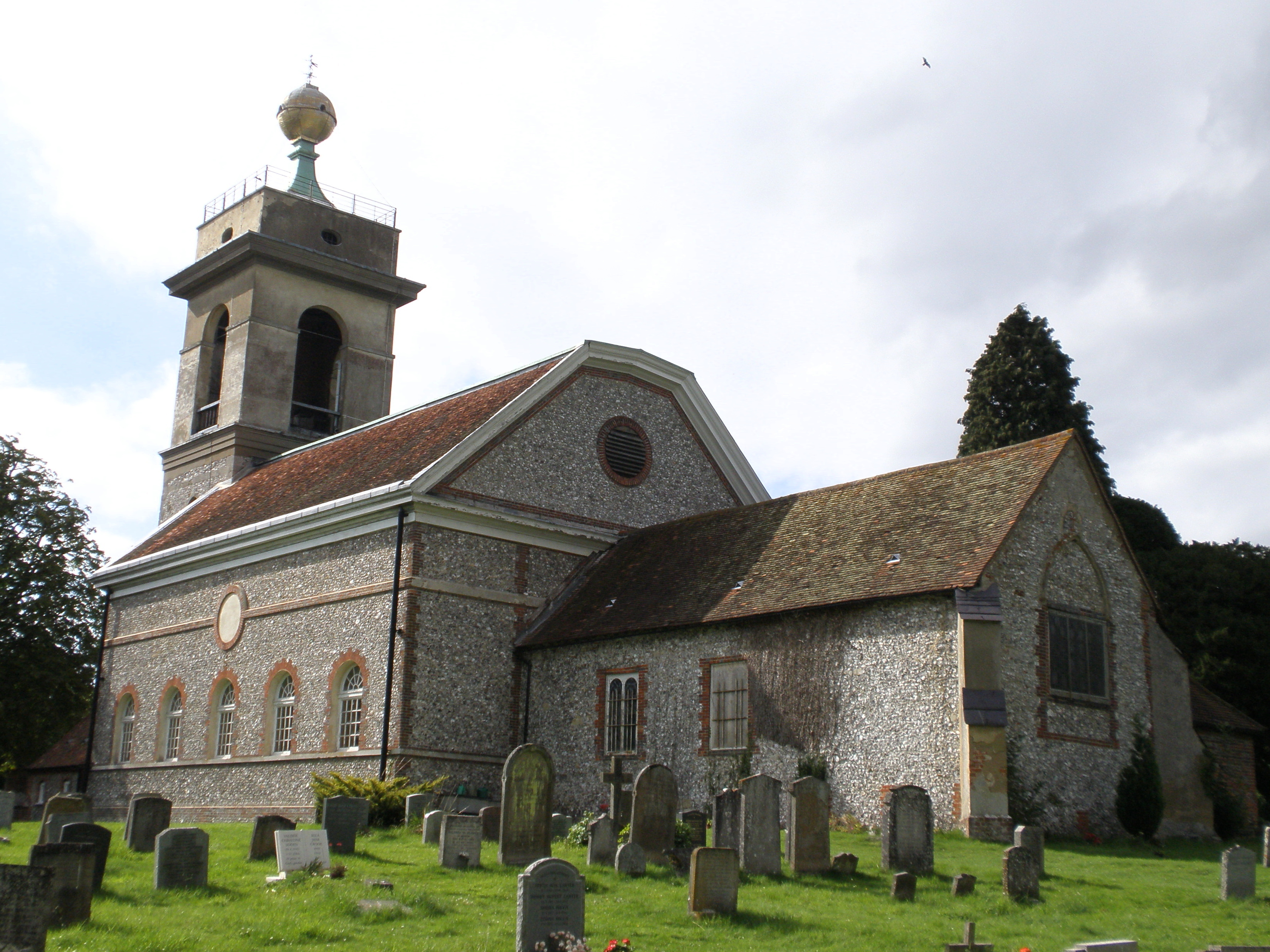
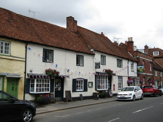
St Lawrence's Church, West Wycombe

St Lawrence's Church is a Church of England church in the parish of West Wycombe, Buckinghamshire, England. It sits on top of West Wycombe Hill in a prominent...

Buttlers Hangings

Buttlers Hangings is a 3.9-hectare (9.6-acre) Site of Special Scientific Interest north of West Wycombe in Buckinghamshire. It is in the Chilterns Area...

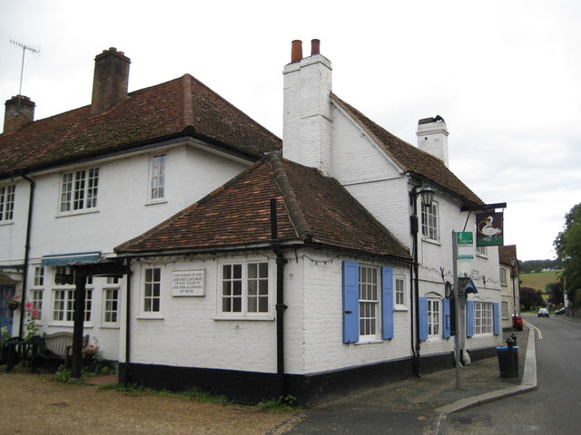
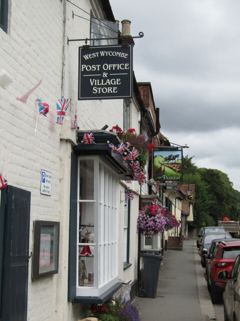
The Swan, West Wycombe

The Swan is a Grade II listed pub at High Street, West Wycombe, Buckinghamshire.It is on the Campaign for Real Ale's National Inventory of Historic Pub...
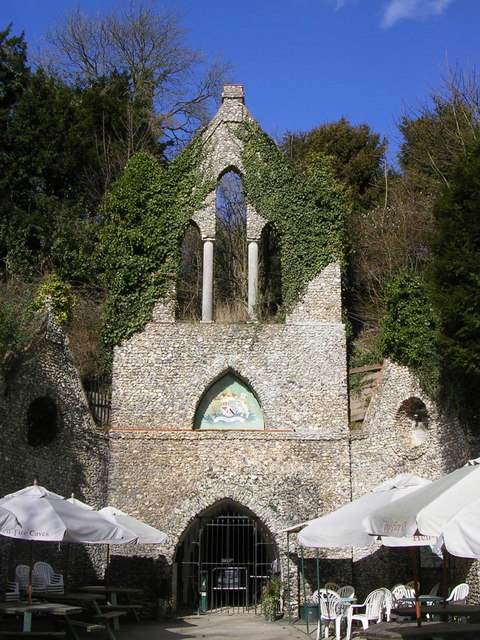
Hellfire Caves

The Hellfire Caves (also known as the West Wycombe Caves) are a network of man-made chalk and flint caverns which extend 260m underground. They are situated...
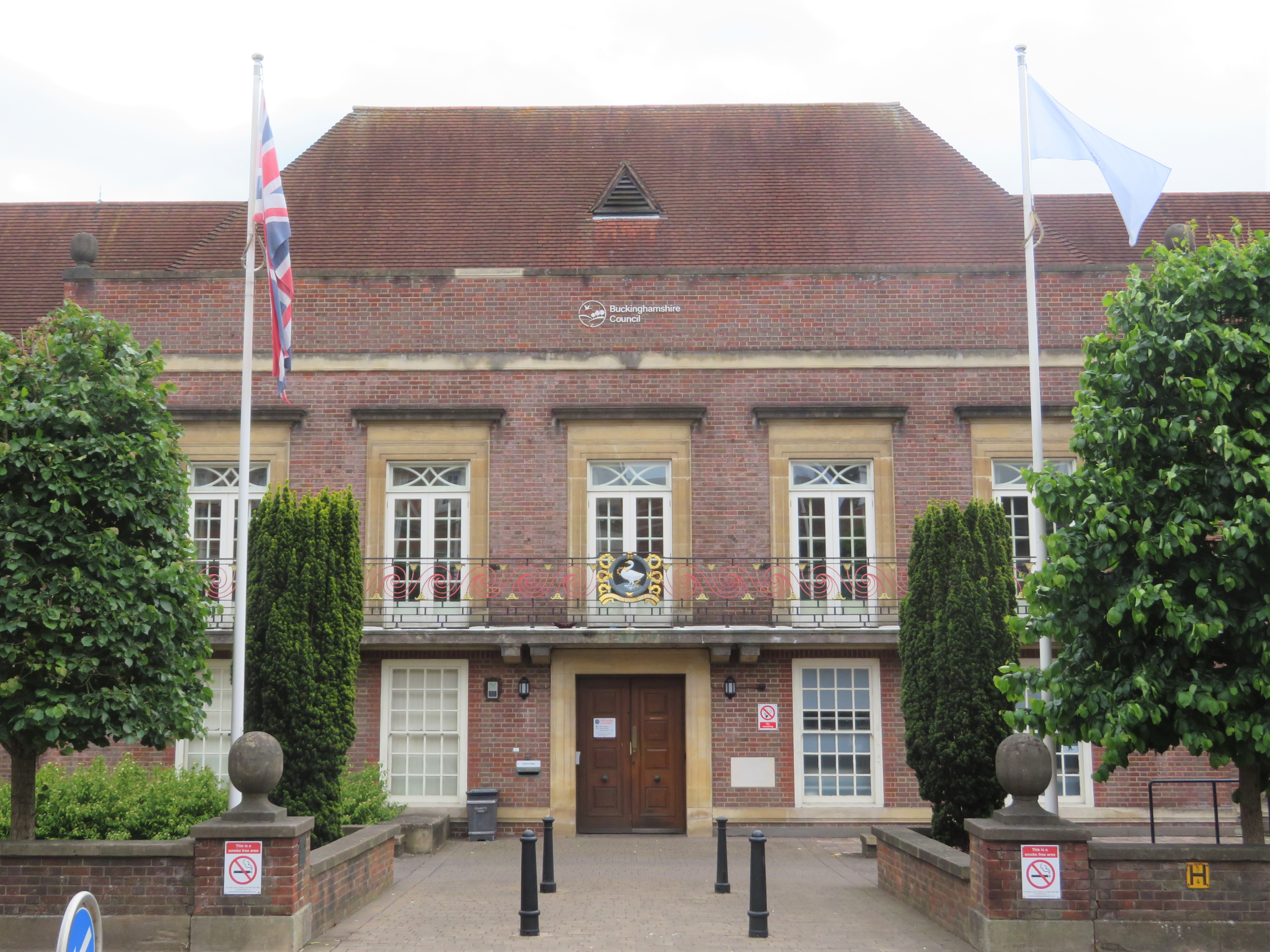
Wycombe District

Wycombe District was a local government district in Buckinghamshire in south-central England. Its council was based in the town of High Wycombe. The district...

West Wycombe Park

West Wycombe Park is a country house built between 1740 and 1800 near the village of West Wycombe in Buckinghamshire, England. It was conceived as a pleasure...

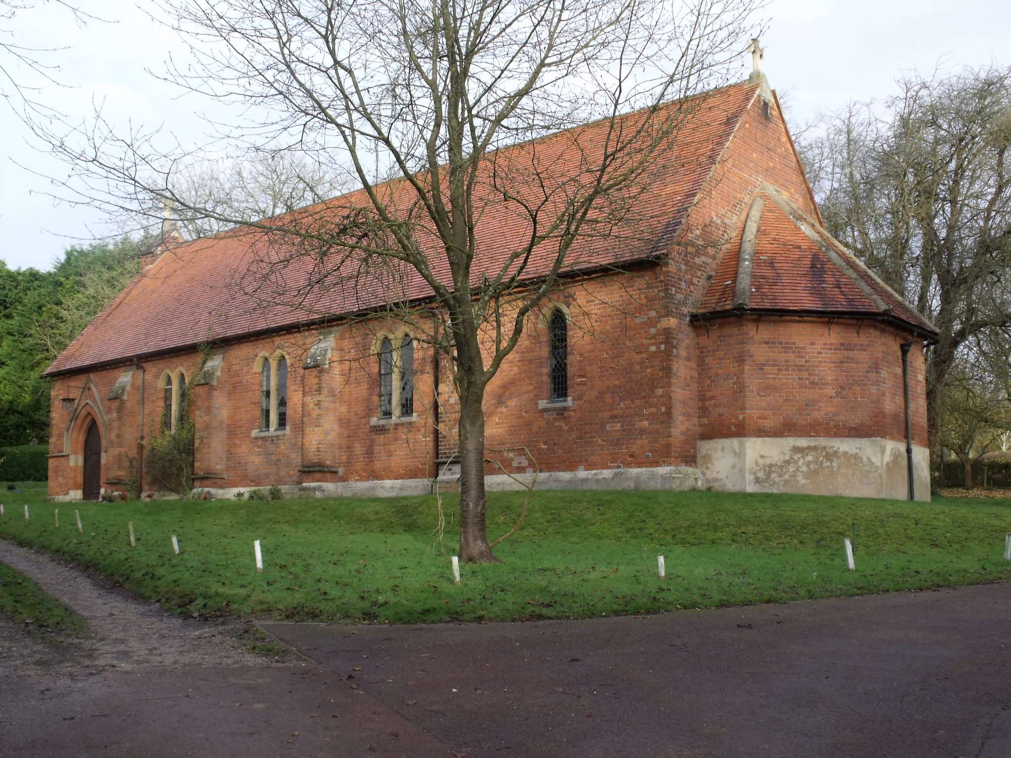
St Paul's Church, West Wycombe

St. Paul's Church, in High Street, West Wycombe, England, is one of two Anglican churches in the village. St. Paul's was built by Lady Elizabeth Dashwood...

Nearby Amenities

Located within 500m of 51.64781,-0.82171386
Note: Footway continues up hill, away from road, in a very straight line.
Lat/Long: 51.6446218/-0.8201931
Power: tower
Lat/Long: 51.6456351/-0.8156636
Power: tower
Lat/Long: 51.6481723/-0.8163683
Power: tower
Lat/Long: 51.6510505/-0.8185831
The data included in this document is from www.openstreetmap.org. The data is made available under ODbL.

Have you been to Little Cockshoots Wood?

Leave your review of Little Cockshoots Wood below (or comments, questions and feedback).