Featherhaugh Wood

Wood, Forest in Yorkshire Ryedale

England

Featherhaugh Wood

The level crossing at Newbridge A crossing for the North Yorkshire Moors Railway with a signal box
The level crossing at Newbridge Credit: David Smith

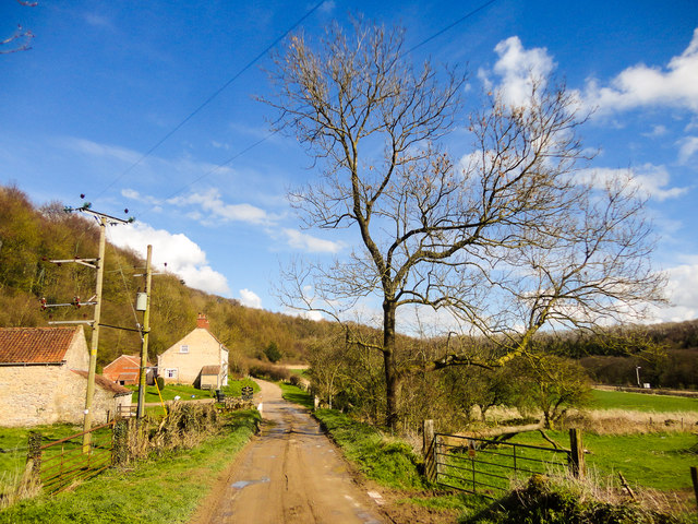
Featherhaugh Wood is a serene forest located in the county of Yorkshire, England. Nestled in the picturesque landscape of the Yorkshire Dales, this wood covers an extensive area of approximately 50 acres, offering visitors a tranquil retreat from the hustle and bustle of city life.

The wood is predominantly composed of native tree species such as oak, ash, and birch, creating a diverse and vibrant ecosystem. The dense canopy formed by these majestic trees provides a welcome shade during hot summer months and adds to the enchanting ambiance of the wood. A carpet of wildflowers, including bluebells and primroses, adorns the forest floor in spring, creating a colorful spectacle.

Featherhaugh Wood is a haven for wildlife enthusiasts and birdwatchers alike. The forest is home to various species of birds, including woodpeckers, owls, and thrushes, that can be spotted and heard throughout the year. Visitors may also have the chance to glimpse small mammals such as squirrels and rabbits scurrying amongst the undergrowth.

A network of walking trails weaves through the wood, allowing visitors to explore its beauty at their own pace. These trails offer breathtaking views of the surrounding countryside and provide opportunities for nature photography and peaceful picnics. The wood also features a small picnic area with benches, perfect for enjoying a packed lunch while immersing oneself in nature's tranquility.

Featherhaugh Wood is a hidden gem in Yorkshire, offering a serene and captivating experience for visitors seeking solace in nature's embrace.

If you have any feedback on the listing, please let us know in the comments section below.

Featherhaugh Wood Images

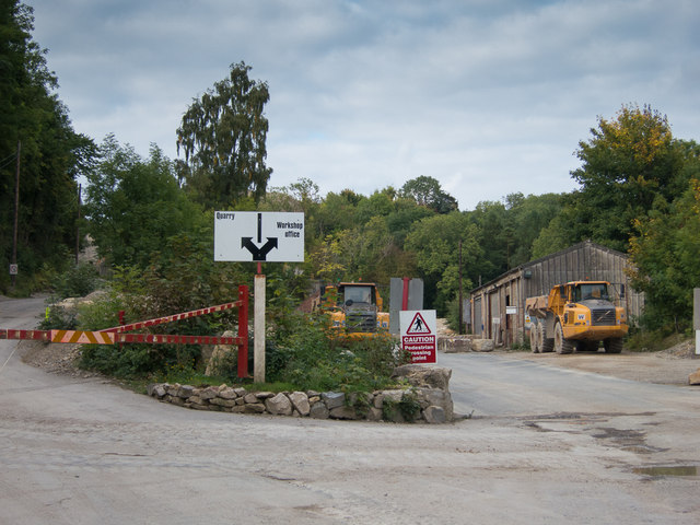
Images are sourced within 2km of 54.259879/-0.76037602 or Grid Reference SE8085. Thanks to Geograph Open Source API. All images are credited.

The level crossing at Newbridge A crossing for the North Yorkshire Moors Railway with a signal box
The level crossing at Newbridge
A crossing for the North Yorkshire Moors Railway with a signal box
Newbridge Quarry entrance There's a rather inconvenient footpath alongside the entrance road, which is not ideal with large lorries frequently passing on weekdays.
Newbridge Quarry entrance
There's a rather inconvenient footpath alongside the entrance road, which is not ideal with large lorries frequently passing on weekdays.
Newbridge Quarry  From by the public footpath
Newbridge Quarry
From by the public footpath
Office near the workshops at Newbridge Quarry The footpath is directed to the left of the building.
Office near the workshops at Newbridge Quarry
The footpath is directed to the left of the building.
Entrance to main quarry area Newbridge Quarry.
Entrance to main quarry area
Newbridge Quarry.
Weighbridge at Newbridge Quarry Lorries are required to be weighed before entering and when leaving loaded.
Weighbridge at Newbridge Quarry
Lorries are required to be weighed before entering and when leaving loaded.
Swampy ground at Little park Wood This lies alongside the railway track of the NYMR
Swampy ground at Little park Wood
This lies alongside the railway track of the NYMR
Footpath railway crossing in Blansby Park Wood View from passing steam train
Footpath railway crossing in Blansby Park Wood
View from passing steam train
Park Gate near Newbridge View from passing steam train
Park Gate near Newbridge
View from passing steam train
Pickering's new flood defences View from passing steam train
Pickering's new flood defences
View from passing steam train
New Bridge level crossing
Over  fields  on  High  Scalla  Moor Little Park Wood to the right
Over fields on High Scalla Moor
Little Park Wood to the right
A  misty  scene  from  Scalla  Moor  Plantation The footpath keeps to the western edge of the plantation
A misty scene from Scalla Moor Plantation
The footpath keeps to the western edge of the plantation
A  walk  down  Howl  Dale A regular walk as a number of footpaths enter the dale at both ends
A walk down Howl Dale
A regular walk as a number of footpaths enter the dale at both ends
Track  in  Little  Park  Wood.  Autumn  leaves (1) To the right as you take the footpath out of Newton Dale up on to Scalla Moor
Track in Little Park Wood. Autumn leaves (1)
To the right as you take the footpath out of Newton Dale up on to Scalla Moor
Track  in  Little  Park  Wood.  Autumn  leaves (2) To the right of the footpath
Track in Little Park Wood. Autumn leaves (2)
To the right of the footpath
How  many  mud  packs  could  you  make  with  that The track around Blansby Park Farm has reached a good consistency we gave it a wide berth
How many mud packs could you make with that
The track around Blansby Park Farm has reached a good consistency we gave it a wide berth
Spring has Sprung, Park Gate
Show me another place!

Featherhaugh Wood is located at Grid Ref: SE8085 (Lat: 54.259879, Lng: -0.76037602)

Division: North Riding

Administrative County: North Yorkshire

District: Ryedale

Police Authority: North Yorkshire

What 3 Words

///nature.dustbin.zones. Near Pickering, North Yorkshire

Related Wikis

Newbridge, North Yorkshire

Newbridge is a hamlet, near Pickering in North Yorkshire, England.
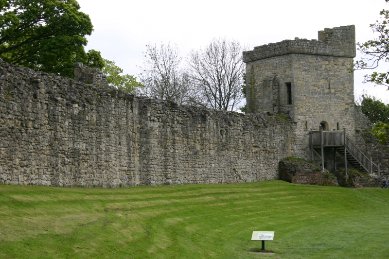
Pickering Castle

Pickering Castle is a motte-and-bailey fortification in Pickering, North Yorkshire, England. == Design == Pickering Castle was originally a timber and...

Lady Lumley's School

Lady Lumley's School is a coeducational secondary school and sixth form located in Pickering, North Yorkshire, England. It was founded in Thornton-le-Dale...

Pickering railway station

Pickering railway station is the southern terminus of the North Yorkshire Moors Railway and serves the town of Pickering in North Yorkshire, England. The...

Nearby Amenities

Located within 500m of 54.259879,-0.76037602
Barrier: kissing_gate
Foot: yes
Lat/Long: 54.2599495/-0.7608966
Barrier: kissing_gate
Foot: yes
Lat/Long: 54.2585453/-0.7583746
Barrier: kissing_gate
Foot: yes
Lat/Long: 54.2576938/-0.7551084
Railway: switch
Lat/Long: 54.2589187/-0.767594
Railway: switch
Switch: three_way
Lat/Long: 54.2589234/-0.7675315
Railway: switch
Lat/Long: 54.2591029/-0.7672709
Woodland Poultry Farm
Place: farm
Lat/Long: 54.2602016/-0.7660416
Park Gate
Place: isolated_dwelling
Lat/Long: 54.2617673/-0.7607581
Railway: switch
Lat/Long: 54.2593794/-0.7667735
Railway: switch
Lat/Long: 54.2591228/-0.767299
The data included in this document is from www.openstreetmap.org. The data is made available under ODbL.

Have you been to Featherhaugh Wood?

Leave your review of Featherhaugh Wood below (or comments, questions and feedback).