Laxton's Covert
Wood, Forest in Leicestershire Melton
England
Laxton's Covert
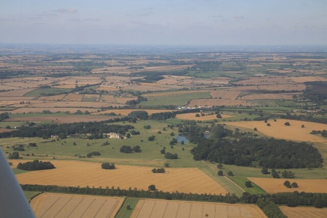
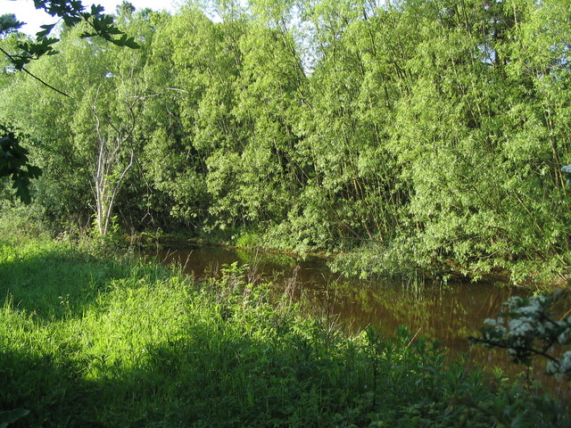
Laxton's Covert is a picturesque woodland located in Leicestershire, England. Situated near the village of Laxton, this enchanting forest covers an area of approximately 500 acres. The woodland is known for its natural beauty and diverse range of flora and fauna.
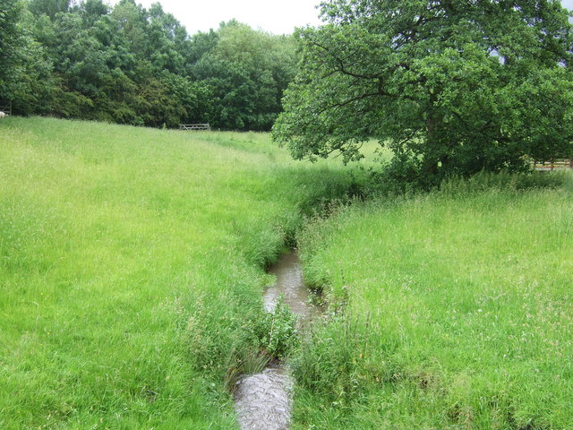
As you enter Laxton's Covert, you are immersed in a peaceful and serene environment. Towering oak trees dominate the landscape, creating a dense canopy overhead. The forest floor is covered in a thick carpet of moss, ferns, and wildflowers, adding to the enchanting atmosphere.
The woodland is home to a wide variety of wildlife. Birdwatchers will delight in spotting species such as woodpeckers, owls, and various songbirds that inhabit the trees. Squirrels scurry among the branches, while rabbits and foxes can often be seen darting through the undergrowth.
Laxton's Covert is also a popular destination for nature lovers and outdoor enthusiasts. There are several walking trails that wind their way through the forest, allowing visitors to explore its beauty at their own pace. The trails offer stunning views of the surrounding countryside, making them a favorite spot for photographers.
In addition to its natural beauty, Laxton's Covert also has historical significance. The woodland was once part of the ancient royal forest of Charnwood, and remnants of its past can still be found, including old boundary markers and the remains of a medieval hunting lodge.
Overall, Laxton's Covert is a haven of tranquility and natural splendor. Whether you are a nature enthusiast, a photographer, or simply seeking a peaceful retreat, this woodland is sure to captivate and inspire.
If you have any feedback on the listing, please let us know in the comments section below.
Laxton's Covert Images
Images are sourced within 2km of 52.740567/-0.80446284 or Grid Reference SK8016. Thanks to Geograph Open Source API. All images are credited.


Laxton's Covert is located at Grid Ref: SK8016 (Lat: 52.740567, Lng: -0.80446284)
Administrative County: Leicestershire
District: Melton
Police Authority: Leicestershire
What 3 Words
///energetic.sticky.stated. Near Wymondham, Leicestershire
Nearby Locations
Related Wikis
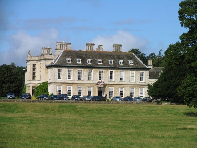
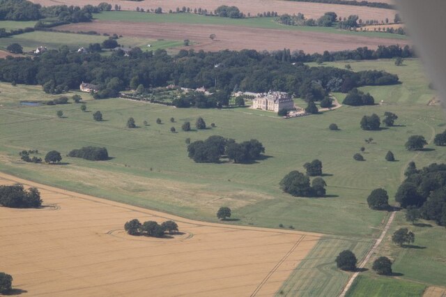
Stapleford Park
Stapleford Park is a Grade I listed country house in Stapleford, near Melton Mowbray in Leicestershire, England, which is now used as a hotel. It was originally...

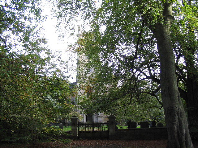
St Mary Magdalene's Church, Stapleford
St Mary Magdalene's Church is a redundant Anglican church near the village of Stapleford, Leicestershire, England. It is recorded in the National Heritage...

Stapleford Miniature Railway
Stapleford Miniature Railway is an historic steam locomotive-hauled 10+1⁄4 in (260 mm) gauge railway at Stapleford Park, Stapleford near Melton Mowbray...

Stapleford, Leicestershire
Stapleford is a village and former civil parish, now in the parish of Freeby, in the Melton district of Leicestershire, England, east of Melton Mowbray...

Langham Brook
The Langham Brook is a watercourse in the East Midlands of England. It is a tributary of the River Eye and part of the River Soar catchment. == Course... ==
Wymondham Rough
Wymondham Rough is a 6.0 hectares (15 acres) biological Site of Special Scientific Interest (SSSI) east of Stapleford in Leicestershire. The SSSI is part...
Whissendine Brook
The Whissendine Brook is a small watercourse in the East Midlands region of England. It is a tributary of the Langham Brook and part of the River Soar...
Brentingby
Brentingby is a village in Leicestershire, England.The population is included in the civil parish of Freeby. The village's name means either 'farm/settlement...
Nearby Amenities
Located within 500m of 52.740567,-0.80446284Have you been to Laxton's Covert?
Leave your review of Laxton's Covert below (or comments, questions and feedback).