Knighton's Copse

Wood, Forest in Buckinghamshire

England

Knighton's Copse

Eakley Lanes north of Stoke Goldington My last visit said this was Horton Road but the latest map shows it changing to Eakley Lanes after Horton.
Eakley Lanes north of Stoke Goldington Credit: David Howard

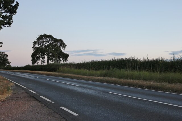
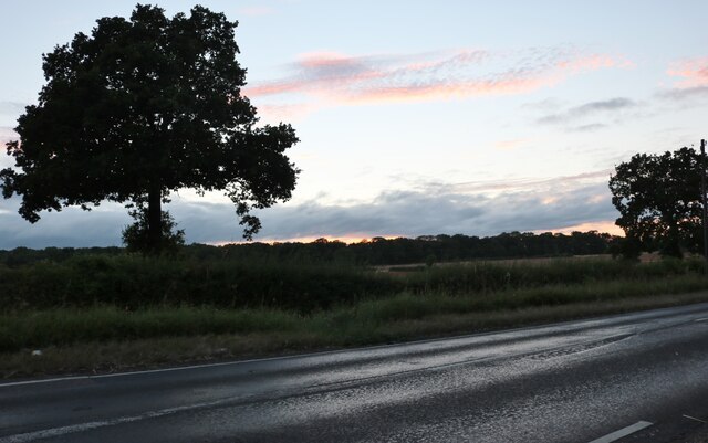
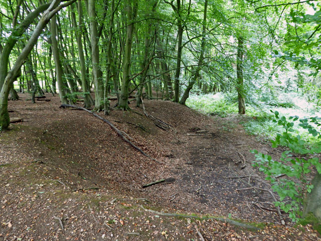
Knighton's Copse is a picturesque woodland located in Buckinghamshire, England. Spanning approximately 50 acres, this ancient forest is known for its natural beauty and diverse ecosystem. The copse is situated near the village of Knighton and is easily accessible to visitors.

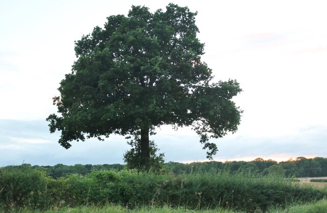
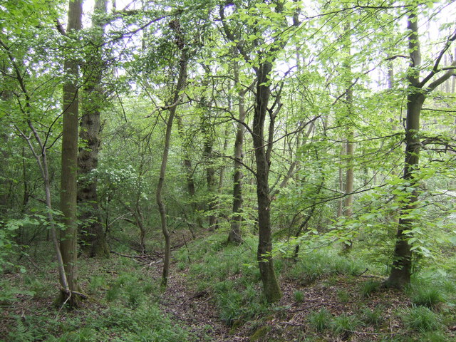
The wood is primarily composed of native tree species, including oak, beech, and ash, which form a dense canopy overhead. This creates a tranquil and shaded environment, perfect for exploring or simply immersing oneself in nature. The forest floor is covered in a thick layer of leaf litter, creating a soft carpet underfoot, and is home to a wide variety of plant life, such as bluebells, wild garlic, and ferns.

Knighton's Copse is also teeming with wildlife. Visitors may spot several species of birds, including woodpeckers, owls, and various songbirds. Squirrels can be seen scurrying about, and if lucky, a glimpse of a fox or deer may be caught. The copse is also home to a rich diversity of insects, such as butterflies and beetles, which adds to the ecosystem's vibrancy.

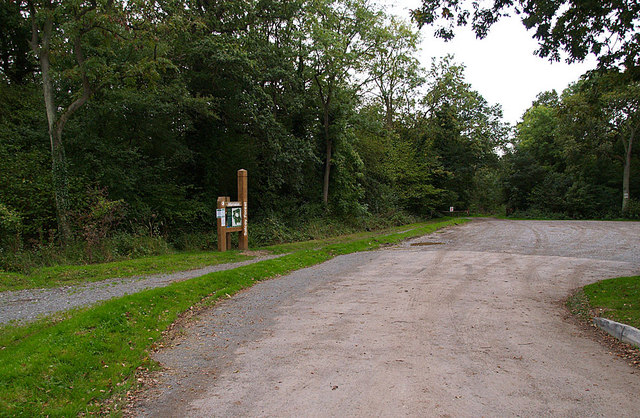
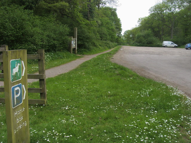
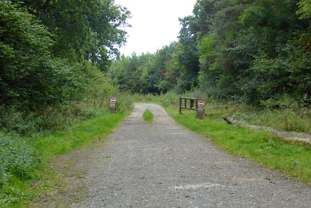
A network of well-maintained footpaths and trails wind through the copse, allowing visitors to explore its different areas and appreciate its beauty from various perspectives. There are also designated picnic areas and benches, providing opportunities for relaxation and enjoying the peaceful surroundings.

Knighton's Copse is not only a haven for nature enthusiasts but also serves as an important ecological site. It contributes to the preservation of biodiversity in the region and acts as a vital habitat for many species. It is a cherished natural gem in Buckinghamshire, attracting both locals and tourists looking to connect with the beauty of the British countryside.

If you have any feedback on the listing, please let us know in the comments section below.

Knighton's Copse Images

Images are sourced within 2km of 52.148185/-0.82085874 or Grid Reference SP8050. Thanks to Geograph Open Source API. All images are credited.

Eakley Lanes north of Stoke Goldington My last visit said this was Horton Road but the latest map shows it changing to Eakley Lanes after Horton.
Eakley Lanes north of Stoke Goldington
My last visit said this was Horton Road but the latest map shows it changing to Eakley Lanes after Horton.
Eakley Lanes north of Stoke Goldington Sunset in the west.
Eakley Lanes north of Stoke Goldington
Sunset in the west.
Tree on Eakley Lanes north of Stoke Goldington
Smart Motorway works - M1 southbound
M1 near Hartwell The M1 is a north–south motorway connecting London to Leeds, where it joins the A1(M) near Aberford. It was the first motorway to be completed in the United Kingdom.
The motorway is 193 miles long and was constructed in four phases. Most of the motorway was opened between 1959 and 1968 but the southern end was extended in 1977 and the northern end was extended in 1999.
M1 near Hartwell
The M1 is a north–south motorway connecting London to Leeds, where it joins the A1(M) near Aberford. It was the first motorway to be completed in the United Kingdom. The motorway is 193 miles long and was constructed in four phases. Most of the motorway was opened between 1959 and 1968 but the southern end was extended in 1977 and the northern end was extended in 1999.
Forest Road crossing M1 southbound
Matrix Board - M1 southbound
Forest Road crosses M1 southbound  A moment of unrestricted movement on this notoriously congested motorway. Forest Road is within the district of the City of Milton Keynes.
Forest Road crosses M1 southbound
A moment of unrestricted movement on this notoriously congested motorway. Forest Road is within the district of the City of Milton Keynes.
Variable Message Sign on the M1 near Hanslope Variable message signs (VMS), also sometimes referred to as matrix signs, are electronic traffic signs used on motorways (and some other major routes) to give drivers information about special events and to warn them about traffic congestion, accidents, incidents, roadworks or speed limits on specific sections of the route. They may also suggest (or instruct) drivers to take alternative routes, limit speed, warn of the duration and location of the incidents or just inform of the traffic conditions
Variable Message Sign on the M1 near Hanslope
Variable message signs (VMS), also sometimes referred to as matrix signs, are electronic traffic signs used on motorways (and some other major routes) to give drivers information about special events and to warn them about traffic congestion, accidents, incidents, roadworks or speed limits on specific sections of the route. They may also suggest (or instruct) drivers to take alternative routes, limit speed, warn of the duration and location of the incidents or just inform of the traffic conditions
Accommodation Bridge across the M1 at Spinney Lodge Farm The M1 is a north–south motorway connecting London to Leeds, where it joins the A1(M) near Aberford. It was the first motorway to be completed in the United Kingdom.
The motorway is 193 miles long and was constructed in four phases. Most of the motorway was opened between 1959 and 1968 but the southern end was extended in 1977 and the northern end was extended in 1999.
Accommodation Bridge across the M1 at Spinney Lodge Farm
The M1 is a north–south motorway connecting London to Leeds, where it joins the A1(M) near Aberford. It was the first motorway to be completed in the United Kingdom. The motorway is 193 miles long and was constructed in four phases. Most of the motorway was opened between 1959 and 1968 but the southern end was extended in 1977 and the northern end was extended in 1999.
Car Park on Swan's Way, Salcey Forest A popular car park for walkers, riders and cyclists. The track leads deep into the forest on the less-busy southern side. The forest warden told me that in the evenings (at the right time of year) nightingales can be heard calling.
Car Park on Swan's Way, Salcey Forest
A popular car park for walkers, riders and cyclists. The track leads deep into the forest on the less-busy southern side. The forest warden told me that in the evenings (at the right time of year) nightingales can be heard calling.
Bullshead Farm A fine looking building on the turn in the B526 road. Keep left to head towards Stoke Goldington or take a right to go through Salcey Forest.
Bullshead Farm
A fine looking building on the turn in the B526 road. Keep left to head towards Stoke Goldington or take a right to go through Salcey Forest.
Salcey Forest in mid-spring The beeches are leafing up nicely, but no bluebells, more's the pity!
Salcey Forest in mid-spring
The beeches are leafing up nicely, but no bluebells, more's the pity!
Stable and shed The footpath should go through somewhere round here but this field is fenced and there is no sign of where to go.
Stable and shed
The footpath should go through somewhere round here but this field is fenced and there is no sign of where to go.
Swan's Way Swan's Way start/finish in Salcey Forest
Swan's Way
Swan's Way start/finish in Salcey Forest
Track, Salcey Forest The no entry signs have an added 'No unauthorised vehicles'.
Track, Salcey Forest
The no entry signs have an added 'No unauthorised vehicles'.
Bridleway towards Salcey Forest It was remarkable how stony the field was - quite large lumps of stone were on the track.
Bridleway towards Salcey Forest
It was remarkable how stony the field was - quite large lumps of stone were on the track.
Old pit, Salcey Forest On old maps shown as an old gravel pit, which is not the mineral that immediately springs to mind in these parts. The geological map suggests limestone is more likely.
Old pit, Salcey Forest
On old maps shown as an old gravel pit, which is not the mineral that immediately springs to mind in these parts. The geological map suggests limestone is more likely.
Show me another place!

Knighton's Copse is located at Grid Ref: SP8050 (Lat: 52.148185, Lng: -0.82085874)

Unitary Authority: West Northamptonshire

Police Authority: Northamptonshire

What 3 Words

///burden.revamped.carting. Near Hartwell, Northamptonshire

Related Wikis

Salcey Forest

Salcey Forest is a fragment of a former medieval hunting forest east of the village of Hartwell, between Northampton and Newport Pagnell in Northamptonshire...

Salcey Green

Salcey Green is an area of farm and wood land within the parish of Hanslope in the Borough of Milton Keynes, England. In 1830 it was the scene of an infamous...

Hartwell, Northamptonshire

Hartwell is a village and civil parish in West Northamptonshire, England, bordering Buckinghamshire. The village is next to Salcey Forest and the M1 motorway...

Salcey Forest railway station

Salcey Forest railway station was a short-lived railway station in England, on the Stratford-upon-Avon, Towcester and Midland Junction Railway which opened...

Related Videos

Walking the Northamptonshire Round - Stage 4 - Stoke Bruerne to Piddington

Stage 4 of our adventures on the Northamptonshire Round on a sunny winters day. Leaving Stoke Bruerne we headed down the ...

Worms & Elephants, a Salcey Forest parkrun tourism adventure

For Iona's 53rd parkrun we visited Salcey Forest parkrun. This was one Ewan was keen to do with us too, from when we visited the ...

Walking Salcey Forest ¦ Walking Tour Salcey Forest ¦ Northampton Forest Walk ¦ Walking With My Son

Walking through Salcey Forest. Northampton: Sat Nav Postcode: NN7 2HX *** Salcey Forest is a fragment of a former medieval ...

Have you been to Knighton's Copse?

Leave your review of Knighton's Copse below (or comments, questions and feedback).