Ashley

Settlement in Hampshire

England

Ashley

Ringwood : The A31 Heading out of Ringwood on the A31.
Ringwood : The A31 Credit: Lewis Clarke

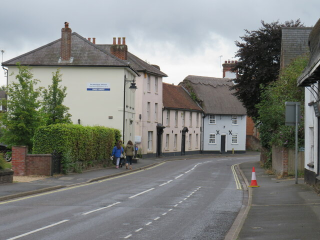
Ashley is a small village located in the county of Hampshire, England. Situated in the Test Valley district, it is nestled between the towns of New Milton and Lymington. With a population of around 1,500 residents, Ashley maintains a peaceful and rural atmosphere.

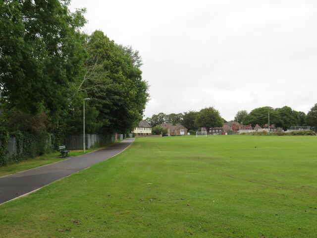
The village is characterized by its picturesque countryside, rolling hills, and charming thatched-roof cottages. It is surrounded by beautiful landscapes, including the nearby New Forest National Park, where visitors can enjoy walks, cycling, and horse riding.

Despite its small size, Ashley boasts a strong sense of community. The village has a local church, St Mary's, which dates back to the 12th century and serves as a hub for religious activities and community events. Additionally, there is a village hall that hosts various gatherings, such as social clubs, classes, and meetings.

Ashley benefits from its proximity to larger towns, providing residents with easy access to amenities and services. The nearby market town of New Milton offers a range of shops, supermarkets, restaurants, and leisure facilities. The coastal town of Lymington, located just a few miles away, is known for its marinas, sailing opportunities, and a vibrant high street with independent shops and eateries.

Transportation in Ashley is primarily reliant on private vehicles, as the village is not served by a railway station. However, bus services connect the village to neighboring towns and villages, providing residents with alternative options.

Overall, Ashley offers a tranquil countryside lifestyle, rich history, and close proximity to larger towns, making it an attractive place to live for those seeking a peaceful retreat with convenient access to amenities.

If you have any feedback on the listing, please let us know in the comments section below.

Ashley Images

Images are sourced within 2km of 50.838885/-1.8051728 or Grid Reference SU1304. Thanks to Geograph Open Source API. All images are credited.

Ringwood : The A31 Heading out of Ringwood on the A31.
Ringwood : The A31
Heading out of Ringwood on the A31.
St Leonards and St Ives : The A31 Heading along the A31 through Dorset.
St Leonards and St Ives : The A31
Heading along the A31 through Dorset.
Meeting House Lane, Ringwood Meeting House Lane in the centre of Ringwood in Hampshire.
Meeting House Lane, Ringwood
Meeting House Lane in the centre of Ringwood in Hampshire.
High Street, Ringwood The high street in the Hampshire town of Ringwood.
High Street, Ringwood
The high street in the Hampshire town of Ringwood.
Market Place, Ringwood The market place in the town of Ringwood, in Hampshire.
Market Place, Ringwood
The market place in the town of Ringwood, in Hampshire.
Market Place, Ringwood The market place in the town of Ringwood, in Hampshire.
Market Place, Ringwood
The market place in the town of Ringwood, in Hampshire.
High Street, Ringwood High Street in the town of Ringwood in Hampshire, photographed on a dull and damp day in August 2021.
High Street, Ringwood
High Street in the town of Ringwood in Hampshire, photographed on a dull and damp day in August 2021.
War Memorial, Ringwood A war memorial in the town of Ringwood, in Hampshire.
War Memorial, Ringwood
A war memorial in the town of Ringwood, in Hampshire.
Christchurch Road, Ringwood Christchurch Road forms part of the route of the B3347 as it heads out of the town of Ringwood.
Christchurch Road, Ringwood
Christchurch Road forms part of the route of the B3347 as it heads out of the town of Ringwood.
Salvation Army, Ringwood The Salvation Army church in Ringwood, photographed on a damp and gloomy day in August 2021.
Salvation Army, Ringwood
The Salvation Army church in Ringwood, photographed on a damp and gloomy day in August 2021.
Bickerley Millstream, Ringwood Bickerley Millstream is a short branch of the River Avon as it passes through the town of Ringwood in Hampshire.
Bickerley Millstream, Ringwood
Bickerley Millstream is a short branch of the River Avon as it passes through the town of Ringwood in Hampshire.
Castleman Trailway, Ringwood The Castleman Trailway crossing the River Avon in Ringwood using a former railway bridge.
Castleman Trailway, Ringwood
The Castleman Trailway crossing the River Avon in Ringwood using a former railway bridge.
Bickerley Millstream, Ringwood Bickerley Millstream is a branch of the River Avon as it flows through Ringwood in Hampshire.
Bickerley Millstream, Ringwood
Bickerley Millstream is a branch of the River Avon as it flows through Ringwood in Hampshire.
Bickerley Millstream, Ringwood Bickerley Millstream is a branch of the River Avon as it flows through Ringwood in Hampshire.
Bickerley Millstream, Ringwood
Bickerley Millstream is a branch of the River Avon as it flows through Ringwood in Hampshire.
Riverside, Ringwood Houses on Riverside in Ringwood.  As its name suggests, this minor road runs along a river bank.
Riverside, Ringwood
Houses on Riverside in Ringwood. As its name suggests, this minor road runs along a river bank.
Bickerley Road, Ringwood Houses on Bickerley Road in Ringwood.
Bickerley Road, Ringwood
Houses on Bickerley Road in Ringwood.
Path across a recreation ground, Ringwood A path across a recreation ground in the town of Ringwood, in Hampshire.
Path across a recreation ground, Ringwood
A path across a recreation ground in the town of Ringwood, in Hampshire.
Recreation Ground, Ringwood A recreation ground in the Hampshire town of Ringwood.
Recreation Ground, Ringwood
A recreation ground in the Hampshire town of Ringwood.
Show me another place!

Ashley is located at Grid Ref: SU1304 (Lat: 50.838885, Lng: -1.8051728)

Unitary Authority: Dorset

Police Authority: Dorset

What 3 Words

///last.dubbing.simulator. Near Ringwood, Hampshire

Nearby Locations

Ashley

Related Wikis

Ringwood Waldorf School

The Ringwood Waldorf School is a private alternative school standing on the borders of Dorset and Hampshire, with classes ranging from Kindergarten to...

Avon Lodge railway station

Avon Lodge was a private untimetabled railway station in the county of Hampshire (now Dorset), opened on 13 November 1862 by the Ringwood, Christchurch...

Avon Heath Country Park

Avon Heath Country Park is a Green Flag–awarded park located in St Leonards, Dorset, approx 10 miles north of Bournemouth. The park is dominated by acres...

St Ives, Dorset

St Ives is a village in the county of Dorset in the south of England. It lies close to the border between Dorset and Hampshire, near Ringwood, Verwood...

Ringwood railway station

Ringwood is a closed railway station in the county of Hampshire, England which served the town of Ringwood. It lay on the former Southampton and Dorchester...

Castleman Trailway

The Castleman Trailway is a footpath in Southern England. Portions of the trailway are also used as a cyclepath but the middle section from East Wimborne...

Ringwood School

Ringwood School (opened in 1959) is a coeducational secondary school and sixth form situated in Ringwood, Hampshire, England. It was a specialist Language...

Ringwood Town F.C.

Ringwood Town F.C. is a football club based in Ringwood, Hampshire, England. The club is affiliated to the Hampshire Football Association, and is a FA...

Nearby Amenities

Located within 500m of 50.838885,-1.8051728
Motorway Junction
Lat/Long: 50.8413221/-1.8096286
Turning Circle
Lat/Long: 50.839319/-1.8090771
Turning Circle
Lat/Long: 50.8391449/-1.8107733
Motorway Junction
Ashley Heath Roundabout
Lat/Long: 50.8415556/-1.8085618
Post Box
Operator: Royal Mail
Operator Wikidata: Q638098
Ref: BH24 49
Ref GB Uprn: 10015368089
Lat/Long: 50.8381355/-1.8063866
Bus Stop
Ashley Heath Roundabout
Bench: no
Bin: no
Bus: yes
Lit: no
Naptan AtcoCode: 1200HA140003
Naptan Bearing: SW
Naptan CommonName: Ashley Heath Roundabout
Naptan Indicator: SW-bound
Naptan NaptanCode: dordjdtg
Naptan Verified: no
Public Transport: platform
Shelter: no
Tactile Paving: no
Lat/Long: 50.8398626/-1.8112193
Bus Stop
Ashley Heath Roundabout
Bench: no
Bin: no
Bus: yes
Lit: no
Naptan AtcoCode: 1200HA140004
Naptan Bearing: NE
Naptan CommonName: Ashley Heath Roundabout
Naptan Indicator: NE-bound
Naptan NaptanCode: dordjdta
Naptan Verified: no
Public Transport: platform
Shelter: no
Tactile Paving: no
Lat/Long: 50.840375/-1.8115157
The data included in this document is from www.openstreetmap.org. The data is made available under ODbL.

Have you been to Ashley?

Leave your review of Ashley below (or comments, questions and feedback).