Brickyard Plantation

Wood, Forest in Leicestershire Melton

England

Brickyard Plantation

Stapleford Park: aerial 2021 (1)
Stapleford Park: aerial 2021 (1) Credit: Chris

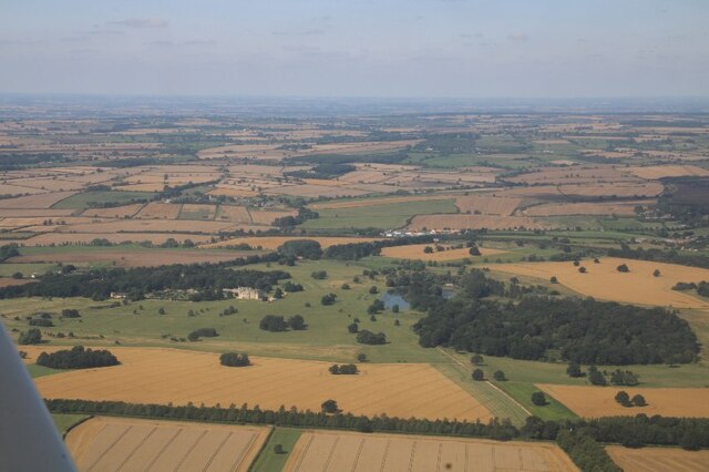
Brickyard Plantation, located in Leicestershire, England, is a well-known woodland area that spans across vast acres of land. Nestled in the heart of the county, this picturesque forest offers visitors a serene and tranquil escape from the bustling city life.

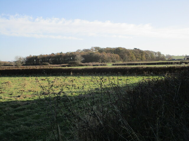
The plantation gets its name from the historical brickmaking industry that once thrived in the area. Today, the remnants of the brick kilns can still be found, adding a touch of nostalgia to the forest's ambiance. The woodland is predominantly composed of various species of deciduous and evergreen trees, creating a rich and diverse ecosystem.

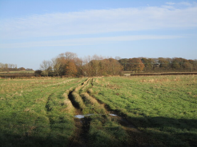
Visitors to Brickyard Plantation can enjoy a myriad of recreational activities. A network of well-maintained trails winds through the forest, providing opportunities for leisurely walks, jogging, or cycling. The peaceful atmosphere and beautiful surroundings make it an ideal location for nature enthusiasts, bird watchers, and photographers.

The forest also serves as a habitat for a wide range of wildlife, including deer, foxes, and various bird species. It is not uncommon to spot these creatures while exploring the plantation, making it a haven for wildlife enthusiasts.

Brickyard Plantation is open to the public year-round, with no admission fees. It is well-equipped with amenities such as picnic areas, benches, and restroom facilities, ensuring a comfortable experience for visitors of all ages. The plantation is easily accessible by car and offers ample parking space.

Overall, Brickyard Plantation in Leicestershire is a hidden gem, offering a perfect blend of natural beauty, historical significance, and recreational opportunities. It is a must-visit destination for those seeking a peaceful retreat in the midst of nature.

If you have any feedback on the listing, please let us know in the comments section below.

Brickyard Plantation Images

Images are sourced within 2km of 52.744417/-0.82003058 or Grid Reference SK7916. Thanks to Geograph Open Source API. All images are credited.

Stapleford Park: aerial 2021 (1)
The Willow Pool If I wanted to dispose of Excalibur, at my Lord's command, this is the sort of place I would fling it.  Ancient, surviving, wrecked willows in a deep pool.

The pool is the remnant of recent rains, when the adjacent River Eye rose and met the torrents falling on the field.  This area is all low-lying wetland, and the Willow is the queen of the landscape.  

This is a stitch of 6 separate images of 6252x4164 pixels, stitched with Microsoft ICE to yield a panoramic shot of 13642x8203 pixels - subsequently downsized to suit Geograph.   The full stitch is available on request.
The Willow Pool
If I wanted to dispose of Excalibur, at my Lord's command, this is the sort of place I would fling it. Ancient, surviving, wrecked willows in a deep pool. The pool is the remnant of recent rains, when the adjacent River Eye rose and met the torrents falling on the field. This area is all low-lying wetland, and the Willow is the queen of the landscape. This is a stitch of 6 separate images of 6252x4164 pixels, stitched with Microsoft ICE to yield a panoramic shot of 13642x8203 pixels - subsequently downsized to suit Geograph. The full stitch is available on request.
Willow in the water One of the trees featured in <a href="https://www.geograph.org.uk/photo/7058886">SK8018 : The Willow Pool</a>.  It is very hard to dissuade a willow from growing, and they revel in wet feet.
Willow in the water
One of the trees featured in SK8018 : The Willow Pool. It is very hard to dissuade a willow from growing, and they revel in wet feet.
Wet enough for thee? One of the Willow trees seen in <a href="https://www.geograph.org.uk/photo/7058886">SK8018 : The Willow Pool</a>.  Broken, wrecked, drowned it still grows vigorously.  This won't be the first time it has stood in floodwater.
Wet enough for thee?
One of the Willow trees seen in SK8018 : The Willow Pool. Broken, wrecked, drowned it still grows vigorously. This won't be the first time it has stood in floodwater.
Ham Bridge  Ham Bridge, on the Eye River.
Ham Bridge
Ham Bridge, on the Eye River.
Downstream The river Eye at Ham Bridge, looking upstream
Downstream
The river Eye at Ham Bridge, looking upstream
Upstream The River Eye from the Ham Bridge
Upstream
The River Eye from the Ham Bridge
Gate lodges, Stapleford park
Thatched Lodge The gate lodge at Stapleford Park
Thatched Lodge
The gate lodge at Stapleford Park
Stapleford estate buildings "The School House" and "The Row"
Stapleford estate buildings
"The School House" and "The Row"
Cut Mark Cut mark on Ham bridge on road between Stapleford and Wyfordby, near Melton Mowbray.
Cut Mark
Cut mark on Ham bridge on road between Stapleford and Wyfordby, near Melton Mowbray.
Stapleford, St. Mary Magdalene's Church: Western aspect
Stapleford, St. Mary Magdalene's Church: West doorway being the main entrance to the church
Stapleford, St. Mary Magdalene's Church: The nave
Track across a grass field OS shows this as a road used as a public footpath but it does not appear on the Leicestershire County Council interactive footpath map.
Track across a grass field
OS shows this as a road used as a public footpath but it does not appear on the Leicestershire County Council interactive footpath map.
Lone tree and sprayed field Burton Lazars in the distance.
Lone tree and sprayed field
Burton Lazars in the distance.
Ellaby's Spinney
Ellaby's Spinney
Wyfordby Level Crossing A manned level crossing on the route between Stamford and Melton Mowbray.
Wyfordby Level Crossing
A manned level crossing on the route between Stamford and Melton Mowbray.
Show me another place!

Brickyard Plantation is located at Grid Ref: SK7916 (Lat: 52.744417, Lng: -0.82003058)

Administrative County: Leicestershire

District: Melton

Police Authority: Leicestershire

What 3 Words

///visits.haunt.turned. Near Melton Mowbray, Leicestershire

Related Wikis

Brentingby

Brentingby is a village in Leicestershire, England.The population is included in the civil parish of Freeby. The village's name means either 'farm/settlement...

St Mary Magdalene's Church, Stapleford

St Mary Magdalene's Church is a redundant Anglican church near the village of Stapleford, Leicestershire, England. It is recorded in the National Heritage...

Stapleford Miniature Railway

Stapleford Miniature Railway is an historic steam locomotive-hauled 10+1⁄4 in (260 mm) gauge railway at Stapleford Park, Stapleford near Melton Mowbray...
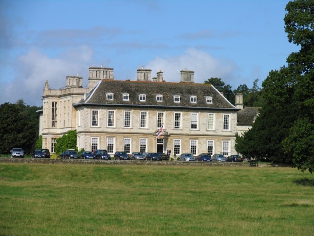
Stapleford Park

Stapleford Park is a Grade I listed country house in Stapleford, near Melton Mowbray in Leicestershire, England, which is now used as a hotel. It was originally...

Stapleford, Leicestershire

Stapleford is a village and former civil parish, now in the parish of Freeby, in the Melton district of Leicestershire, England, east of Melton Mowbray...

St Mary's Church, Brentingby

St Mary's Church is a redundant Anglican church in the village of Brentingby, Leicestershire, England. The walls of the church required renovation when...

Langham Brook

The Langham Brook is a watercourse in the East Midlands of England. It is a tributary of the River Eye and part of the River Soar catchment. == Course... ==

Saxby railway station

Saxby railway station was a station serving the villages of Saxby and Freeby, Leicestershire. It was located between the two villages. == Access == The...

Nearby Amenities

Located within 500m of 52.744417,-0.82003058
Power: tower
Source: Bing
Lat/Long: 52.7426892/-0.8238939
Power: tower
Source: Bing
Lat/Long: 52.74545/-0.8253692
Power: pole
Lat/Long: 52.7467167/-0.8196454
Power: pole
Lat/Long: 52.7466972/-0.8182346
Power: pole
Lat/Long: 52.7479636/-0.8227836
Power: pole
Lat/Long: 52.7467167/-0.8156221
Power: pole
Lat/Long: 52.7473823/-0.8219629
Power: pole
Lat/Long: 52.7467037/-0.8143615
Building: yes
Lat/Long: 52.7460314/-0.8198294
The data included in this document is from www.openstreetmap.org. The data is made available under ODbL.

Have you been to Brickyard Plantation?

Leave your review of Brickyard Plantation below (or comments, questions and feedback).